|
||

 |
D-MINT HISTORY FILE for 2025_02E
| Date | Time | MW Sensor | MSLP | Vmax (30th-70th percentile average) | Vmax 25th percentile | Vmax 75th percentile | Image |
| 20250611 | 0124 UTC | SSMISF17 | 1006 hPa | 26 kts | 24 kts | 28 kts |  |
| 20250611 | 0118 UTC | SSMISF16 | 1006 hPa | 27 kts | 25 kts | 30 kts | 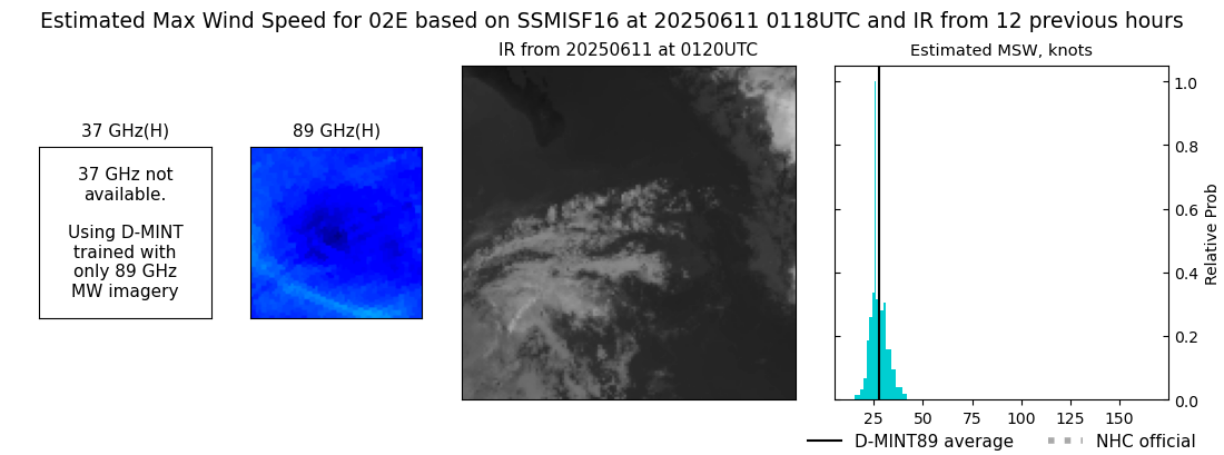 |
| 20250610 | 2213 UTC | GMI | 1006 hPa | 30 kts | 28 kts | 34 kts | 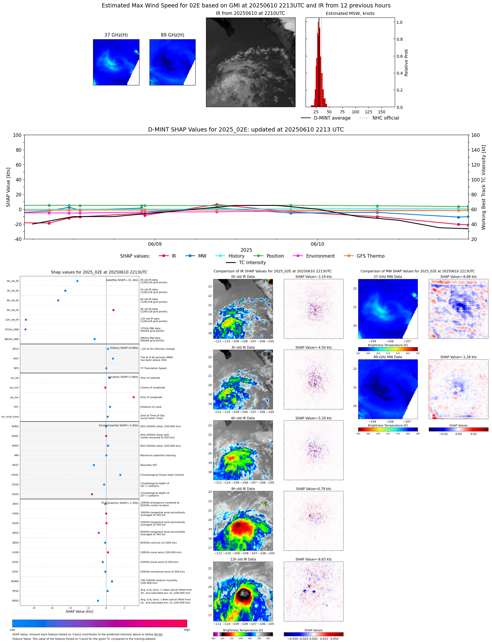 |
| 20250610 | 2045 UTC | AMSR2 | 1006 hPa | 30 kts | 27 kts | 33 kts | 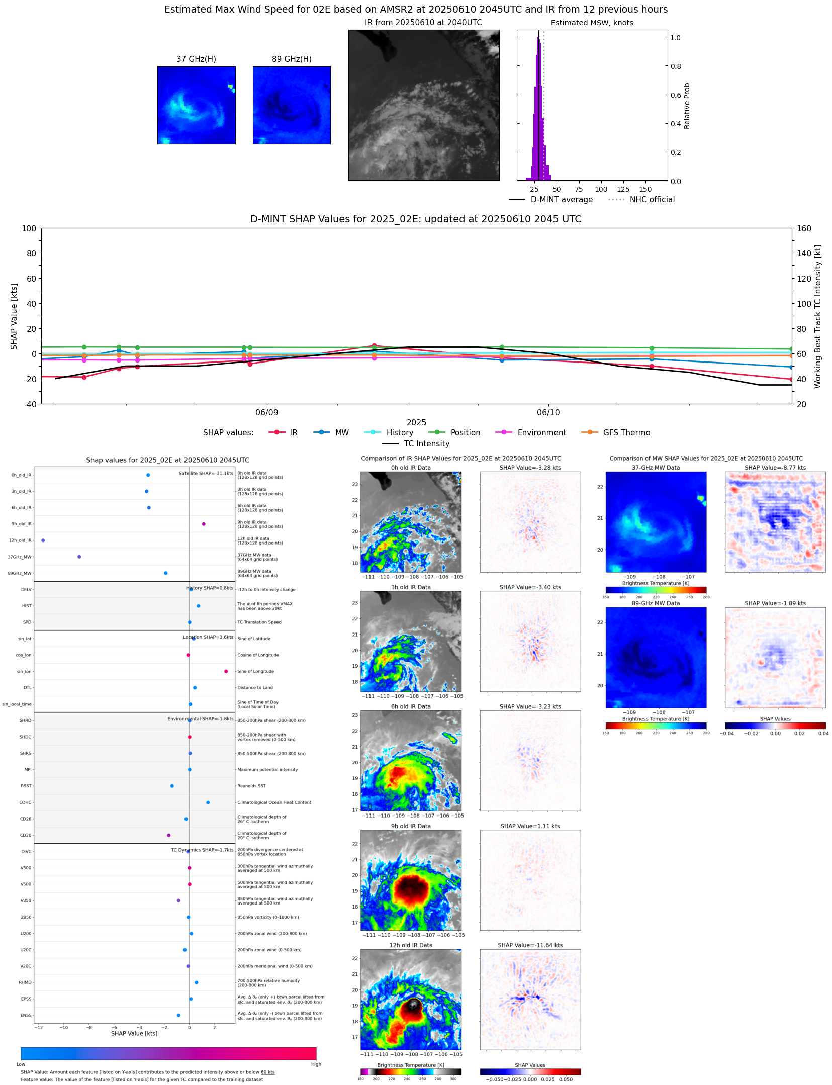 |
| 20250610 | 1801 UTC | TMS02 | 1007 hPa | 30 kts | 27 kts | 34 kts |  |
| 20250610 | 1638 UTC | TROPICS05 | 1006 hPa | 34 kts | 30 kts | 39 kts |  |
| 20250610 | 0848 UTC | GMI | 999 hPa | 47 kts | 42 kts | 53 kts |  |
| 20250610 | 0203 UTC | TMS04 | 1000 hPa | 59 kts | 53 kts | 65 kts | 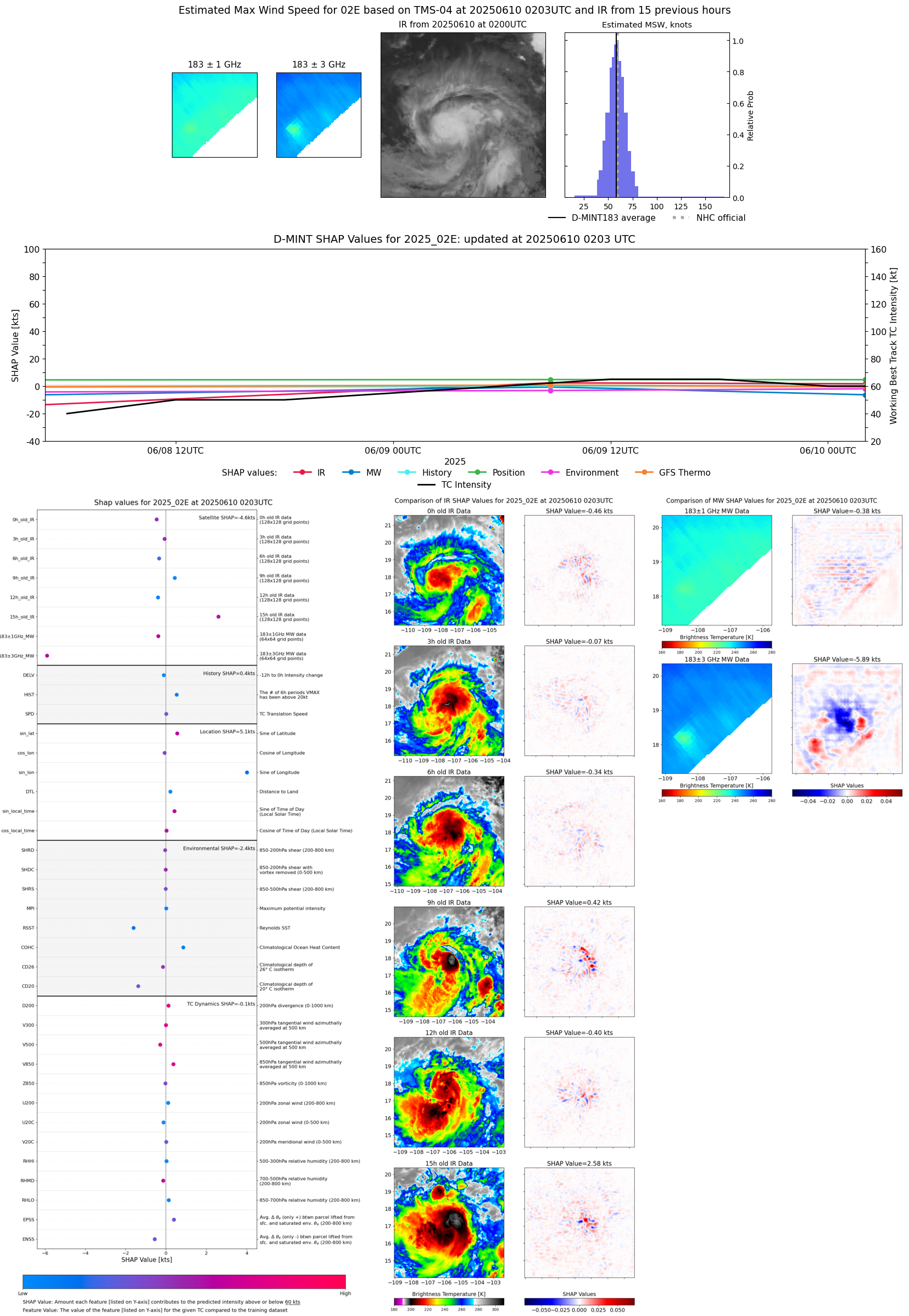 |
| 20250609 | 2125 UTC | TROPICS03 | 994 hPa | 67 kts | 60 kts | 73 kts | 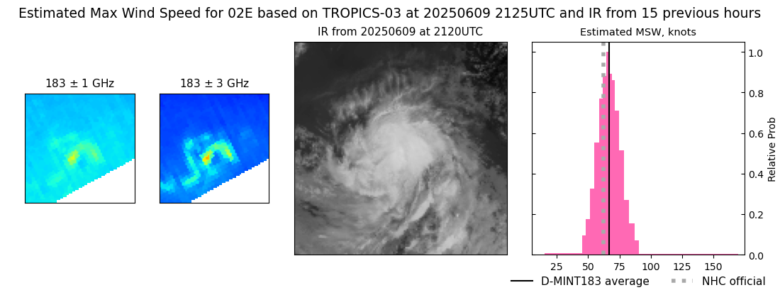 |
| 20250609 | 2002 UTC | AMSR2 | 995 hPa | 52 kts | 47 kts | 58 kts |  |
| 20250609 | 1107 UTC | SSMISF18 | 997 hPa | 56 kts | 49 kts | 63 kts | 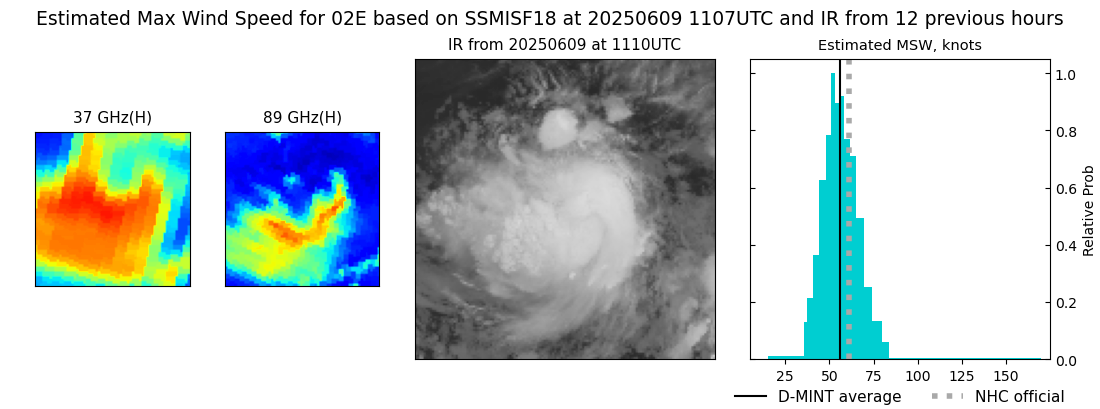 |
| 20250609 | 0909 UTC | AMSR2 | 994 hPa | 68 kts | 62 kts | 75 kts |  |
| 20250609 | 0840 UTC | ATMS-N20 | 989 hPa | 65 kts | 59 kts | 71 kts |  |
| 20250609 | 0813 UTC | ATMS-N20 | 993 hPa | 64 kts | 58 kts | 71 kts |  |
| 20250609 | 0146 UTC | SSMISF16 | 990 hPa | 56 kts | 49 kts | 63 kts |  |
| 20250608 | 2233 UTC | SSMISF18 | 1000 hPa | 47 kts | 42 kts | 53 kts | 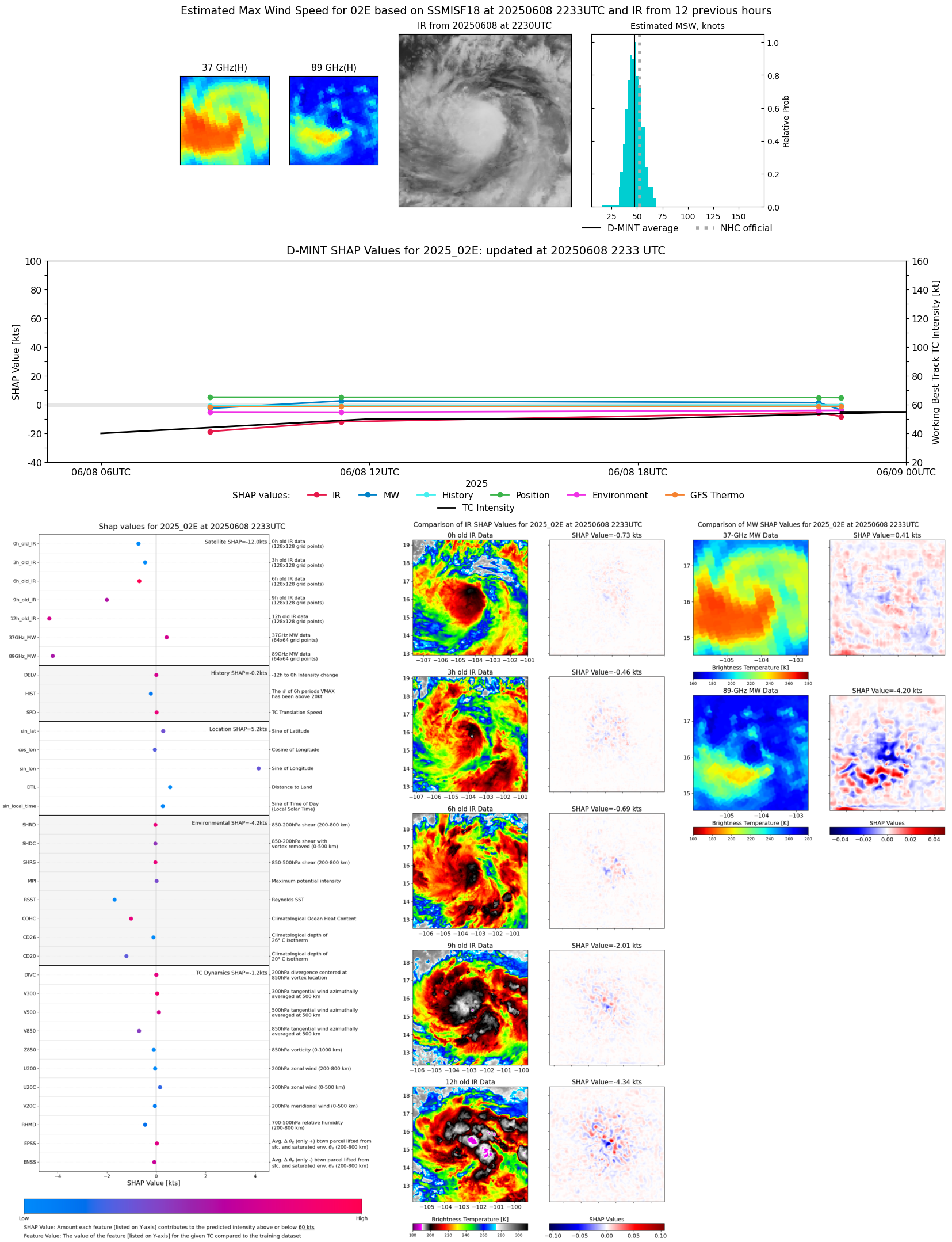 |
| 20250608 | 2203 UTC | GMI | 1000 hPa | 55 kts | 50 kts | 61 kts | 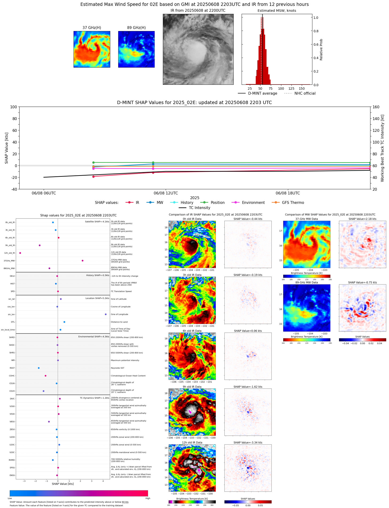 |
| 20250608 | 1258 UTC | SSMISF17 | 998 hPa | 47 kts | 42 kts | 52 kts |  |
| 20250608 | 1122 UTC | SSMISF18 | 998 hPa | 49 kts | 43 kts | 55 kts | 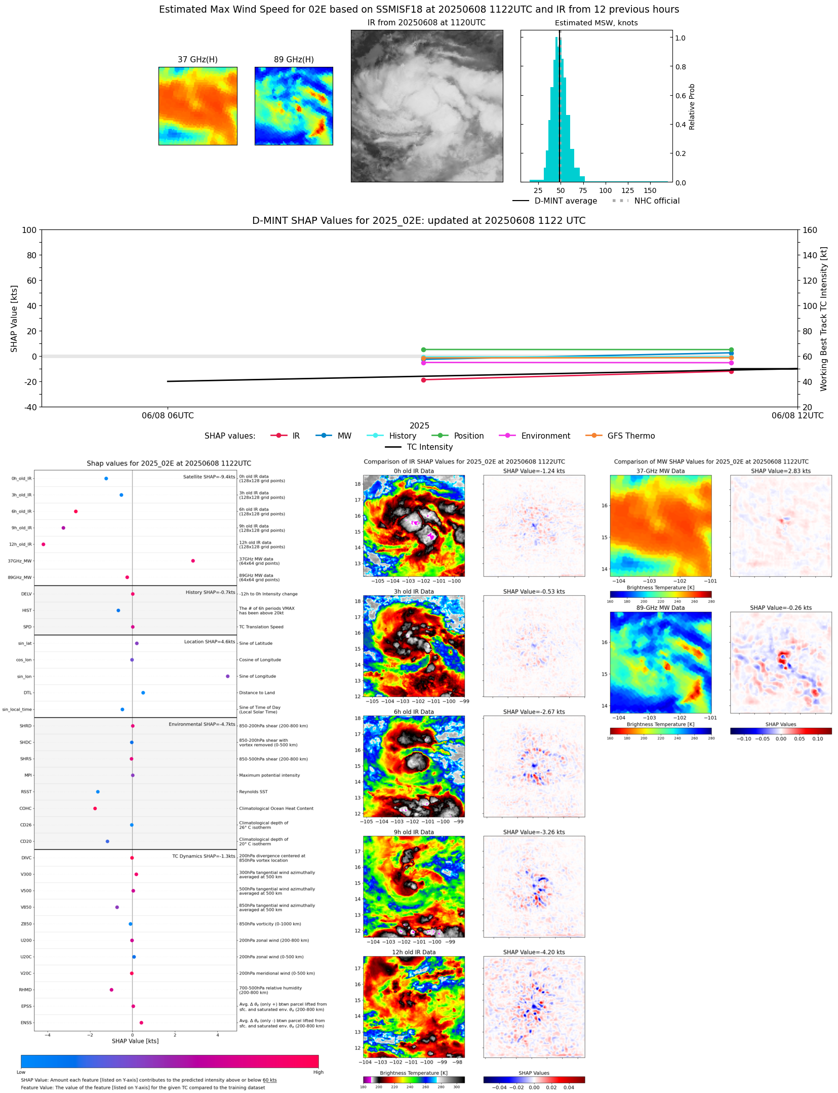 |
| 20250608 | 0826 UTC | AMSR2 | 997 hPa | 37 kts | 33 kts | 41 kts |  |
| 20250607 | 2247 UTC | SSMISF18 | NaN hPa | 30 kts | 27 kts | 35 kts | 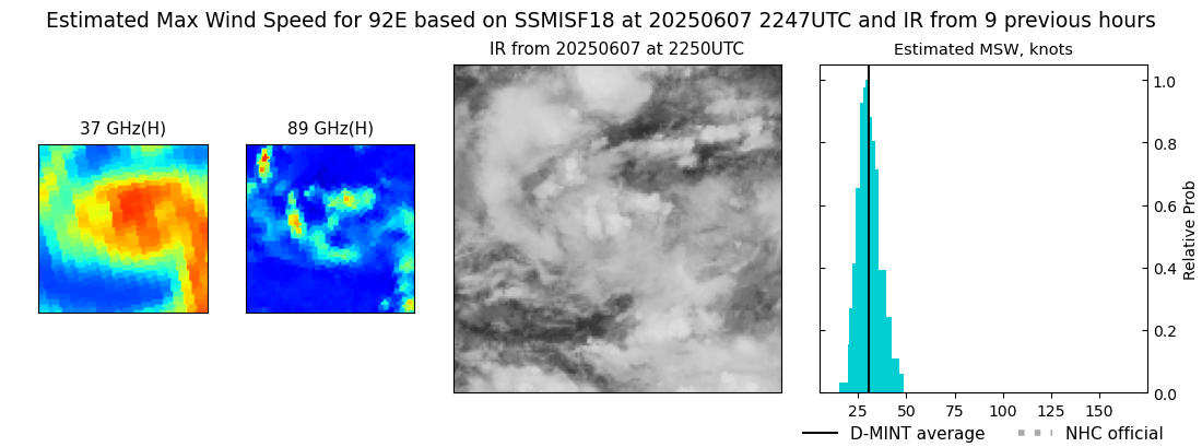 |
| 20250607 | 2013 UTC | AMSR2 | NaN hPa | 30 kts | 26 kts | 33 kts | 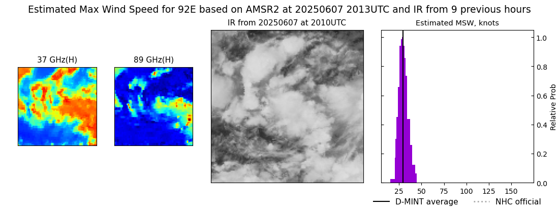 |
| 20250607 | 2000 UTC | ATMS-N20 | 1004 hPa | 32 kts | 29 kts | 35 kts |  |
| 20250607 | 1313 UTC | SSMISF17 | 1007 hPa | 28 kts | 25 kts | 31 kts |  |
| 20250607 | 0928 UTC | GMI | NaN hPa | 23 kts | 21 kts | 26 kts | 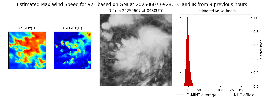 |
| 20250607 | 0637 UTC | TROPICS03 | 1007 hPa | 28 kts | 25 kts | 31 kts |  |
| 20250607 | 0036 UTC | SSMISF17 | NaN hPa | 28 kts | 25 kts | 31 kts | 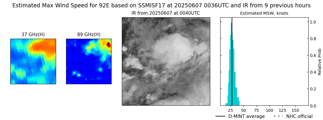 |
| 20250607 | 0030 UTC | SSMISF16 | NaN hPa | 23 kts | 21 kts | 27 kts | 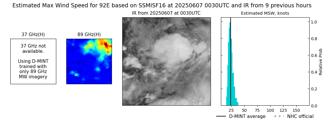 |
| 20250606 | 2154 UTC | GMI | NaN hPa | 25 kts | 23 kts | 29 kts | 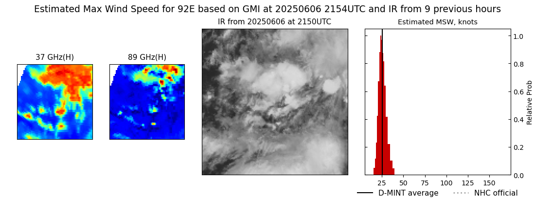 |
| 20250606 | 1929 UTC | AMSR2 | NaN hPa | 24 kts | 22 kts | 27 kts |  |