|
||

 |
D-MINT HISTORY FILE for 2025_02W
| Date | Time | MW Sensor | MSLP | Vmax (30th-70th percentile average) | Vmax 25th percentile | Vmax 75th percentile | Image |
| 20250627 | 0113 UTC | GMI | 1005 hPa | 23 kts | 20 kts | 26 kts | 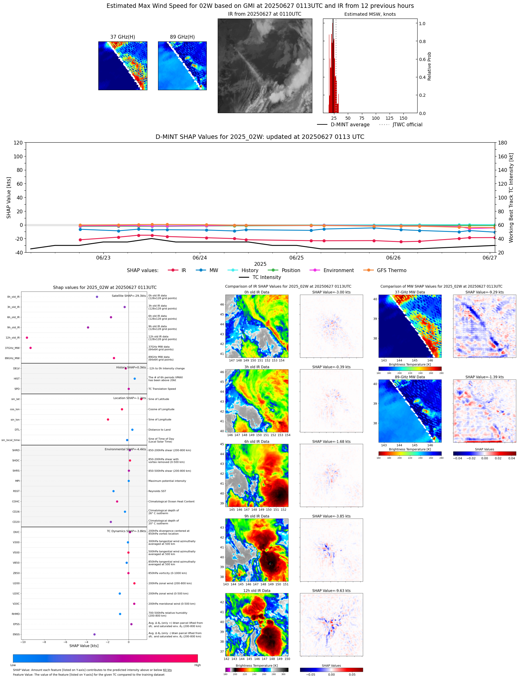 |
| 20250626 | 2026 UTC | SSMISF17 | 1004 hPa | 21 kts | 18 kts | 25 kts | 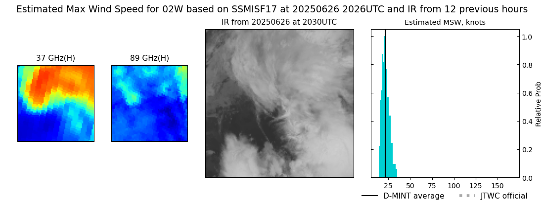 |
| 20250626 | 1853 UTC | SSMISF18 | 1004 hPa | 23 kts | 20 kts | 27 kts |  |
| 20250626 | 1621 UTC | AMSR2 | 1004 hPa | 23 kts | 21 kts | 26 kts |  |
| 20250626 | 1247 UTC | TMS02 | 1004 hPa | 25 kts | 22 kts | 28 kts | 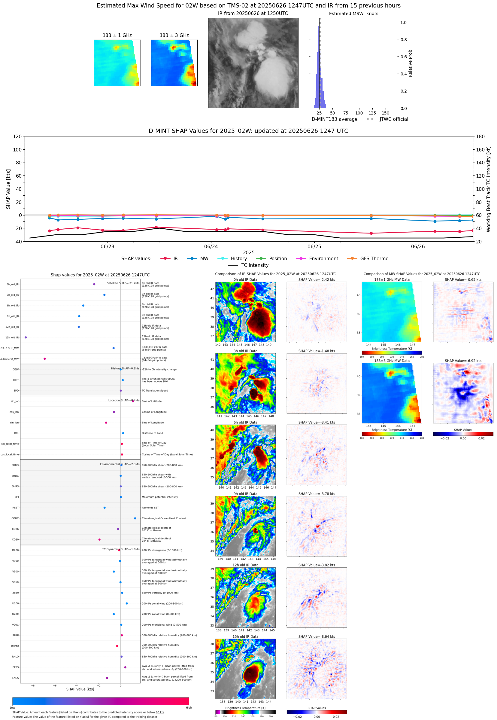 |
| 20250626 | 0937 UTC | TMS03 | 1004 hPa | 23 kts | 21 kts | 26 kts | 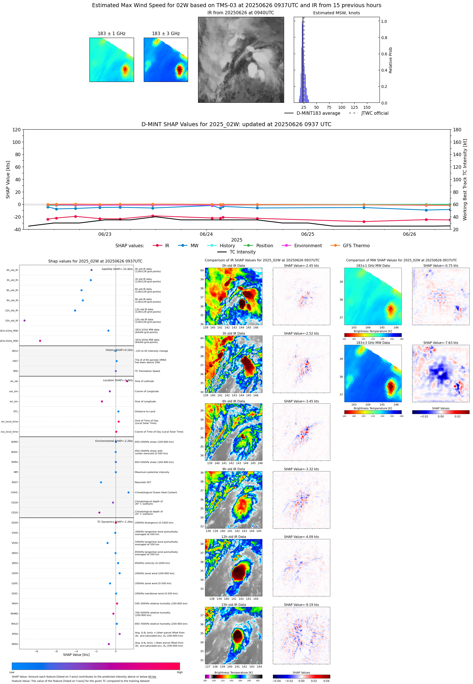 |
| 20250626 | 0808 UTC | SSMISF16 | 1004 hPa | 25 kts | 22 kts | 28 kts | 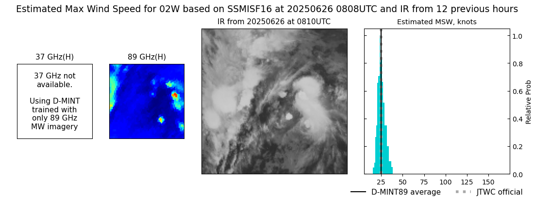 |
| 20250626 | 0632 UTC | SSMISF18 | 1003 hPa | 23 kts | 21 kts | 26 kts |  |
| 20250626 | 0356 UTC | ATMS-N20 | 1007 hPa | 23 kts | 21 kts | 26 kts | 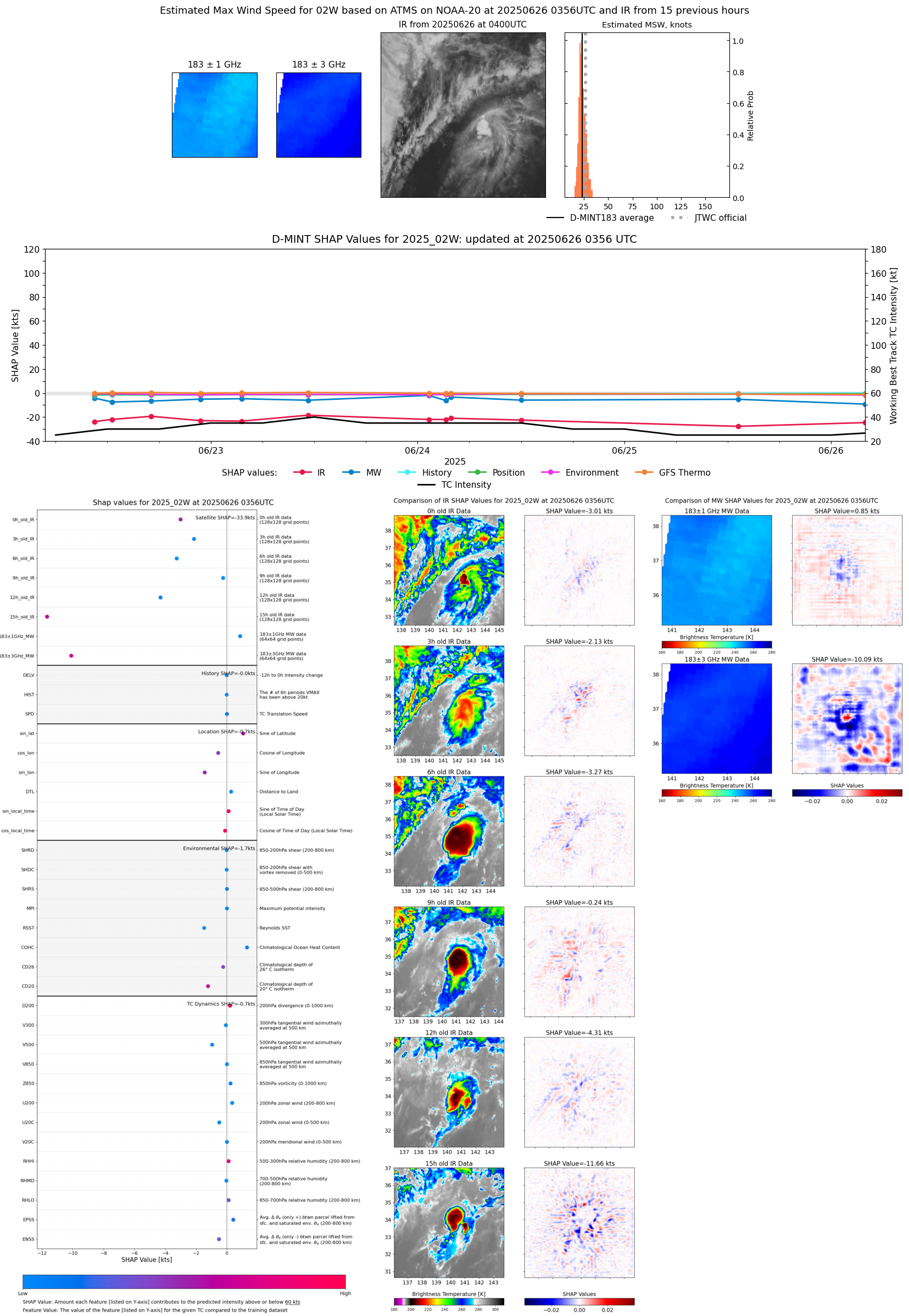 |
| 20250626 | 0153 UTC | GMI | 1006 hPa | 24 kts | 21 kts | 26 kts | 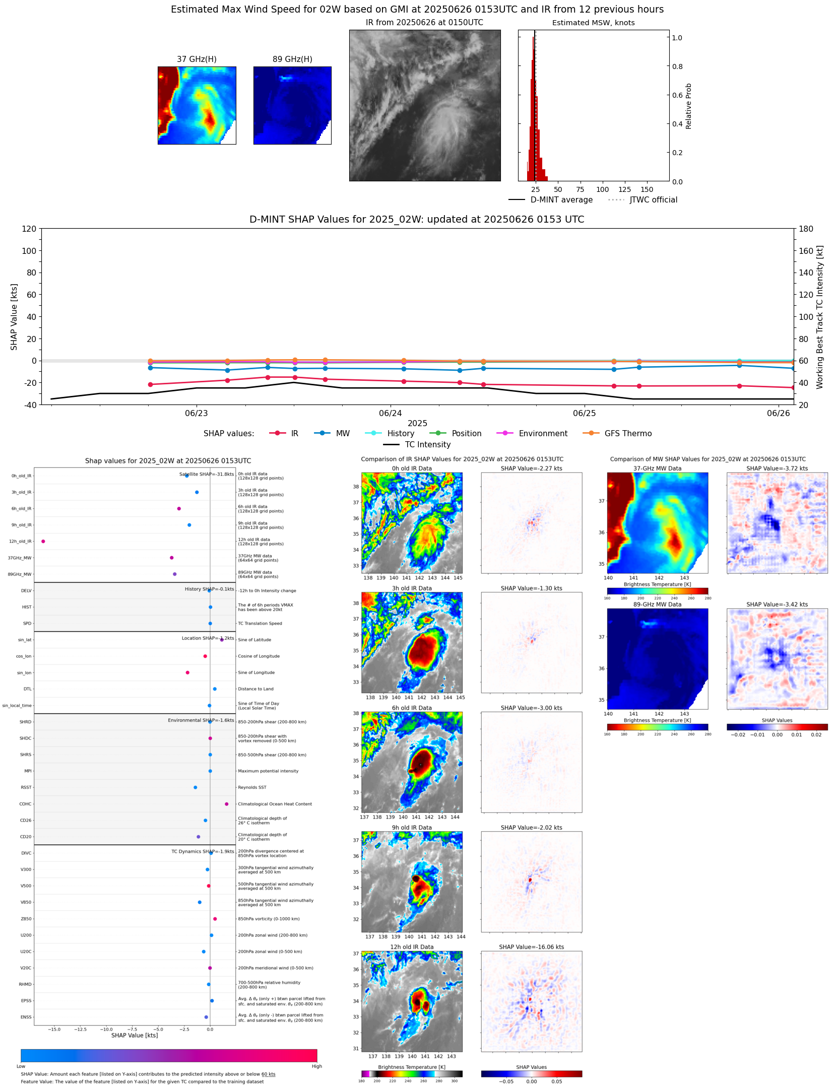 |
| 20250625 | 2043 UTC | SSMISF17 | 1006 hPa | 27 kts | 23 kts | 31 kts |  |
| 20250625 | 1909 UTC | SSMISF18 | 1003 hPa | 28 kts | 25 kts | 32 kts | 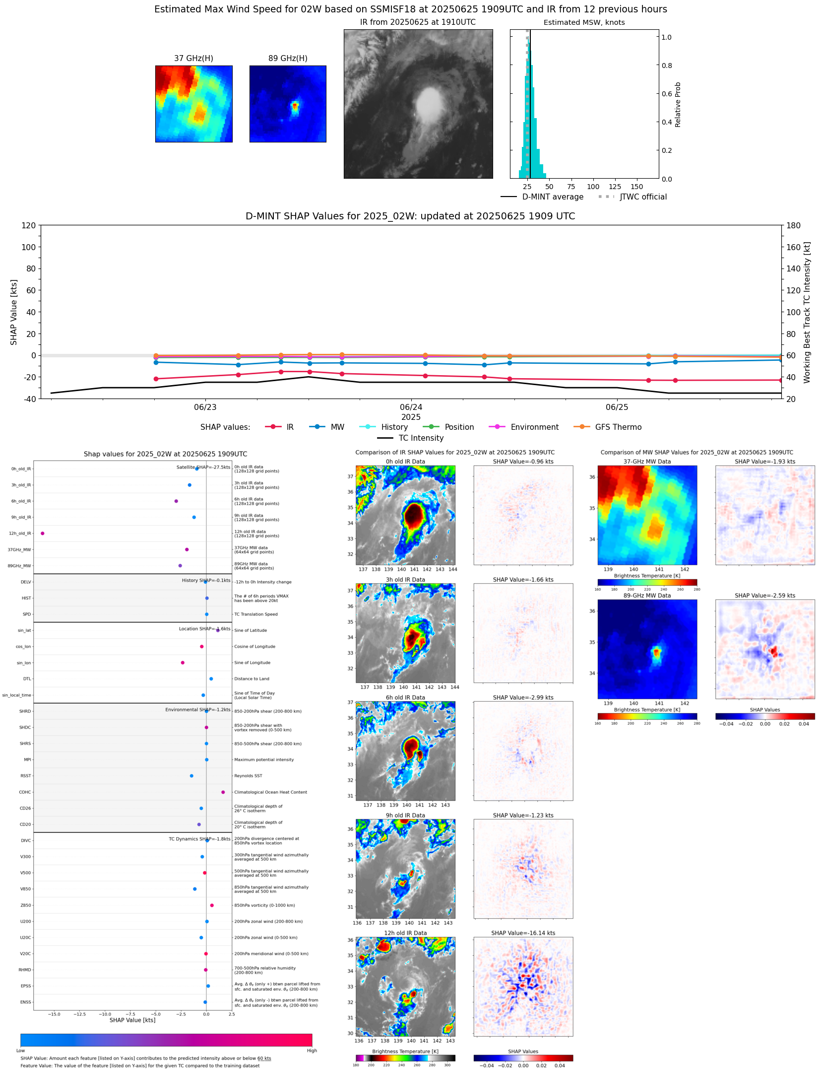 |
| 20250625 | 1311 UTC | TMS02 | 1008 hPa | 25 kts | 23 kts | 27 kts |  |
| 20250625 | 0645 UTC | SSMISF18 | 1004 hPa | 28 kts | 25 kts | 31 kts |  |
| 20250625 | 0337 UTC | AMSR2 | 1006 hPa | 26 kts | 24 kts | 28 kts | 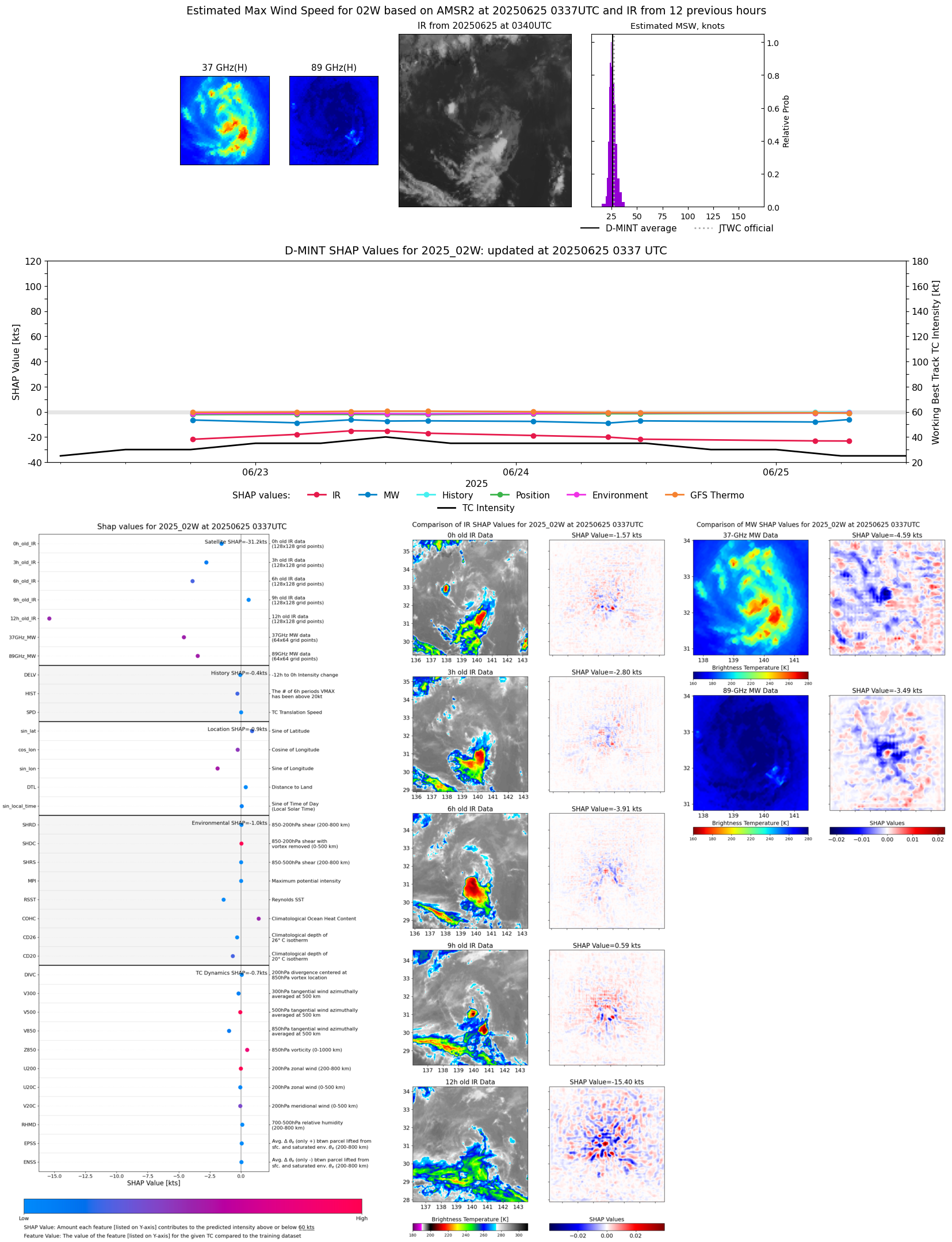 |
| 20250625 | 0016 UTC | TROPICS03 | 1008 hPa | 26 kts | 24 kts | 29 kts |  |
| 20250624 | 2057 UTC | SSMISF17 | 1003 hPa | 28 kts | 25 kts | 31 kts |  |
| 20250624 | 1636 UTC | AMSR2 | 1001 hPa | 27 kts | 24 kts | 30 kts |  |
| 20250624 | 1201 UTC | TROPICS05 | 1003 hPa | 29 kts | 26 kts | 33 kts |  |
| 20250624 | 1128 UTC | GMI | 1004 hPa | 27 kts | 25 kts | 31 kts | 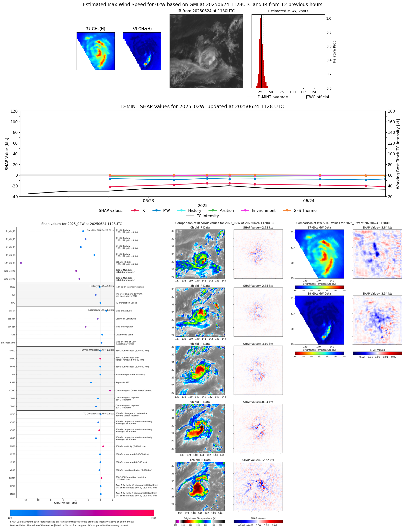 |
| 20250624 | 0834 UTC | SSMISF16 | 1004 hPa | 28 kts | 25 kts | 32 kts | 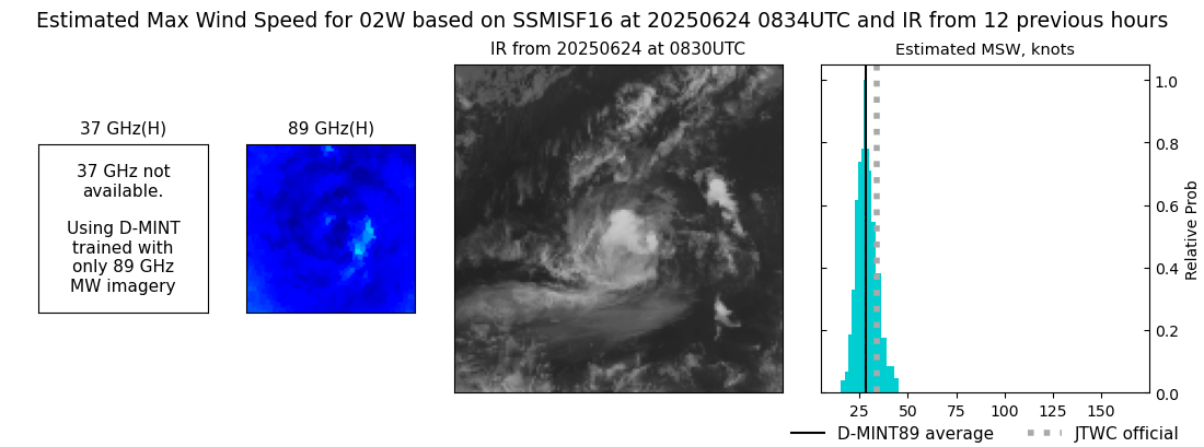 |
| 20250624 | 0831 UTC | SSMISF17 | 1003 hPa | 27 kts | 24 kts | 31 kts |  |
| 20250624 | 0354 UTC | TMS03 | 1002 hPa | 32 kts | 29 kts | 36 kts | 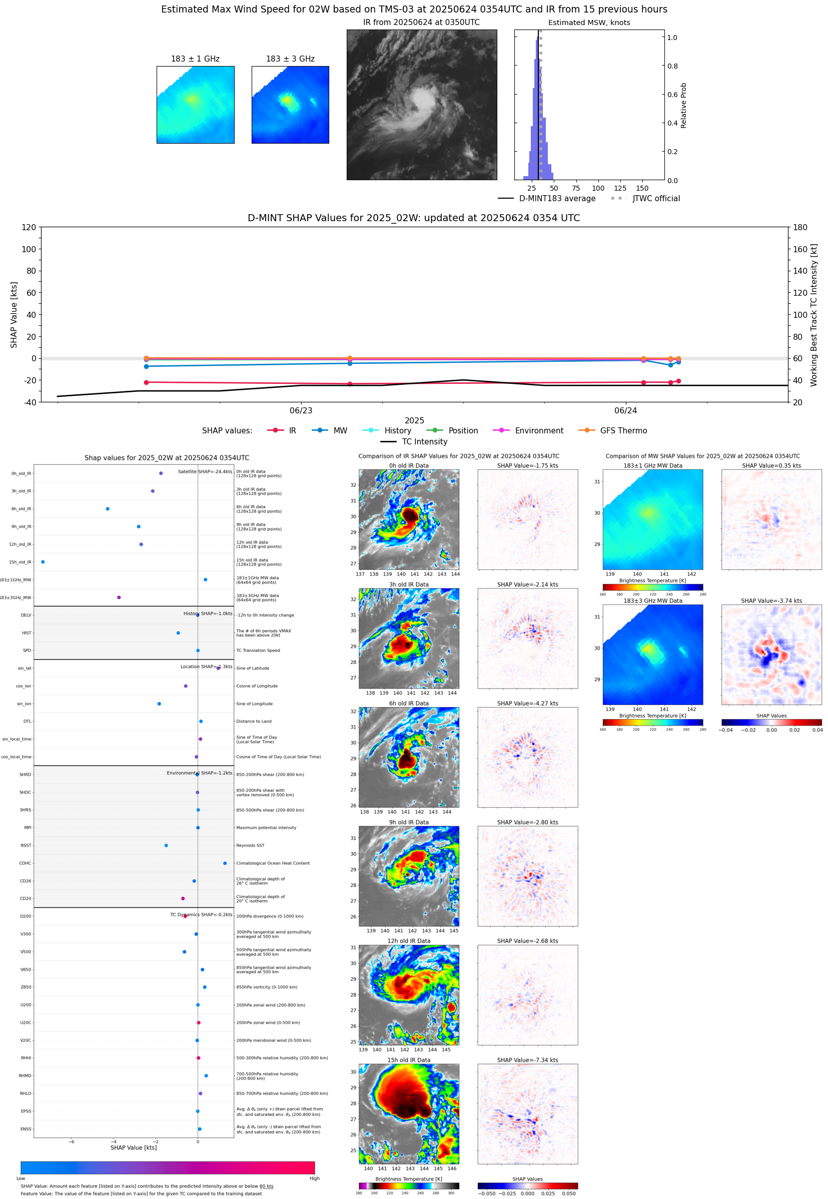 |
| 20250624 | 0318 UTC | ATMS-N20 | 1004 hPa | 28 kts | 25 kts | 32 kts | 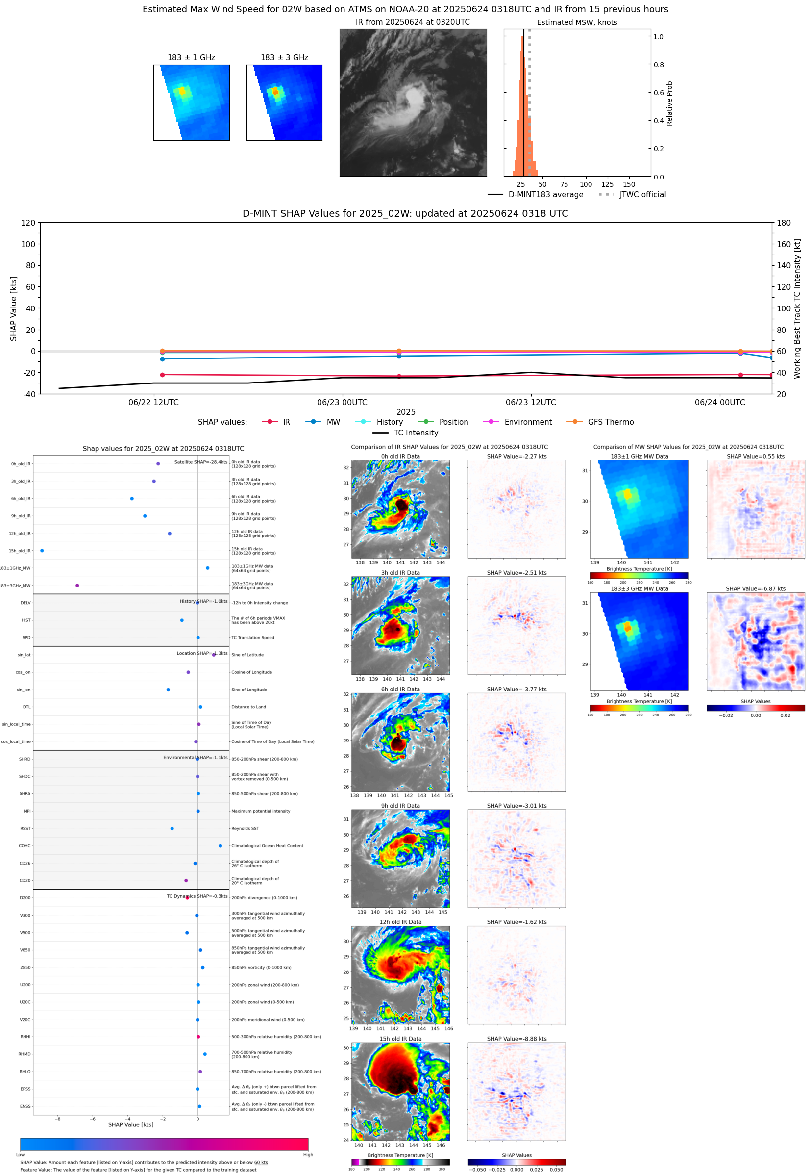 |
| 20250624 | 0138 UTC | GMI | 1002 hPa | 30 kts | 26 kts | 33 kts | 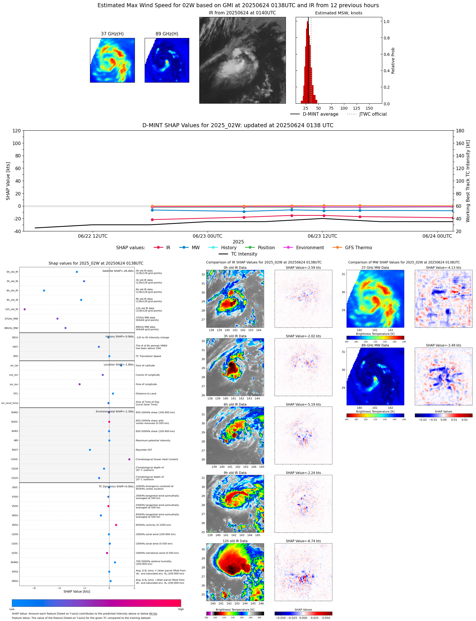 |
| 20250624 | 0119 UTC | TMS02 | 1003 hPa | 32 kts | 29 kts | 36 kts | 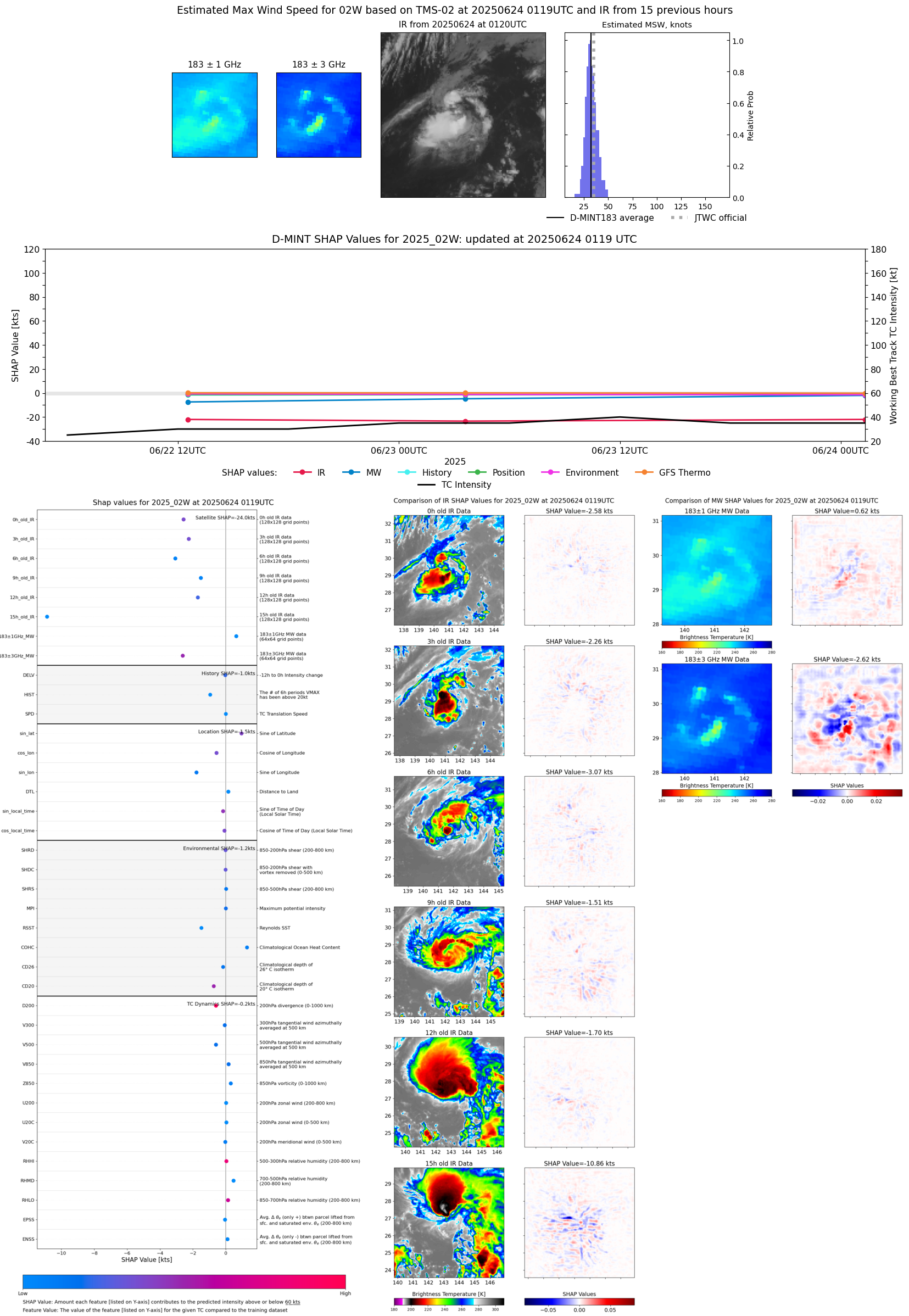 |
| 20250623 | 2114 UTC | SSMISF16 | 995 hPa | 39 kts | 35 kts | 44 kts |  |
| 20250623 | 2112 UTC | SSMISF17 | 999 hPa | 37 kts | 33 kts | 42 kts |  |
| 20250623 | 1554 UTC | AMSR2 | 999 hPa | 31 kts | 28 kts | 35 kts |  |
| 20250623 | 1208 UTC | GMI | 1001 hPa | 33 kts | 29 kts | 37 kts | 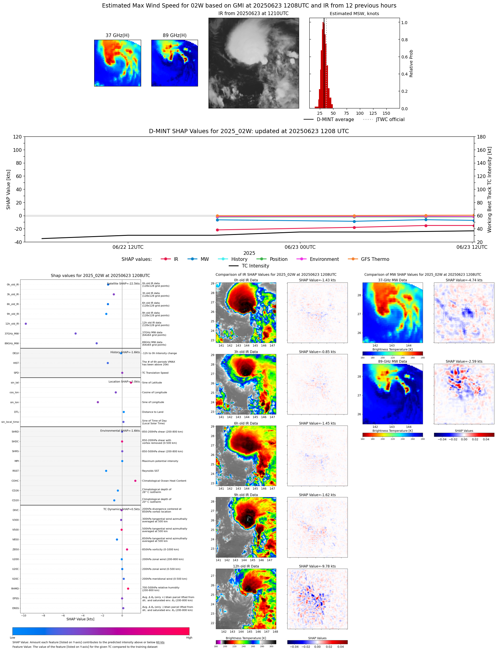 |
| 20250623 | 1117 UTC | TROPICS05 | 1002 hPa | 32 kts | 29 kts | 36 kts | 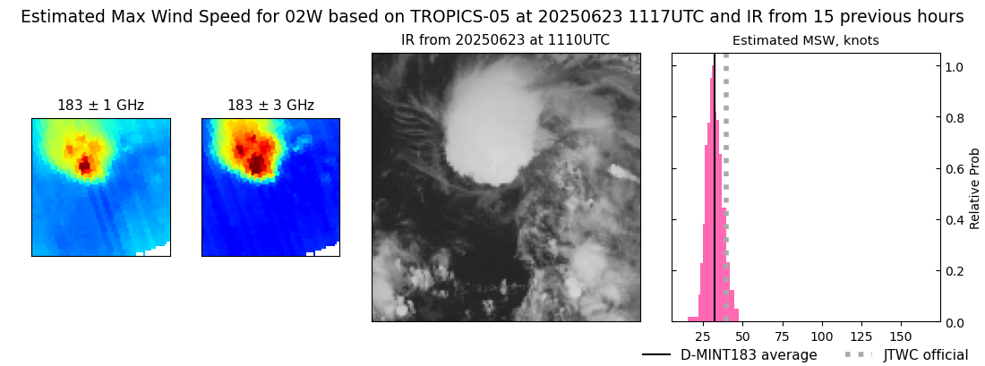 |
| 20250623 | 0846 UTC | SSMISF16 | 1002 hPa | 34 kts | 30 kts | 38 kts | 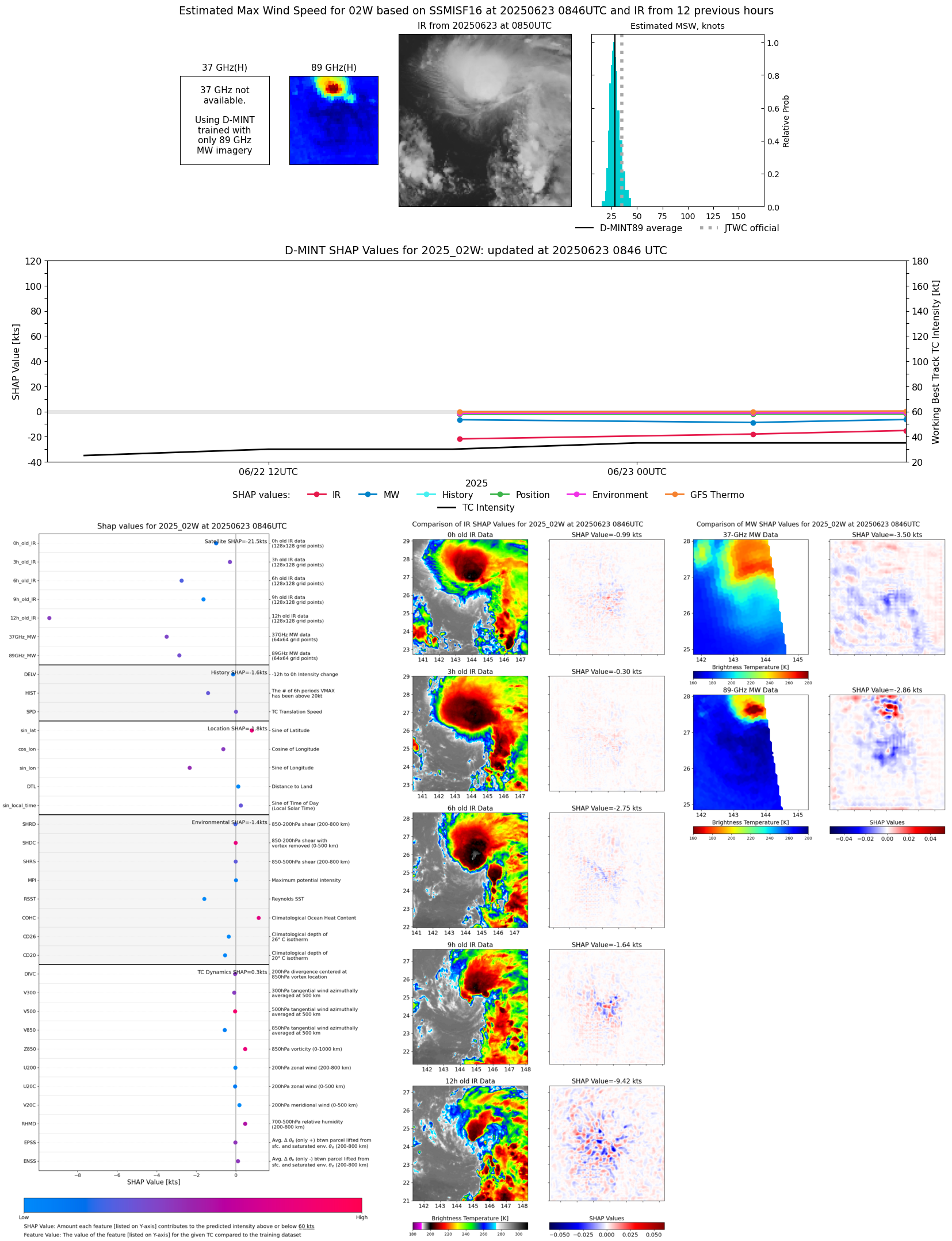 |
| 20250623 | 0846 UTC | SSMISF17 | 1002 hPa | 34 kts | 30 kts | 38 kts | 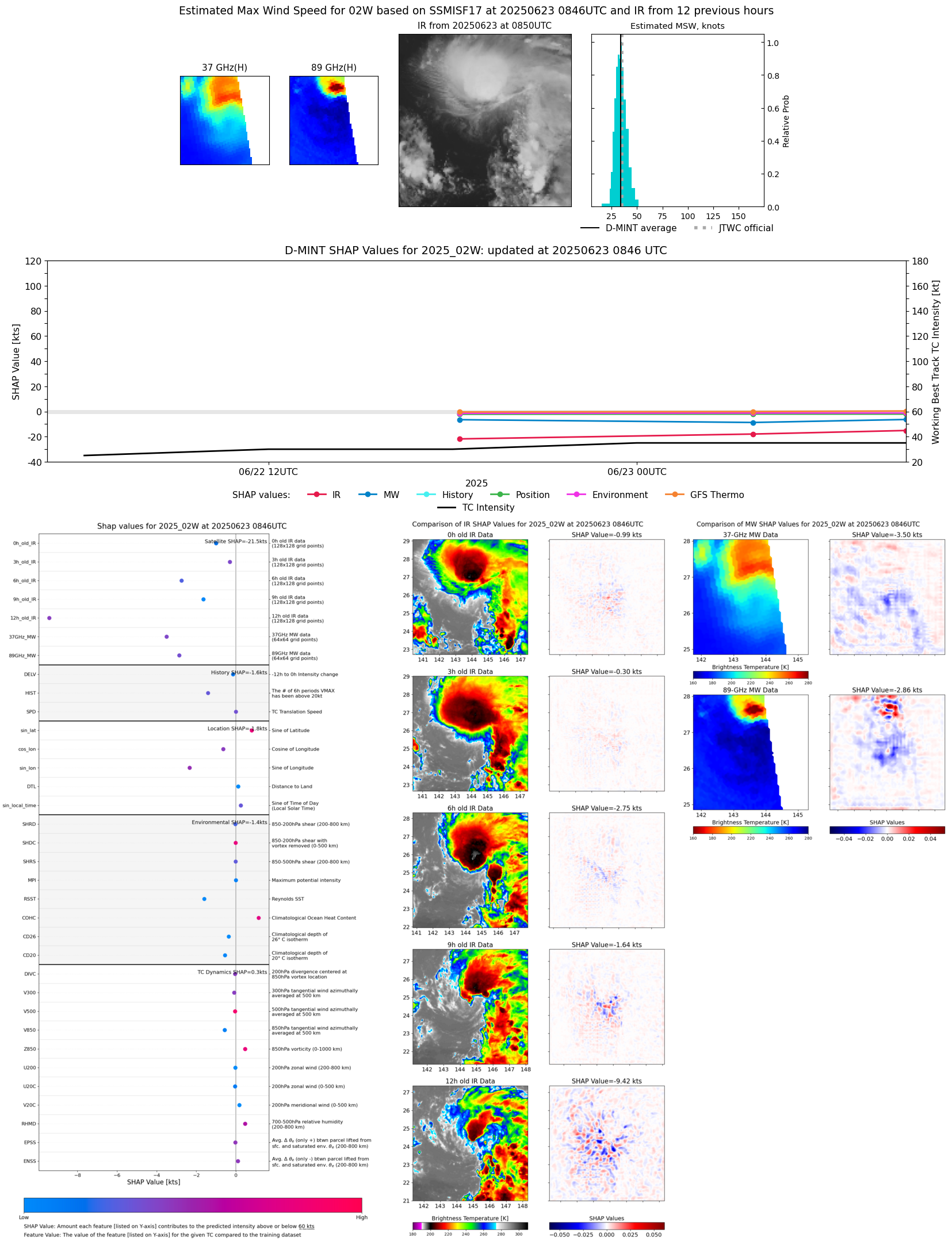 |
| 20250623 | 0347 UTC | AMSR2 | 1004 hPa | 28 kts | 26 kts | 31 kts |  |
| 20250623 | 0336 UTC | ATMS-N20 | 1004 hPa | 28 kts | 25 kts | 31 kts |  |
| 20250622 | 2247 UTC | TROPICS03 | 1005 hPa | 27 kts | 24 kts | 30 kts | 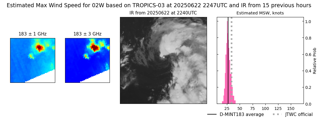 |
| 20250622 | 2129 UTC | SSMISF16 | 1004 hPa | 25 kts | 22 kts | 28 kts | 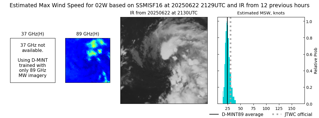 |
| 20250622 | 1813 UTC | SSMISF18 | 1003 hPa | 26 kts | 23 kts | 29 kts | 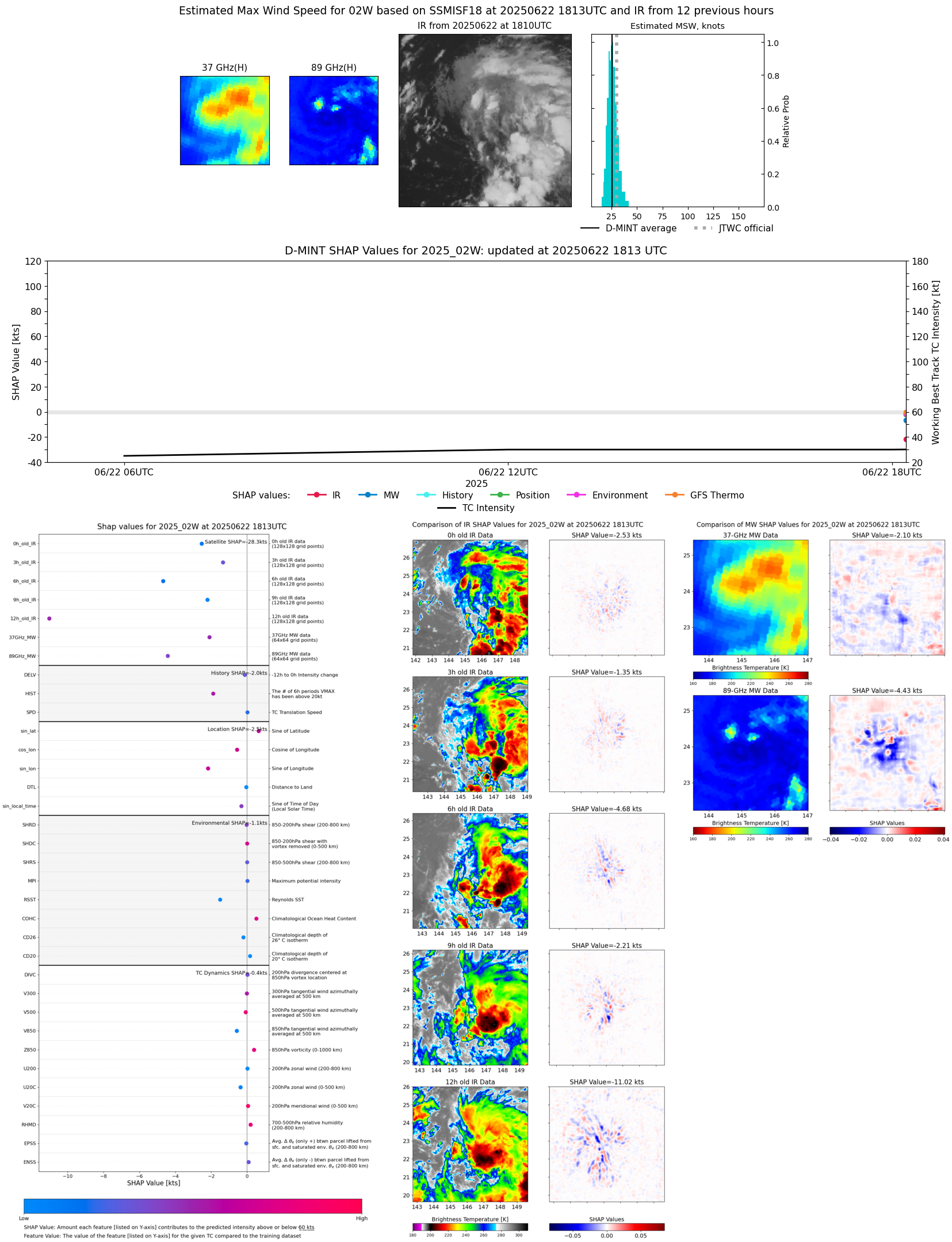 |
| 20250622 | 1705 UTC | TROPICS05 | 1002 hPa | 30 kts | 27 kts | 34 kts |  |
| 20250622 | 1232 UTC | TMS02 | 1005 hPa | 27 kts | 25 kts | 30 kts |  |
| 20250622 | 1032 UTC | TROPICS05 | 1004 hPa | 28 kts | 25 kts | 32 kts | 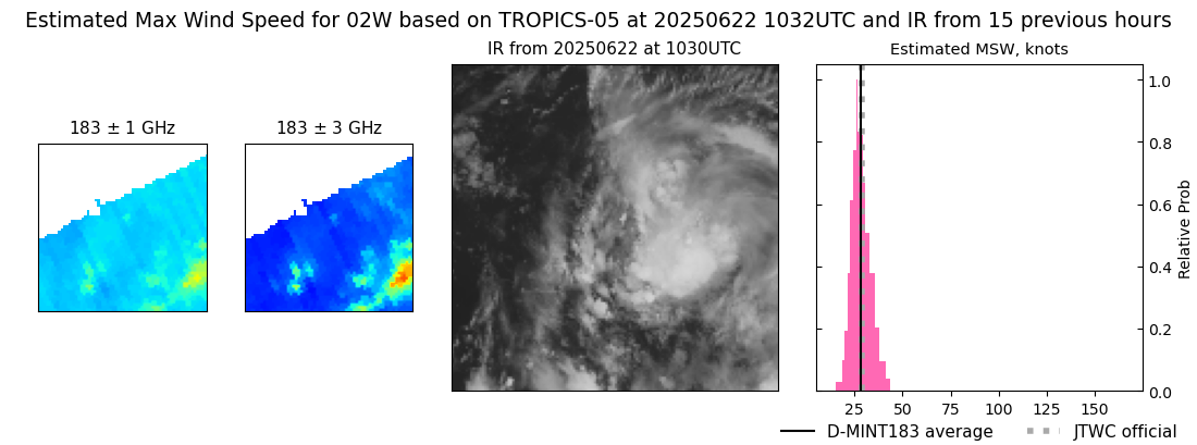 |