|
||

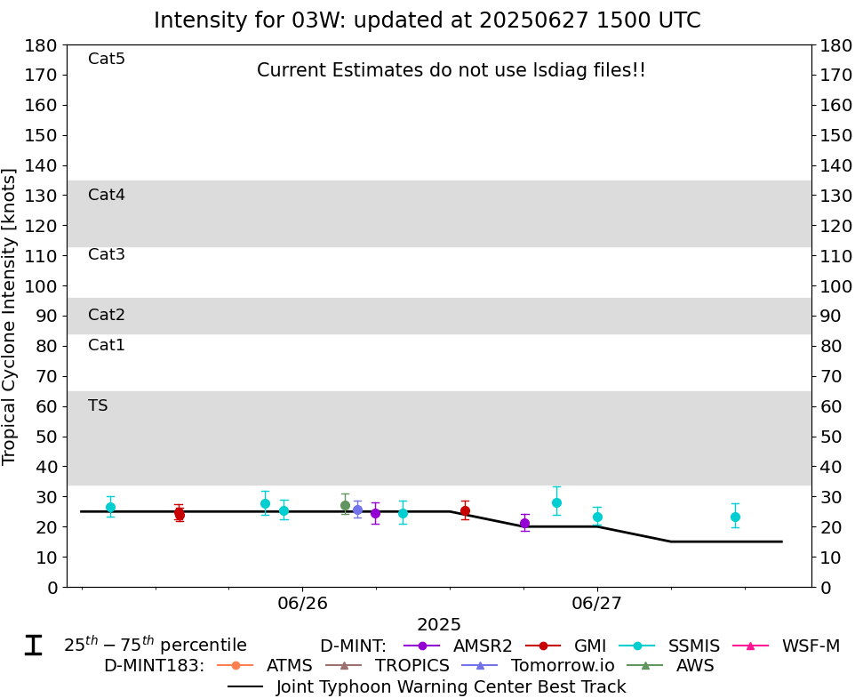 |
D-MINT HISTORY FILE for 2025_03W
| Date | Time | MW Sensor | MSLP | Vmax (30th-70th percentile average) | Vmax 25th percentile | Vmax 75th percentile | Image |
| 20250627 | 1112 UTC | SSMISF17 | 1006 hPa | 23 kts | 20 kts | 28 kts | 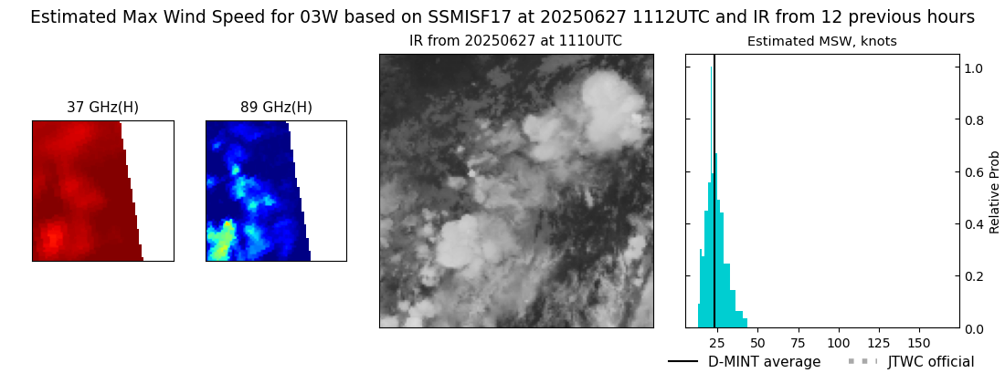 |
| 20250626 | 2358 UTC | SSMISF16 | 1008 hPa | 23 kts | 21 kts | 27 kts | 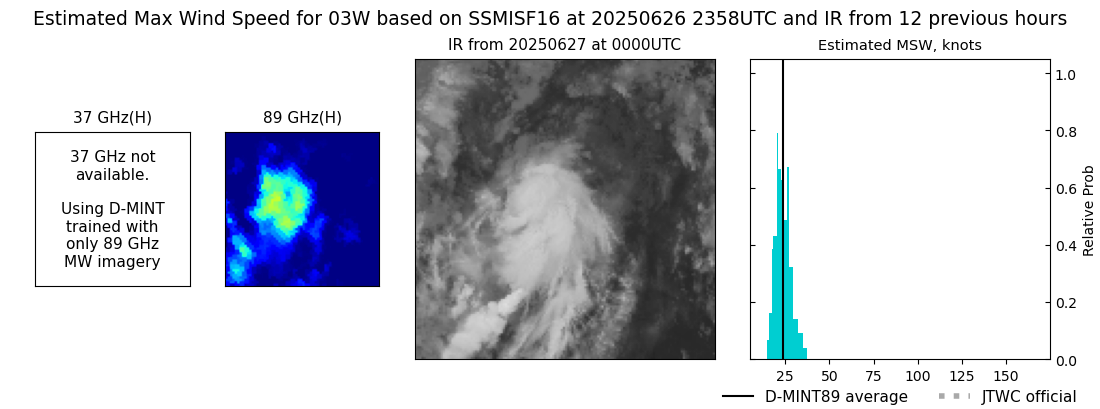 |
| 20250626 | 2041 UTC | SSMISF18 | 1005 hPa | 28 kts | 24 kts | 33 kts | 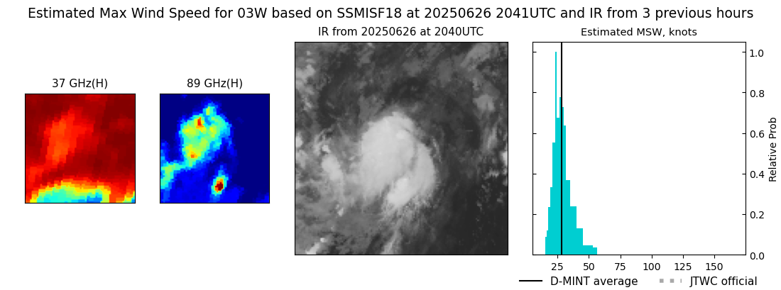 |
| 20250626 | 1806 UTC | AMSR2 | 1005 hPa | 21 kts | 19 kts | 24 kts |  |
| 20250626 | 1313 UTC | GMI | 1001 hPa | 25 kts | 22 kts | 29 kts | 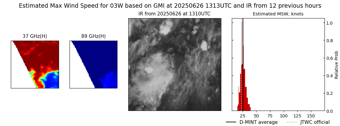 |
| 20250626 | 0809 UTC | SSMISF18 | 1001 hPa | 25 kts | 21 kts | 29 kts | 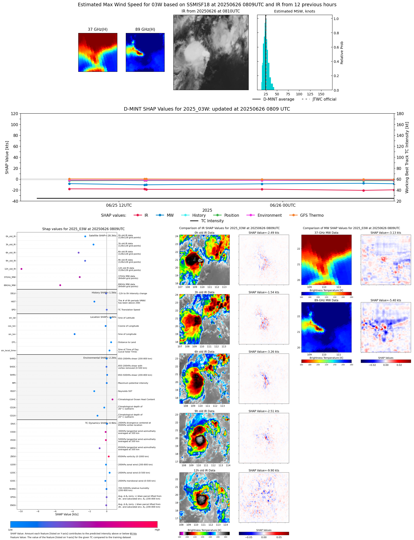 |
| 20250626 | 0555 UTC | AMSR2 | 1004 hPa | 24 kts | 21 kts | 28 kts | 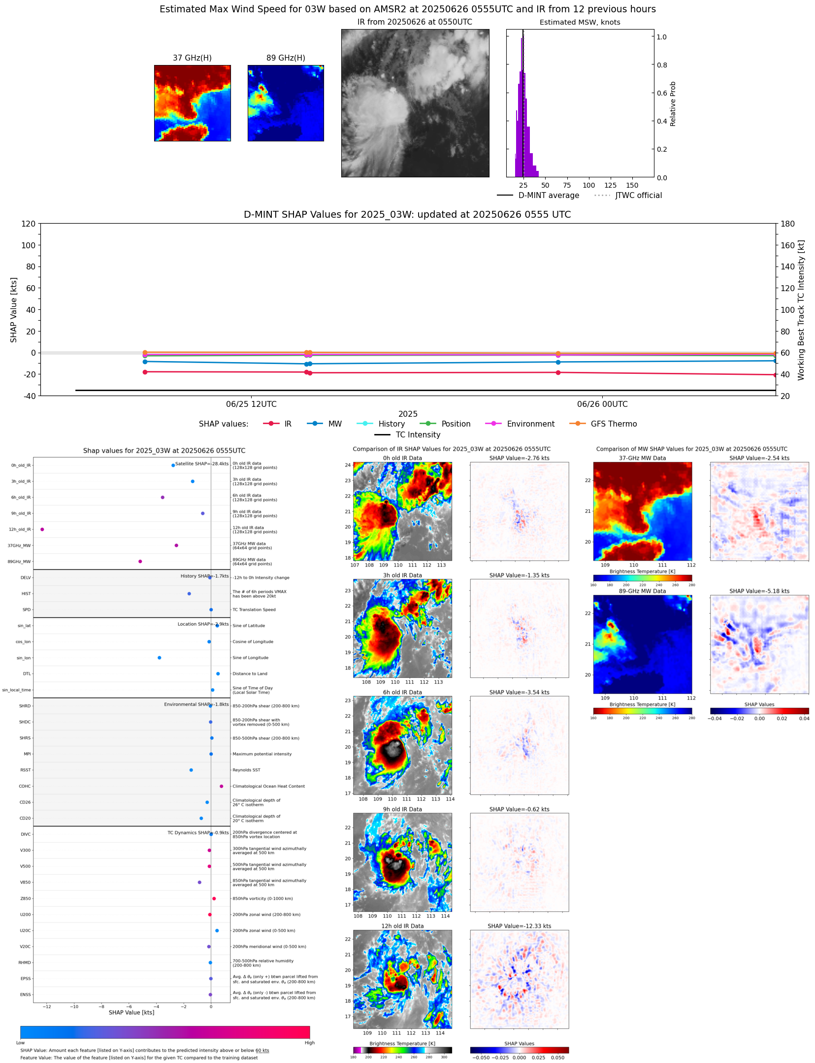 |
| 20250626 | 0429 UTC | TMS03 | 1000 hPa | 26 kts | 23 kts | 29 kts | 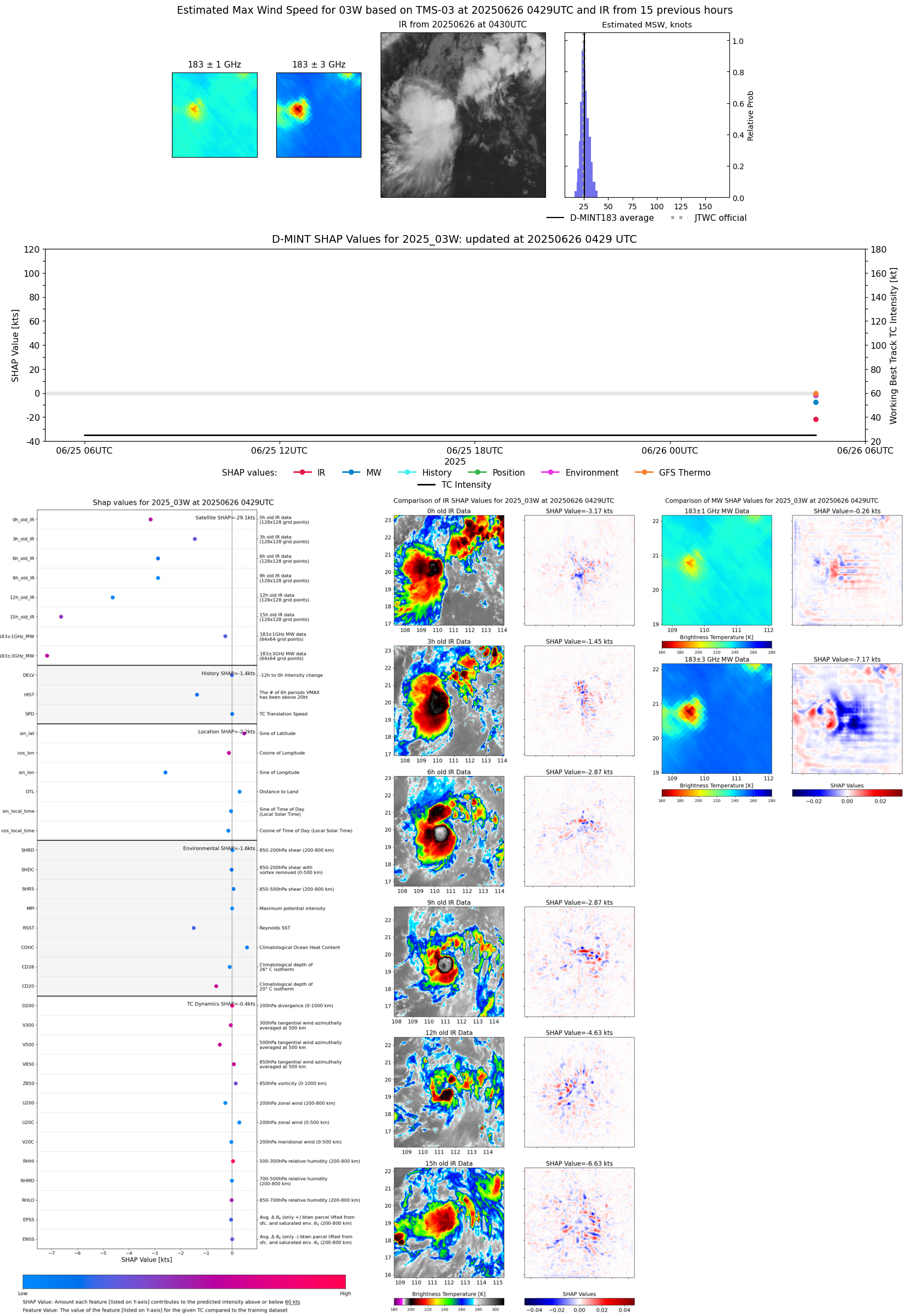 |
| 20250625 | 2229 UTC | SSMISF17 | 1001 hPa | 25 kts | 22 kts | 29 kts | 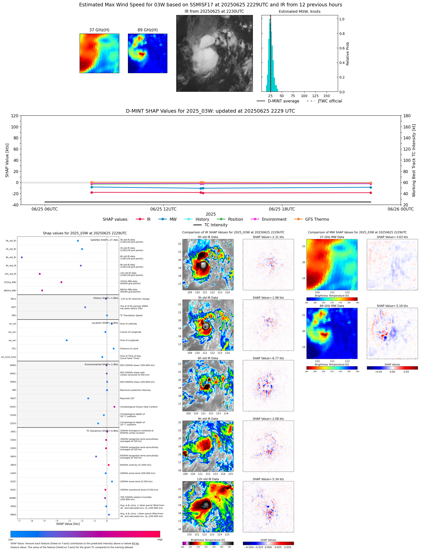 |
| 20250625 | 2055 UTC | SSMISF18 | 1002 hPa | 28 kts | 24 kts | 32 kts | 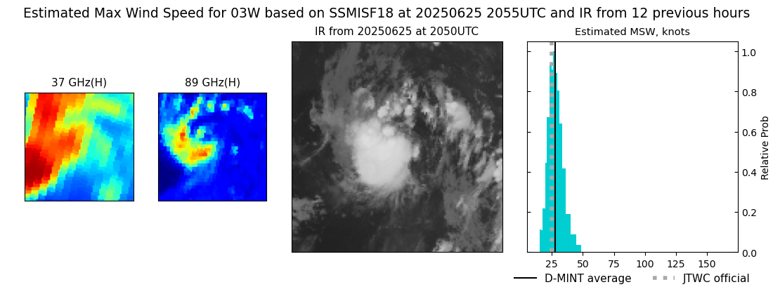 |
| 20250625 | 1400 UTC | GMI | 1001 hPa | 24 kts | 22 kts | 26 kts |  |
| 20250625 | 1353 UTC | GMI | 1002 hPa | 25 kts | 22 kts | 27 kts |  |
| 20250625 | 0822 UTC | SSMISF18 | 999 hPa | 27 kts | 23 kts | 30 kts | 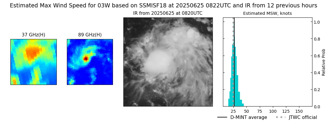 |