|
||

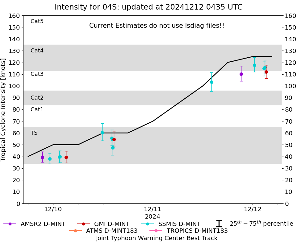 |
D-MINT HISTORY FILE for 2025_04S
| Date | Time | MW Sensor | MSLP | Vmax (30th-70th percentile average) | Vmax 25th percentile | Vmax 75th percentile | Image |
| 20241216 | 1604 UTC | SSMISF17 | NaN hPa | 26 kts | 23 kts | 30 kts | 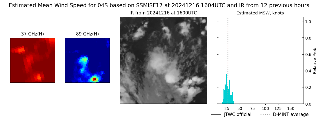 |
| 20241216 | 1347 UTC | SSMISF18 | NaN hPa | 27 kts | 23 kts | 30 kts | 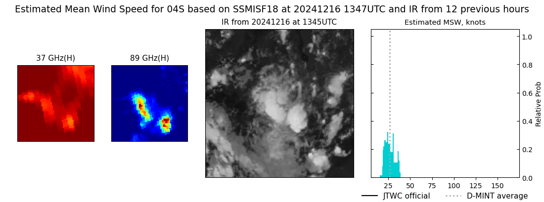 |
| 20241216 | 0336 UTC | GMI | NaN hPa | 30 kts | 25 kts | 36 kts | 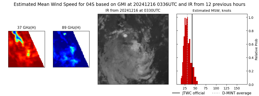 |
| 20241216 | 0330 UTC | SSMISF17 | NaN hPa | 30 kts | 25 kts | 36 kts | 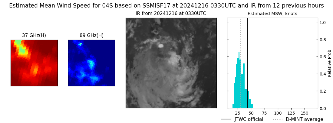 |
| 20241215 | 2231 UTC | AMSR2 | NaN hPa | 35 kts | 29 kts | 41 kts | 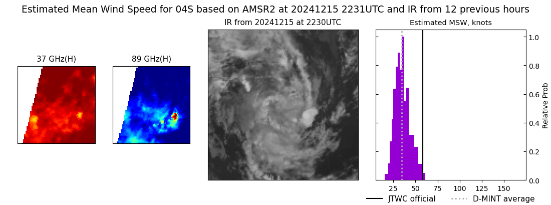 |
| 20241215 | 1414 UTC | GMI | NaN hPa | 70 kts | 61 kts | 80 kts | 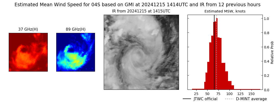 |
| 20241215 | 1402 UTC | SSMISF18 | NaN hPa | 73 kts | 65 kts | 83 kts | 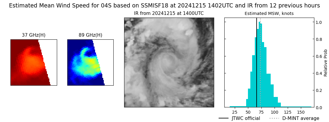 |
| 20241215 | 1048 UTC | ATMS-N20 | NaN hPa | 65 kts | 59 kts | 72 kts | 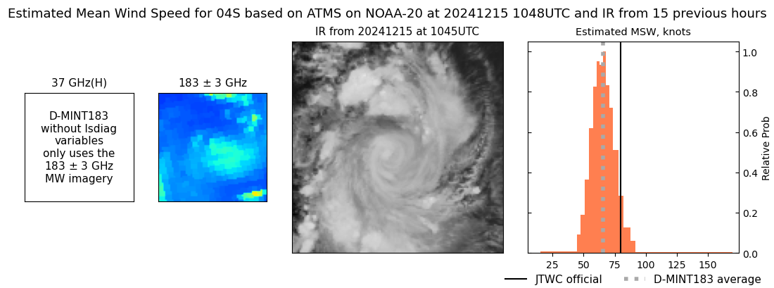 |
| 20241215 | 0513 UTC | TROPICS05 | NaN hPa | 97 kts | 90 kts | 104 kts | 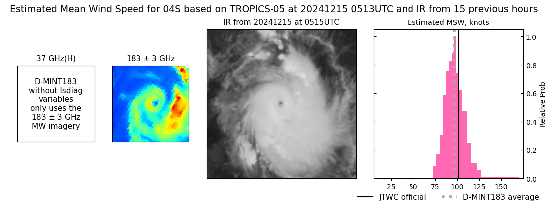 |
| 20241215 | 0343 UTC | SSMISF17 | NaN hPa | 95 kts | 87 kts | 104 kts |  |
| 20241215 | 0125 UTC | SSMISF18 | NaN hPa | 87 kts | 80 kts | 95 kts | 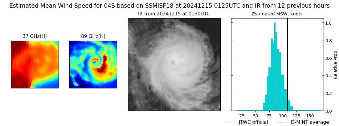 |
| 20241214 | 2237 UTC | ATMS-N20 | NaN hPa | 101 kts | 94 kts | 107 kts | 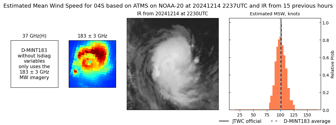 |
| 20241214 | 2214 UTC | ATMS-N20 | NaN hPa | 102 kts | 96 kts | 109 kts | 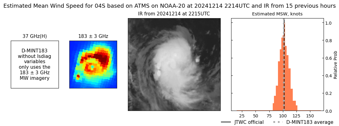 |
| 20241214 | 0950 UTC | ATMS-N20 | NaN hPa | 65 kts | 59 kts | 71 kts | 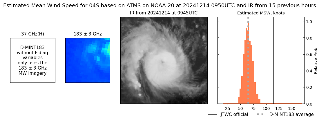 |
| 20241213 | 2242 UTC | AMSR2 | NaN hPa | 84 kts | 79 kts | 90 kts | 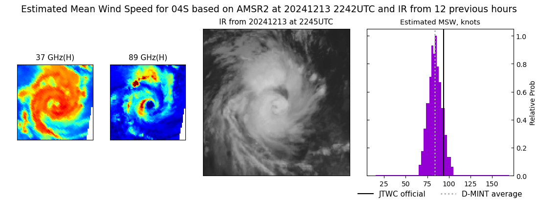 |
| 20241213 | 2233 UTC | ATMS-N20 | NaN hPa | 83 kts | 77 kts | 91 kts | 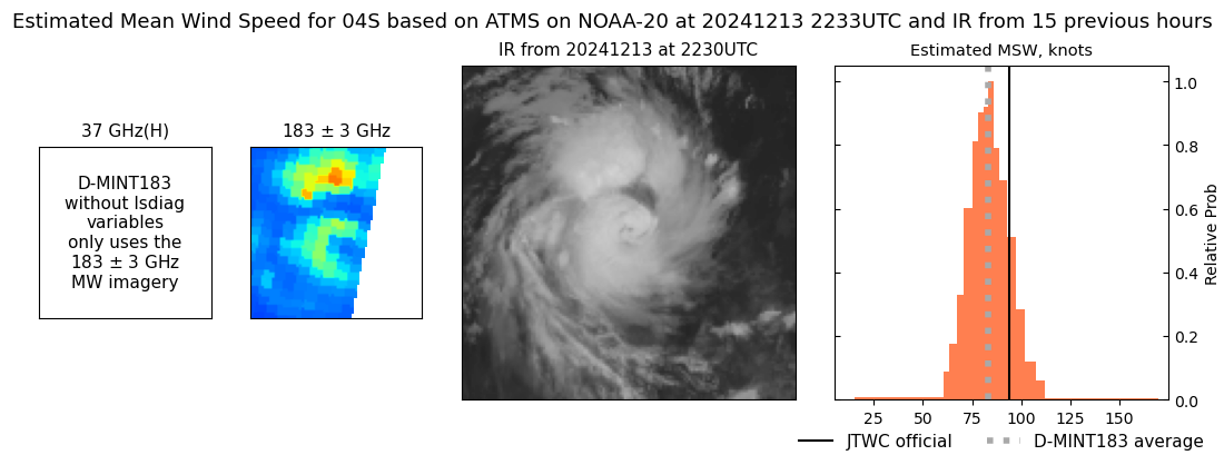 |
| 20241213 | 1632 UTC | TROPICS03 | NaN hPa | 96 kts | 89 kts | 104 kts | 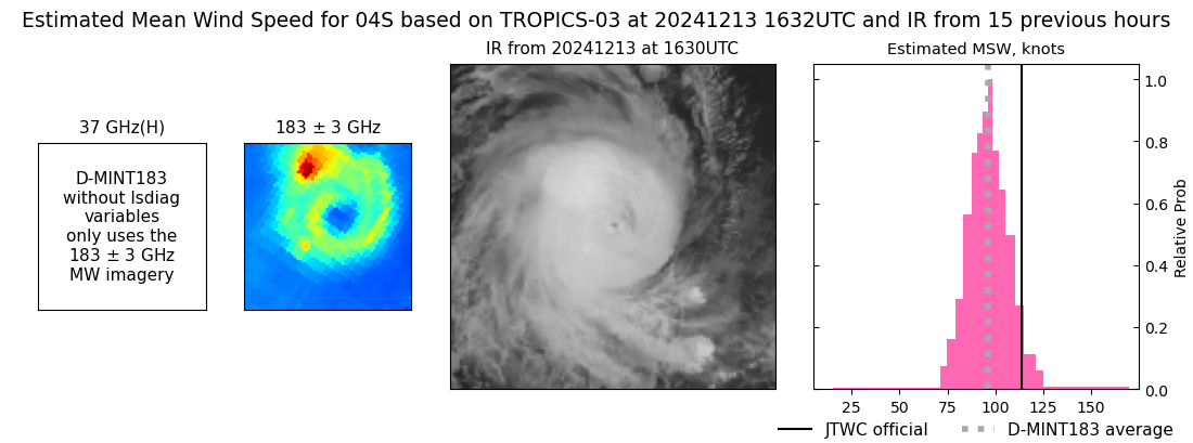 |
| 20241213 | 1506 UTC | SSMISF17 | NaN hPa | 98 kts | 92 kts | 105 kts | 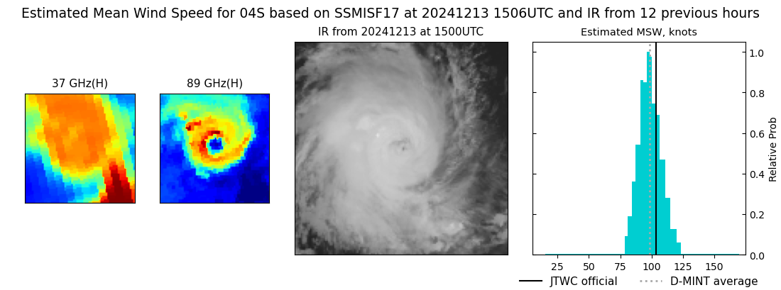 |
| 20241213 | 1247 UTC | SSMISF18 | NaN hPa | 94 kts | 88 kts | 101 kts | 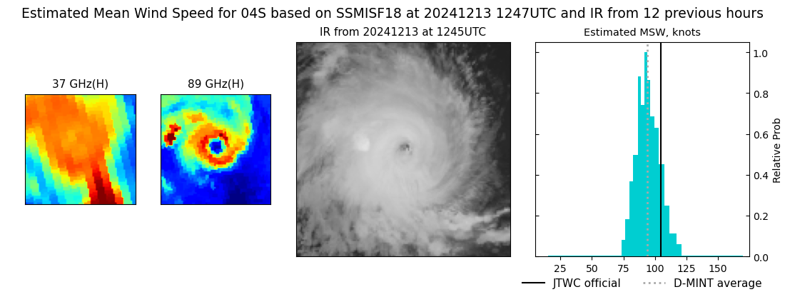 |
| 20241213 | 1013 UTC | AMSR2 | NaN hPa | 103 kts | 97 kts | 110 kts | 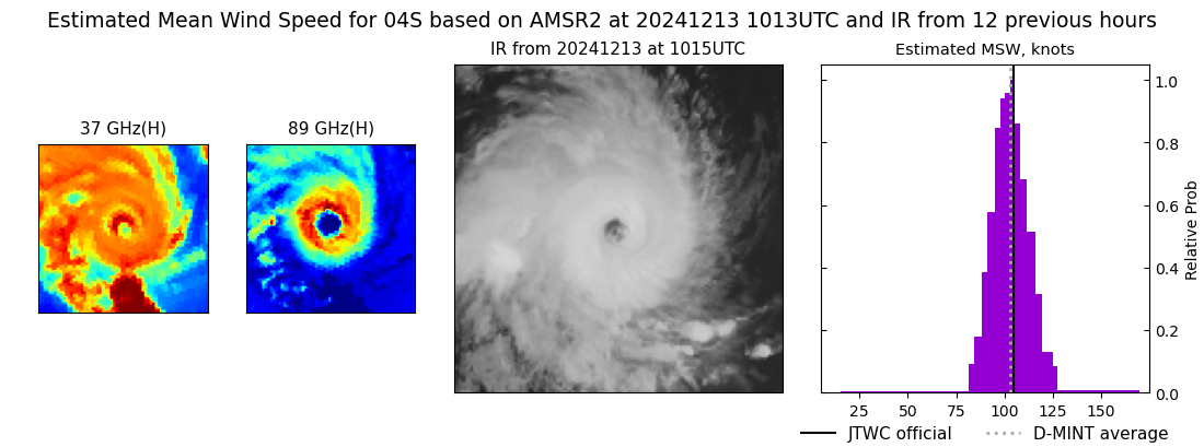 |
| 20241213 | 0229 UTC | SSMISF17 | NaN hPa | 110 kts | 104 kts | 117 kts |  |
| 20241213 | 0010 UTC | SSMISF18 | NaN hPa | 107 kts | 100 kts | 114 kts | 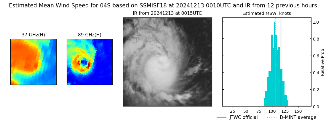 |
| 20241212 | 2157 UTC | AMSR2 | NaN hPa | 99 kts | 92 kts | 106 kts | 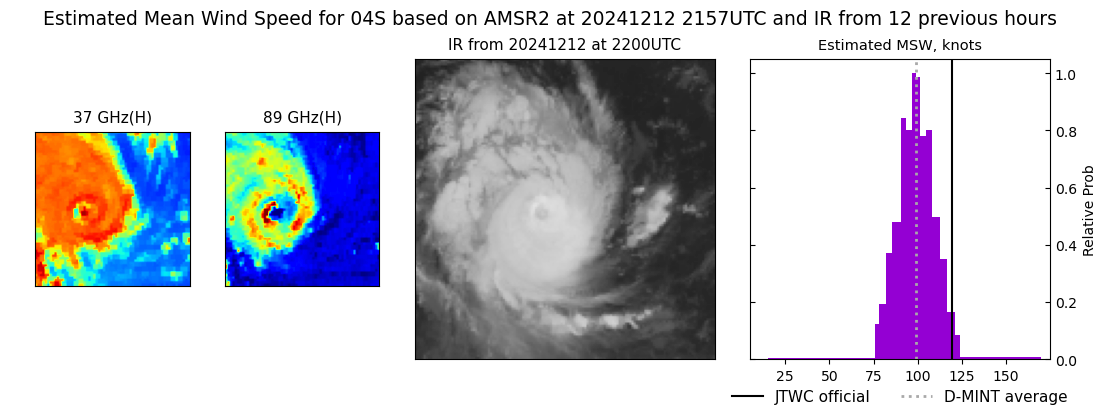 |
| 20241212 | 1028 UTC | ATMS-N20 | NaN hPa | 126 kts | 120 kts | 133 kts | 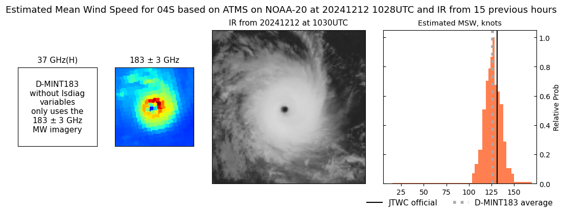 |
| 20241212 | 1005 UTC | ATMS-N20 | NaN hPa | 126 kts | 120 kts | 133 kts | 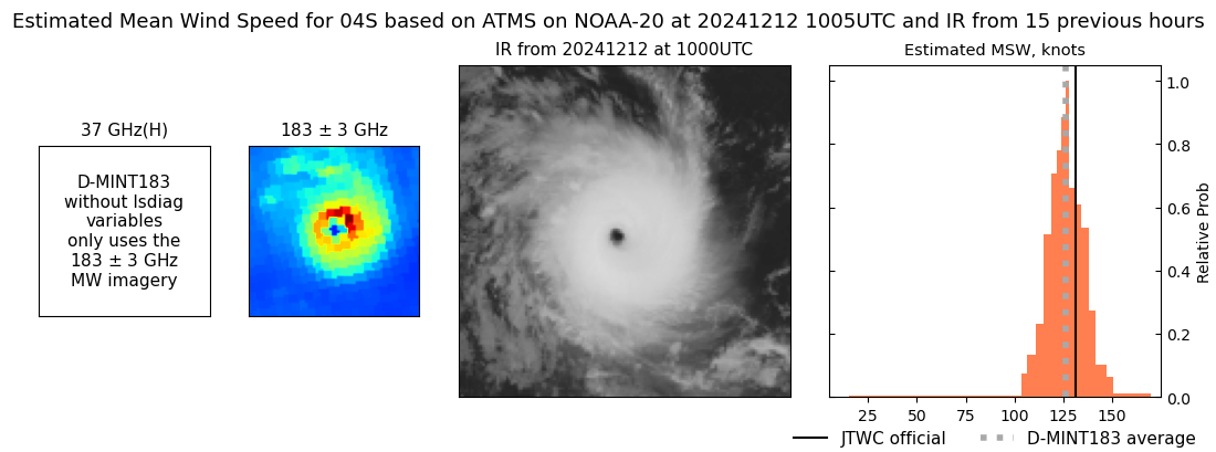 |
| 20241212 | 0316 UTC | GMI | NaN hPa | 112 kts | 107 kts | 118 kts | 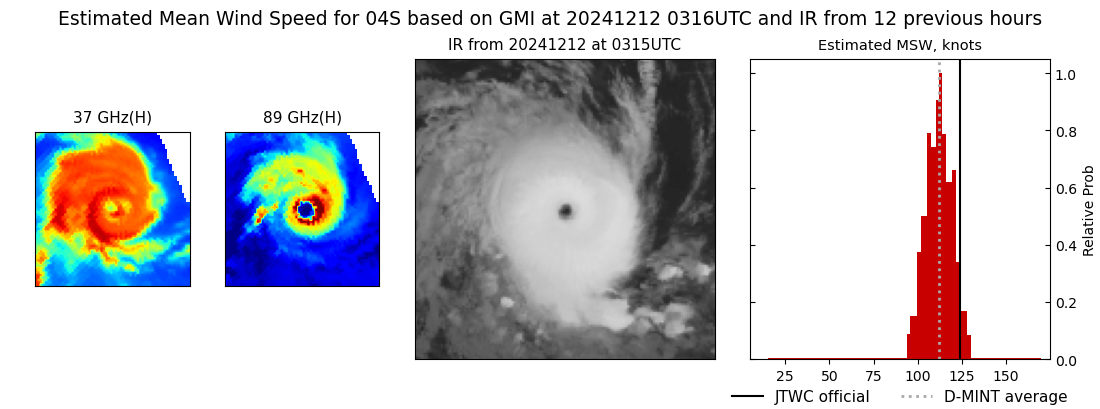 |
| 20241212 | 0255 UTC | SSMISF16 | NaN hPa | 116 kts | 110 kts | 121 kts |  |
| 20241212 | 0243 UTC | SSMISF17 | NaN hPa | 115 kts | 109 kts | 121 kts | 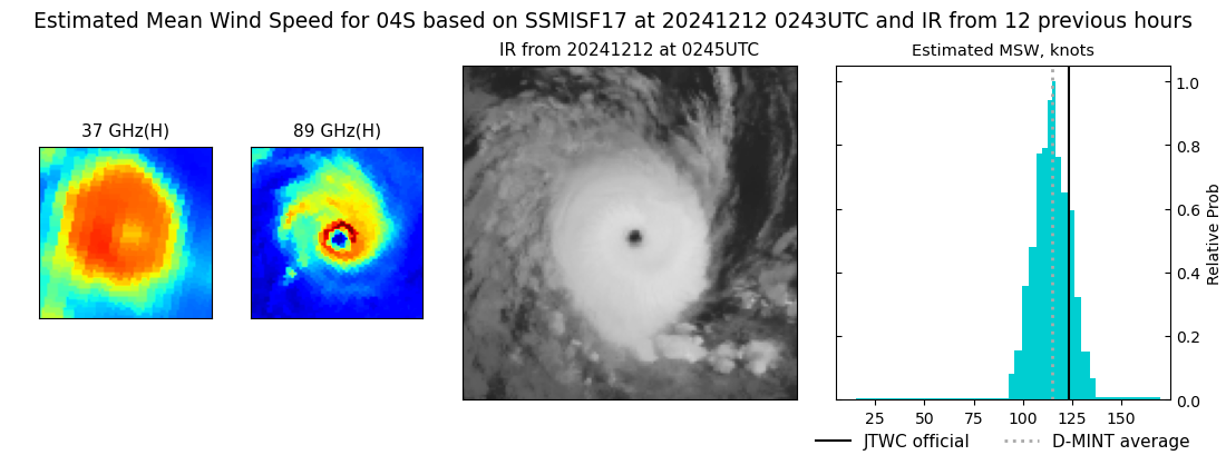 |
| 20241212 | 0023 UTC | SSMISF18 | NaN hPa | 118 kts | 112 kts | 124 kts | 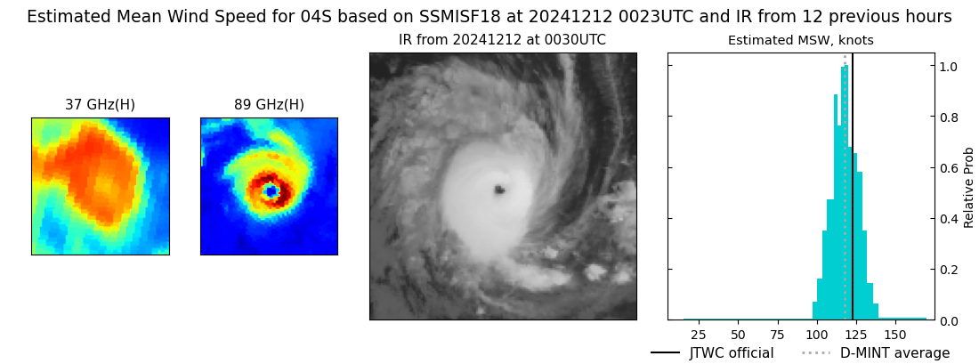 |
| 20241211 | 2115 UTC | AMSR2 | NaN hPa | 110 kts | 104 kts | 117 kts | 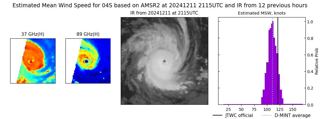 |
| 20241211 | 1405 UTC | SSMISF16 | NaN hPa | 103 kts | 95 kts | 111 kts | 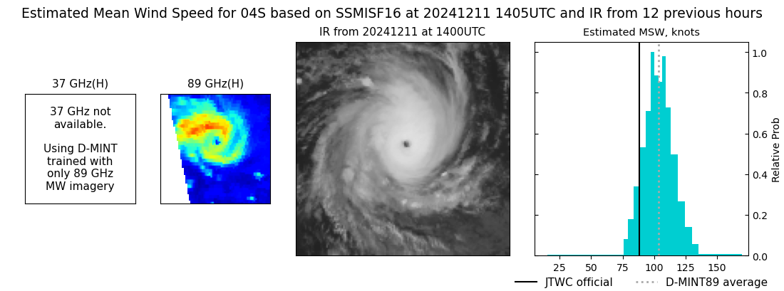 |
| 20241211 | 0551 UTC | TROPICS05 | NaN hPa | 72 kts | 66 kts | 80 kts | 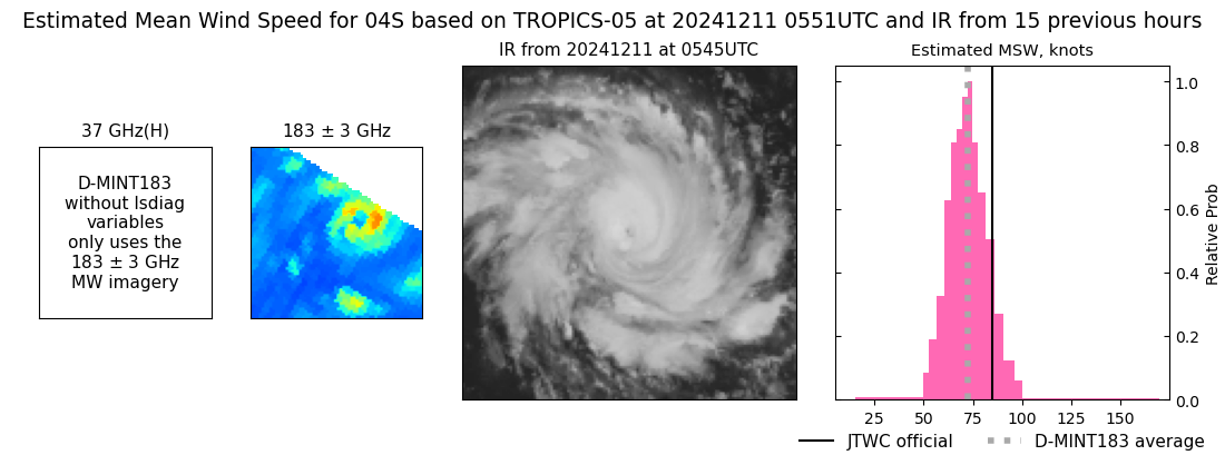 |
| 20241211 | 0445 UTC | TROPICS06 | NaN hPa | 78 kts | 71 kts | 86 kts | 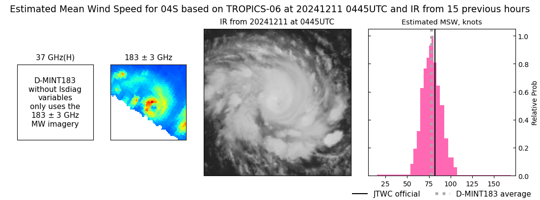 |
| 20241210 | 1439 UTC | GMI | NaN hPa | 54 kts | 48 kts | 61 kts | 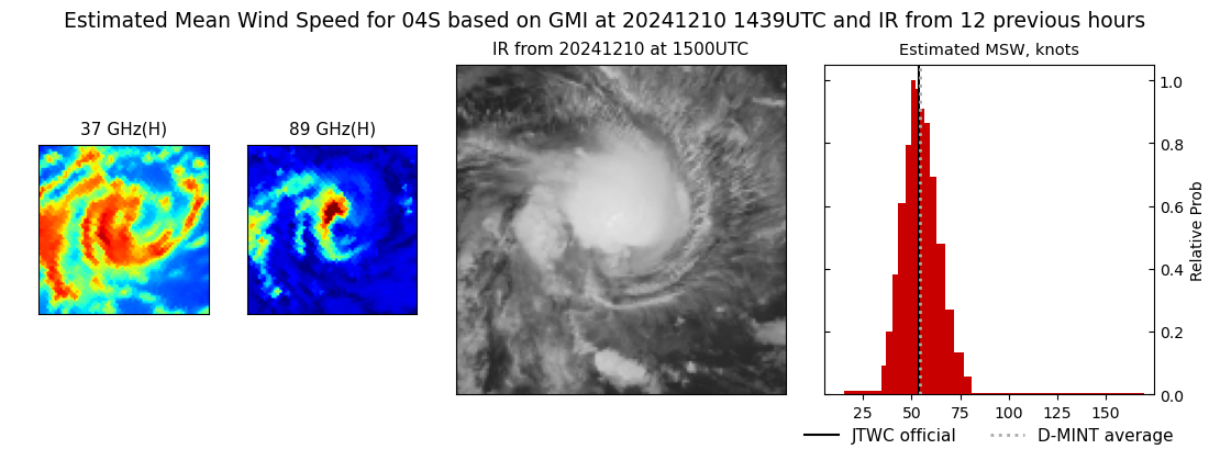 |
| 20241210 | 1418 UTC | SSMISF16 | NaN hPa | 47 kts | 41 kts | 54 kts | 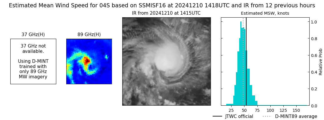 |
| 20241210 | 1408 UTC | SSMISF17 | NaN hPa | 56 kts | 49 kts | 63 kts | 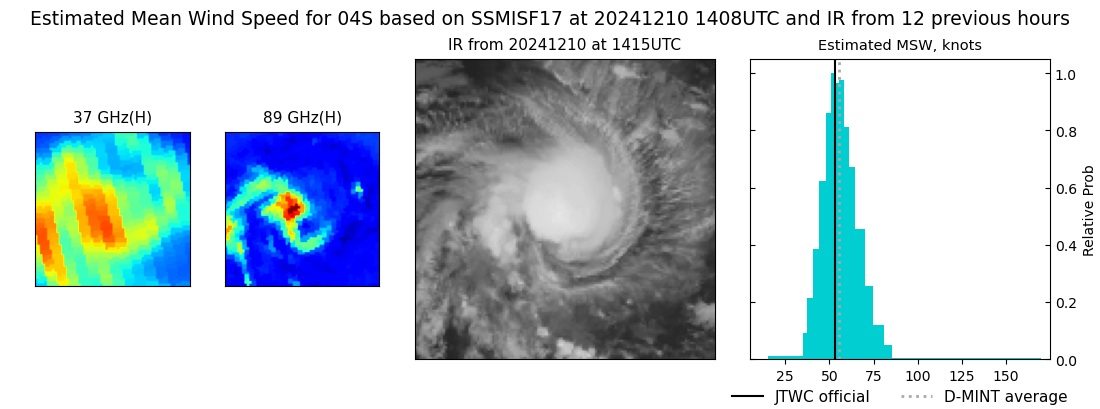 |
| 20241210 | 1148 UTC | SSMISF18 | NaN hPa | 60 kts | 53 kts | 68 kts | 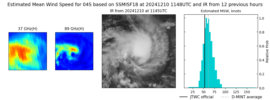 |
| 20241210 | 0522 UTC | TROPICS06 | NaN hPa | 47 kts | 41 kts | 53 kts | 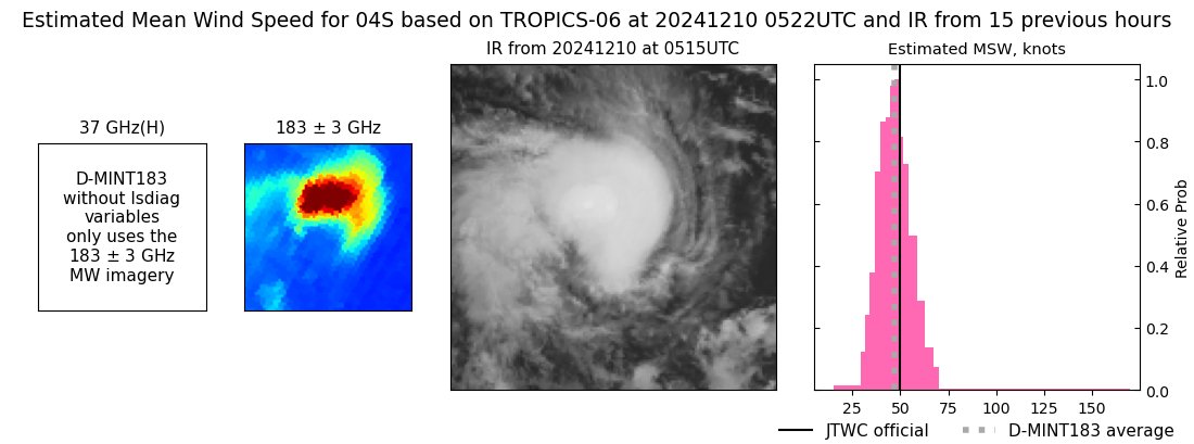 |
| 20241210 | 0308 UTC | TROPICS03 | NaN hPa | 50 kts | 44 kts | 56 kts | 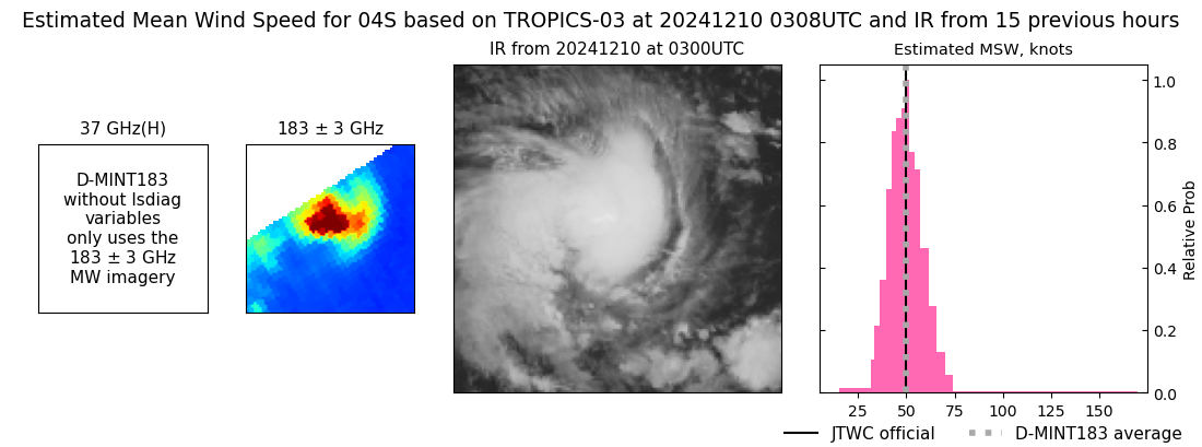 |
| 20241210 | 0306 UTC | GMI | NaN hPa | 39 kts | 35 kts | 45 kts | 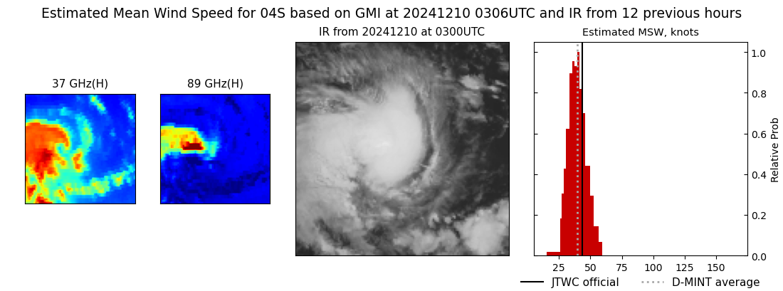 |
| 20241210 | 0140 UTC | SSMISF16 | NaN hPa | 40 kts | 35 kts | 45 kts | 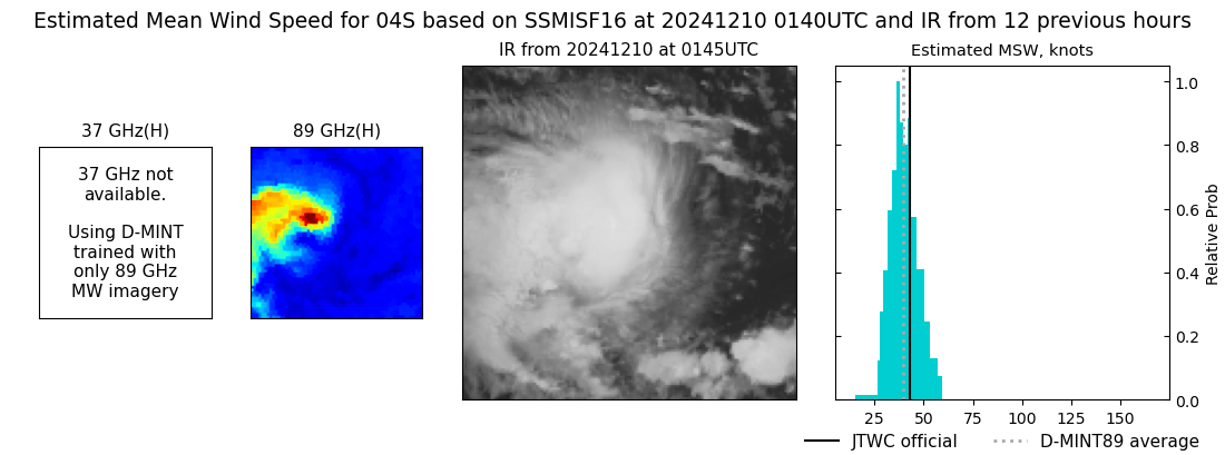 |
| 20241210 | 0131 UTC | SSMISF17 | NaN hPa | 40 kts | 35 kts | 45 kts | 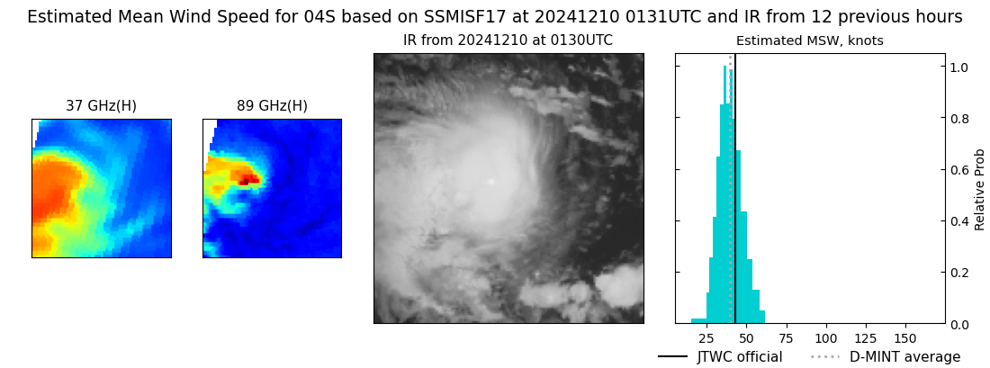 |
| 20241209 | 2311 UTC | SSMISF18 | NaN hPa | 38 kts | 34 kts | 43 kts | 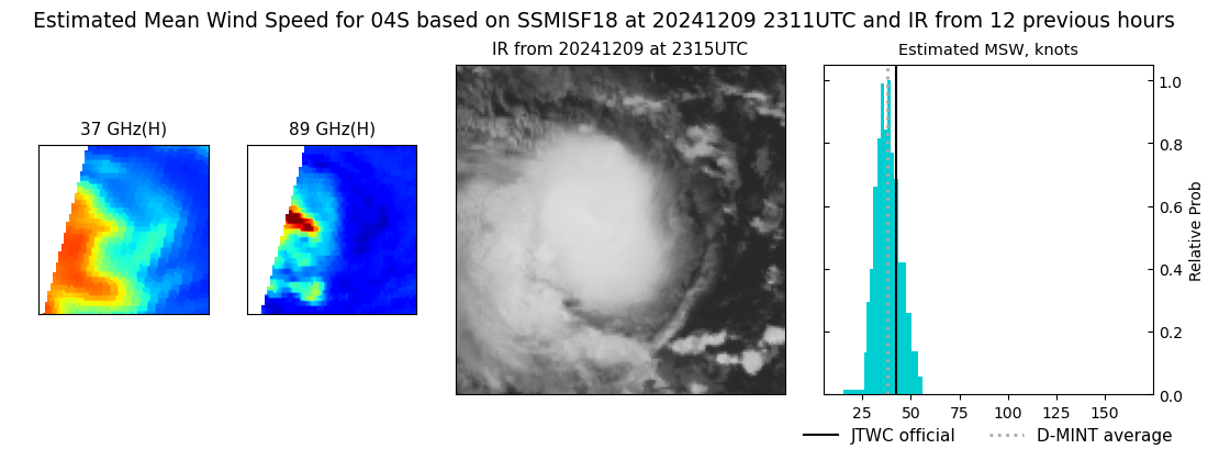 |
| 20241209 | 2126 UTC | AMSR2 | NaN hPa | 39 kts | 35 kts | 44 kts |  |
| 20241209 | 0921 UTC | ATMS-N21 | NaN hPa | 34 kts | 30 kts | 38 kts | 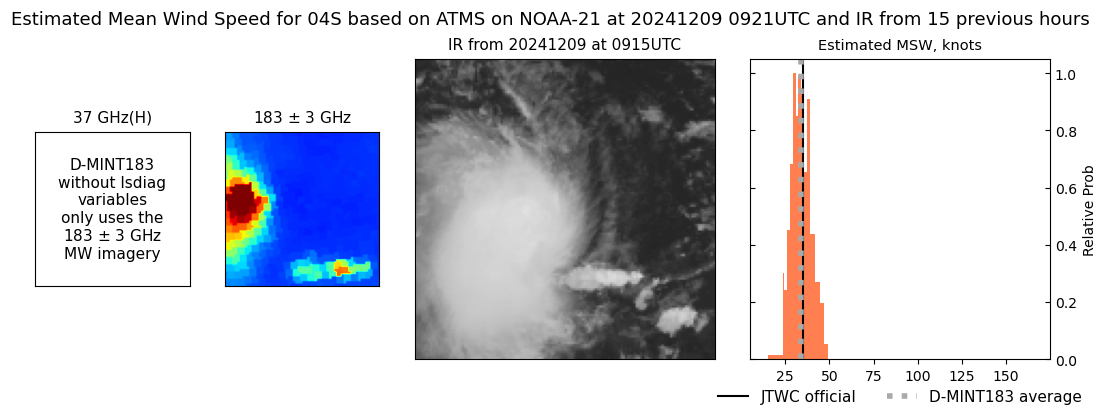 |