|
||

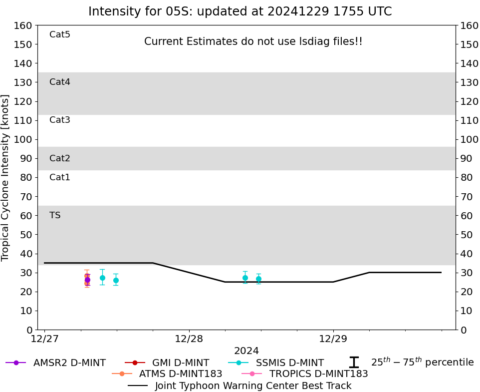 |
D-MINT HISTORY FILE for 2025_05S
| Date | Time | MW Sensor | MSLP | Vmax (30th-70th percentile average) | Vmax 25th percentile | Vmax 75th percentile | Image |
| 20250102 | 0809 UTC | AMSR2 | NaN hPa | 21 kts | 20 kts | 23 kts | 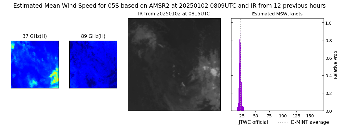 |
| 20250101 | 1957 UTC | AMSR2 | NaN hPa | 24 kts | 23 kts | 26 kts | 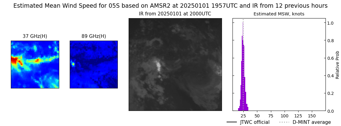 |
| 20250101 | 1005 UTC | SSMISF18 | NaN hPa | 21 kts | 20 kts | 22 kts | 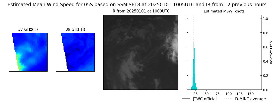 |
| 20241231 | 1914 UTC | AMSR2 | 1007 hPa | 23 kts | 23 kts | 24 kts | 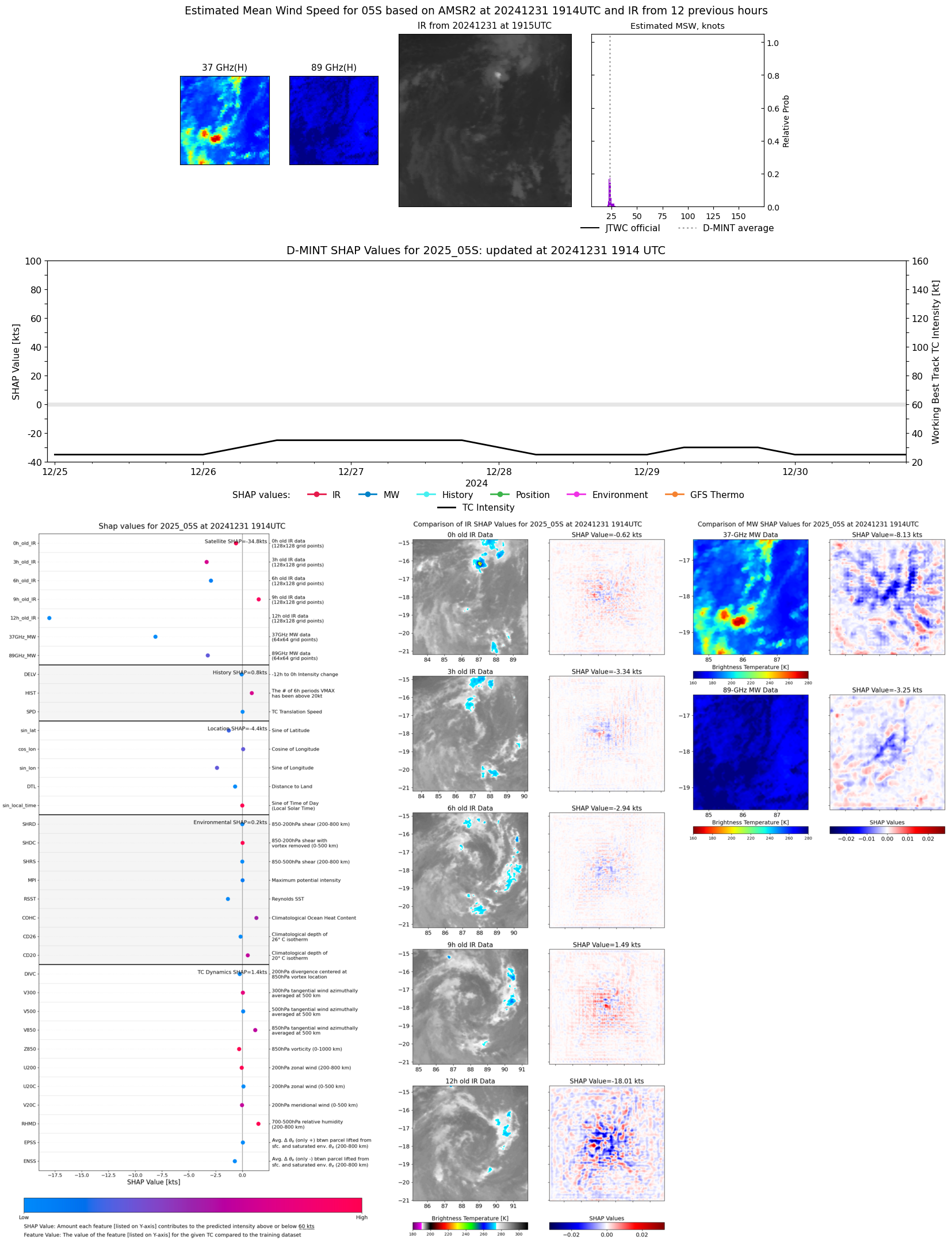 |
| 20241231 | 1252 UTC | SSMISF16 | 1006 hPa | 23 kts | 22 kts | 24 kts | 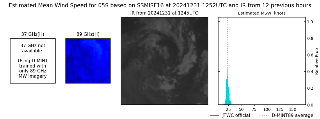 |
| 20241231 | 1232 UTC | SSMISF17 | 1007 hPa | 25 kts | 24 kts | 27 kts | 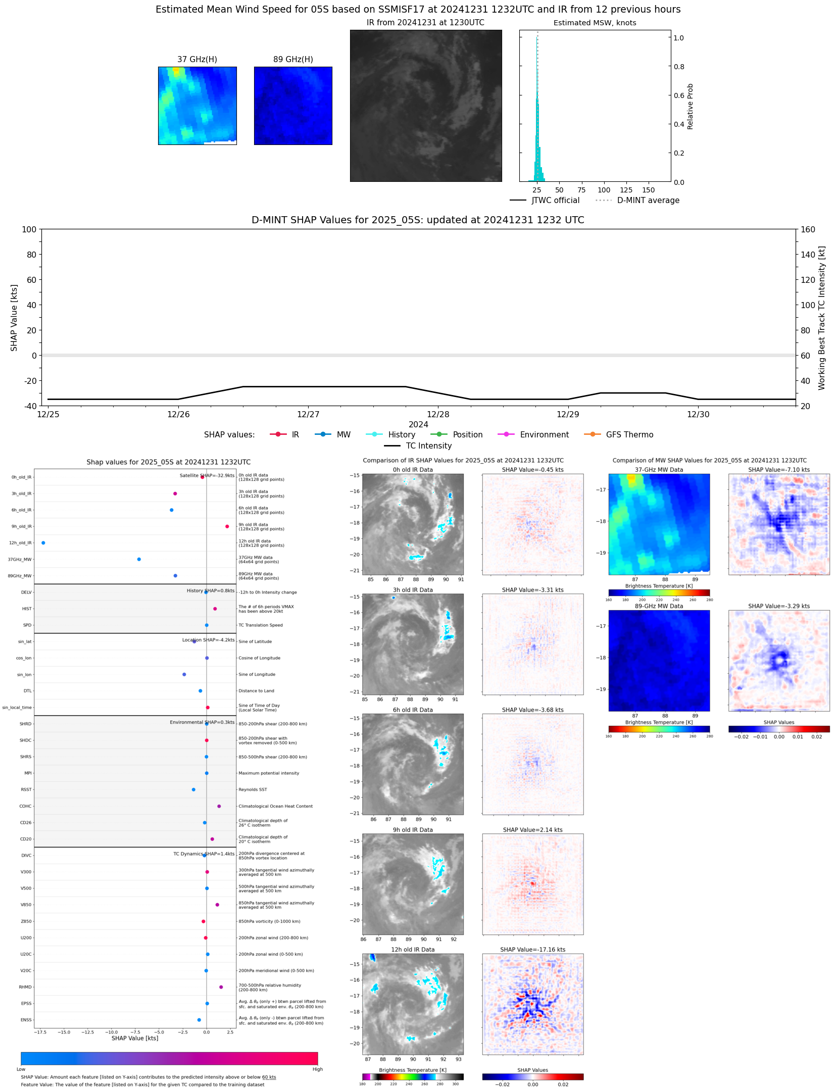 |
| 20241231 | 1017 UTC | SSMISF18 | 1006 hPa | 26 kts | 25 kts | 28 kts |  |
| 20241231 | 0017 UTC | SSMISF16 | 1006 hPa | 24 kts | 23 kts | 26 kts | 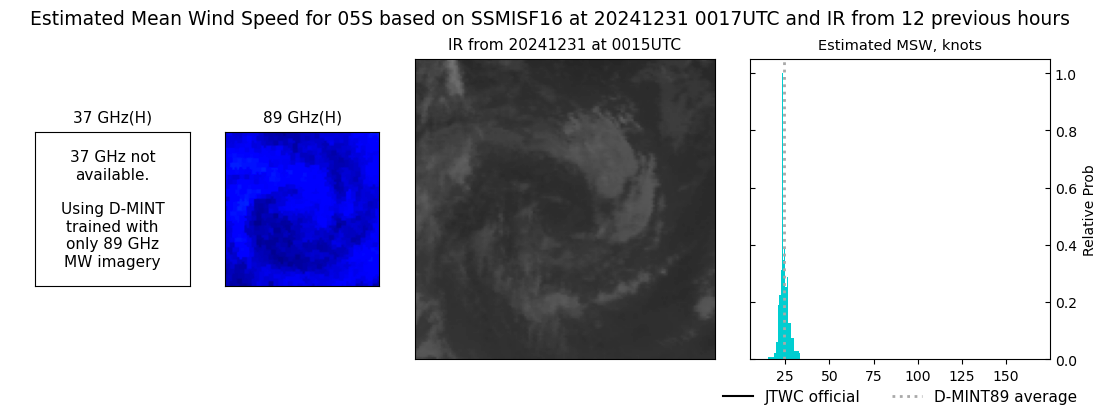 |
| 20241229 | 1910 UTC | ATMS-N20 | NaN hPa | 29 kts | 26 kts | 33 kts | 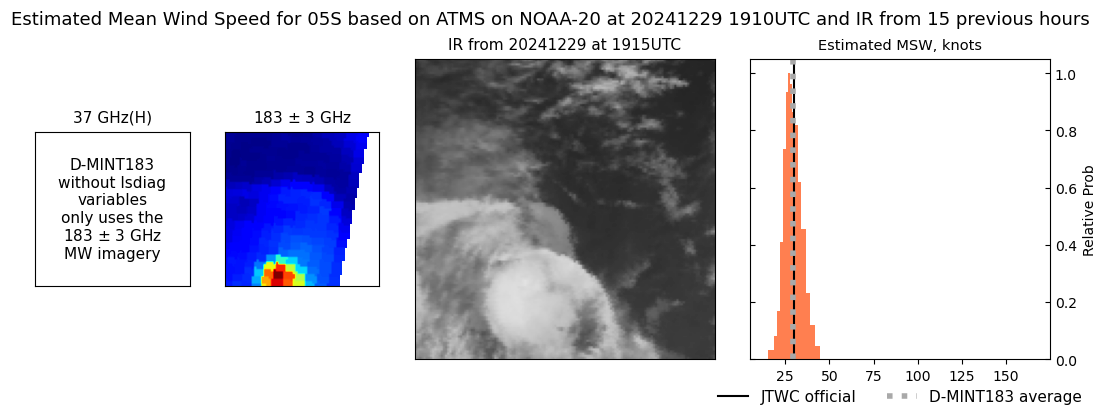 |
| 20241228 | 1152 UTC | SSMISF16 | 1002 hPa | 29 kts | 27 kts | 32 kts | 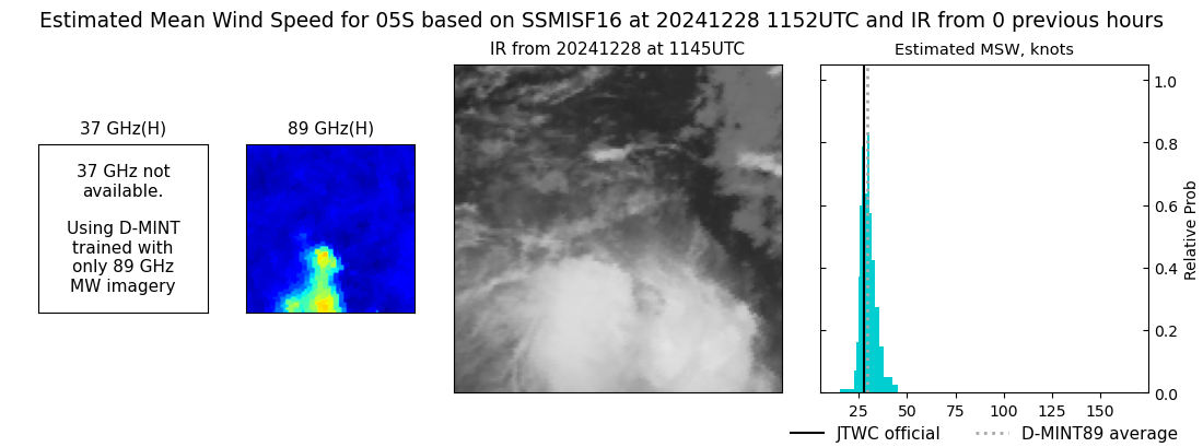 |
| 20241228 | 1134 UTC | SSMISF17 | NaN hPa | 27 kts | 24 kts | 29 kts | 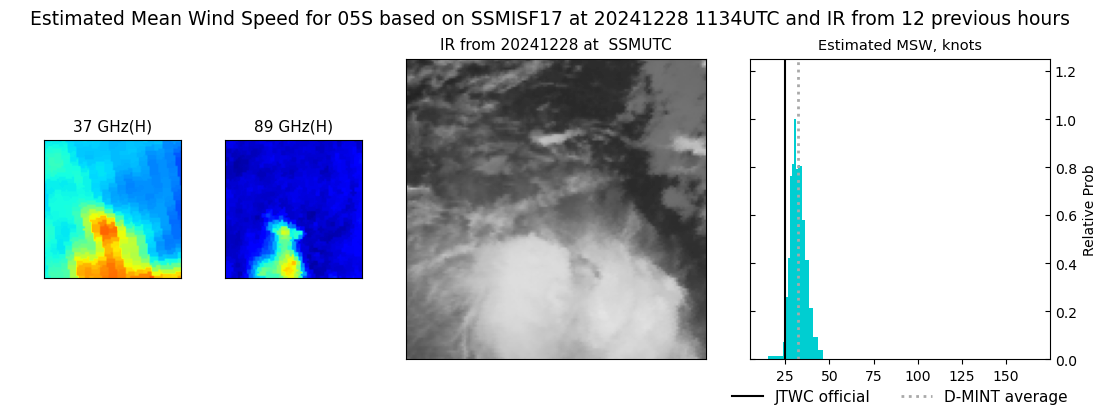 |
| 20241228 | 0919 UTC | SSMISF18 | NaN hPa | 27 kts | 24 kts | 31 kts | 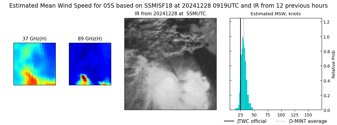 |
| 20241227 | 2316 UTC | SSMISF16 | 1003 hPa | 26 kts | 24 kts | 28 kts | 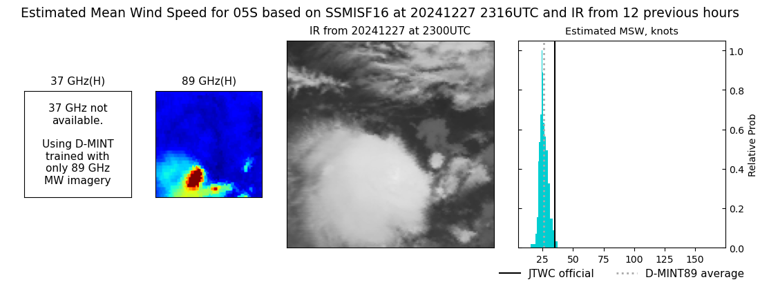 |
| 20241227 | 1206 UTC | SSMISF16 | 1003 hPa | 27 kts | 24 kts | 30 kts | 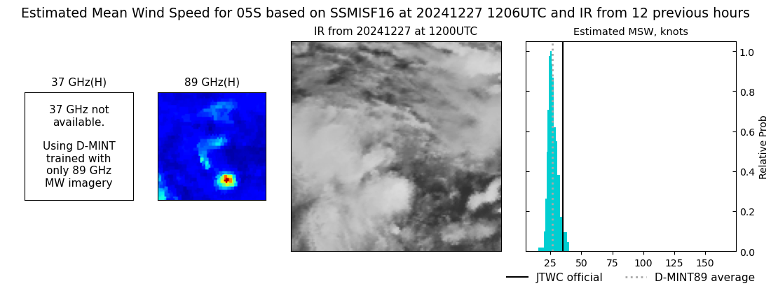 |
| 20241227 | 1148 UTC | SSMISF17 | NaN hPa | 26 kts | 23 kts | 29 kts | 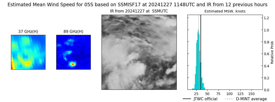 |
| 20241227 | 0933 UTC | SSMISF18 | NaN hPa | 27 kts | 24 kts | 32 kts | 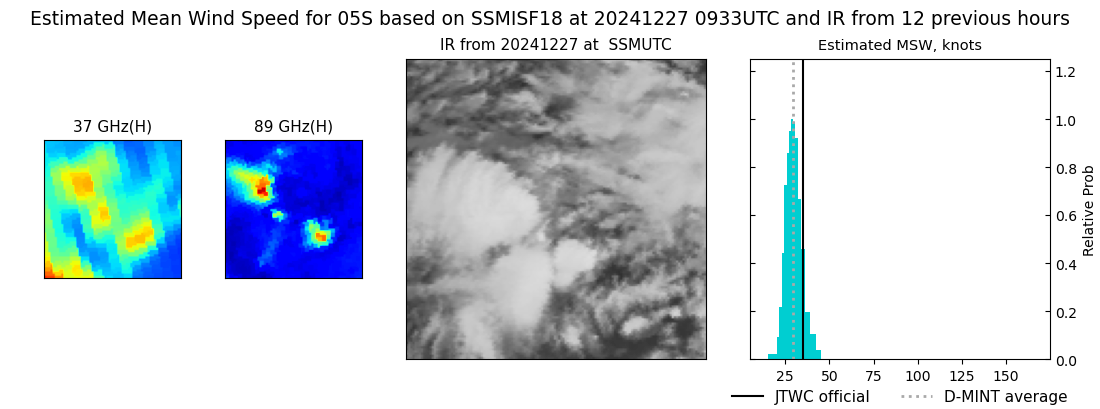 |
| 20241227 | 0708 UTC | AMSR2 | NaN hPa | 26 kts | 23 kts | 29 kts | 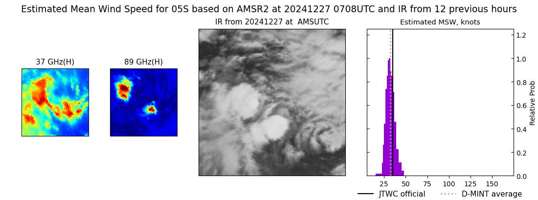 |
| 20241227 | 0700 UTC | ATMS-N20 | NaN hPa | 24 kts | 22 kts | 27 kts | 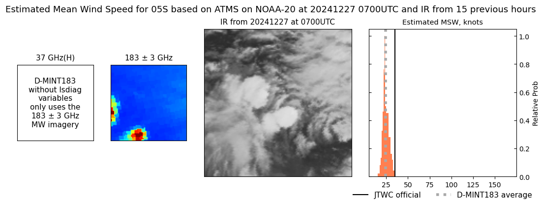 |
| 20241227 | 0659 UTC | ATMS-N20 | NaN hPa | 28 kts | 26 kts | 31 kts | 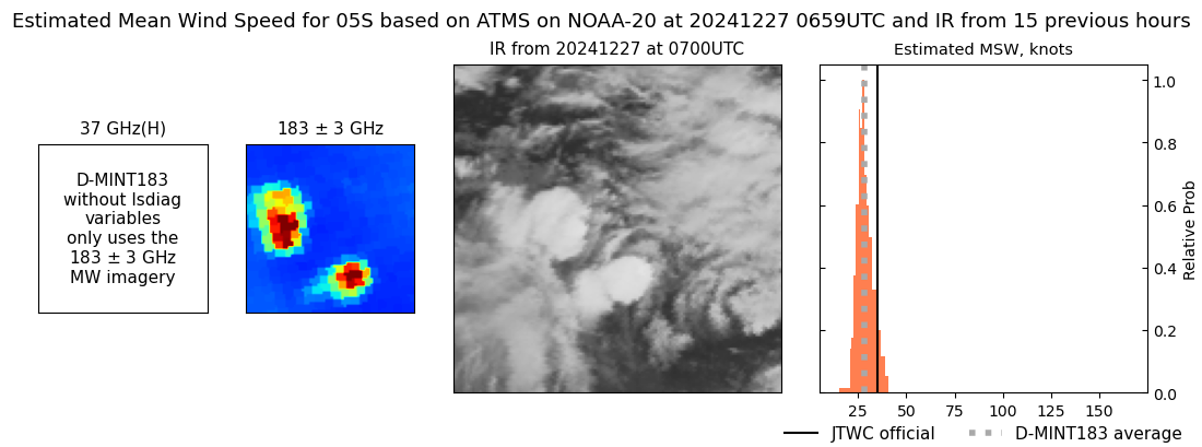 |
| 20241226 | 0719 UTC | ATMS-N20 | NaN hPa | 26 kts | 25 kts | 29 kts | 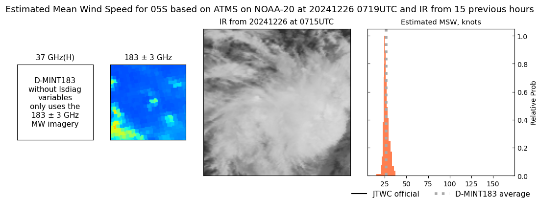 |