|
||

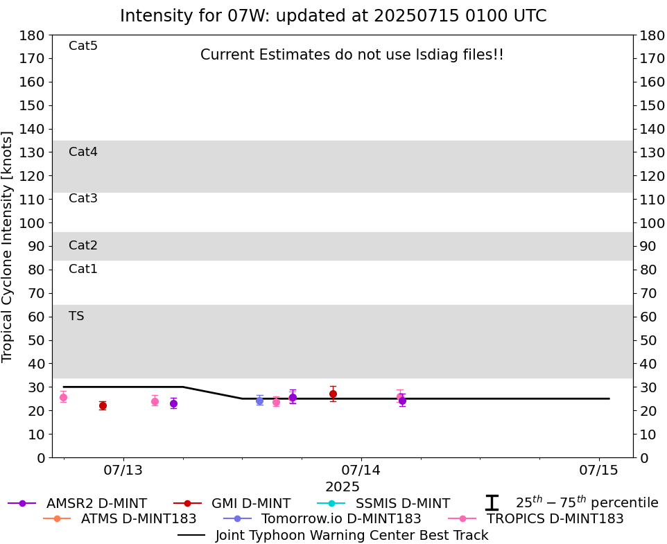 |
D-MINT HISTORY FILE for 2025_07W
| Date | Time | MW Sensor | MSLP | Vmax (30th-70th percentile average) | Vmax 25th percentile | Vmax 75th percentile | Image |
| 20250714 | 0407 UTC | AMSR2 | 995 hPa | 24 kts | 22 kts | 27 kts | 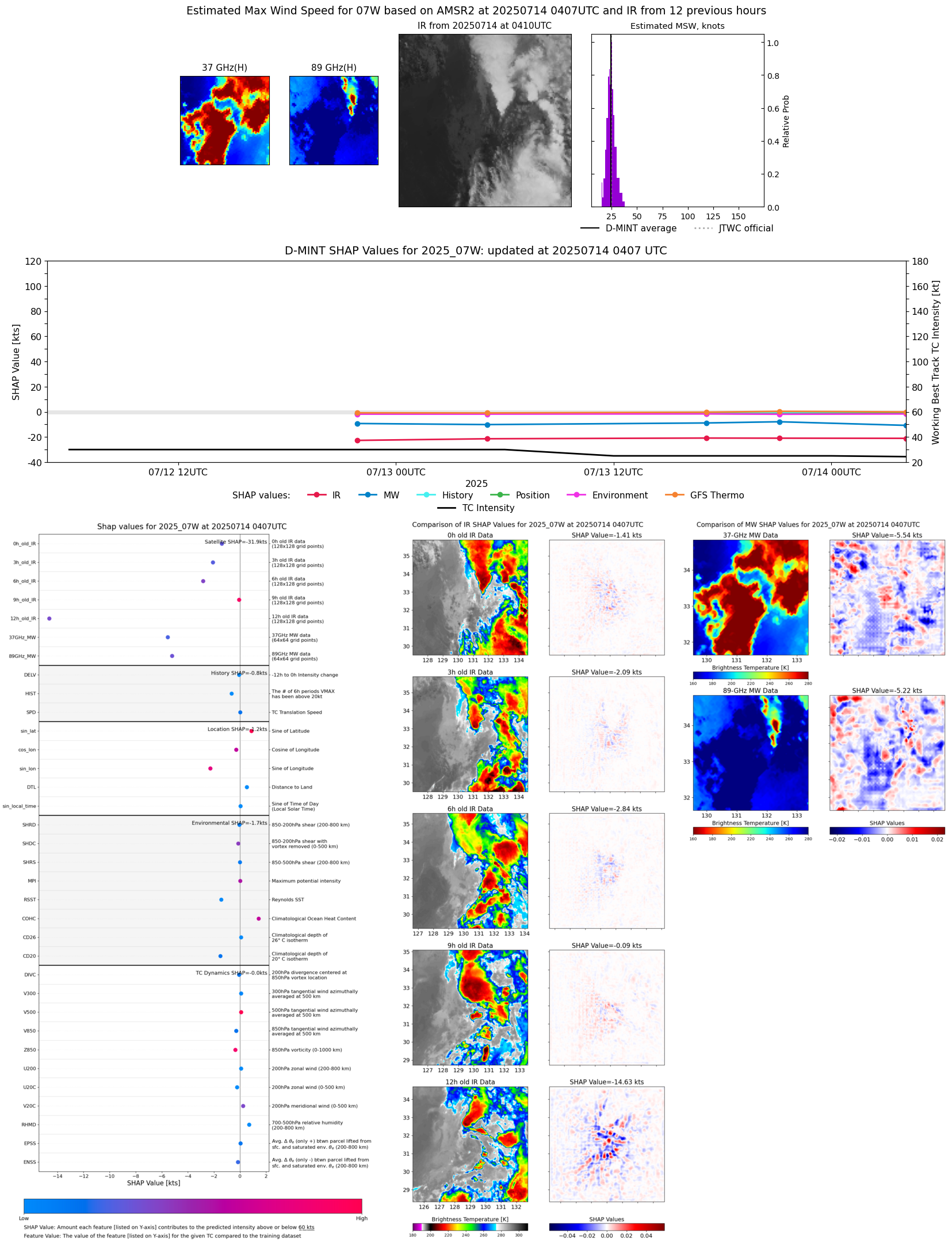 |
| 20250714 | 0354 UTC | TROPICS05 | 995 hPa | 26 kts | 24 kts | 29 kts | 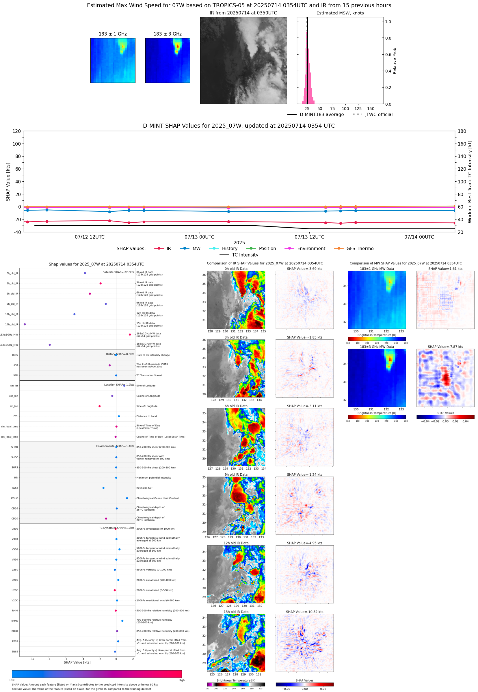 |
| 20250713 | 2108 UTC | GMI | 994 hPa | 27 kts | 24 kts | 30 kts | 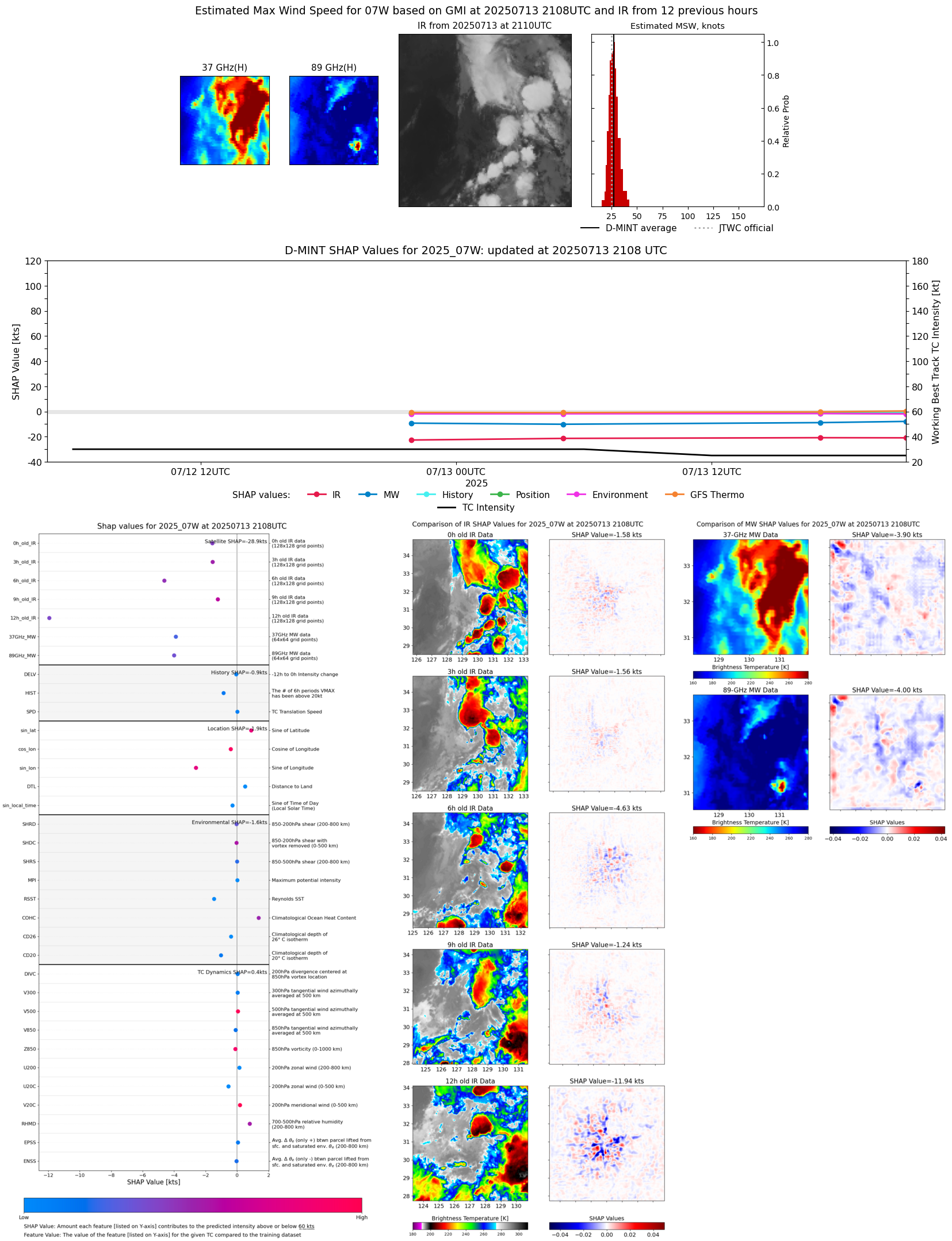 |
| 20250713 | 1706 UTC | AMSR2 | 996 hPa | 26 kts | 23 kts | 29 kts |  |
| 20250713 | 1702 UTC | TROPICS03 | 995 hPa | 25 kts | 23 kts | 28 kts | 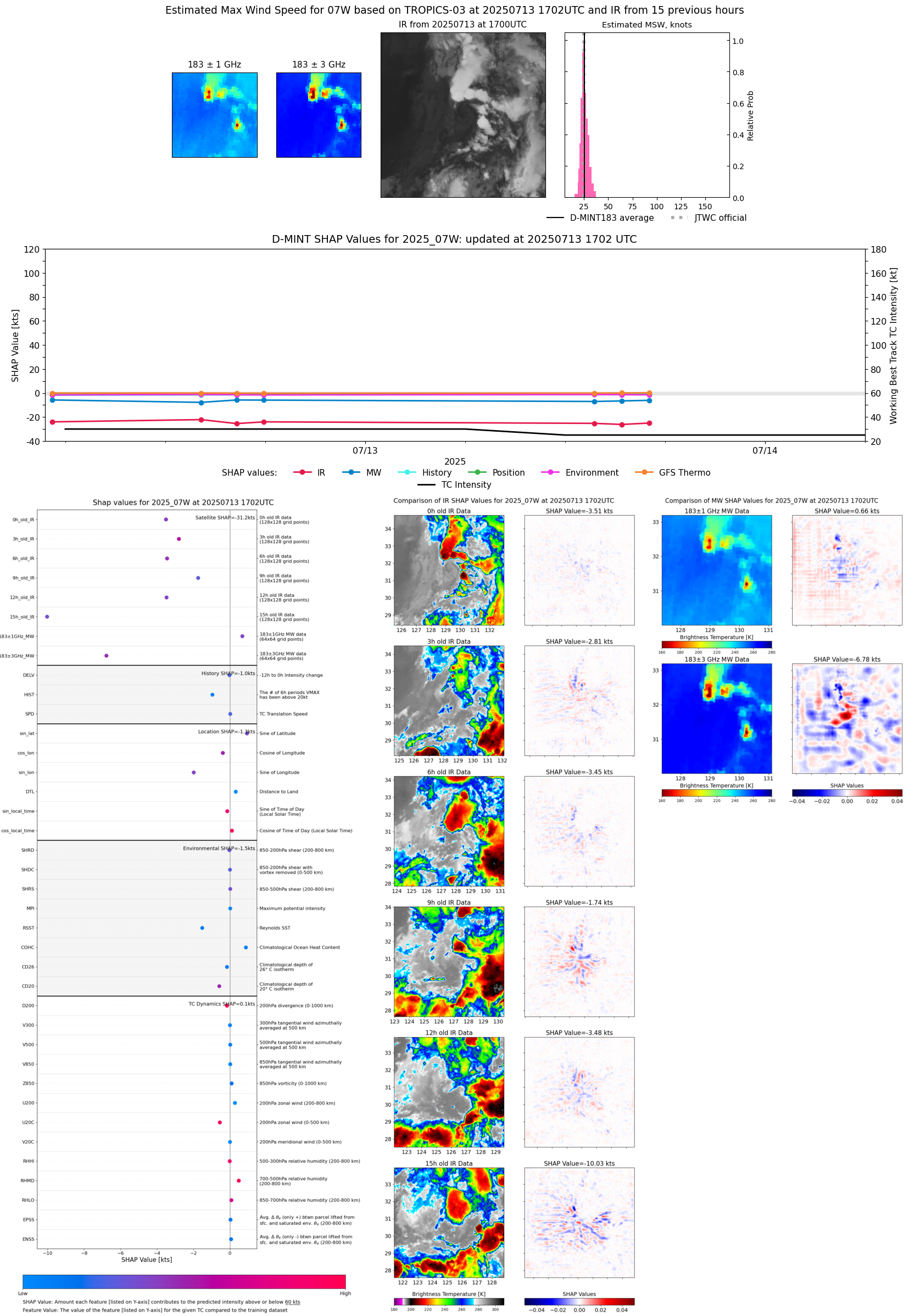 |
| 20250713 | 1524 UTC | TROPICS03 | 996 hPa | 24 kts | 22 kts | 26 kts | 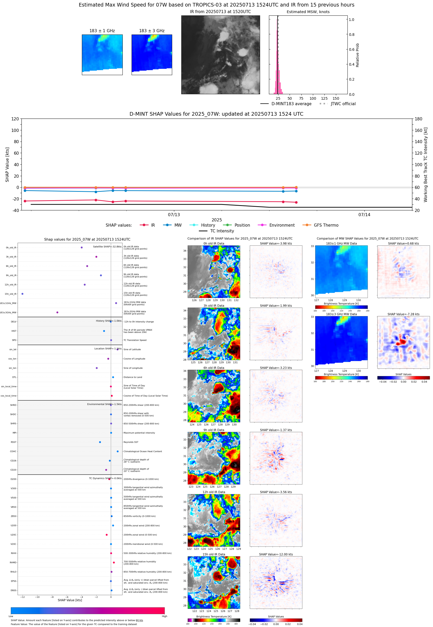 |
| 20250713 | 1345 UTC | TMS02 | 999 hPa | 24 kts | 22 kts | 26 kts |  |
| 20250713 | 0502 UTC | AMSR2 | 998 hPa | 23 kts | 21 kts | 25 kts | 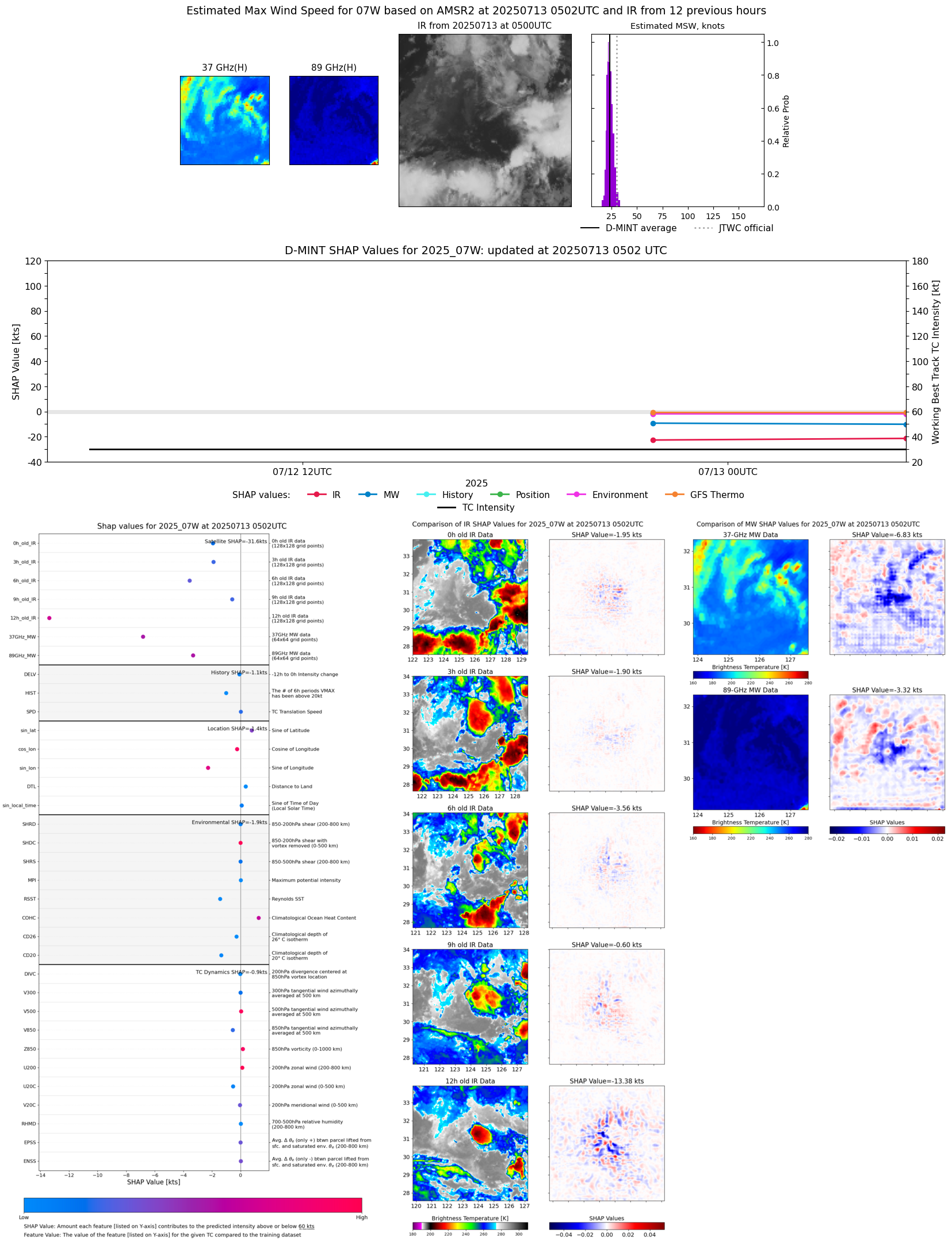 |
| 20250713 | 0309 UTC | TROPICS05 | 999 hPa | 24 kts | 22 kts | 26 kts | 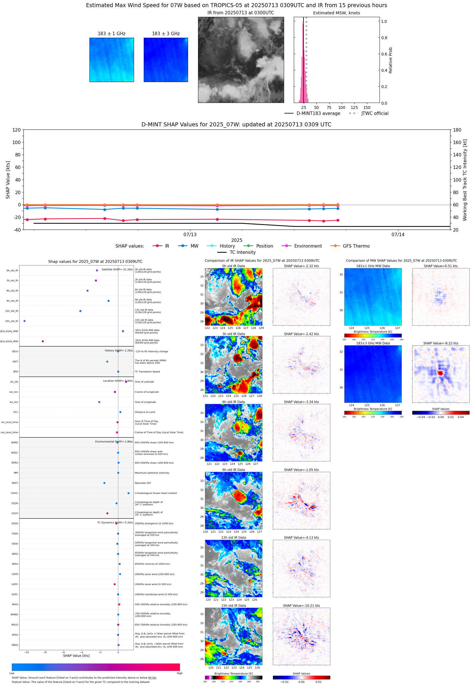 |
| 20250712 | 2153 UTC | GMI | 1001 hPa | 22 kts | 20 kts | 24 kts | 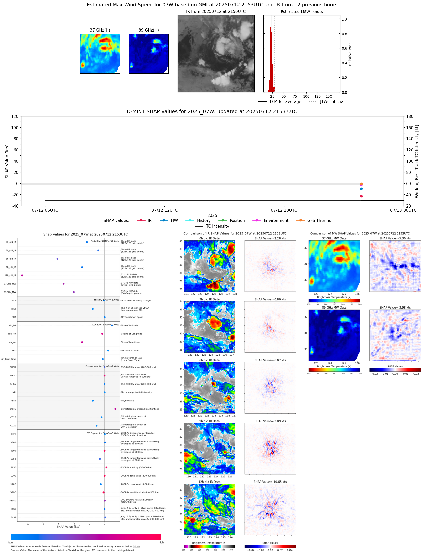 |
| 20250712 | 1755 UTC | TROPICS03 | 1004 hPa | 26 kts | 24 kts | 28 kts | 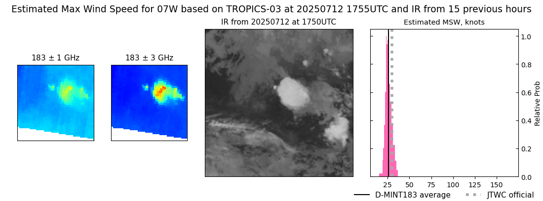 |
| 20250712 | 1617 UTC | TROPICS03 | 1004 hPa | 24 kts | 23 kts | 27 kts | 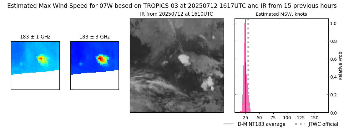 |
| 20250712 | 1409 UTC | TMS02 | 1003 hPa | 26 kts | 24 kts | 29 kts | 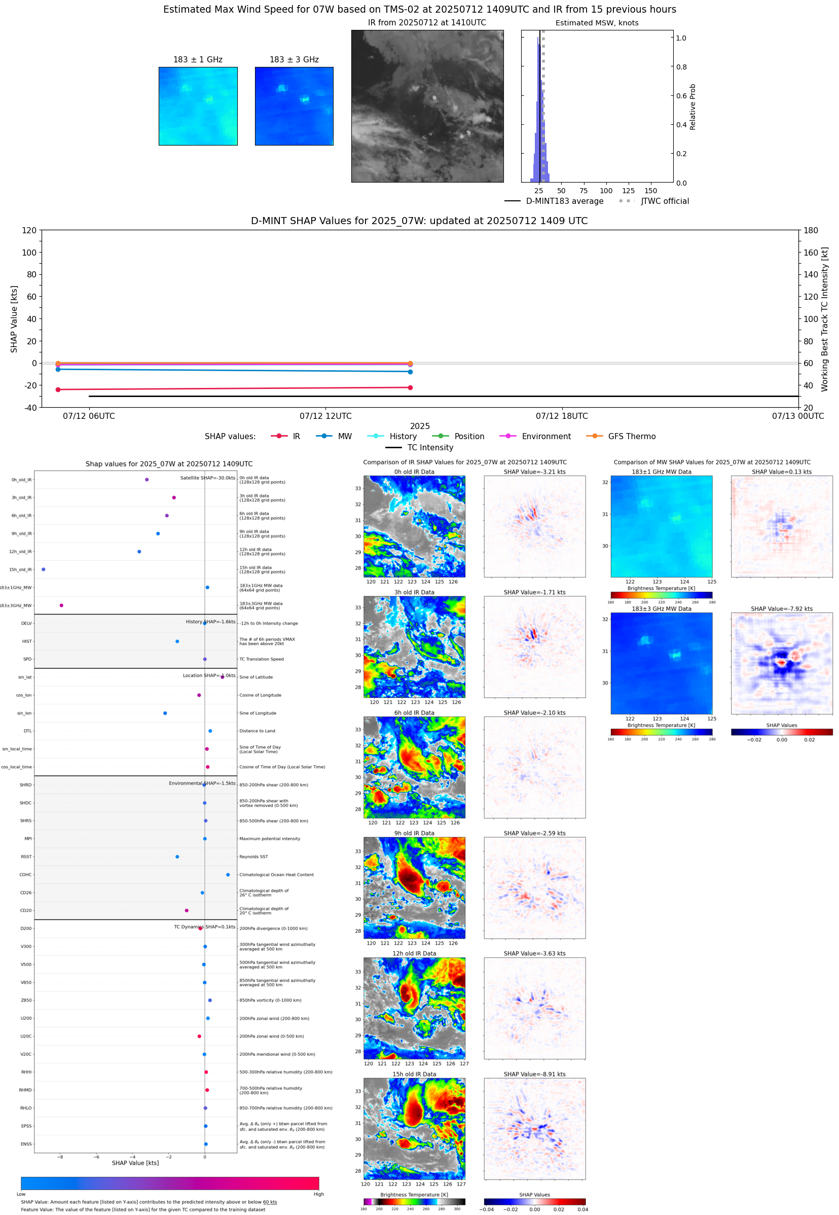 |
| 20250712 | 0718 UTC | TROPICS05 | 1003 hPa | 27 kts | 25 kts | 31 kts | 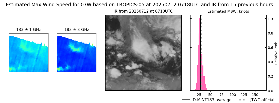 |
| 20250712 | 0512 UTC | TMS03 | 1003 hPa | 25 kts | 23 kts | 29 kts |  |
| 20250712 | 0402 UTC | TROPICS05 | 1004 hPa | 25 kts | 23 kts | 28 kts | 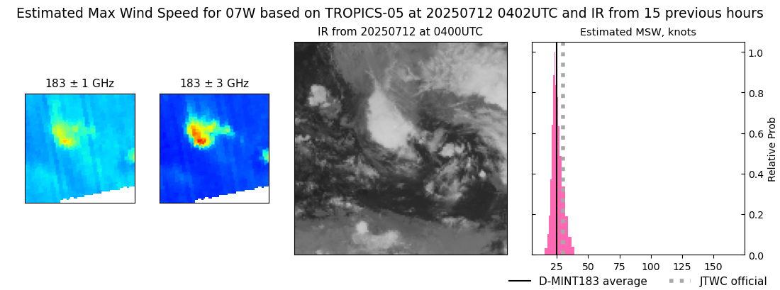 |