|
||

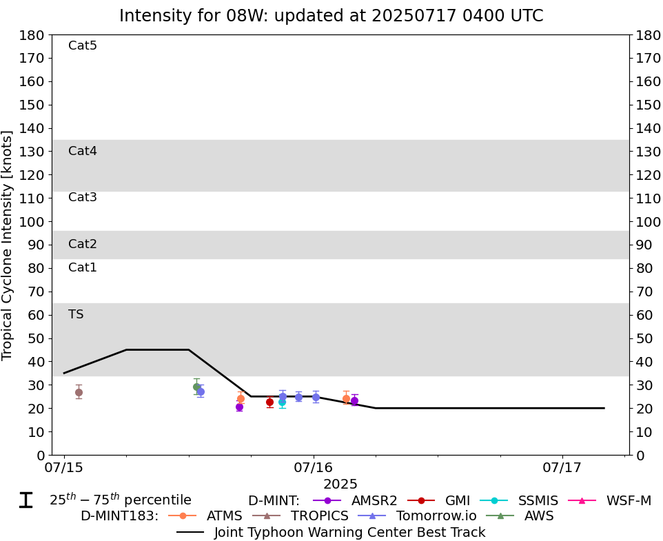 |
D-MINT HISTORY FILE for 2025_08W
| Date | Time | MW Sensor | MSLP | Vmax (30th-70th percentile average) | Vmax 25th percentile | Vmax 75th percentile | Image |
| 20250716 | 0358 UTC | AMSR2 | 1005 hPa | 23 kts | 21 kts | 26 kts |  |
| 20250716 | 0308 UTC | ATMS-NPP | 1004 hPa | 24 kts | 22 kts | 27 kts | 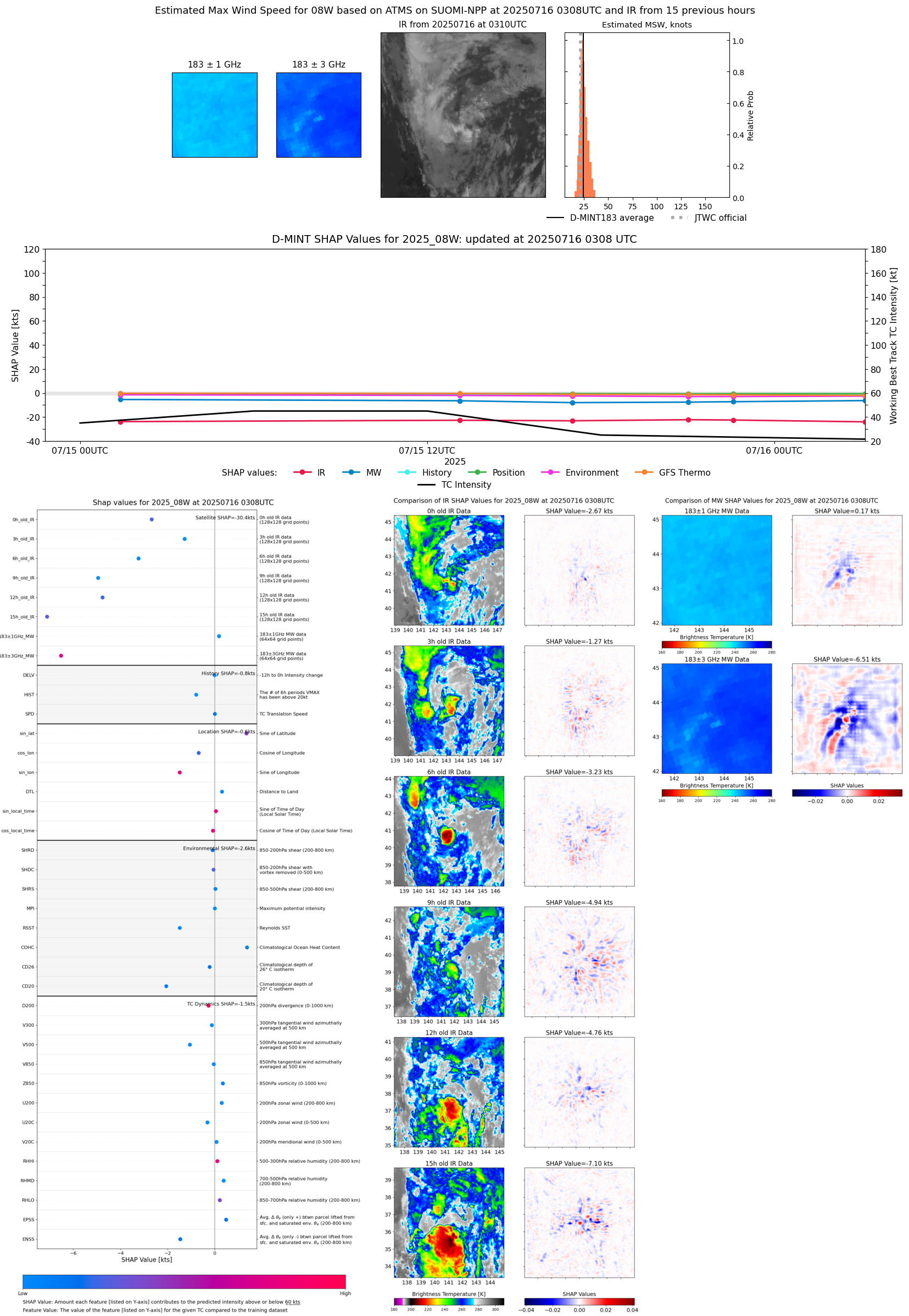 |
| 20250716 | 0014 UTC | TMS03 | 1004 hPa | 25 kts | 23 kts | 27 kts | 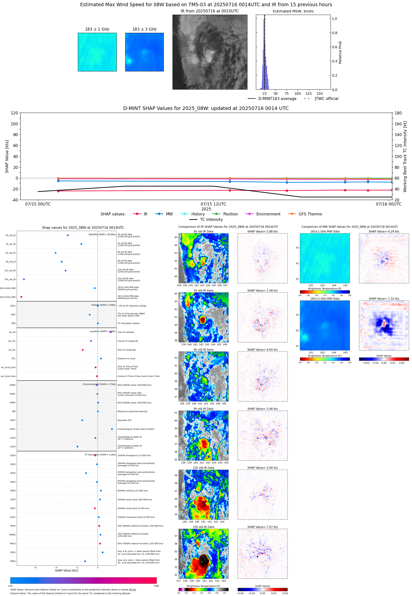 |
| 20250715 | 2235 UTC | TMS03 | 1003 hPa | 25 kts | 23 kts | 27 kts | 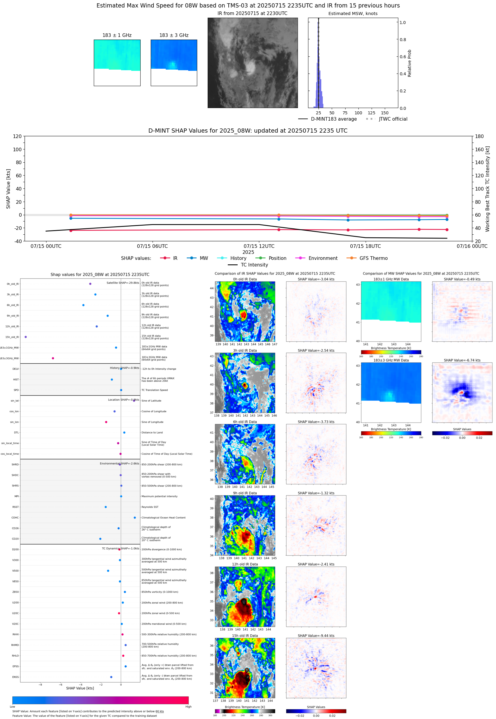 |
| 20250715 | 2101 UTC | TMS03 | 1004 hPa | 25 kts | 23 kts | 28 kts | 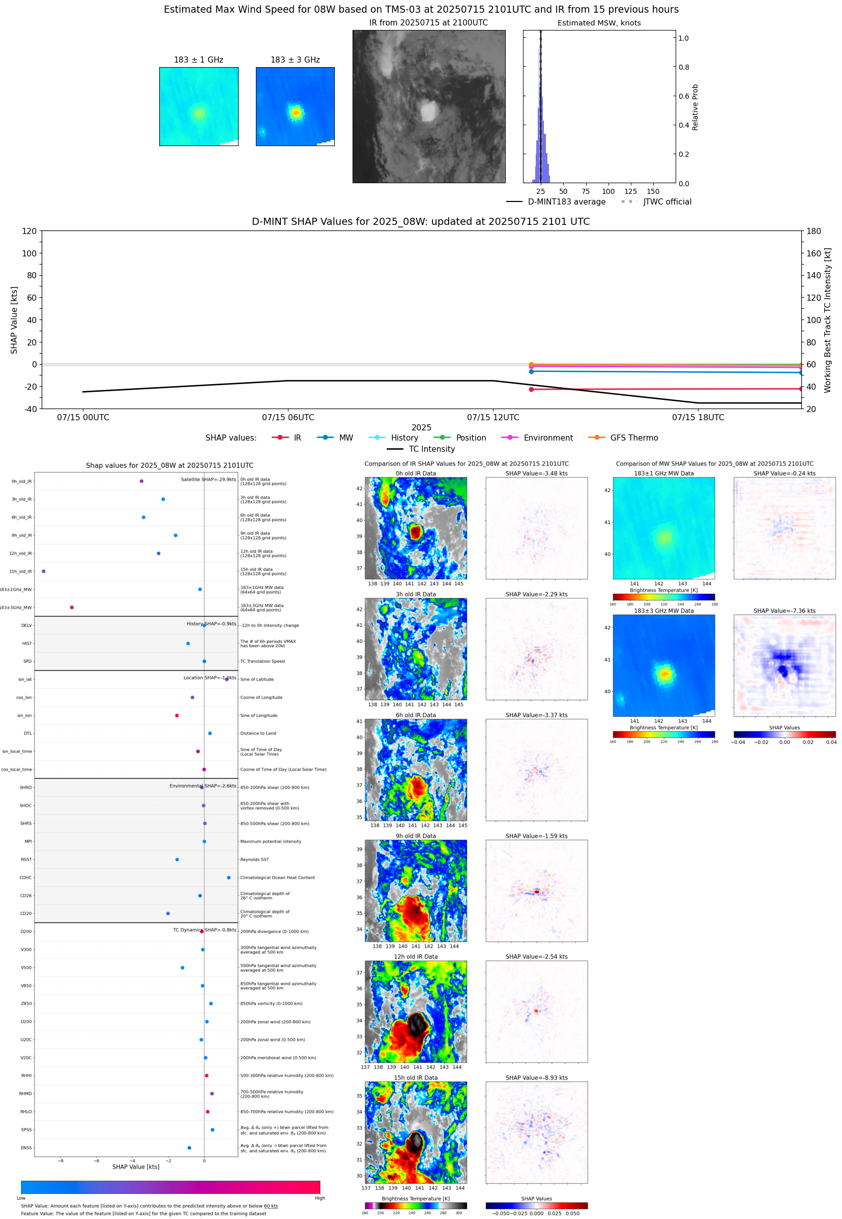 |
| 20250715 | 2100 UTC | SSMISF17 | 1004 hPa | 23 kts | 20 kts | 26 kts |  |
| 20250715 | 1948 UTC | GMI | 1005 hPa | 23 kts | 20 kts | 25 kts | 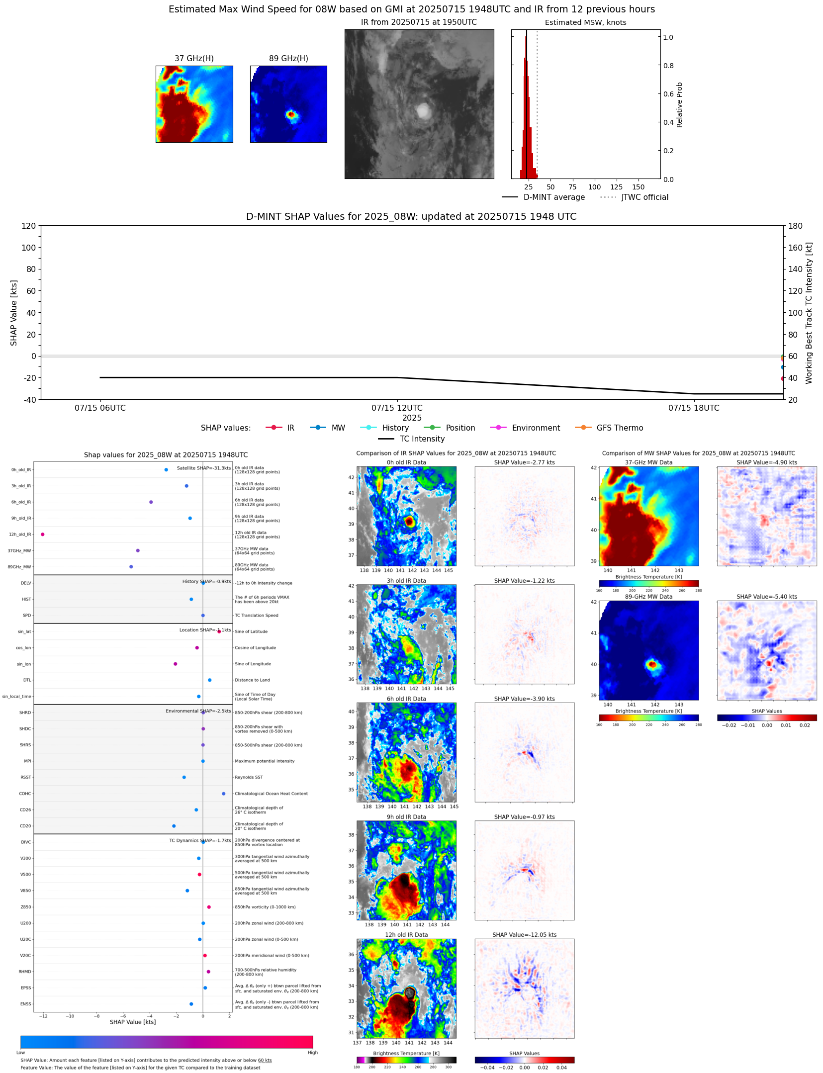 |
| 20250715 | 1701 UTC | ATMS-N21 | 1005 hPa | 24 kts | 22 kts | 27 kts | 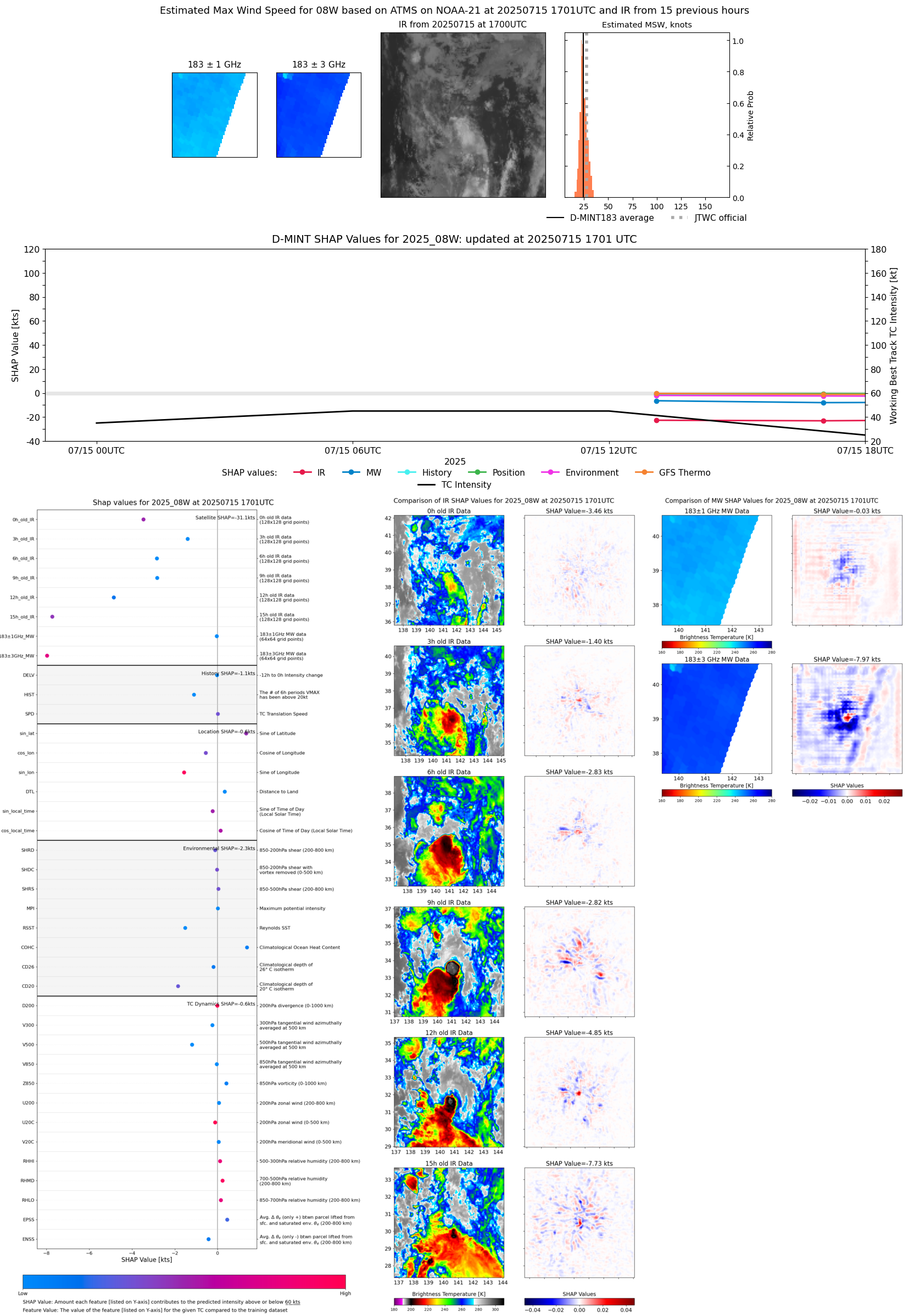 |
| 20250715 | 1652 UTC | AMSR2 | 1004 hPa | 21 kts | 19 kts | 23 kts | 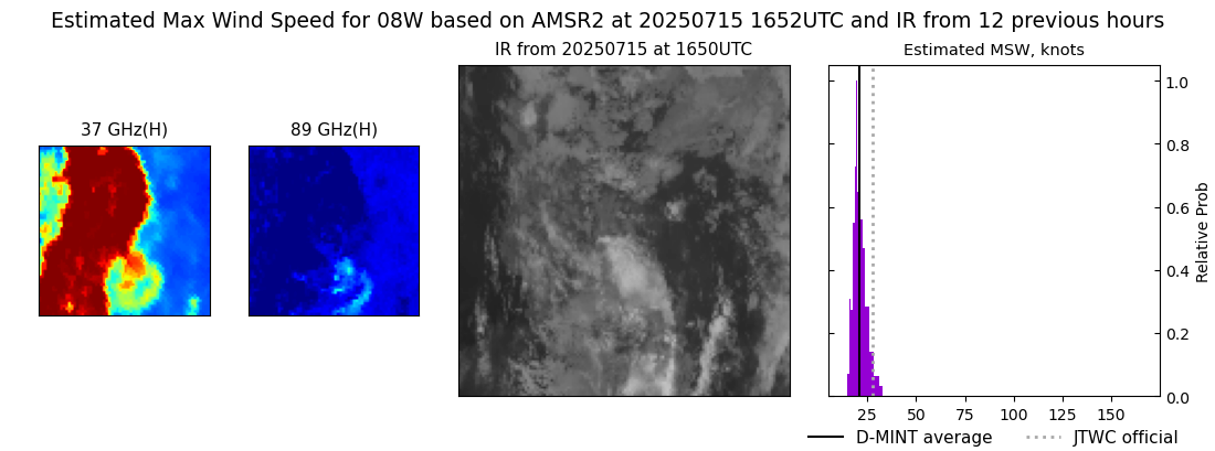 |
| 20250715 | 1307 UTC | TMS02 | 1002 hPa | 27 kts | 25 kts | 30 kts |  |
| 20250715 | 0123 UTC | TROPICS05 | 1001 hPa | 27 kts | 24 kts | 30 kts | 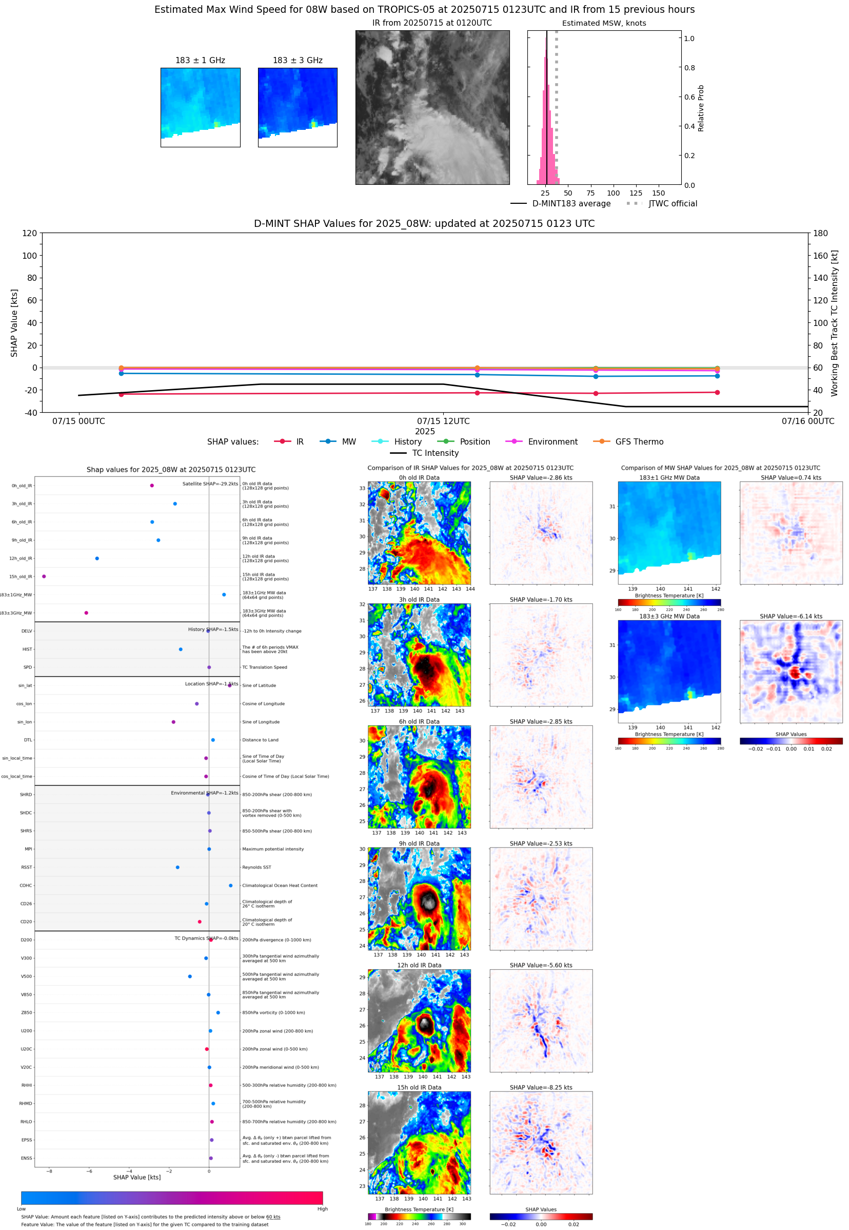 |