|
||

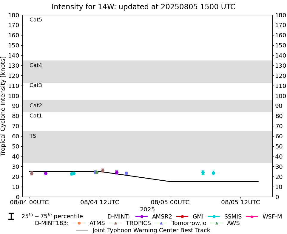 |
D-MINT HISTORY FILE for 2025_14W
| Date | Time | MW Sensor | MSLP | Vmax (30th-70th percentile average) | Vmax 25th percentile | Vmax 75th percentile | Image |
| 20250805 | 0721 UTC | SSMISF16 | 1008 hPa | 24 kts | 22 kts | 26 kts |  |
| 20250805 | 0534 UTC | SSMISF18 | 1009 hPa | 24 kts | 22 kts | 26 kts | 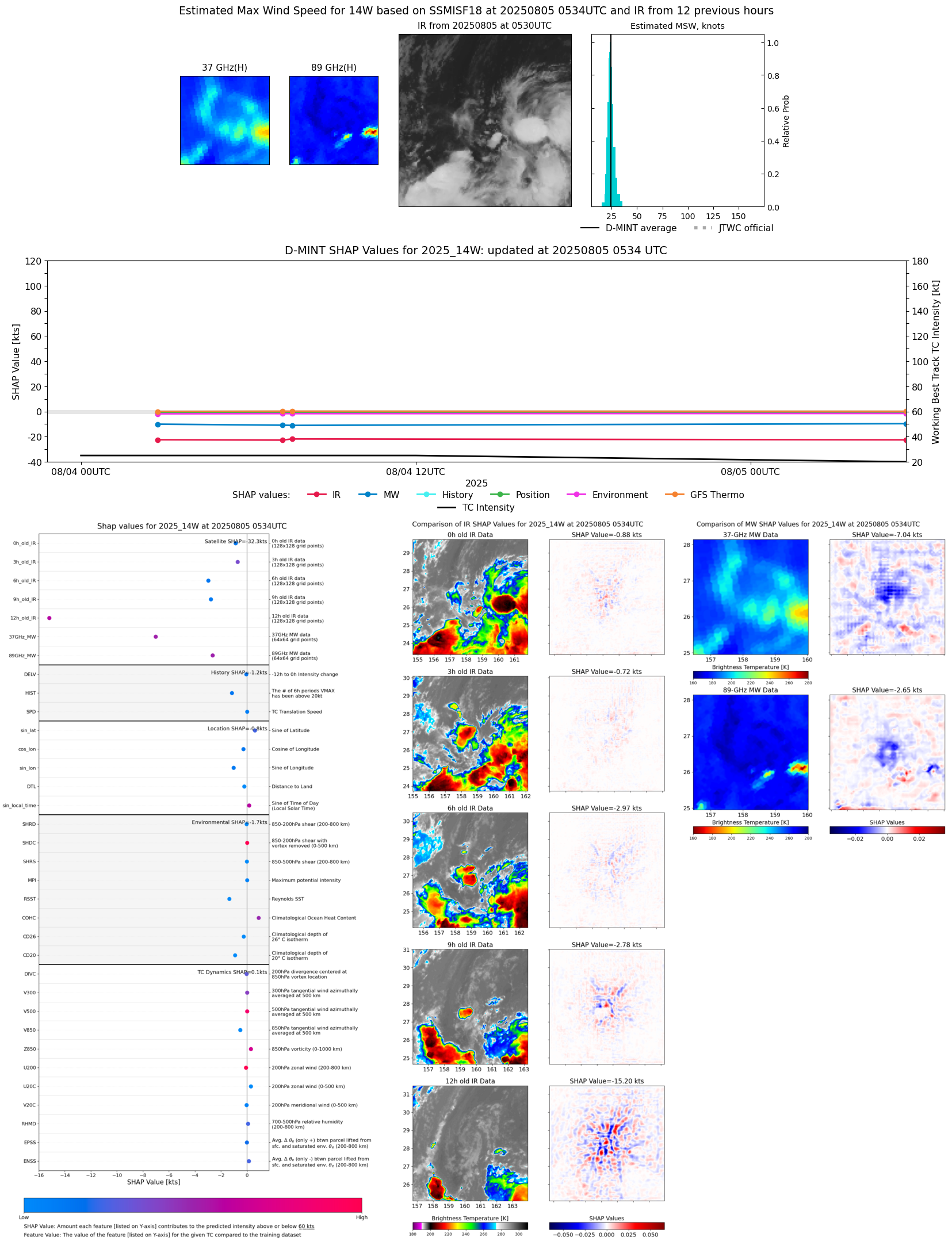 |
| 20250804 | 1630 UTC | TMS03 | 1010 hPa | 23 kts | 22 kts | 25 kts | 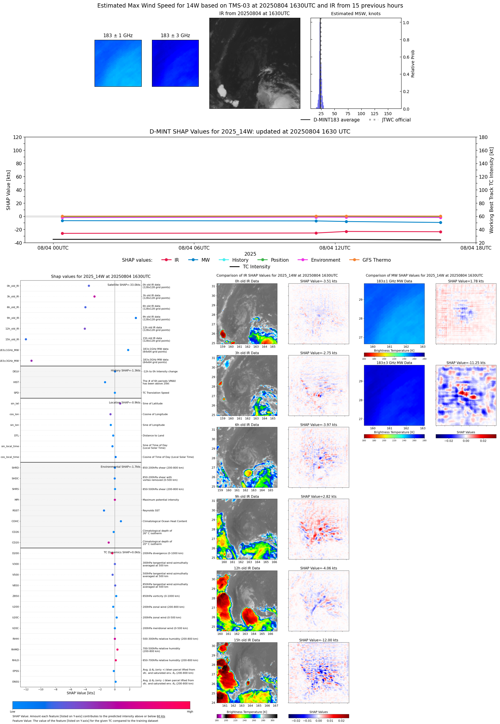 |
| 20250804 | 1451 UTC | AMSR2 | 1008 hPa | 24 kts | 23 kts | 26 kts | 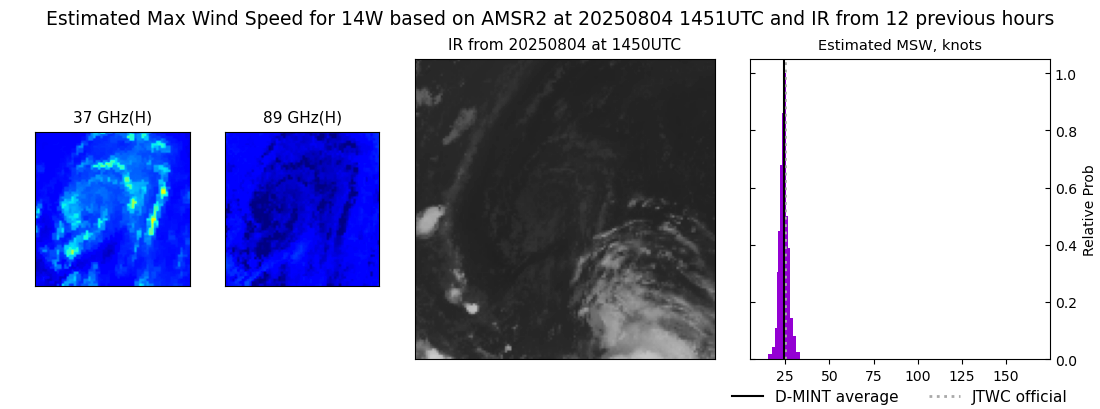 |
| 20250804 | 1229 UTC | TROPICS05 | 1009 hPa | 26 kts | 24 kts | 28 kts | 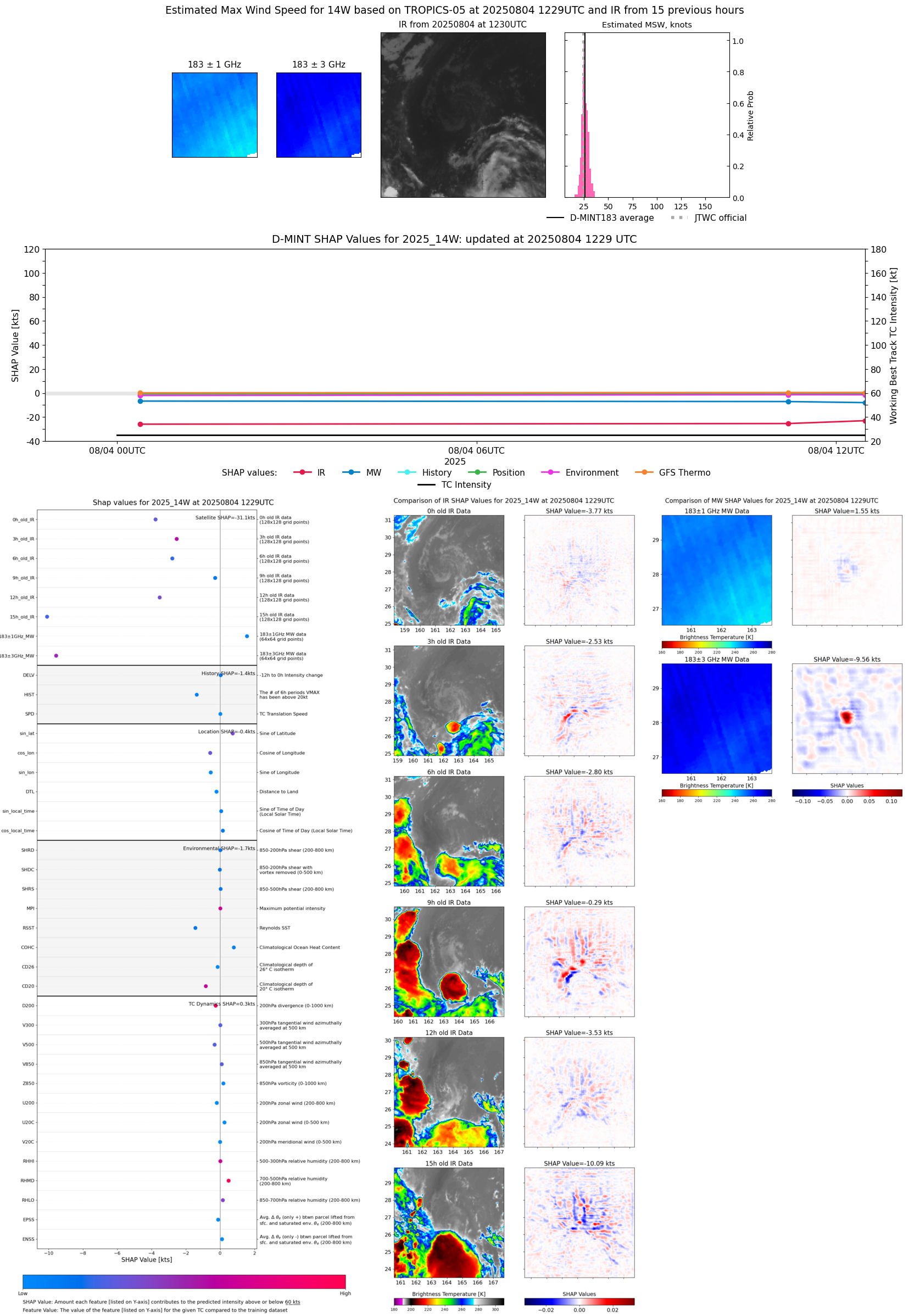 |
| 20250804 | 1112 UTC | TMS02 | 1009 hPa | 24 kts | 23 kts | 26 kts | 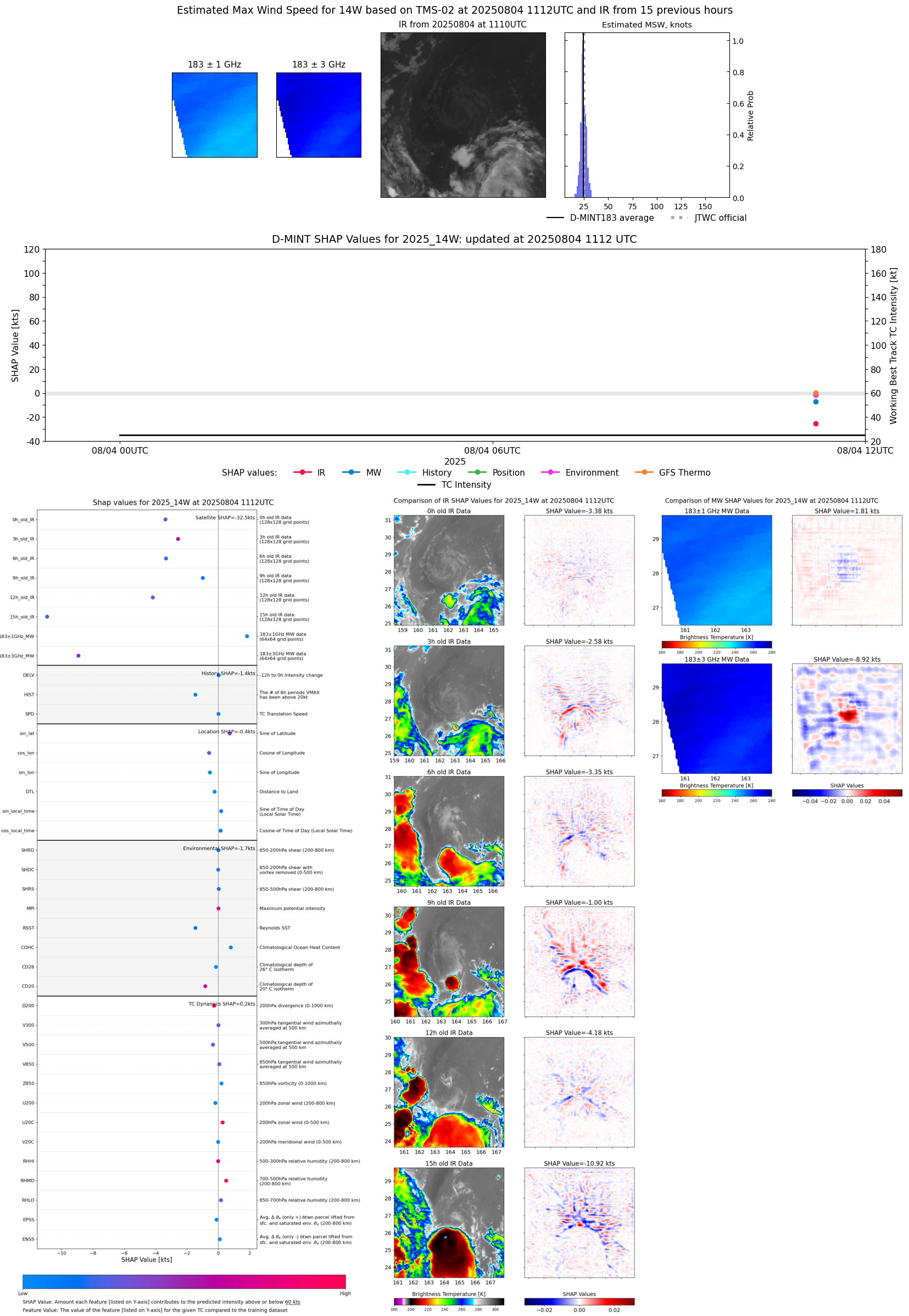 |
| 20250804 | 0734 UTC | SSMISF16 | 1007 hPa | 23 kts | 22 kts | 25 kts | 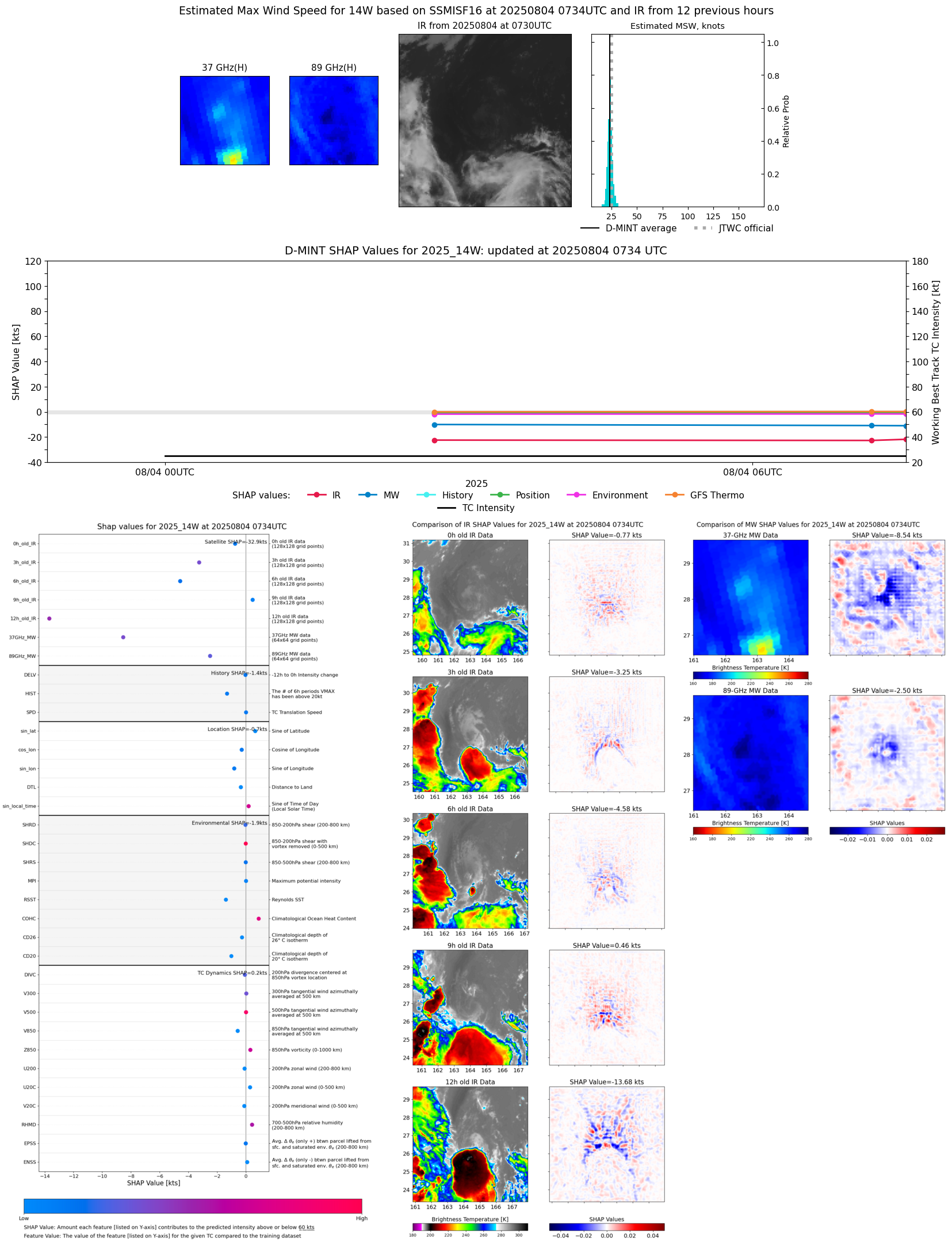 |
| 20250804 | 0713 UTC | SSMISF17 | 1007 hPa | 23 kts | 21 kts | 24 kts |  |
| 20250804 | 0245 UTC | AMSR2 | 1010 hPa | 23 kts | 22 kts | 25 kts | 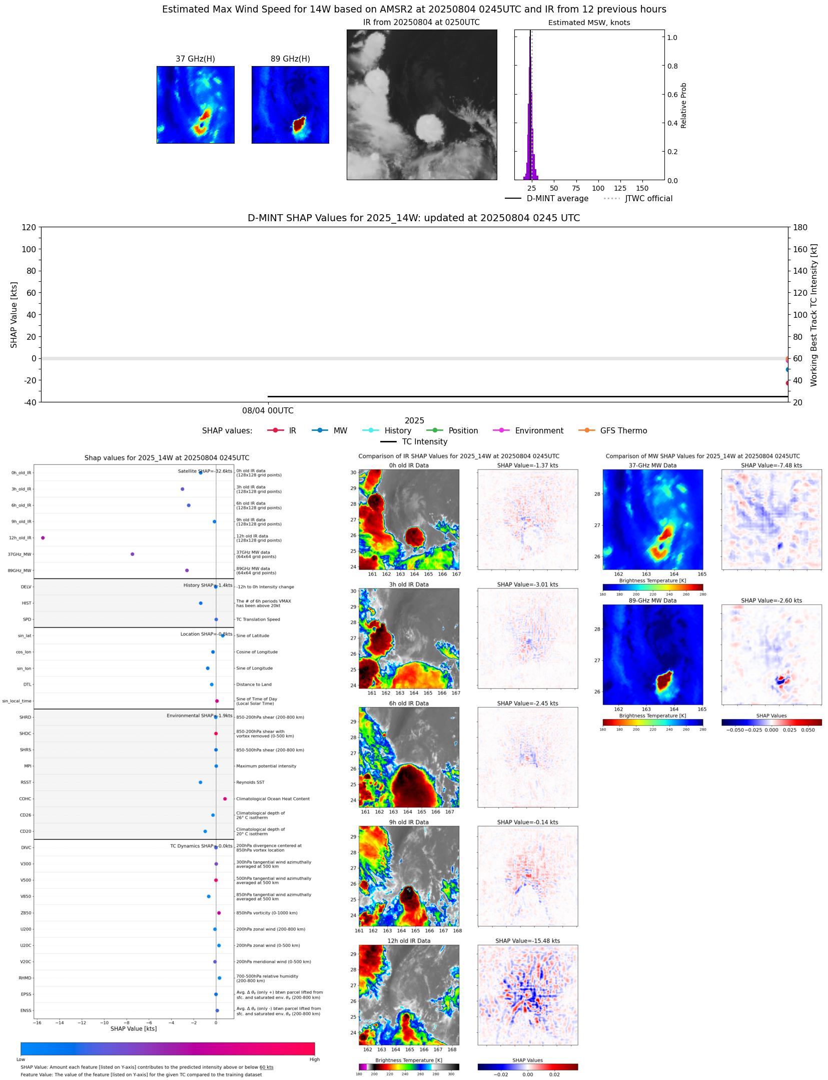 |
| 20250804 | 0023 UTC | TROPICS03 | 1010 hPa | 23 kts | 22 kts | 25 kts | 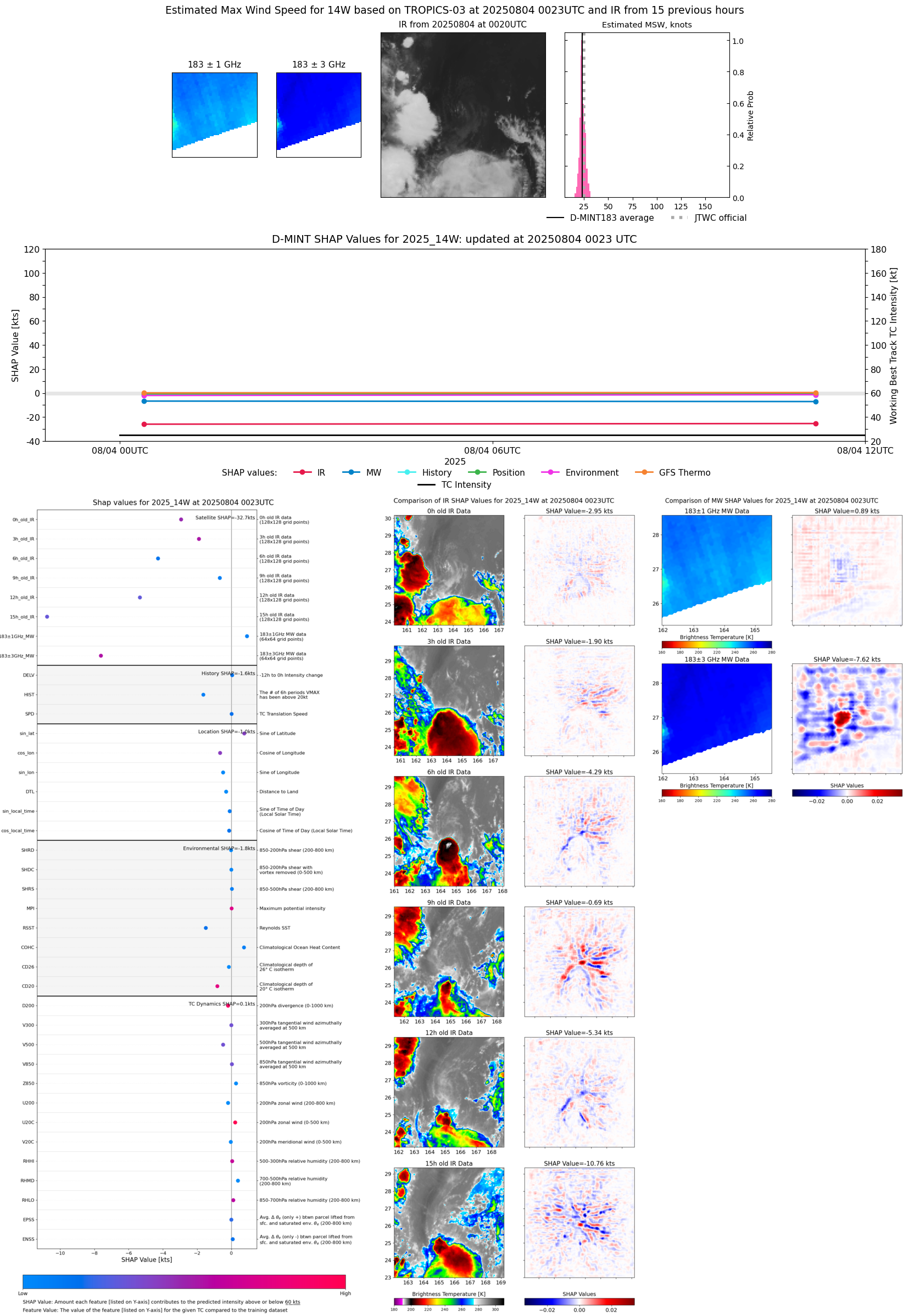 |