|
||

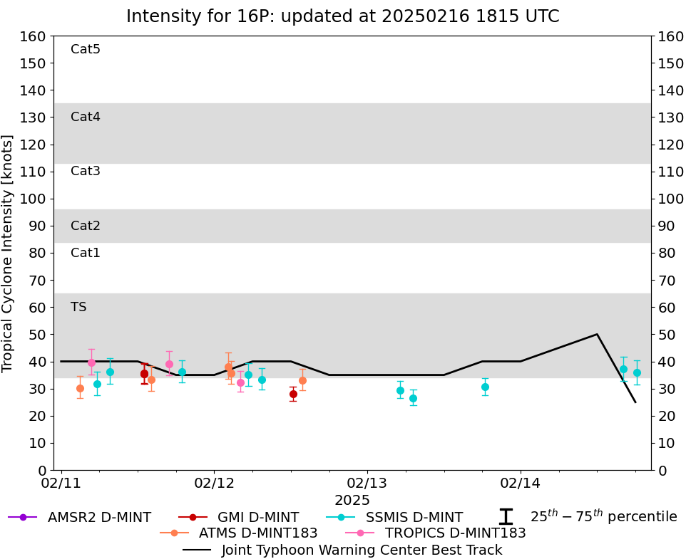 |
D-MINT HISTORY FILE for 2025_16P
| Date | Time | MW Sensor | MSLP | Vmax (30th-70th percentile average) | Vmax 25th percentile | Vmax 75th percentile | Image |
| 20250214 | 1812 UTC | SSMISF17 | 992 hPa | 36 kts | 32 kts | 40 kts |  |
| 20250214 | 1609 UTC | SSMISF18 | 992 hPa | 37 kts | 33 kts | 42 kts | 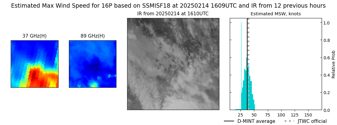 |
| 20250213 | 1826 UTC | SSMISF17 | 997 hPa | 31 kts | 28 kts | 34 kts | 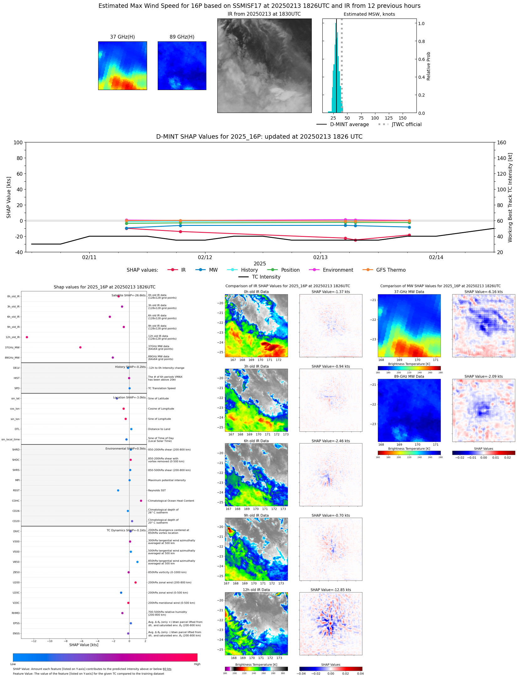 |
| 20250213 | 0711 UTC | SSMISF17 | 999 hPa | 27 kts | 24 kts | 30 kts | 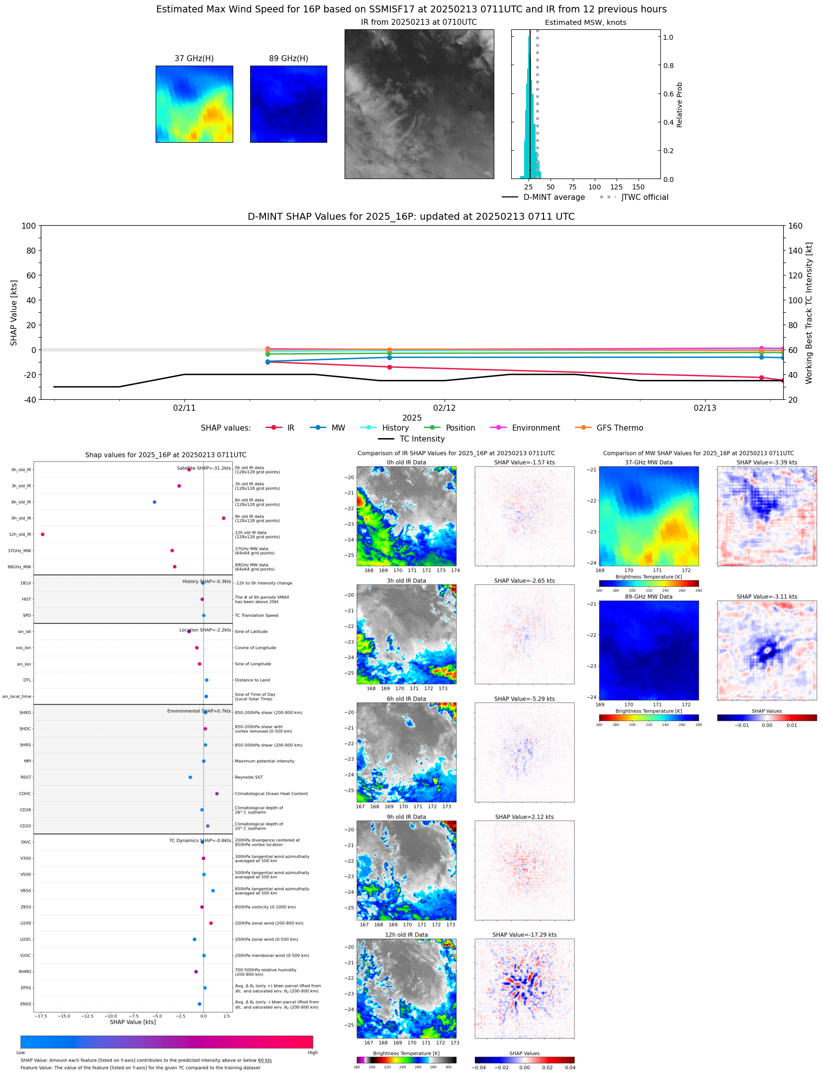 |
| 20250213 | 0509 UTC | SSMISF18 | 999 hPa | 29 kts | 26 kts | 33 kts |  |
| 20250212 | 1349 UTC | ATMS-N20 | 999 hPa | 33 kts | 29 kts | 37 kts | 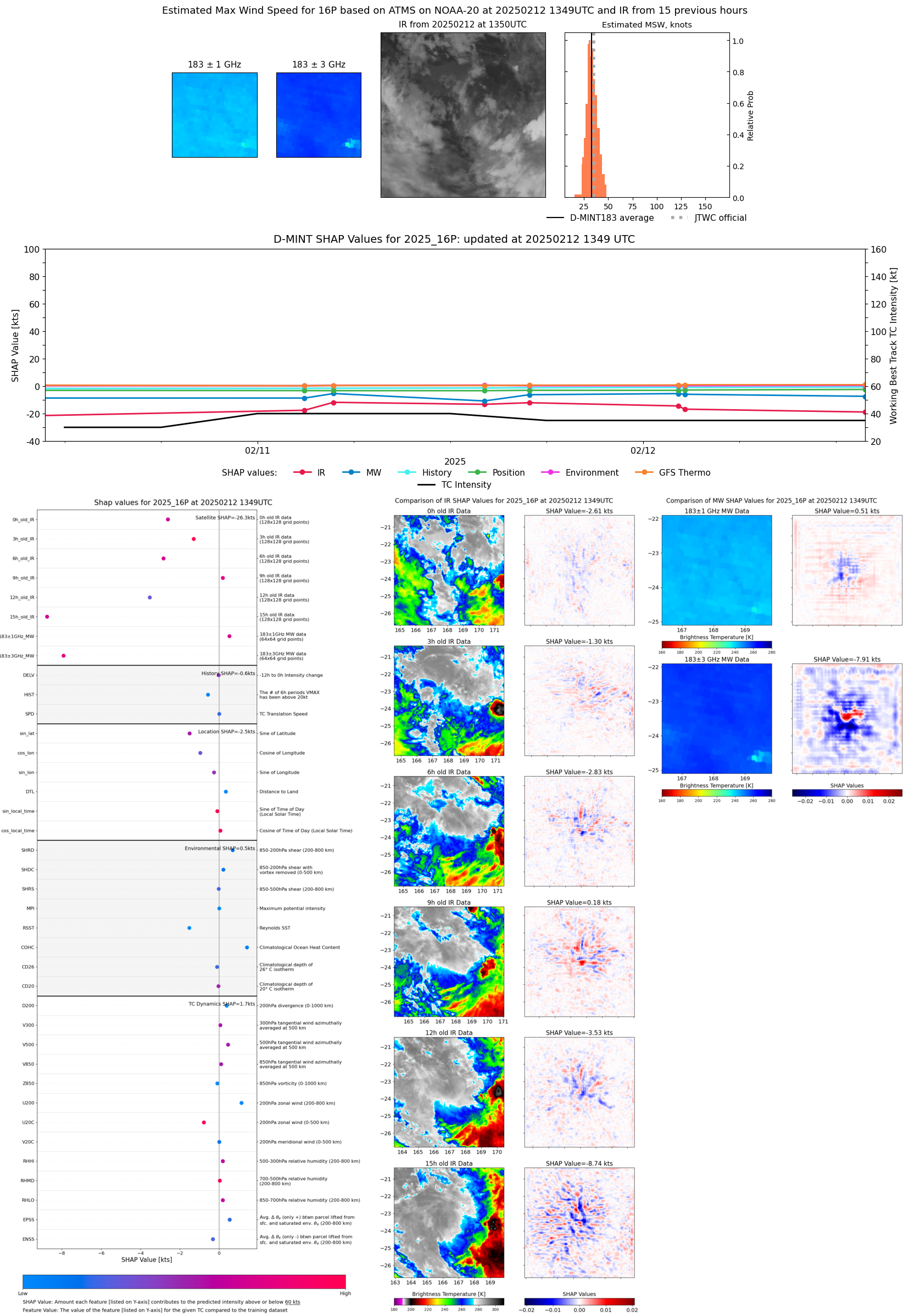 |
| 20250212 | 1218 UTC | GMI | NaN hPa | 28 kts | 25 kts | 31 kts | 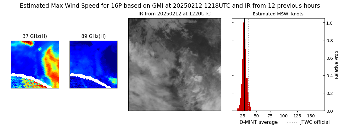 |
| 20250212 | 0725 UTC | SSMISF17 | NaN hPa | 33 kts | 30 kts | 38 kts |  |
| 20250212 | 0522 UTC | SSMISF18 | 998 hPa | 35 kts | 31 kts | 39 kts |  |
| 20250212 | 0406 UTC | TROPICS03 | 997 hPa | 32 kts | 29 kts | 36 kts | 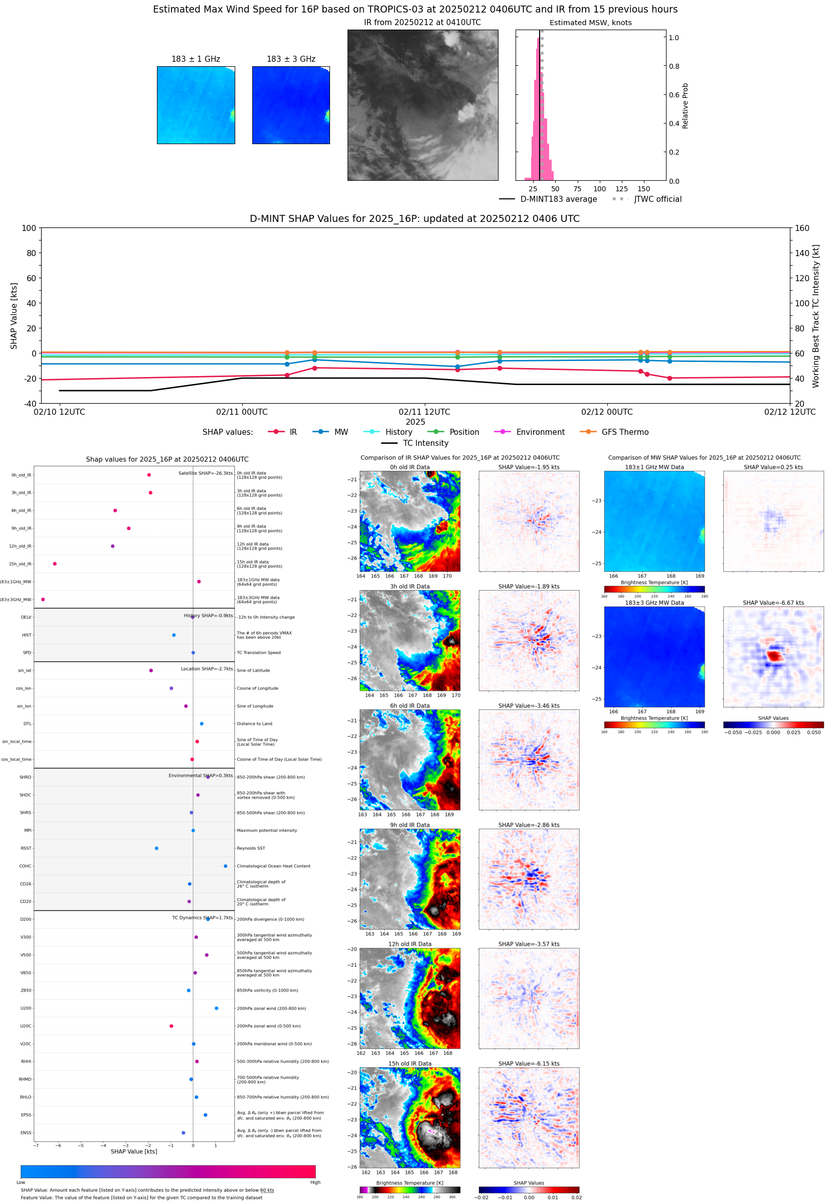 |
| 20250212 | 0236 UTC | ATMS-N20 | 996 hPa | 36 kts | 32 kts | 40 kts | 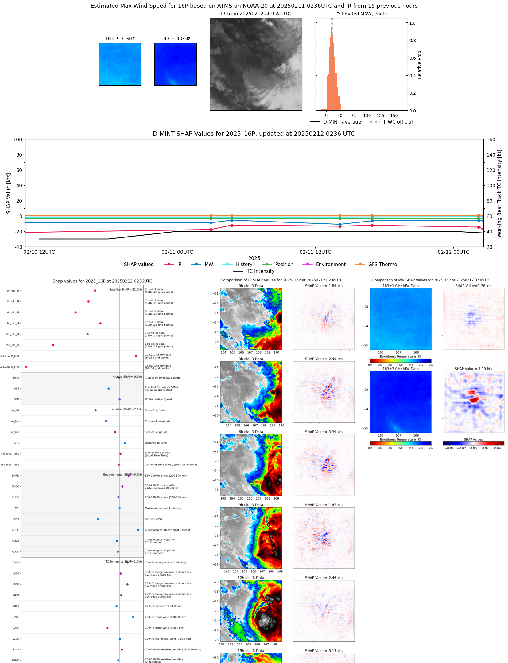 |
| 20250212 | 0211 UTC | ATMS-N20 | 995 hPa | 38 kts | 34 kts | 43 kts | 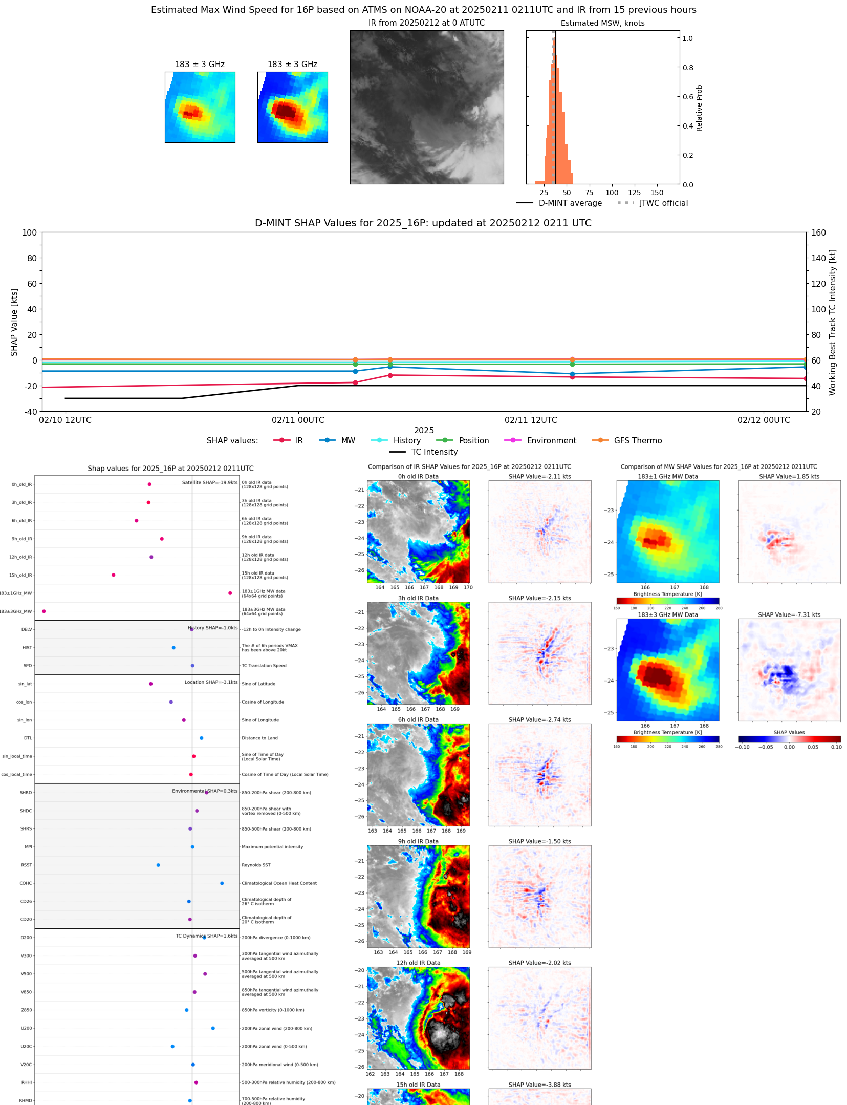 |
| 20250211 | 1854 UTC | SSMISF17 | 998 hPa | 36 kts | 32 kts | 40 kts | 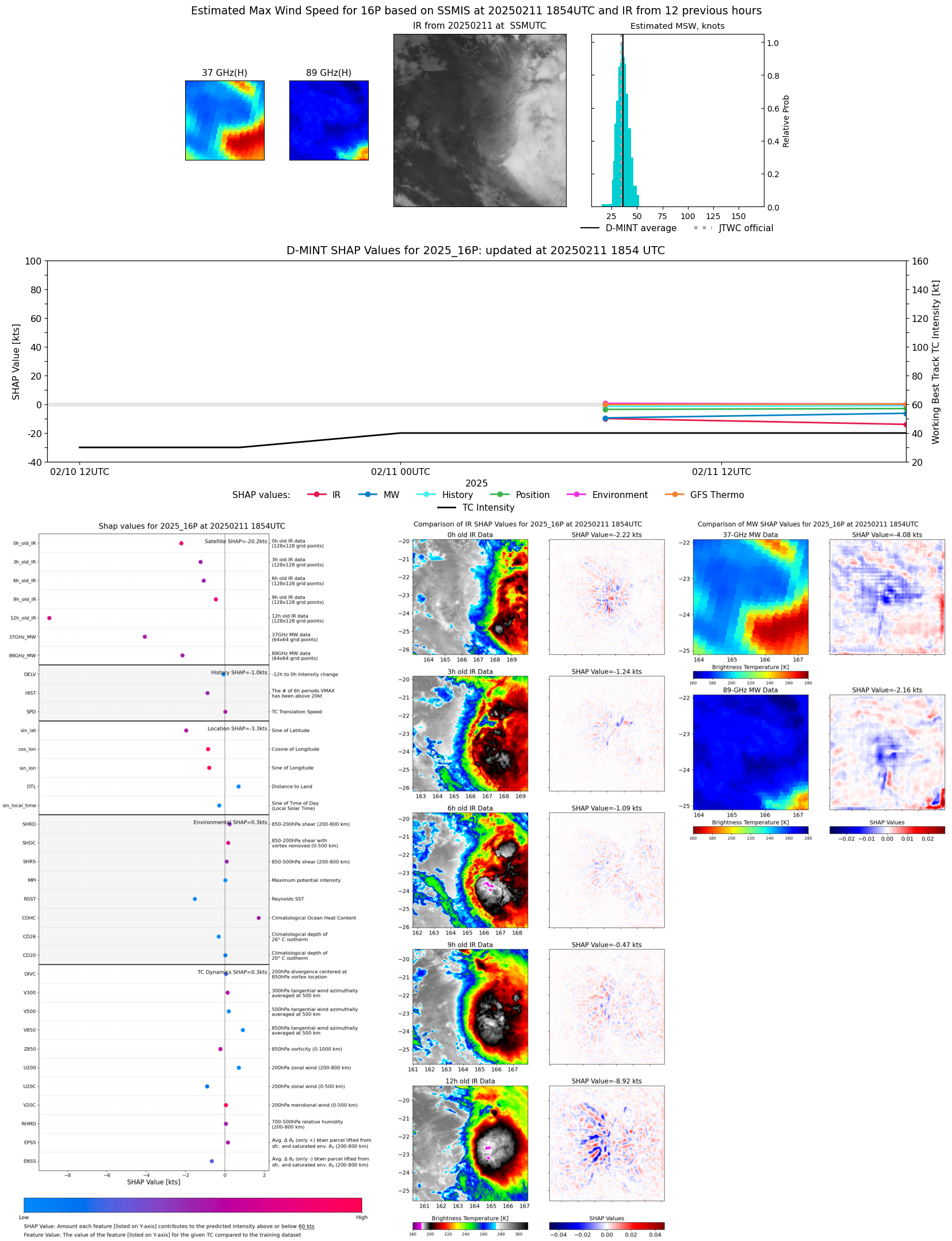 |
| 20250211 | 1655 UTC | TROPICS05 | 998 hPa | 39 kts | 35 kts | 44 kts | 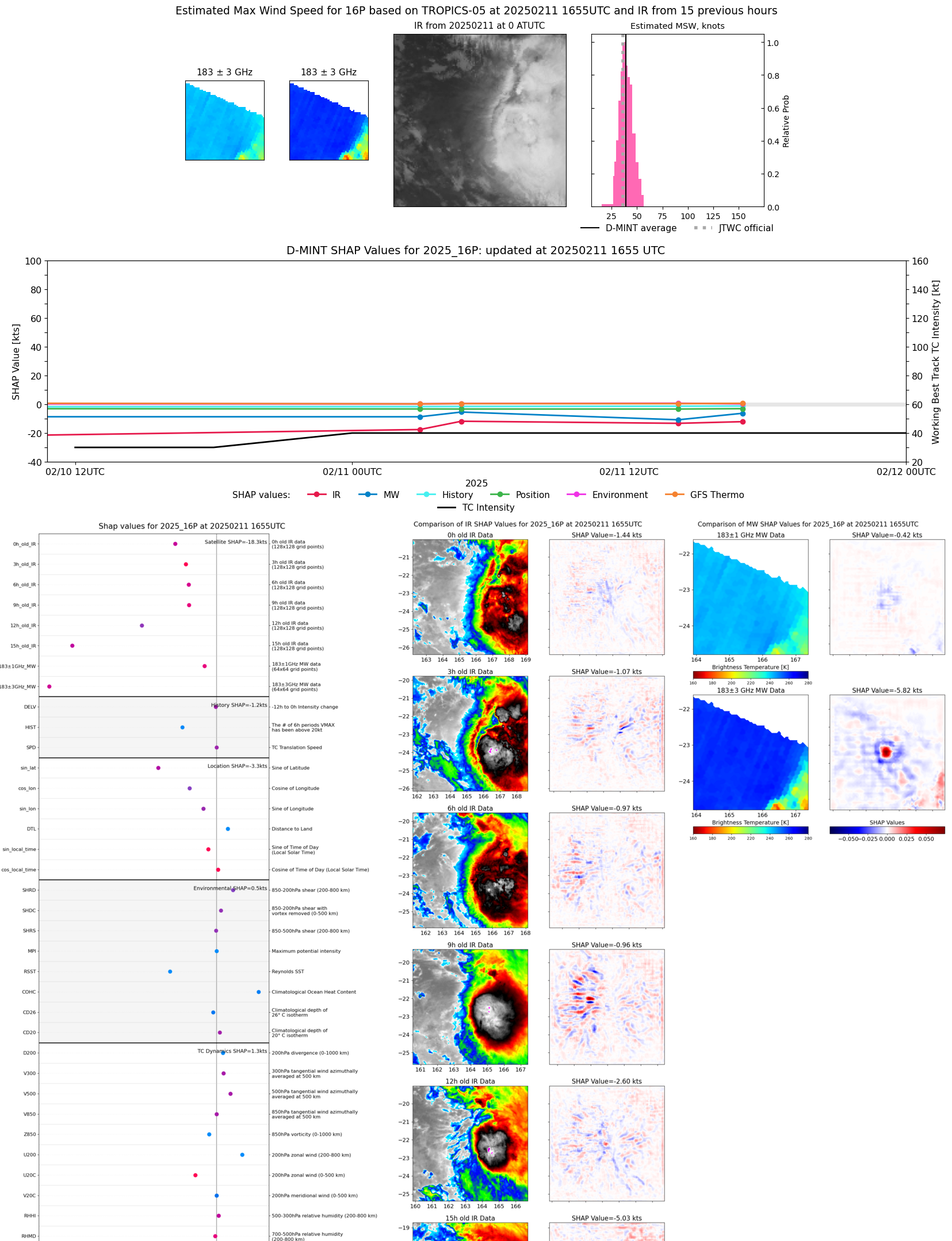 |
| 20250211 | 1408 UTC | ATMS-N20 | 998 hPa | 33 kts | 29 kts | 38 kts | 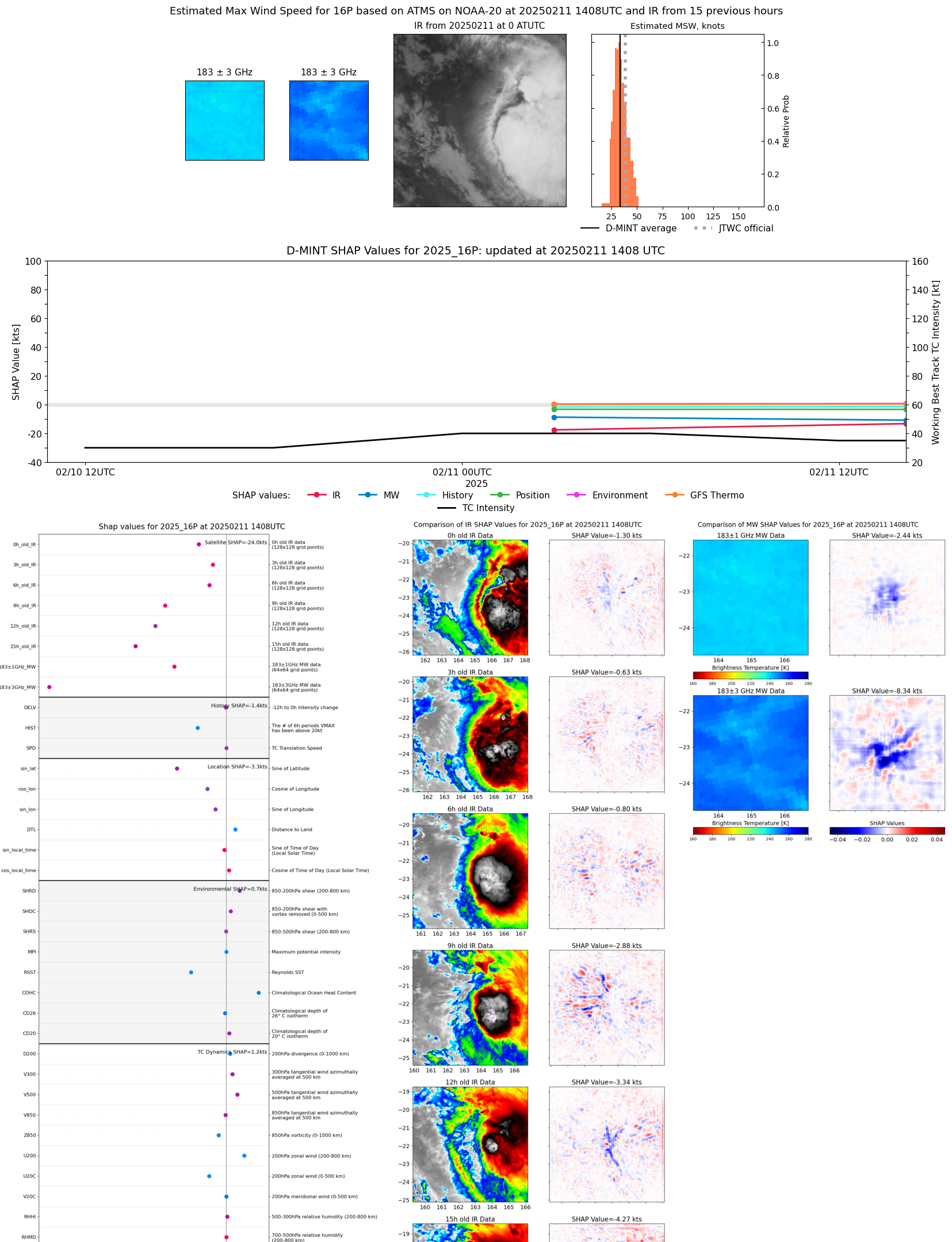 |
| 20250211 | 1302 UTC | GMI | NaN hPa | 35 kts | 32 kts | 39 kts |  |
| 20250211 | 1259 UTC | GMI | NaN hPa | 36 kts | 32 kts | 39 kts |  |
| 20250211 | 1258 UTC | GMI | NaN hPa | 35 kts | 32 kts | 39 kts | 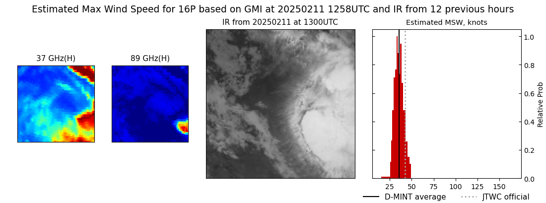 |
| 20250211 | 0739 UTC | SSMISF17 | 995 hPa | 36 kts | 32 kts | 41 kts |  |
| 20250211 | 0536 UTC | SSMISF18 | 999 hPa | 32 kts | 28 kts | 36 kts | 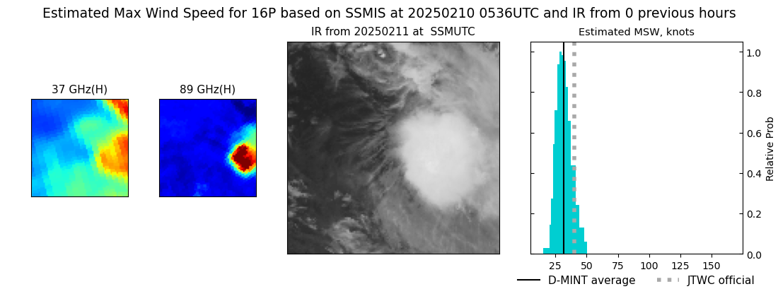 |
| 20250211 | 0444 UTC | TROPICS03 | 996 hPa | 40 kts | 35 kts | 45 kts | 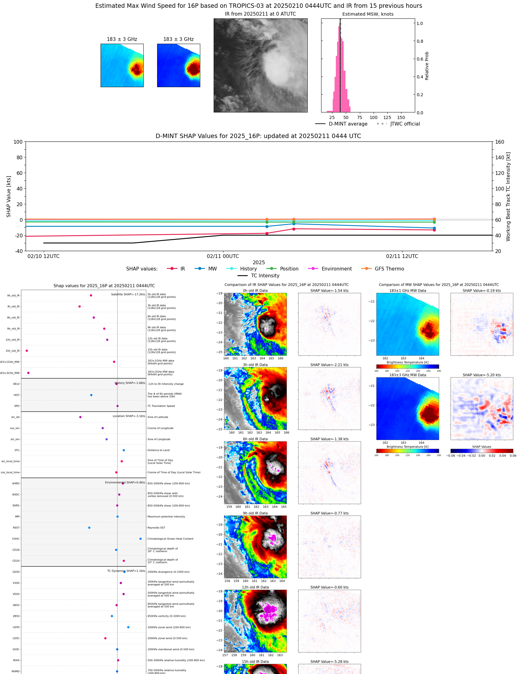 |
| 20250211 | 0256 UTC | ATMS-N20 | 1000 hPa | 30 kts | 27 kts | 35 kts | 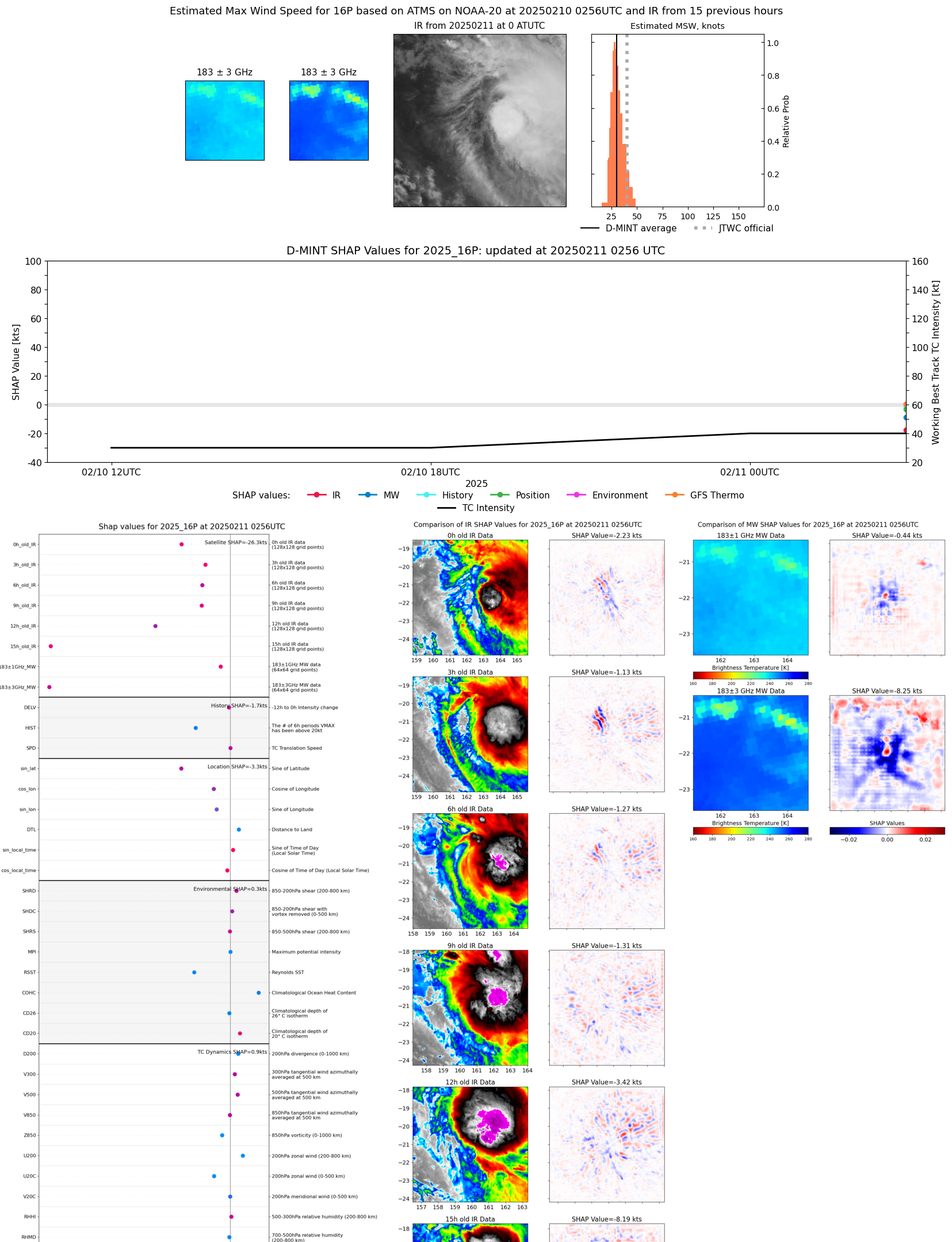 |
| 20250210 | 1159 UTC | TROPICS03 | 1003 hPa | 27 kts | 25 kts | 31 kts | 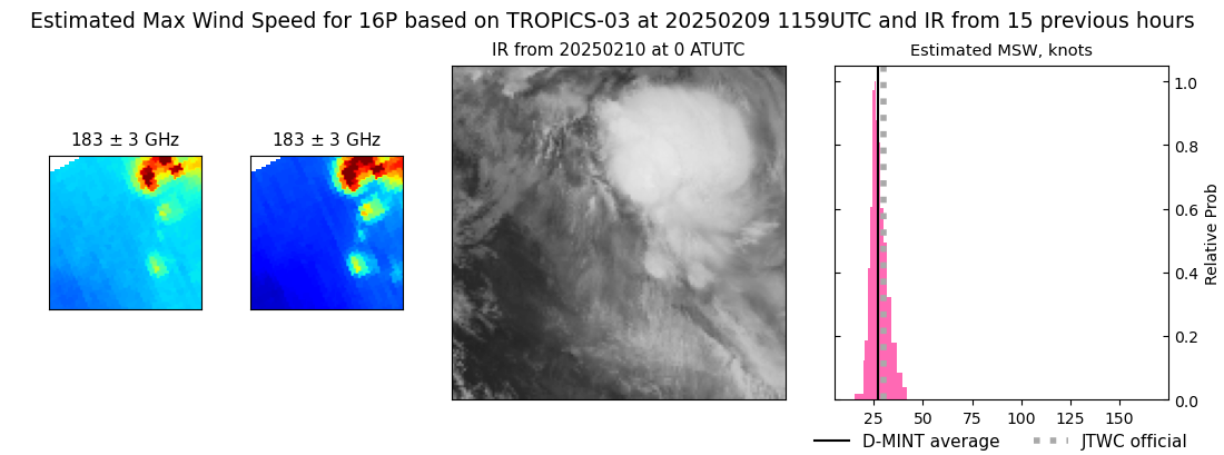 |
| 20250210 | 0520 UTC | TROPICS03 | 1001 hPa | 25 kts | 24 kts | 28 kts | 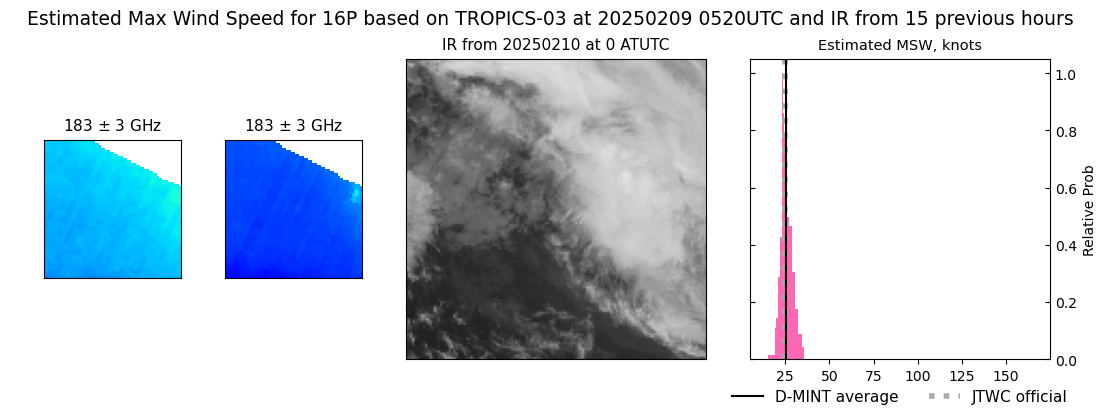 |