|
||

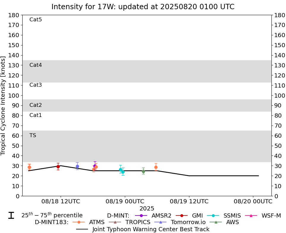 |
D-MINT HISTORY FILE for 2025_17W
| Date | Time | MW Sensor | MSLP | Vmax (30th-70th percentile average) | Vmax 25th percentile | Vmax 75th percentile | Image |
| 20250819 | 0548 UTC | ATMS-NPP | 1000 hPa | 29 kts | 25 kts | 32 kts | 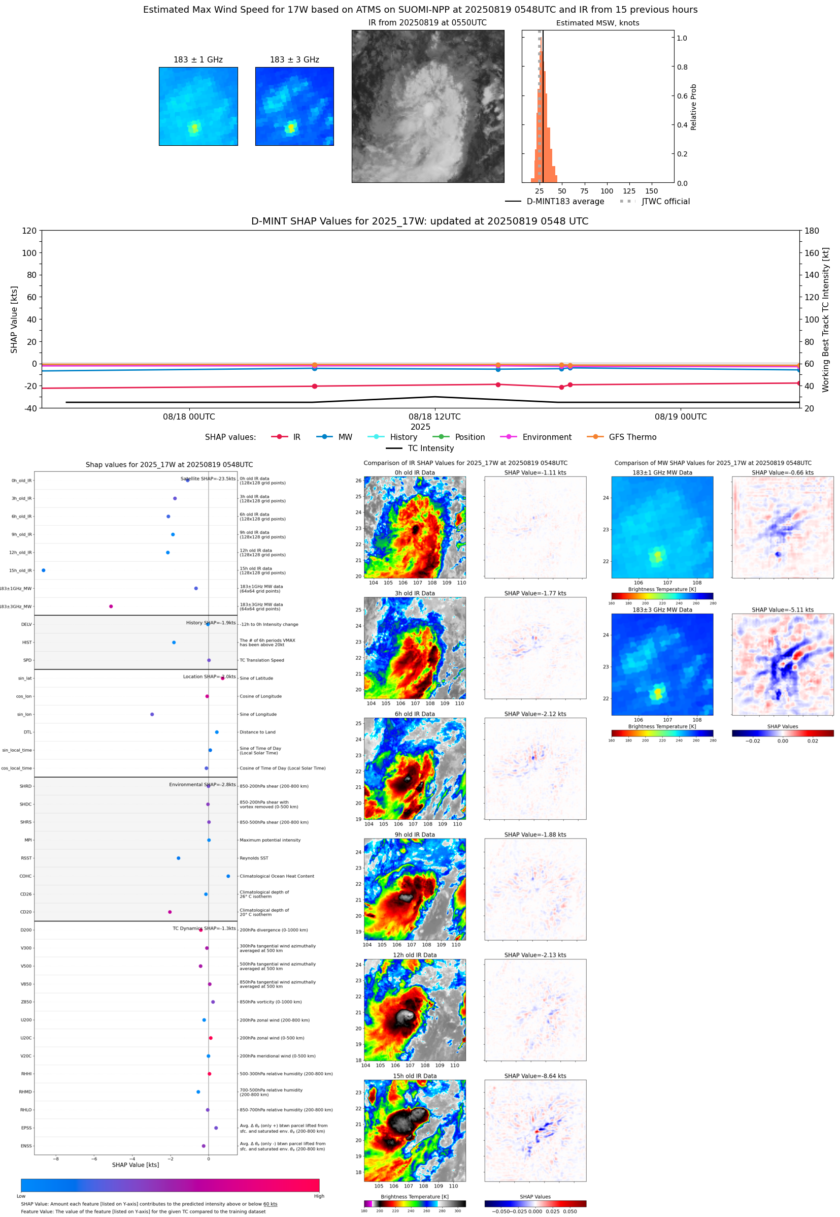 |
| 20250818 | 2338 UTC | SSMISF16 | 1004 hPa | 24 kts | 21 kts | 28 kts |  |
| 20250818 | 2310 UTC | SSMISF17 | 1002 hPa | 26 kts | 23 kts | 31 kts |  |
| 20250818 | 1836 UTC | ATMS- | 998 hPa | 29 kts | 26 kts | 32 kts | 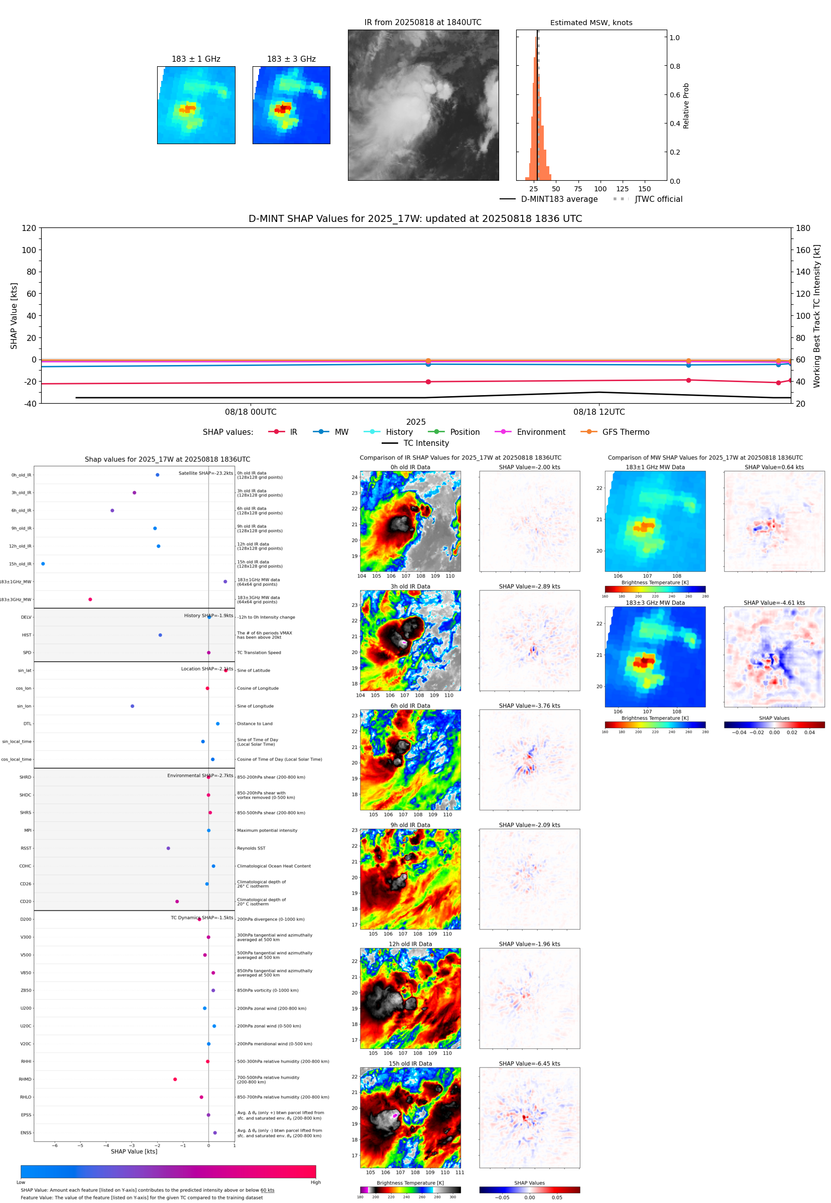 |
| 20250818 | 1823 UTC | AMSR2 | 1002 hPa | 30 kts | 26 kts | 34 kts | 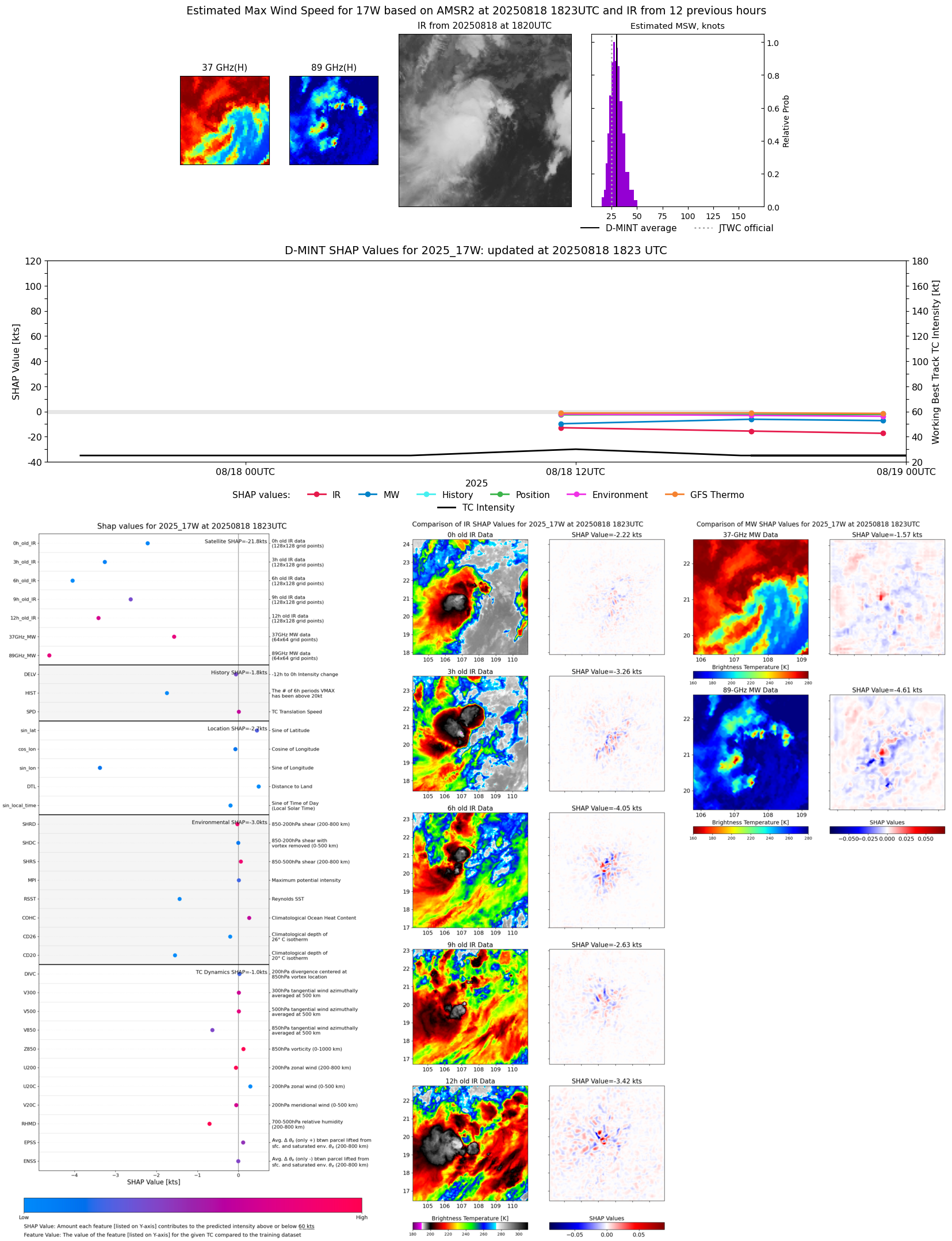 |
| 20250818 | 1810 UTC | ATMS-N21 | 1000 hPa | 27 kts | 24 kts | 30 kts |  |
| 20250818 | 1504 UTC | TMS02 | 1001 hPa | 29 kts | 26 kts | 33 kts |  |
| 20250818 | 1128 UTC | GMI | 1002 hPa | 29 kts | 26 kts | 33 kts | 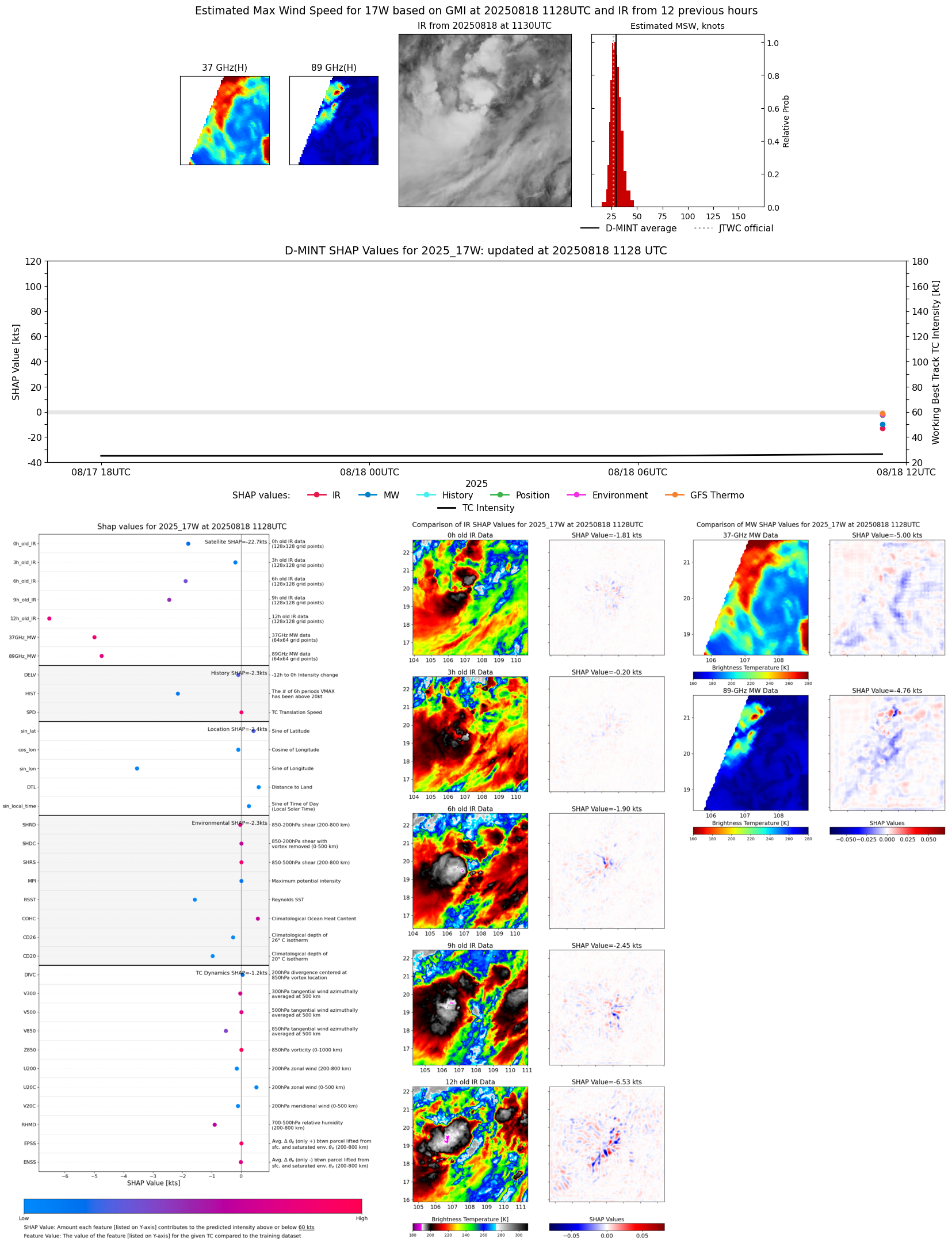 |
| 20250818 | 0607 UTC | ATMS-NPP | 1002 hPa | 29 kts | 26 kts | 32 kts |  |
| 20250818 | 0606 UTC | ATMS-NPP | 1002 hPa | 29 kts | 26 kts | 32 kts | 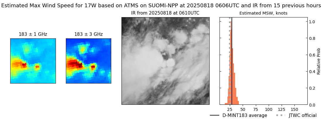 |
| 20250817 | 0324 UTC | TMS02 | 1003 hPa | 21 kts | 19 kts | 23 kts | 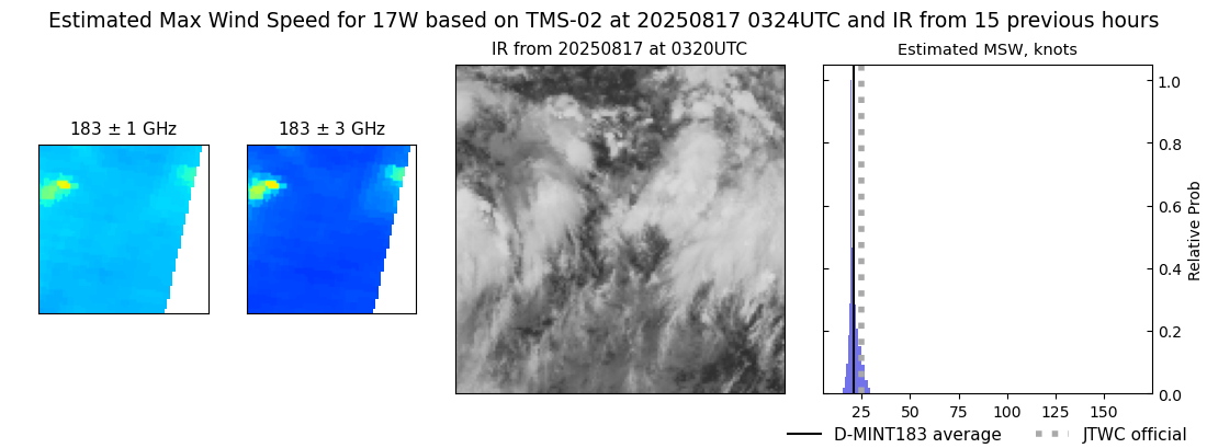 |