|
||

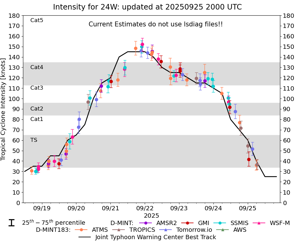 |
D-MINT HISTORY FILE for 2025_24W
| Date | Time | MW Sensor | MSLP | Vmax (30th-70th percentile average) | Vmax 25th percentile | Vmax 75th percentile | Image |
| 20250925 | 0625 UTC | TROPICS03 | NaN hPa | 37 kts | 32 kts | 42 kts |  |
| 20250925 | 0310 UTC | TMS02 | NaN hPa | 52 kts | 45 kts | 58 kts | 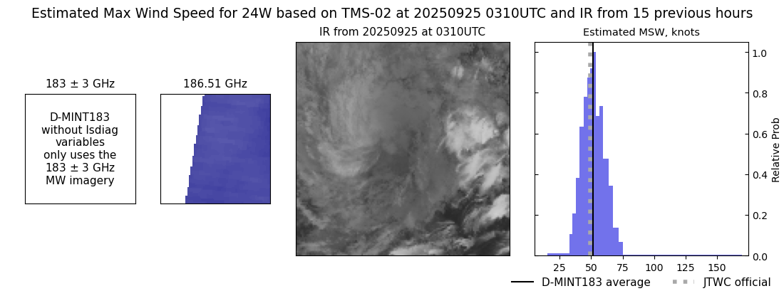 |
| 20250925 | 0043 UTC | GMI | NaN hPa | 42 kts | 35 kts | 49 kts | 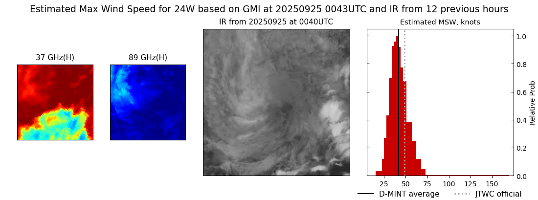 |
| 20250924 | 2354 UTC | TROPICS03 | NaN hPa | 54 kts | 48 kts | 61 kts | 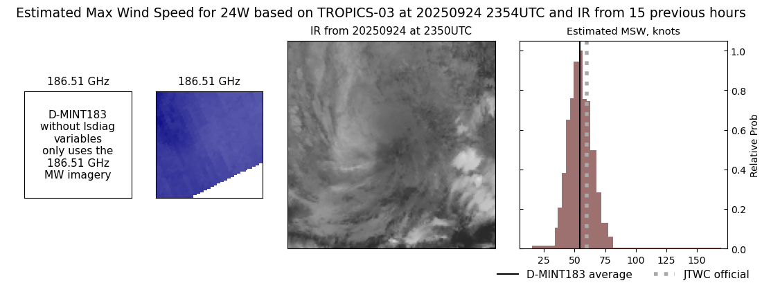 |
| 20250924 | 1908 UTC | TROPICS05 | NaN hPa | 72 kts | 65 kts | 79 kts | 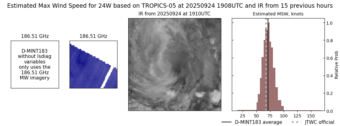 |
| 20250924 | 1508 UTC | TMS05 | NaN hPa | 88 kts | 81 kts | 95 kts |  |
| 20250924 | 1123 UTC | GMI | 955 hPa | 92 kts | 86 kts | 98 kts | 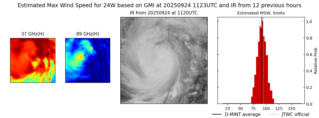 |
| 20250924 | 1103 UTC | SSMISF16 | 952 hPa | 95 kts | 89 kts | 101 kts |  |
| 20250924 | 1025 UTC | WSFM01 | 945 hPa | 97 kts | 91 kts | 103 kts |  |
| 20250924 | 1018 UTC | SSMISF17 | 945 hPa | 100 kts | 95 kts | 106 kts | 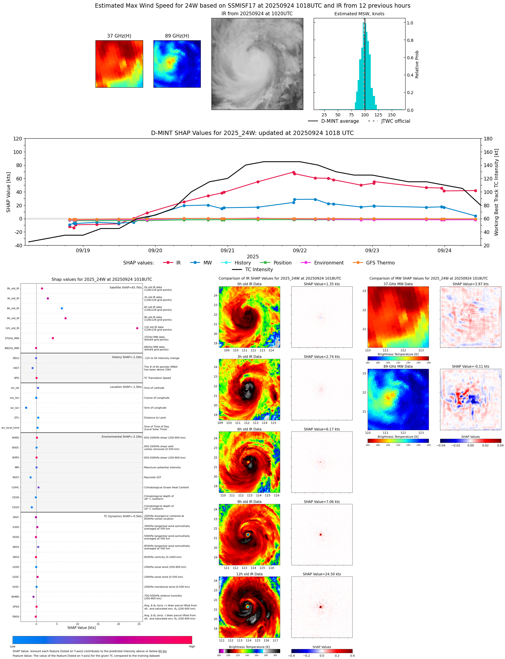 |
| 20250924 | 0547 UTC | ATMS-N21 | 945 hPa | 105 kts | 99 kts | 111 kts | 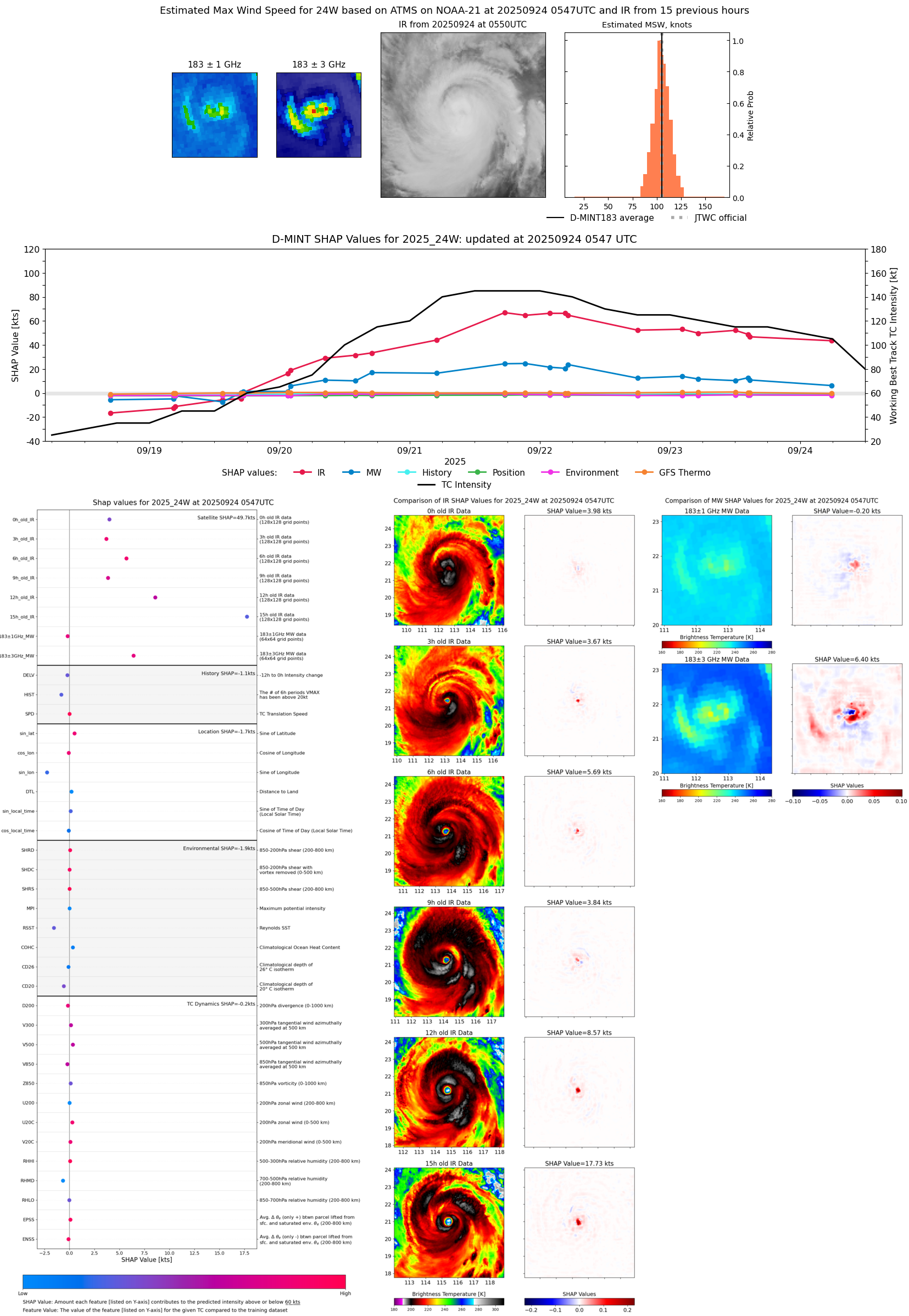 |
| 20250923 | 2350 UTC | SSMISF16 | 937 hPa | 112 kts | 106 kts | 117 kts |  |
| 20250923 | 2304 UTC | SSMISF17 | 932 hPa | 119 kts | 113 kts | 124 kts | 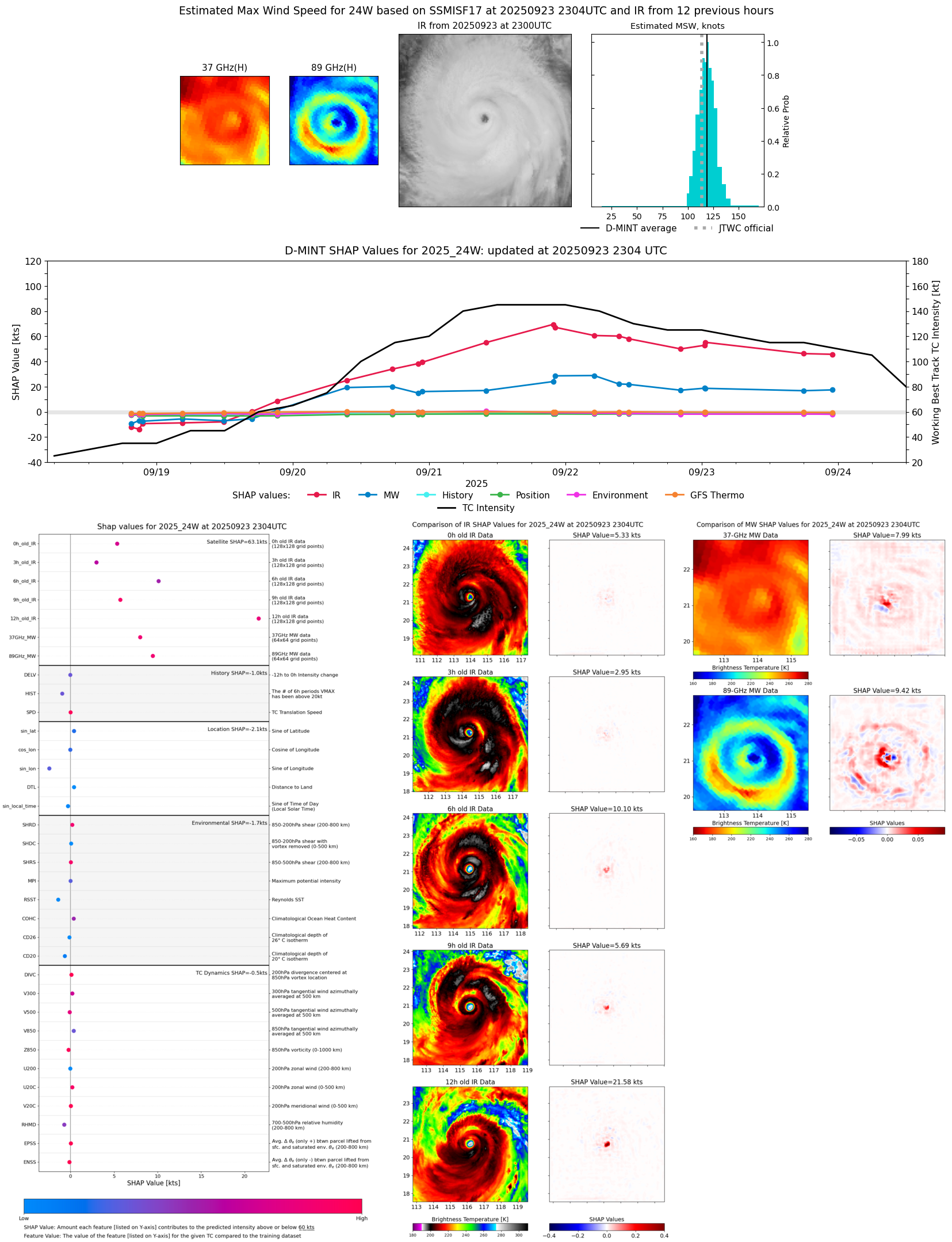 |
| 20250923 | 2007 UTC | SSMISF18 | 932 hPa | 119 kts | 113 kts | 125 kts | 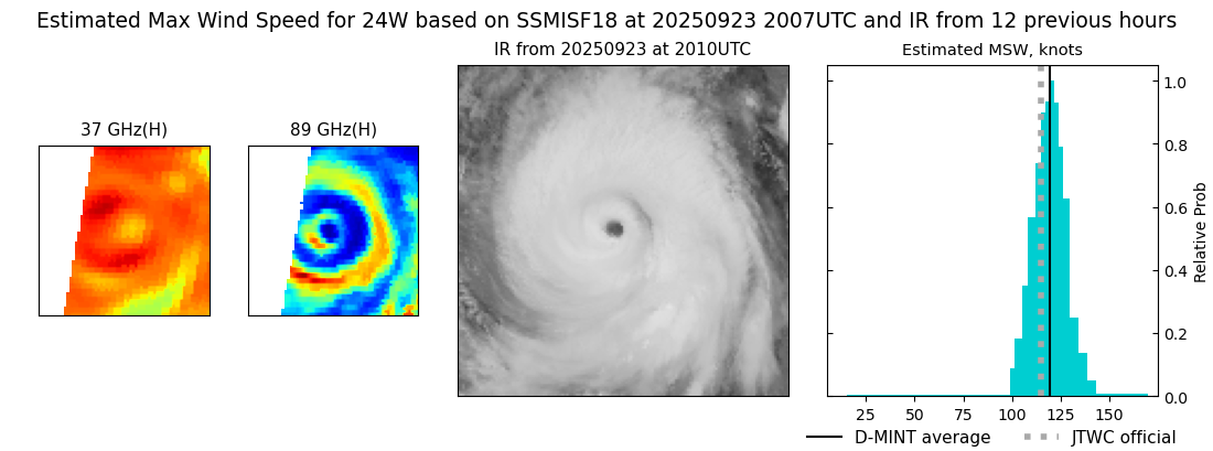 |
| 20250923 | 1758 UTC | AMSR2 | 930 hPa | 117 kts | 111 kts | 123 kts | 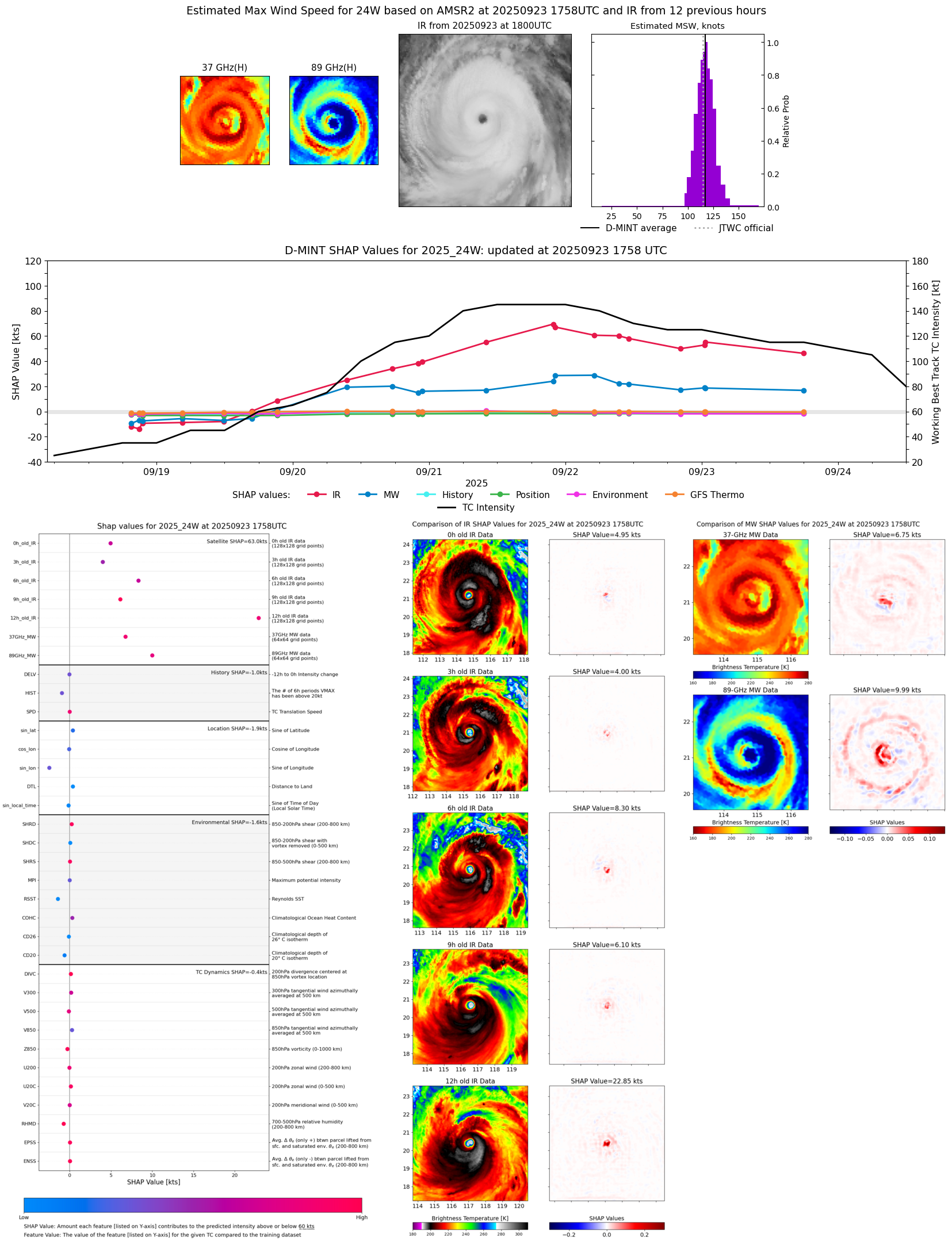 |
| 20250923 | 1743 UTC | ATMS-N20 | 933 hPa | 125 kts | 117 kts | 133 kts | 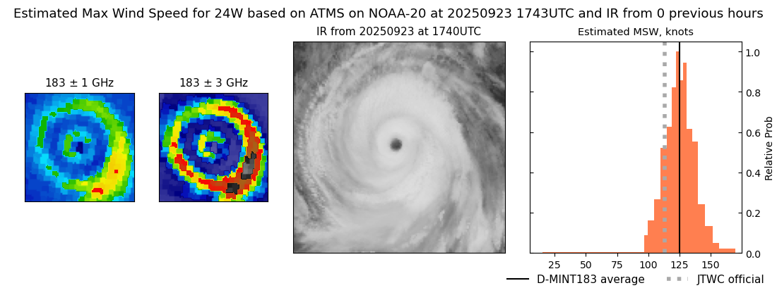 |
| 20250923 | 1442 UTC | TMS06 | 932 hPa | 114 kts | 108 kts | 120 kts | 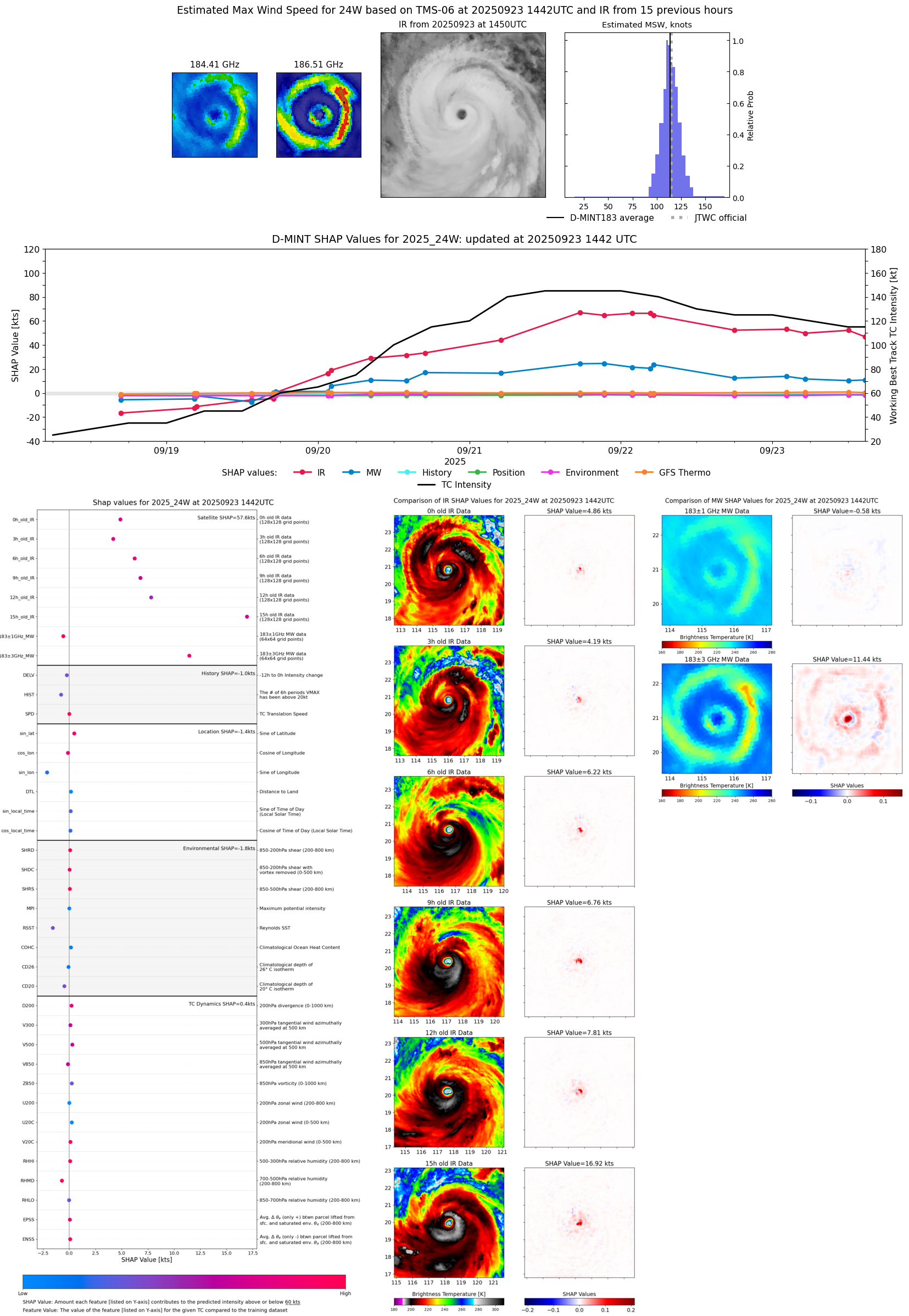 |
| 20250923 | 1426 UTC | TMS02 | 933 hPa | 118 kts | 111 kts | 124 kts | 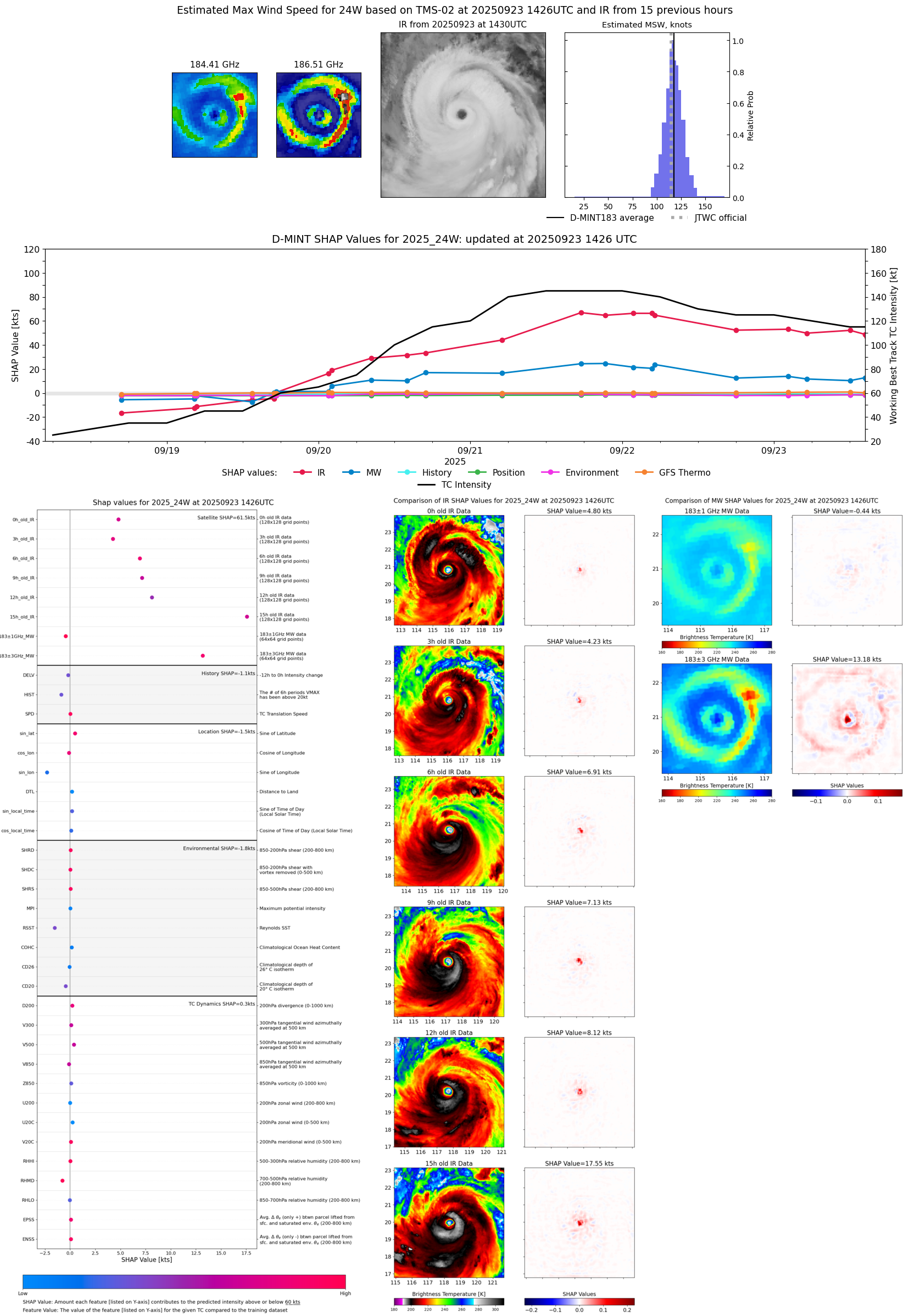 |
| 20250923 | 1204 UTC | TROPICS05 | 933 hPa | 119 kts | 114 kts | 125 kts | 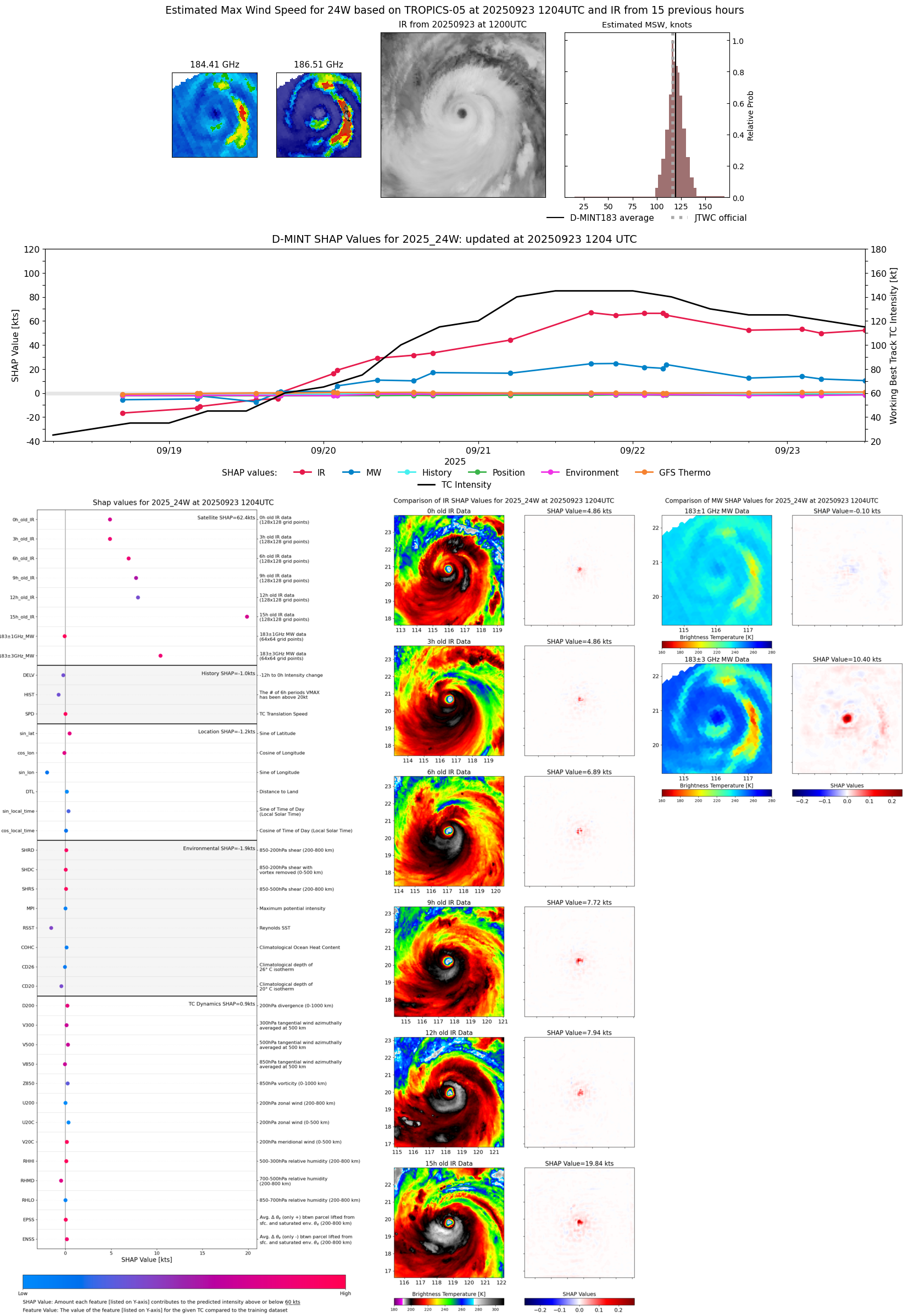 |
| 20250923 | 0513 UTC | ATMS-N20 | 928 hPa | 118 kts | 112 kts | 124 kts | 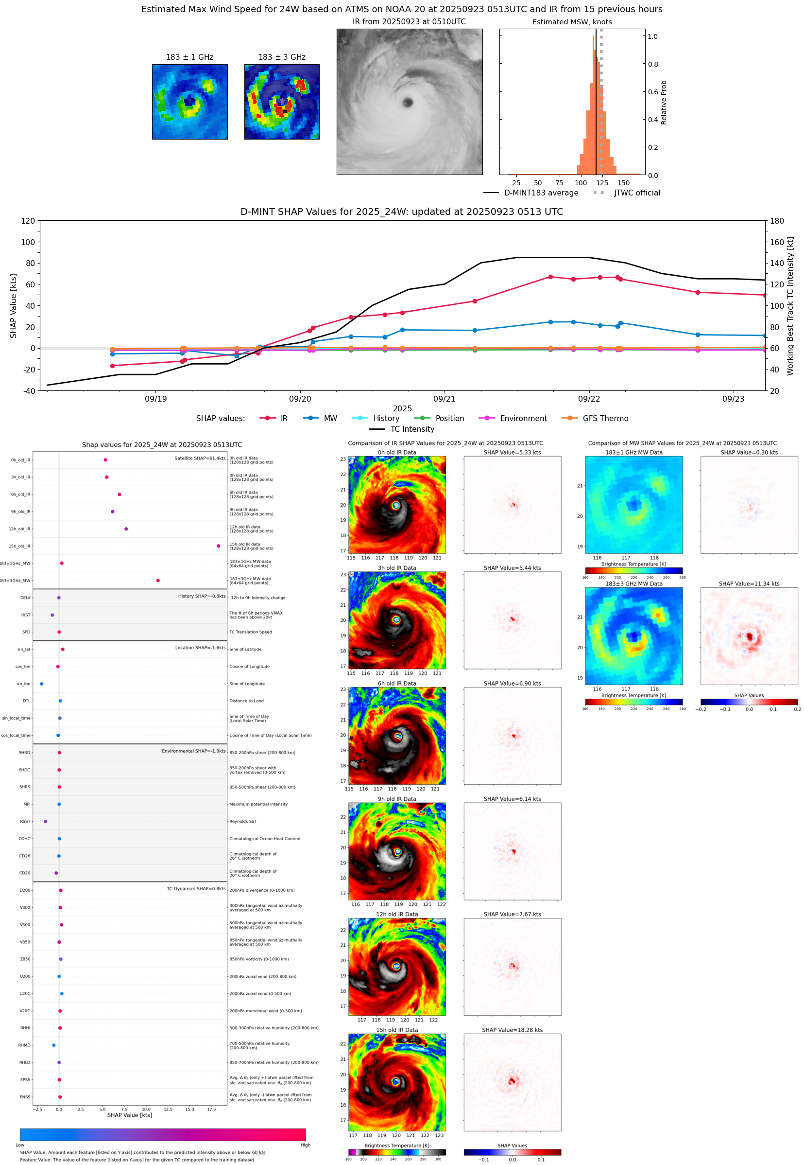 |
| 20250923 | 0215 UTC | TMS05 | 931 hPa | 123 kts | 117 kts | 129 kts |  |
| 20250923 | 0040 UTC | GMI | 930 hPa | 129 kts | 123 kts | 135 kts | 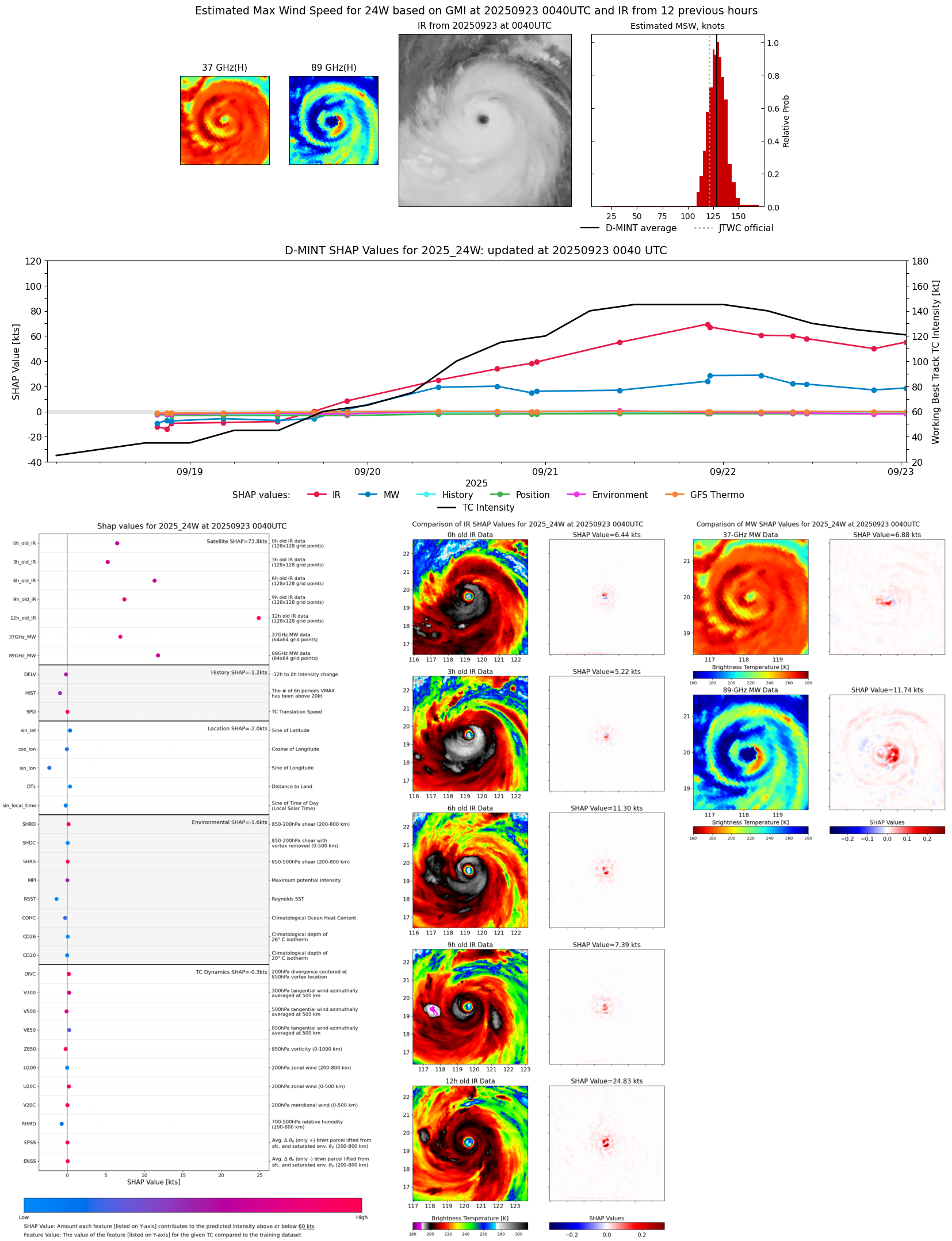 |
| 20250923 | 0033 UTC | GMI | 932 hPa | 127 kts | 121 kts | 132 kts | 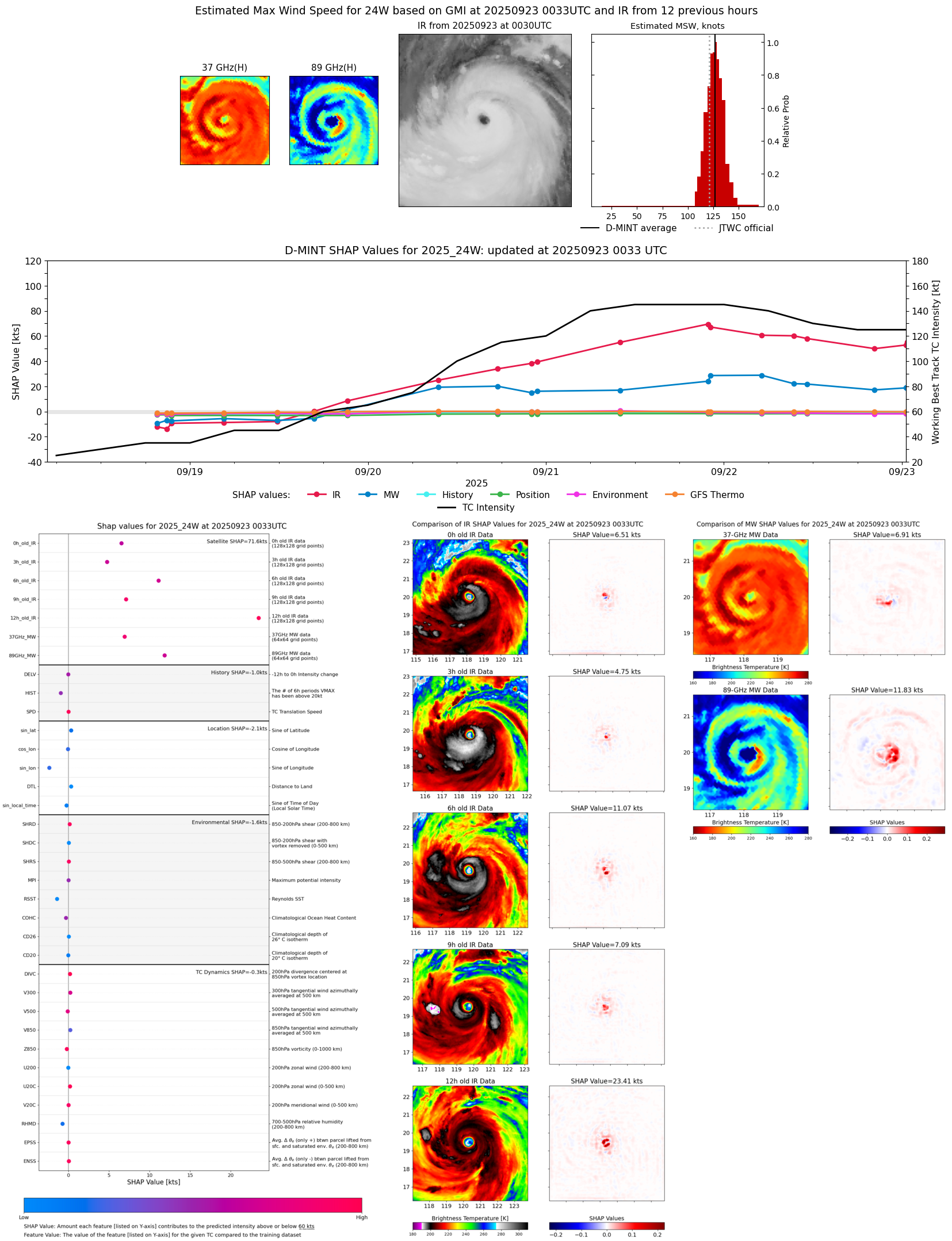 |
| 20250922 | 2154 UTC | WSFM01 | 934 hPa | 122 kts | 116 kts | 128 kts | 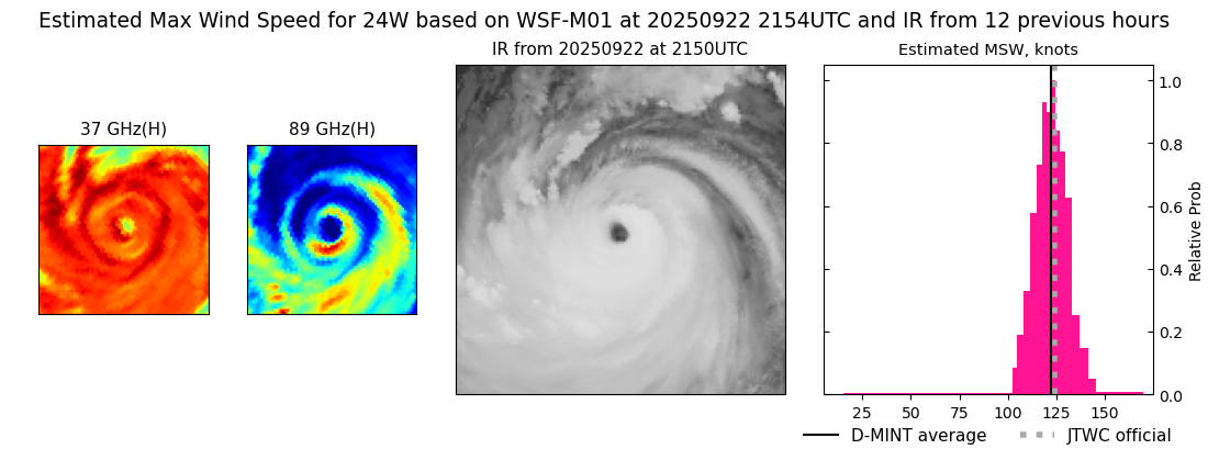 |
| 20250922 | 2019 UTC | SSMISF18 | 930 hPa | 122 kts | 117 kts | 127 kts |  |
| 20250922 | 1801 UTC | ATMS-N20 | 932 hPa | 120 kts | 113 kts | 126 kts | 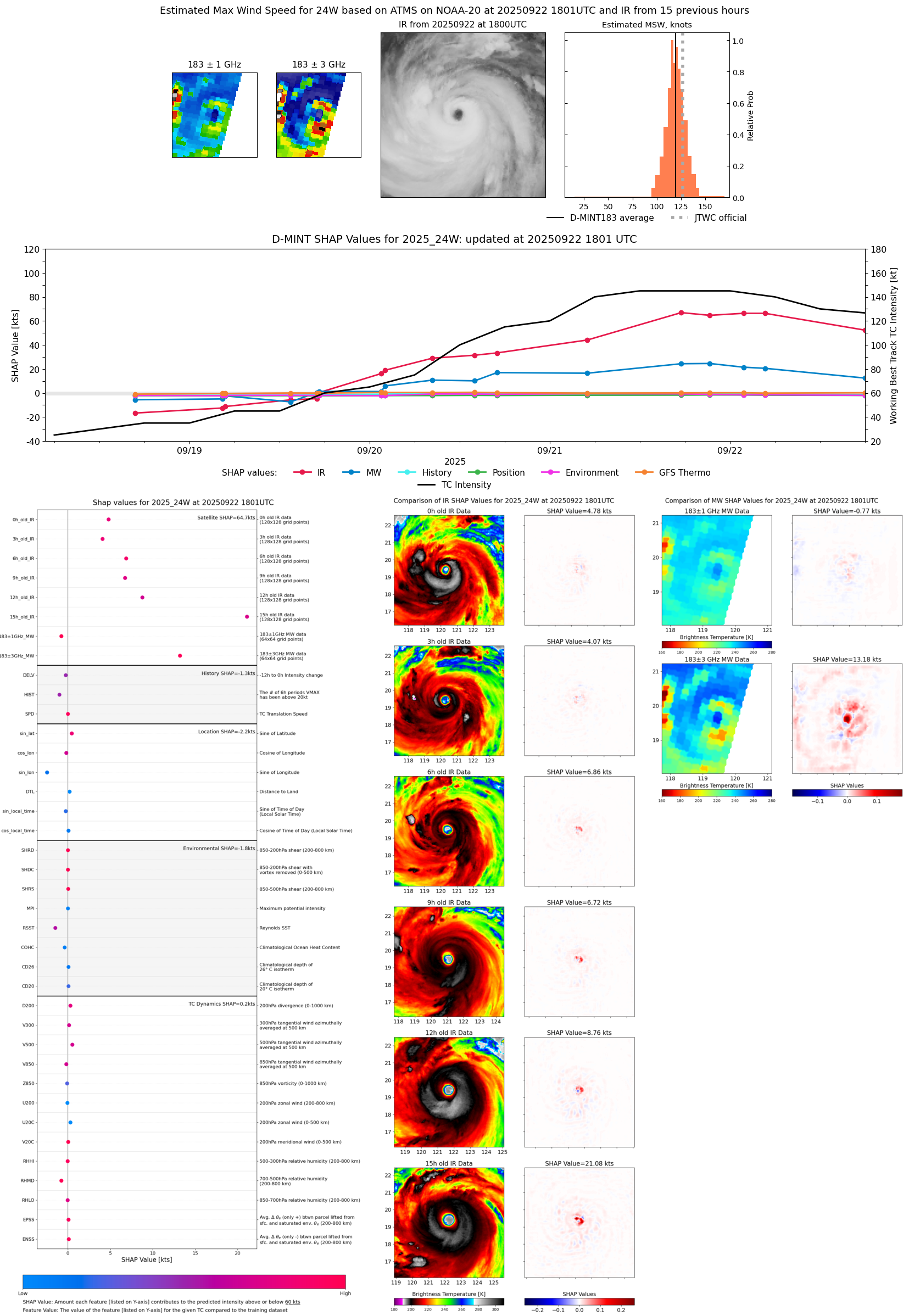 |
| 20250922 | 1740 UTC | ATMS-NPP | 929 hPa | 130 kts | 122 kts | 139 kts | 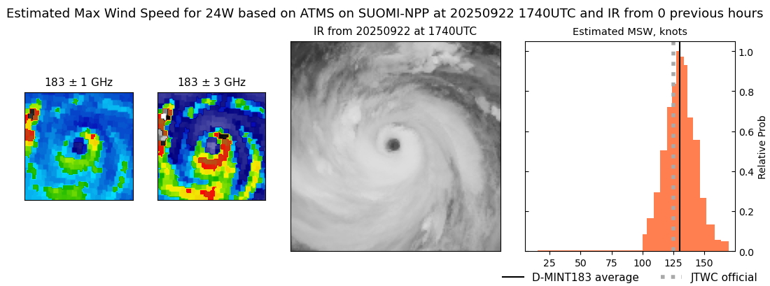 |
| 20250922 | 1113 UTC | GMI | 922 hPa | 136 kts | 130 kts | 141 kts | 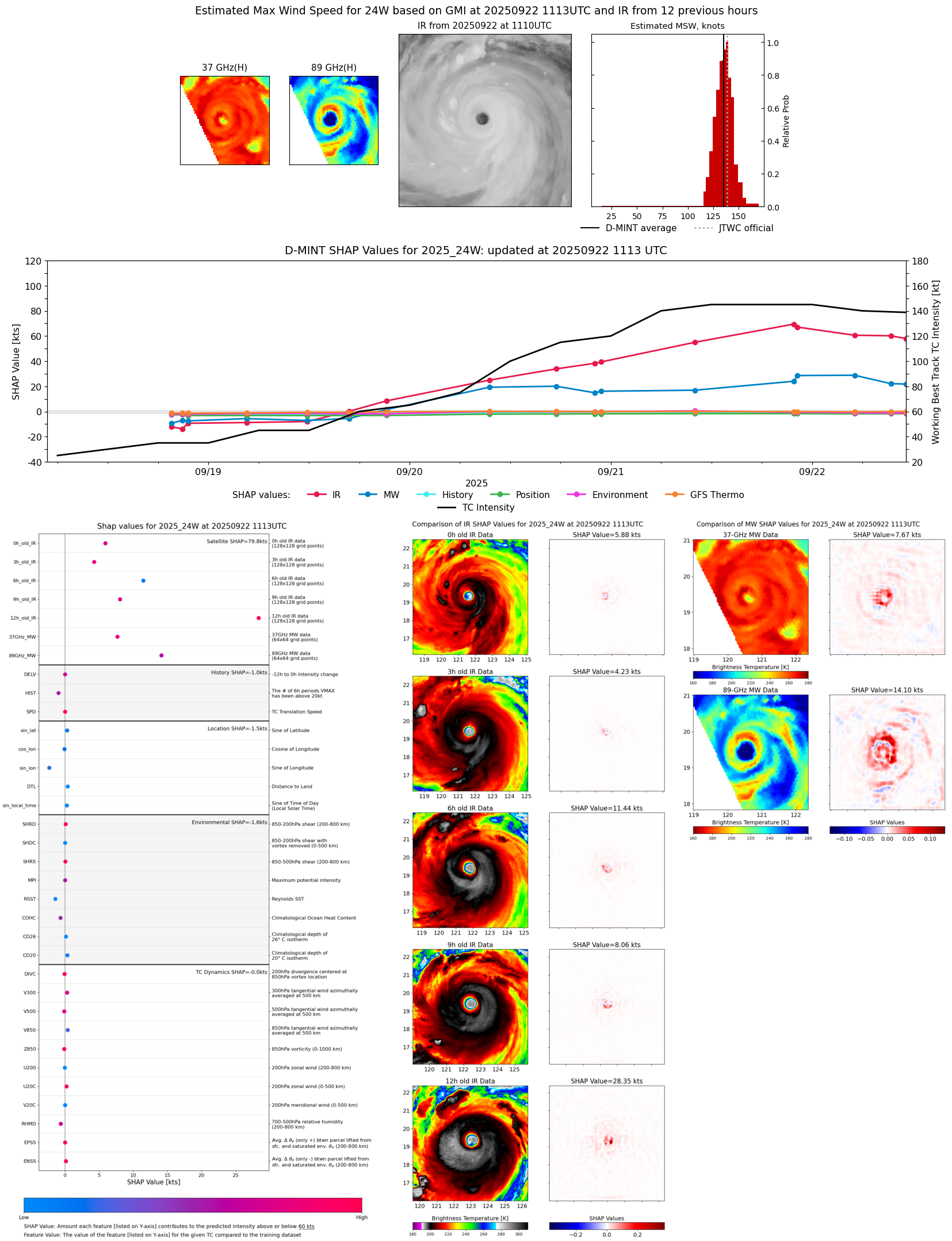 |
| 20250922 | 0924 UTC | WSFM01 | 916 hPa | 138 kts | 132 kts | 143 kts | 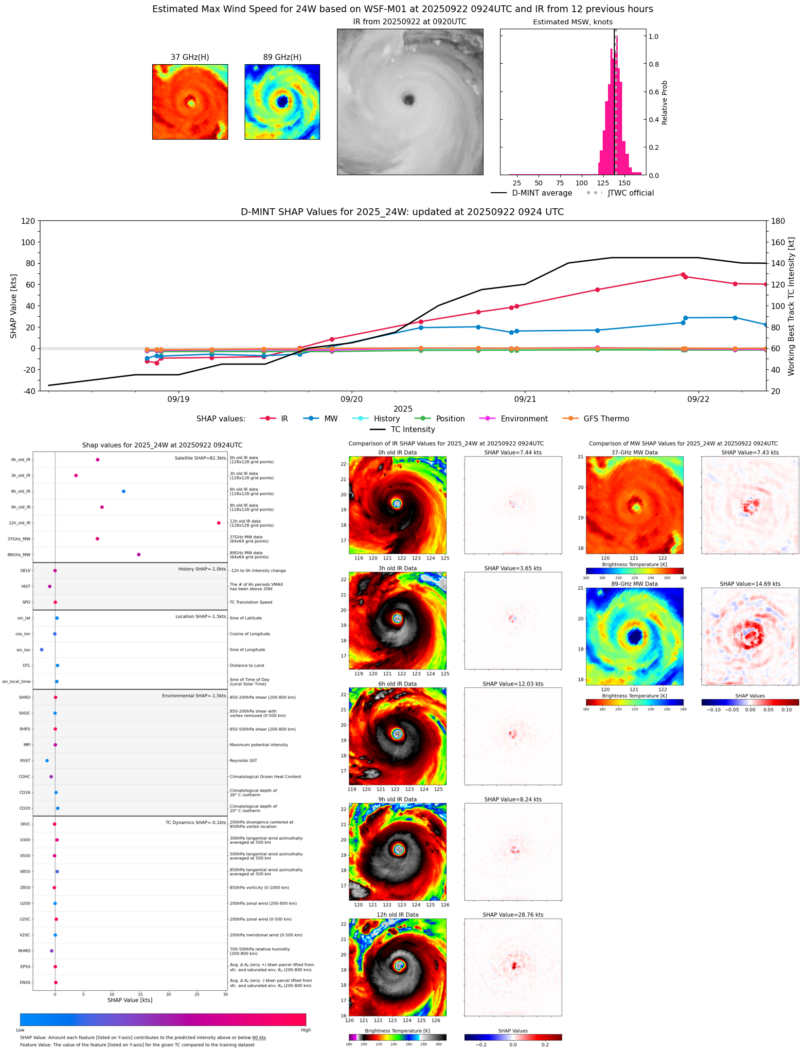 |
| 20250922 | 0510 UTC | ATMS-NPP | 910 hPa | 145 kts | 139 kts | 151 kts | 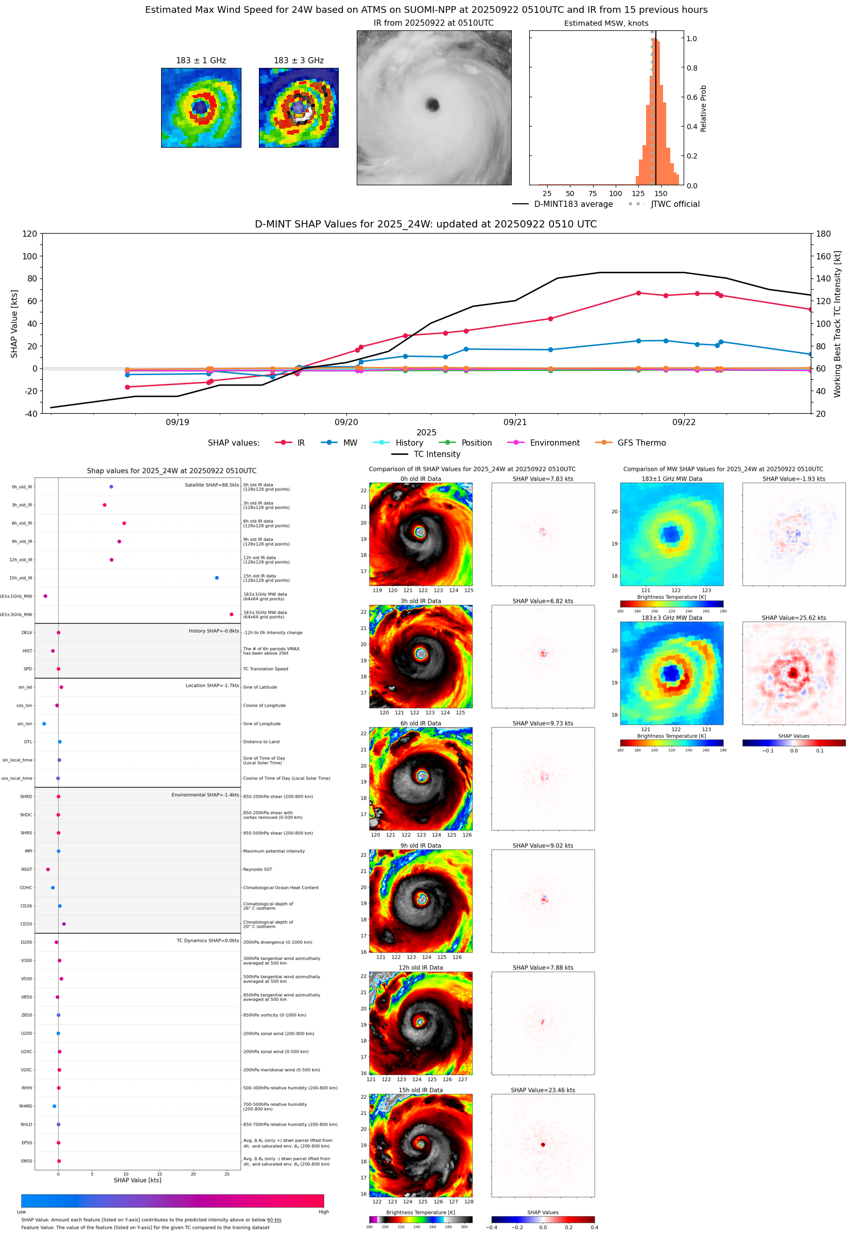 |
| 20250922 | 0505 UTC | AMSR2 | 918 hPa | 146 kts | 139 kts | 152 kts | 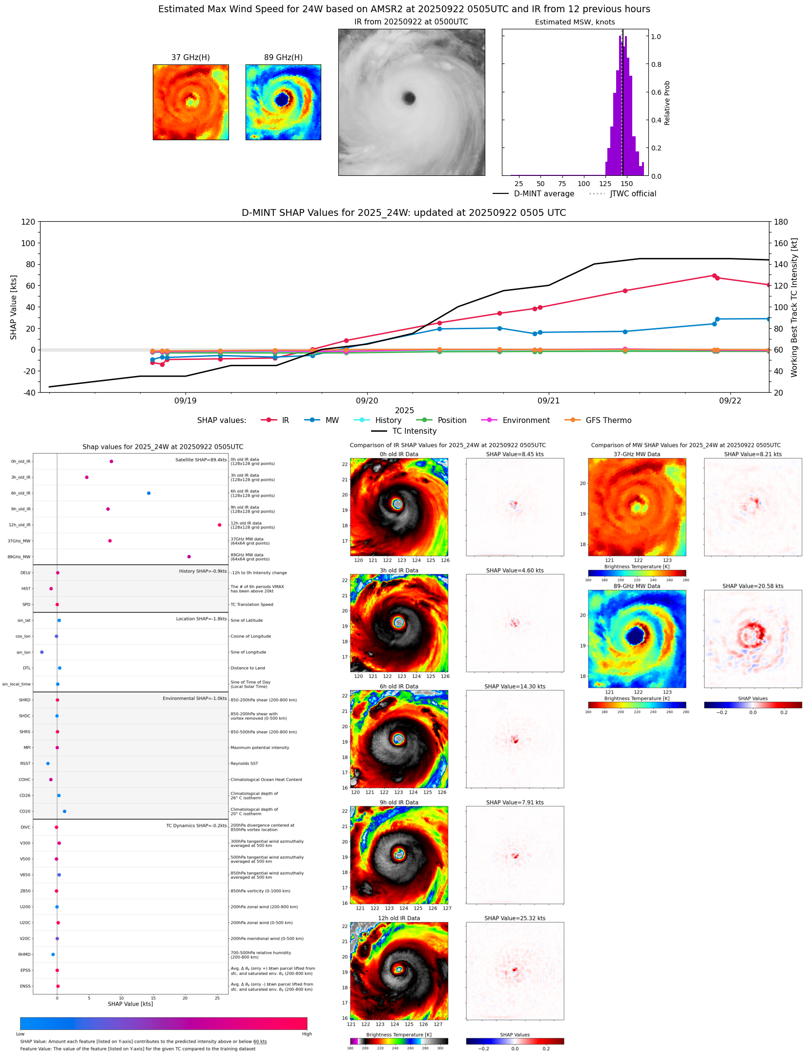 |
| 20250922 | 0442 UTC | ATMS-N21 | 912 hPa | 143 kts | 137 kts | 149 kts | 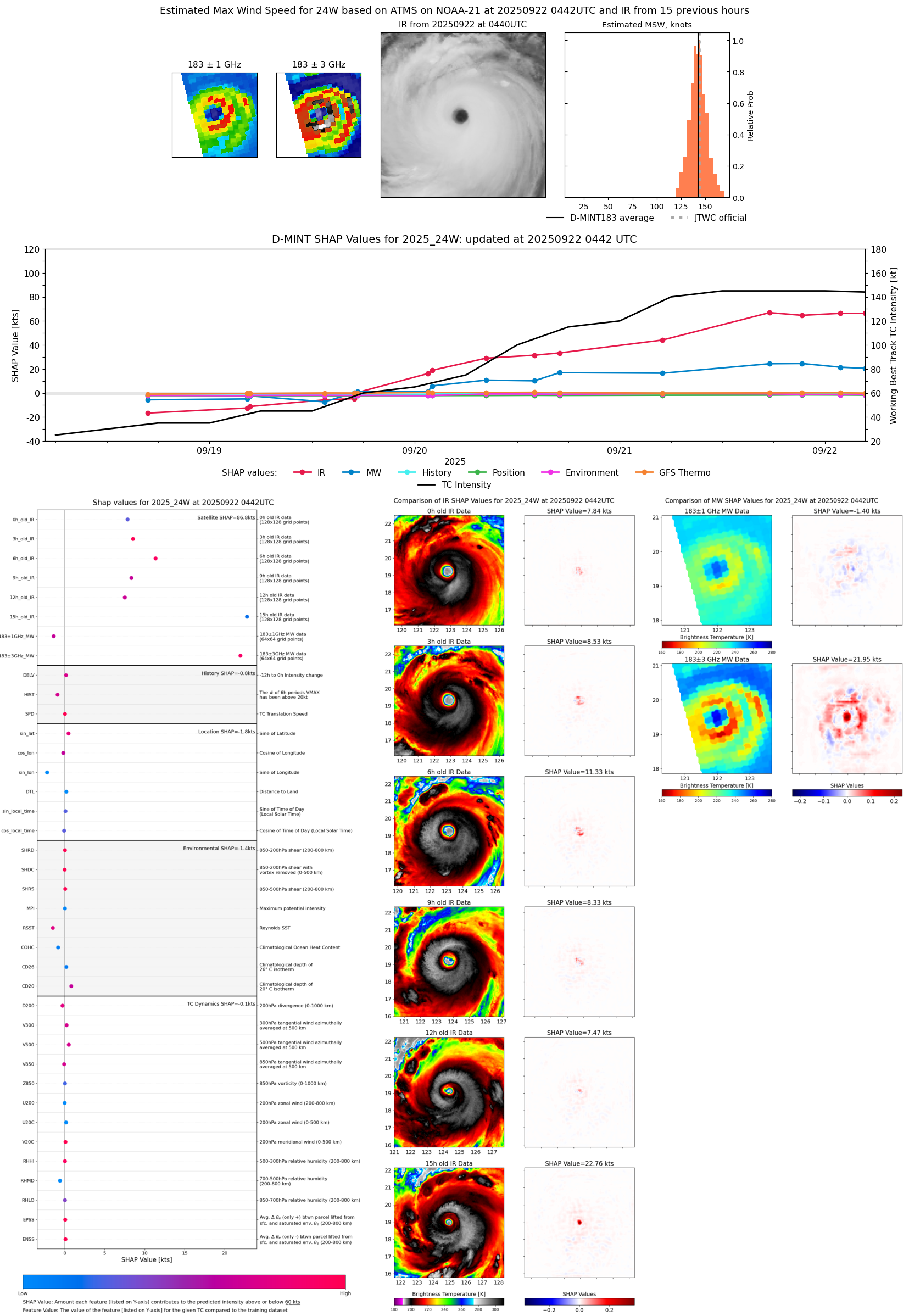 |
| 20250922 | 0149 UTC | TMS06 | 914 hPa | 144 kts | 139 kts | 150 kts | 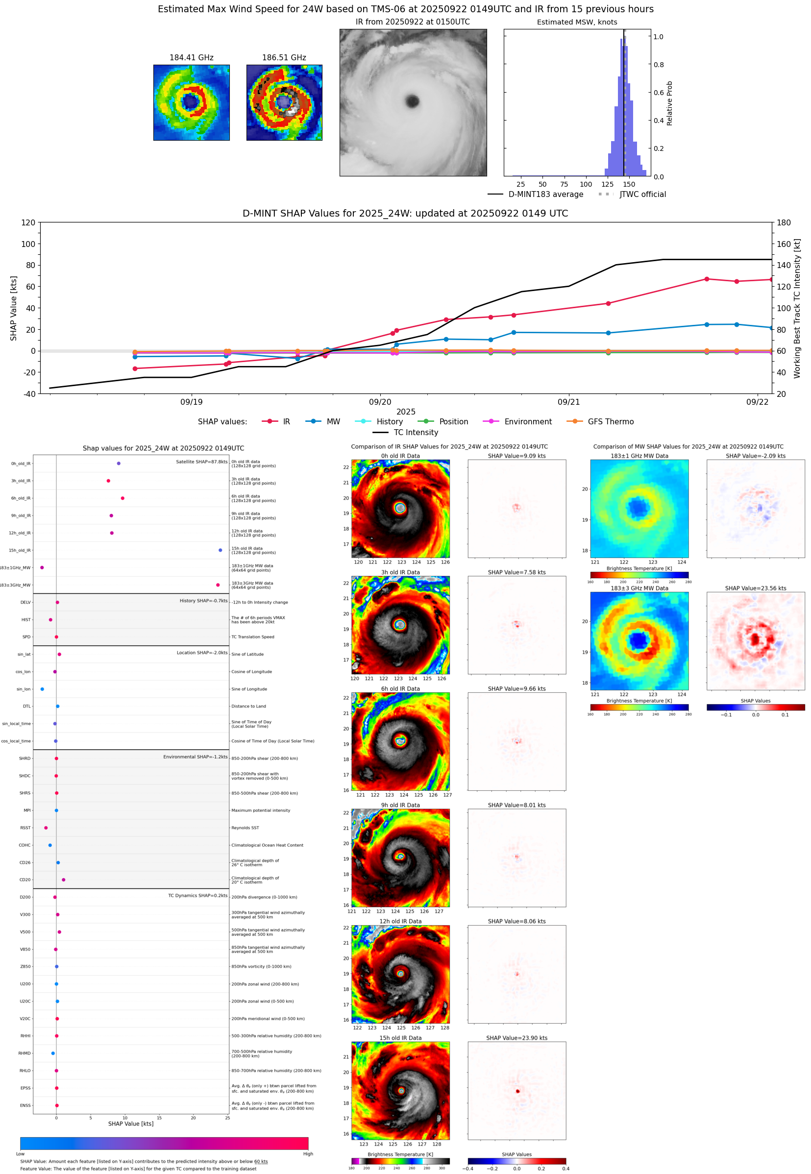 |
| 20250921 | 2213 UTC | WSFM01 | 917 hPa | 152 kts | 146 kts | 158 kts | 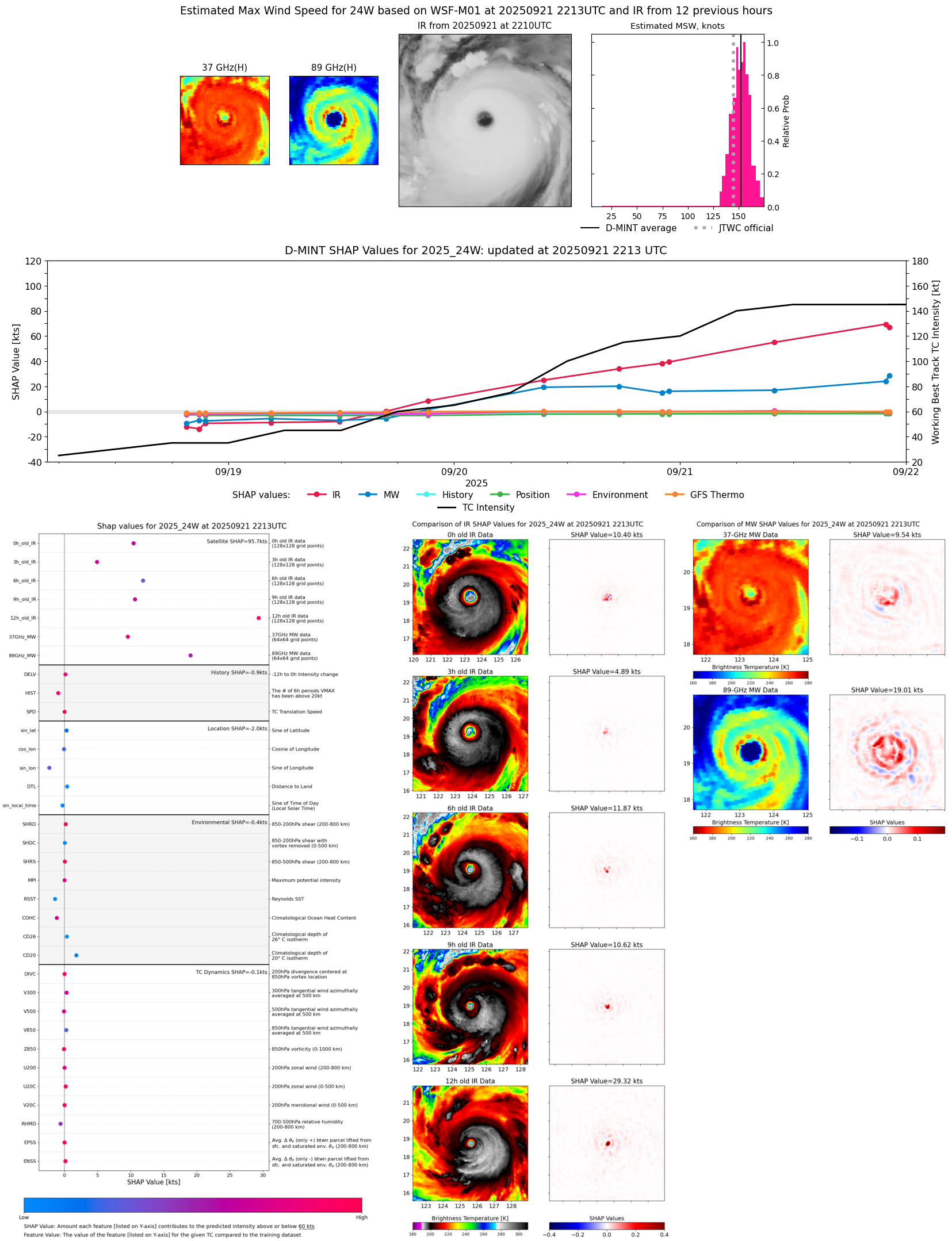 |
| 20250921 | 2151 UTC | SSMISF17 | 917 hPa | 150 kts | 144 kts | 156 kts | 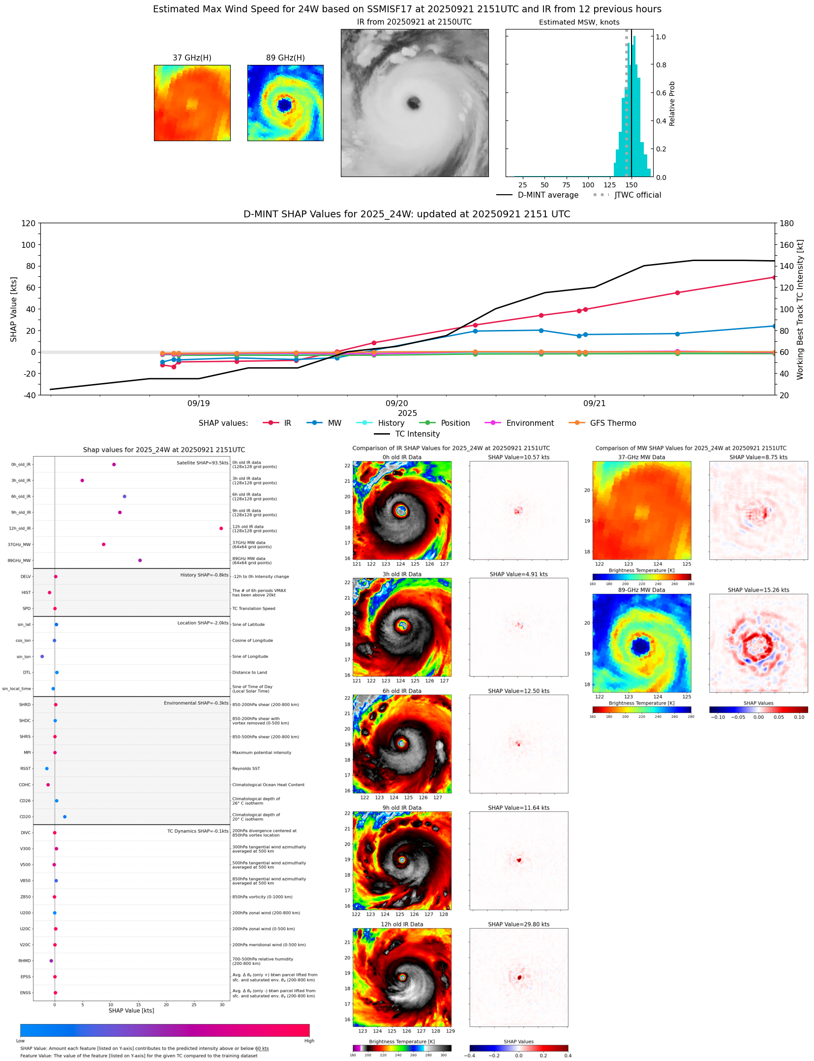 |
| 20250921 | 2120 UTC | TMS07 | 905 hPa | 146 kts | 140 kts | 152 kts | 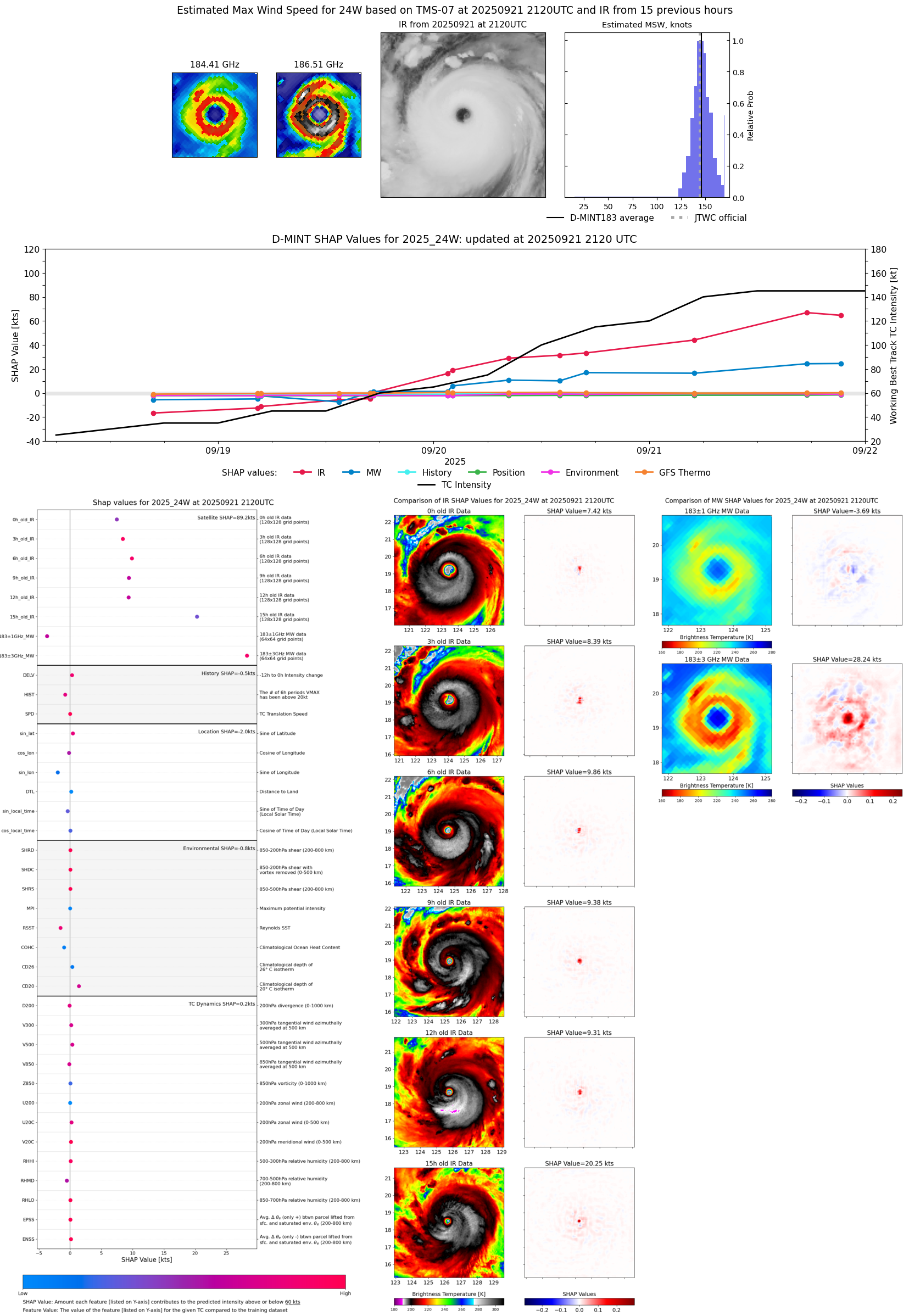 |
| 20250921 | 1731 UTC | ATMS-N21 | 907 hPa | 148 kts | 142 kts | 155 kts | 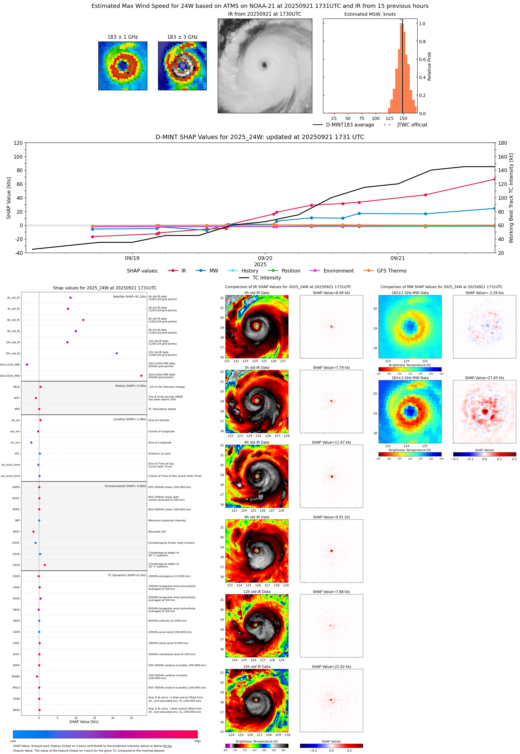 |
| 20250921 | 1002 UTC | SSMISF16 | 922 hPa | 130 kts | 123 kts | 137 kts | 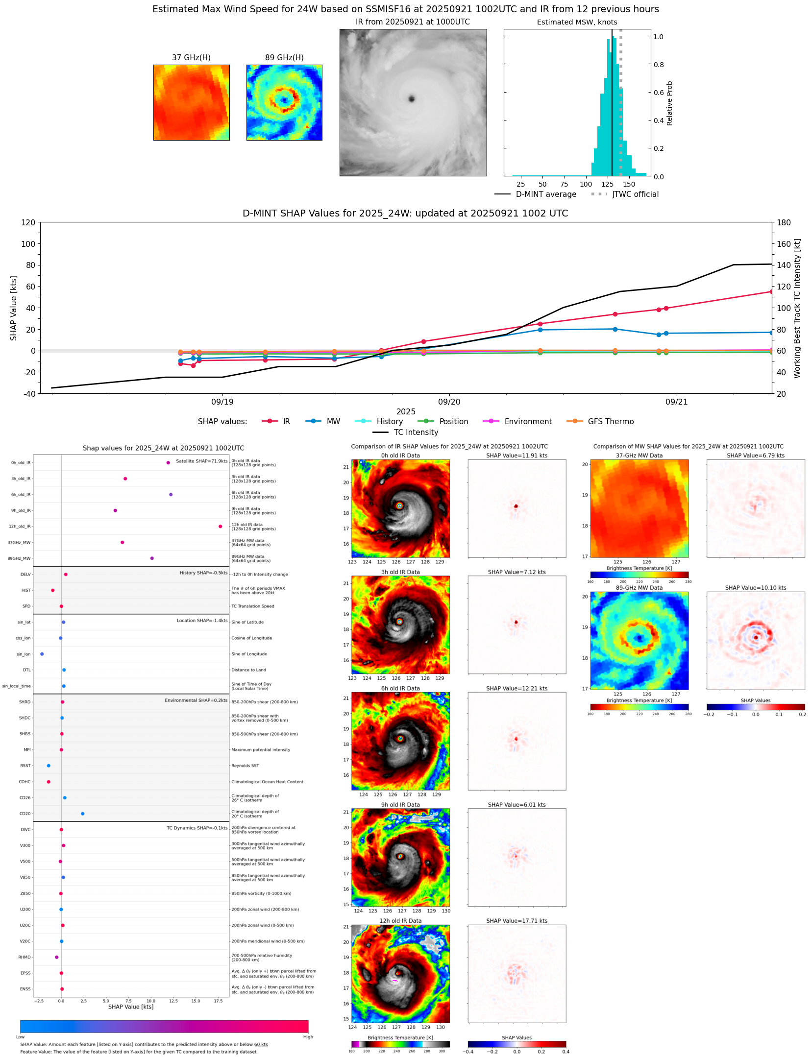 |
| 20250921 | 0944 UTC | WSFM01 | 921 hPa | 128 kts | 121 kts | 135 kts | 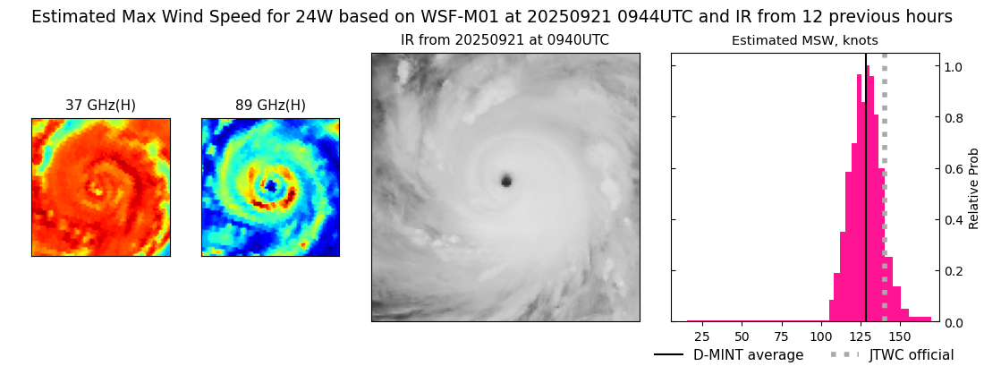 |
| 20250921 | 0500 UTC | ATMS-N21 | 936 hPa | 118 kts | 112 kts | 125 kts | 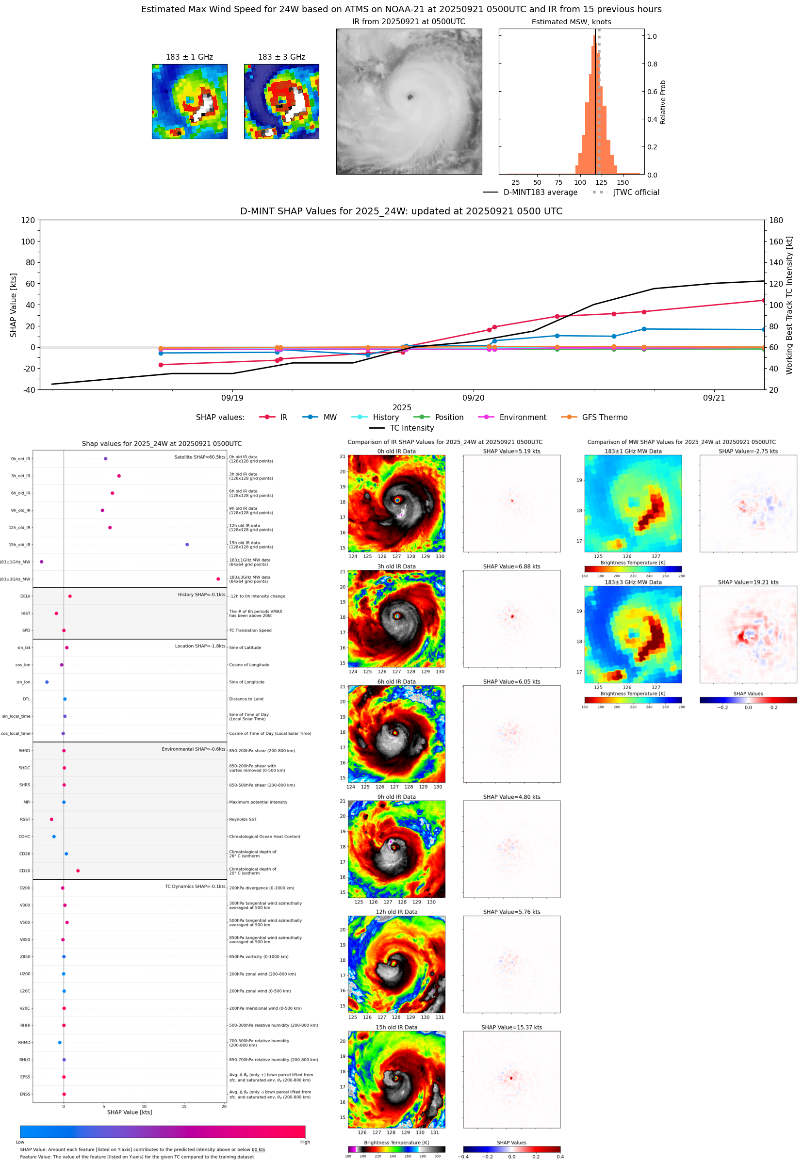 |
| 20250921 | 0023 UTC | GMI | 934 hPa | 117 kts | 111 kts | 122 kts | 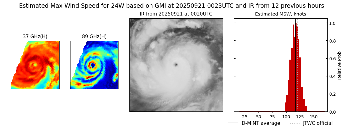 |
| 20250920 | 2251 UTC | SSMISF16 | 935 hPa | 117 kts | 111 kts | 123 kts |  |
| 20250920 | 2206 UTC | SSMISF17 | 939 hPa | 112 kts | 106 kts | 118 kts | 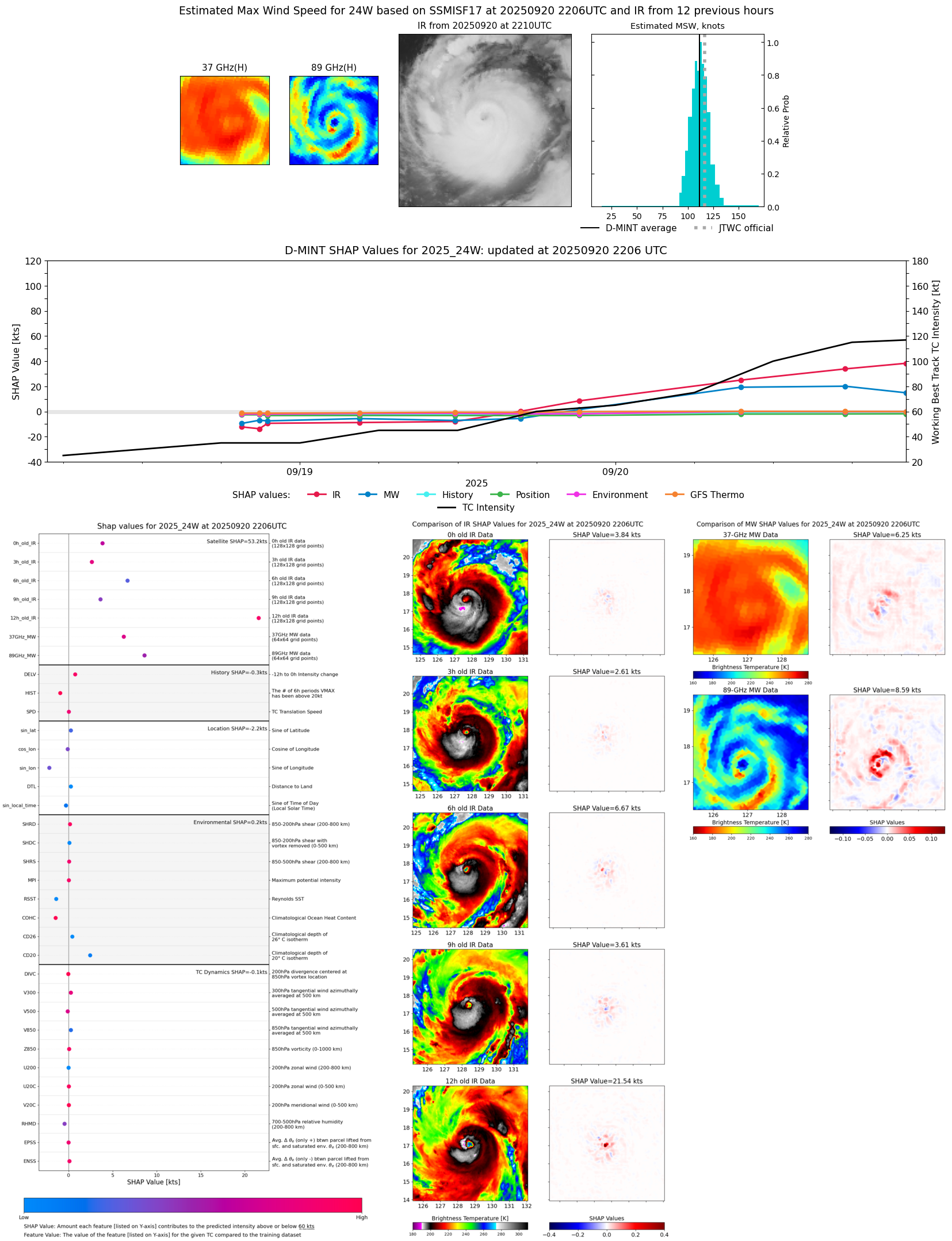 |
| 20250920 | 1729 UTC | AMSR2 | 945 hPa | 112 kts | 106 kts | 118 kts | 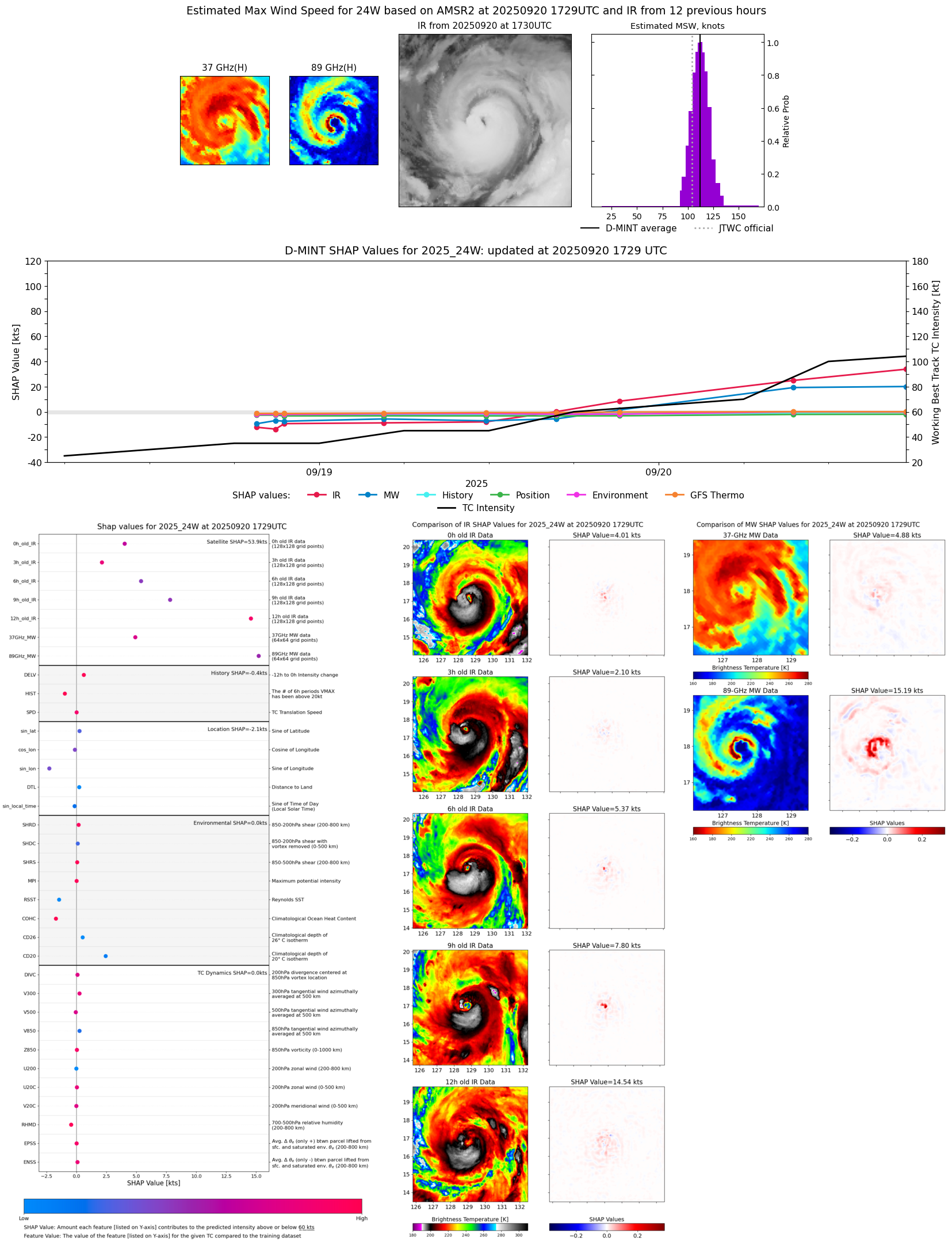 |
| 20250920 | 1659 UTC | ATMS-N20 | 945 hPa | 108 kts | 101 kts | 115 kts | 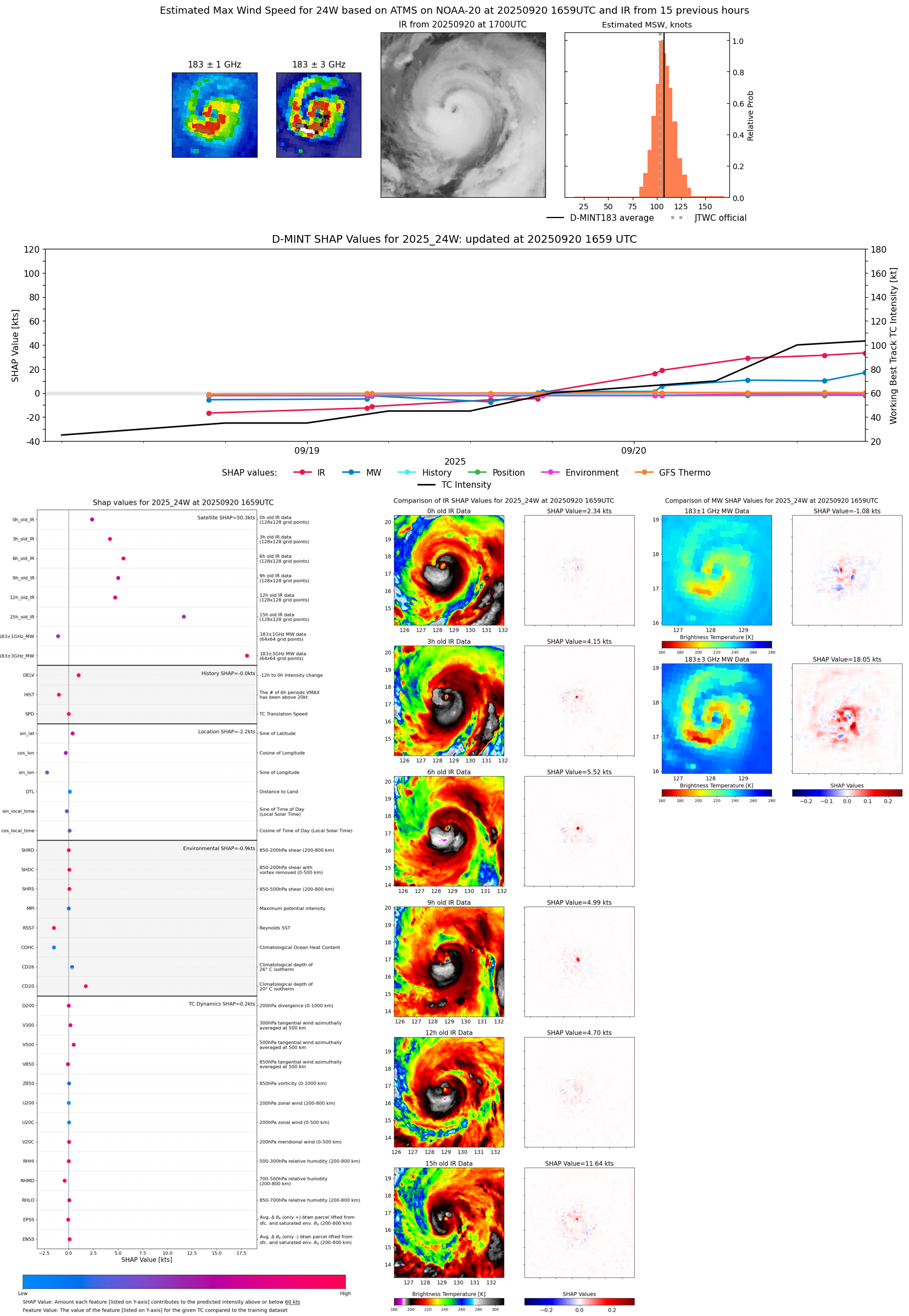 |
| 20250920 | 1401 UTC | TMS06 | 955 hPa | 99 kts | 92 kts | 107 kts | 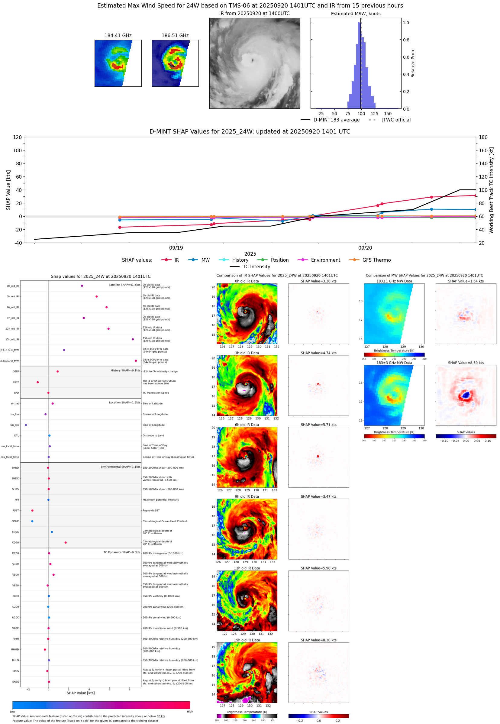 |
| 20250920 | 0932 UTC | SSMISF17 | 956 hPa | 101 kts | 94 kts | 108 kts | 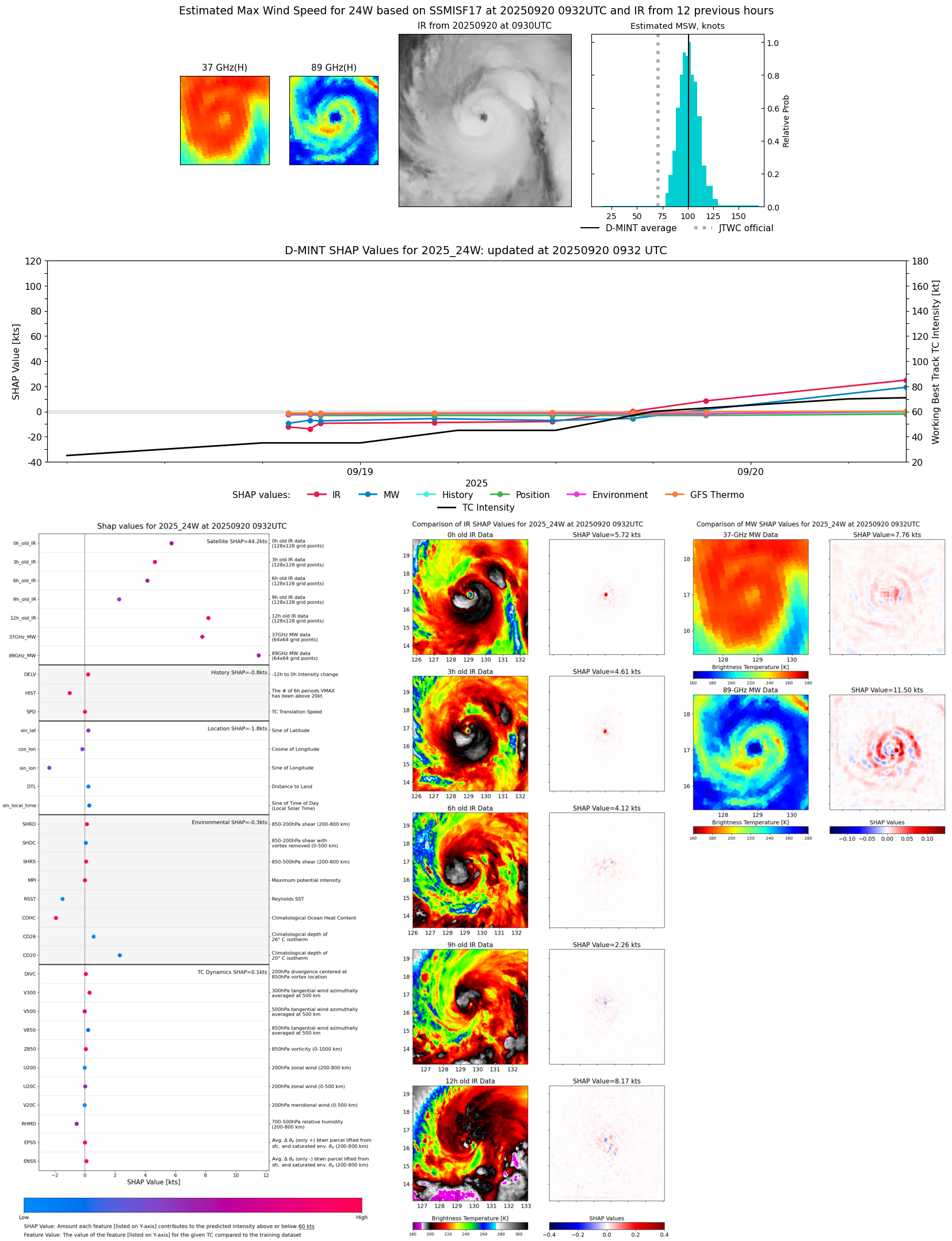 |
| 20250920 | 0822 UTC | TROPICS03 | 959 hPa | 97 kts | 90 kts | 104 kts | 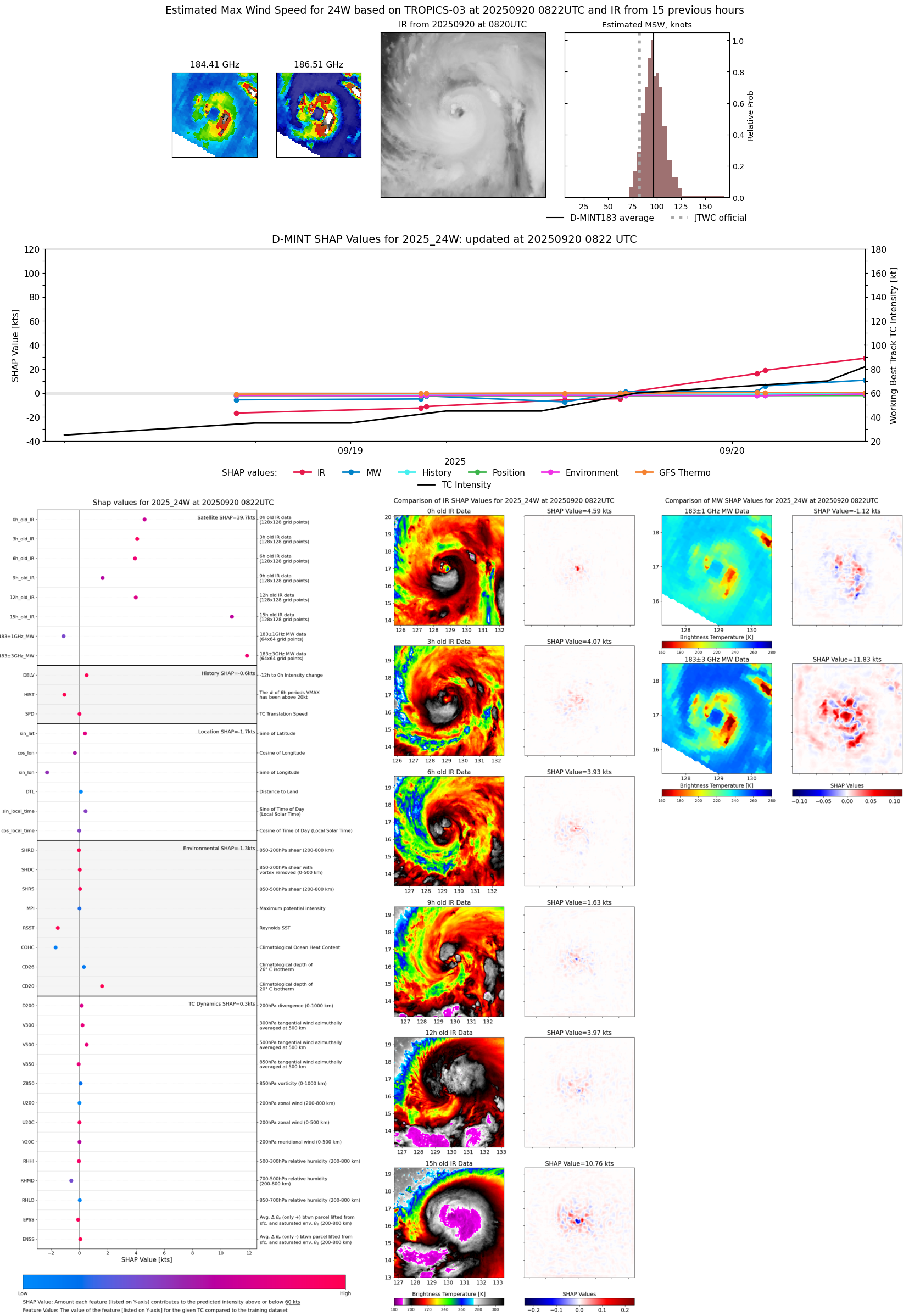 |
| 20250920 | 0205 UTC | TMS02 | 970 hPa | 80 kts | 74 kts | 87 kts | 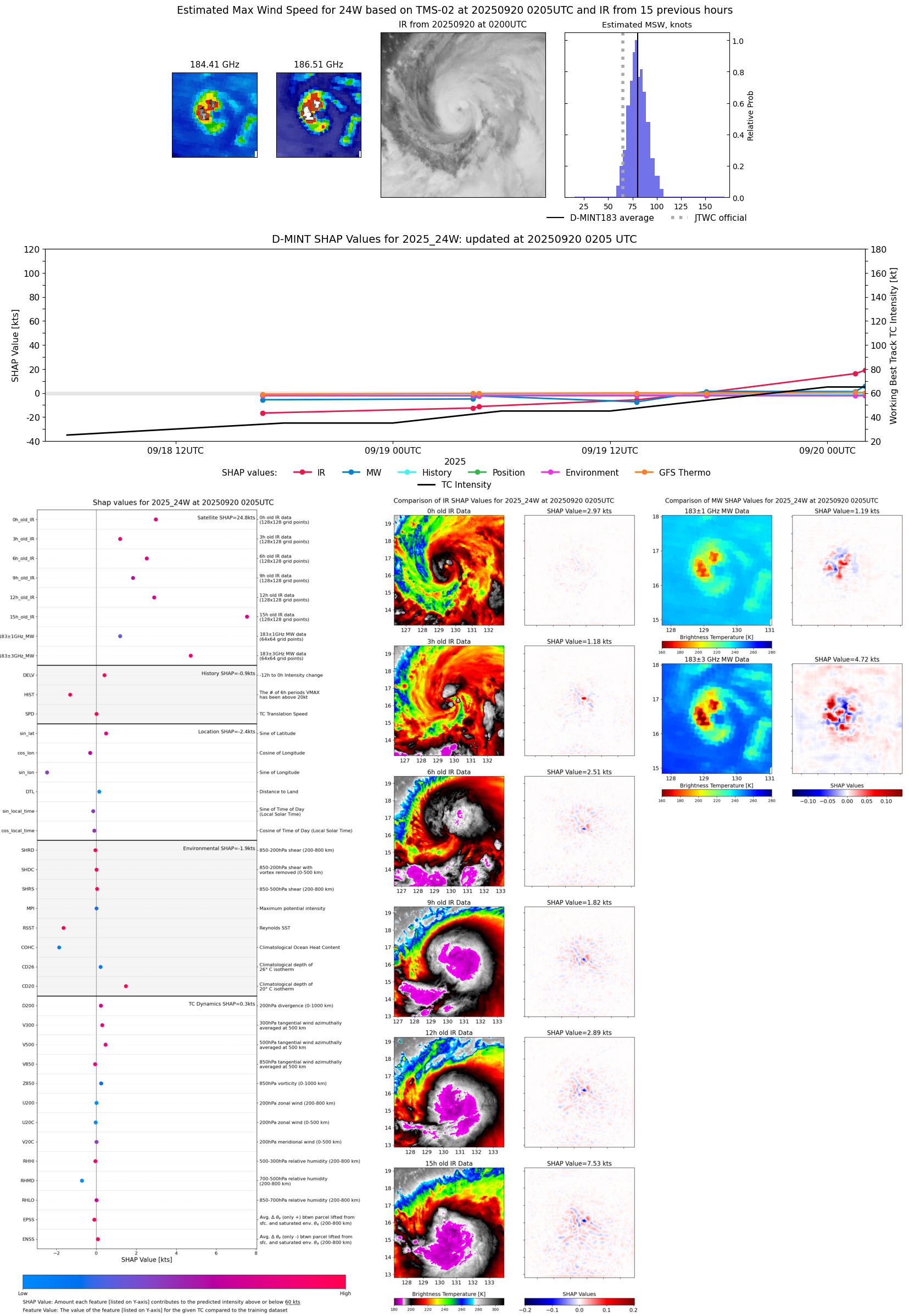 |
| 20250920 | 0133 UTC | TMS05 | 974 hPa | 73 kts | 66 kts | 79 kts |  |
| 20250919 | 2114 UTC | WSFM01 | 984 hPa | 63 kts | 56 kts | 70 kts | 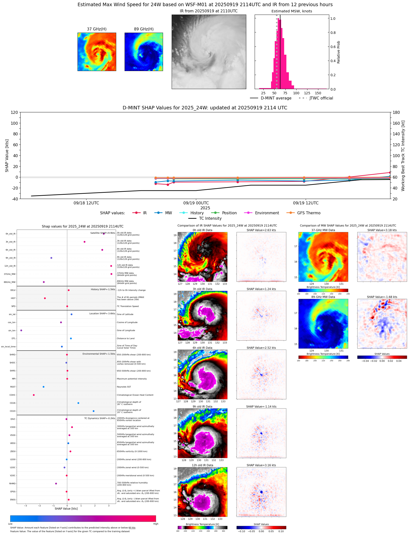 |
| 20250919 | 1922 UTC | SSMISF18 | 985 hPa | 59 kts | 52 kts | 66 kts | 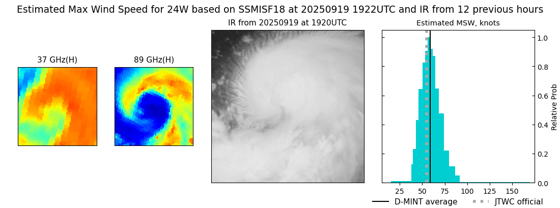 |
| 20250919 | 1718 UTC | ATMS-N20 | 987 hPa | 56 kts | 50 kts | 62 kts | 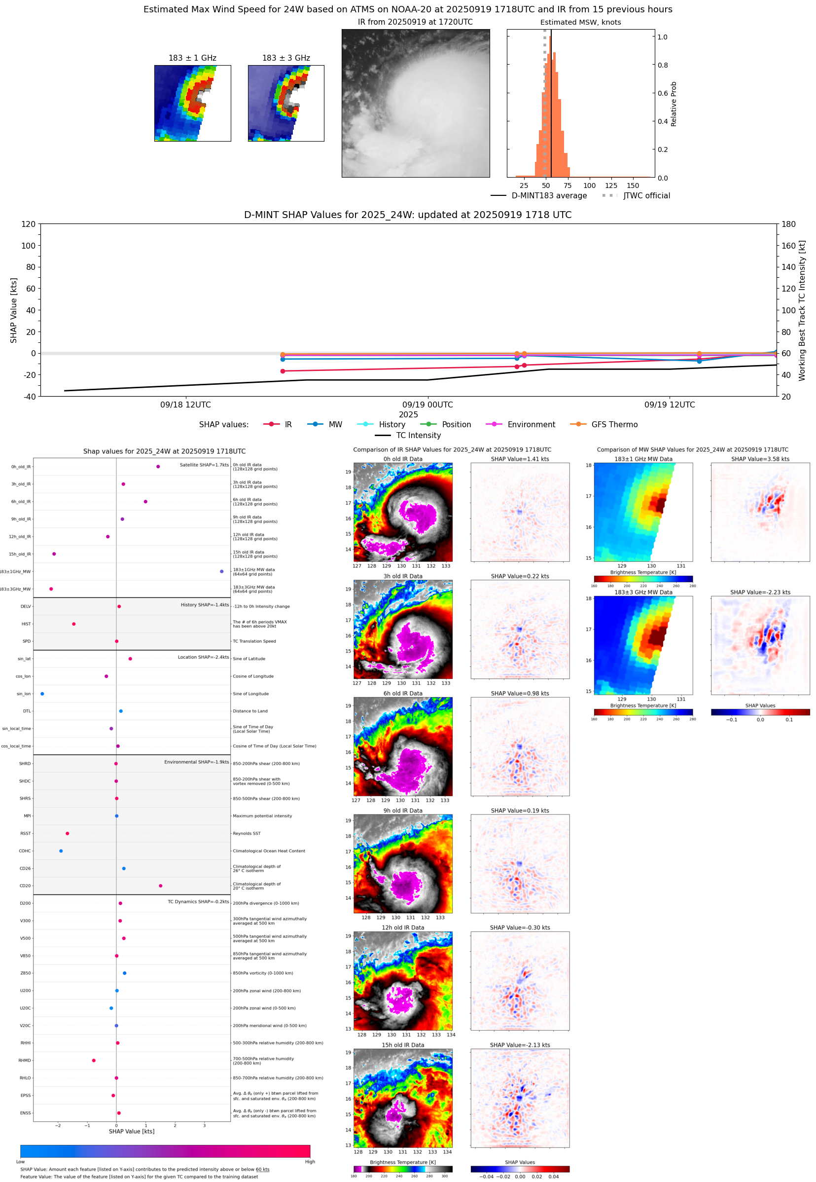 |
| 20250919 | 1657 UTC | ATMS-NPP | 990 hPa | 49 kts | 44 kts | 55 kts | 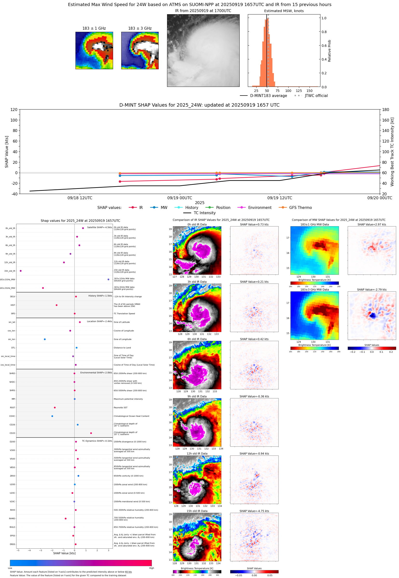 |
| 20250919 | 1646 UTC | AMSR2 | 998 hPa | 47 kts | 42 kts | 52 kts | 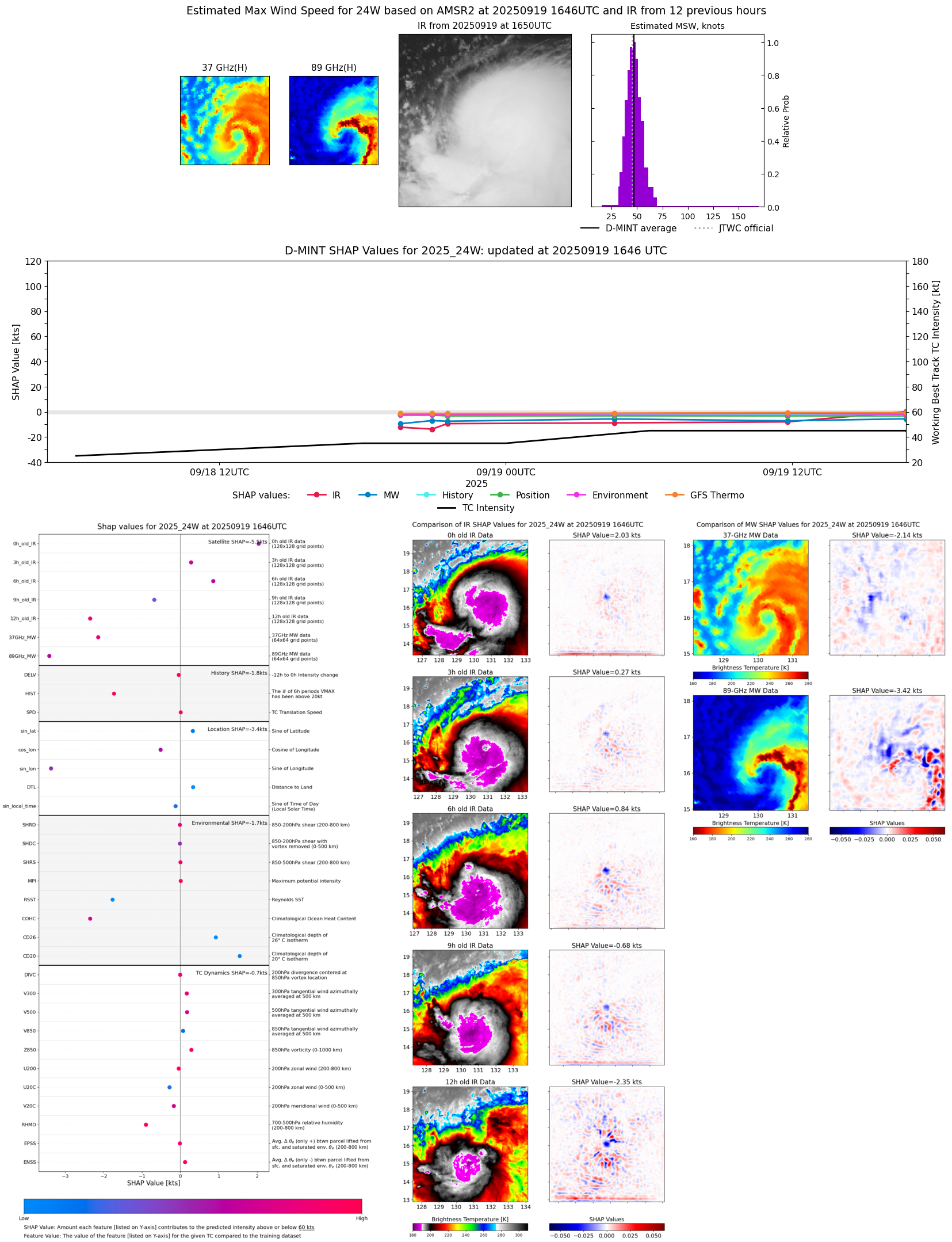 |
| 20250919 | 1328 UTC | TMS05 | 995 hPa | 41 kts | 36 kts | 46 kts | 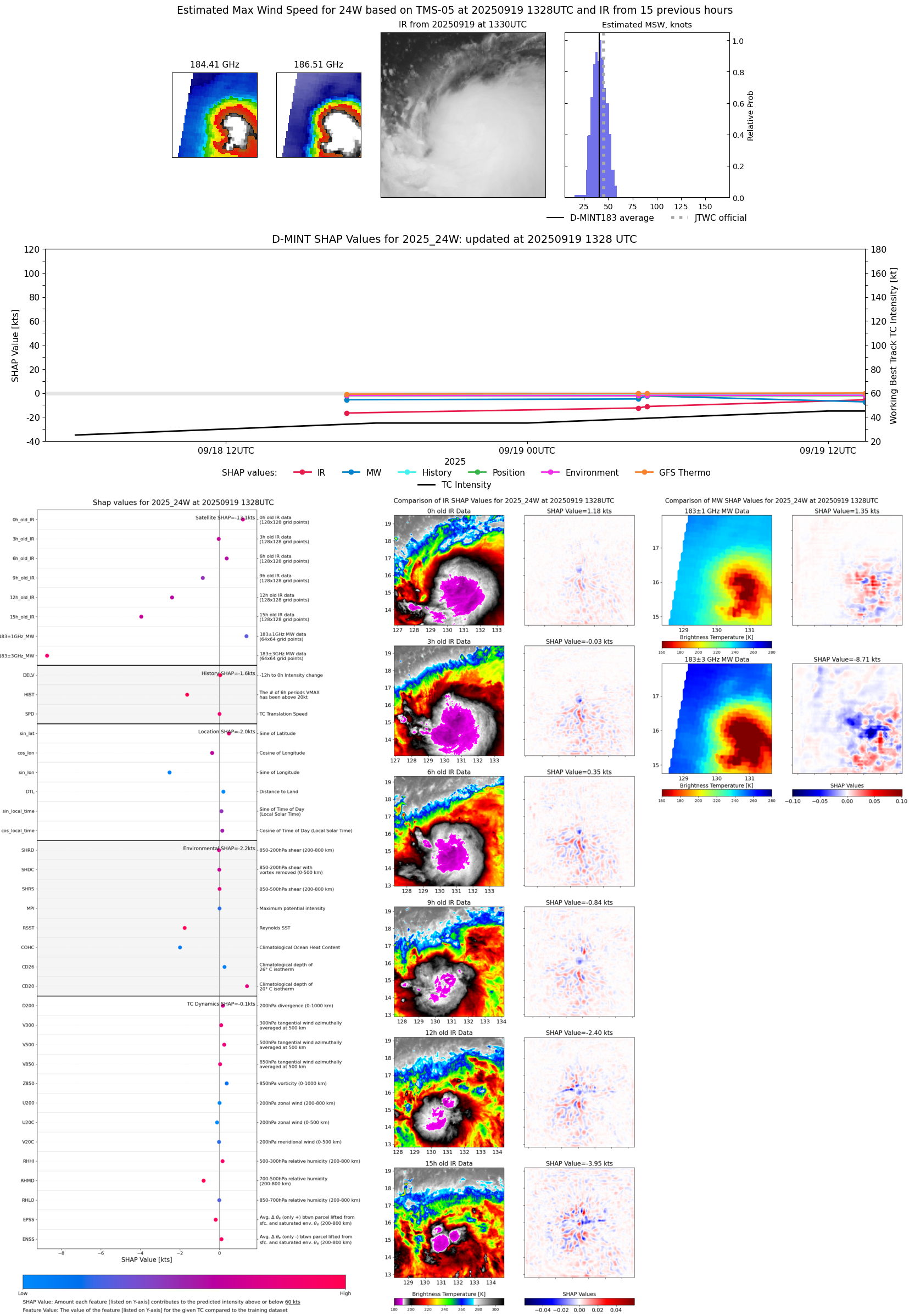 |
| 20250919 | 1148 UTC | GMI | 998 hPa | 37 kts | 33 kts | 42 kts | 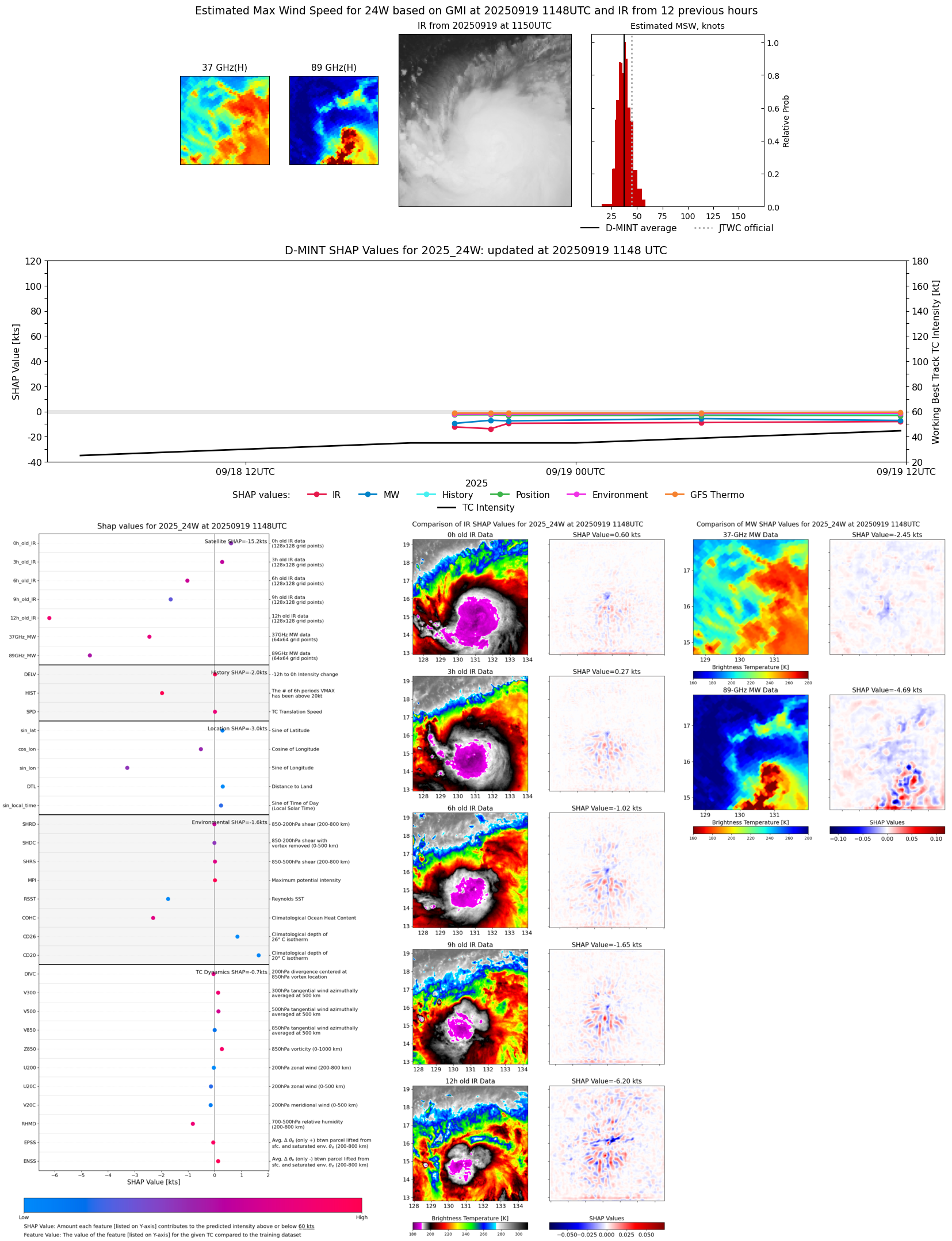 |
| 20250919 | 0843 UTC | WSFM01 | 997 hPa | 40 kts | 35 kts | 46 kts |  |
| 20250919 | 0446 UTC | ATMS-N20 | 996 hPa | 40 kts | 35 kts | 45 kts | 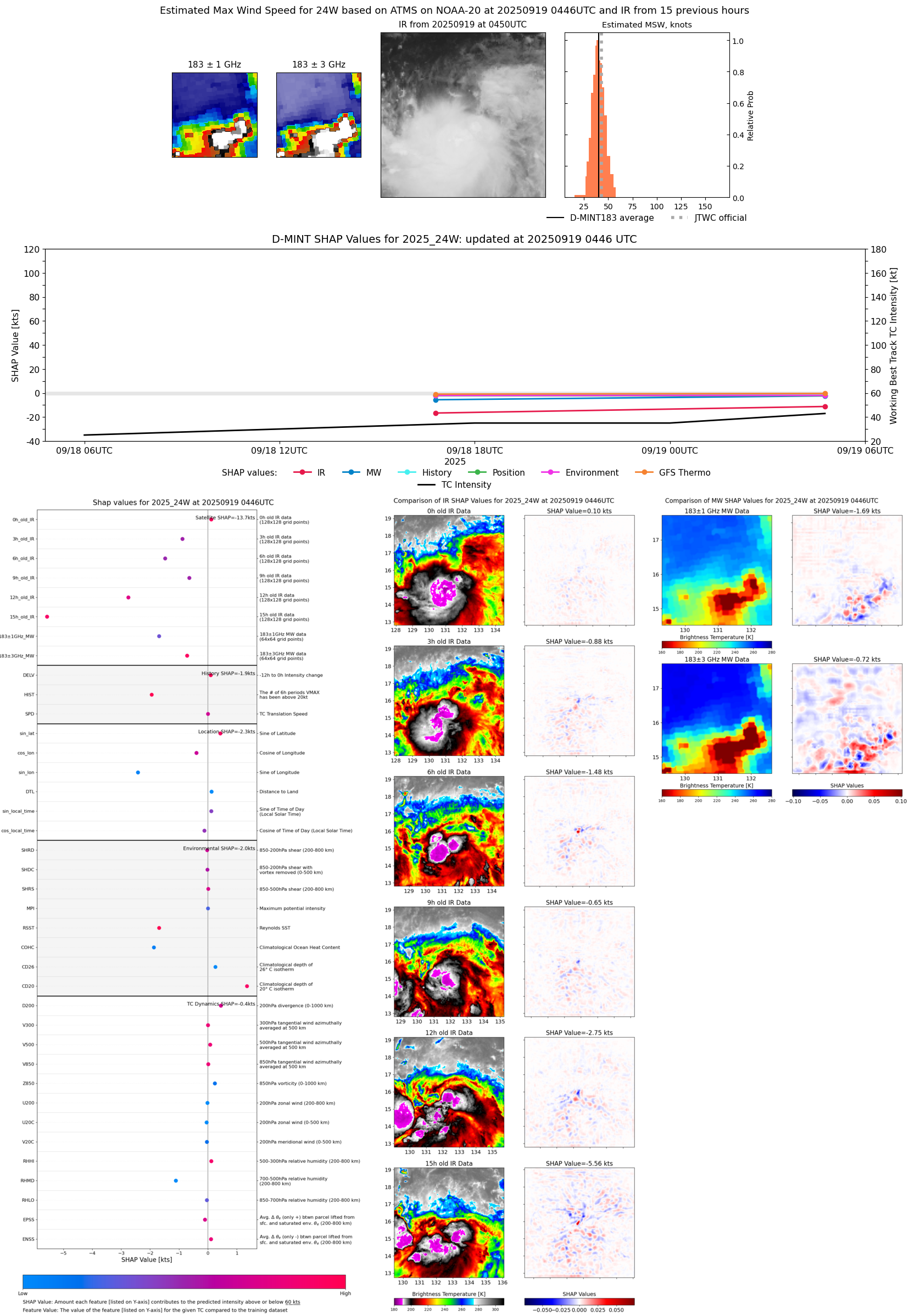 |
| 20250919 | 0433 UTC | AMSR2 | 998 hPa | 38 kts | 34 kts | 42 kts | 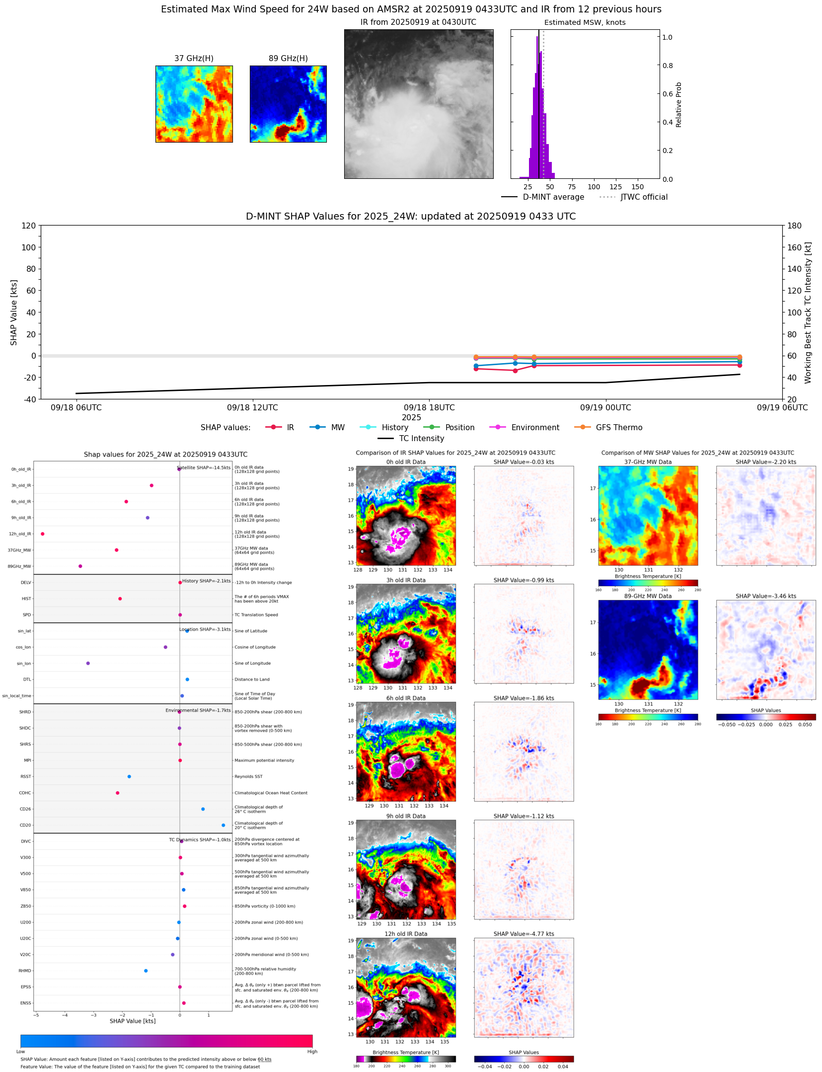 |
| 20250919 | 0425 UTC | ATMS-NPP | 994 hPa | 36 kts | 32 kts | 40 kts | 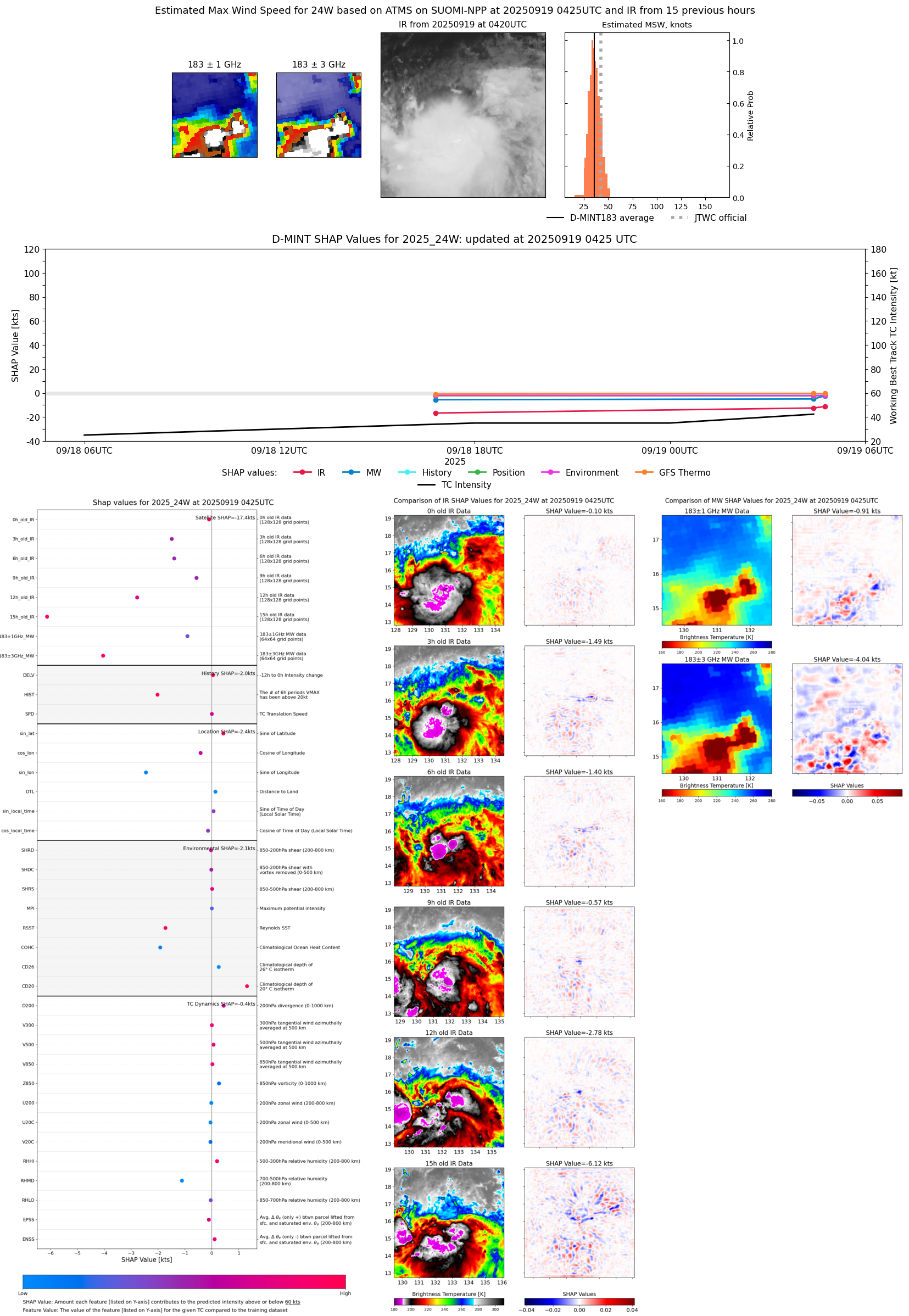 |
| 20250918 | 2133 UTC | WSFM01 | 1003 hPa | 32 kts | 29 kts | 36 kts | 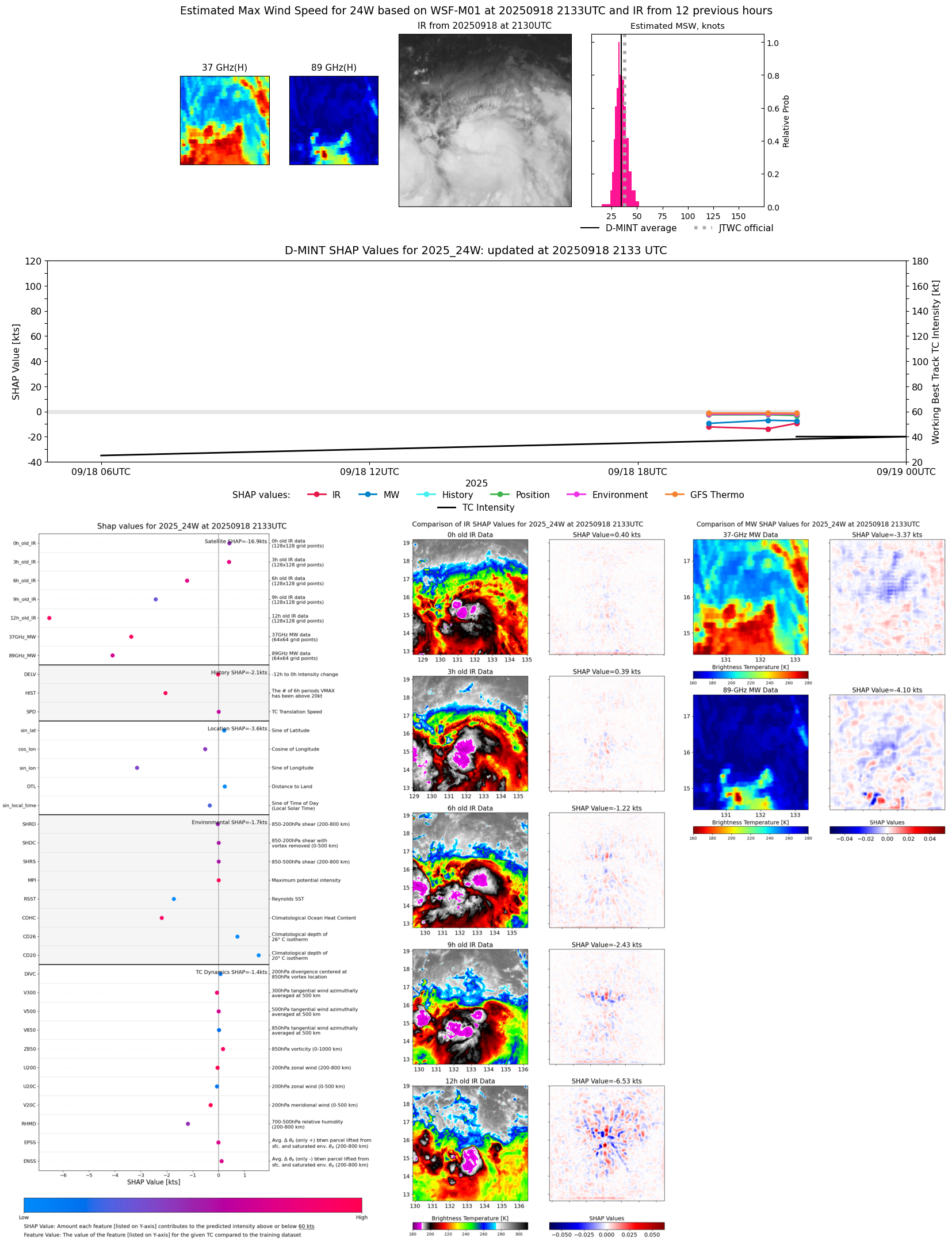 |
| 20250918 | 2133 UTC | WSFM01 | 1003 hPa | 32 kts | 29 kts | 36 kts | 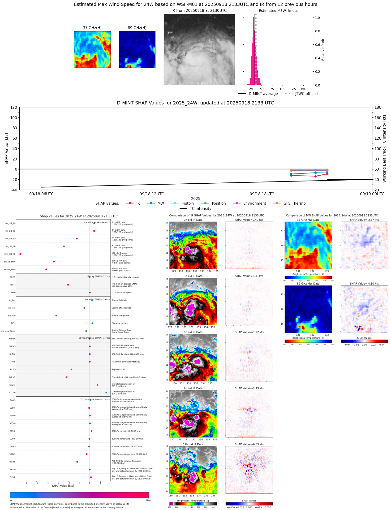 |
| 20250918 | 2055 UTC | SSMISF17 | 1003 hPa | 32 kts | 29 kts | 35 kts | 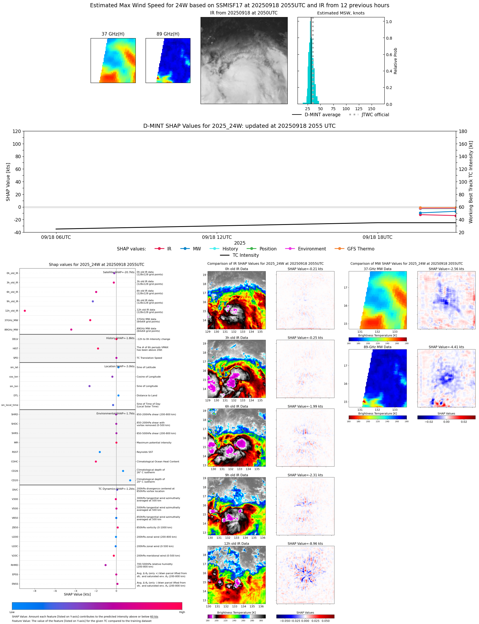 |
| 20250918 | 1935 UTC | SSMISF18 | 1004 hPa | 30 kts | 28 kts | 33 kts | 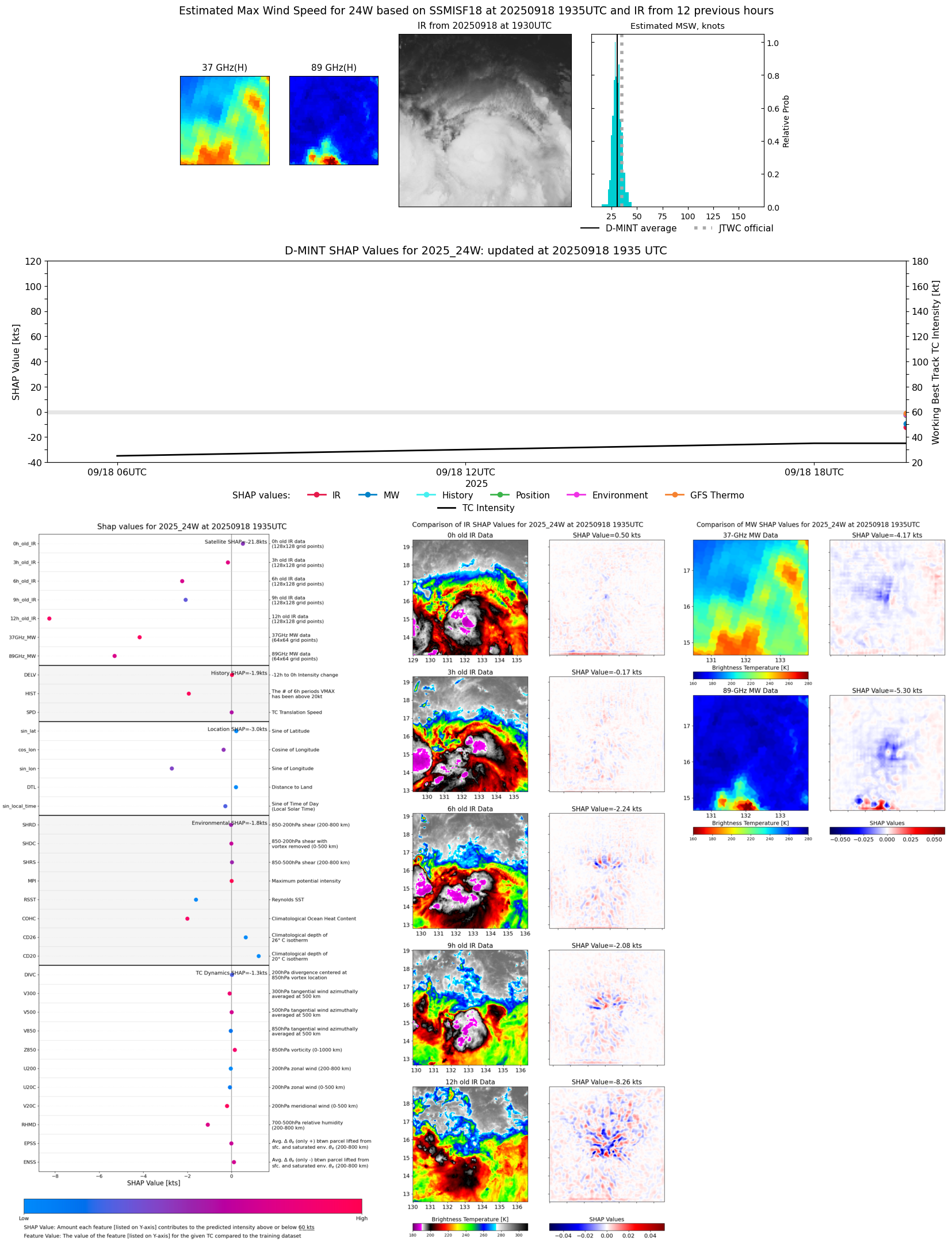 |
| 20250918 | 1648 UTC | ATMS-N21 | 1003 hPa | 31 kts | 27 kts | 35 kts |  |
| 20250918 | 0902 UTC | WSFM01 | 1004 hPa | 24 kts | 22 kts | 27 kts |  |