|
||

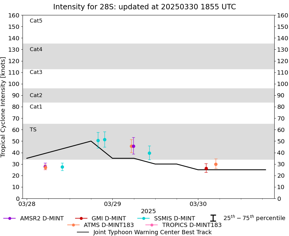 |
D-MINT HISTORY FILE for 2025_28S
| Date | Time | MW Sensor | MSLP | Vmax (30th-70th percentile average) | Vmax 25th percentile | Vmax 75th percentile | Image |
| 20250330 | 0458 UTC | ATMS-N20 | 997 hPa | 30 kts | 26 kts | 35 kts | 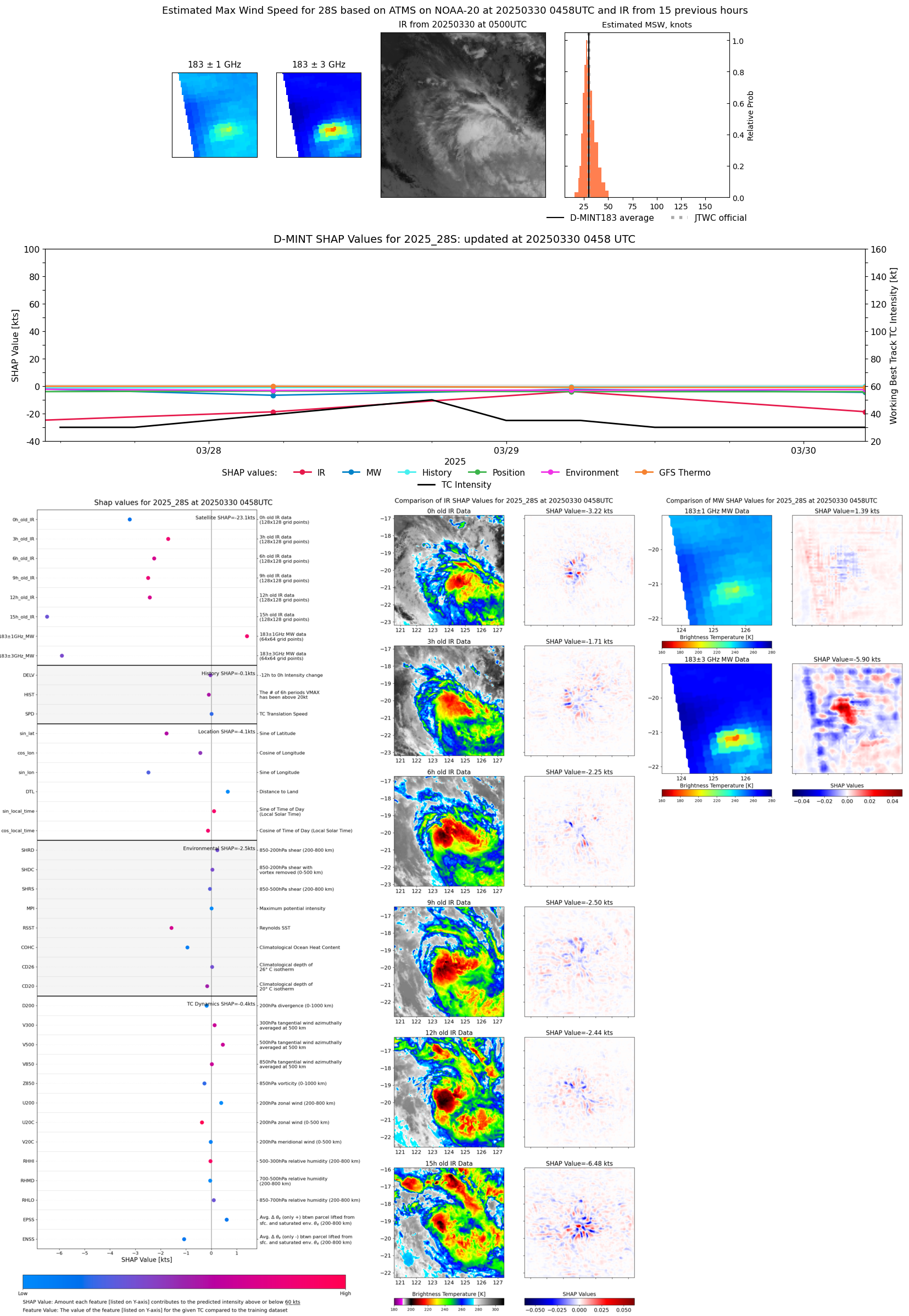 |
| 20250330 | 0213 UTC | GMI | 1001 hPa | 26 kts | 23 kts | 30 kts | 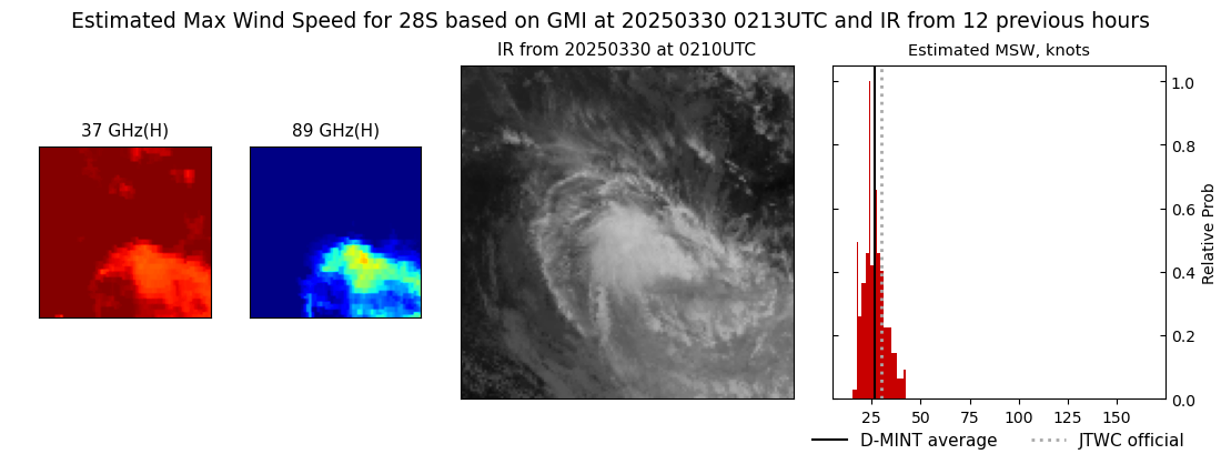 |
| 20250329 | 1021 UTC | SSMISF17 | 991 hPa | 40 kts | 34 kts | 46 kts |  |
| 20250329 | 0551 UTC | AMSR2 | 987 hPa | 46 kts | 39 kts | 53 kts |  |
| 20250329 | 0516 UTC | ATMS-N20 | 989 hPa | 46 kts | 40 kts | 52 kts |  |
| 20250328 | 2147 UTC | SSMISF17 | 986 hPa | 51 kts | 45 kts | 58 kts |  |
| 20250328 | 1955 UTC | SSMISF18 | 989 hPa | 51 kts | 44 kts | 58 kts |  |
| 20250328 | 0956 UTC | SSMISF16 | 996 hPa | 27 kts | 24 kts | 31 kts |  |
| 20250328 | 0510 UTC | ATMS-N20 | 999 hPa | 27 kts | 25 kts | 29 kts |  |
| 20250328 | 0509 UTC | AMSR2 | 998 hPa | 28 kts | 25 kts | 31 kts | 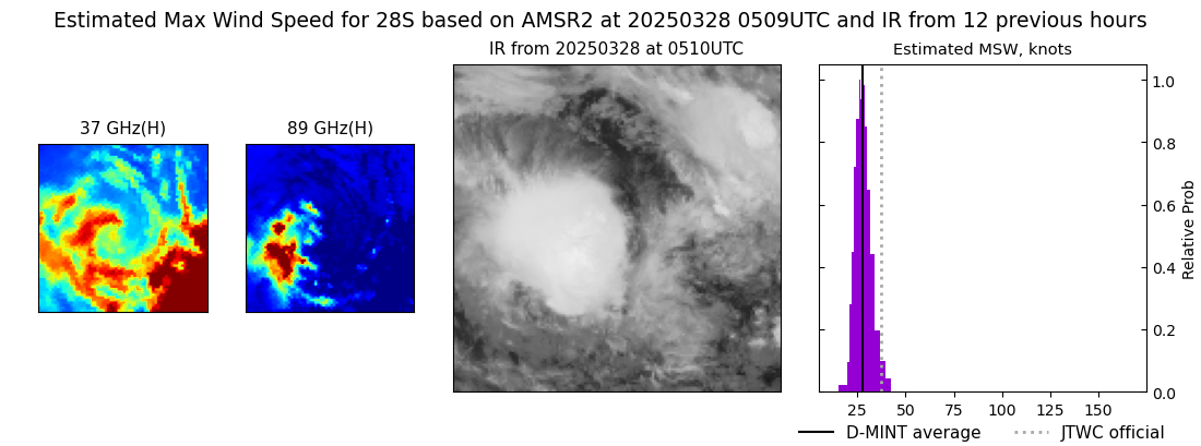 |
| 20250327 | 0529 UTC | ATMS-N20 | 1000 hPa | 25 kts | 22 kts | 28 kts |  |