|
||

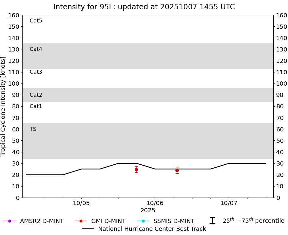 |
D-MINT HISTORY FILE for 2025_95L
| Date | Time | MW Sensor | Vmax (30th-70th percentile average) | Vmax 25th percentile | Vmax 75th percentile | Image |
| 20251006 | 0707 UTC | GMI | 24 kts | 21 kts | 27 kts |  |
| 20251005 | 1749 UTC | GMI | 25 kts | 22 kts | 27 kts | 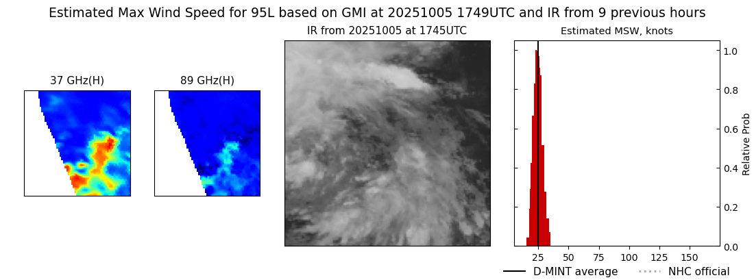 |
| 20250803 | 2306 UTC | SSMISF16 | 42 kts | 37 kts | 48 kts | 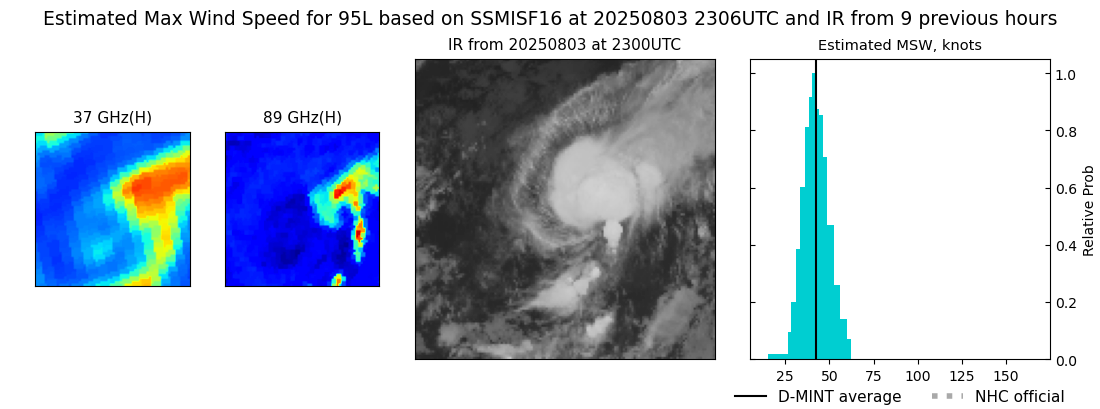 |
| 20250803 | 2246 UTC | SSMISF17 | 42 kts | 37 kts | 48 kts |  |
| 20250803 | 1145 UTC | SSMISF16 | 41 kts | 37 kts | 46 kts |  |
| 20250803 | 0503 UTC | GMI | 32 kts | 28 kts | 36 kts | 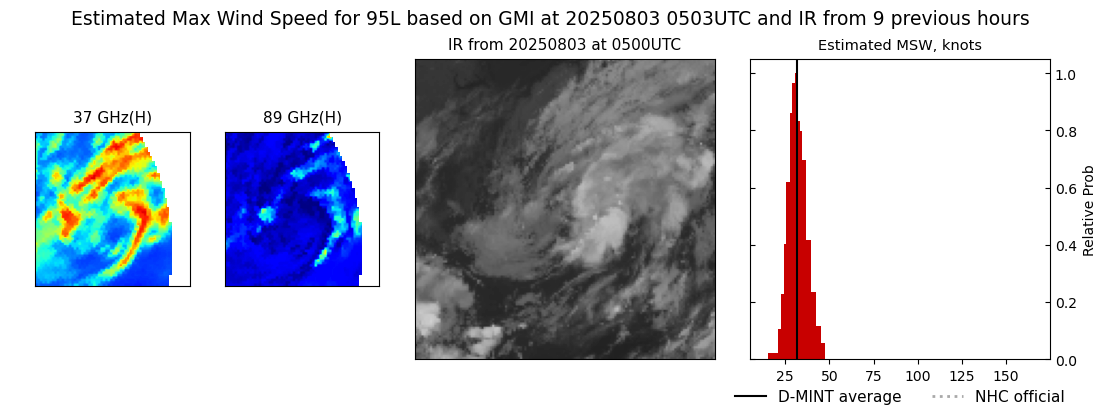 |