|
||
 |
D-MINT HISTORY FILE for 2026_01B
| Date | Time | MW Sensor | MSLP | Vmax (30th-70th percentile average) | Vmax 25th percentile | Vmax 75th percentile | Image |
| 20260926 | 1202 UTC | SSMISF17 | 998 hPa | 28 kts | 24 kts | 33 kts |  |
| 20260926 | 0616 UTC | AMSR3 | 993 hPa | 27 kts | 23 kts | 31 kts |  |
| 20260926 | 0046 UTC | SSMISF17 | 993 hPa | 45 kts | 38 kts | 51 kts |  |
| 20260925 | 2028 UTC | AMSR3 | 987 hPa | 49 kts | 43 kts | 56 kts |  |
| 20260925 | 0130 UTC | SSMISF16 | 985 hPa | 46 kts | 40 kts | 52 kts |  |
| 20260925 | 0102 UTC | SSMISF17 | 984 hPa | 45 kts | 39 kts | 51 kts |  |
| 20260924 | 2011 UTC | ATMS-N20 | 982 hPa | 50 kts | 44 kts | 56 kts |  |
| 20260924 | 1656 UTC | GMI | 983 hPa | 50 kts | 44 kts | 56 kts |  |
| 20260924 | 1537 UTC | TMS09 | 984 hPa | 49 kts | 45 kts | 54 kts |  |
| 20260924 | 1230 UTC | SSMISF17 | 983 hPa | 47 kts | 41 kts | 54 kts |  |
| 20260924 | 1014 UTC | SSMISF18 | 991 hPa | 43 kts | 37 kts | 48 kts |  |
| 20260924 | 0741 UTC | ATMS-N20 | 989 hPa | 48 kts | 43 kts | 54 kts |  |
| 20260924 | 0643 UTC | AMSR3 | 989 hPa | 46 kts | 41 kts | 52 kts |  |
| 20260924 | 0444 UTC | TMS06 | 982 hPa | 51 kts | 46 kts | 57 kts |  |
| 20260924 | 0201 UTC | TMS09 | 980 hPa | 48 kts | 43 kts | 53 kts |  |
| 20260923 | 2301 UTC | SSMISF18 | 984 hPa | 61 kts | 54 kts | 68 kts |  |
| 20260923 | 2030 UTC | ATMS-N20 | 988 hPa | 55 kts | 49 kts | 62 kts |  |
| 20260923 | 1934 UTC | ATMS-N21 | 983 hPa | 51 kts | 45 kts | 57 kts |  |
| 20260923 | 1645 UTC | TMS06 | 986 hPa | 49 kts | 44 kts | 55 kts |  |
| 20260923 | 1629 UTC | AWS | 983 hPa | 56 kts | 49 kts | 62 kts |  |
| 20260923 | 1558 UTC | TMS09 | 990 hPa | 56 kts | 50 kts | 62 kts |  |
| 20260923 | 1028 UTC | SSMISF18 | 995 hPa | 42 kts | 37 kts | 48 kts |  |
| 20260923 | 0759 UTC | ATMS-N20 | 992 hPa | 42 kts | 38 kts | 47 kts |  |
| 20260923 | 0703 UTC | ATMS-N21 | 993 hPa | 44 kts | 39 kts | 49 kts |  |
| 20260923 | 0616 UTC | AMSR3 | 997 hPa | 40 kts | 35 kts | 45 kts |  |
| 20260923 | 0505 UTC | TMS06 | 991 hPa | 41 kts | 37 kts | 45 kts |  |
| 20260923 | 0414 UTC | GMI | 996 hPa | 40 kts | 36 kts | 45 kts |  |
| 20260923 | 0223 UTC | TMS09 | 992 hPa | 42 kts | 38 kts | 46 kts |  |
| 20260923 | 0157 UTC | SSMISF16 | 998 hPa | 38 kts | 34 kts | 43 kts |  |
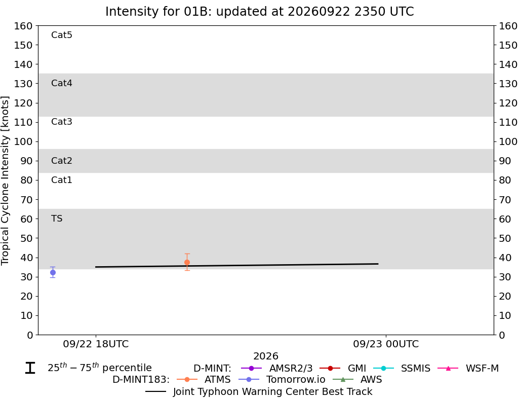
| 20260922 | 2316 UTC | SSMISF18 | 998 hPa | 35 kts | 31 kts | 40 kts |  |
| 20260922 | 1953 UTC | ATMS-N21 | 997 hPa | 38 kts | 33 kts | 42 kts |  |
| 20260922 | 1706 UTC | TMS06 | 995 hPa | 32 kts | 30 kts | 35 kts |  |
| 20260922 | 1620 UTC | TMS09 | 995 hPa | 33 kts | 30 kts | 36 kts |  |
| 20260922 | 0722 UTC | ATMS-N21 | 1000 hPa | 33 kts | 29 kts | 37 kts |  |
| 20260922 | 0245 UTC | TMS09 | 998 hPa | 33 kts | 30 kts | 36 kts |  |
| 20260921 | 2012 UTC | ATMS-N21 | 1003 hPa | 27 kts | 24 kts | 30 kts |  |
| 20260921 | 1953 UTC | AMSR3 | 1004 hPa | 27 kts | 24 kts | 30 kts |  |
| 20260921 | 1927 UTC | ATMS-N20 | 1003 hPa | 28 kts | 24 kts | 31 kts |  |
| 20260920 | 1916 UTC | AMSR3 | 999 hPa | 22 kts | 20 kts | 24 kts |  |
| 20260920 | 0611 UTC | AMSR3 | 999 hPa | 22 kts | 20 kts | 24 kts |  |
| 20260920 | 0449 UTC | GMI | NaN hPa | 18 kts | 16 kts | 20 kts |  |