|
||

 |
D-MINT HISTORY FILE for 2026_02S
| Date | Time | MW Sensor | MSLP | Vmax (30th-70th percentile average) | Vmax 25th percentile | Vmax 75th percentile | Image |
| 20250808 | 1653 UTC | GMI | 1006 hPa | 27 kts | 25 kts | 28 kts |  |
| 20250808 | 0910 UTC | ATMS-NPP | 1001 hPa | 27 kts | 25 kts | 30 kts | 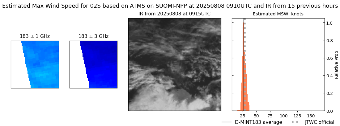 |
| 20250808 | 0517 UTC | GMI | 1004 hPa | 26 kts | 24 kts | 28 kts |  |
| 20250807 | 1144 UTC | SSMISF18 | 1001 hPa | 27 kts | 24 kts | 29 kts |  |
| 20250807 | 0942 UTC | AMSR2 | 1001 hPa | 27 kts | 25 kts | 30 kts | 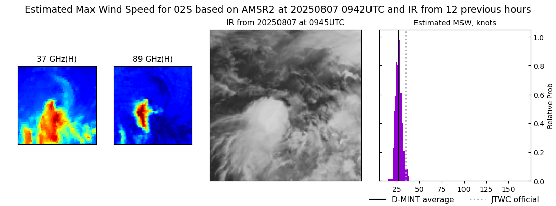 |
| 20250807 | 0927 UTC | ATMS-NPP | 1000 hPa | 27 kts | 25 kts | 30 kts |  |
| 20250807 | 0901 UTC | ATMS-N21 | 1001 hPa | 27 kts | 25 kts | 30 kts |  |
| 20250807 | 0232 UTC | SSMISF16 | 1002 hPa | 29 kts | 26 kts | 32 kts |  |
| 20250807 | 0210 UTC | SSMISF17 | 1002 hPa | 28 kts | 25 kts | 30 kts |  |
| 20250806 | 0920 UTC | ATMS-N21 | 1003 hPa | 29 kts | 26 kts | 32 kts |  |