|
||
 |
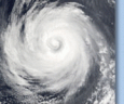
D-MINT HISTORY FILE for 2026_05W
| Date | Time | MW Sensor | MSLP | Vmax (30th-70th percentile average) | Vmax 25th percentile | Vmax 75th percentile | Image |
| 20260513 | 0457 UTC | AMSR2 | 1006 hPa | 23 kts | 21 kts | 25 kts |  |
| 20260512 | 2158 UTC | SSMISF17 | 1006 hPa | 23 kts | 21 kts | 25 kts |  |
| 20260512 | 1021 UTC | SSMISF16 | 1005 hPa | 25 kts | 23 kts | 27 kts |  |
| 20260511 | 1946 UTC | SSMISF18 | 1005 hPa | 23 kts | 21 kts | 25 kts |  |
| 20260511 | 1724 UTC | AMSR2 | 1005 hPa | 25 kts | 22 kts | 27 kts |  |
| 20260511 | 0709 UTC | SSMISF18 | 1003 hPa | 25 kts | 21 kts | 29 kts |  |
| 20260510 | 2246 UTC | TMS09 | 1001 hPa | 28 kts | 25 kts | 32 kts |  |
| 20260510 | 2001 UTC | SSMISF18 | 1003 hPa | 22 kts | 21 kts | 24 kts |  |
| 20260510 | 1704 UTC | ATMS-N21 | 1003 hPa | 25 kts | 23 kts | 27 kts |  |
| 20260510 | 1642 UTC | AMSR2 | 1003 hPa | 24 kts | 22 kts | 25 kts |  |
| 20260510 | 1615 UTC | ATMS-N20 | 1004 hPa | 27 kts | 25 kts | 30 kts |  |
| 20260510 | 0913 UTC | TMS09 | 997 hPa | 27 kts | 24 kts | 30 kts |  |
| 20260510 | 0722 UTC | SSMISF18 | 1002 hPa | 27 kts | 24 kts | 31 kts |  |
| 20260510 | 0429 UTC | ATMS-N21 | 1001 hPa | 28 kts | 25 kts | 31 kts |  |
| 20260510 | 0428 UTC | ATMS-N21 | 1001 hPa | 28 kts | 25 kts | 30 kts |  |
| 20260509 | 2158 UTC | SSMISF16 | 999 hPa | 32 kts | 28 kts | 36 kts |  |
| 20260509 | 2101 UTC | SSMISF17 | 999 hPa | 29 kts | 26 kts | 33 kts |  |
| 20260509 | 2058 UTC | WSFM01 | 999 hPa | 31 kts | 28 kts | 35 kts |  |
| 20260509 | 1634 UTC | ATMS-N20 | 999 hPa | 33 kts | 30 kts | 36 kts |  |
| 20260509 | 0934 UTC | TMS09 | 997 hPa | 30 kts | 27 kts | 34 kts |  |
| 20260509 | 0824 UTC | WSFM01 | 1000 hPa | 30 kts | 27 kts | 34 kts |  |
| 20260509 | 0447 UTC | ATMS-N21 | 1002 hPa | 31 kts | 27 kts | 34 kts |  |
| 20260509 | 0358 UTC | ATMS-N20 | 1002 hPa | 29 kts | 26 kts | 32 kts |  |
| 20260509 | 0122 UTC | TMS06 | 1000 hPa | 28 kts | 25 kts | 31 kts |  |
| 20260508 | 2212 UTC | SSMISF16 | 1003 hPa | 25 kts | 23 kts | 27 kts |  |
| 20260508 | 2118 UTC | WSFM01 | 1004 hPa | 26 kts | 24 kts | 29 kts |  |
| 20260508 | 1849 UTC | SSMISF18 | 1002 hPa | 24 kts | 22 kts | 27 kts |  |
| 20260508 | 1655 UTC | AMSR2 | 1002 hPa | 31 kts | 27 kts | 36 kts |  |
| 20260508 | 1653 UTC | ATMS-N20 | 1001 hPa | 29 kts | 25 kts | 34 kts |  |
| 20260508 | 1601 UTC | ATMS-N21 | 1001 hPa | 28 kts | 24 kts | 31 kts |  |
| 20260508 | 1327 UTC | TMS06 | 997 hPa | 29 kts | 26 kts | 33 kts |  |
| 20260508 | 0955 UTC | TMS09 | 997 hPa | 26 kts | 23 kts | 31 kts |  |
| 20260508 | 0843 UTC | WSFM01 | 1002 hPa | 27 kts | 24 kts | 31 kts |  |
| 20260508 | 0438 UTC | AMSR2 | 1000 hPa | 28 kts | 24 kts | 32 kts |  |
| 20260508 | 0417 UTC | ATMS-N20 | 999 hPa | 33 kts | 30 kts | 37 kts |  |
| 20260508 | 0325 UTC | ATMS-N21 | 996 hPa | 35 kts | 32 kts | 39 kts |  |
| 20260507 | 2209 UTC | TMS09 | 998 hPa | 37 kts | 33 kts | 41 kts |  |
| 20260507 | 1903 UTC | SSMISF18 | 1000 hPa | 31 kts | 27 kts | 35 kts |  |
| 20260507 | 1620 UTC | ATMS-N21 | 1000 hPa | 34 kts | 30 kts | 38 kts |  |
| 20260507 | 1611 UTC | AMSR2 | 1000 hPa | 29 kts | 25 kts | 32 kts |  |
| 20260507 | 1531 UTC | ATMS-N20 | 1001 hPa | 30 kts | 27 kts | 34 kts |  |
| 20260507 | 1017 UTC | TMS09 | 998 hPa | 29 kts | 26 kts | 33 kts |  |
| 20260507 | 0947 UTC | SSMISF16 | 1001 hPa | 27 kts | 24 kts | 31 kts |  |
| 20260507 | 0851 UTC | SSMISF17 | 1001 hPa | 29 kts | 26 kts | 32 kts |  |
| 20260507 | 0624 UTC | SSMISF18 | 1003 hPa | 28 kts | 25 kts | 32 kts |  |
| 20260507 | 0435 UTC | ATMS-N20 | 1000 hPa | 28 kts | 25 kts | 31 kts |  |
| 20260507 | 0354 UTC | AMSR2 | 1001 hPa | 29 kts | 26 kts | 32 kts |  |
| 20260507 | 0343 UTC | ATMS-N21 | 1002 hPa | 30 kts | 27 kts | 34 kts |  |
| 20260507 | 0027 UTC | TMS06 | 1000 hPa | 30 kts | 27 kts | 33 kts |  |
| 20260506 | 2100 UTC | SSMISF16 | 1002 hPa | 27 kts | 24 kts | 30 kts |  |
| 20260506 | 2018 UTC | WSFM01 | 1002 hPa | 27 kts | 25 kts | 30 kts |  |
| 20260506 | 2004 UTC | SSMISF17 | 1002 hPa | 27 kts | 25 kts | 30 kts |  |
| 20260506 | 1550 UTC | ATMS-N20 | 1002 hPa | 26 kts | 24 kts | 29 kts |  |
| 20260506 | 1529 UTC | AMSR2 | 1001 hPa | 28 kts | 25 kts | 31 kts |  |
| 20260506 | 0743 UTC | WSFM01 | 1002 hPa | 27 kts | 24 kts | 31 kts |  |
| 20260506 | 0638 UTC | SSMISF18 | 1003 hPa | 22 kts | 20 kts | 24 kts |  |
| 20260506 | 0402 UTC | ATMS-N21 | 1006 hPa | 23 kts | 21 kts | 25 kts |  |
| 20260506 | 0313 UTC | ATMS-N20 | 1006 hPa | 23 kts | 21 kts | 25 kts |  |
| 20260506 | 0047 UTC | TMS06 | 1003 hPa | 31 kts | 27 kts | 34 kts |  |
| 20260505 | 2112 UTC | SSMISF16 | 1004 hPa | 30 kts | 26 kts | 34 kts |  |
| 20260505 | 2038 UTC | WSFM01 | 1006 hPa | 24 kts | 21 kts | 28 kts |  |
| 20260505 | 2017 UTC | SSMISF17 | 1003 hPa | 27 kts | 23 kts | 32 kts |  |
| 20260505 | 0834 UTC | SSMISF16 | NaN hPa | 35 kts | 29 kts | 41 kts |  |
| 20260505 | 0738 UTC | SSMISF17 | NaN hPa | 23 kts | 19 kts | 27 kts |  |
| 20260504 | 1804 UTC | SSMISF18 | NaN hPa | 23 kts | 20 kts | 28 kts |  |
| 20260504 | 1540 UTC | AMSR2 | NaN hPa | 20 kts | 17 kts | 24 kts |  |
| 20260504 | 0752 UTC | SSMISF17 | NaN hPa | 19 kts | 17 kts | 22 kts |  |