|
||

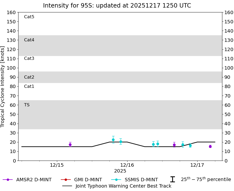 |
D-MINT HISTORY FILE for 2026_95S
| Date | Time | MW Sensor | Vmax (30th-70th percentile average) | Vmax 25th percentile | Vmax 75th percentile | Image |
| 20251217 | 0421 UTC | AMSR2 | 15 kts | 14 kts | 17 kts |  |
| 20251216 | 2131 UTC | SSMISF16 | 16 kts | 14 kts | 18 kts |  |
| 20251216 | 1900 UTC | SSMISF18 | 17 kts | 15 kts | 21 kts |  |
| 20251216 | 1604 UTC | AMSR2 | 17 kts | 15 kts | 20 kts |  |
| 20251216 | 1025 UTC | SSMISF16 | 18 kts | 15 kts | 21 kts |  |
| 20251216 | 0857 UTC | SSMISF17 | 18 kts | 15 kts | 21 kts |  |
| 20251215 | 2145 UTC | SSMISF16 | 21 kts | 17 kts | 24 kts |  |
| 20251215 | 1915 UTC | SSMISF18 | 23 kts | 19 kts | 27 kts |  |
| 20251215 | 0432 UTC | AMSR2 | 17 kts | 15 kts | 20 kts |  |