|
||

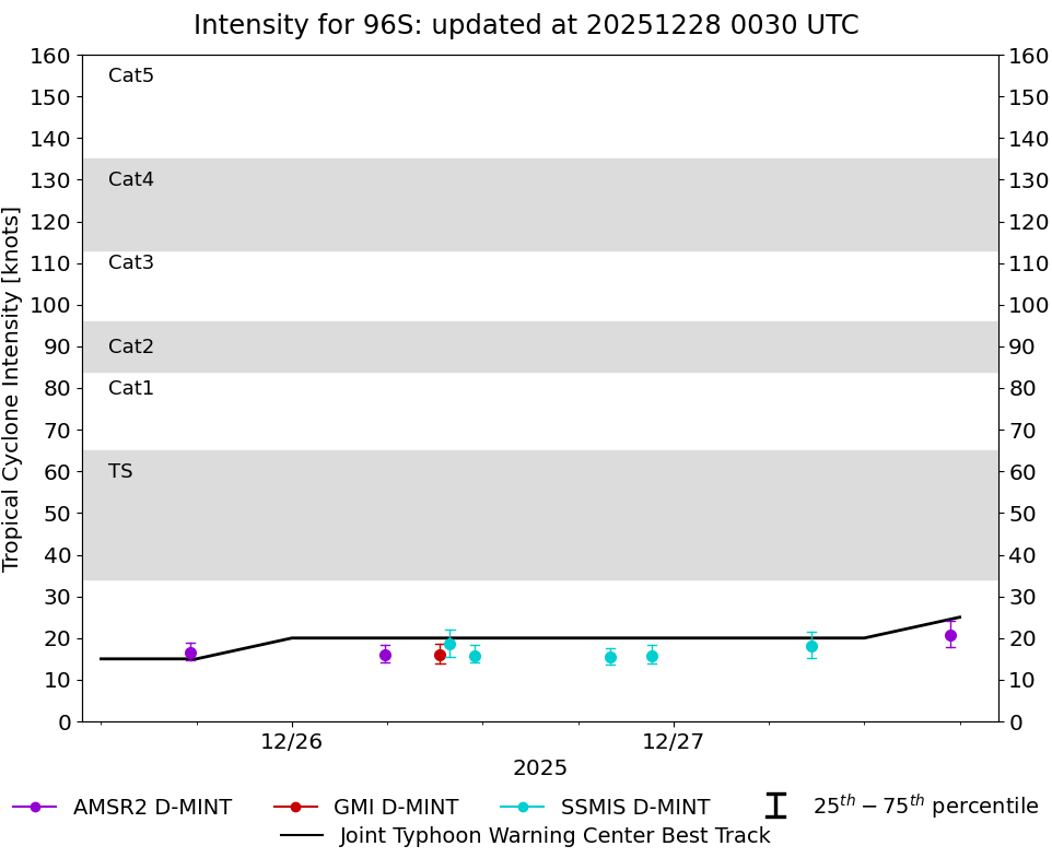 |
D-MINT HISTORY FILE for 2026_96S
| Date | Time | MW Sensor | Vmax (30th-70th percentile average) | Vmax 25th percentile | Vmax 75th percentile | Image |
| 20260213 | 2157 UTC | SSMISF18 | 16 kts | 14 kts | 18 kts |  |
| 20260213 | 2022 UTC | GMI | 17 kts | 15 kts | 18 kts |  |
| 20260213 | 1903 UTC | AMSR2 | 15 kts | 14 kts | 16 kts |  |