Tropical Storm 02E
|
Passive Microwave (PMW) Intensity Information Advanced Dvorak Technique (ADT) Version 8.1.4 (experimental) |
Overpass Inten Ring Ring Wind Forecast Final Target
Date Time Score Meaning Pct Diam BTdiff Est Sat Lat Lon Lat Lon Lat Lon
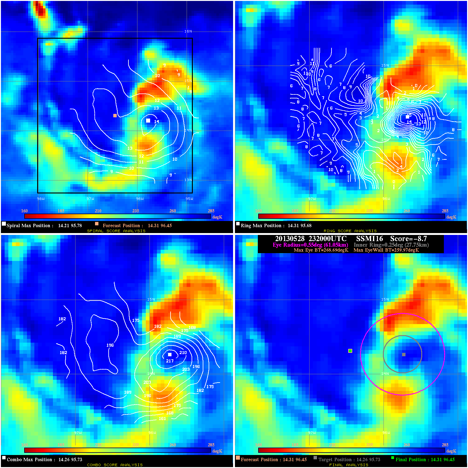
20130528 232000 -8.7 N/A 57.5% 122.21 8.72 30.0 SSMI16 14.3 96.5 14.3 96.5 14.3 95.7 Analysis Plot
20130529 003800 -15.0 N/A N/A N/A 2.01 30.0 SSMI17 14.4 96.4 14.4 96.4 14.8 96.2 Analysis Plot
20130529 014800 -10.9 N/A 78.1% 99.99 10.86 30.0 SSMI18 14.5 96.3 14.5 96.3 14.5 96.0 Analysis Plot
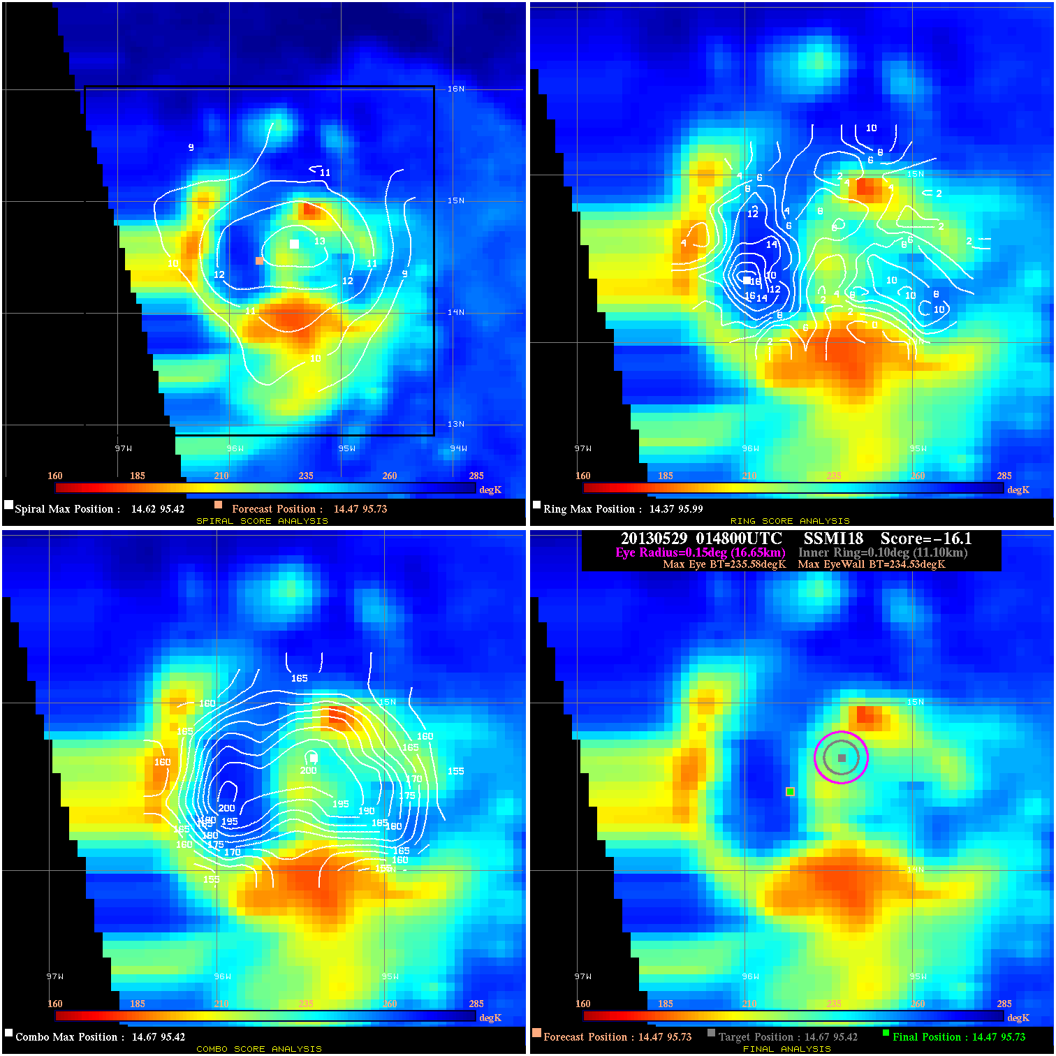
20130529 014800 -16.1 N/A 90.4% 33.33 1.05 35.0 SSMI18 14.5 95.7 14.5 95.7 14.7 95.4 Analysis Plot
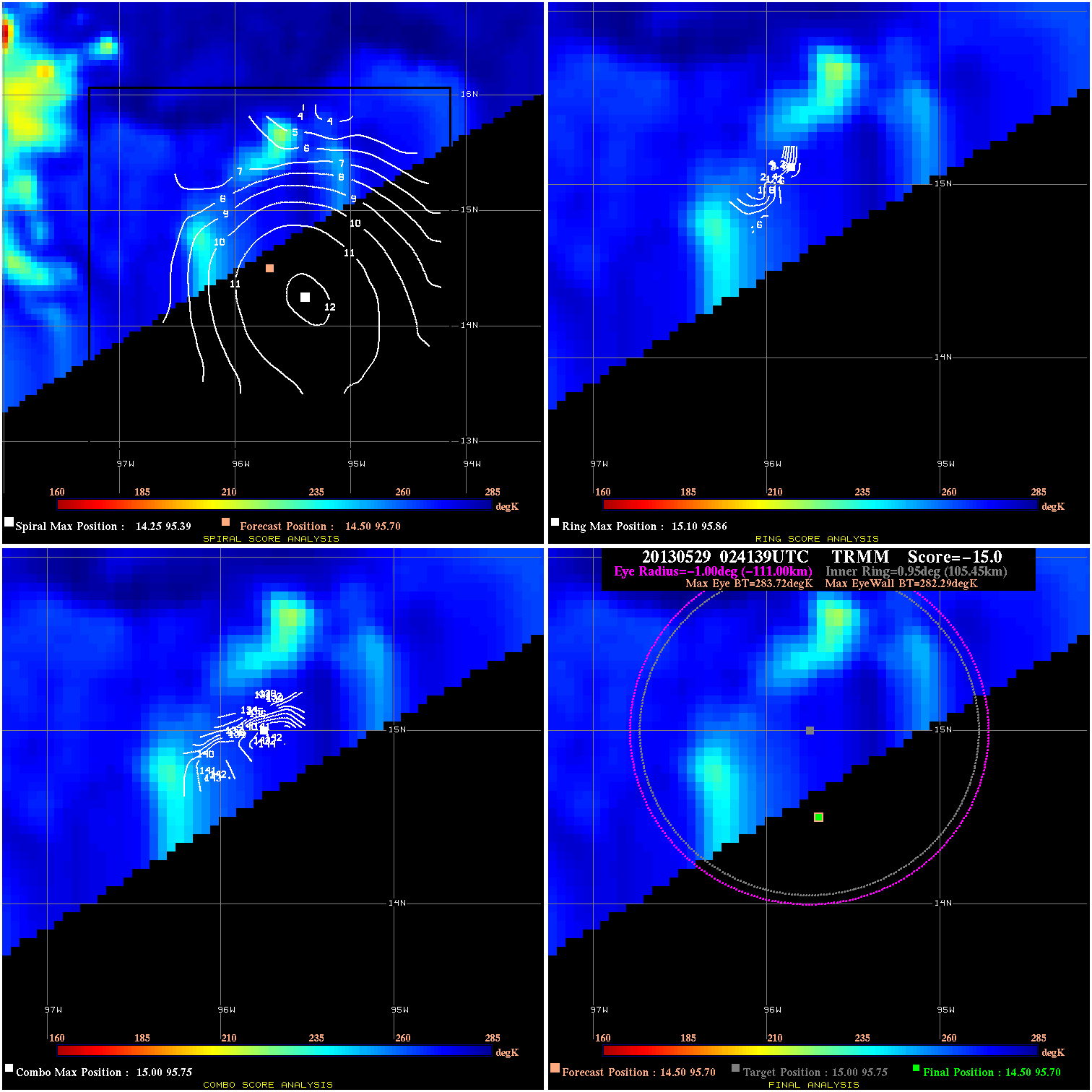
20130529 024139 -15.0 N/A N/A N/A 1.43 35.0 TRMM 14.5 95.7 14.5 95.7 15.0 95.8 Analysis Plot
20130529 105331 -40.3 N/A 100.0% 66.66 25.27 50.0 TRMM 14.9 95.5 14.9 94.9 14.9 94.9 Analysis Plot
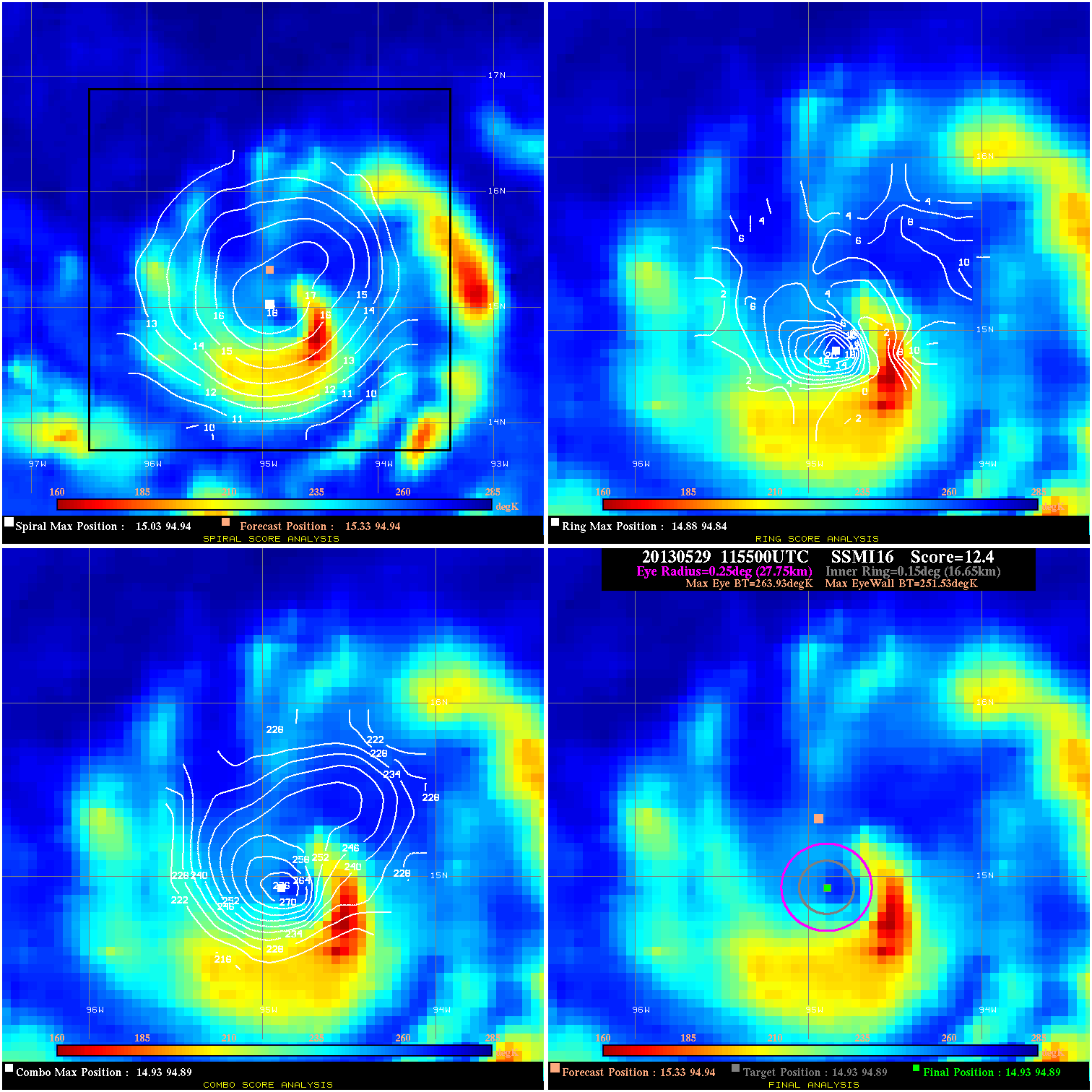
20130529 115500 12.4 N/A 68.5% 55.55 12.40 55.0 SSMI16 15.3 94.9 14.9 94.9 14.9 94.9 Analysis Plot
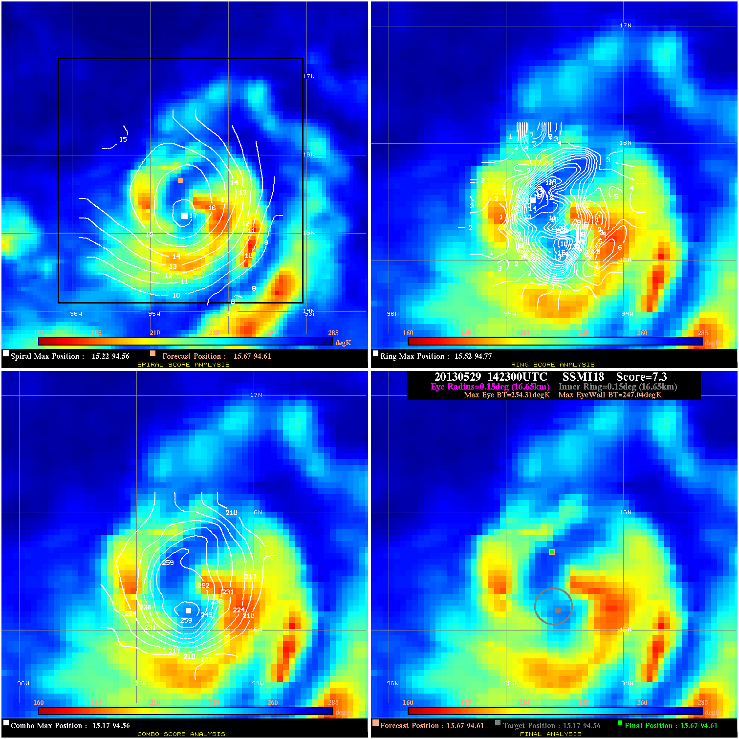
20130529 142300 7.3 N/A 43.8% 33.33 7.27 55.0 SSMI18 15.7 94.6 15.7 94.6 15.2 94.6 Analysis Plot
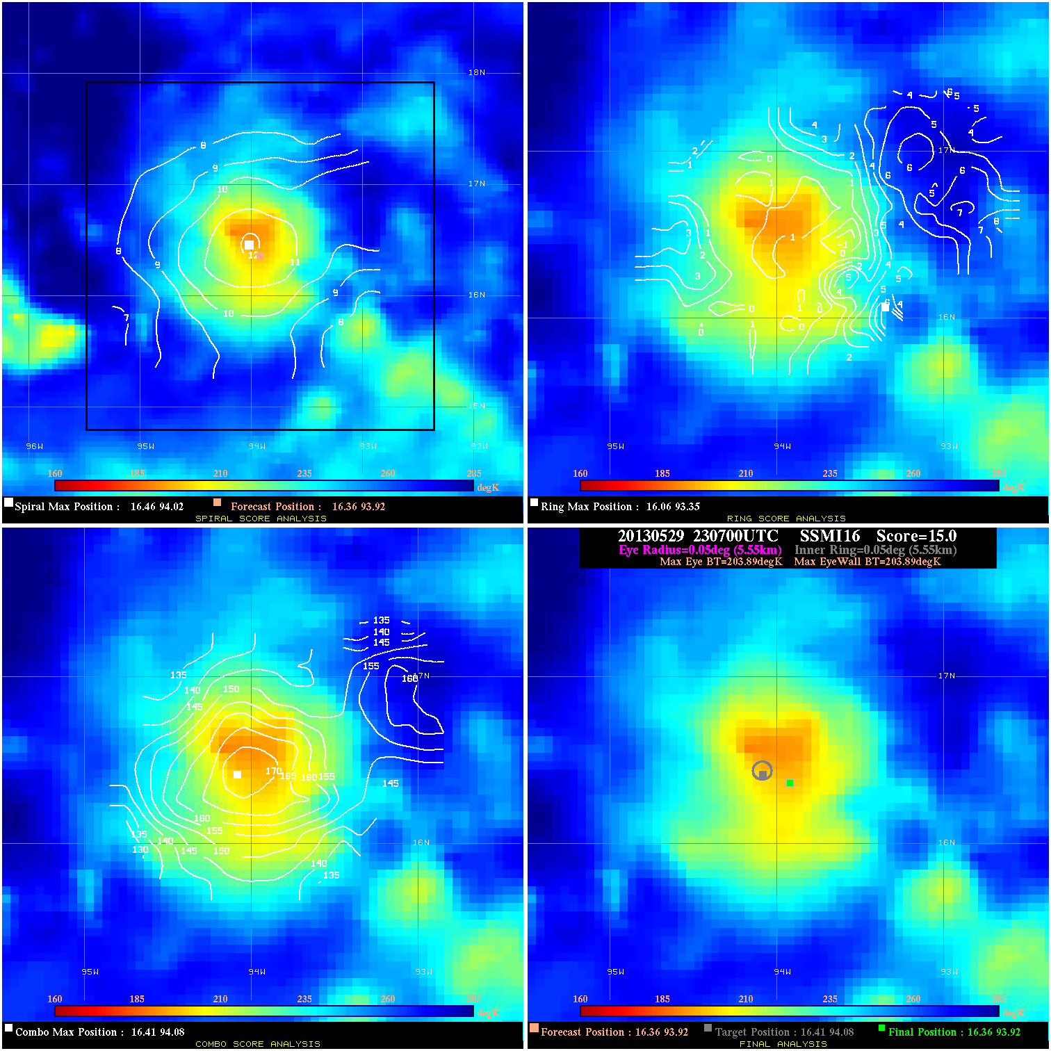
20130529 230700 N/A N/A N/A N/A N/A 65.0 SSMI16 16.4 93.9 16.4 93.9 16.4 94.1 Analysis Plot
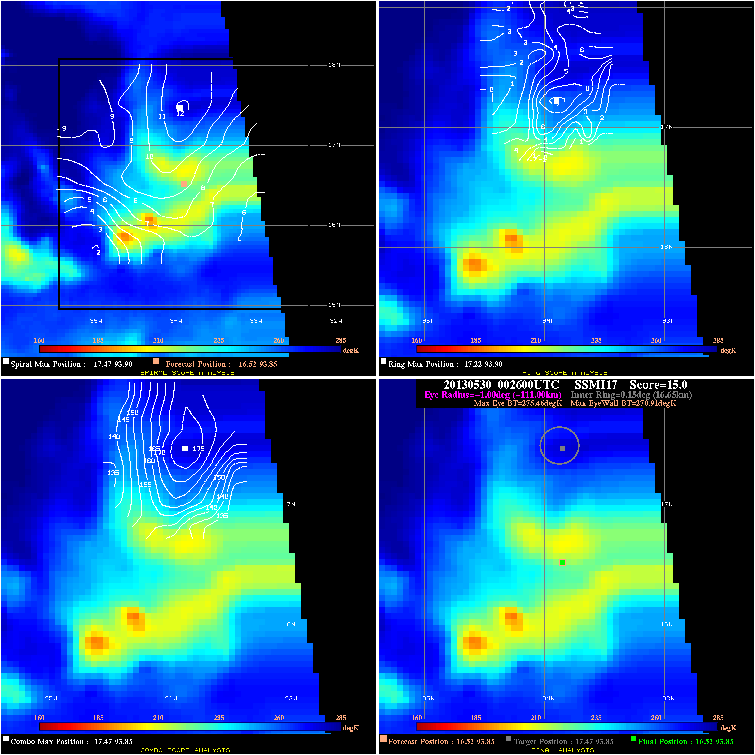
20130530 002600 15.0 N/A N/A N/A 4.55 65.0 SSMI17 16.5 93.8 16.5 93.8 17.5 93.8 Analysis Plot
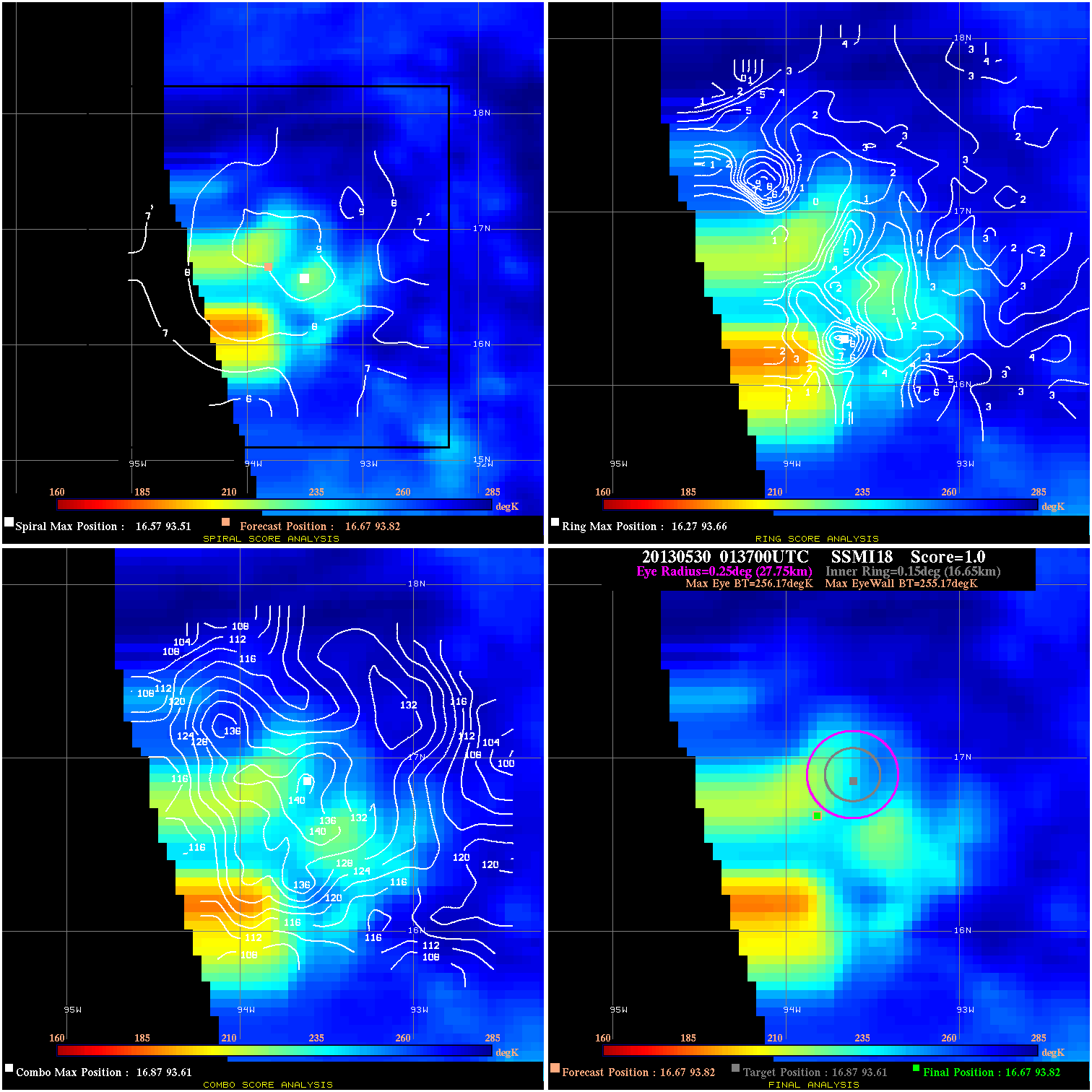
20130530 013700 1.0 N/A 30.1% 55.55 1.00 65.0 SSMI18 16.7 93.8 16.7 93.8 16.9 93.6 Analysis Plot
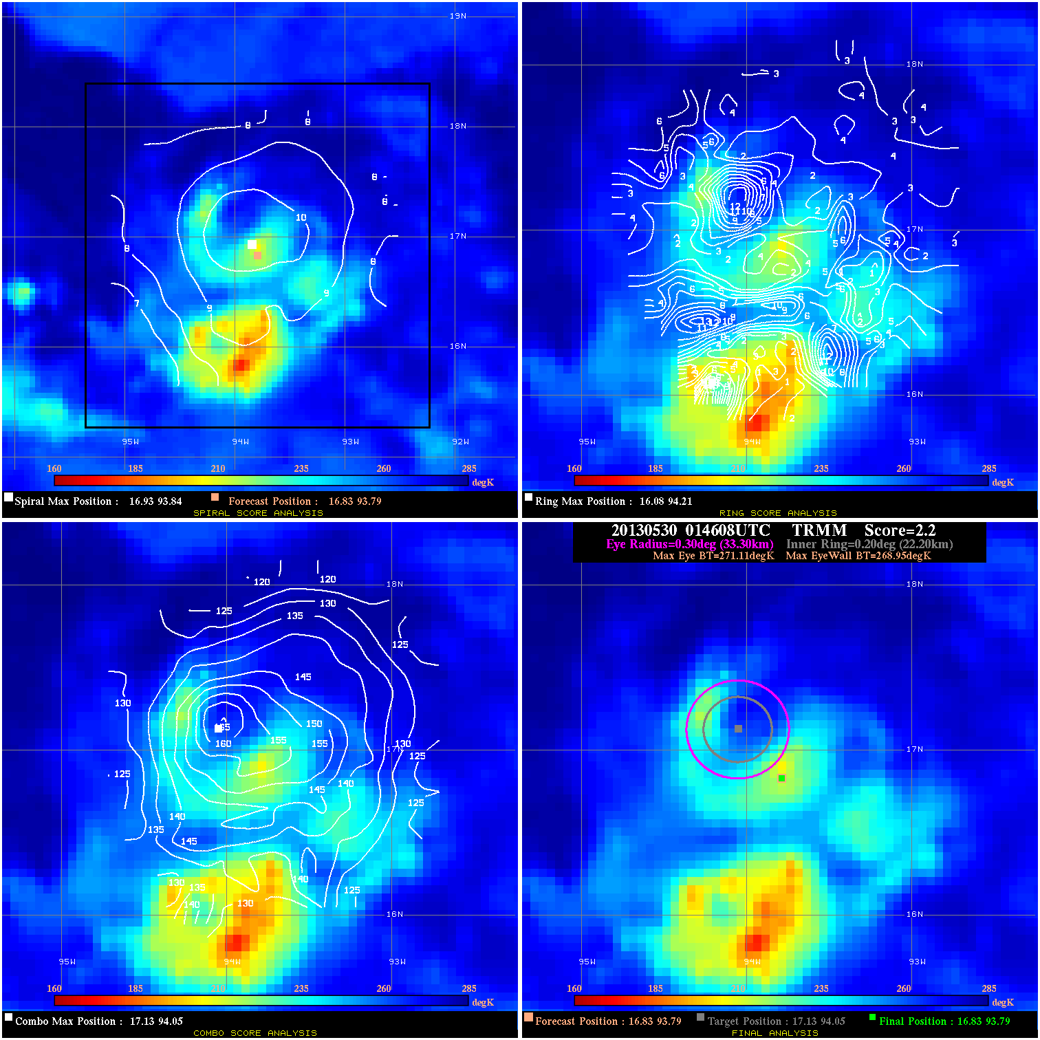
20130530 014608 2.2 N/A 39.7% 66.66 2.16 65.0 TRMM 16.8 93.8 16.8 93.8 17.1 94.0 Analysis Plot
|
|
Legend: - Date/Time are determined from PMW imagery at Forecast (initial guess) Lat/Lon position. - Positive/Negative Latitude = North/South Hemisphere; Longitude = Western/Eastern Hemisphere. - "Ring Diam" value indicates the estimated surface eyewall diameter in km (the MI eyewall edge diameter minus 10 km). - "Ring Pct" is the percentage of the "ring" (eyewall inner boundary) that is 1) colder than the "hot spot" (warmest eye pixel) in the eye by 20K, or 2) the percentage that is a) colder than 232K and b) colder than the "hot spot" by 10K, whichever is greater. - Values are red if Ring % <= 65, yellow/brown if Ring % <= 85 and green if Ring % > 85. - "Tb diff" is the difference between the "hot spot" (warmest eye pixel) and the warmest pixel on the eyewall. - Intensity score are listed as negative, and not used, when the JTWC or NHC estimated Vmax is <50 kts in order to rule out weak but highly symmetric TCs. - Error messages in intensity scores: -920 is used when the hottest pixel in the eye is <200K, to prevent false positives; -909 is a failure to process (bad input data). |