Tropical Depression 07W
|
Passive Microwave (PMW) Intensity Information Advanced Dvorak Technique (ADT) Version 8.2.1 |
Overpass Inten Ring Ring Wind Forecast Final Target
Date Time Score Meaning Pct Diam BTdiff Est Sat Lat Lon Lat Lon Lat Lon
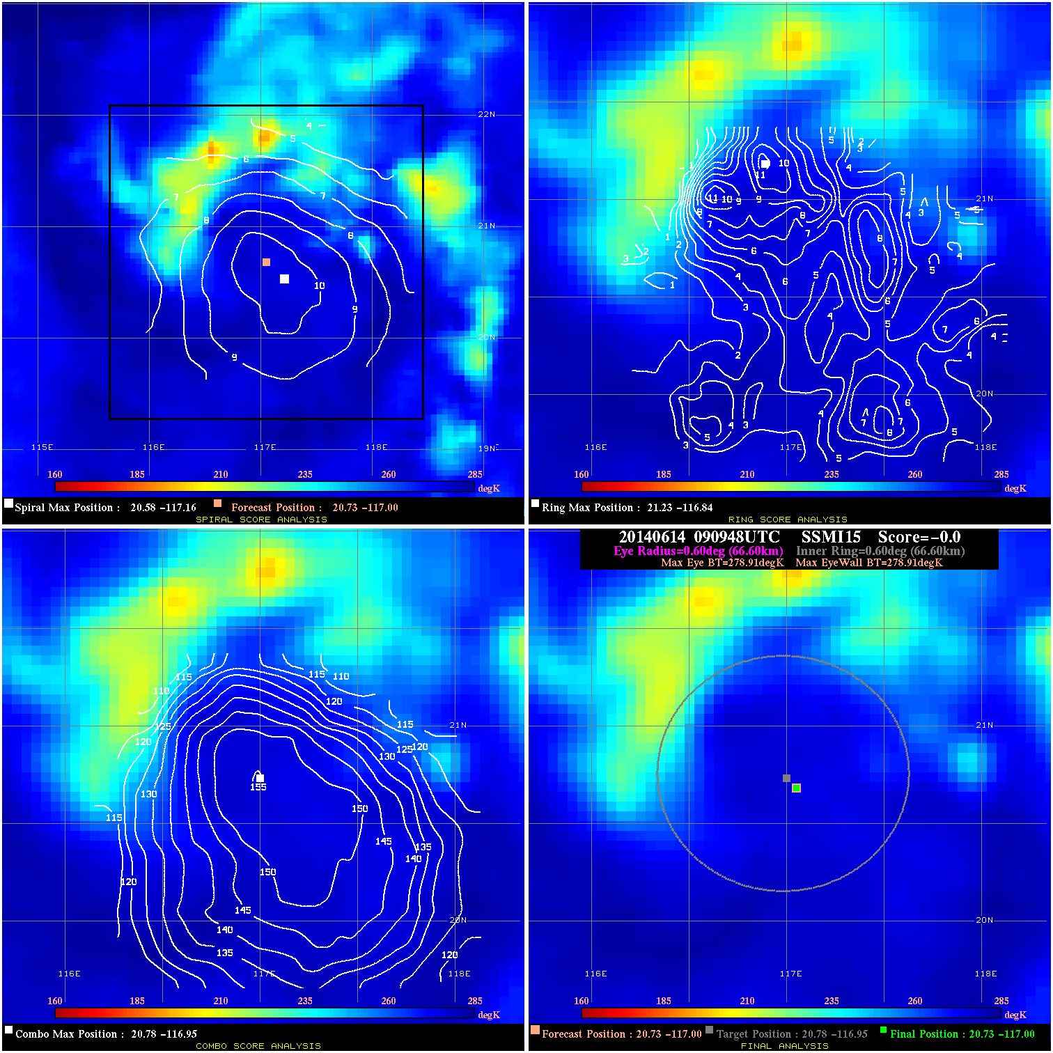
20140614 090948 -0.0 N/A N/A N/A 0.00 35.0 SSMI15 20.7 -117.0 20.7 -117.0 20.8 -116.9 Analysis Plot
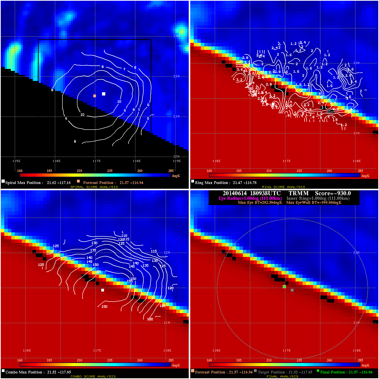
20140614 180938 -930.0 N/A N/A 222.20 1281.5 40.0 TRMM 21.6 -116.9 21.6 -116.9 21.5 -117.1 Analysis Plot
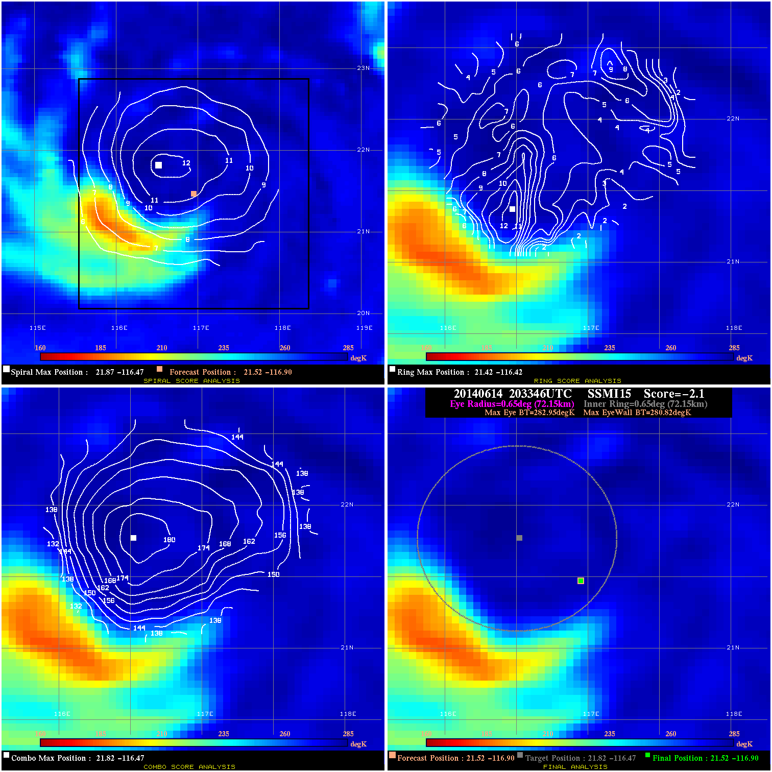
20140614 203346 -2.1 N/A 26.0% 144.43 2.13 40.0 SSMI15 21.5 -116.9 21.5 -116.9 21.8 -116.5 Analysis Plot
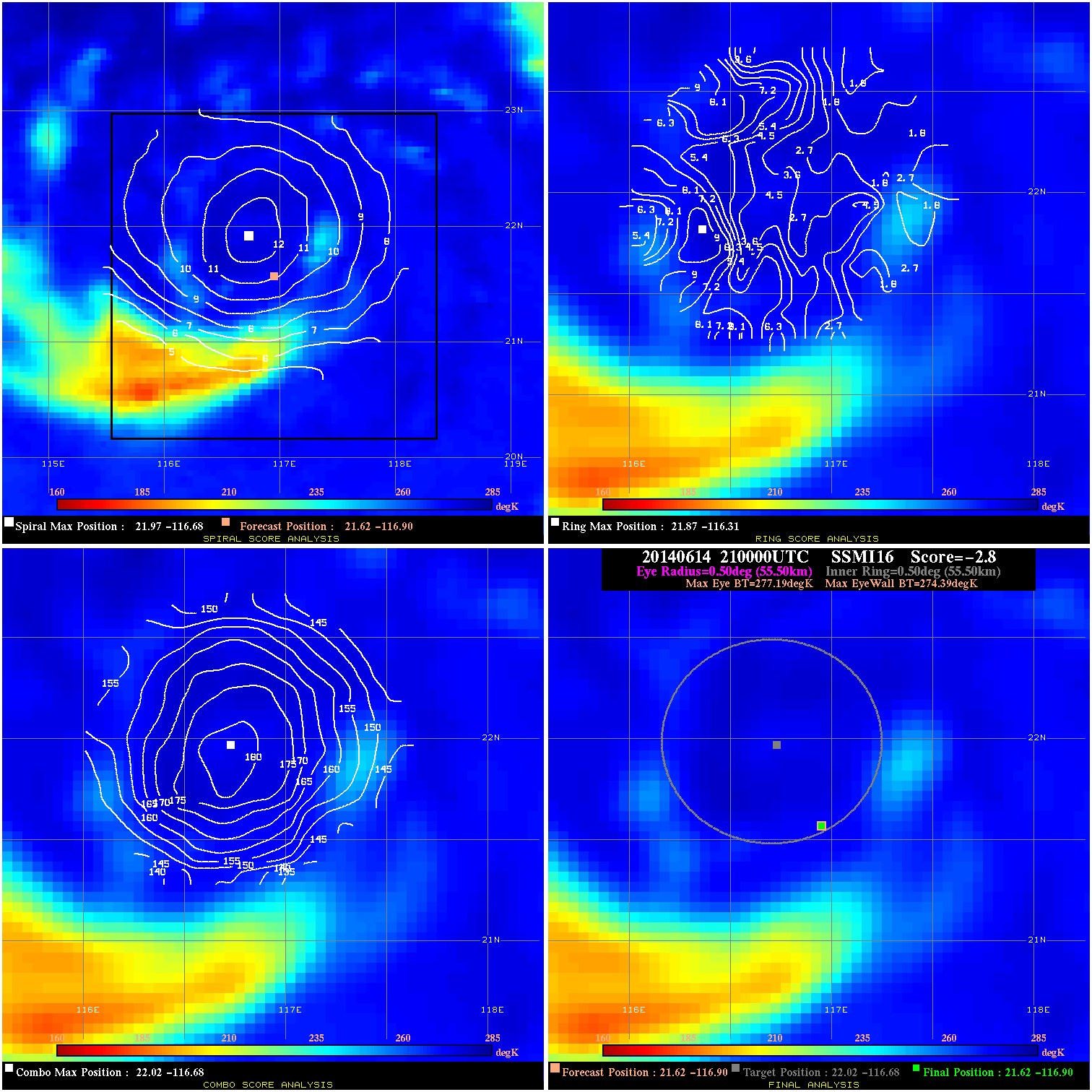
20140614 210000 -2.8 N/A N/A 111.10 2.80 40.0 SSMI16 21.6 -116.9 21.6 -116.9 22.0 -116.7 Analysis Plot
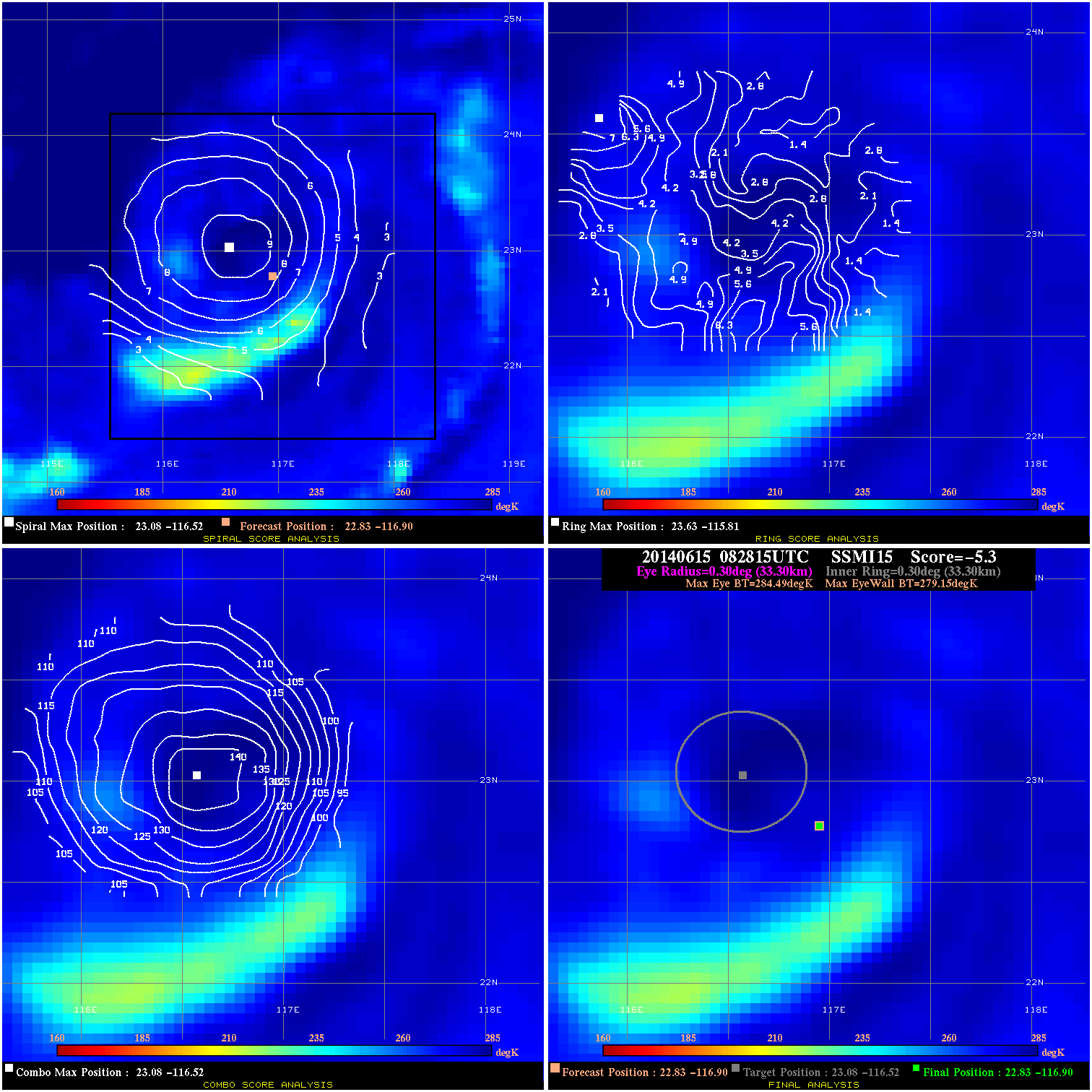
20140615 082815 -5.3 N/A N/A 66.66 5.34 40.0 SSMI15 22.8 -116.9 22.8 -116.9 23.1 -116.5 Analysis Plot
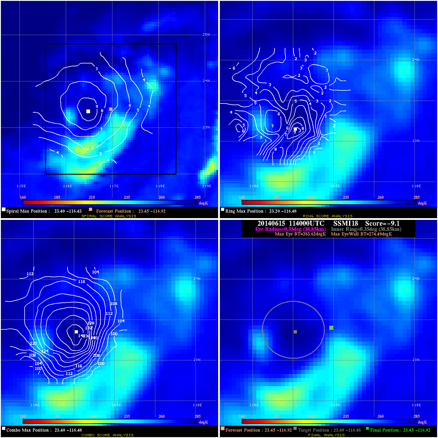
20140615 114000 -9.1 N/A 4.1% 77.77 9.13 40.0 SSMI18 23.5 -116.9 23.5 -116.9 23.4 -116.5 Analysis Plot
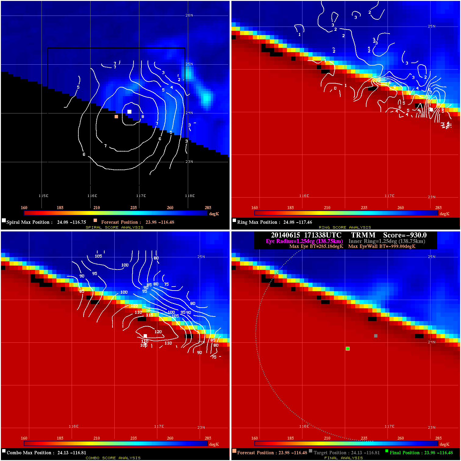
20140615 171338 -930.0 N/A N/A 277.75 1284.1 35.0 TRMM 24.0 -116.5 24.0 -116.5 24.1 -116.8 Analysis Plot
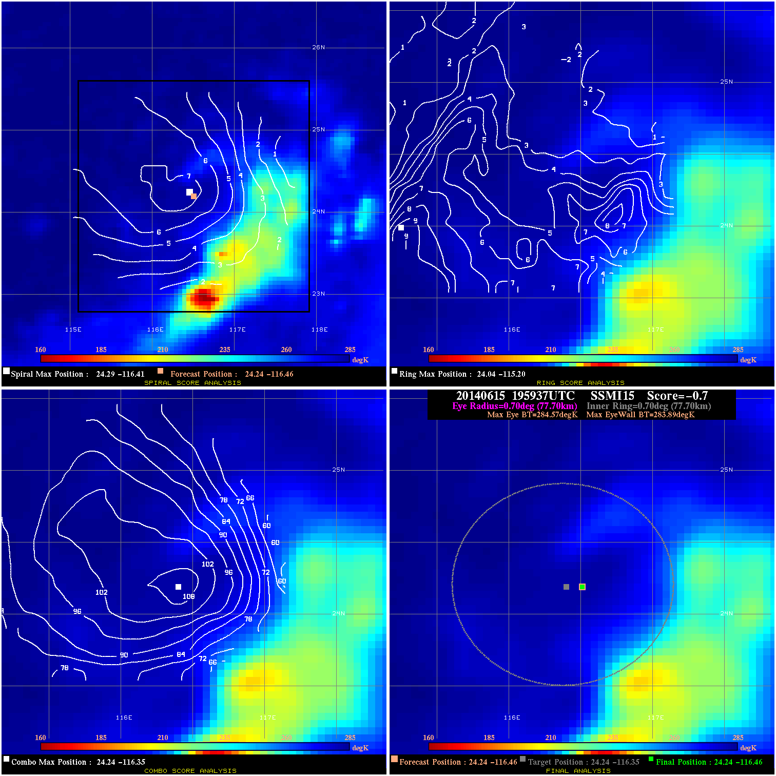
20140615 195937 -0.7 N/A 6.8% 155.54 .68 35.0 SSMI15 24.2 -116.5 24.2 -116.5 24.2 -116.3 Analysis Plot
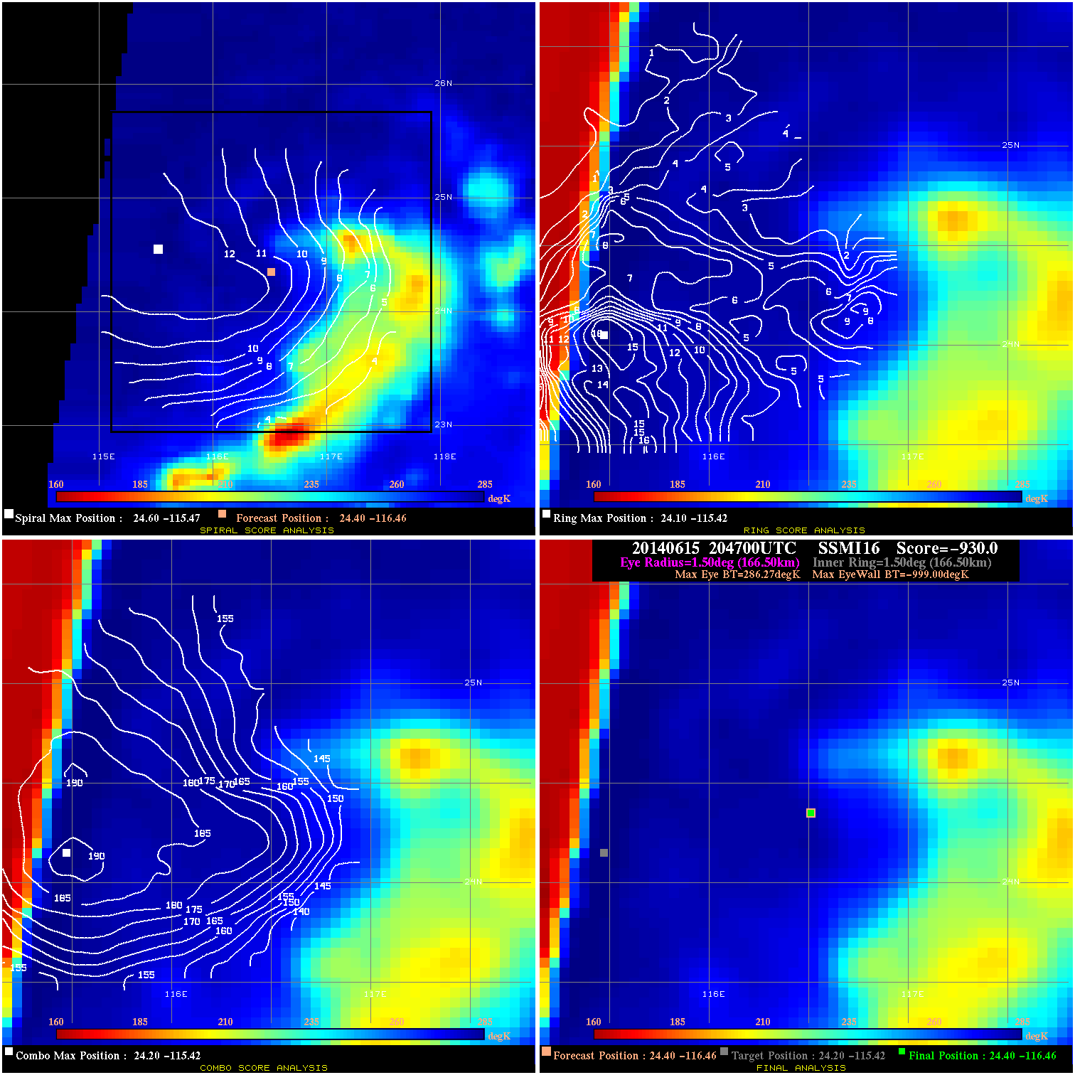
20140615 204700 -930.0 N/A N/A 333.30 1285.2 35.0 SSMI16 24.4 -116.5 24.4 -116.5 24.2 -115.4 Analysis Plot
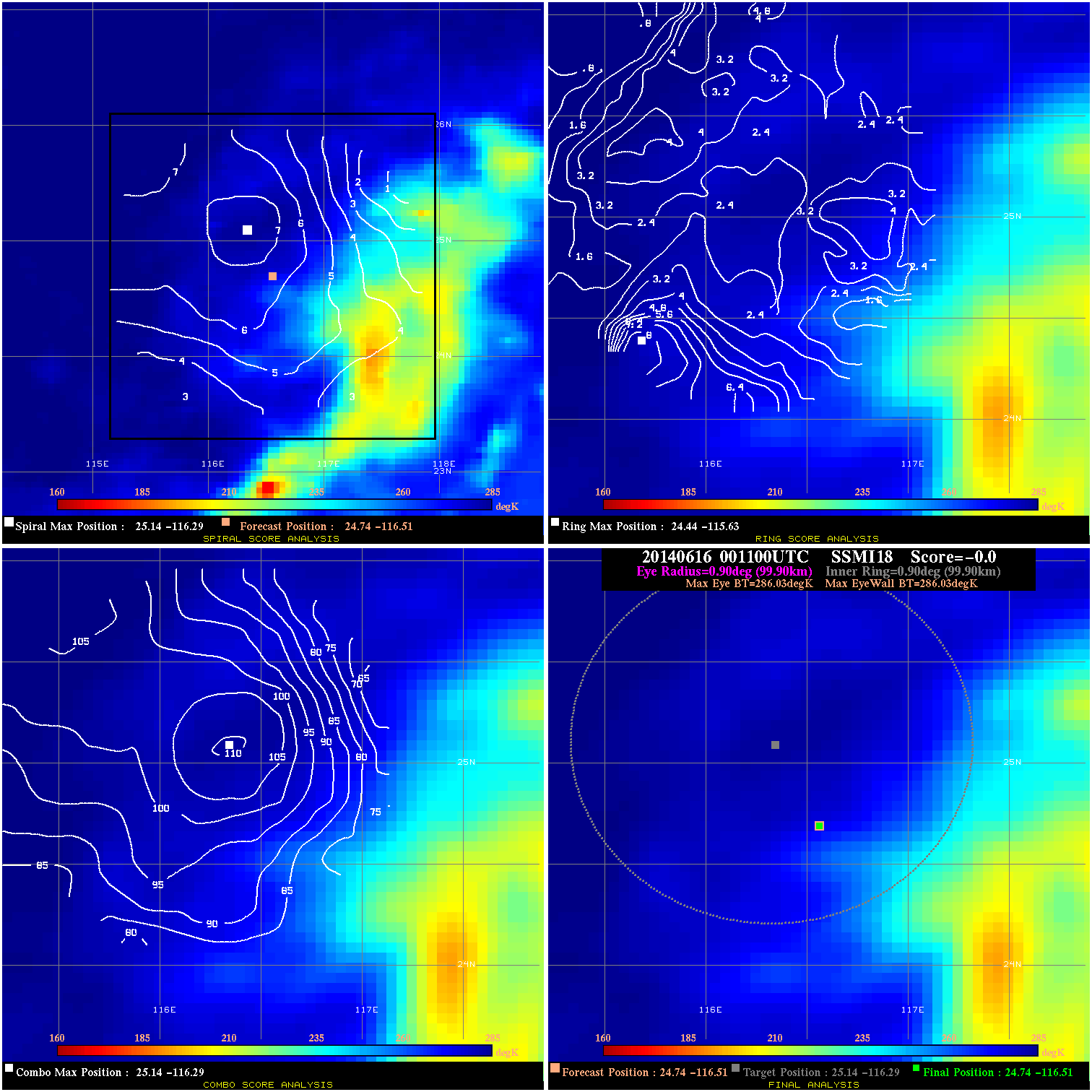
20140616 001100 -0.0 N/A N/A N/A 0.00 35.0 SSMI18 24.7 -116.5 24.7 -116.5 25.1 -116.3 Analysis Plot
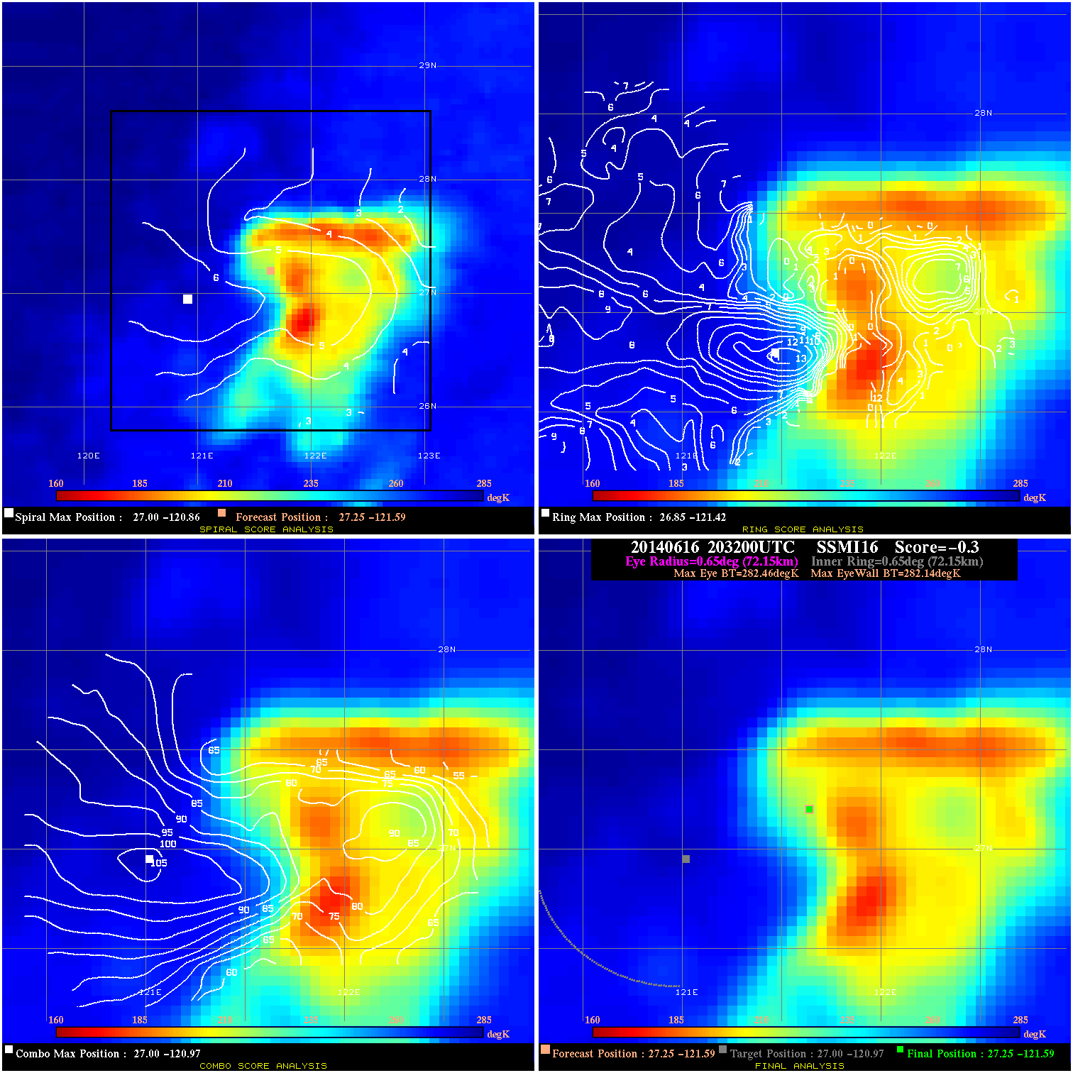
20140616 203200 -0.3 N/A 28.8% 144.43 .32 25.0 SSMI16 27.3 -121.6 27.3 -121.6 27.0 -121.0 Analysis Plot
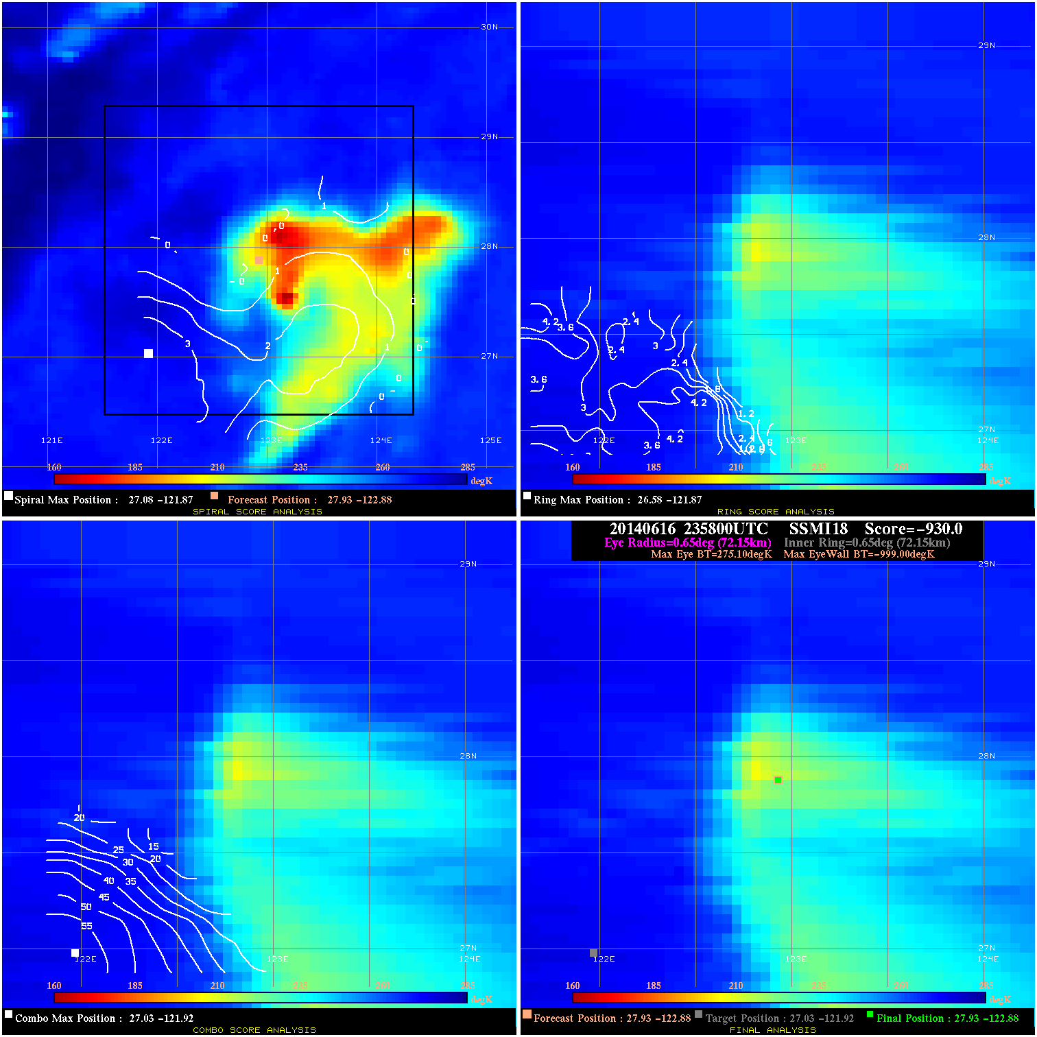
20140616 235800 -930.0 N/A N/A 144.43 1274.1 25.0 SSMI18 27.9 -122.9 27.9 -122.9 27.0 -121.9 Analysis Plot
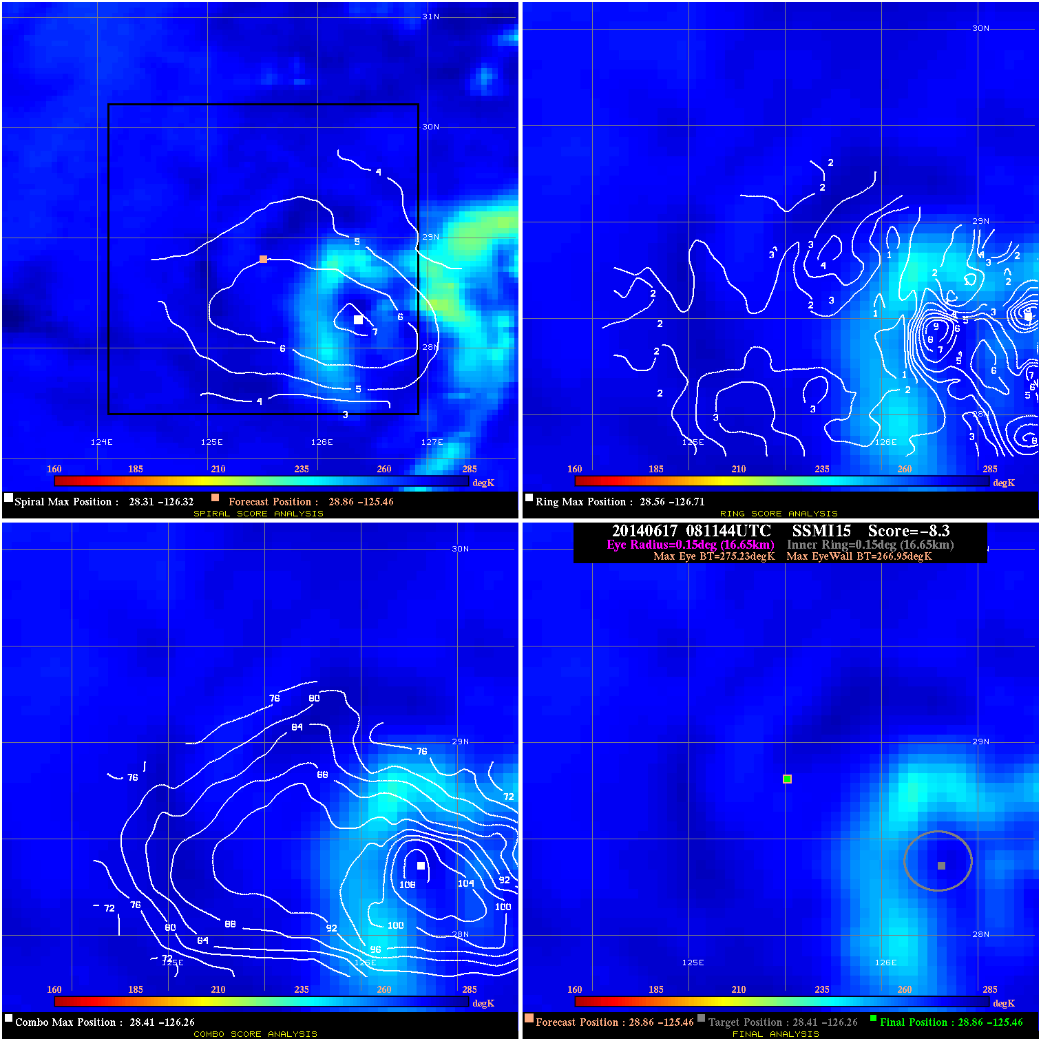
20140617 081144 -8.3 N/A N/A 33.33 8.28 25.0 SSMI15 28.9 -125.5 28.9 -125.5 28.4 -126.3 Analysis Plot
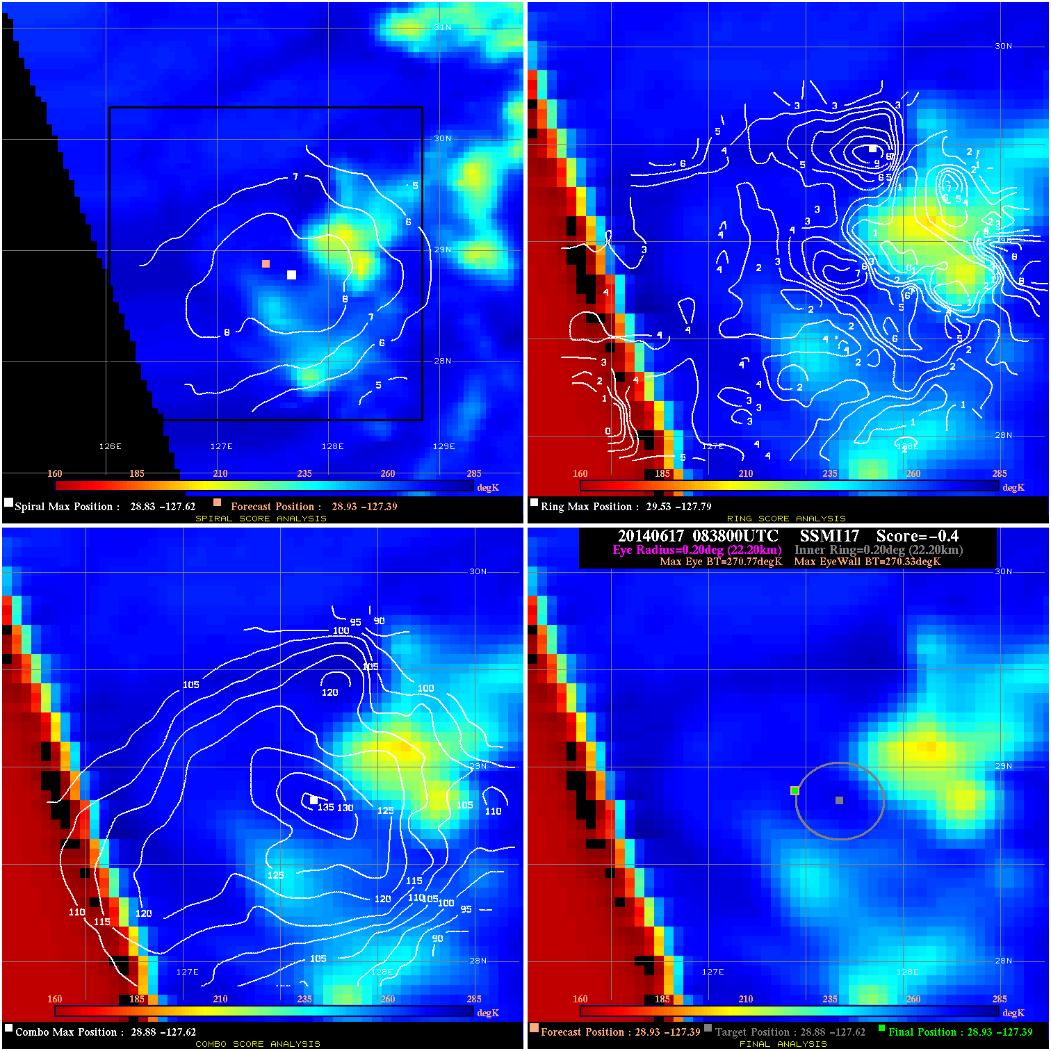
20140617 083800 -0.4 N/A N/A 44.44 .44 30.0 SSMI17 28.9 -127.4 28.9 -127.4 28.9 -127.6 Analysis Plot
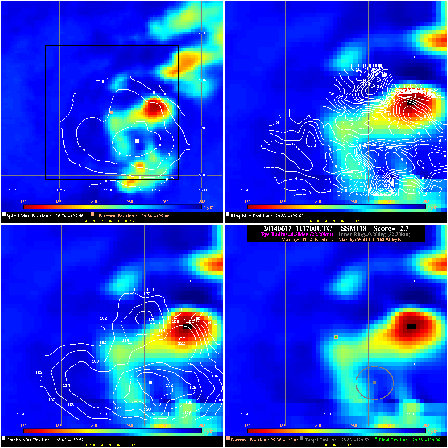
20140617 111700 -2.7 N/A 37.0% 44.44 2.70 30.0 SSMI18 29.4 -129.1 29.4 -129.1 28.8 -129.5 Analysis Plot
20140617 152440 -6.4 N/A 61.6% 66.66 6.42 30.0 TRMM 29.7 -132.0 29.7 -132.0 29.5 -132.7 Analysis Plot
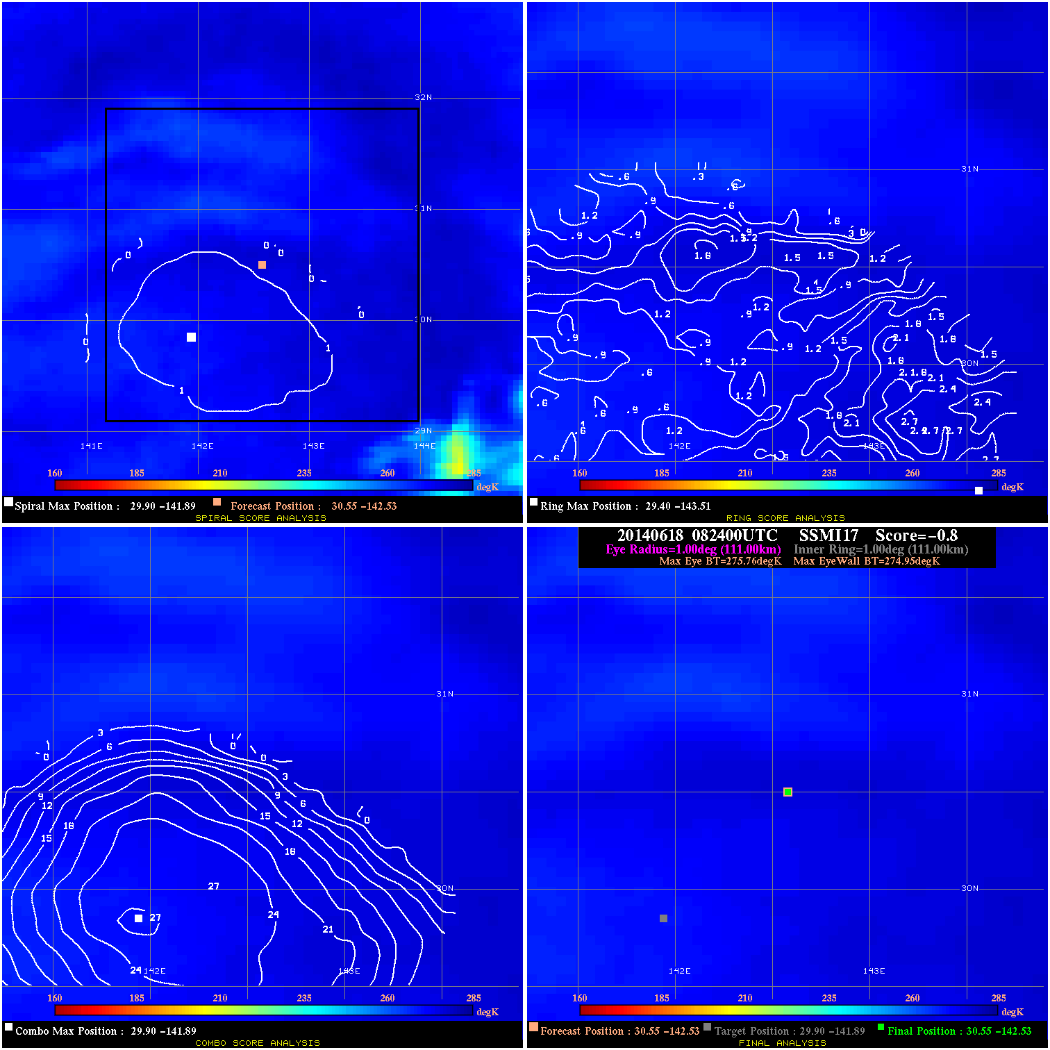
20140618 082400 -0.8 N/A N/A 222.20 .81 30.0 SSMI17 30.5 -142.5 30.5 -142.5 29.9 -141.9 Analysis Plot
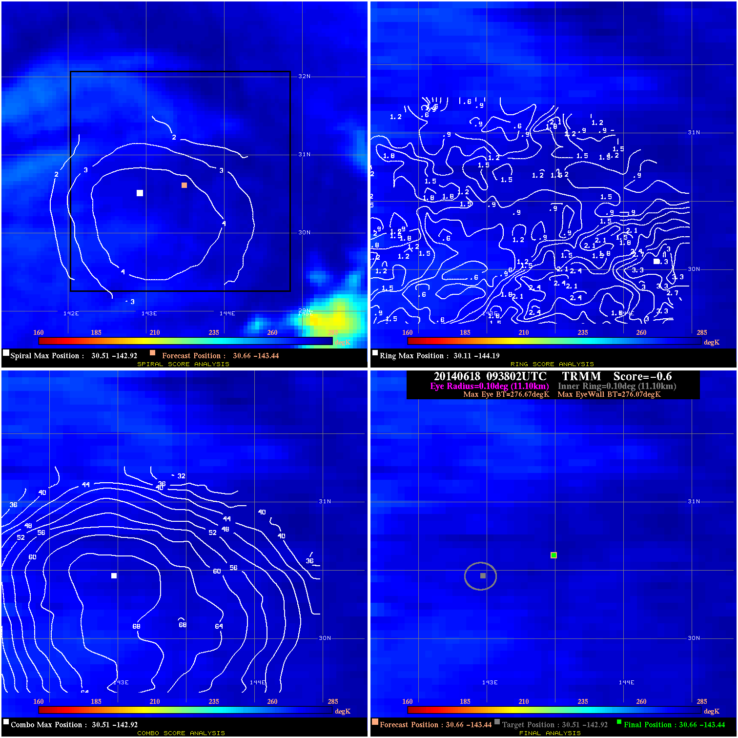
20140618 093802 -0.6 N/A N/A 22.22 .60 30.0 TRMM 30.7 -143.4 30.7 -143.4 30.5 -142.9 Analysis Plot
|
|
Legend: - Date/Time are determined from PMW imagery at Forecast (initial guess) Lat/Lon position. - Positive/Negative Latitude = North/South Hemisphere; Longitude = Western/Eastern Hemisphere. - "Ring Diam" value indicates the estimated surface eyewall diameter in km (the MI eyewall edge diameter minus 10 km). - "Ring Pct" is the percentage of the "ring" (eyewall inner boundary) that is 1) colder than the "hot spot" (warmest eye pixel) in the eye by 20K, or 2) the percentage that is a) colder than 232K and b) colder than the "hot spot" by 10K, whichever is greater. - Values are red if Ring % <= 65, yellow/brown if Ring % <= 85 and green if Ring % > 85. - "Tb diff" is the difference between the "hot spot" (warmest eye pixel) and the warmest pixel on the eyewall. - Intensity score are listed as negative, and not used, when the JTWC or NHC estimated Vmax is <55 kts in order to rule out weak but highly symmetric TCs. - Error messages in intensity scores: -920 is used when the hottest pixel in the eye is <200K, to prevent false positives; -930 means <85% of eyewall has observations/data. |