Tropical Storm 10L
|
Passive Microwave (PMW) Intensity Information Advanced Dvorak Technique (ADT) Version 8.2.1 |
Overpass Inten Ring Ring Wind Forecast Final Target
Date Time Score Meaning Pct Diam BTdiff Est Sat Lat Lon Lat Lon Lat Lon
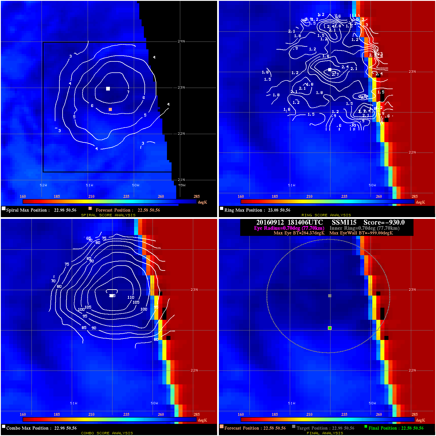
20160912 181406 -930.0 N/A N/A N/A 0.00 35.0 SSMI15 22.6 50.6 22.6 50.6 23.0 50.6 Analysis Plot
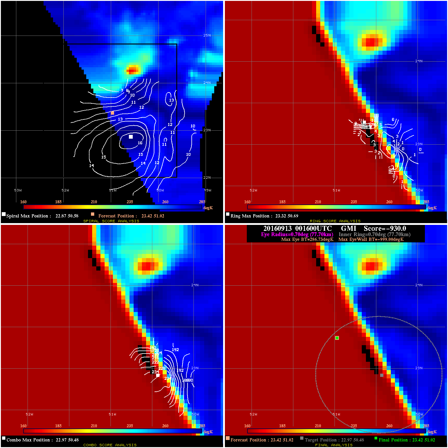
20160913 001600 -930.0 N/A N/A N/A 0.00 35.0 GMI 23.4 51.0 23.4 51.0 23.0 50.5 Analysis Plot
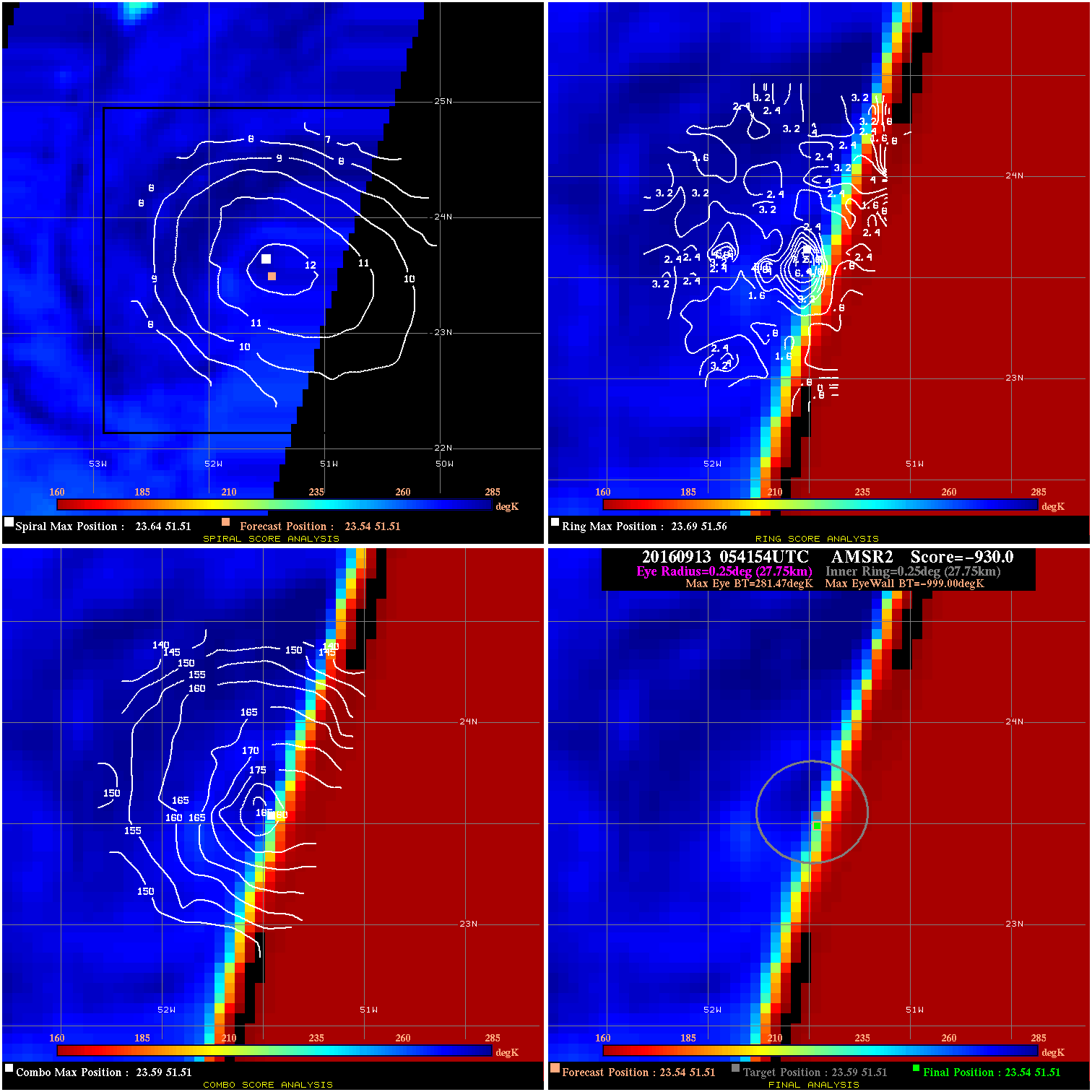
20160913 054154 -930.0 N/A N/A N/A 0.00 40.0 AMSR2 23.5 51.5 23.5 51.5 23.6 51.5 Analysis Plot
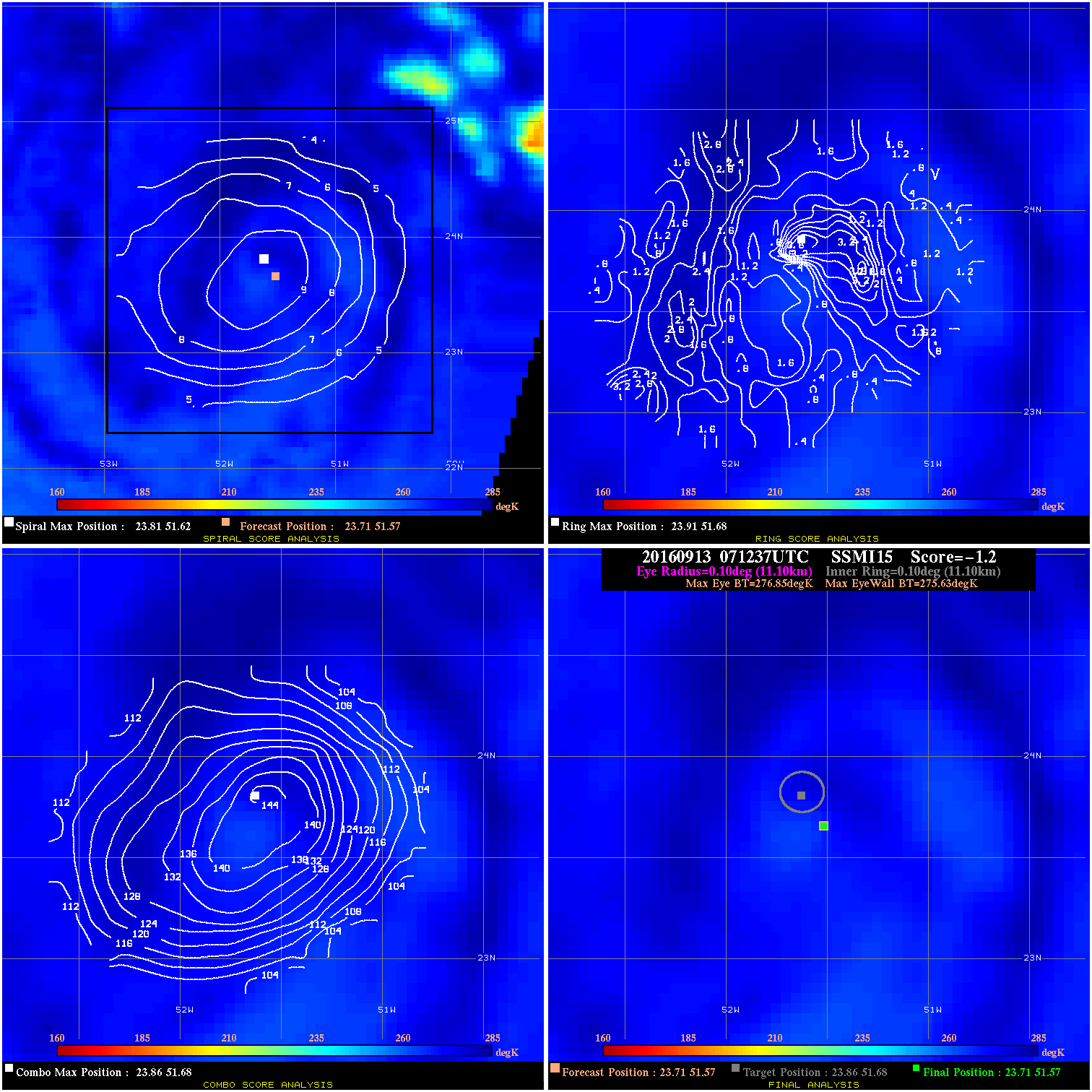
20160913 071237 -1.2 N/A N/A 22.22 1.22 40.0 SSMI15 23.7 51.6 23.7 51.6 23.9 51.7 Analysis Plot
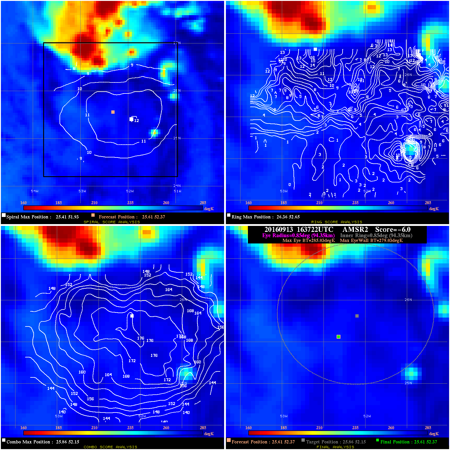
20160913 163722 -6.0 N/A 12.3% 188.87 6.00 40.0 AMSR2 25.6 52.4 25.6 52.4 25.9 52.2 Analysis Plot
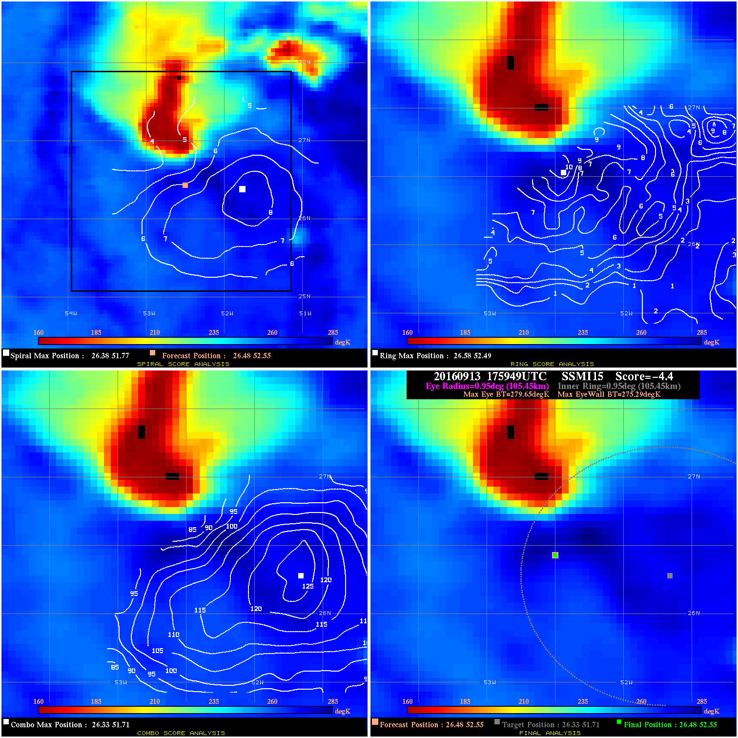
20160913 175949 -4.4 N/A 11.0% 211.09 4.36 40.0 SSMI15 26.5 52.5 26.5 52.5 26.3 51.7 Analysis Plot
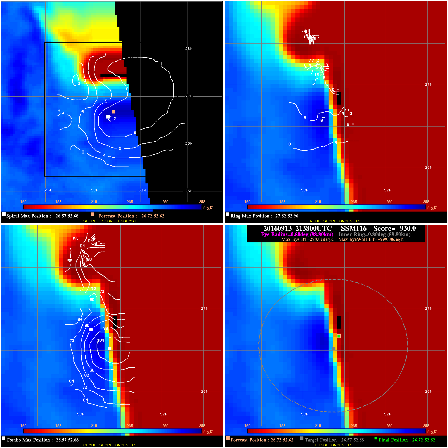
20160913 213800 -930.0 N/A N/A N/A 0.00 40.0 SSMI16 26.7 52.6 26.7 52.6 26.6 52.7 Analysis Plot
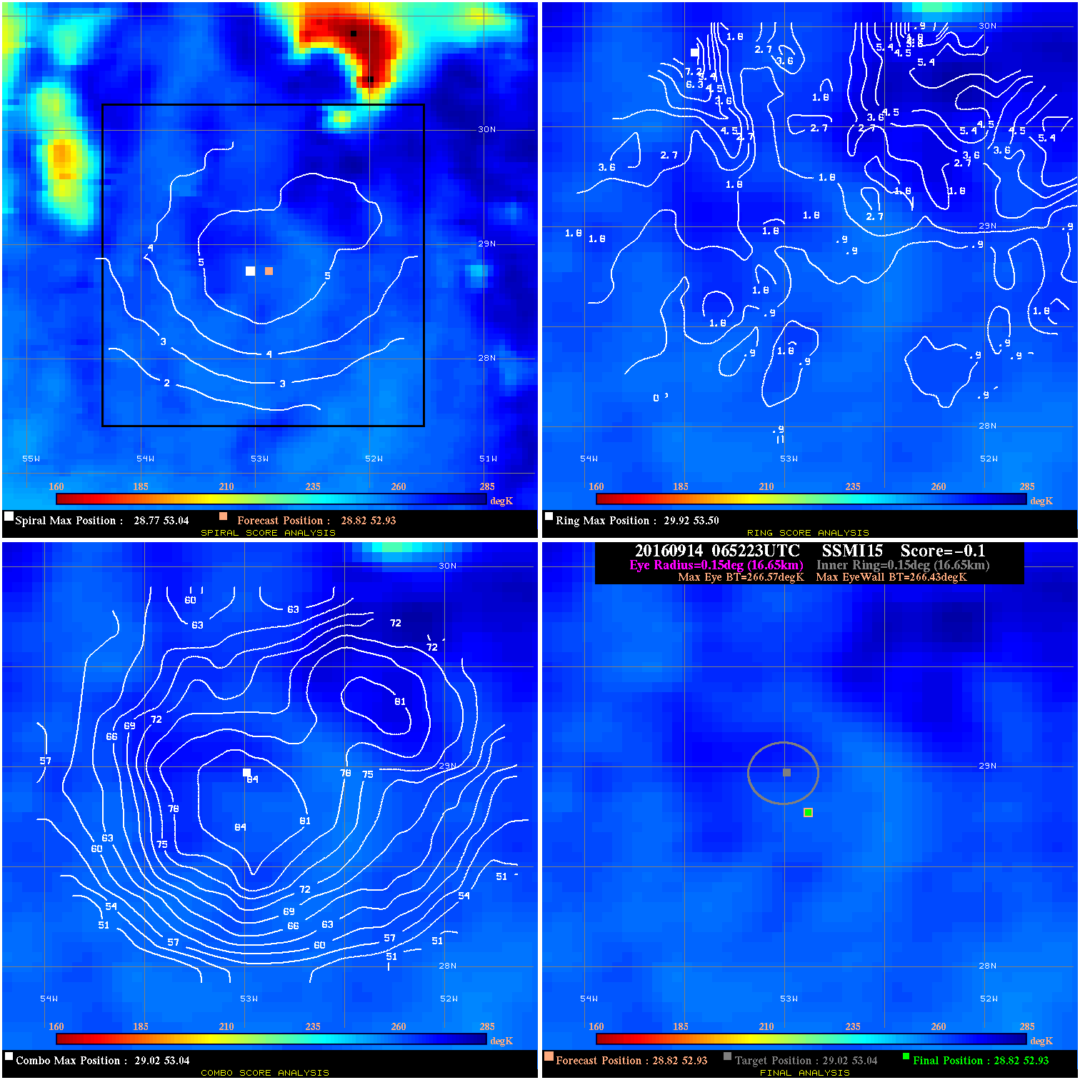
20160914 065223 -0.1 N/A N/A 33.33 .14 45.0 SSMI15 28.8 52.9 28.8 52.9 29.0 53.0 Analysis Plot
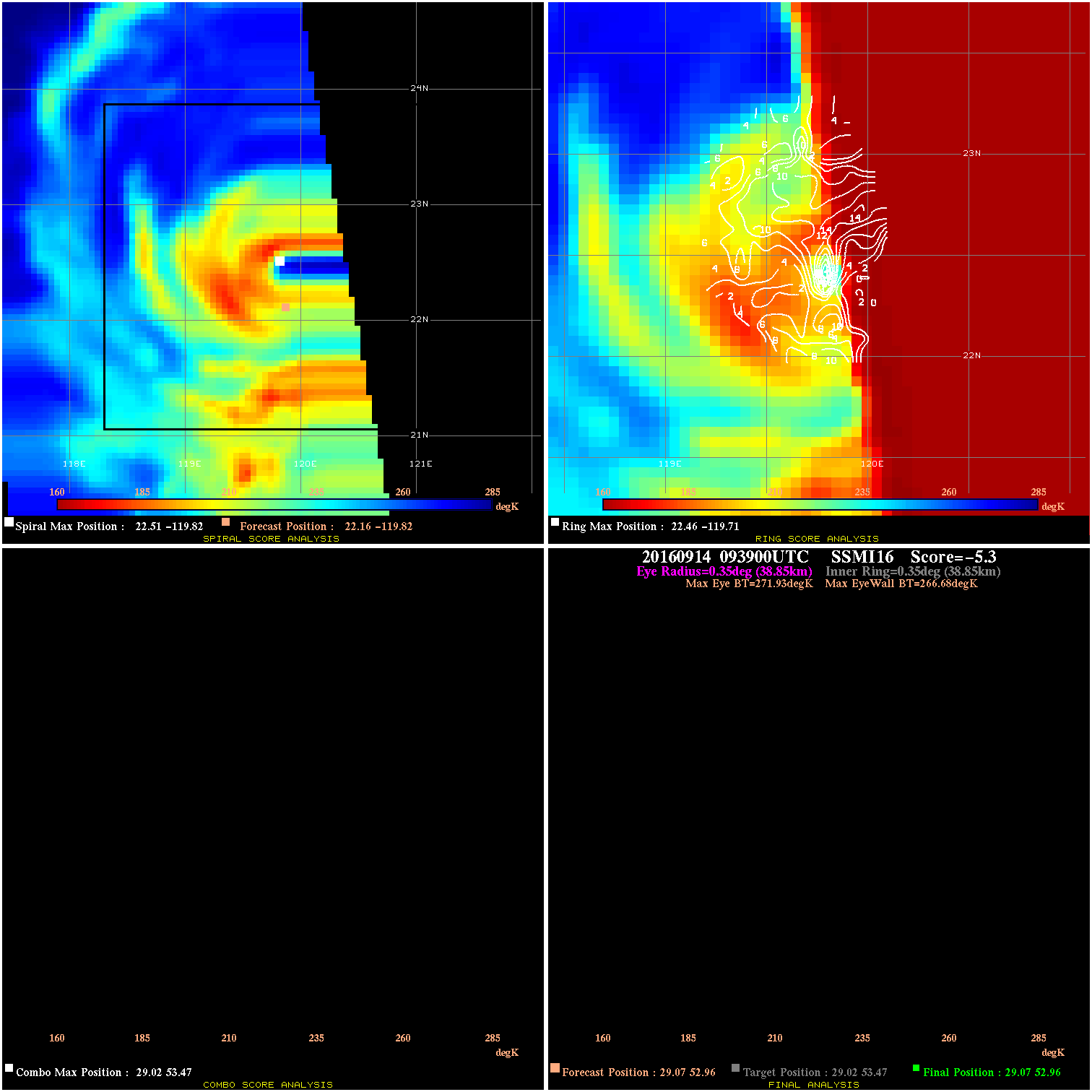
20160914 093900 -5.3 N/A N/A 77.77 5.25 45.0 SSMI16 29.1 53.0 29.1 53.0 29.0 53.5 Analysis Plot
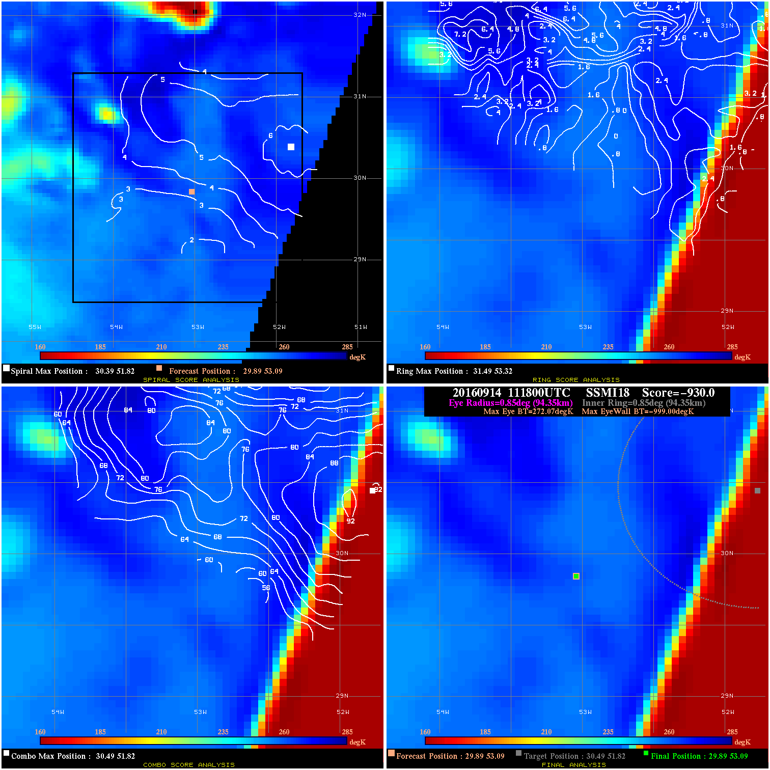
20160914 111800 -930.0 N/A N/A N/A 0.00 45.0 SSMI18 29.9 53.1 29.9 53.1 30.5 51.8 Analysis Plot
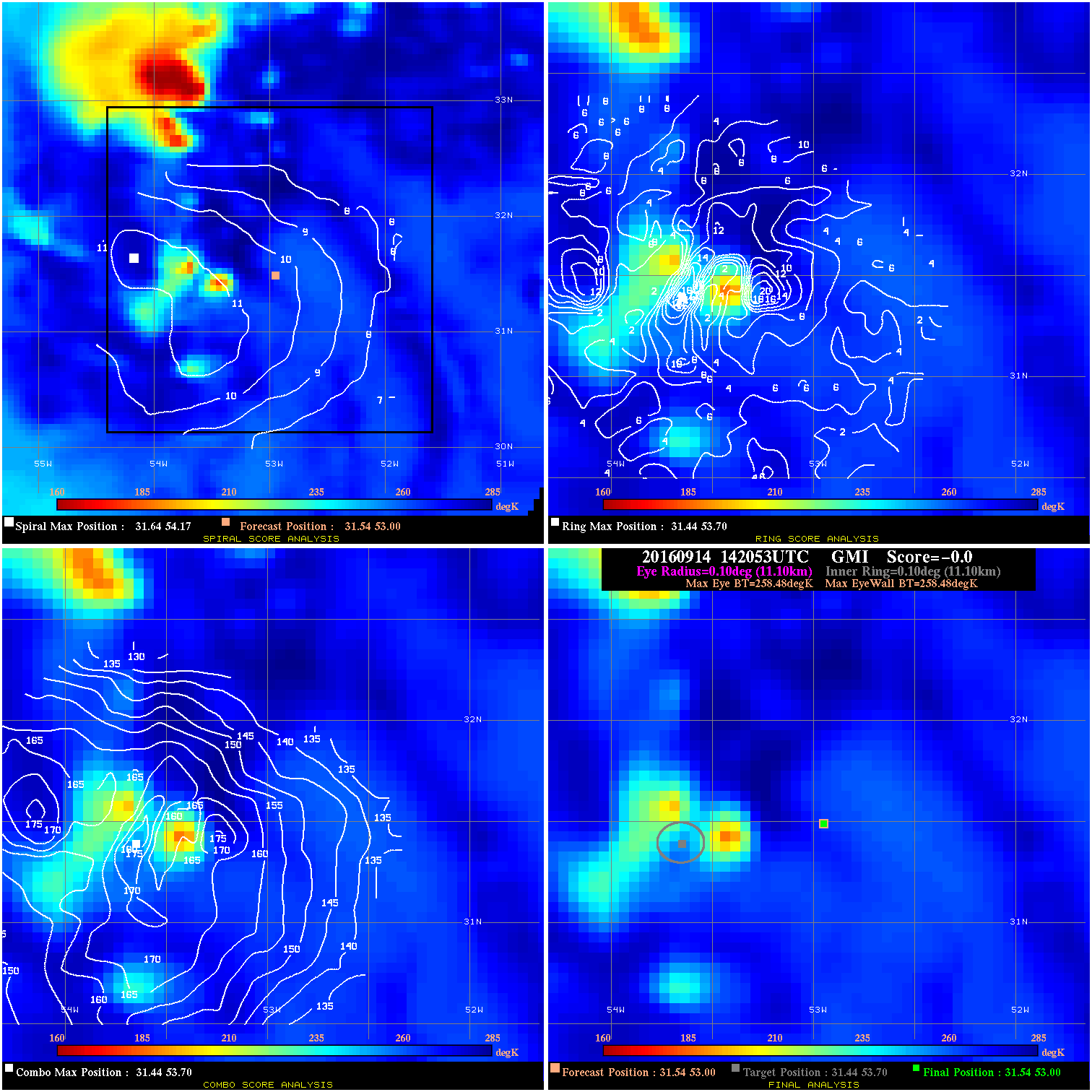
20160914 142053 -0.0 N/A N/A N/A 0.00 45.0 GMI 31.5 53.0 31.5 53.0 31.4 53.7 Analysis Plot
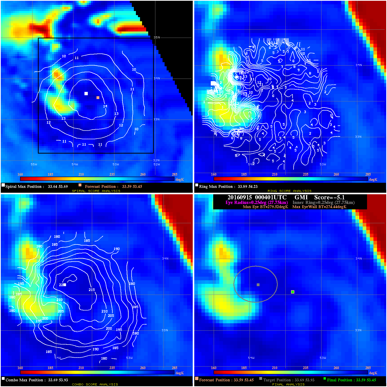
20160915 000401 -5.1 N/A 23.3% 55.55 5.08 45.0 GMI 33.6 53.5 33.6 53.5 33.7 53.9 Analysis Plot
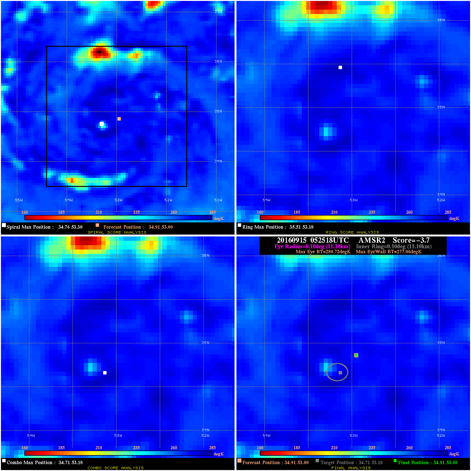
20160915 052518 -3.7 N/A N/A 22.22 3.66 45.0 AMSR2 34.9 53.0 34.9 53.0 34.7 53.2 Analysis Plot
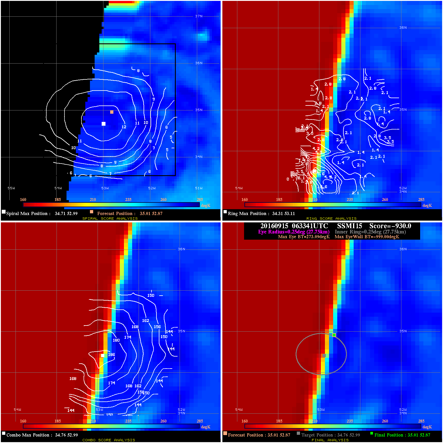
20160915 063341 -930.0 N/A N/A N/A 0.00 45.0 SSMI15 35.0 52.9 35.0 52.9 34.8 53.0 Analysis Plot
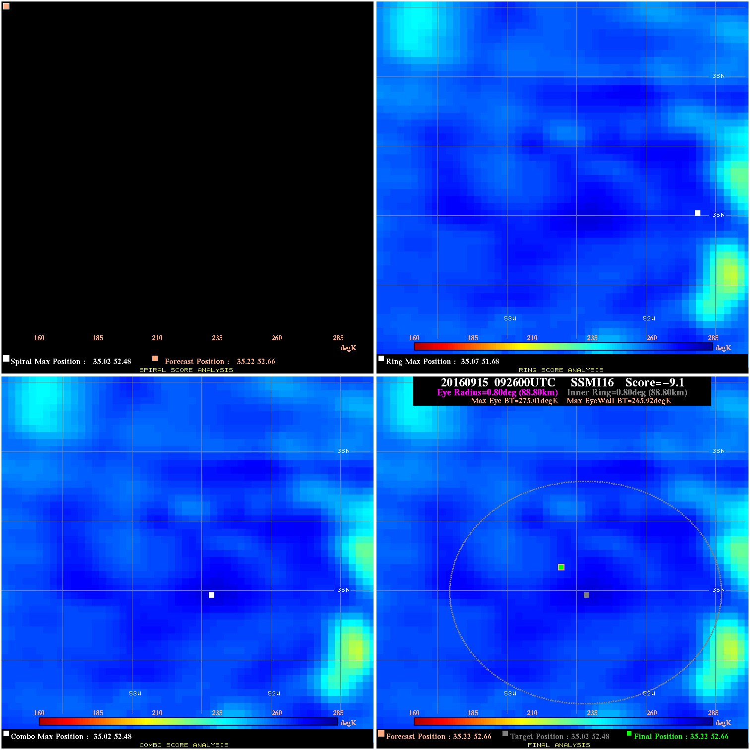
20160915 092600 -9.1 N/A N/A 177.76 9.09 45.0 SSMI16 35.2 52.7 35.2 52.7 35.0 52.5 Analysis Plot
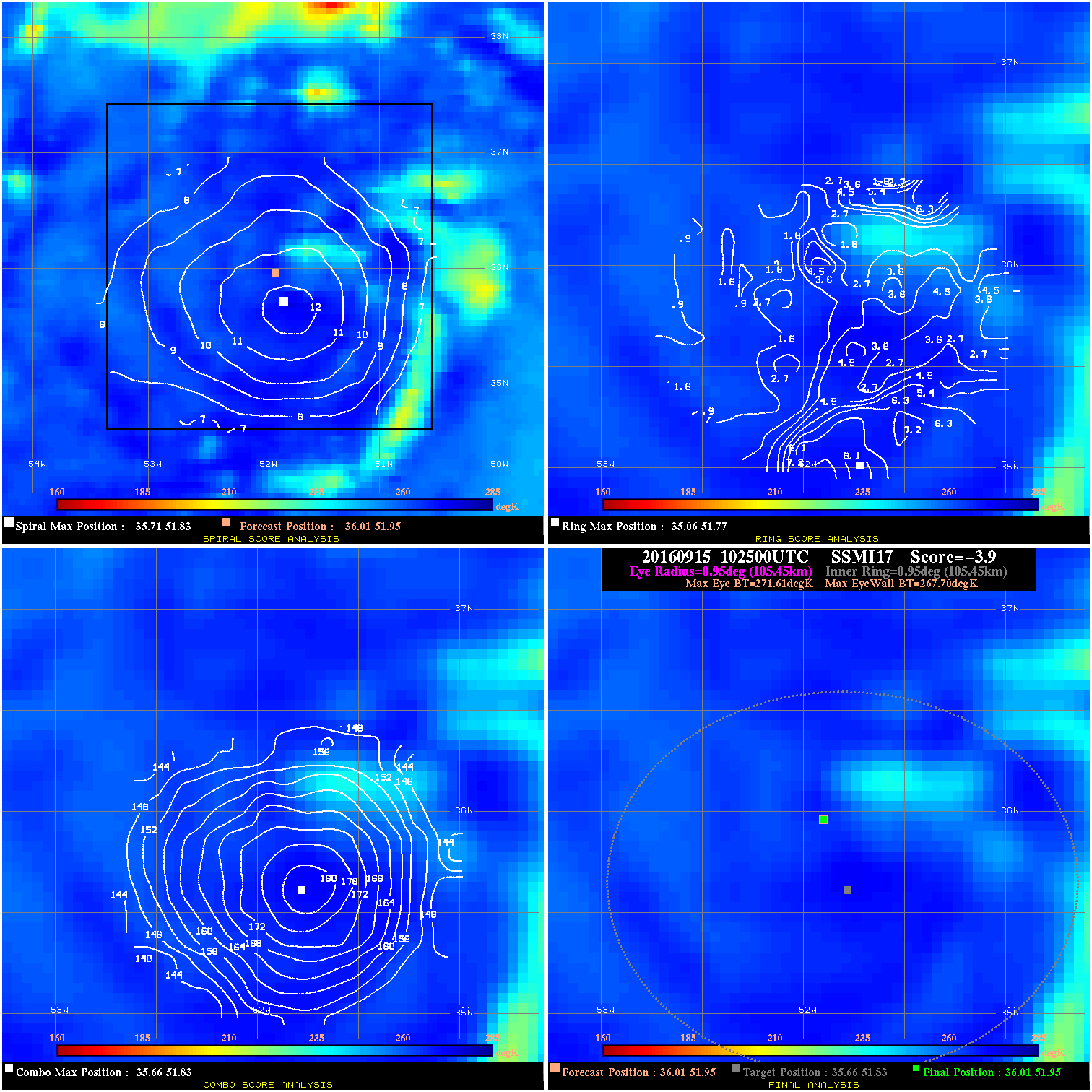
20160915 102500 -3.9 N/A 8.2% 211.09 3.91 45.0 SSMI17 36.0 52.0 36.0 52.0 35.7 51.8 Analysis Plot
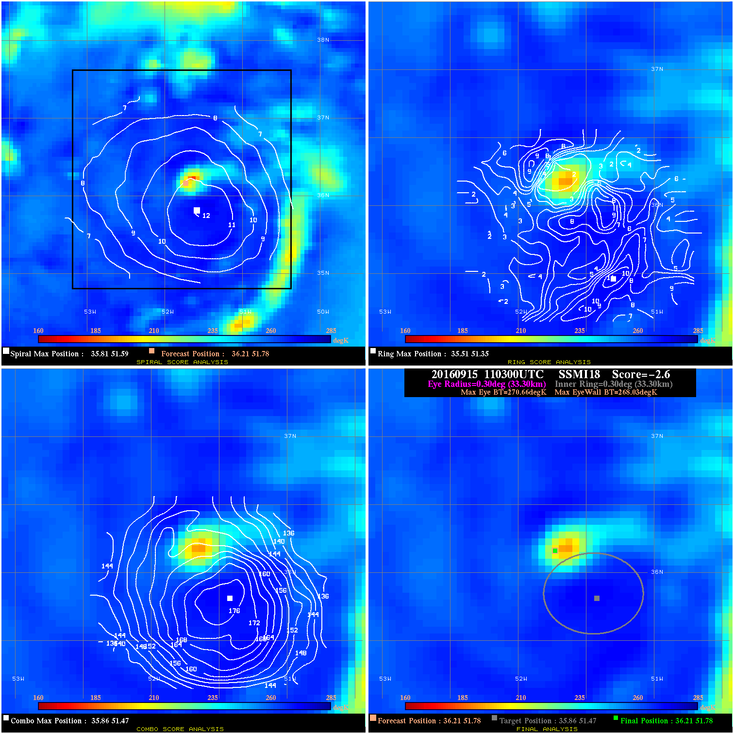
20160915 110300 -2.6 N/A 8.2% 66.66 2.63 45.0 SSMI18 36.2 51.8 36.2 51.8 35.9 51.5 Analysis Plot
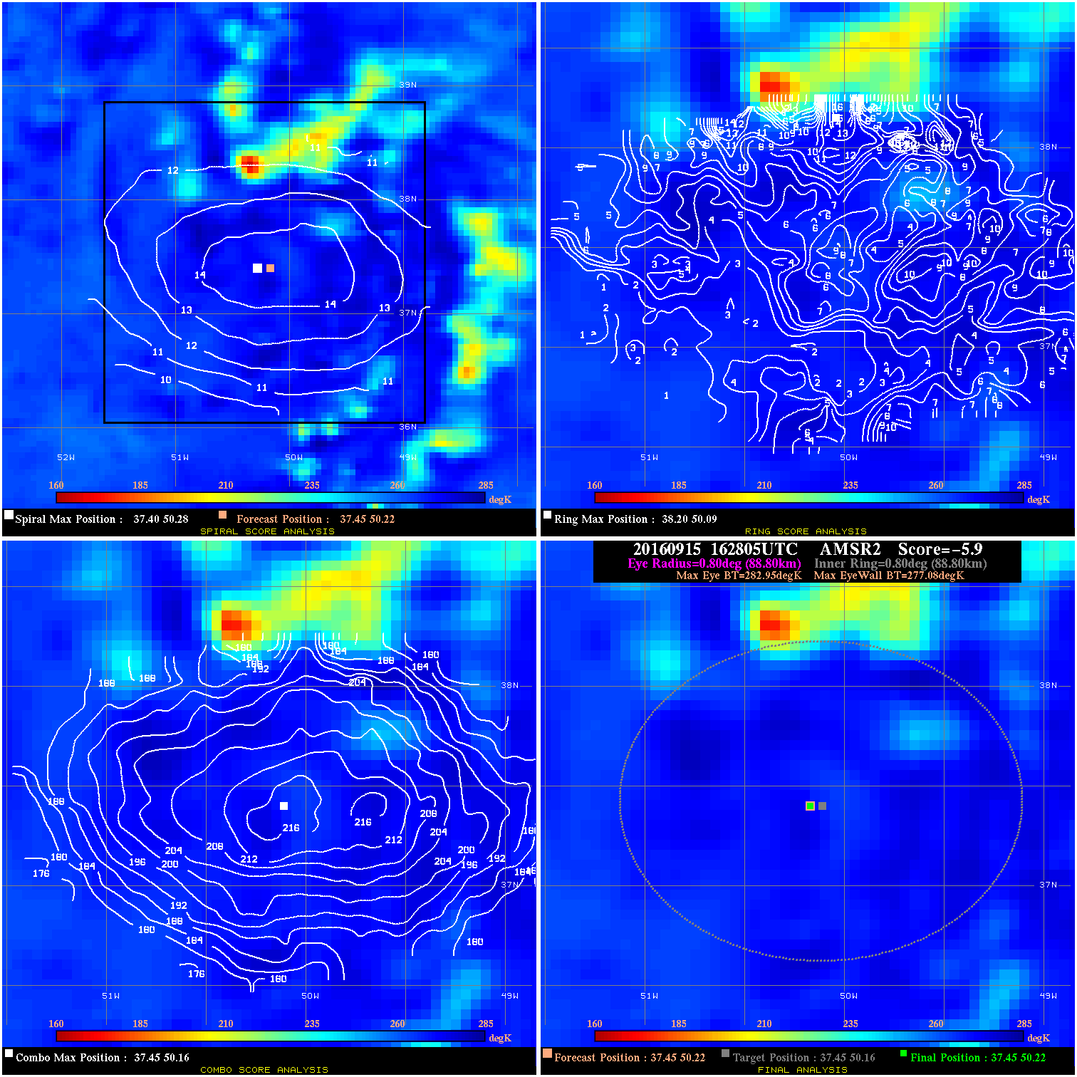
20160915 162805 -5.9 N/A 9.6% 177.76 5.87 45.0 AMSR2 37.5 50.2 37.5 50.2 37.5 50.2 Analysis Plot
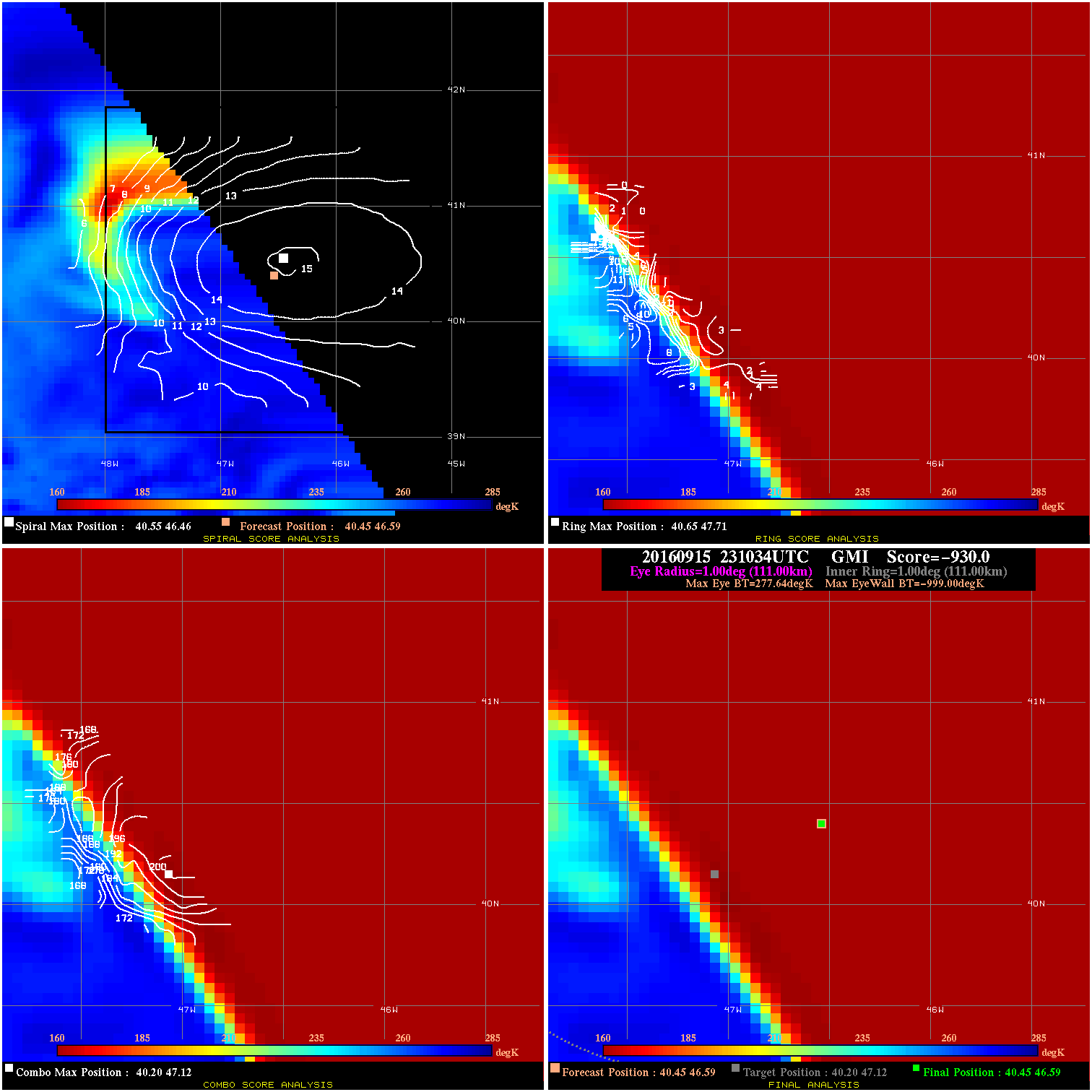
20160915 231034 -930.0 N/A N/A N/A 0.00 45.0 GMI 40.5 46.6 40.5 46.6 40.2 47.1 Analysis Plot
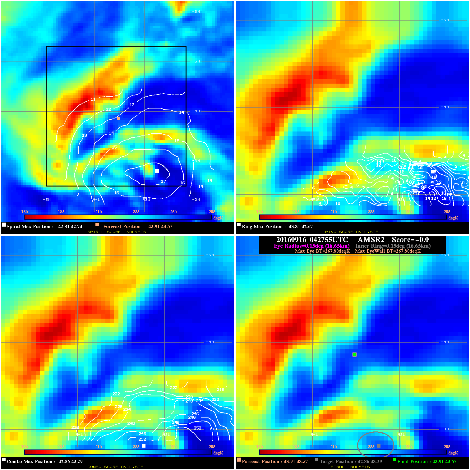
20160916 042755 -0.0 N/A N/A N/A 0.00 45.0 AMSR2 43.9 43.6 43.9 43.6 42.9 43.3 Analysis Plot
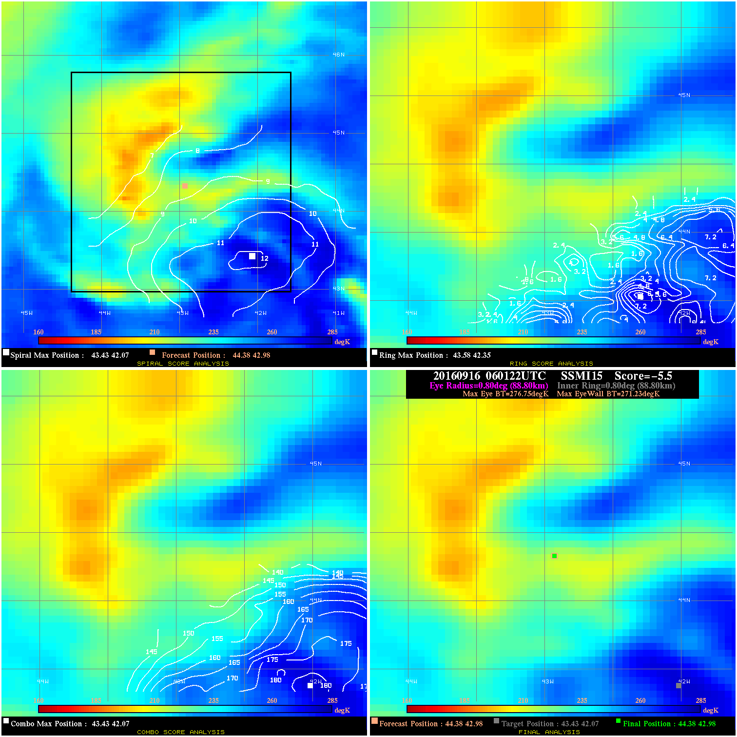
20160916 060122 -5.5 N/A 38.4% 177.76 5.52 50.0 SSMI15 44.4 43.0 44.4 43.0 43.4 42.1 Analysis Plot
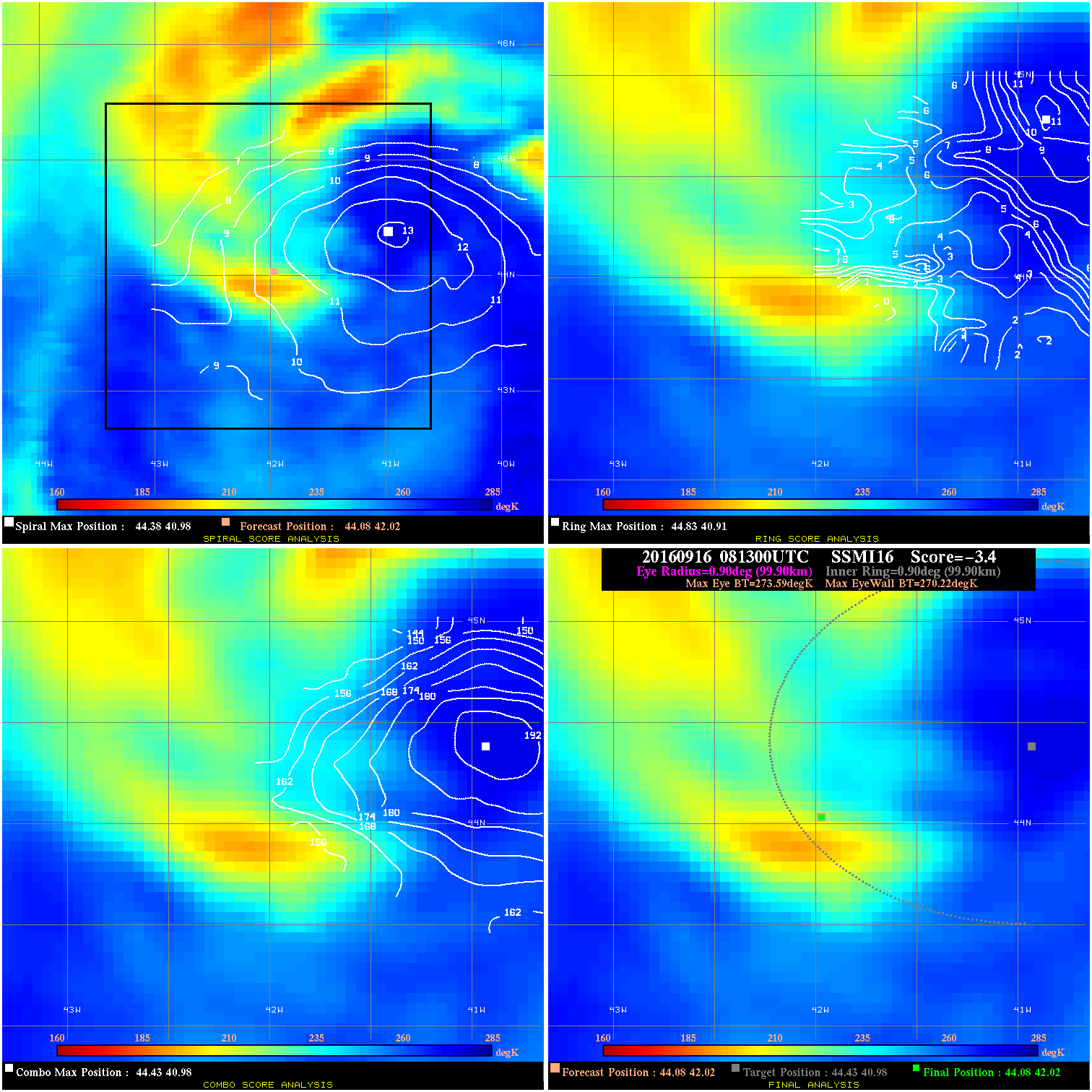
20160916 081300 -3.4 N/A 34.2% 199.98 3.37 50.0 SSMI16 44.1 42.0 44.1 42.0 44.4 41.0 Analysis Plot
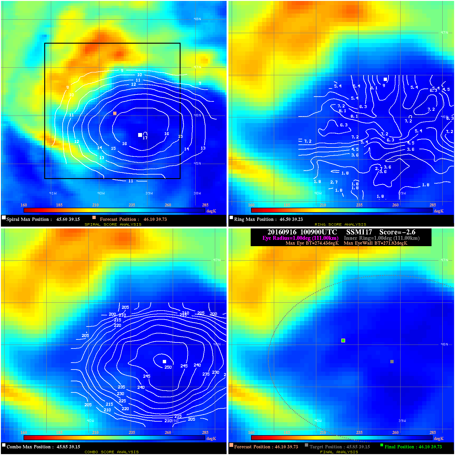
20160916 100900 -2.6 N/A 41.1% 222.20 2.61 50.0 SSMI17 46.1 39.7 46.1 39.7 45.8 39.2 Analysis Plot
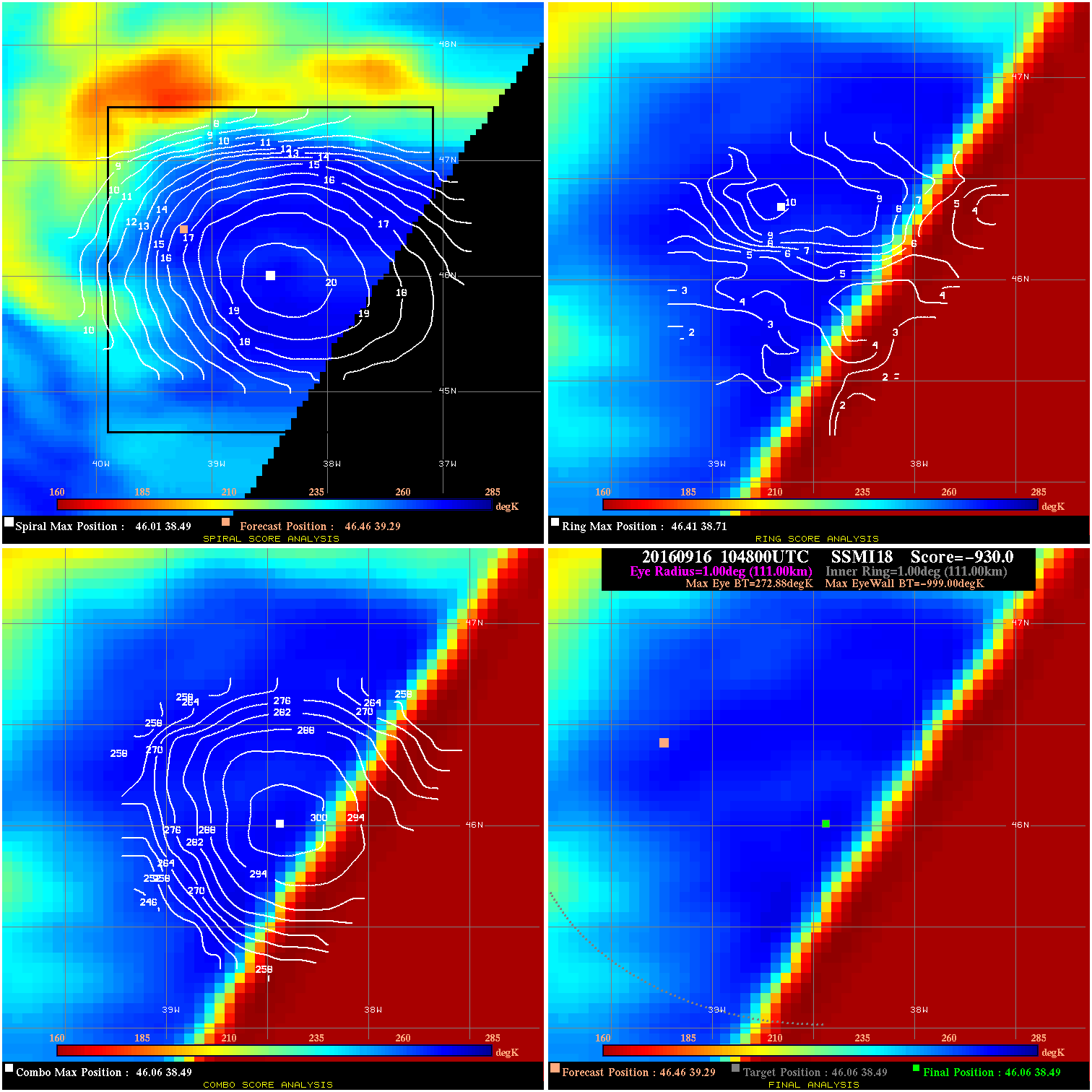
20160916 104800 -930.0 N/A N/A N/A 0.00 50.0 SSMI18 46.5 39.3 46.1 38.5 46.1 38.5 Analysis Plot
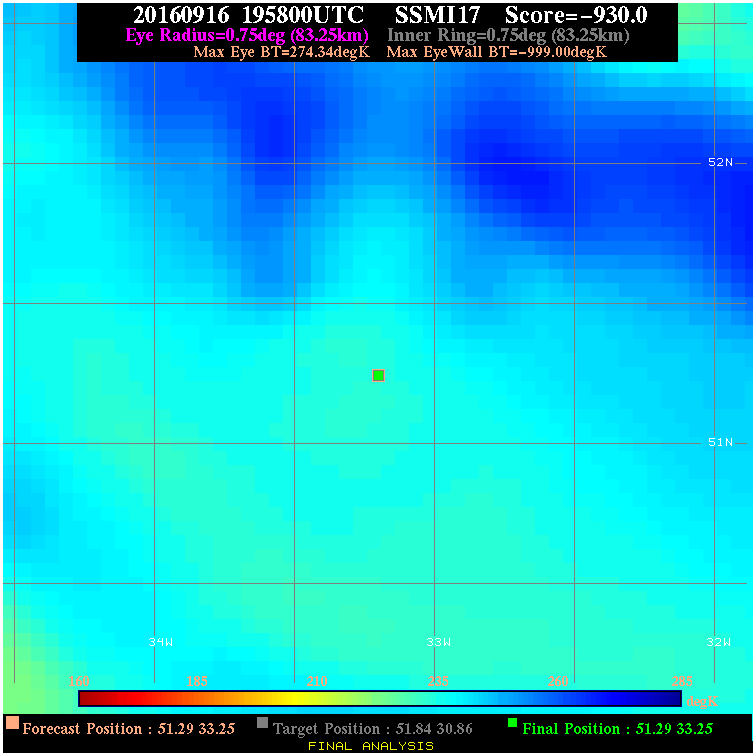
20160916 195800 -930.0 N/A N/A N/A 0.00 55.0 SSMI17 51.3 33.3 51.3 33.3 51.8 30.9 Analysis Plot
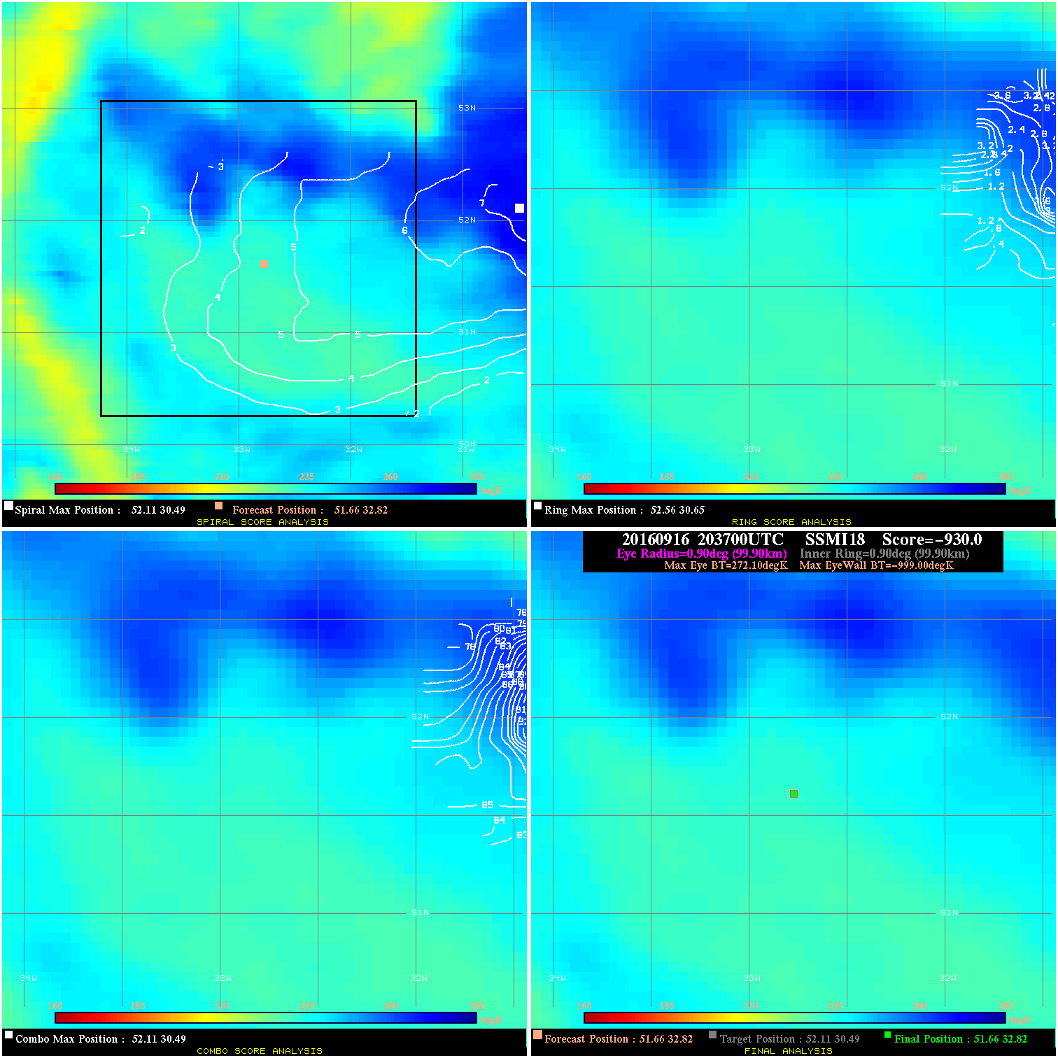
20160916 203700 -930.0 N/A N/A N/A 0.00 55.0 SSMI18 51.7 32.8 51.7 32.8 52.1 30.5 Analysis Plot
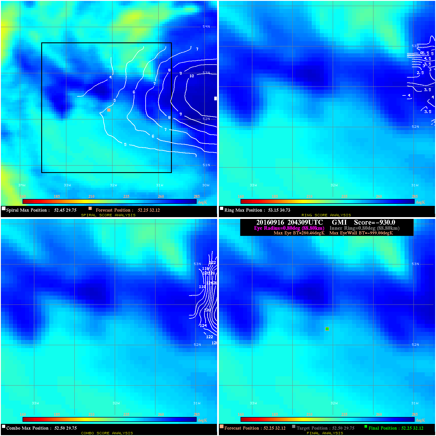
20160916 204309 -930.0 N/A N/A N/A 0.00 55.0 GMI 52.3 32.1 52.3 32.1 52.5 29.8 Analysis Plot
|
|
Legend: - Date/Time are determined from PMW imagery at Forecast (initial guess) Lat/Lon position. - Positive/Negative Latitude = North/South Hemisphere; Longitude = Western/Eastern Hemisphere. - "Ring Diam" value indicates the estimated surface eyewall diameter in km (the MI eyewall edge diameter minus 10 km). - "Ring Pct" is the percentage of the "ring" (eyewall inner boundary) that is 1) colder than the "hot spot" (warmest eye pixel) in the eye by 20K, or 2) the percentage that is a) colder than 232K and b) colder than the "hot spot" by 10K, whichever is greater. - Values are red if Ring % <= 65, yellow/brown if Ring % <= 85 and green if Ring % > 85. - "Tb diff" is the difference between the "hot spot" (warmest eye pixel) and the warmest pixel on the eyewall. - Intensity score are listed as negative, and not used, when the JTWC or NHC estimated Vmax is <55 kts in order to rule out weak but highly symmetric TCs. - Error messages in intensity scores: -920 is used when the hottest pixel in the eye is <200K, to prevent false positives; -930 means <85% of eyewall has observations/data. |