Tropical Depression 13L
|
Passive Microwave (PMW) Intensity Information Advanced Dvorak Technique (ADT) Version 8.2.1 |
Overpass Inten Ring Ring Wind Forecast Final Target
Date Time Score Meaning Pct Diam BTdiff Est Sat Lat Lon Lat Lon Lat Lon
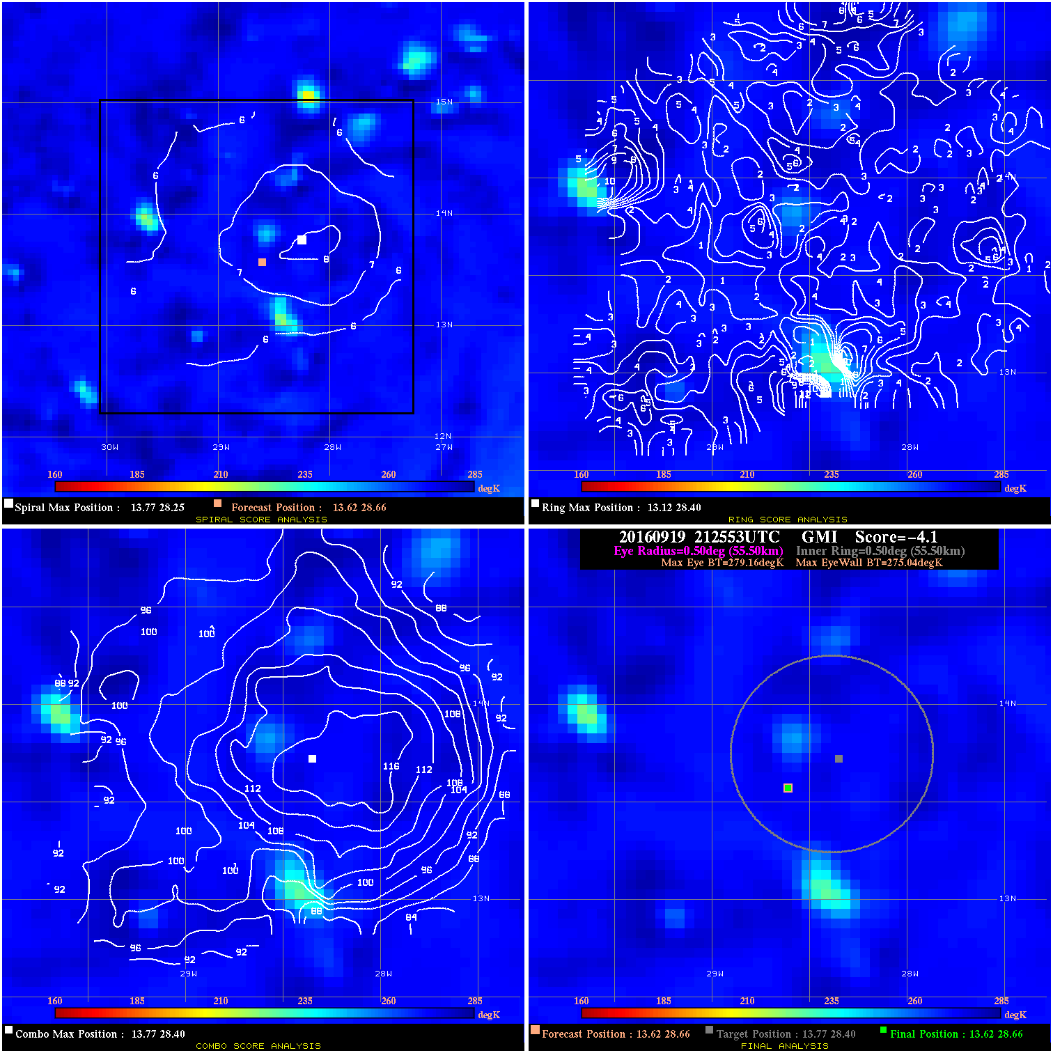
20160919 212553 -4.1 N/A N/A 111.10 4.12 30.0 GMI 13.6 28.7 13.6 28.7 13.8 28.4 Analysis Plot
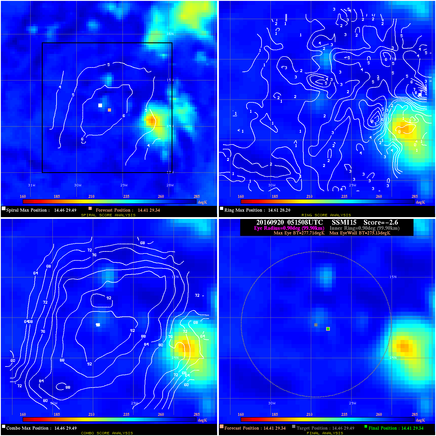
20160920 051508 -2.6 N/A 5.5% 199.98 2.58 30.0 SSMI15 14.4 29.3 14.4 29.3 14.5 29.5 Analysis Plot
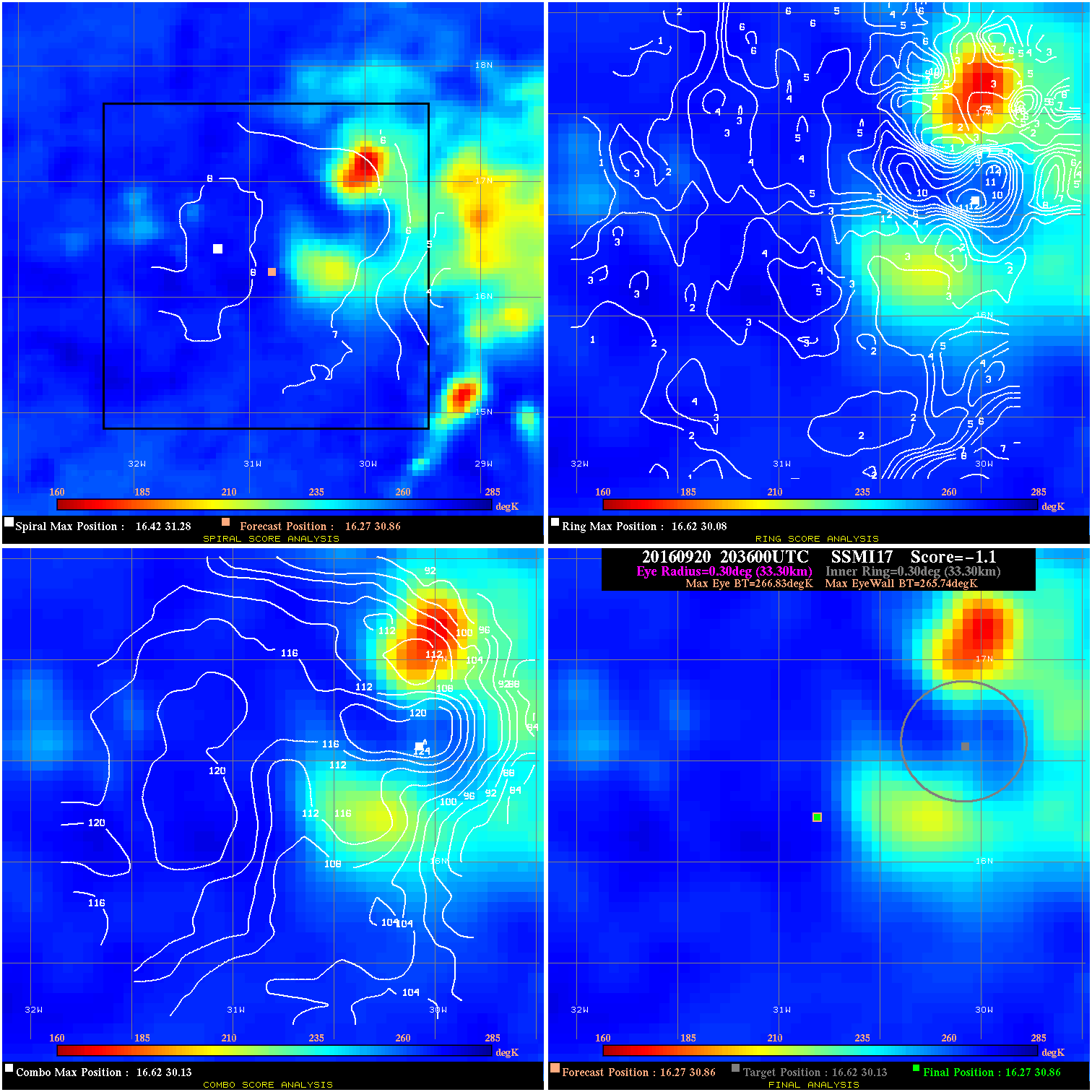
20160920 203600 -1.1 N/A 24.7% 66.66 1.09 40.0 SSMI17 16.3 30.9 16.3 30.9 16.6 30.1 Analysis Plot
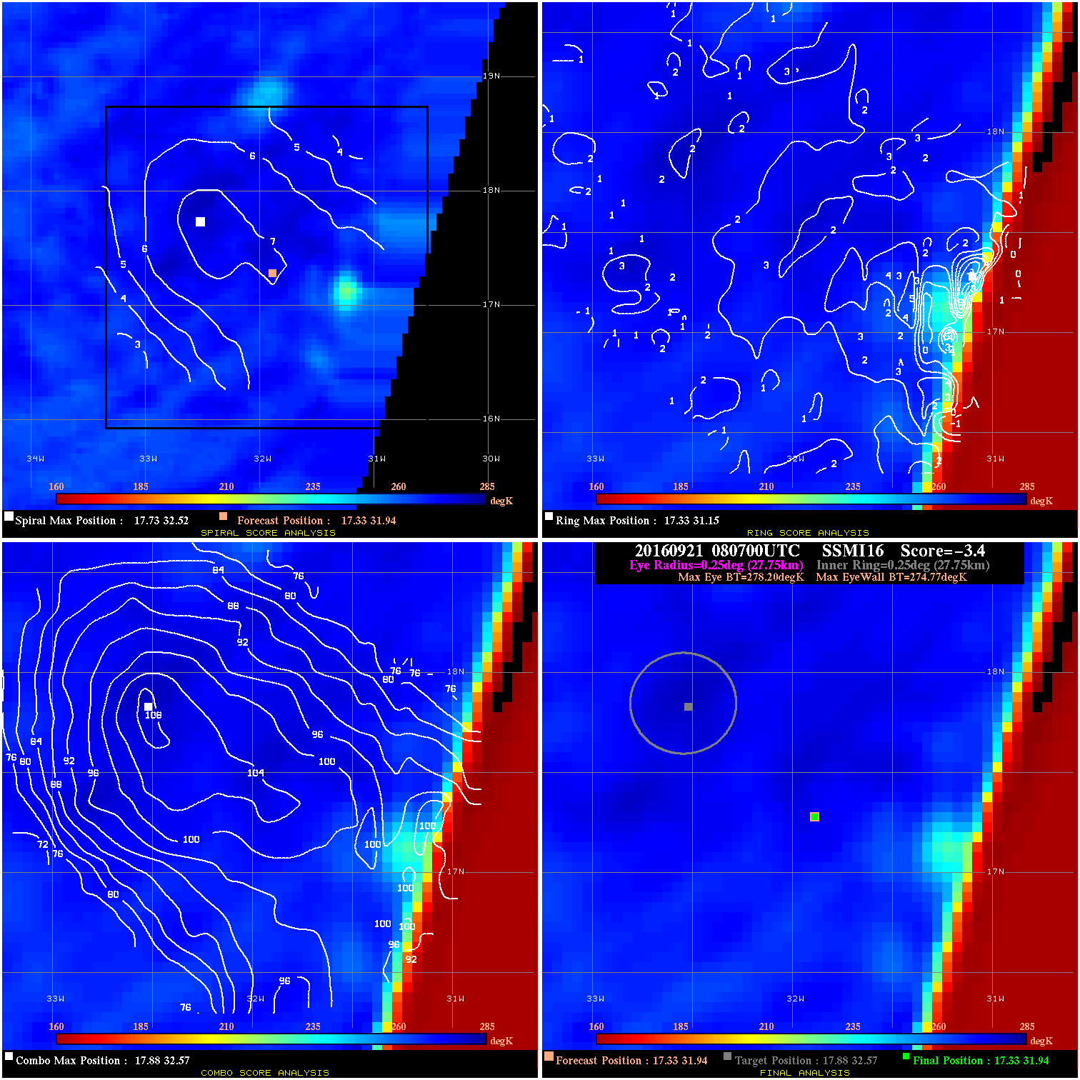
20160921 080700 -3.4 N/A N/A 55.55 3.43 45.0 SSMI16 17.3 31.9 17.3 31.9 17.9 32.6 Analysis Plot
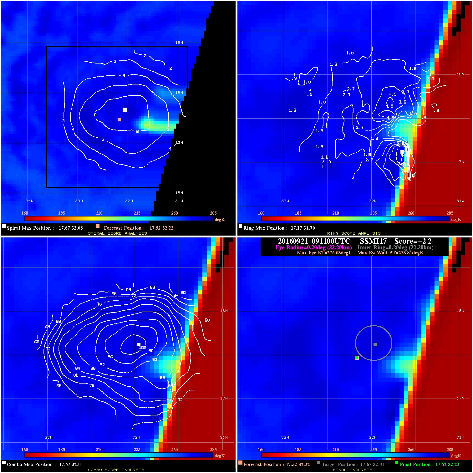
20160921 091100 -2.2 N/A N/A 44.44 2.22 45.0 SSMI17 17.5 32.2 17.5 32.2 17.7 32.0 Analysis Plot
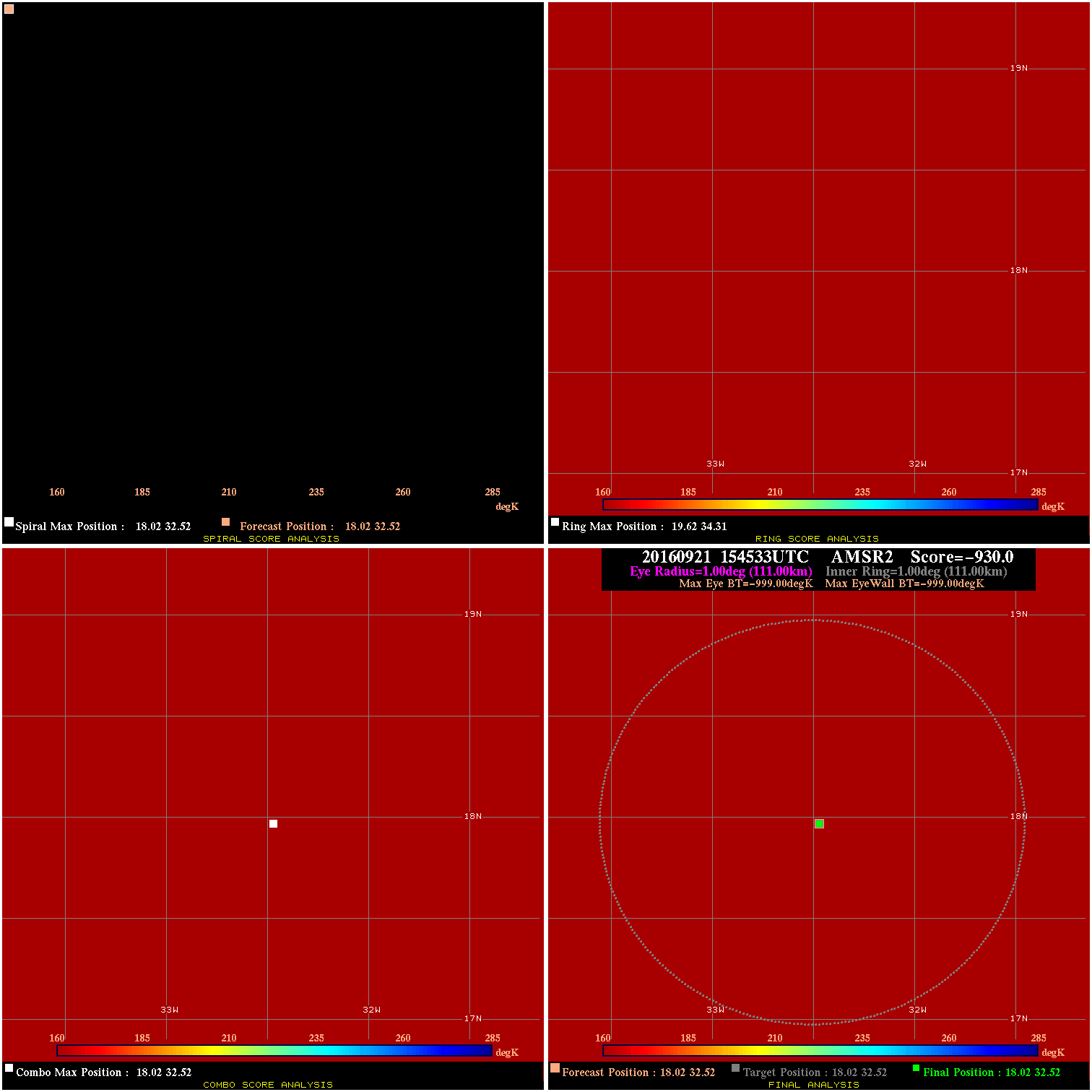
20160921 154533 -0.0 N/A N/A N/A 0.00 45.0 AMSR2 18.0 32.5 18.0 32.5 18.0 32.5 Analysis Plot
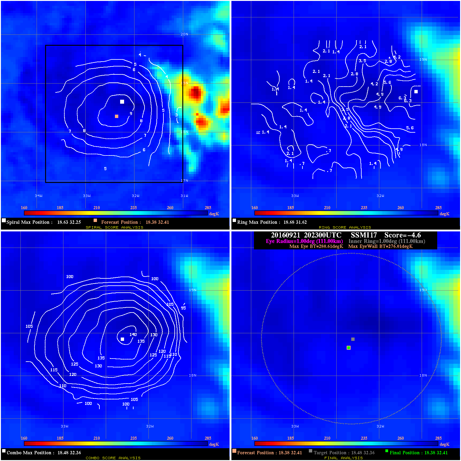
20160921 202300 -4.6 N/A 5.5% 222.20 4.60 40.0 SSMI17 18.4 32.4 18.4 32.4 18.5 32.4 Analysis Plot
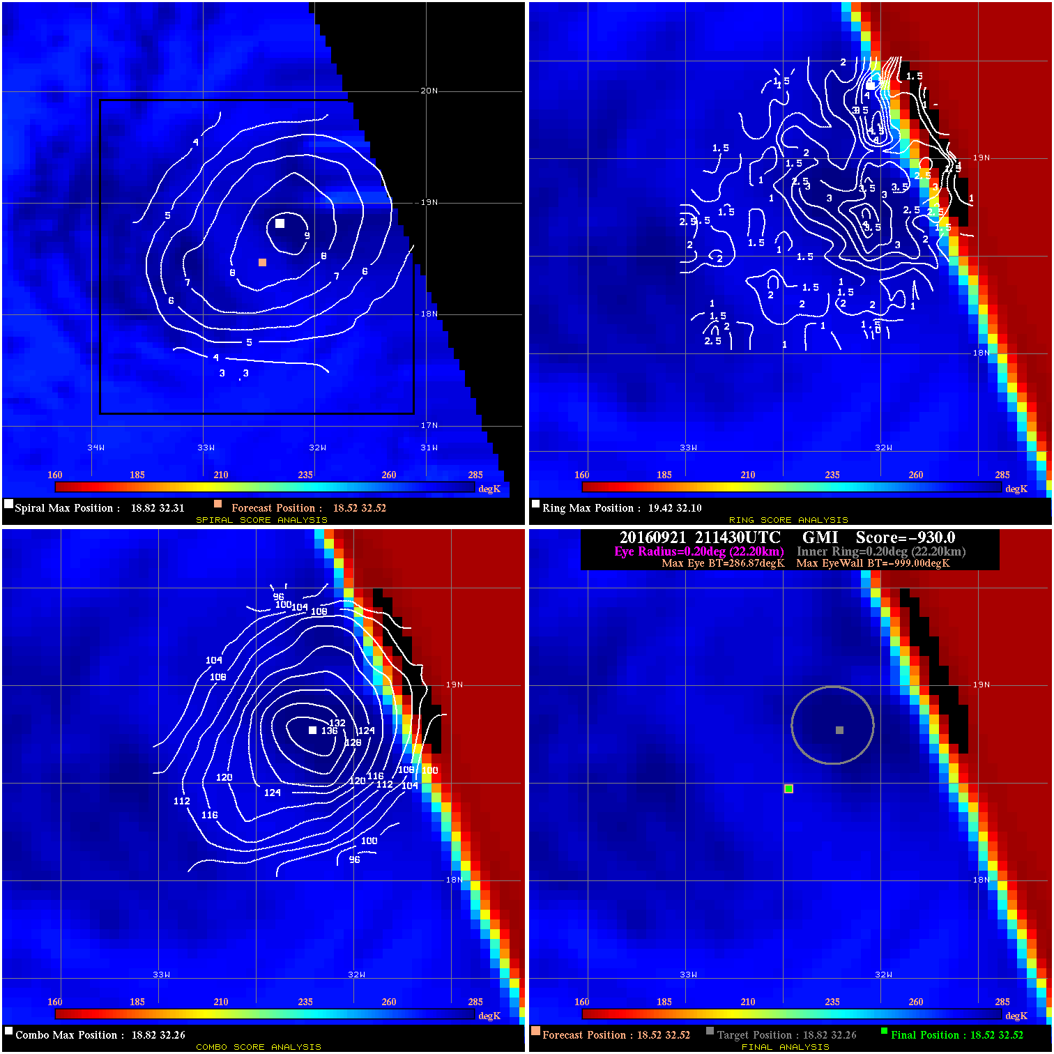
20160921 211430 -930.0 N/A N/A N/A 0.00 40.0 GMI 18.5 32.5 18.5 32.5 18.8 32.3 Analysis Plot
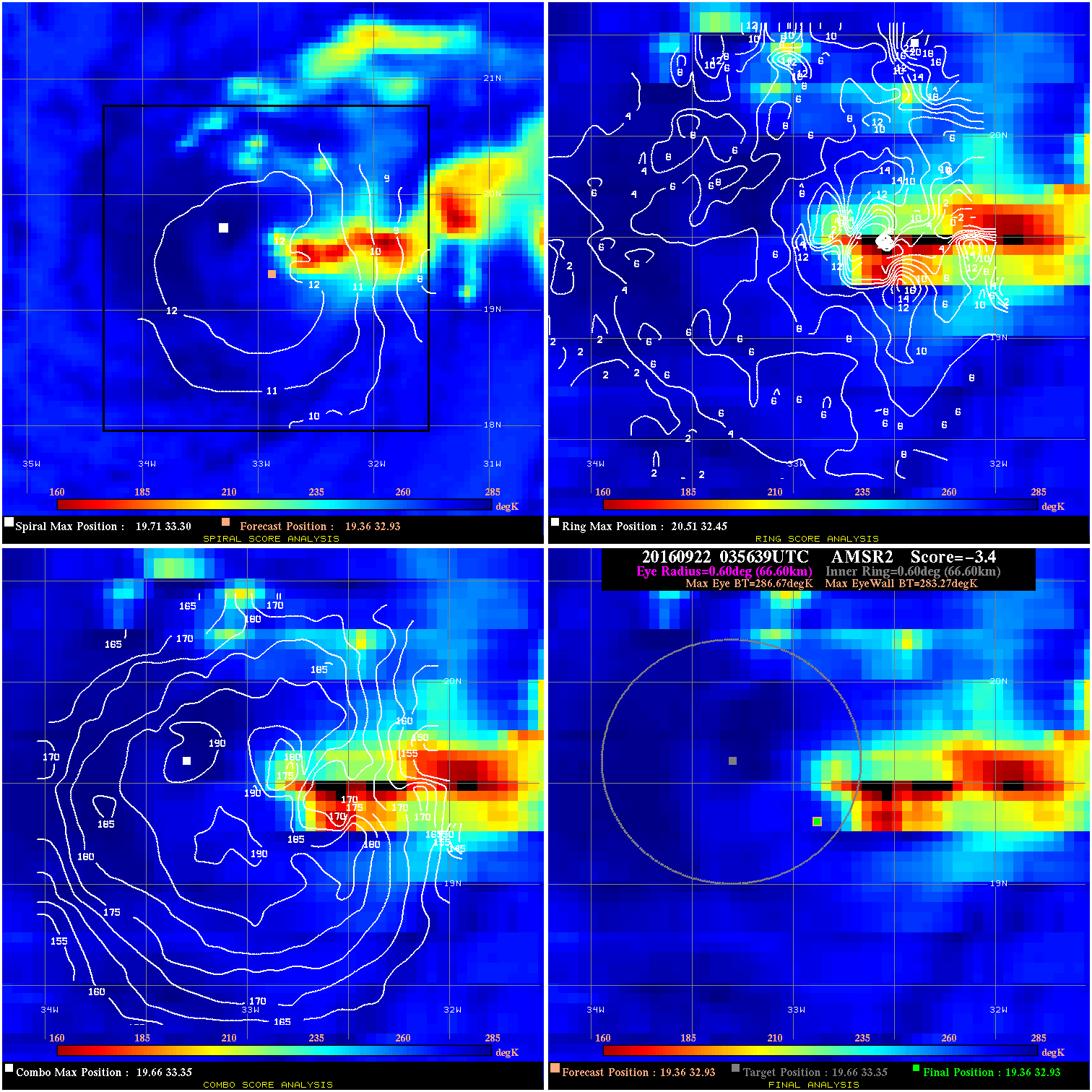
20160922 035639 -3.4 N/A 12.3% 133.32 3.40 40.0 AMSR2 19.4 32.9 19.4 32.9 19.7 33.3 Analysis Plot
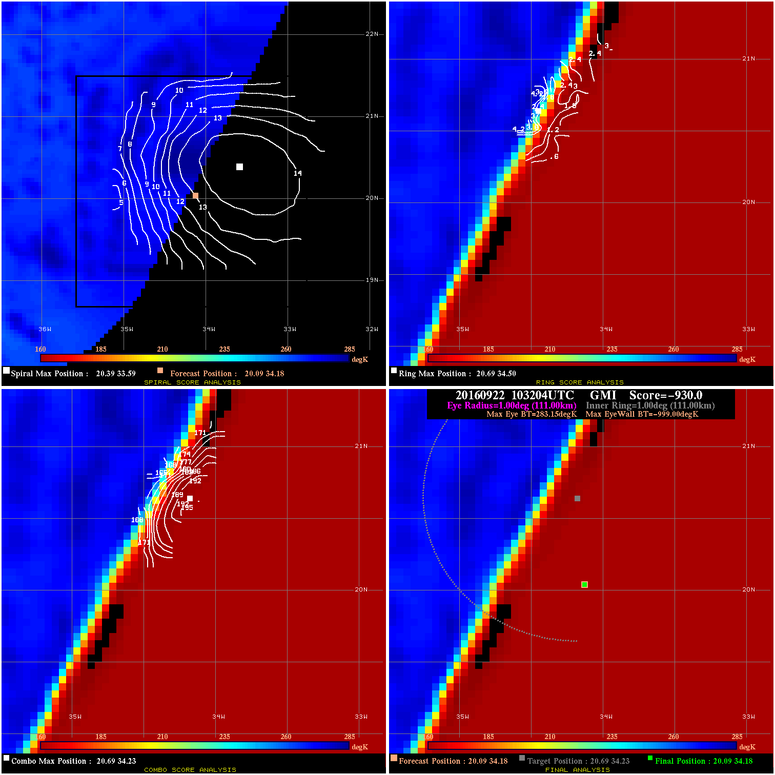
20160922 103204 -930.0 N/A N/A N/A 0.00 40.0 GMI 20.1 34.2 20.1 34.2 20.7 34.2 Analysis Plot
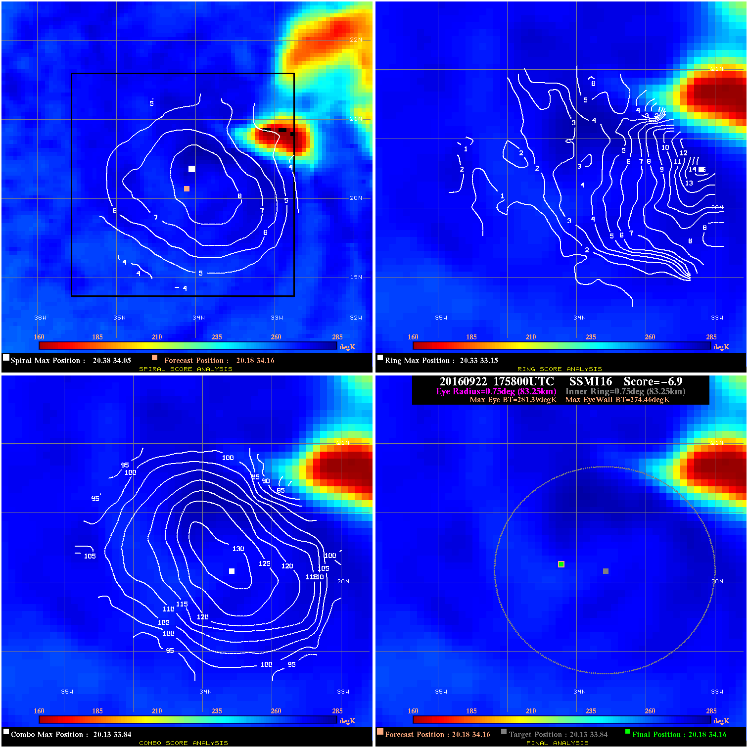
20160922 175800 -6.9 N/A 9.6% 166.65 6.93 45.0 SSMI16 20.2 34.2 20.2 34.2 20.1 33.8 Analysis Plot
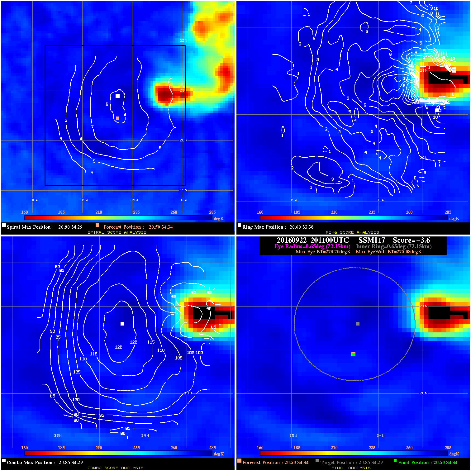
20160922 201100 -3.6 N/A 11.0% 144.43 3.62 45.0 SSMI17 20.5 34.3 20.5 34.3 20.9 34.3 Analysis Plot
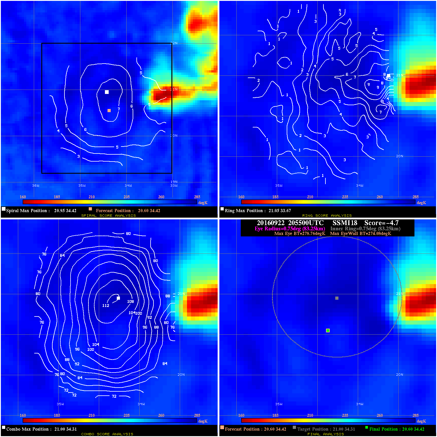
20160922 205500 -4.7 N/A 12.3% 166.65 4.68 45.0 SSMI18 20.6 34.4 20.6 34.4 21.0 34.3 Analysis Plot
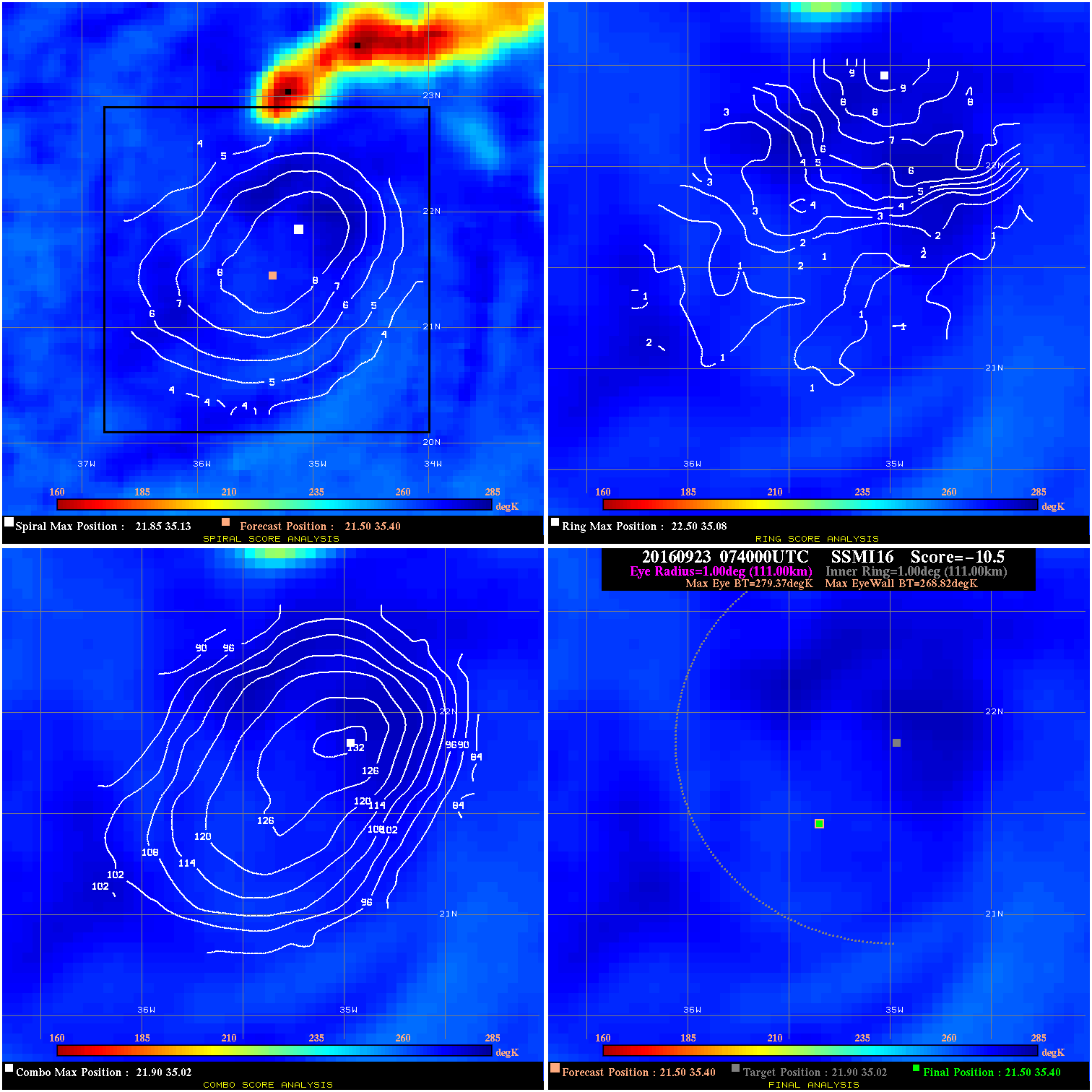
20160923 074000 -10.5 N/A 8.2% 222.20 10.55 35.0 SSMI16 21.5 35.4 21.5 35.4 21.9 35.0 Analysis Plot
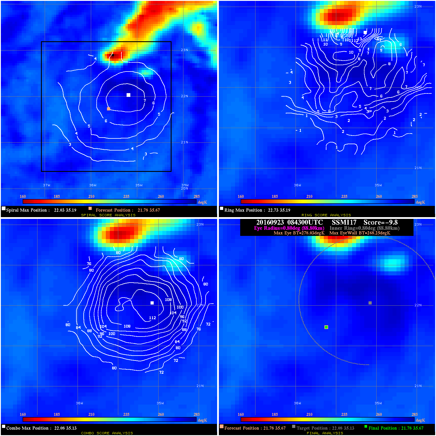
20160923 084300 -9.8 N/A 13.7% 177.76 9.78 35.0 SSMI17 21.8 35.7 21.8 35.7 22.1 35.1 Analysis Plot
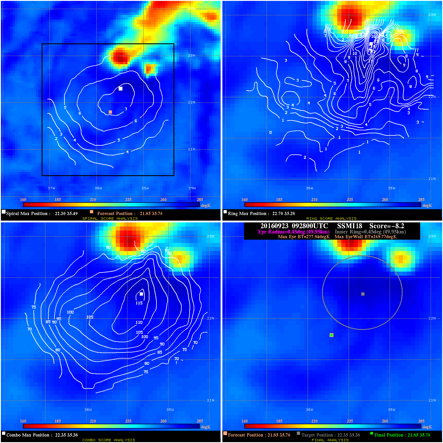
20160923 092800 -8.2 N/A 15.1% 99.99 8.17 35.0 SSMI18 21.9 35.8 21.9 35.8 22.4 35.4 Analysis Plot
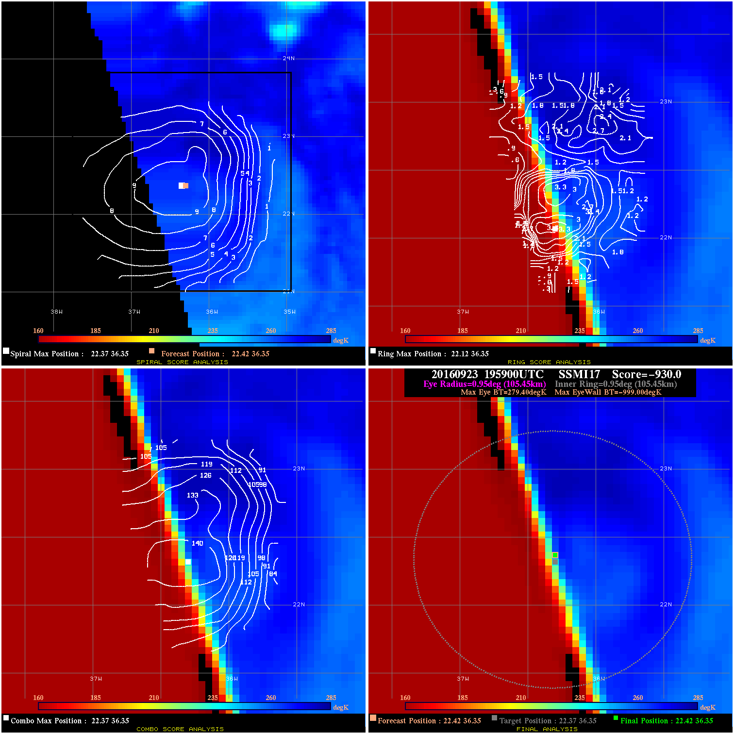
20160923 195900 -930.0 N/A N/A N/A 0.00 30.0 SSMI17 22.4 36.3 22.4 36.3 22.4 36.3 Analysis Plot
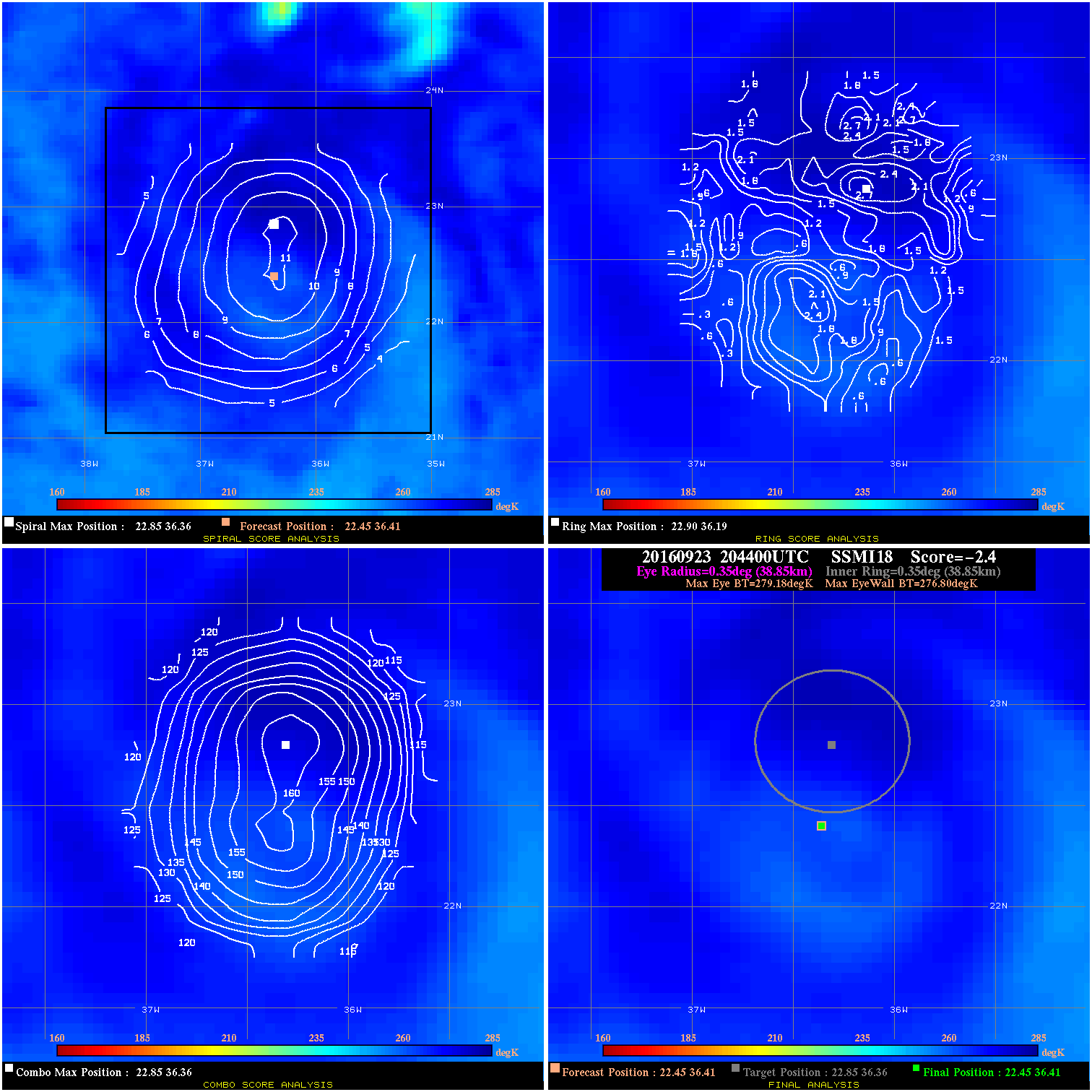
20160923 204400 -2.4 N/A N/A 77.77 2.38 30.0 SSMI18 22.5 36.4 22.5 36.4 22.9 36.4 Analysis Plot
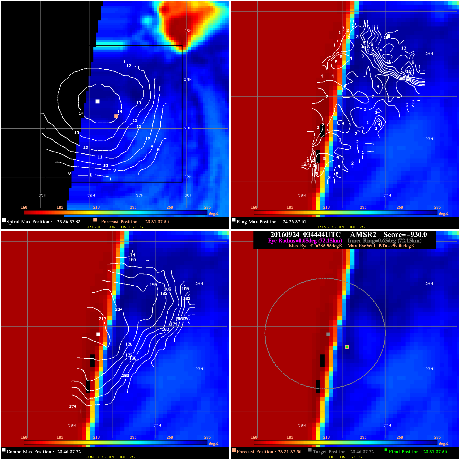
20160924 034444 -930.0 N/A N/A N/A 0.00 35.0 AMSR2 23.3 37.5 23.3 37.5 23.5 37.7 Analysis Plot
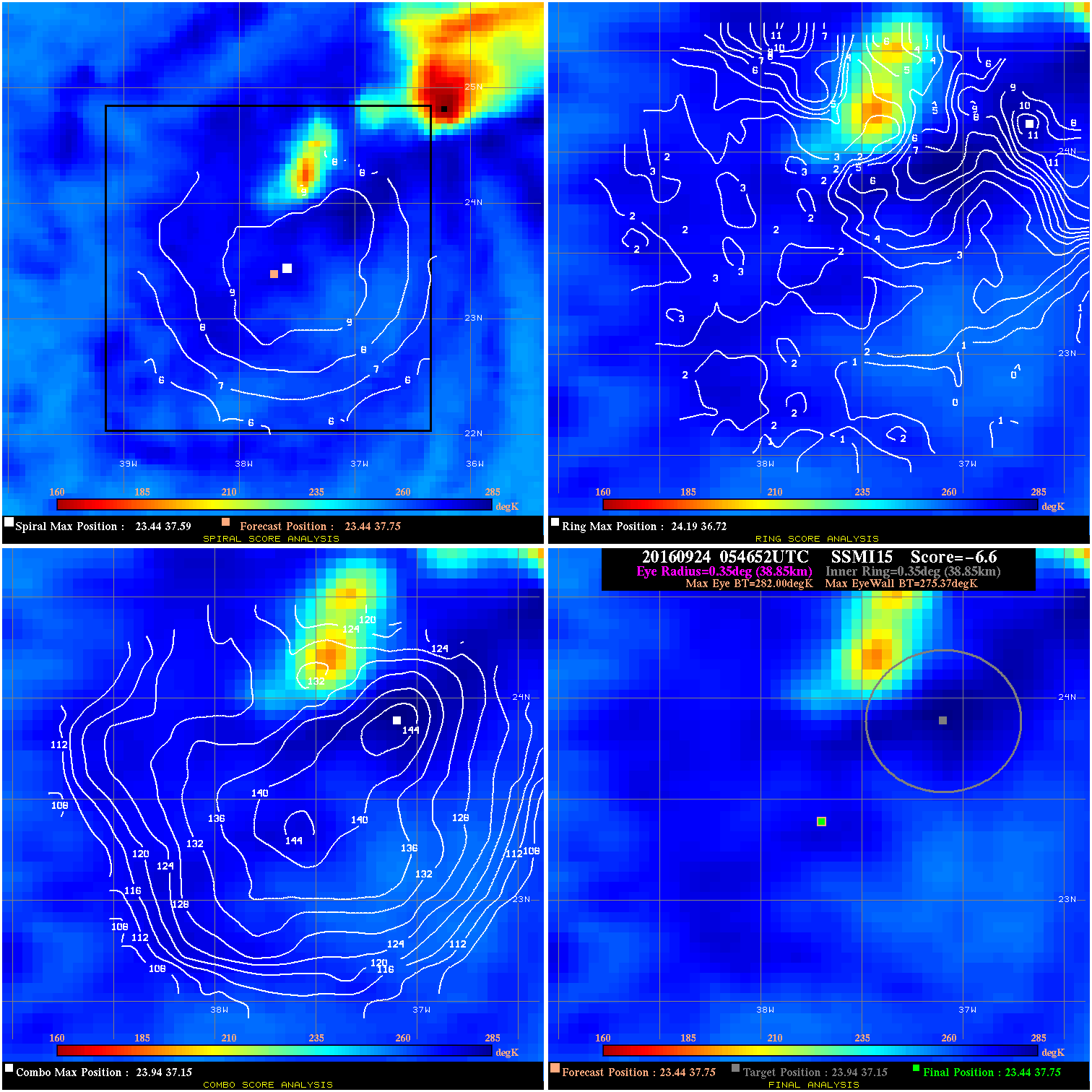
20160924 054652 -6.6 N/A 6.8% 77.77 6.63 35.0 SSMI15 23.4 37.8 23.4 37.8 23.9 37.2 Analysis Plot
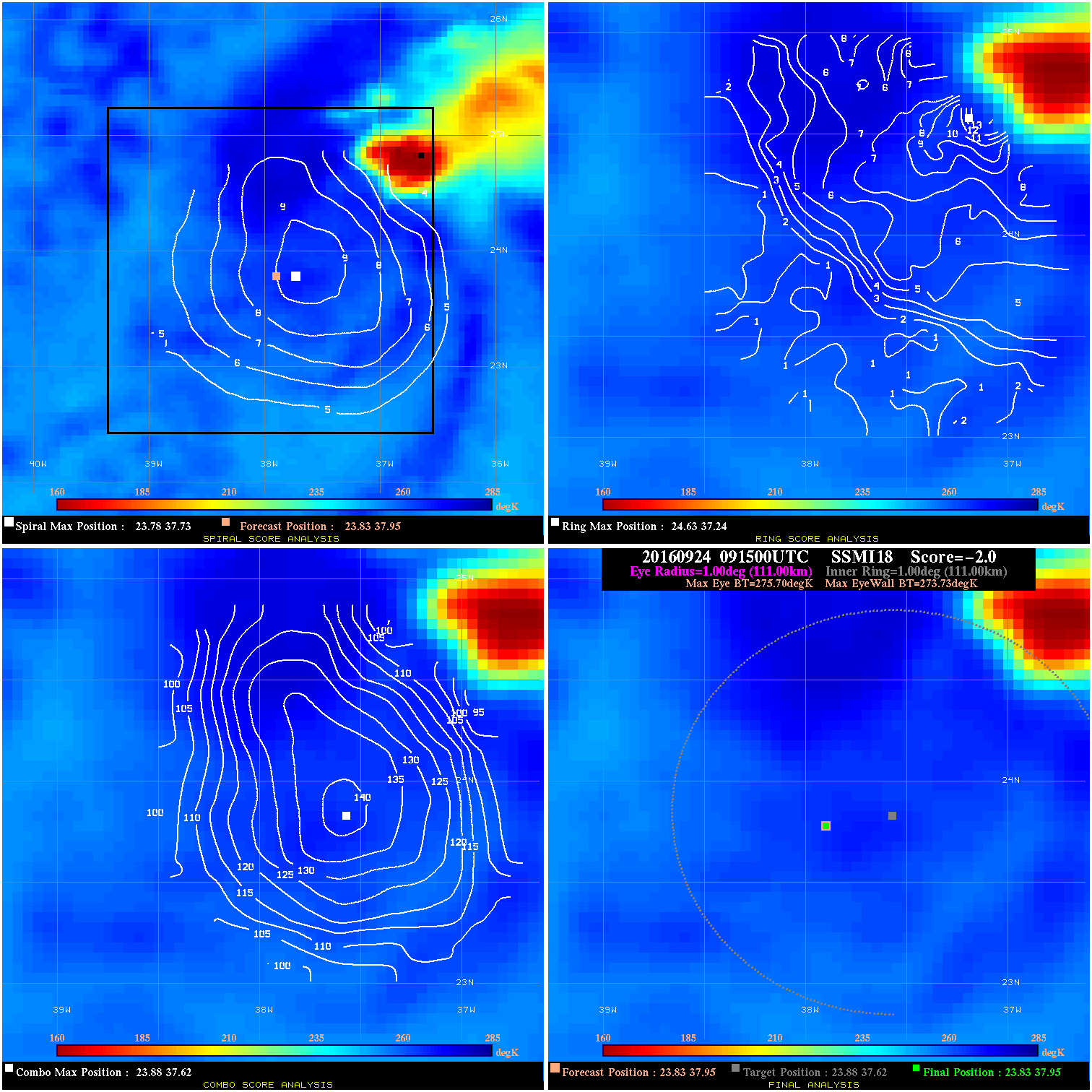
20160924 091500 -2.0 N/A 9.6% 222.20 1.97 30.0 SSMI18 23.8 38.0 23.8 38.0 23.9 37.6 Analysis Plot
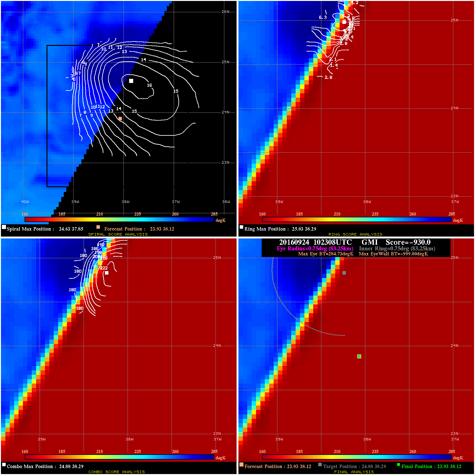
20160924 102308 -930.0 N/A N/A N/A 0.00 30.0 GMI 23.9 38.1 23.9 38.1 24.9 38.3 Analysis Plot
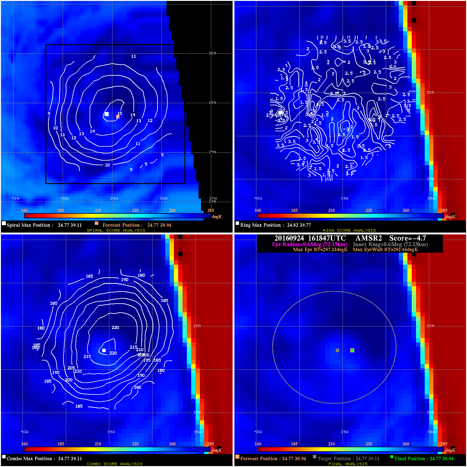
20160924 161847 -4.7 N/A N/A 144.43 4.66 40.0 AMSR2 24.8 38.9 24.8 38.9 24.8 39.1 Analysis Plot
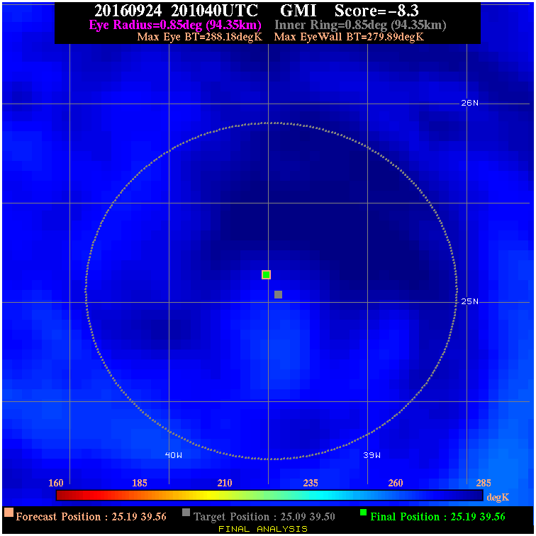
20160924 201040 -8.3 N/A N/A 188.87 8.29 30.0 GMI 25.2 39.6 25.2 39.6 25.1 39.5 Analysis Plot
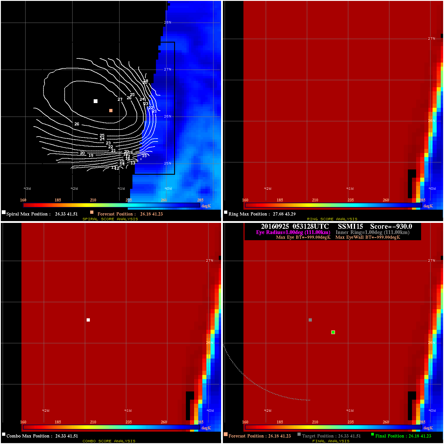
20160925 053128 -0.0 N/A N/A N/A 0.00 30.0 SSMI15 26.2 41.2 26.2 41.2 26.3 41.5 Analysis Plot
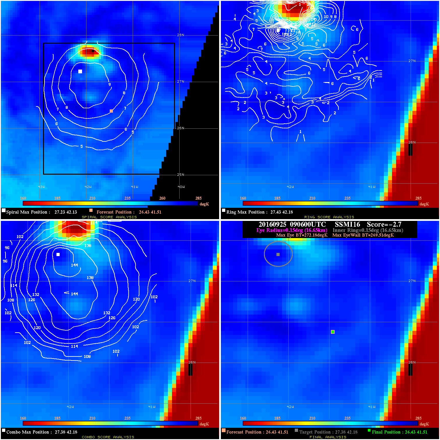
20160925 090600 -2.7 N/A 19.2% 33.33 2.67 30.0 SSMI16 26.4 41.5 26.4 41.5 27.4 42.2 Analysis Plot
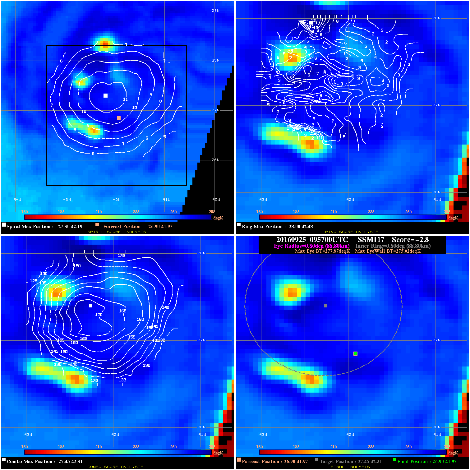
20160925 095700 -2.8 N/A N/A 177.76 2.85 30.0 SSMI17 26.9 42.0 26.9 42.0 27.5 42.3 Analysis Plot
|
|
Legend: - Date/Time are determined from PMW imagery at Forecast (initial guess) Lat/Lon position. - Positive/Negative Latitude = North/South Hemisphere; Longitude = Western/Eastern Hemisphere. - "Ring Diam" value indicates the estimated surface eyewall diameter in km (the MI eyewall edge diameter minus 10 km). - "Ring Pct" is the percentage of the "ring" (eyewall inner boundary) that is 1) colder than the "hot spot" (warmest eye pixel) in the eye by 20K, or 2) the percentage that is a) colder than 232K and b) colder than the "hot spot" by 10K, whichever is greater. - Values are red if Ring % <= 65, yellow/brown if Ring % <= 85 and green if Ring % > 85. - "Tb diff" is the difference between the "hot spot" (warmest eye pixel) and the warmest pixel on the eyewall. - Intensity score are listed as negative, and not used, when the JTWC or NHC estimated Vmax is <55 kts in order to rule out weak but highly symmetric TCs. - Error messages in intensity scores: -920 is used when the hottest pixel in the eye is <200K, to prevent false positives; -930 means <85% of eyewall has observations/data. |