Tropical Depression 01W
|
Passive Microwave (PMW) Intensity Information Advanced Dvorak Technique (ADT) Version 8.2.1 |
Overpass Inten Ring Ring Wind Forecast Final Target
Date Time Score Meaning Pct Diam BTdiff Est Sat Lat Lon Lat Lon Lat Lon
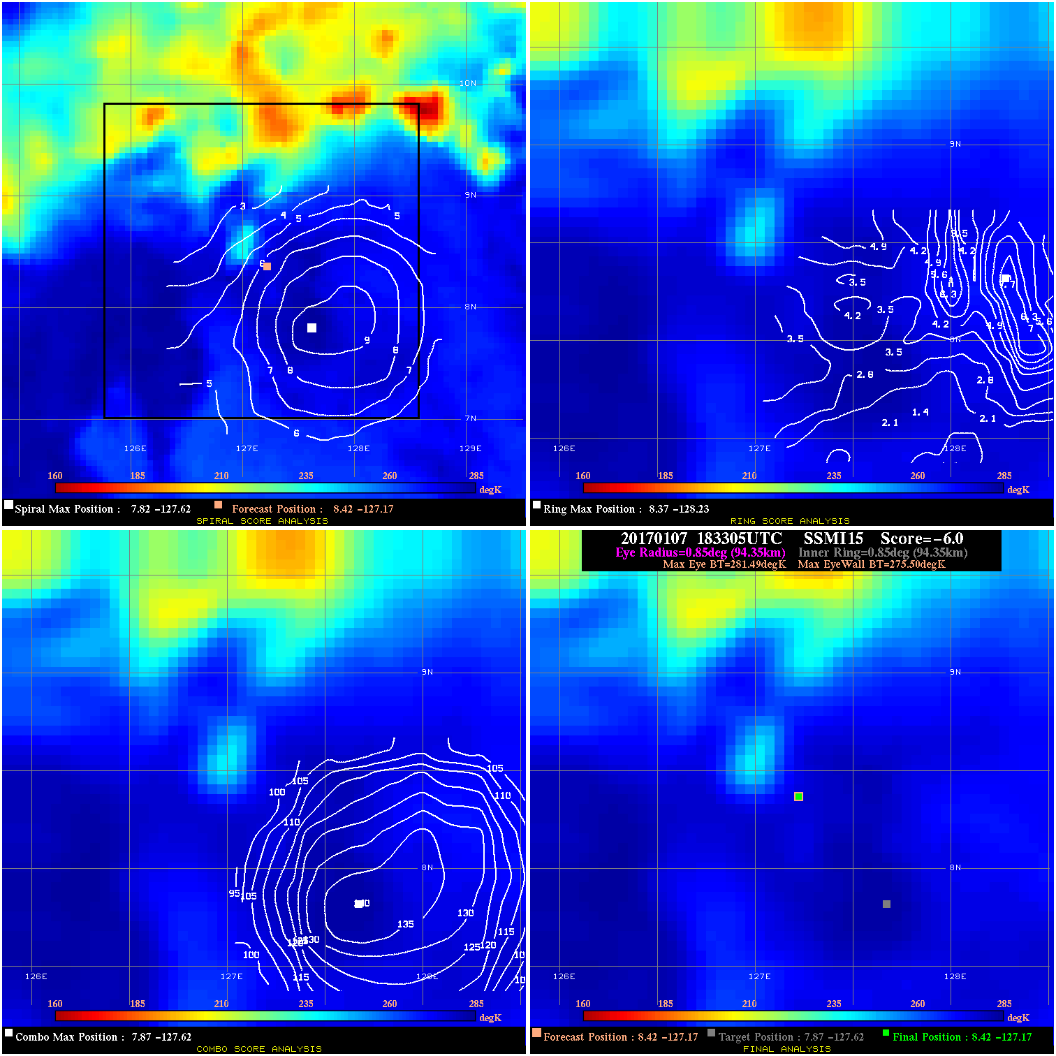
20170107 183305 -6.0 N/A N/A 188.87 5.99 25.0 SSMI15 8.4 -127.2 8.4 -127.2 7.9 -127.6 Analysis Plot
20170107 222800 -930.0 N/A N/A N/A 0.00 25.0 SSMI17 8.9 -126.6 8.9 -126.6 8.4 -125.4 Analysis Plot
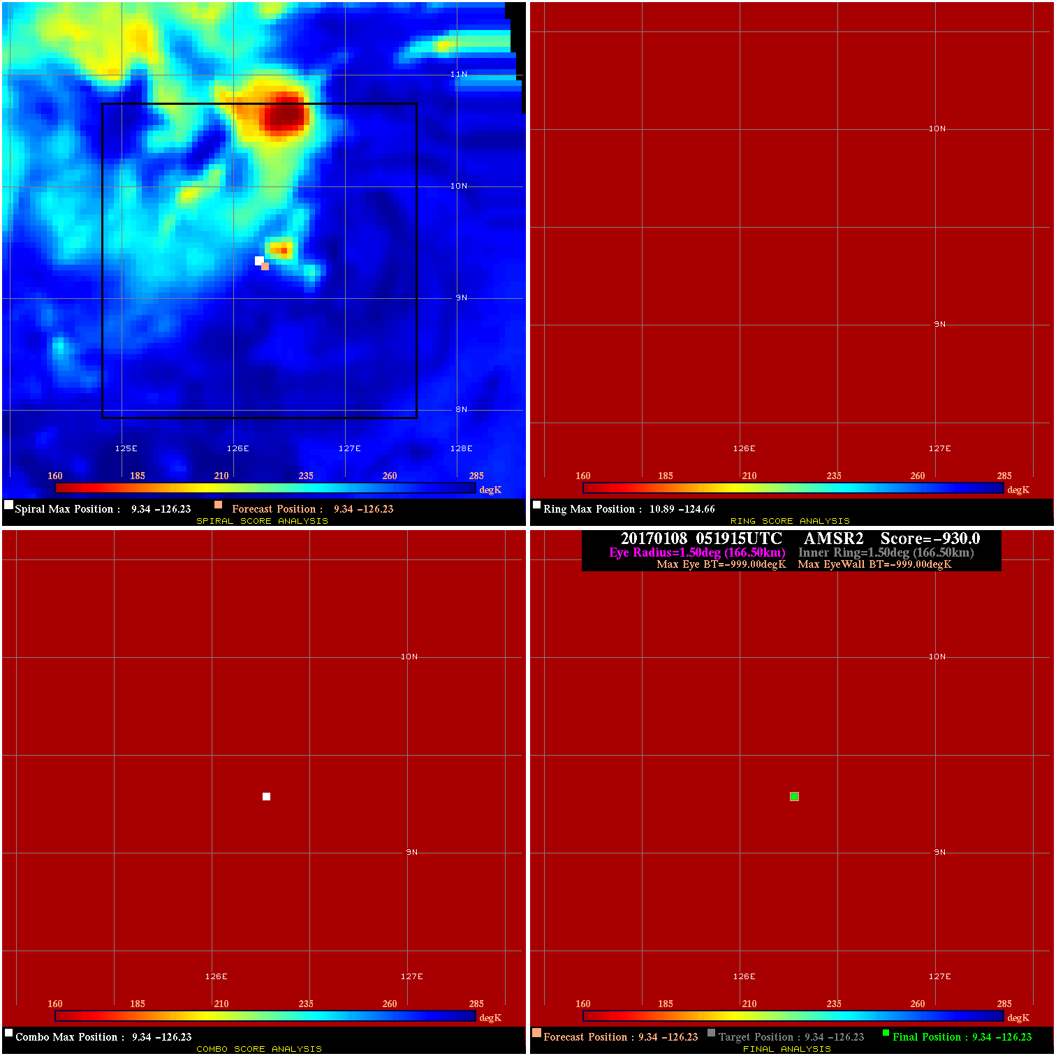
20170108 051915 -0.0 N/A N/A N/A 0.00 25.0 AMSR2 9.3 -126.2 9.3 -126.2 9.3 -126.2 Analysis Plot
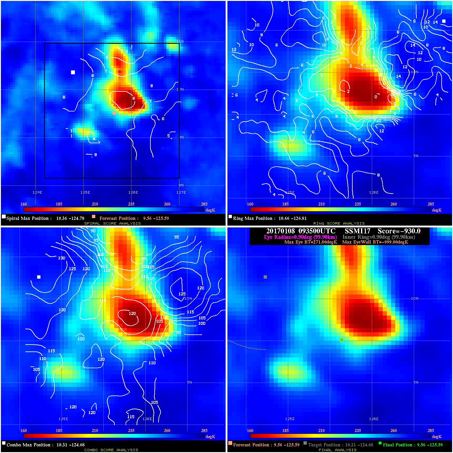
20170108 093500 -930.0 N/A N/A N/A 0.00 25.0 SSMI17 9.6 -125.6 9.6 -125.6 10.3 -124.7 Analysis Plot
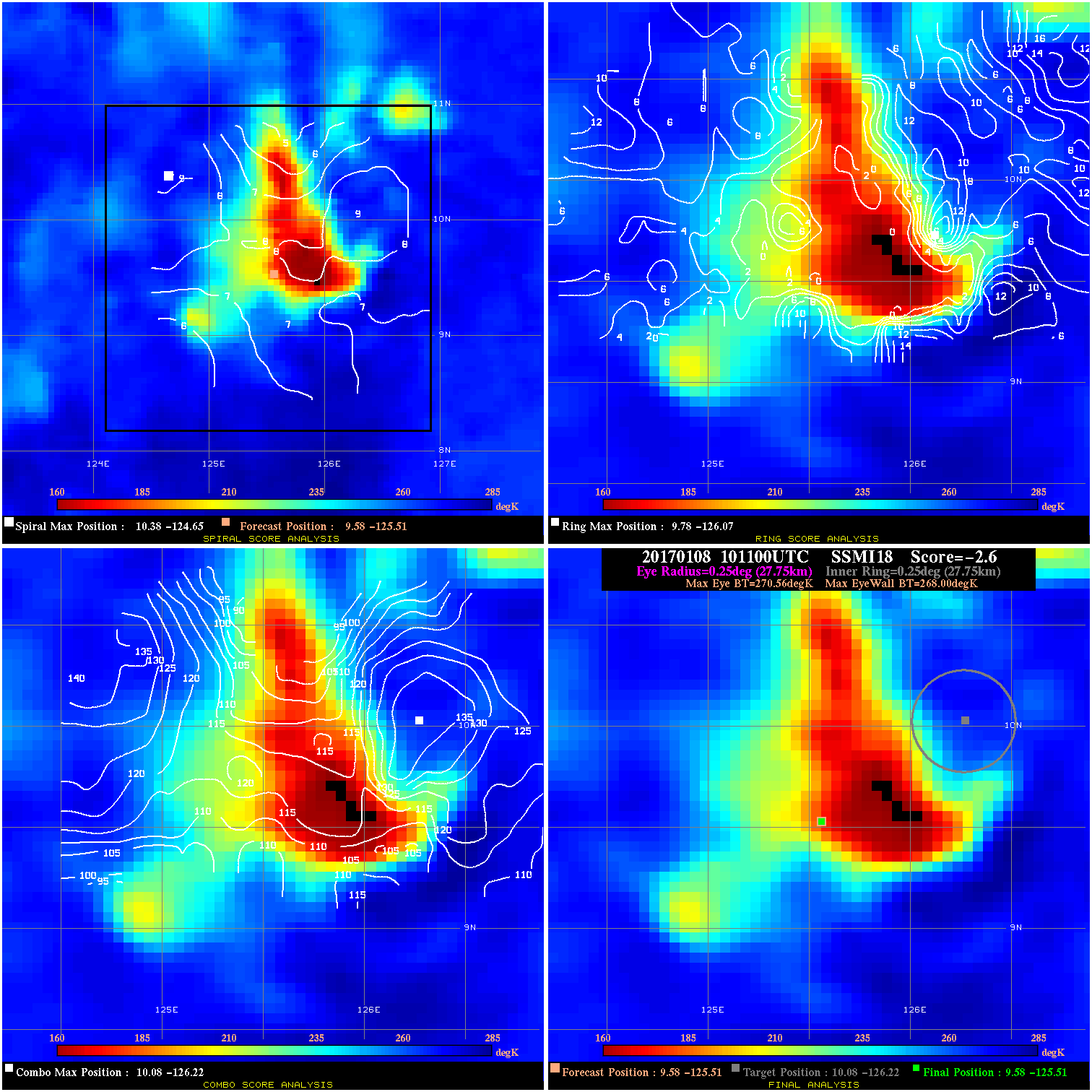
20170108 101100 -2.6 N/A 23.3% 55.55 2.56 25.0 SSMI18 9.6 -125.5 9.6 -125.5 10.1 -126.2 Analysis Plot
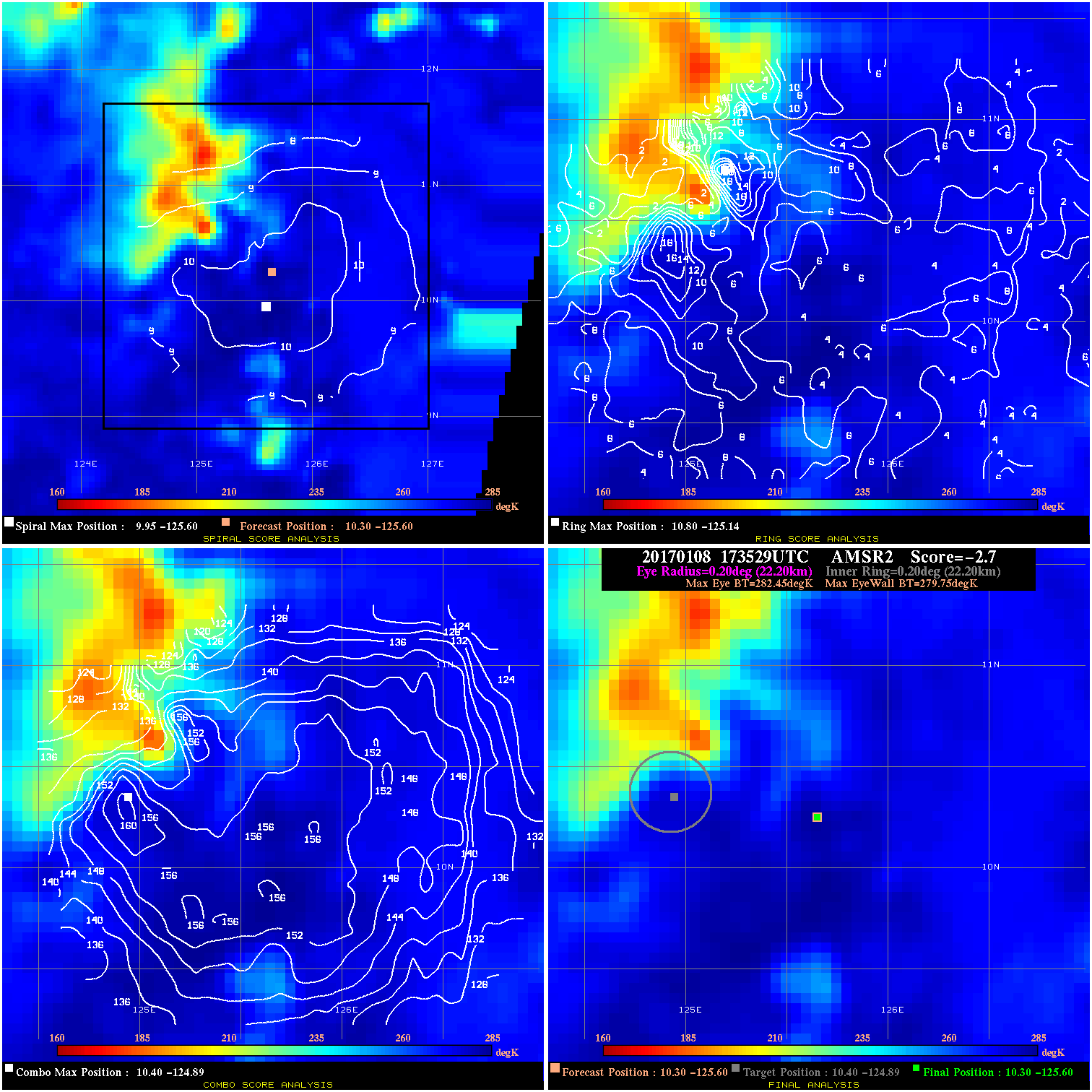
20170108 173529 -2.7 N/A 35.6% 44.44 2.70 30.0 AMSR2 10.3 -125.6 10.3 -125.6 10.4 -124.9 Analysis Plot
20170108 211900 -930.0 N/A N/A N/A 0.00 30.0 SSMI16 10.3 -125.4 10.3 -125.4 10.4 -125.0 Analysis Plot
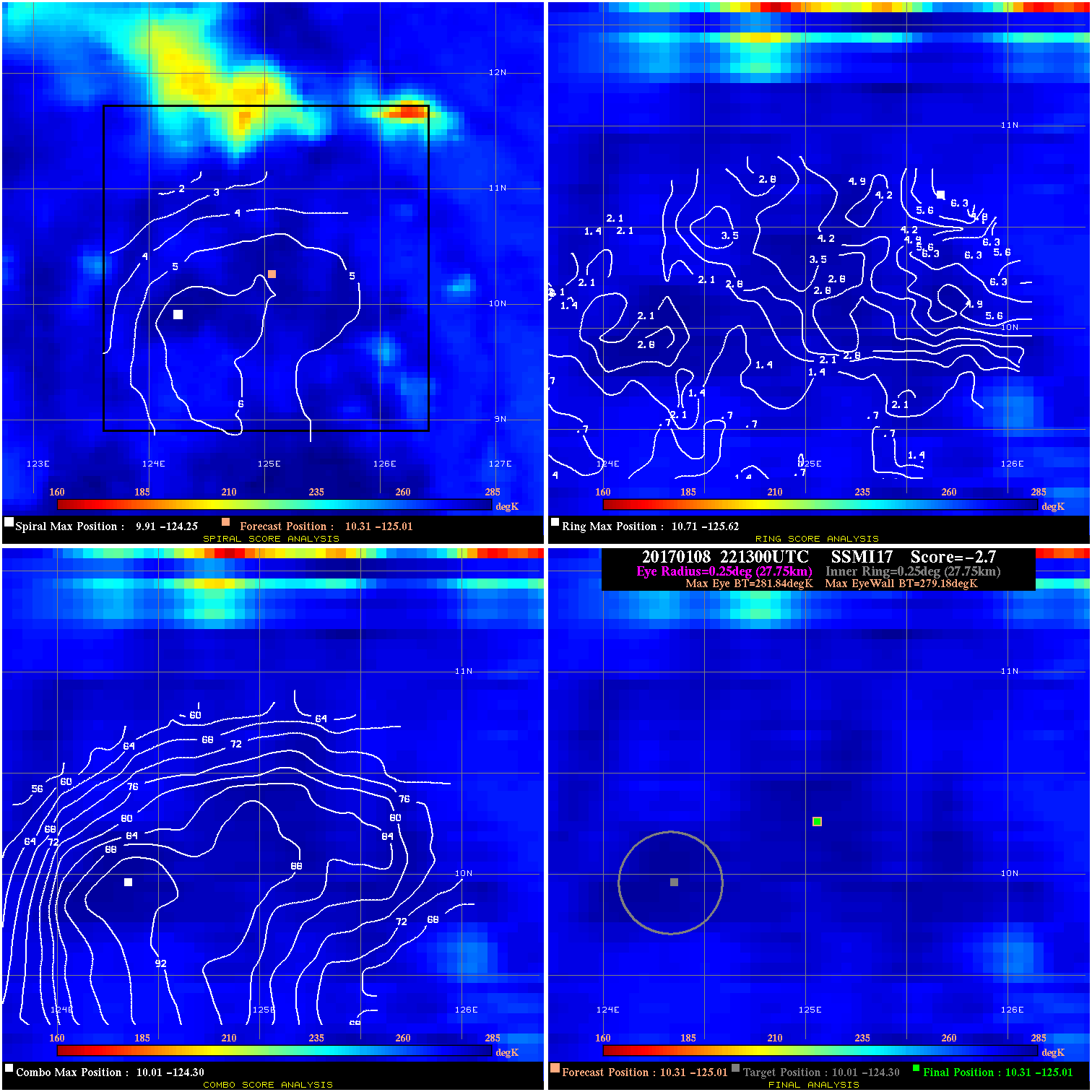
20170108 221300 -2.7 N/A N/A 55.55 2.66 30.0 SSMI17 10.3 -125.0 10.3 -125.0 10.0 -124.3 Analysis Plot
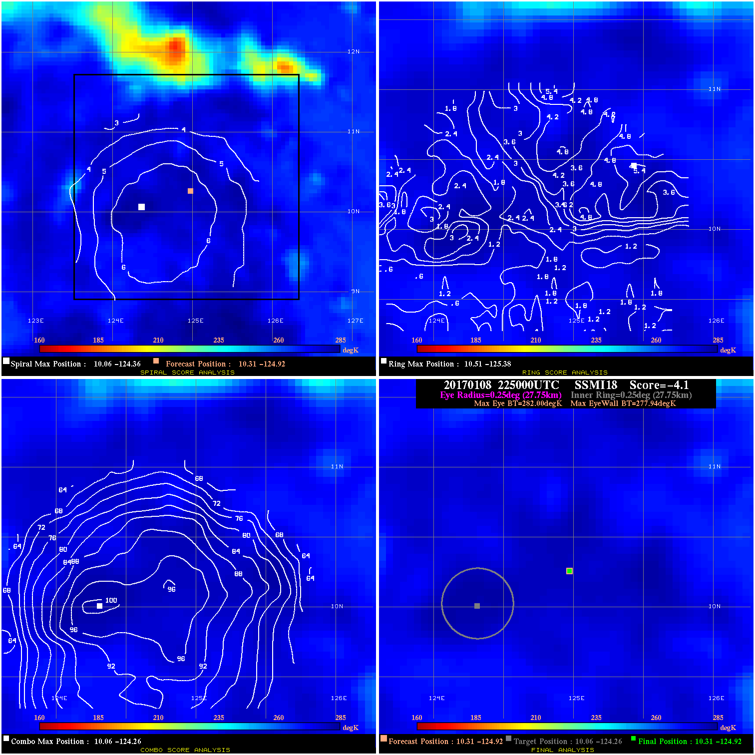
20170108 225000 -4.1 N/A N/A 55.55 4.06 30.0 SSMI18 10.3 -124.9 10.3 -124.9 10.1 -124.3 Analysis Plot
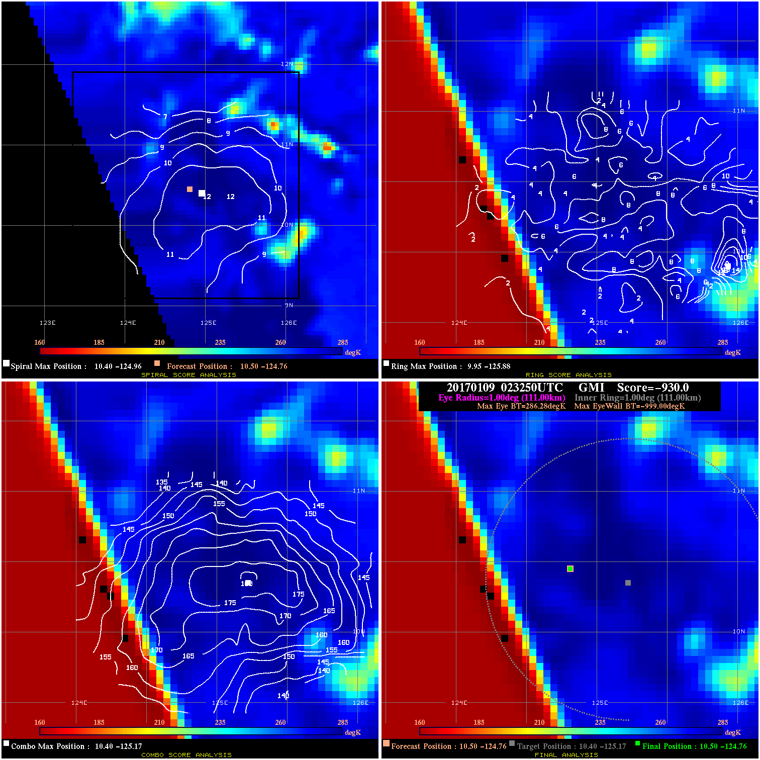
20170109 023250 -930.0 N/A N/A N/A 0.00 25.0 GMI 10.5 -124.8 10.5 -124.8 10.4 -125.2 Analysis Plot
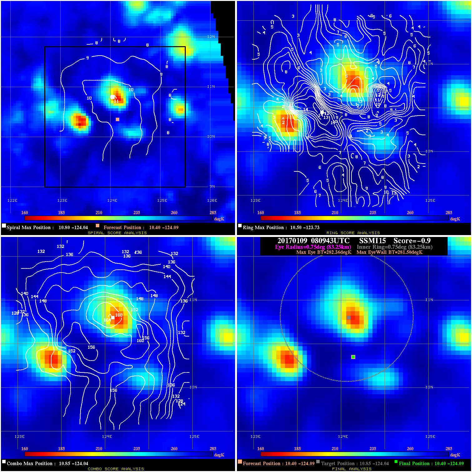
20170109 080943 -0.9 N/A 4.1% 166.65 .86 20.0 SSMI15 10.4 -124.1 10.4 -124.1 10.9 -124.0 Analysis Plot
20170109 100000 -0.0 N/A 15.1% 44.44 .04 20.0 SSMI18 10.3 -123.5 10.3 -123.5 10.5 -123.5 Analysis Plot
20170109 154637 -930.0 N/A N/A N/A 0.00 20.0 GMI 10.1 -122.5 10.1 -122.5 10.0 -122.1 Analysis Plot
20170109 205800 -930.0 N/A N/A N/A 0.00 20.0 SSMI16 10.1 -121.9 10.1 -121.9 10.5 -122.3 Analysis Plot
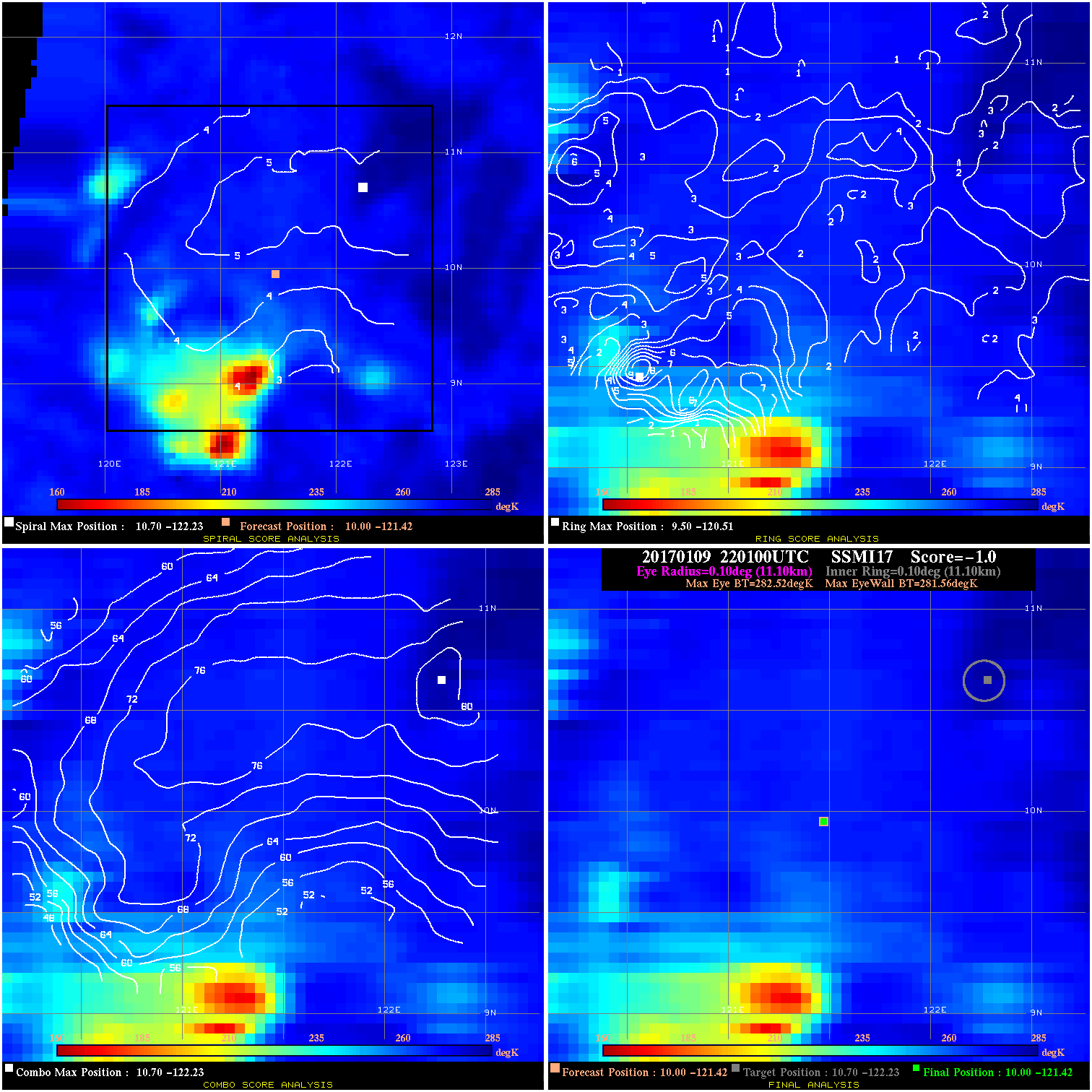
20170109 220100 -1.0 N/A N/A 22.22 .96 20.0 SSMI17 10.0 -121.4 10.0 -121.4 10.7 -122.2 Analysis Plot
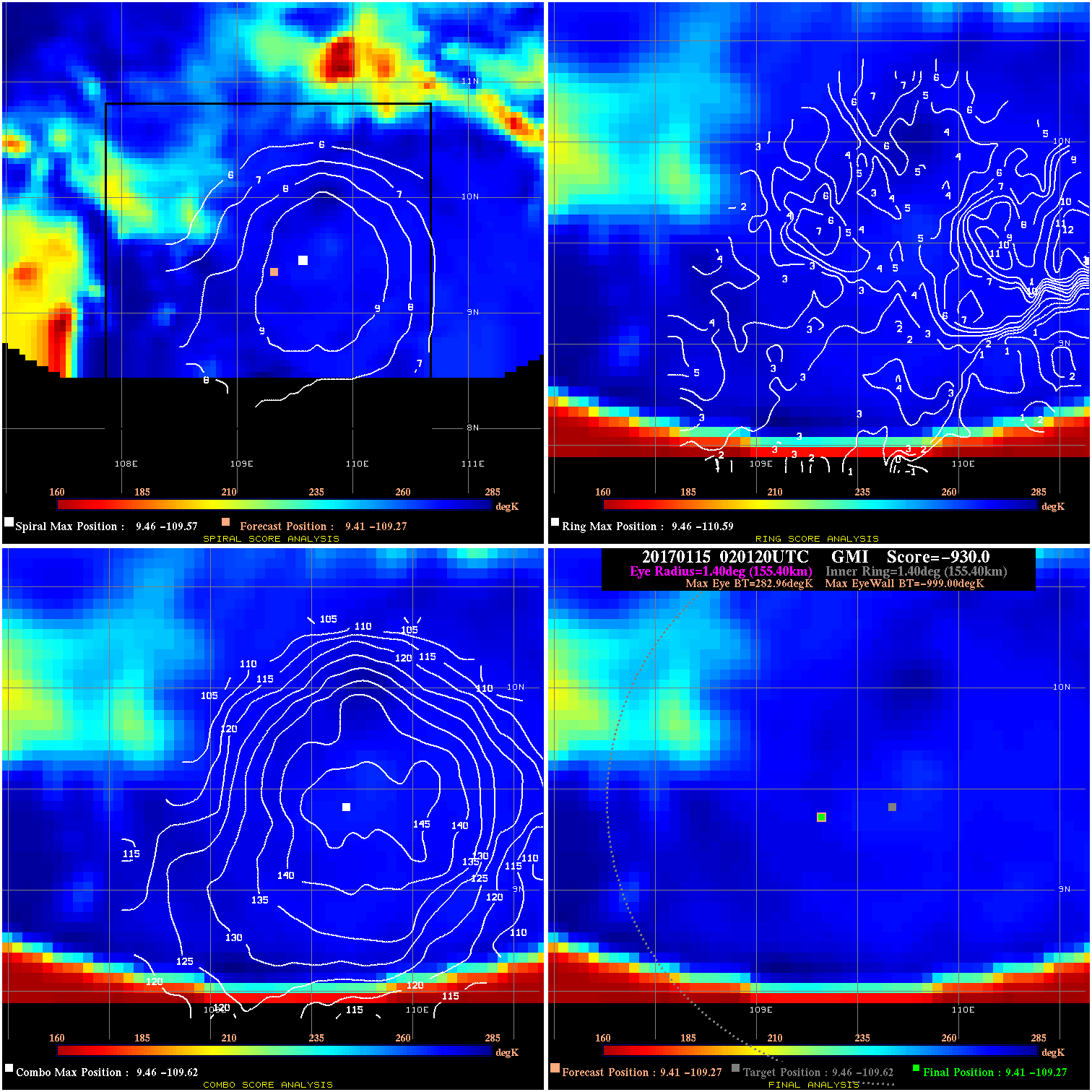
20170115 020120 -930.0 N/A N/A N/A 0.00 30.0 GMI 9.4 -109.3 9.4 -109.3 9.5 -109.6 Analysis Plot
20170115 112500 -3.3 N/A 52.1% 88.88 3.29 30.0 SSMI17 9.7 -108.6 9.7 -108.6 9.8 -108.8 Analysis Plot
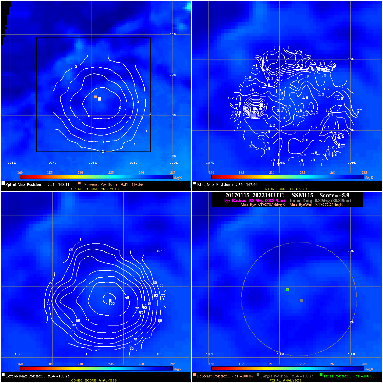
20170115 202214 -5.9 N/A N/A 177.76 5.93 25.0 SSMI15 9.5 -108.1 9.5 -108.1 9.4 -108.3 Analysis Plot
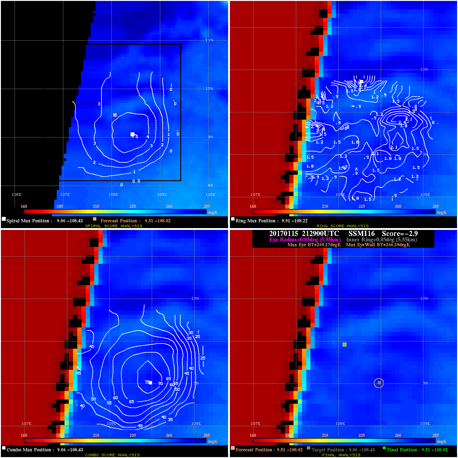
20170115 212900 -2.9 N/A N/A 11.11 2.88 25.0 SSMI16 9.5 -108.0 9.5 -108.0 9.1 -108.4 Analysis Plot
20170116 060840 -2.1 N/A 1.4% 144.43 2.12 25.0 AMSR2 8.9 -106.4 8.9 -106.4 8.8 -105.9 Analysis Plot
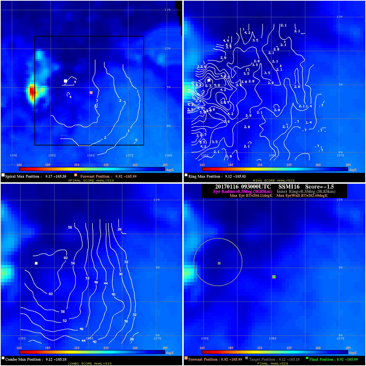
20170116 093000 -1.5 N/A 4.1% 77.77 1.51 25.0 SSMI16 8.9 -106.0 8.9 -106.0 9.1 -105.2 Analysis Plot
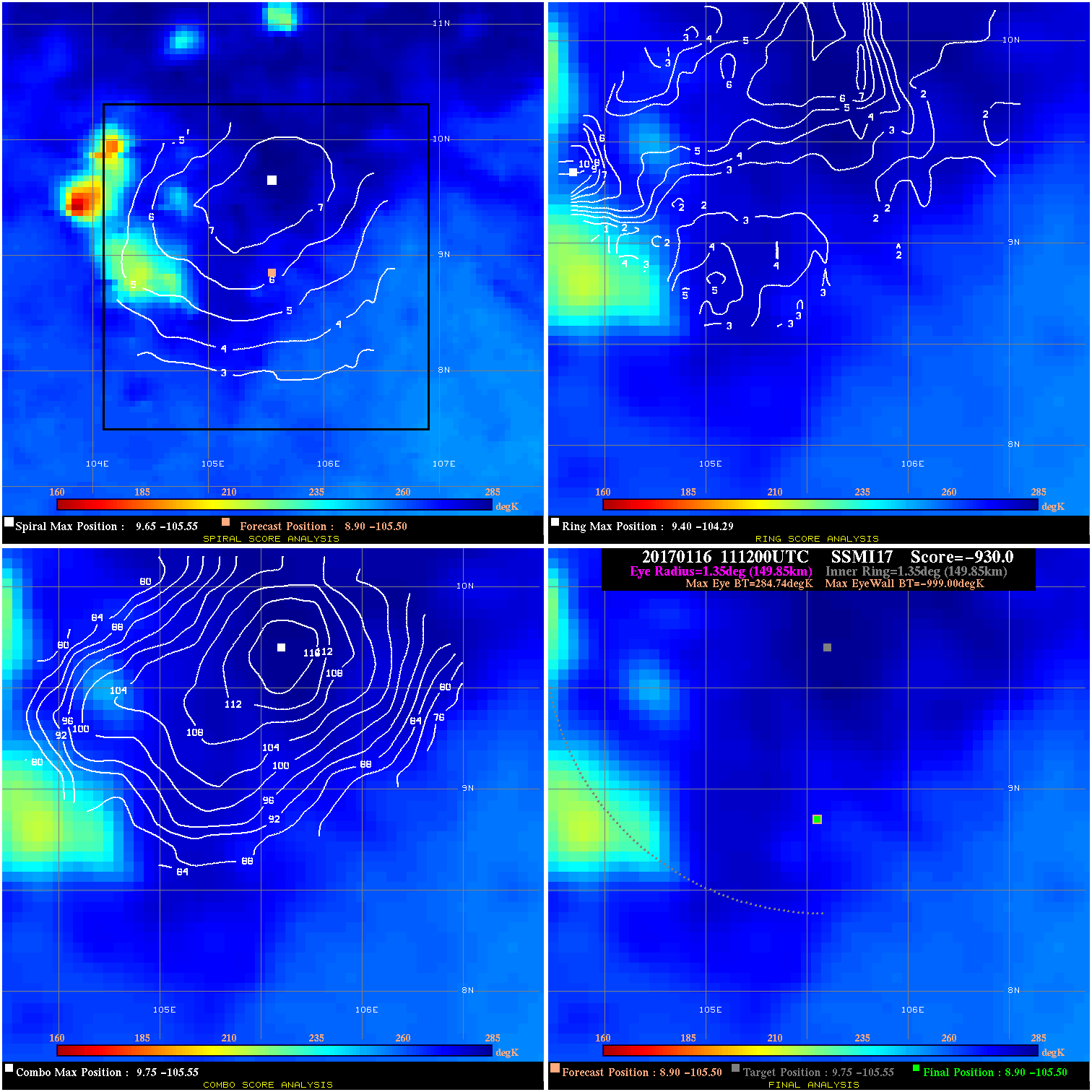
20170116 111200 -930.0 N/A N/A N/A 0.00 25.0 SSMI17 8.9 -105.5 8.9 -105.5 9.8 -105.6 Analysis Plot
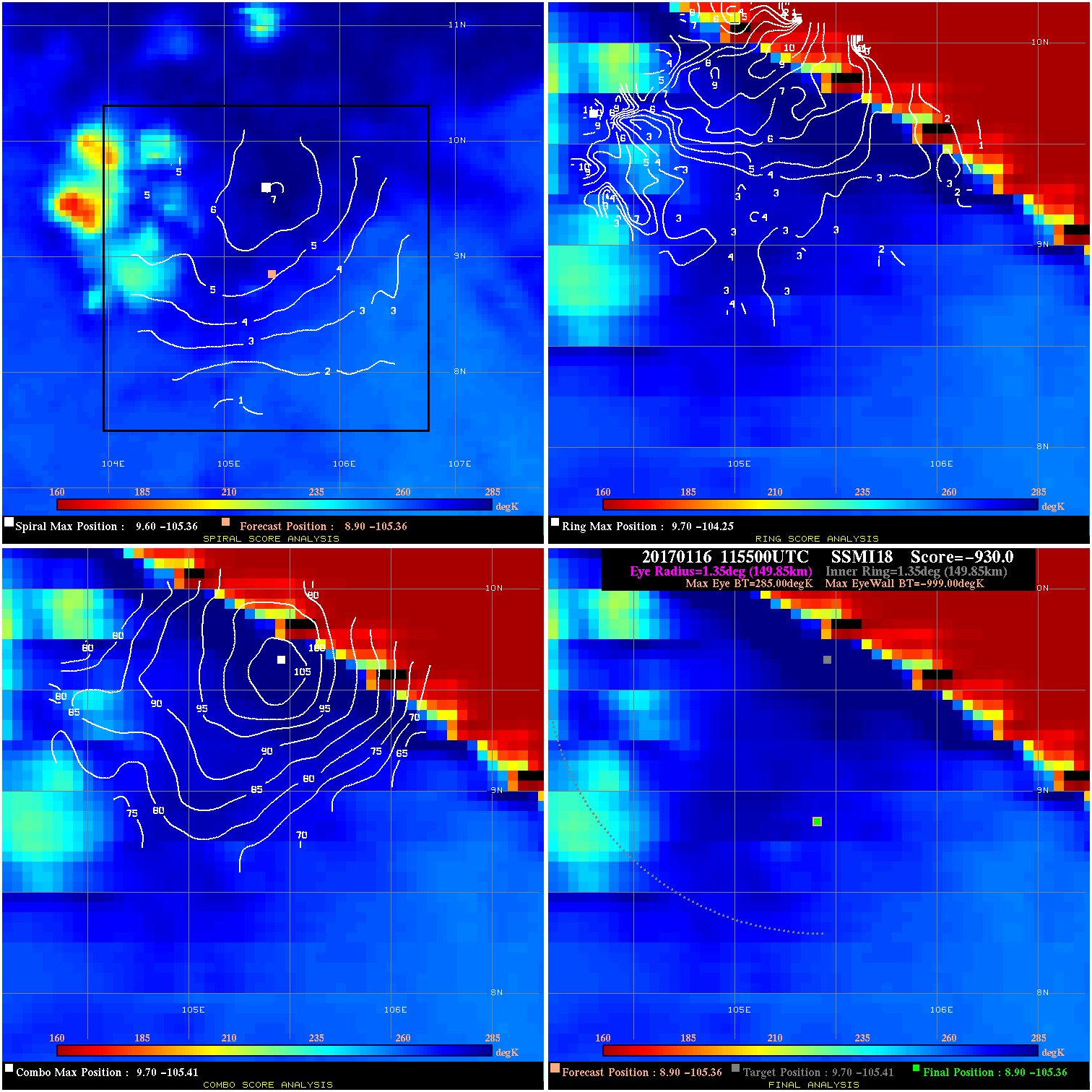
20170116 115500 -930.0 N/A N/A N/A 0.00 25.0 SSMI18 8.9 -105.4 8.9 -105.4 9.7 -105.4 Analysis Plot
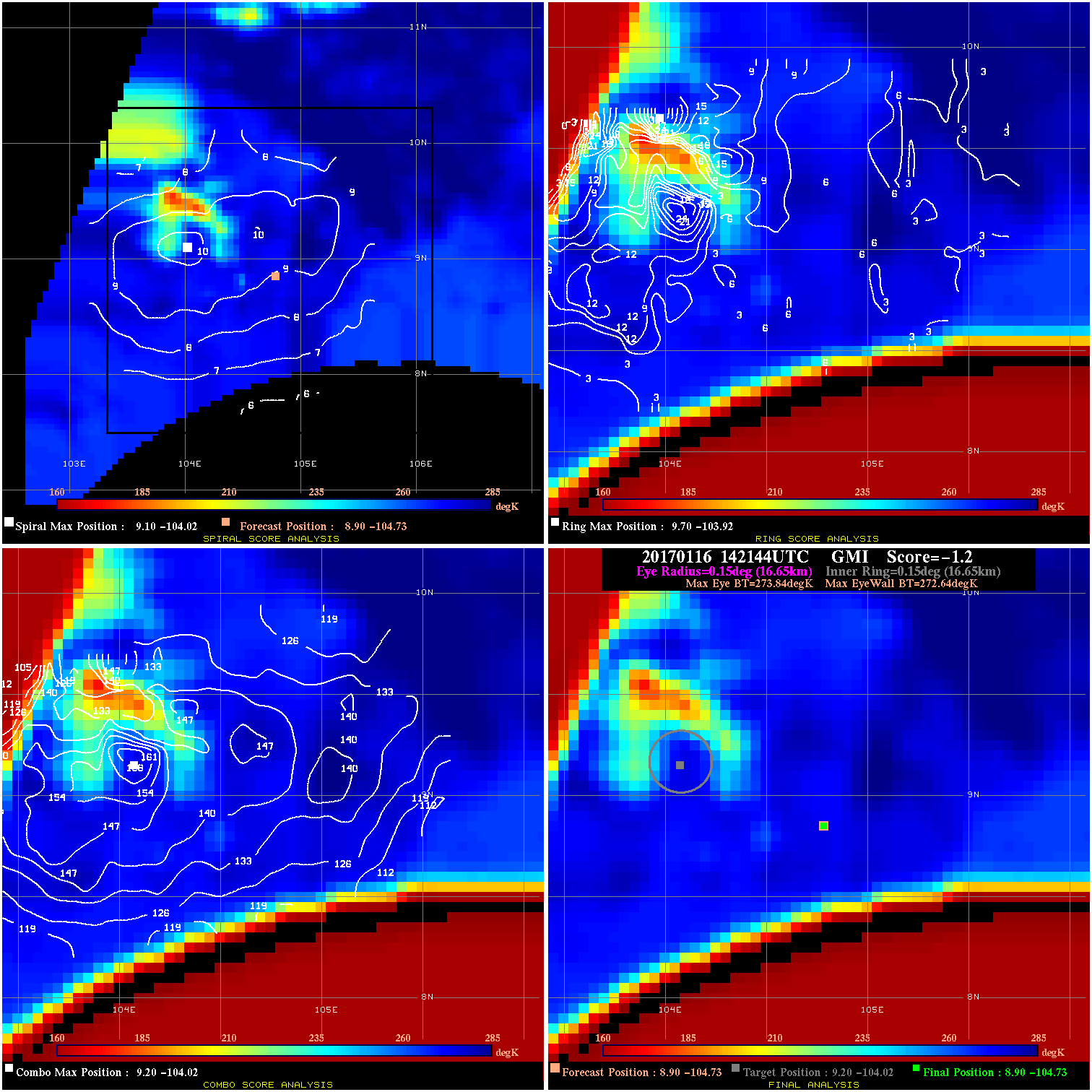
20170116 142144 -1.2 N/A 45.2% 33.33 1.20 25.0 GMI 8.9 -104.7 8.9 -104.7 9.2 -104.0 Analysis Plot
20170116 182530 -4.0 N/A 31.5% 22.22 3.96 25.0 AMSR2 8.9 -103.8 8.9 -103.8 9.5 -103.3 Analysis Plot
|
|
Legend: - Date/Time are determined from PMW imagery at Forecast (initial guess) Lat/Lon position. - Positive/Negative Latitude = North/South Hemisphere; Longitude = Western/Eastern Hemisphere. - "Ring Diam" value indicates the estimated surface eyewall diameter in km (the MI eyewall edge diameter minus 10 km). - "Ring Pct" is the percentage of the "ring" (eyewall inner boundary) that is 1) colder than the "hot spot" (warmest eye pixel) in the eye by 20K, or 2) the percentage that is a) colder than 232K and b) colder than the "hot spot" by 10K, whichever is greater. - Values are red if Ring % <= 65, yellow/brown if Ring % <= 85 and green if Ring % > 85. - "Tb diff" is the difference between the "hot spot" (warmest eye pixel) and the warmest pixel on the eyewall. - Intensity score are listed as negative, and not used, when the JTWC or NHC estimated Vmax is <55 kts in order to rule out weak but highly symmetric TCs. - Error messages in intensity scores: -920 is used when the hottest pixel in the eye is <200K, to prevent false positives; -930 means <85% of eyewall has observations/data. |