Tropical Storm 03B
|
Passive Microwave (PMW) Intensity Information Advanced Dvorak Technique (ADT) Version 8.2.1 |
Overpass Inten Ring Ring Wind Forecast Final Target
Date Time Score Meaning Pct Diam BTdiff Est Sat Lat Lon Lat Lon Lat Lon
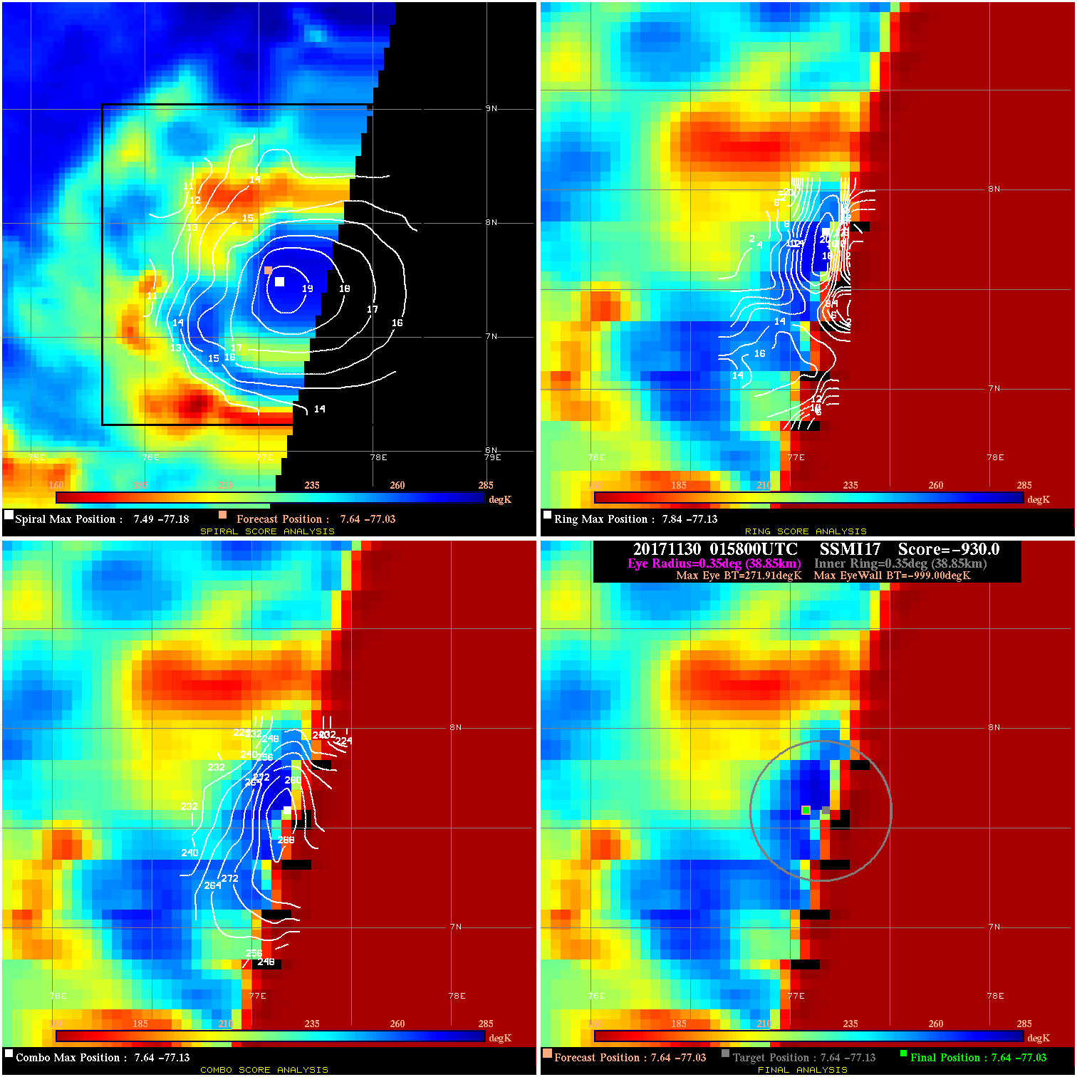
20171130 015800 -930.0 N/A N/A N/A 0.00 40.0 SSMI17 7.6 -77.0 7.6 -77.0 7.6 -77.1 Analysis Plot
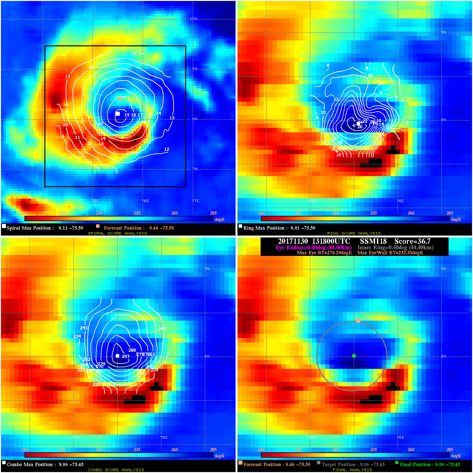
20171130 131800 36.7 >65 kts 100.0% 88.88 21.67 55.0 SSMI18 8.5 -75.5 8.1 -75.4 8.1 -75.4 Analysis Plot
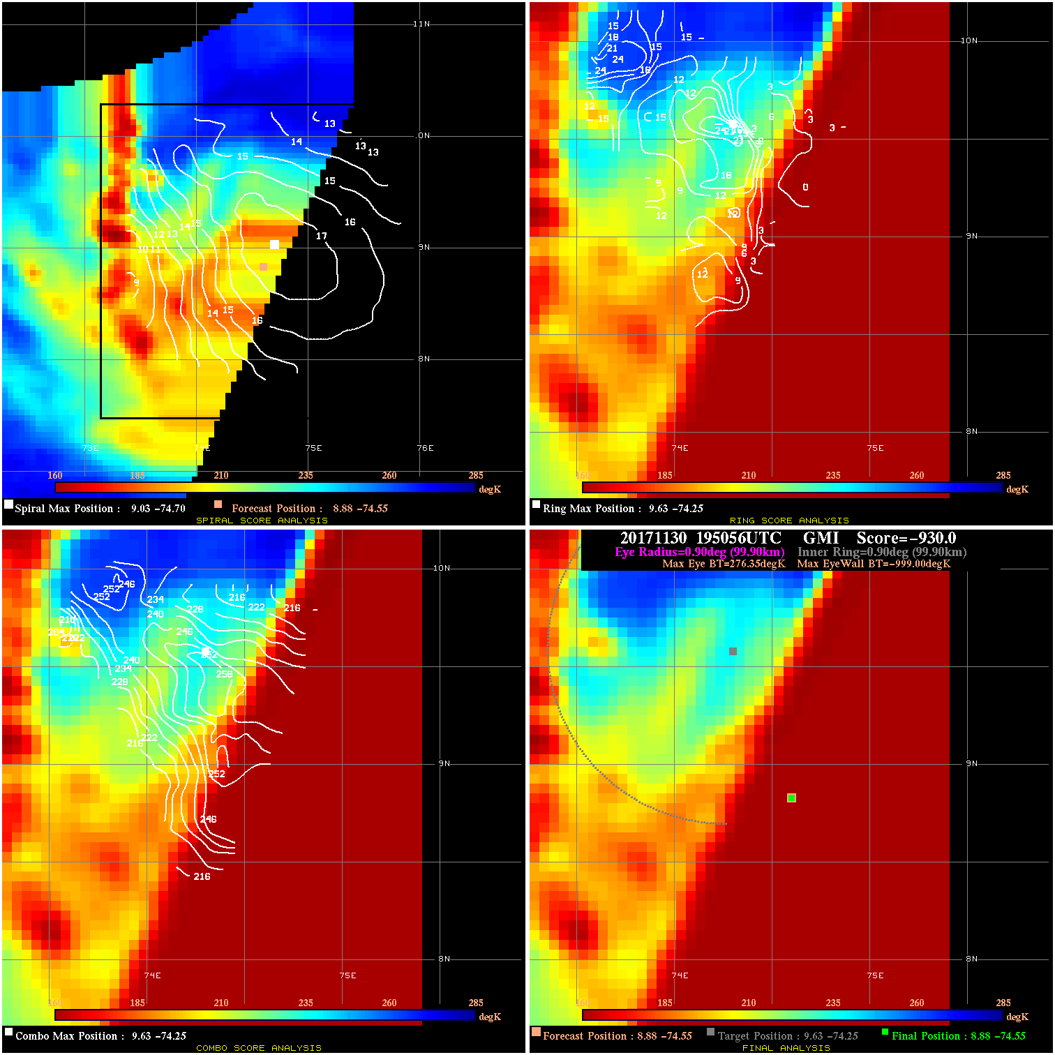
20171130 195056 -930.0 N/A N/A N/A 0.00 55.0 GMI 8.9 -74.6 8.9 -74.6 9.6 -74.3 Analysis Plot
20171130 224153 28.3 >65 kts 53.4% 88.88 28.31 60.0 SSMI15 8.8 -74.1 8.6 -74.4 8.6 -74.4 Analysis Plot
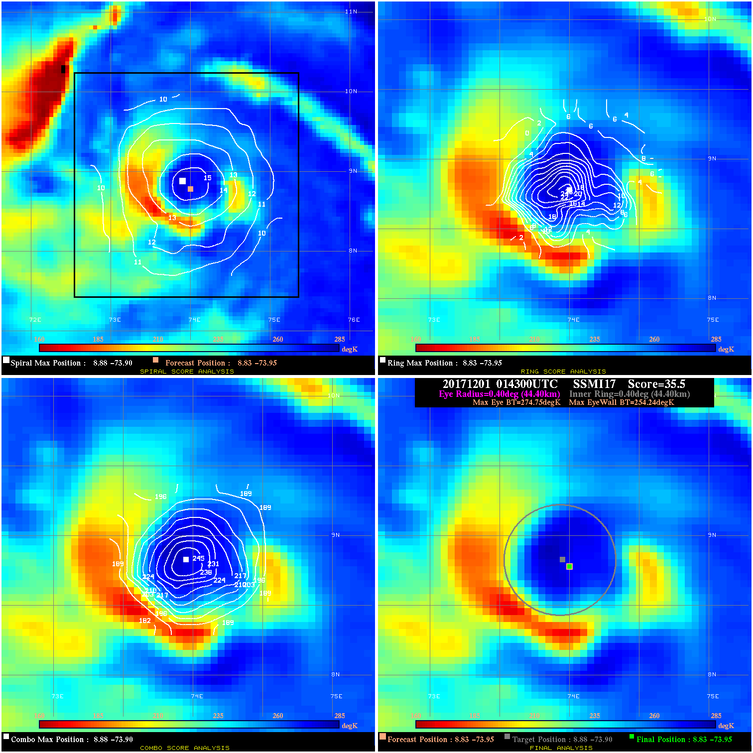
20171201 014300 35.5 >65 kts 100.0% 88.88 20.51 60.0 SSMI17 8.8 -73.9 8.8 -73.9 8.9 -73.9 Analysis Plot
20171201 084256 61.0 >85 kts 100.0% 77.77 46.03 70.0 AMSR2 8.9 -73.2 8.7 -72.9 8.7 -72.9 Analysis Plot
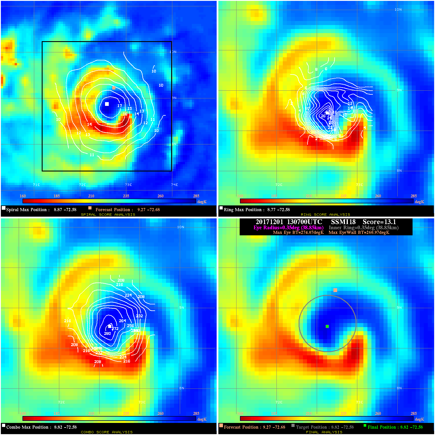
20171201 130700 13.1 N/A 75.3% 77.77 13.10 70.0 SSMI18 9.3 -72.7 8.8 -72.6 8.8 -72.6 Analysis Plot
20171201 224324 24.9 >65 kts 71.2% 66.66 24.92 80.0 SSMI15 9.5 -71.6 9.1 -71.7 9.1 -71.7 Analysis Plot
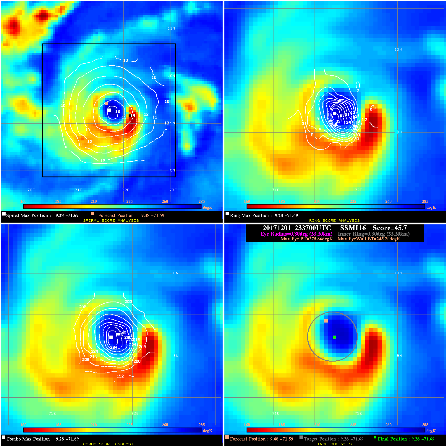
20171201 233700 45.7 >65 kts 100.0% 66.66 30.66 80.0 SSMI16 9.5 -71.6 9.3 -71.7 9.3 -71.7 Analysis Plot
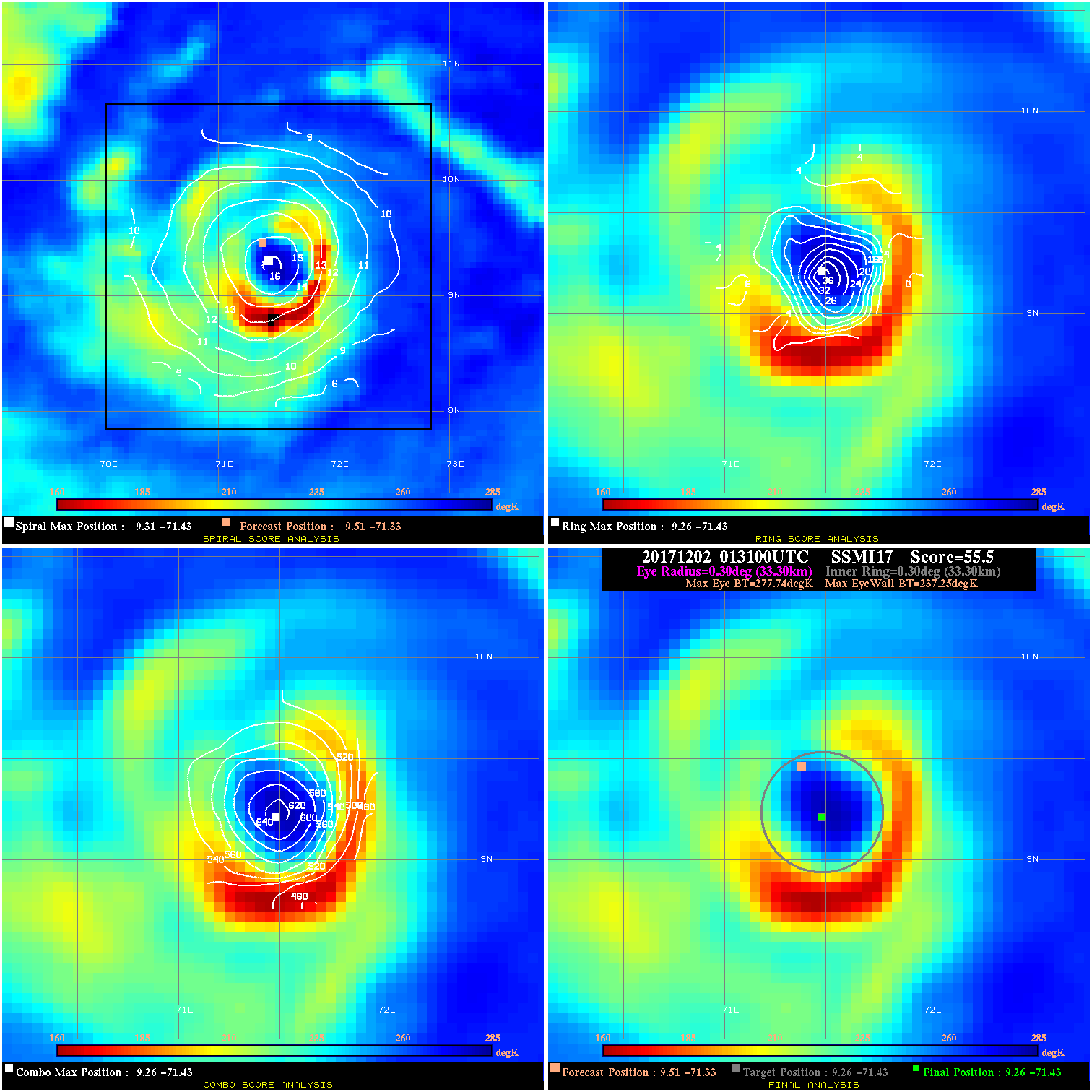
20171202 013100 55.5 >65 kts 100.0% 66.66 40.49 85.0 SSMI17 9.5 -71.3 9.3 -71.4 9.3 -71.4 Analysis Plot
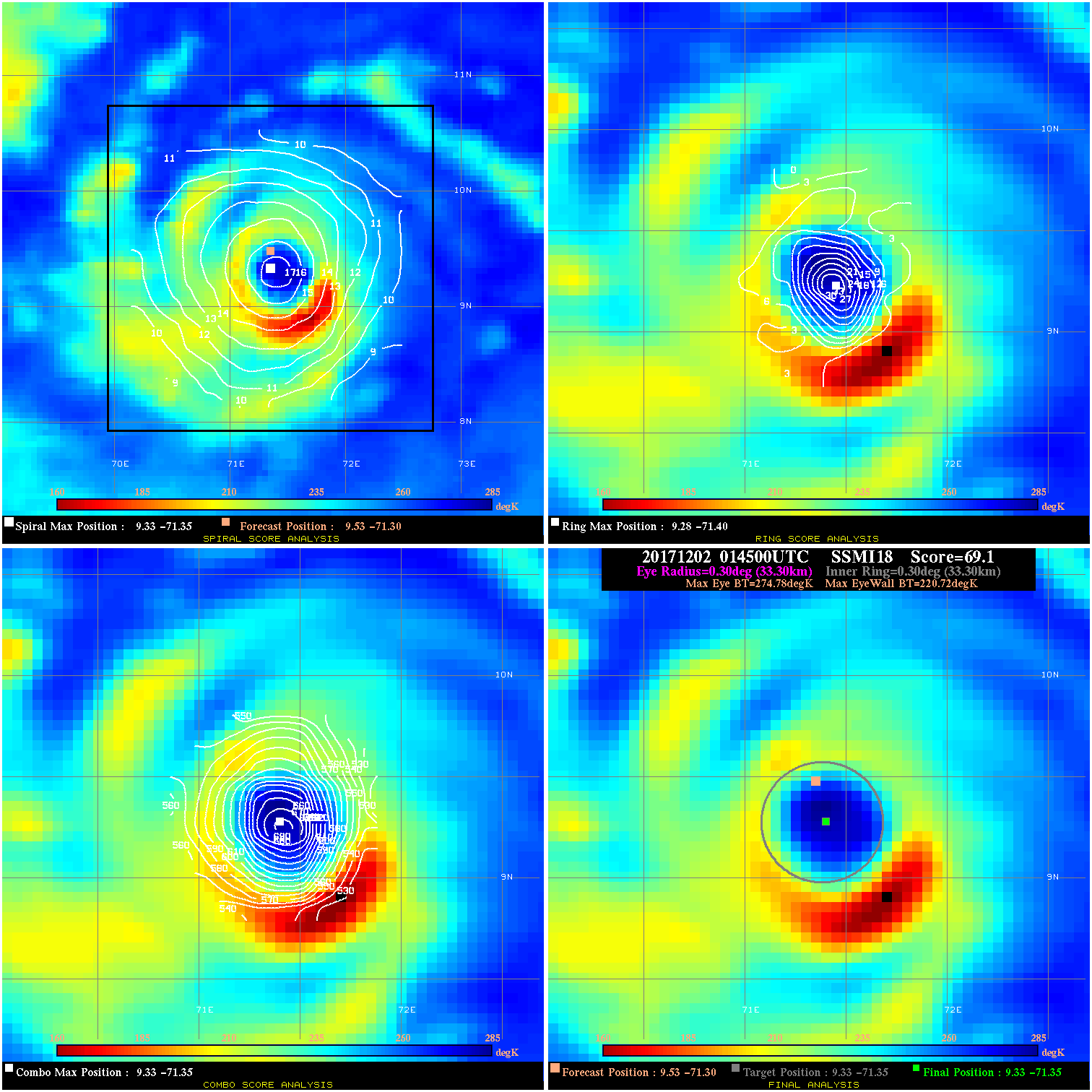
20171202 014500 69.1 >85 kts 100.0% 66.66 54.06 85.0 SSMI18 9.5 -71.3 9.3 -71.3 9.3 -71.3 Analysis Plot
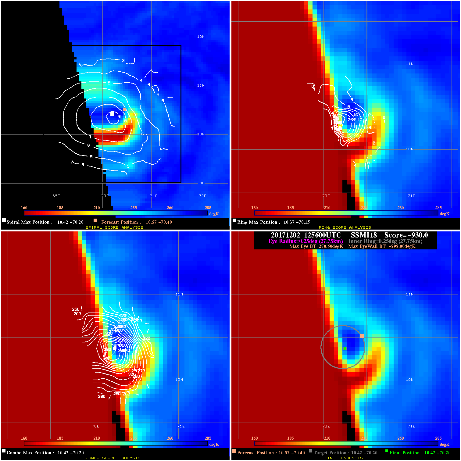
20171202 125600 -930.0 N/A N/A N/A 0.00 85.0 SSMI18 10.6 -70.4 10.4 -70.2 10.4 -70.2 Analysis Plot
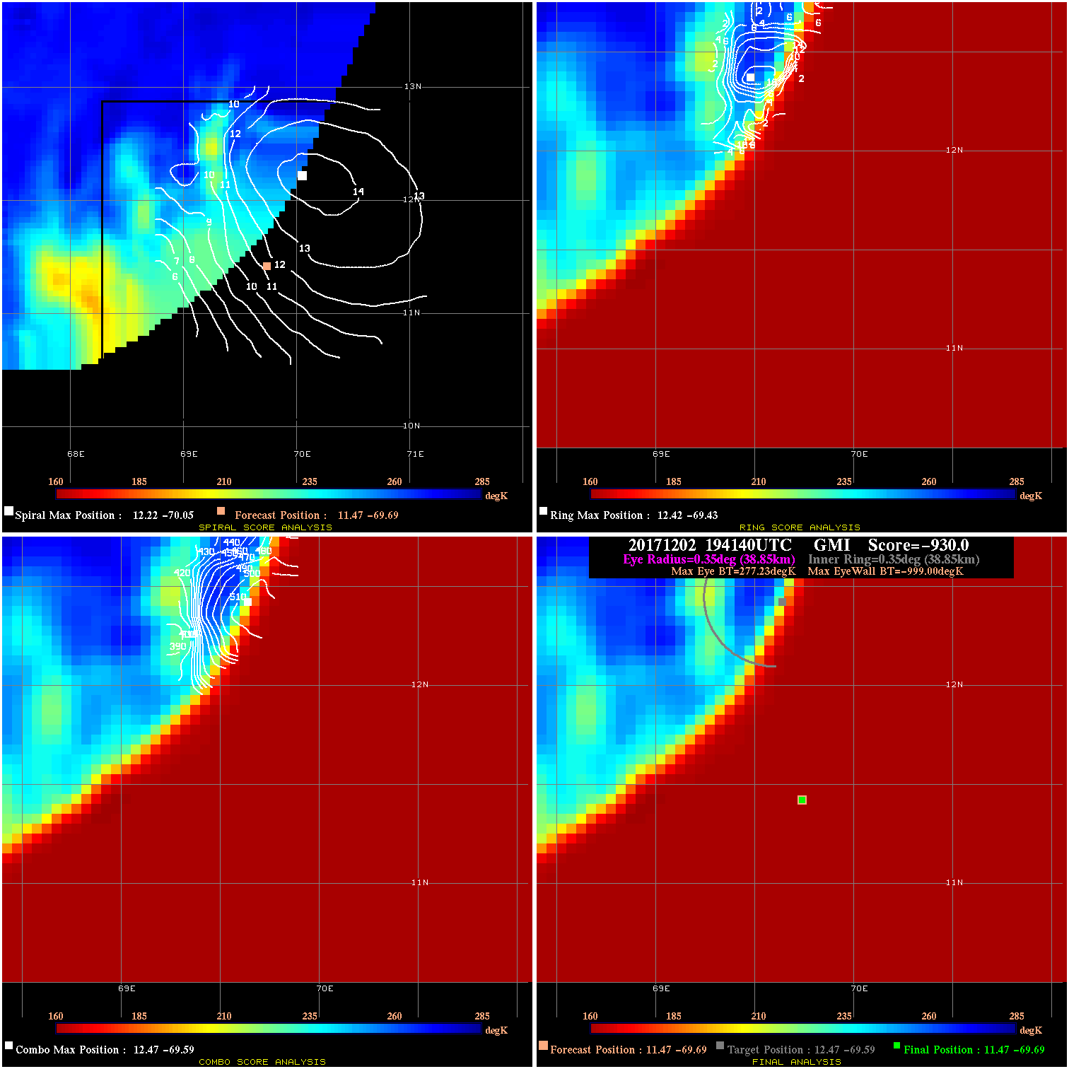
20171202 194140 -930.0 N/A N/A N/A 0.00 100.0 GMI 11.5 -69.7 11.5 -69.7 12.5 -69.6 Analysis Plot
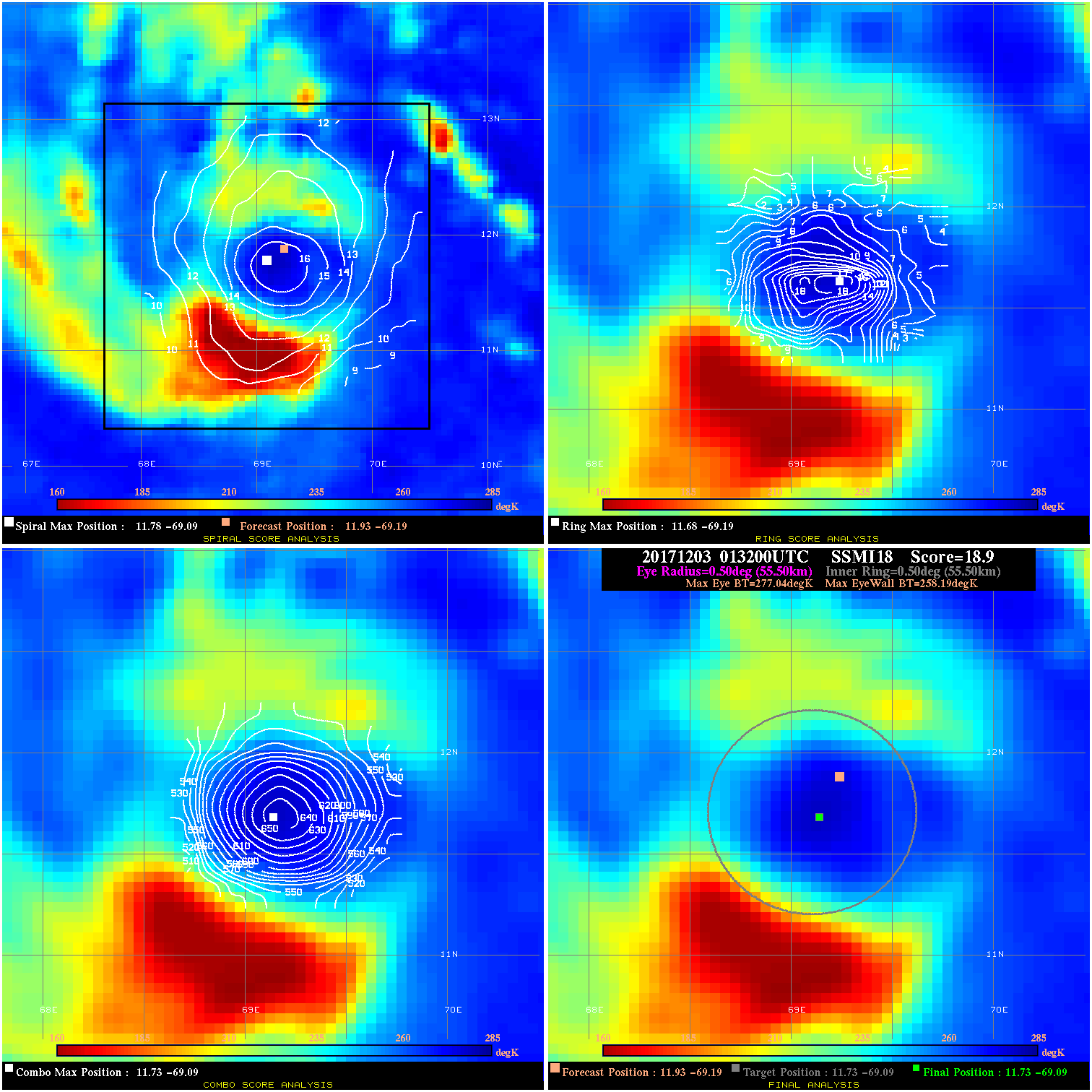
20171203 013200 18.9 N/A 63.0% 111.10 18.85 95.0 SSMI18 11.9 -69.2 11.7 -69.1 11.7 -69.1 Analysis Plot
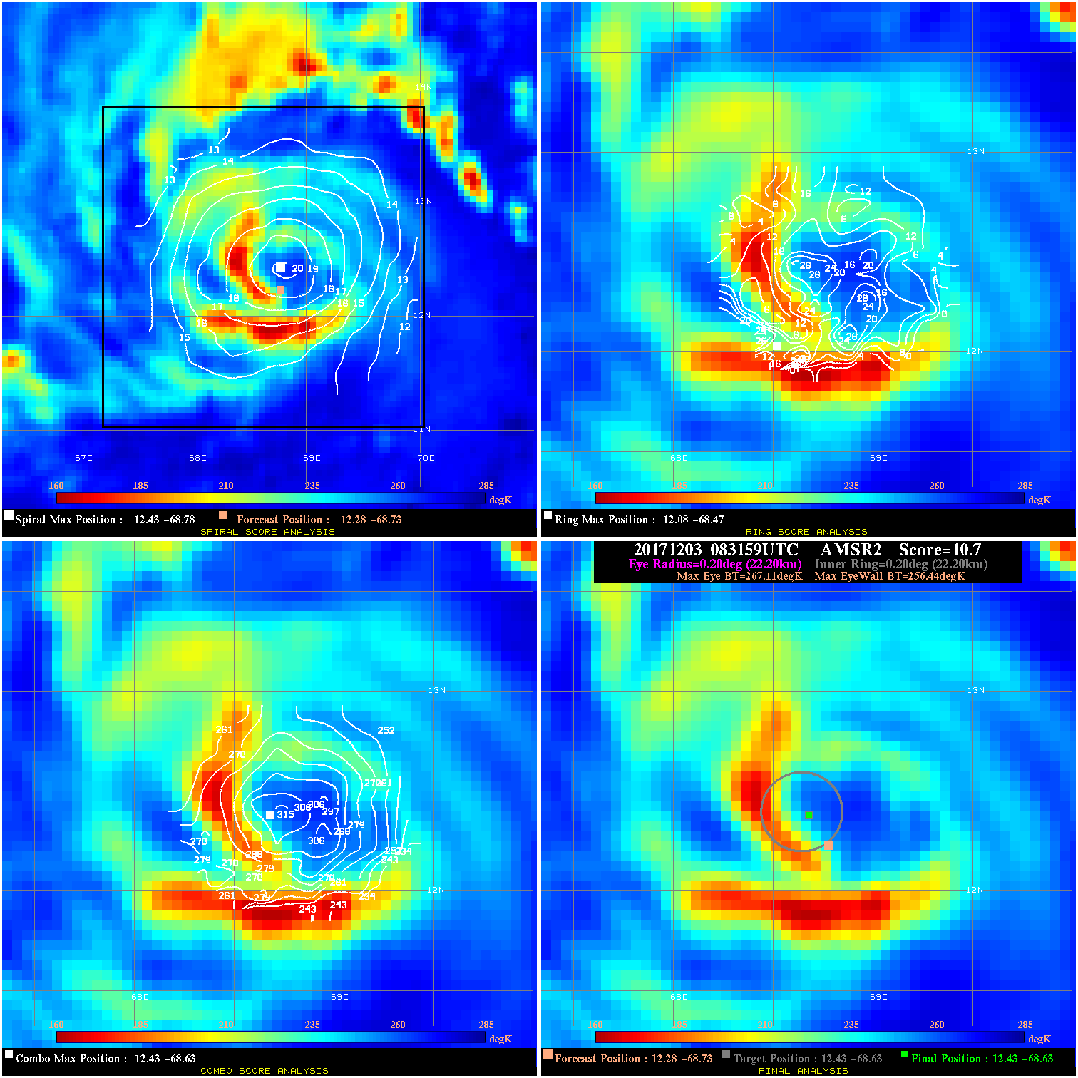
20171203 083159 10.7 N/A 50.7% 44.44 10.67 80.0 AMSR2 12.3 -68.7 12.4 -68.6 12.4 -68.6 Analysis Plot
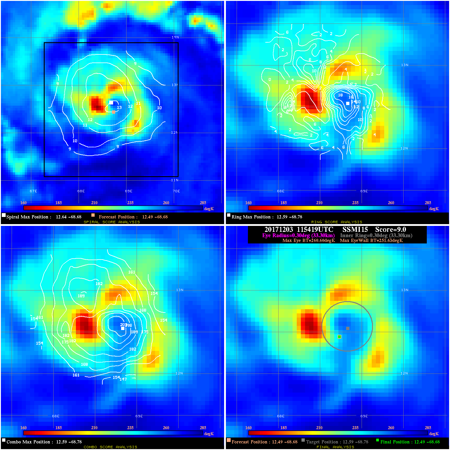
20171203 115419 9.0 N/A 78.1% 66.66 8.97 80.0 SSMI15 12.5 -68.7 12.5 -68.7 12.6 -68.8 Analysis Plot
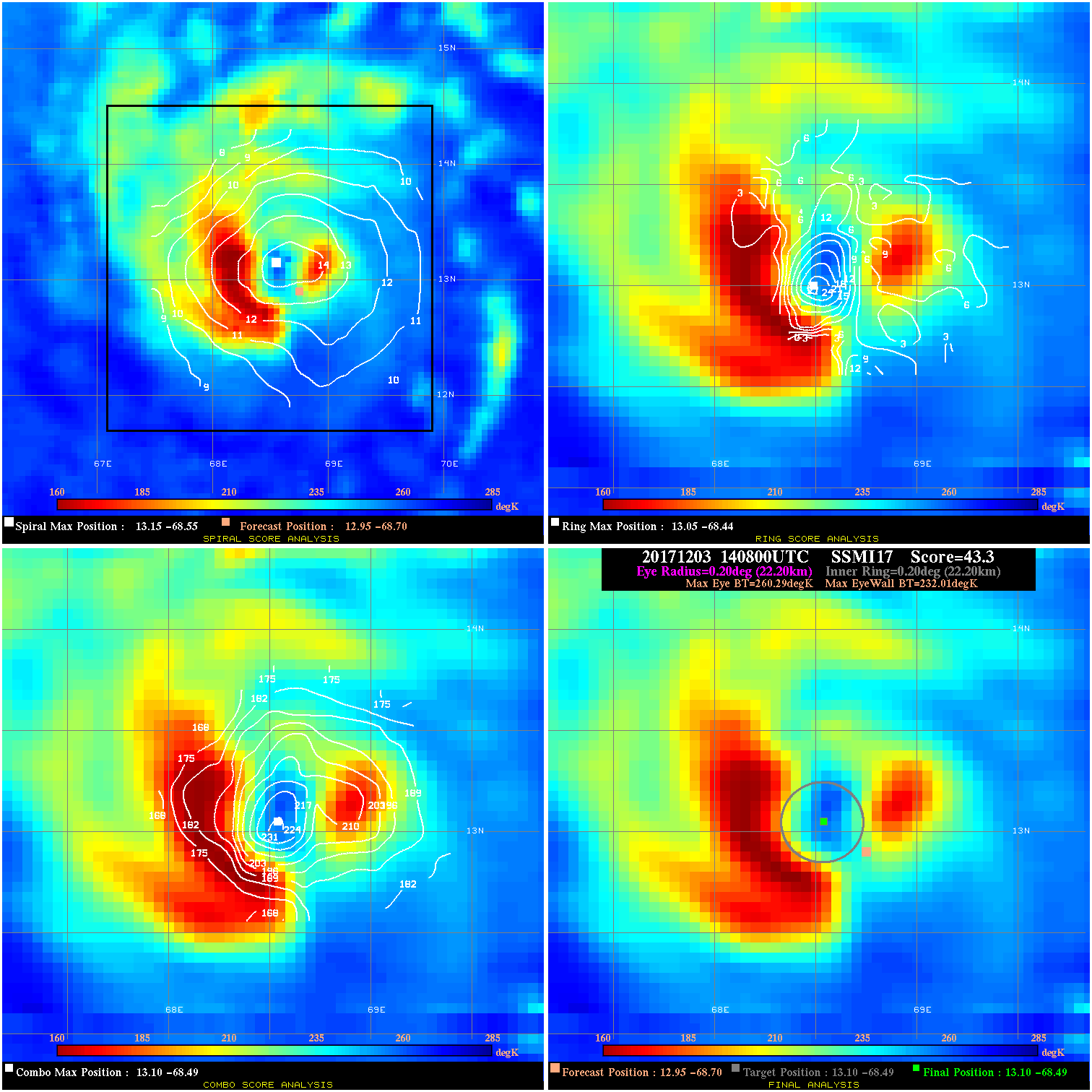
20171203 140800 43.3 >65 kts 100.0% 44.44 28.28 75.0 SSMI17 12.9 -68.7 13.1 -68.5 13.1 -68.5 Analysis Plot
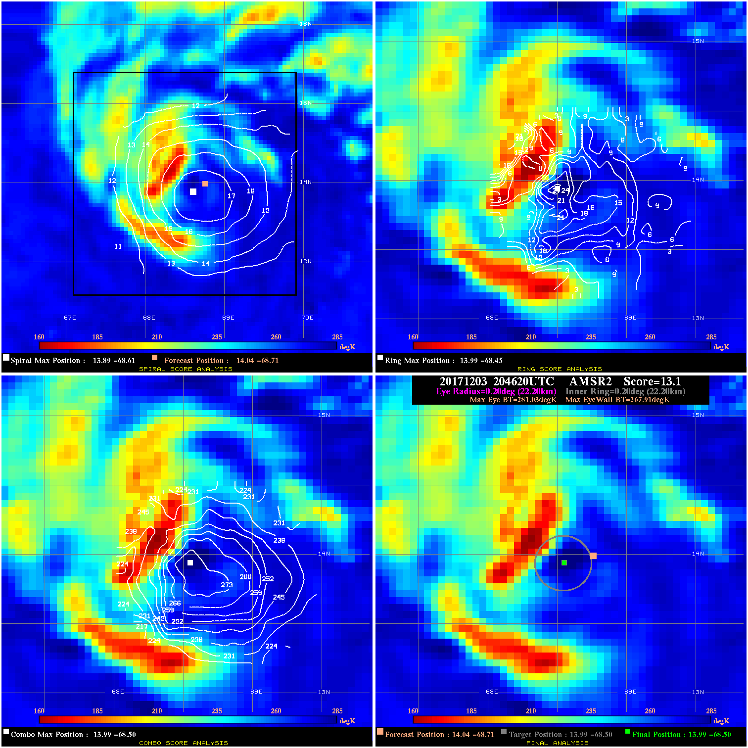
20171203 204620 13.1 N/A 21.9% 44.44 13.12 75.0 AMSR2 14.0 -68.7 14.0 -68.5 14.0 -68.5 Analysis Plot
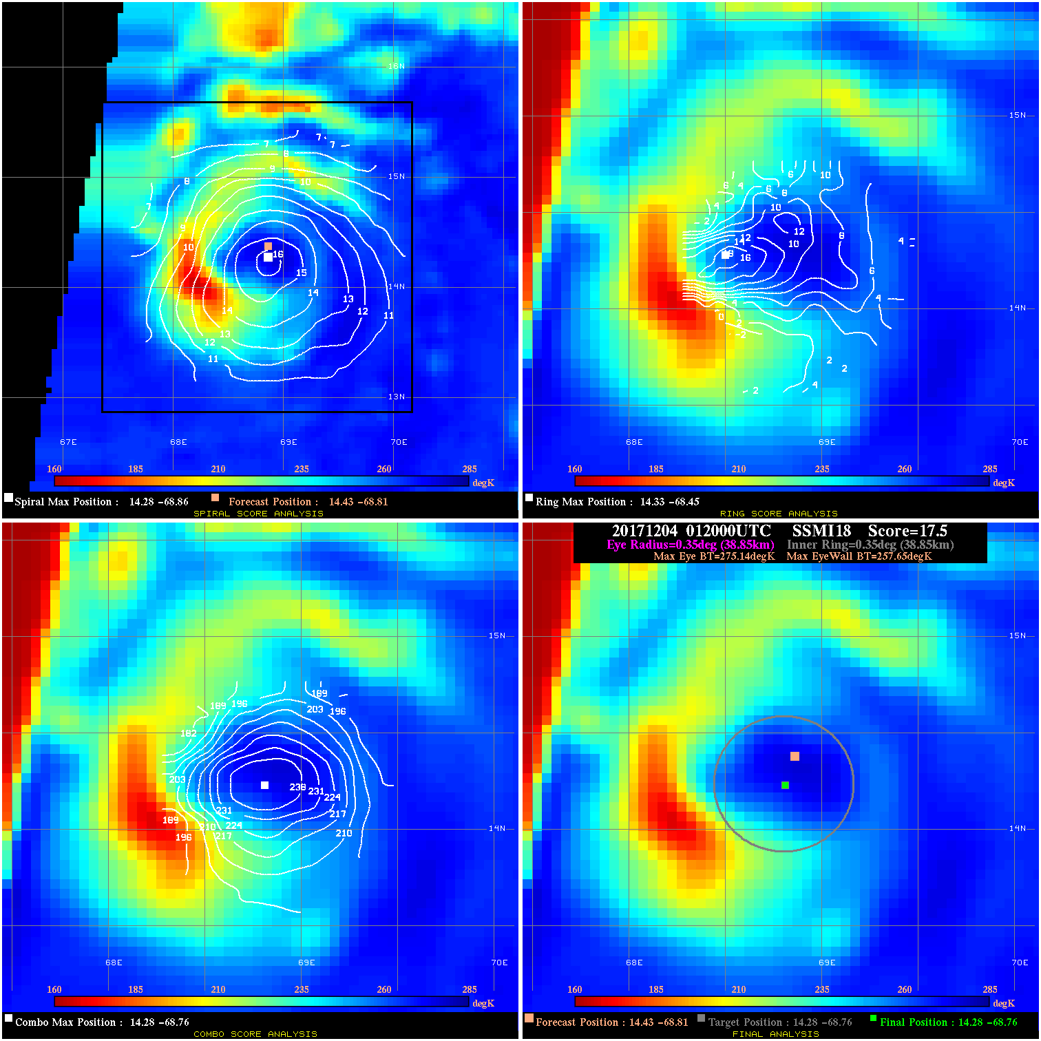
20171204 012000 17.5 N/A 34.2% 77.77 17.49 70.0 SSMI18 14.4 -68.8 14.3 -68.8 14.3 -68.8 Analysis Plot
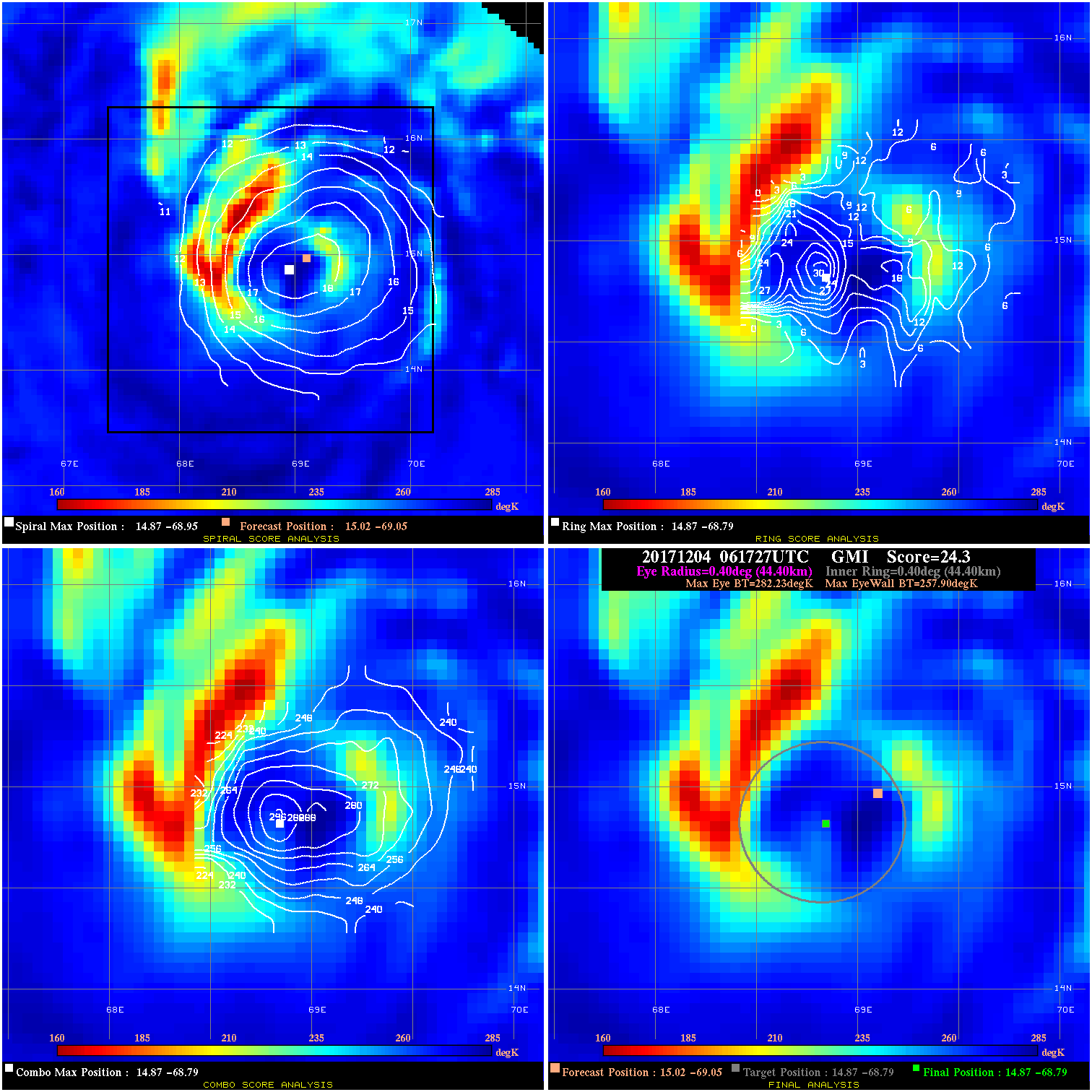
20171204 061727 24.3 >65 kts 57.5% 88.88 24.33 70.0 GMI 15.0 -69.1 14.9 -68.8 14.9 -68.8 Analysis Plot
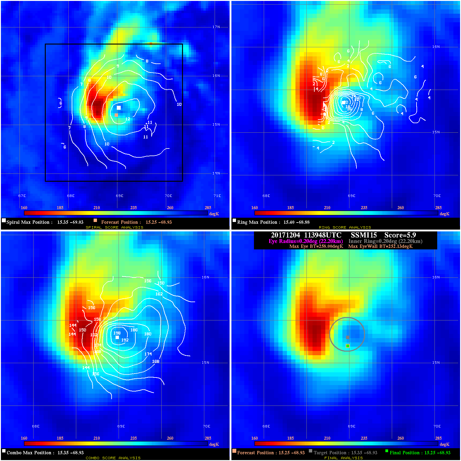
20171204 113948 5.9 N/A 64.4% 44.44 5.87 70.0 SSMI15 15.3 -68.9 15.3 -68.9 15.4 -68.9 Analysis Plot
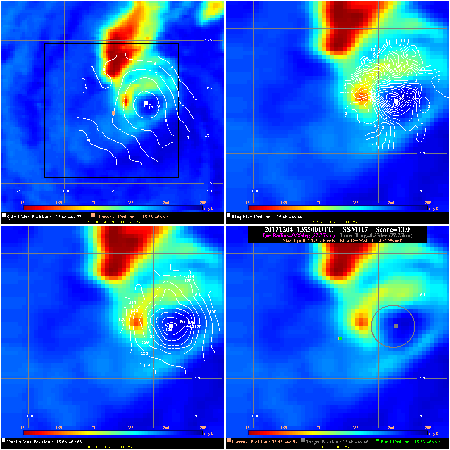
20171204 135500 13.0 N/A 35.6% 55.55 13.02 65.0 SSMI17 15.5 -69.0 15.5 -69.0 15.7 -69.7 Analysis Plot
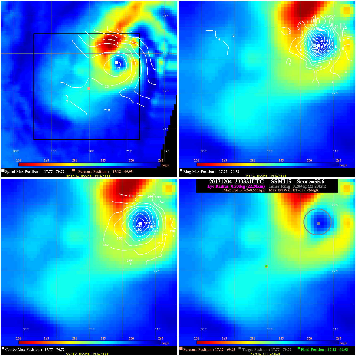
20171204 233331 55.6 >65 kts 100.0% 44.44 40.62 60.0 SSMI15 17.1 -69.9 17.1 -69.9 17.8 -70.7 Analysis Plot
20171205 023000 -930.0 N/A N/A N/A 0.00 60.0 SSMI17 17.8 -70.7 17.8 -70.7 17.0 -71.0 Analysis Plot
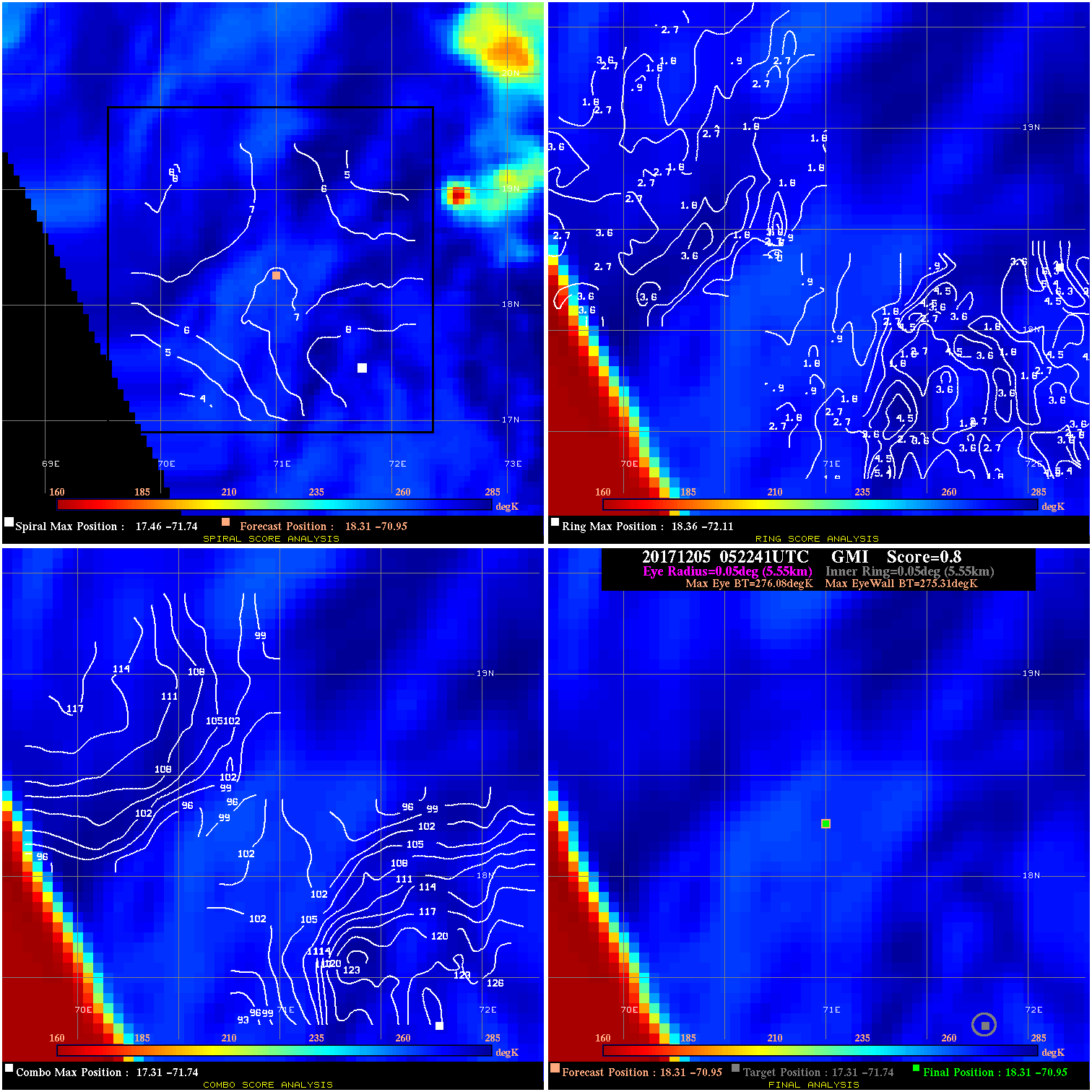
20171205 052241 0.8 N/A N/A 11.11 .77 60.0 GMI 18.3 -70.9 18.3 -70.9 17.3 -71.7 Analysis Plot
20171205 110025 -1.7 N/A N/A 88.88 1.69 45.0 SSMI15 18.7 -70.8 18.7 -70.8 18.7 -71.9 Analysis Plot
|
|
Legend: - Date/Time are determined from PMW imagery at Forecast (initial guess) Lat/Lon position. - Positive/Negative Latitude = North/South Hemisphere; Longitude = Western/Eastern Hemisphere. - "Ring Diam" value indicates the estimated surface eyewall diameter in km (the MI eyewall edge diameter minus 10 km). - "Ring Pct" is the percentage of the "ring" (eyewall inner boundary) that is 1) colder than the "hot spot" (warmest eye pixel) in the eye by 20K, or 2) the percentage that is a) colder than 232K and b) colder than the "hot spot" by 10K, whichever is greater. - Values are red if Ring % <= 65, yellow/brown if Ring % <= 85 and green if Ring % > 85. - "Tb diff" is the difference between the "hot spot" (warmest eye pixel) and the warmest pixel on the eyewall. - Intensity score are listed as negative, and not used, when the JTWC or NHC estimated Vmax is <55 kts in order to rule out weak but highly symmetric TCs. - Error messages in intensity scores: -920 is used when the hottest pixel in the eye is <200K, to prevent false positives; -930 means <85% of eyewall has observations/data. |