Tropical Storm 04S
|
Passive Microwave (PMW) Intensity Information Advanced Dvorak Technique (ADT) Version 8.2.1 |
Overpass Inten Ring Ring Wind Forecast Final Target
Date Time Score Meaning Pct Diam BTdiff Est Sat Lat Lon Lat Lon Lat Lon
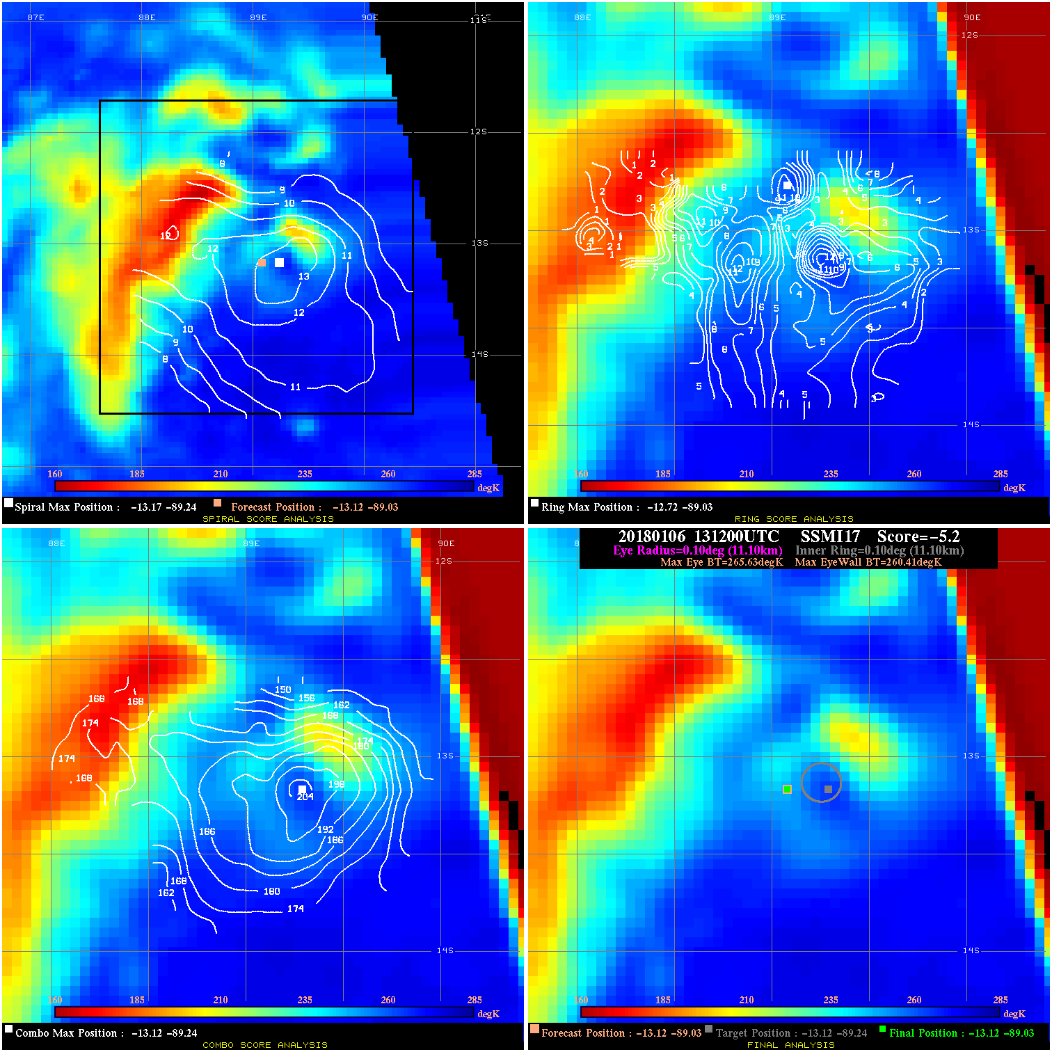
20180106 131200 -5.2 N/A 21.9% 22.22 5.22 40.0 SSMI17 -13.1 -89.0 -13.1 -89.0 -13.1 -89.2 Analysis Plot
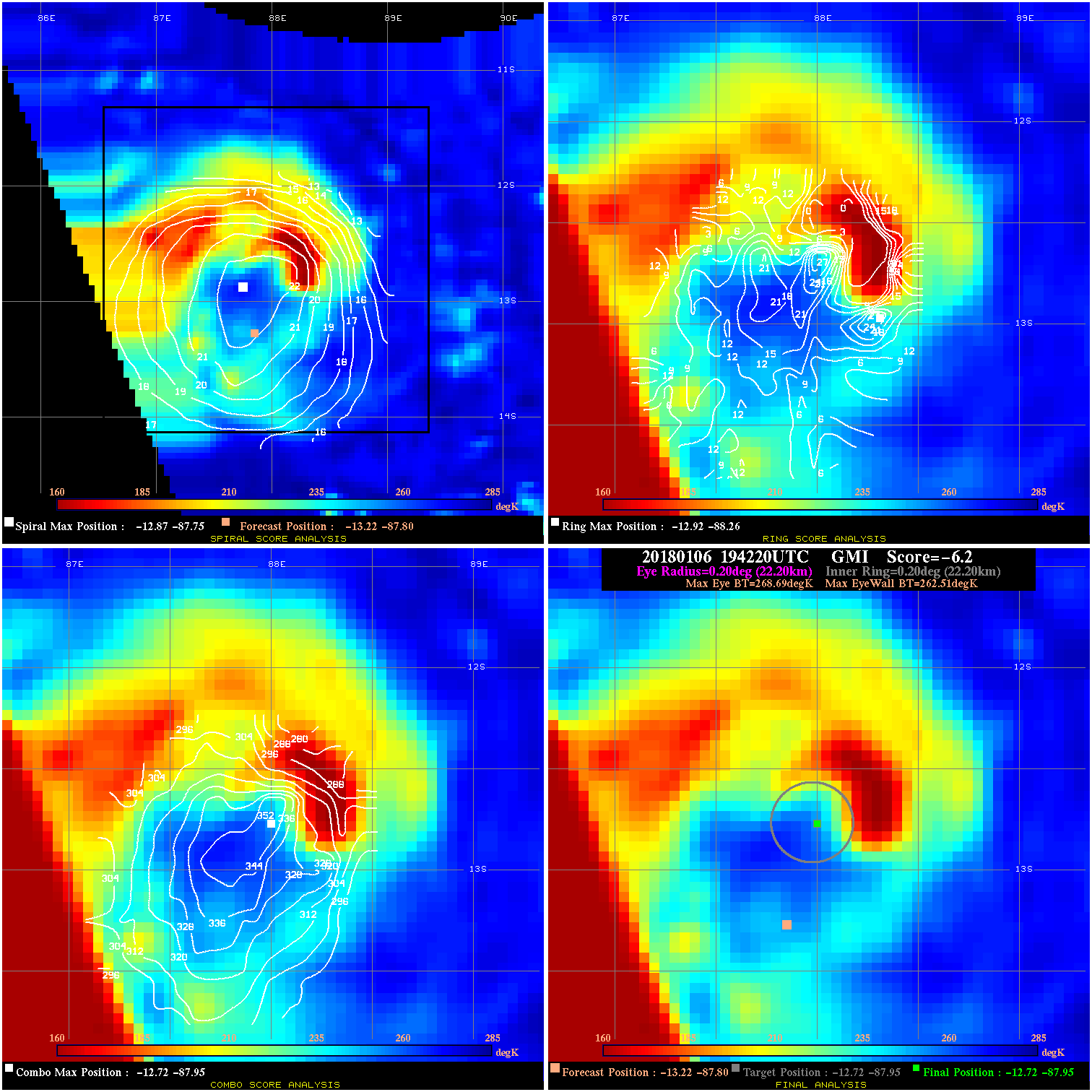
20180106 194220 -6.2 N/A 54.8% 44.44 6.18 45.0 GMI -13.2 -87.8 -12.7 -87.9 -12.7 -87.9 Analysis Plot
20180107 070900 10.1 N/A 49.3% 133.32 10.12 65.0 GMI -14.4 -85.4 -14.3 -85.4 -14.3 -85.4 Analysis Plot
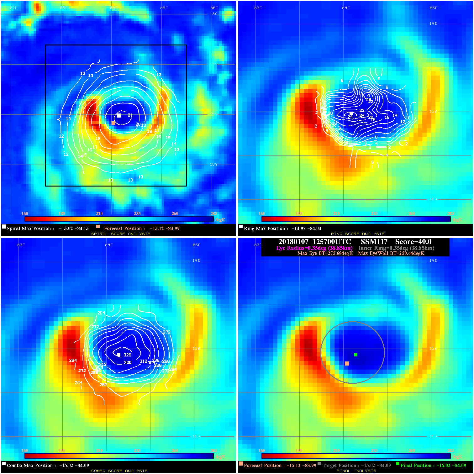
20180107 125700 40.0 >65 kts 100.0% 77.77 25.04 65.0 SSMI17 -15.1 -84.0 -15.0 -84.1 -15.0 -84.1 Analysis Plot
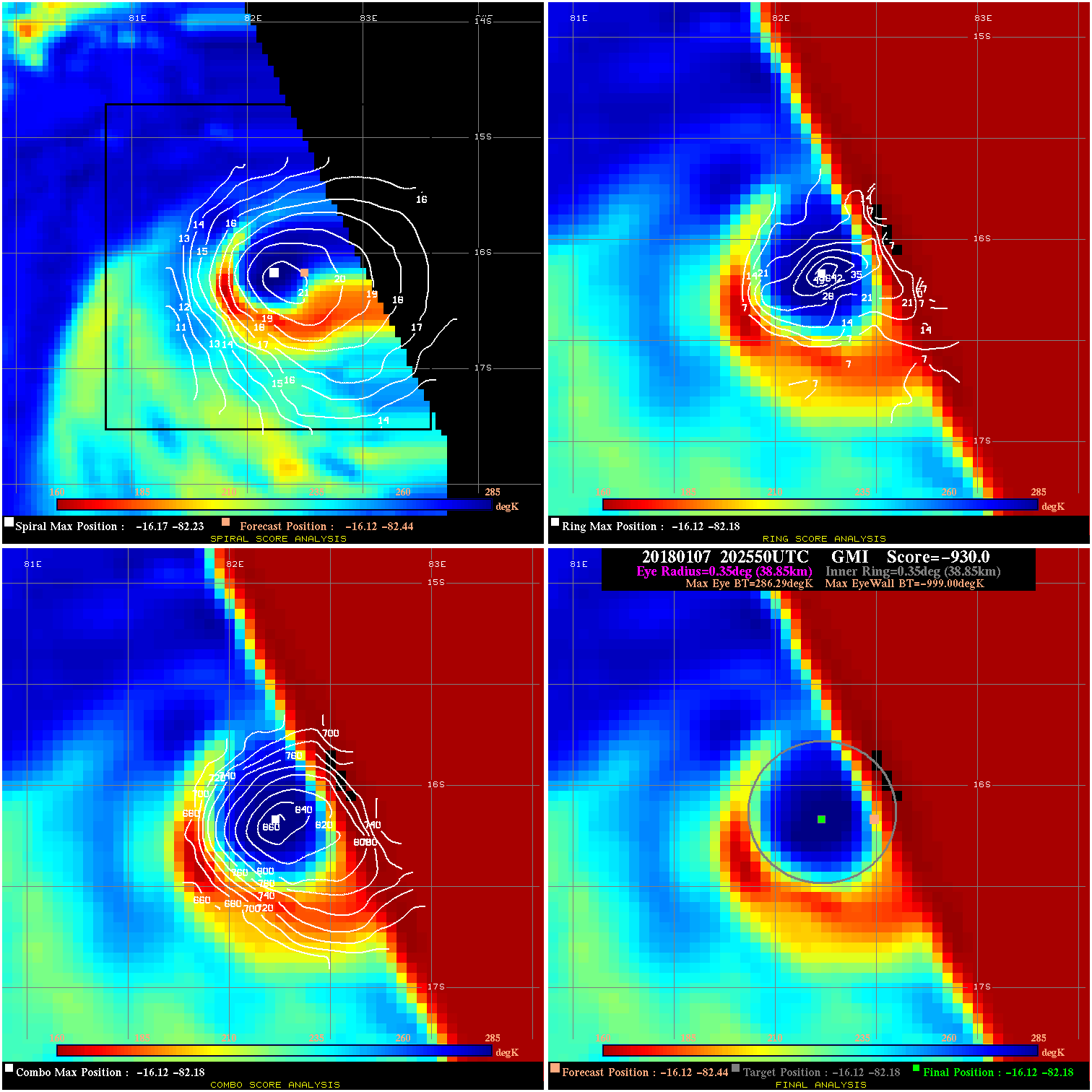
20180107 202550 -930.0 N/A N/A N/A 0.00 90.0 GMI -16.1 -82.4 -16.1 -82.2 -16.1 -82.2 Analysis Plot
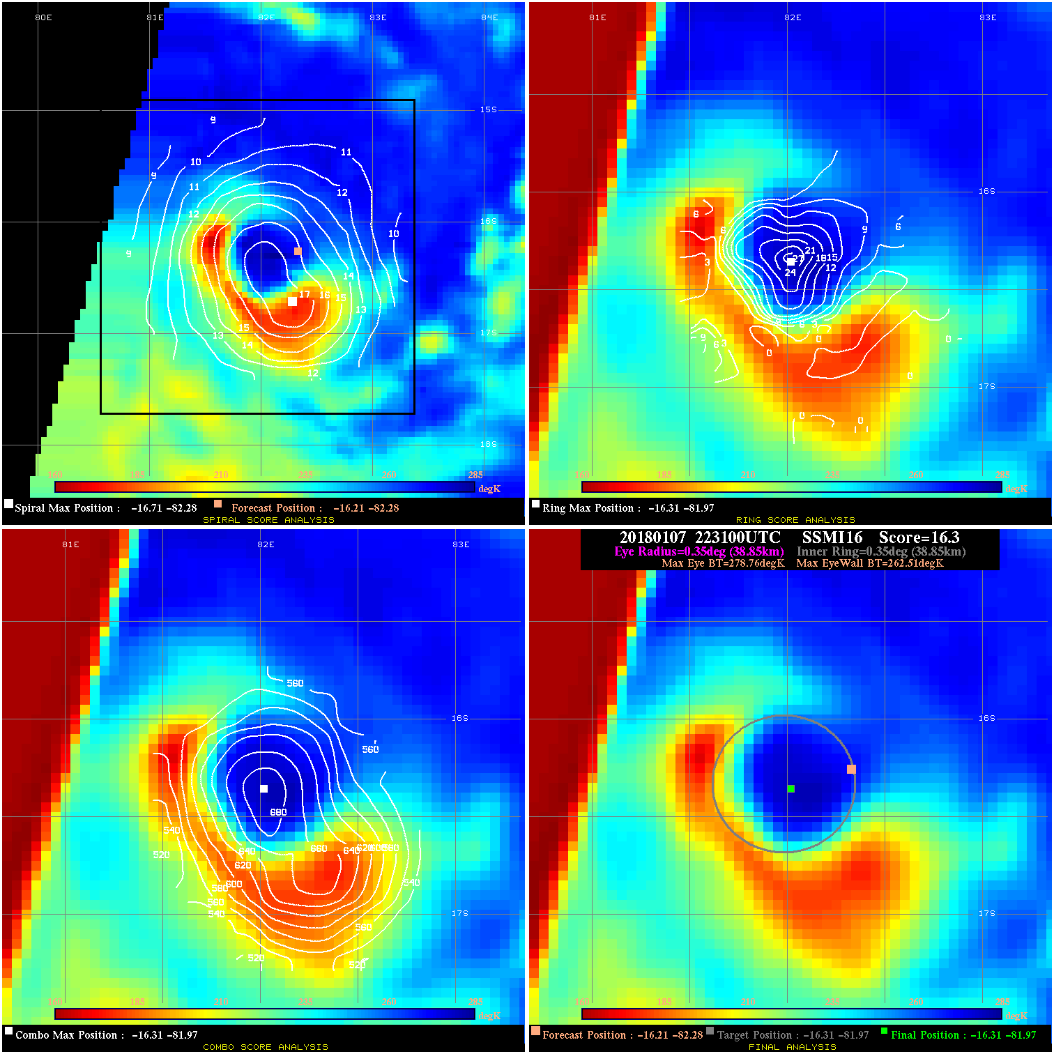
20180107 223100 16.3 N/A 68.5% 77.77 16.25 90.0 SSMI16 -16.2 -82.3 -16.3 -82.0 -16.3 -82.0 Analysis Plot
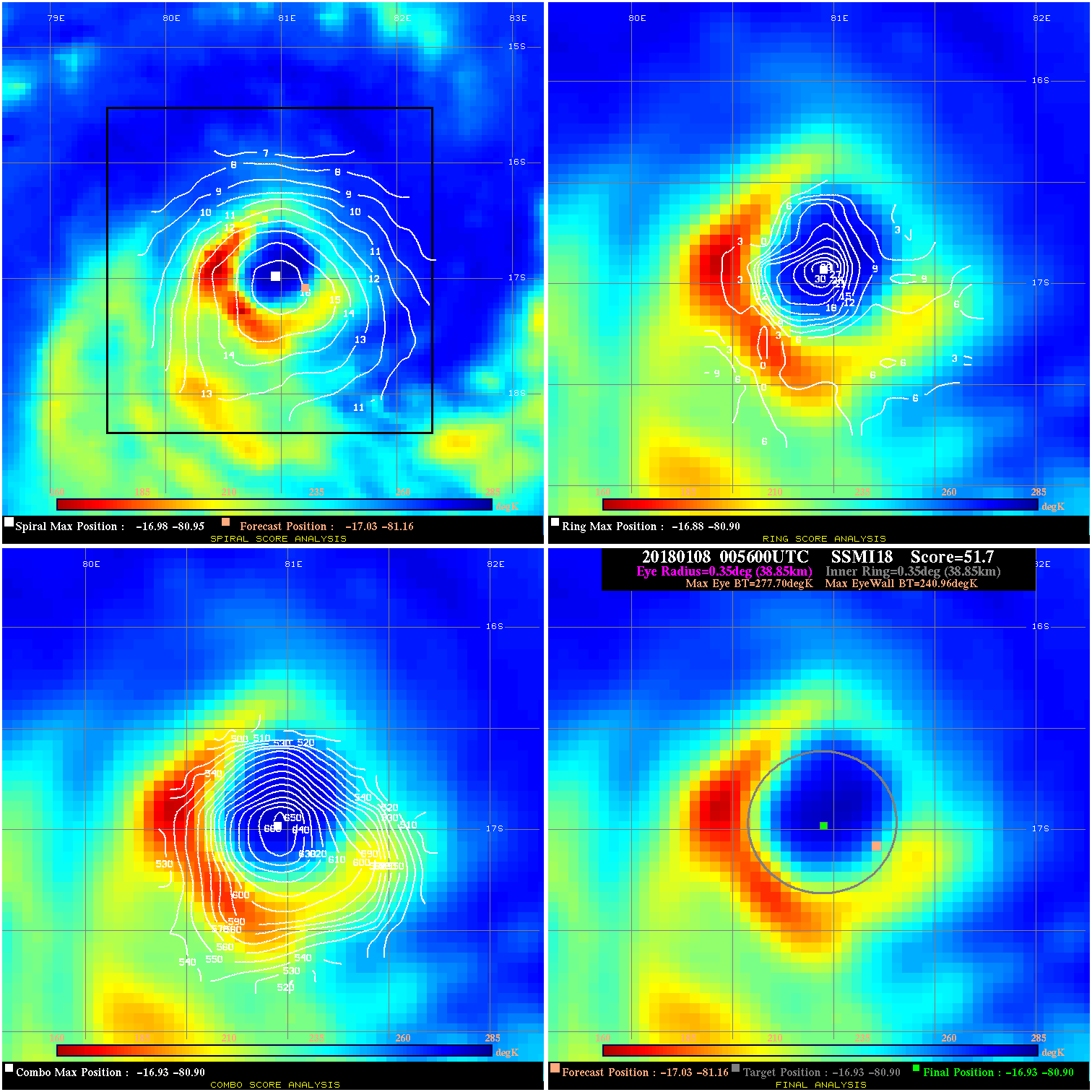
20180108 005600 51.7 >65 kts 100.0% 77.77 36.74 90.0 SSMI18 -17.0 -81.2 -16.9 -80.9 -16.9 -80.9 Analysis Plot
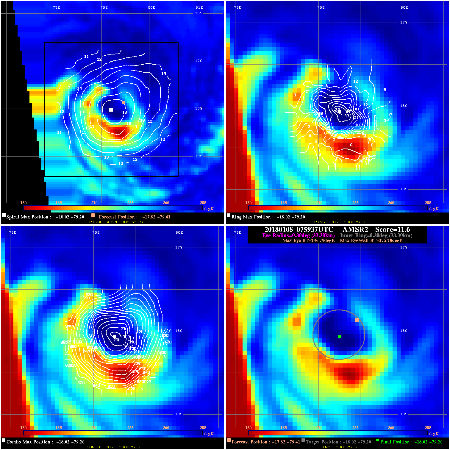
20180108 075937 11.6 N/A 43.8% 66.66 11.59 90.0 AMSR2 -17.8 -79.4 -18.0 -79.2 -18.0 -79.2 Analysis Plot
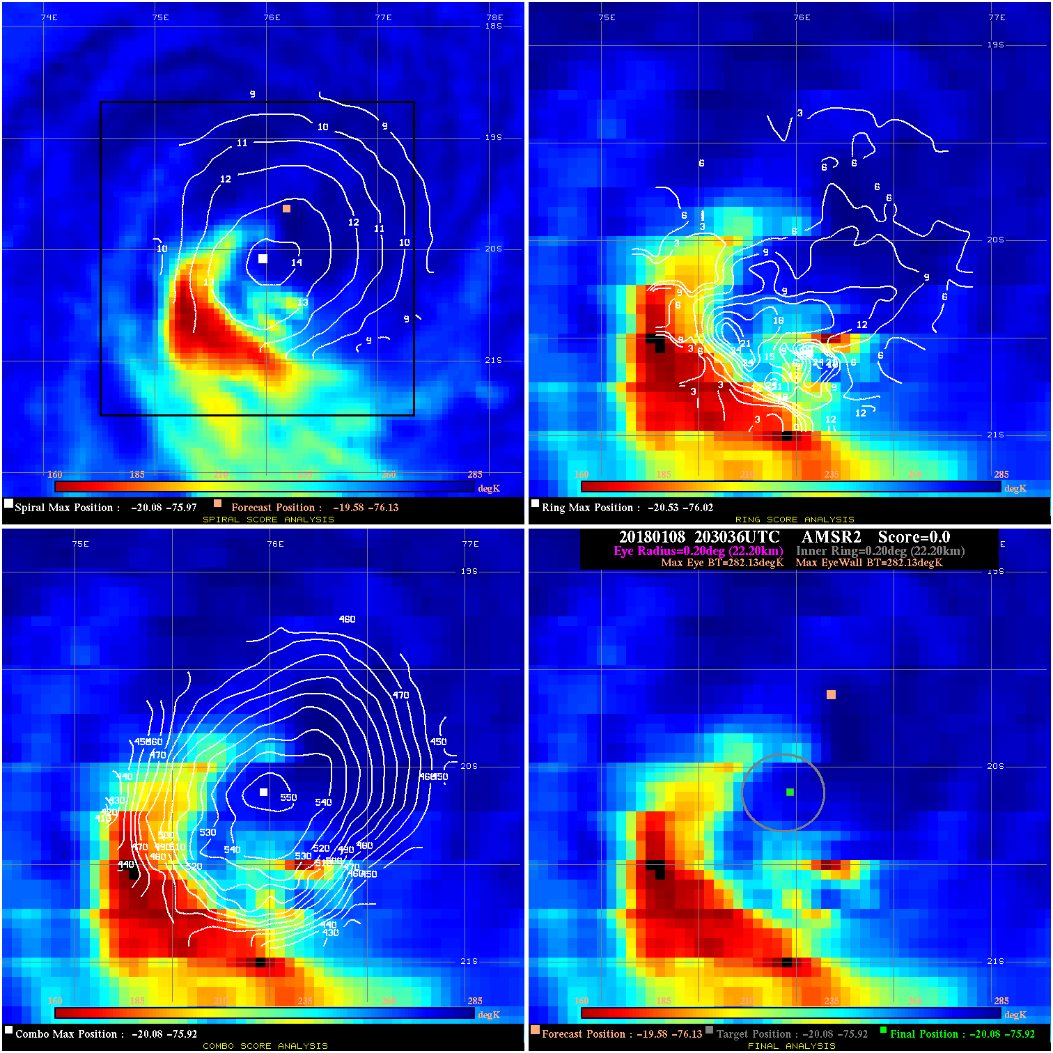
20180108 203036 -0.0 N/A N/A N/A 0.00 90.0 AMSR2 -19.6 -76.1 -20.1 -75.9 -20.1 -75.9 Analysis Plot
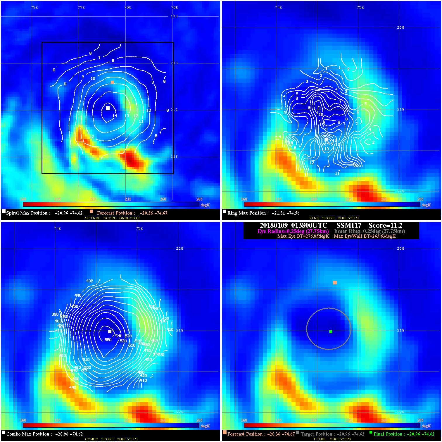
20180109 013800 11.2 N/A 13.7% 55.55 11.22 85.0 SSMI17 -20.4 -74.7 -21.0 -74.6 -21.0 -74.6 Analysis Plot
20180109 065916 -0.0 N/A N/A N/A 0.00 85.0 GMI -21.3 -73.3 -22.3 -73.3 -22.3 -73.3 Analysis Plot
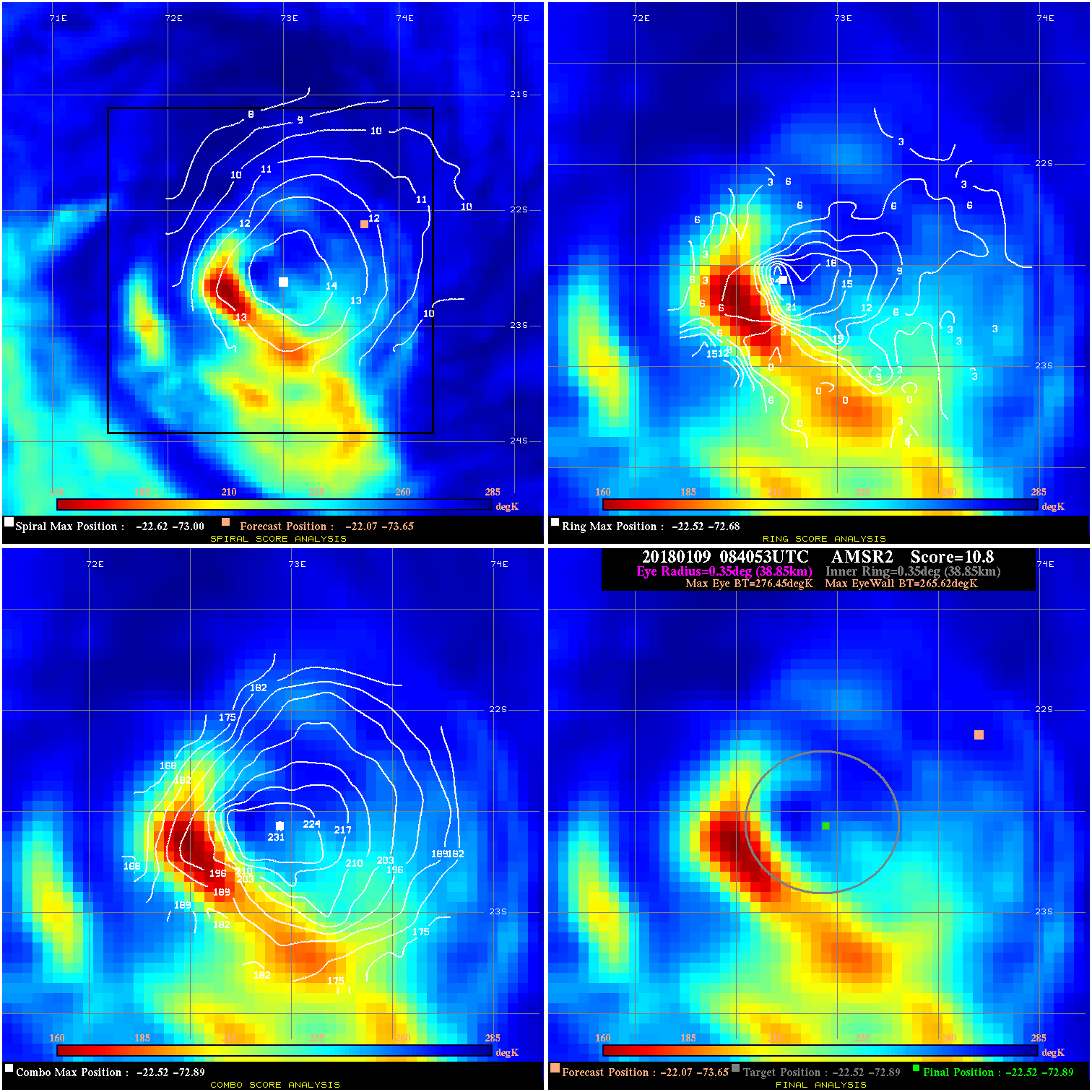
20180109 084053 10.8 N/A 45.2% 77.77 10.83 75.0 AMSR2 -22.1 -73.7 -22.5 -72.9 -22.5 -72.9 Analysis Plot
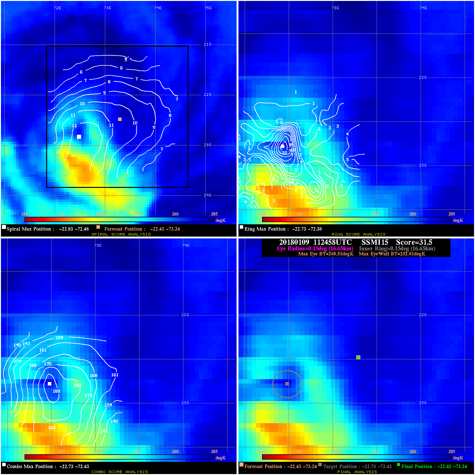
20180109 112458 31.5 >65 kts 90.4% 33.33 16.50 75.0 SSMI15 -22.4 -73.2 -22.4 -73.2 -22.7 -72.4 Analysis Plot
20180109 122500 1.7 N/A 26.0% 66.66 1.68 75.0 SSMI16 -22.6 -73.1 -22.6 -73.1 -23.2 -72.1 Analysis Plot
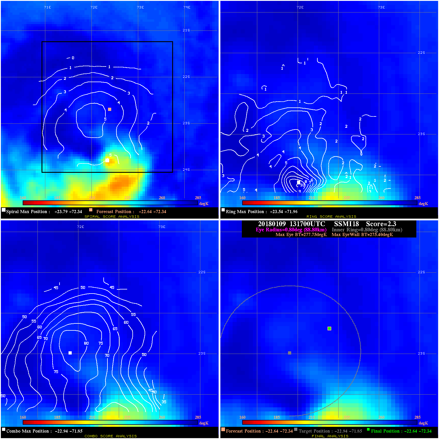
20180109 131700 2.3 N/A 9.6% 177.76 2.35 70.0 SSMI18 -22.6 -72.3 -22.6 -72.3 -22.9 -71.8 Analysis Plot
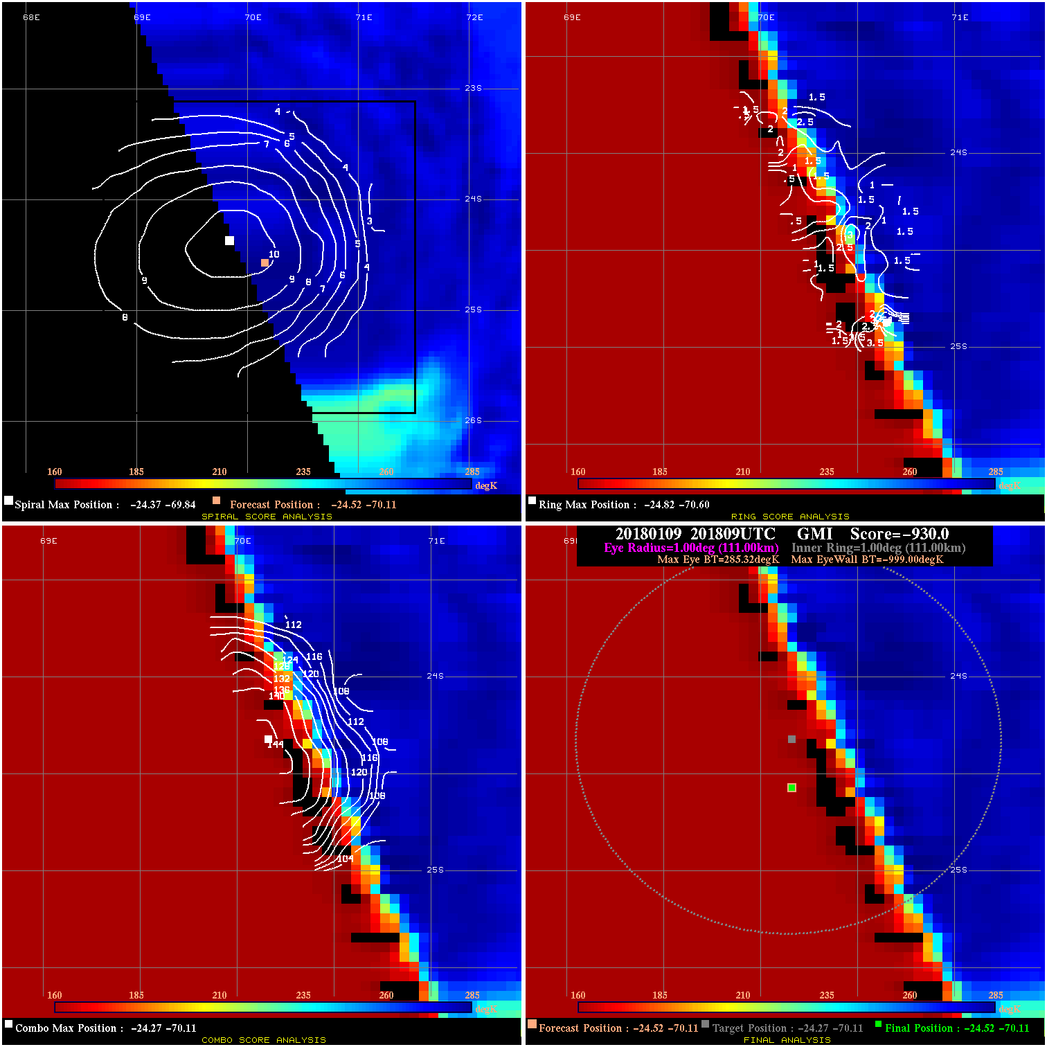
20180109 201809 -930.0 N/A N/A N/A 0.00 65.0 GMI -24.5 -70.1 -24.5 -70.1 -24.3 -70.1 Analysis Plot
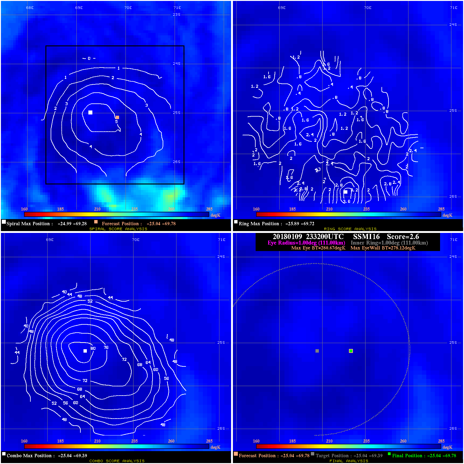
20180109 233200 2.6 N/A N/A 222.20 2.55 65.0 SSMI16 -25.0 -69.8 -25.0 -69.8 -25.0 -69.4 Analysis Plot
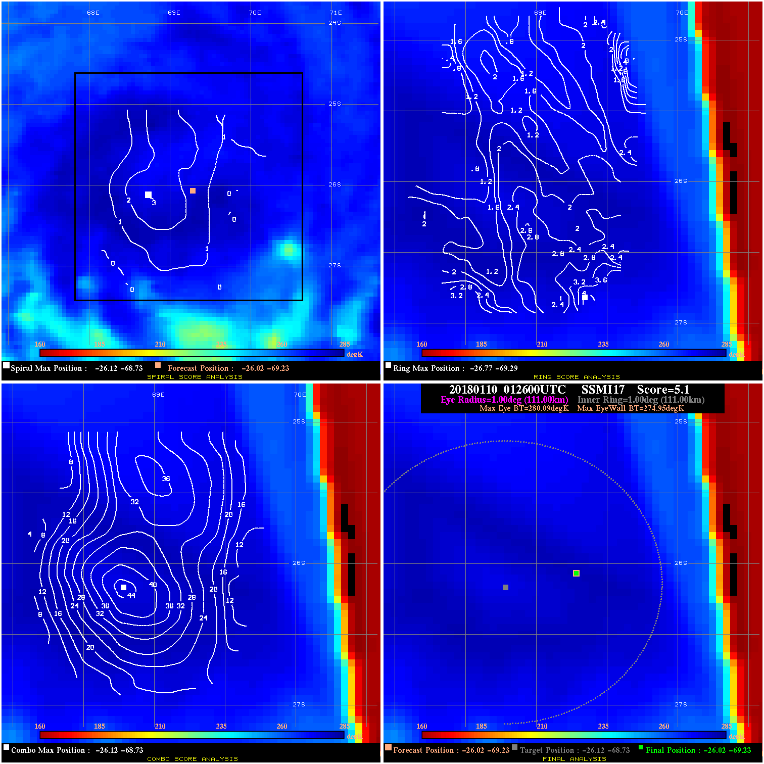
20180110 012600 5.1 N/A N/A 222.20 5.14 60.0 SSMI17 -26.0 -69.2 -26.0 -69.2 -26.1 -68.7 Analysis Plot
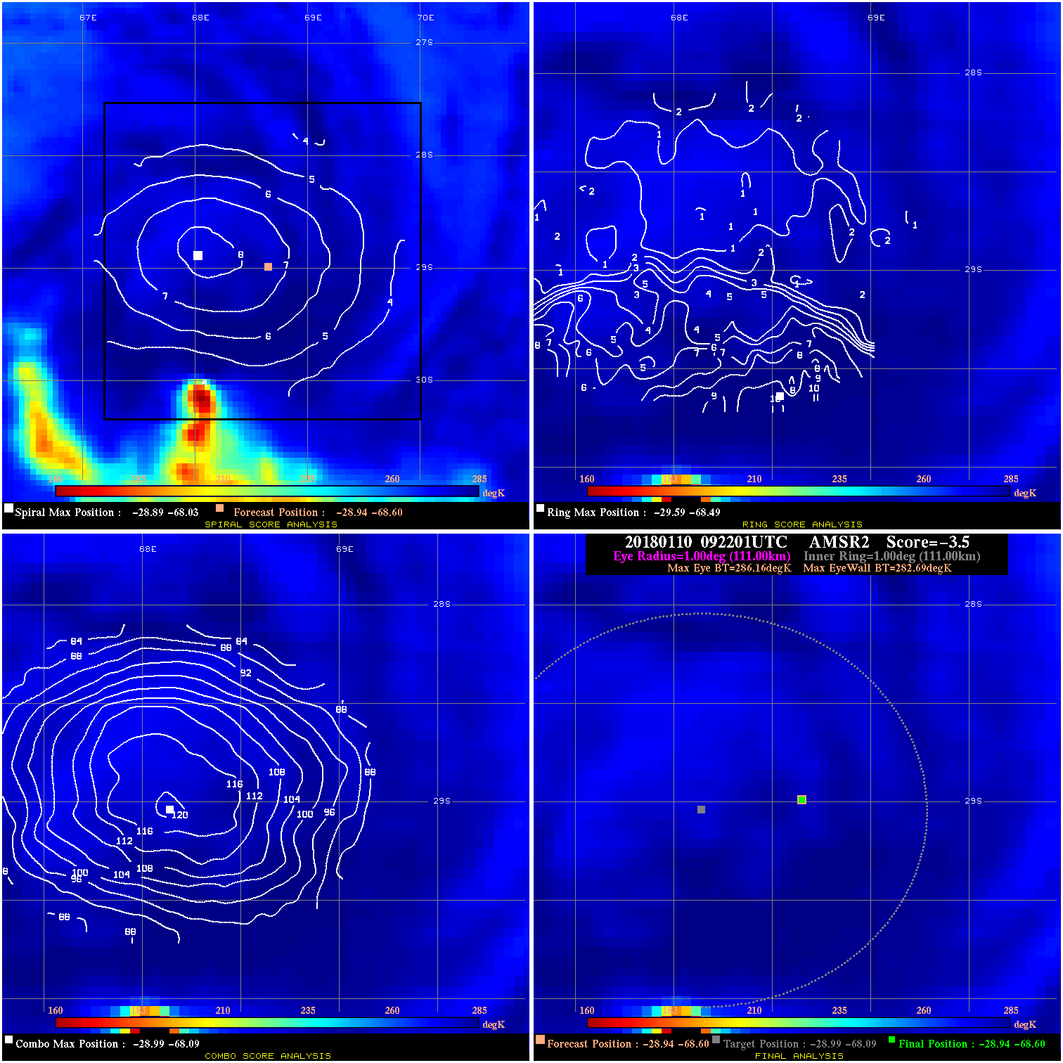
20180110 092201 -3.5 N/A 2.7% 222.20 3.47 45.0 AMSR2 -28.9 -68.6 -28.9 -68.6 -29.0 -68.1 Analysis Plot
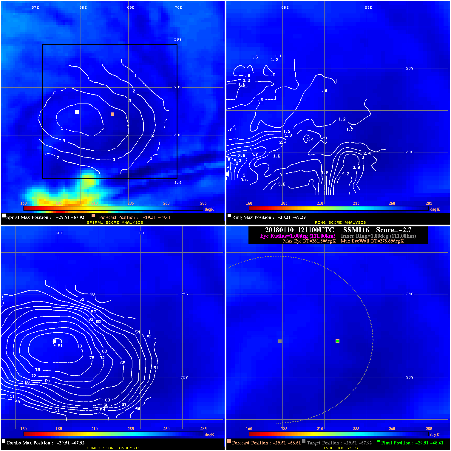
20180110 121100 -2.7 N/A 1.5% 222.20 2.71 45.0 SSMI16 -29.5 -68.6 -29.5 -68.6 -29.5 -67.9 Analysis Plot
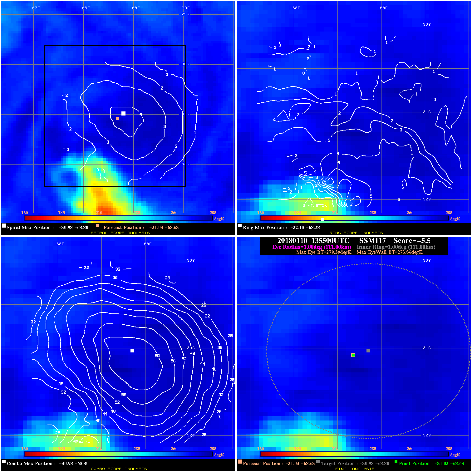
20180110 135500 -5.5 N/A 4.1% 222.20 5.53 40.0 SSMI17 -31.0 -68.6 -31.0 -68.6 -31.0 -68.8 Analysis Plot
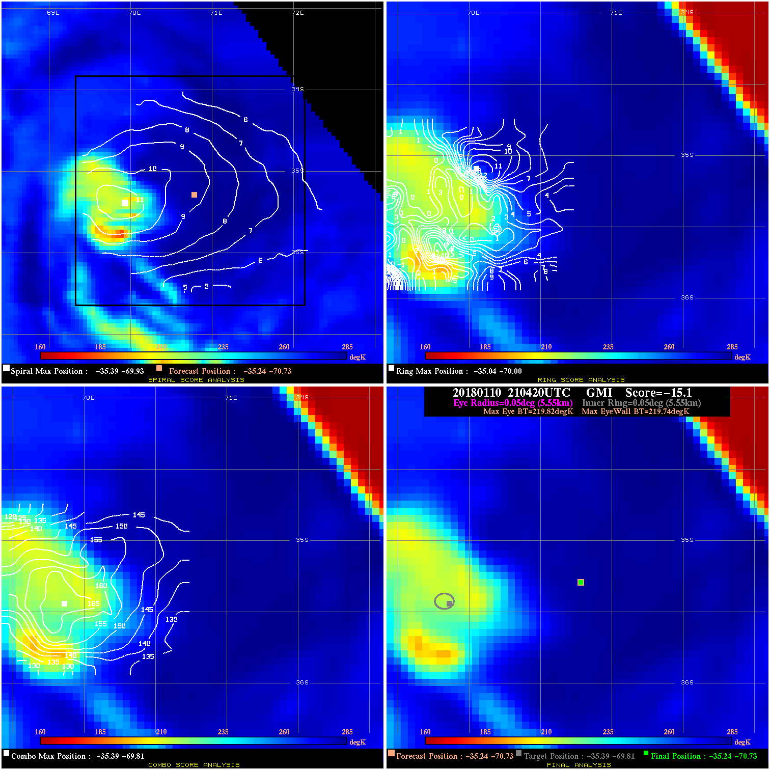
20180110 210420 -15.1 N/A 100.0% 11.11 .08 40.0 GMI -35.2 -70.7 -35.2 -70.7 -35.4 -69.8 Analysis Plot
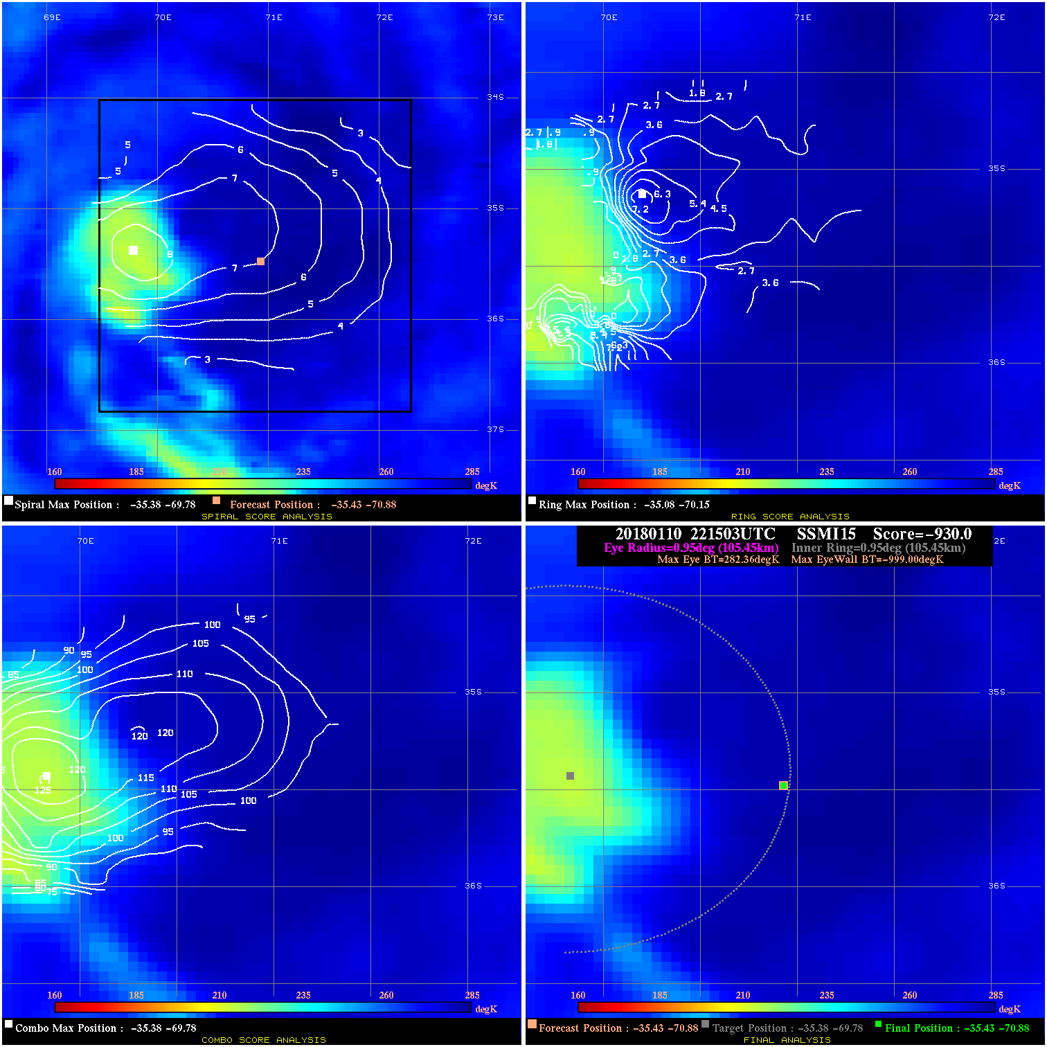
20180110 221503 -930.0 N/A N/A N/A 0.00 40.0 SSMI15 -35.4 -70.9 -35.4 -70.9 -35.4 -69.8 Analysis Plot
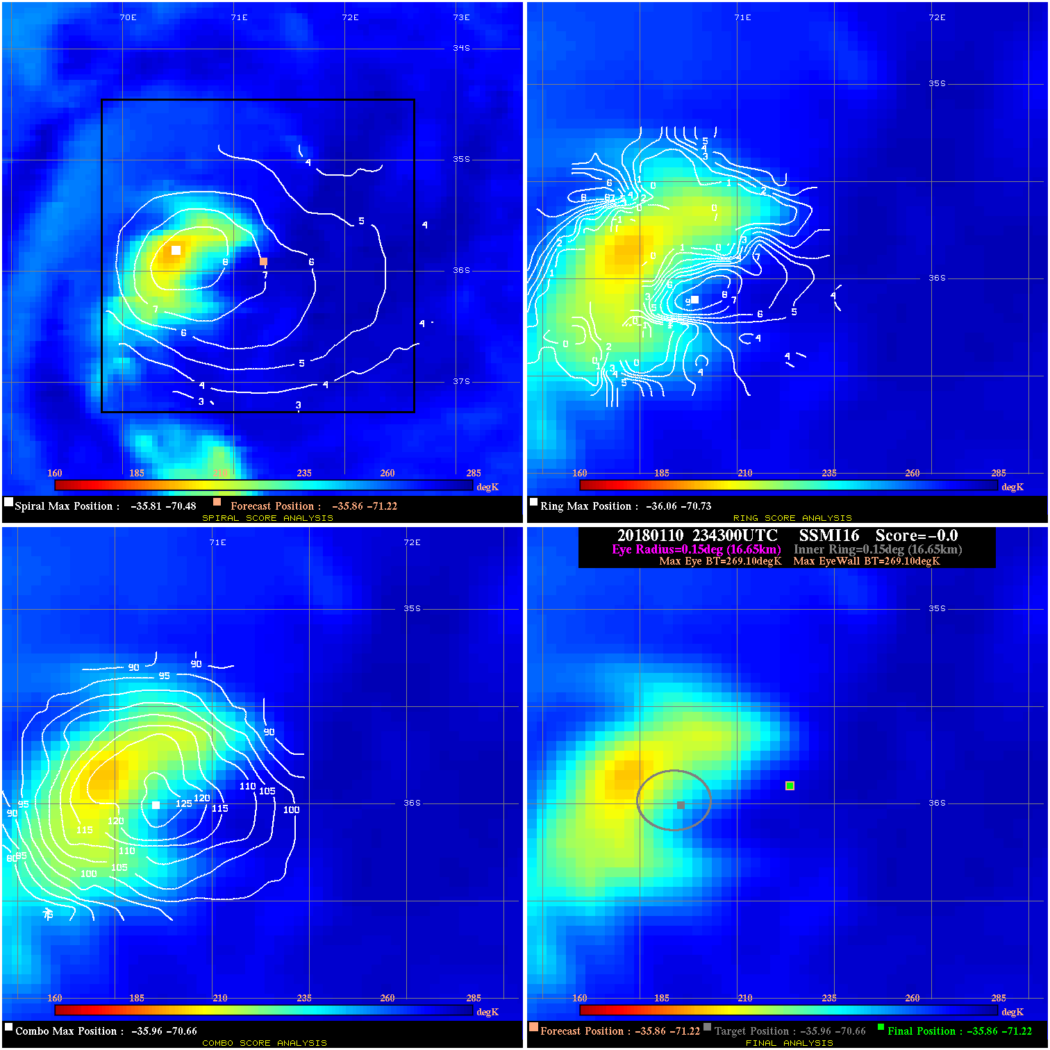
20180110 234300 -0.0 N/A N/A N/A 0.00 40.0 SSMI16 -35.9 -71.2 -35.9 -71.2 -36.0 -70.7 Analysis Plot
20180111 011600 -0.0 N/A N/A N/A 0.00 40.0 SSMI17 -37.8 -72.8 -37.8 -72.8 -37.1 -72.4 Analysis Plot
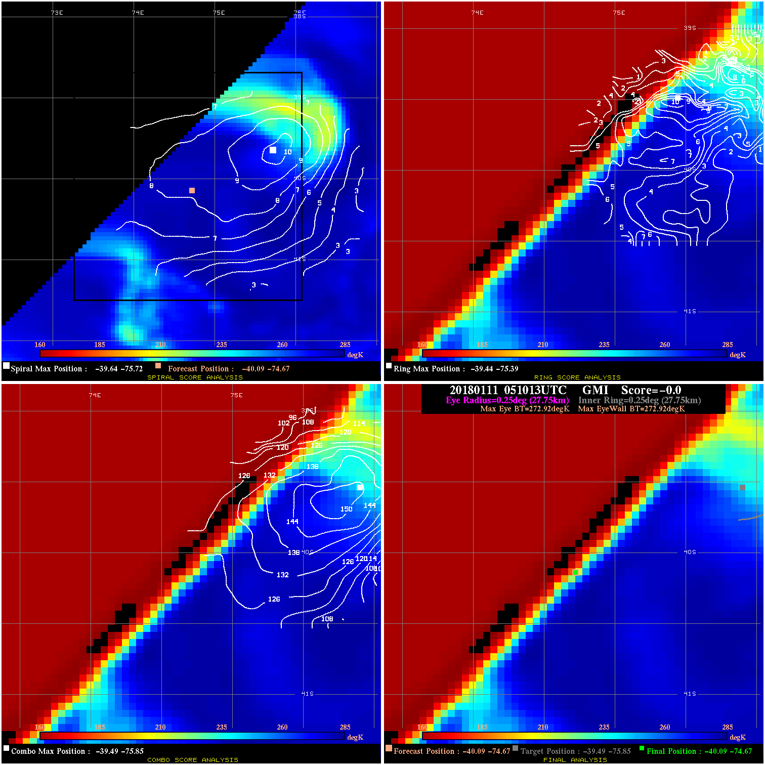
20180111 051013 -0.0 N/A N/A N/A 0.00 40.0 GMI -40.1 -74.7 -40.1 -74.7 -39.5 -75.8 Analysis Plot
|
|
Legend: - Date/Time are determined from PMW imagery at Forecast (initial guess) Lat/Lon position. - Positive/Negative Latitude = North/South Hemisphere; Longitude = Western/Eastern Hemisphere. - "Ring Diam" value indicates the estimated surface eyewall diameter in km (the MI eyewall edge diameter minus 10 km). - "Ring Pct" is the percentage of the "ring" (eyewall inner boundary) that is 1) colder than the "hot spot" (warmest eye pixel) in the eye by 20K, or 2) the percentage that is a) colder than 232K and b) colder than the "hot spot" by 10K, whichever is greater. - Values are red if Ring % <= 65, yellow/brown if Ring % <= 85 and green if Ring % > 85. - "Tb diff" is the difference between the "hot spot" (warmest eye pixel) and the warmest pixel on the eyewall. - Intensity score are listed as negative, and not used, when the JTWC or NHC estimated Vmax is <55 kts in order to rule out weak but highly symmetric TCs. - Error messages in intensity scores: -920 is used when the hottest pixel in the eye is <200K, to prevent false positives; -930 means <85% of eyewall has observations/data. |