Tropical Depression 04W
|
Passive Microwave (PMW) Intensity Information Advanced Dvorak Technique (ADT) Version 8.2.1 |
Overpass Inten Ring Ring Wind Forecast Final Target
Date Time Score Meaning Pct Diam BTdiff Est Sat Lat Lon Lat Lon Lat Lon
20180512 033653 -5.5 N/A 19.2% 222.20 5.52 30.0 AMSR2 18.8 -148.5 18.8 -148.5 18.5 -148.5 Analysis Plot
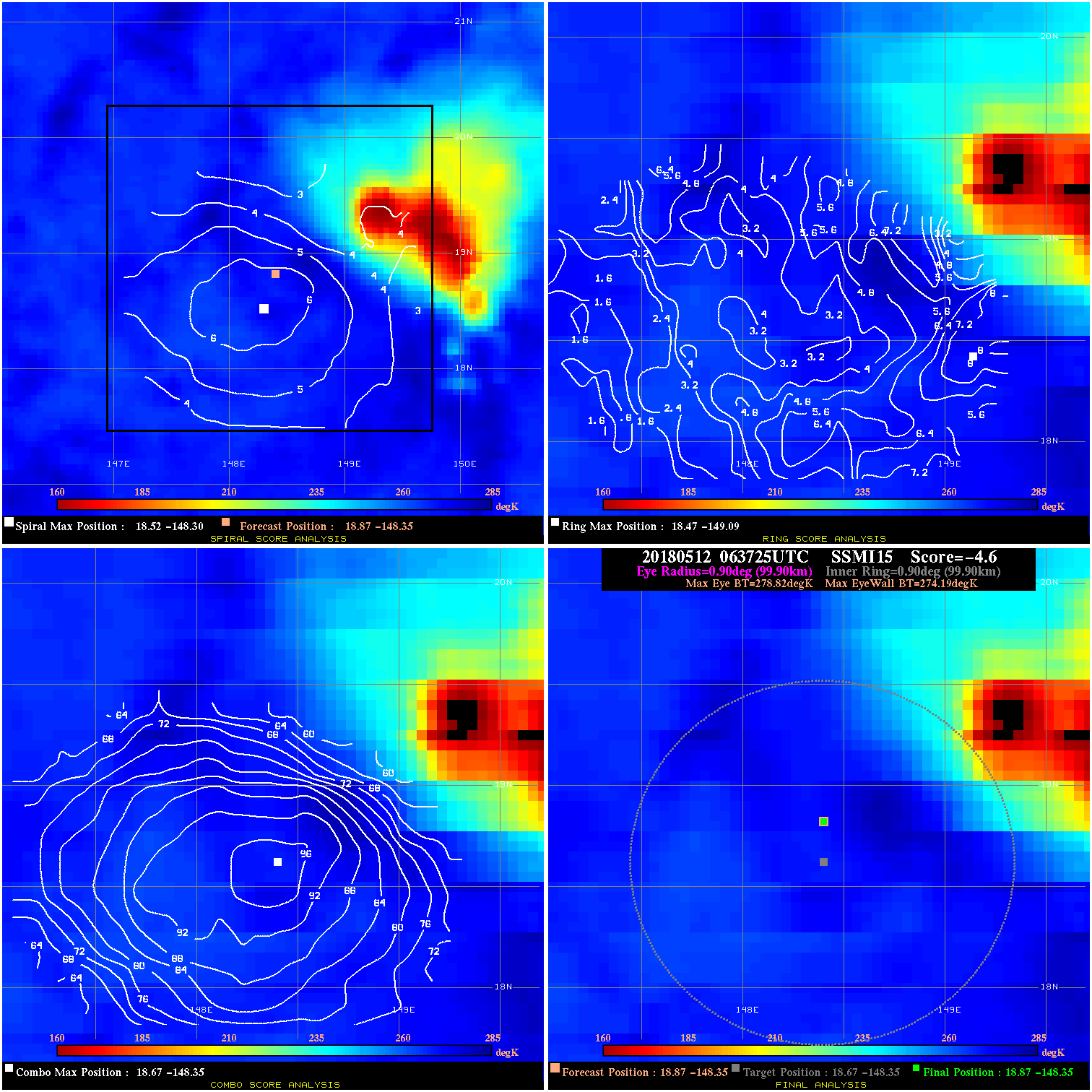
20180512 063725 -4.6 N/A 13.7% 199.98 4.63 30.0 SSMI15 18.9 -148.4 18.9 -148.4 18.7 -148.4 Analysis Plot
20180512 080300 -7.7 N/A 11.0% 188.87 7.69 30.0 SSMI18 19.3 -147.8 19.3 -147.8 19.2 -148.0 Analysis Plot
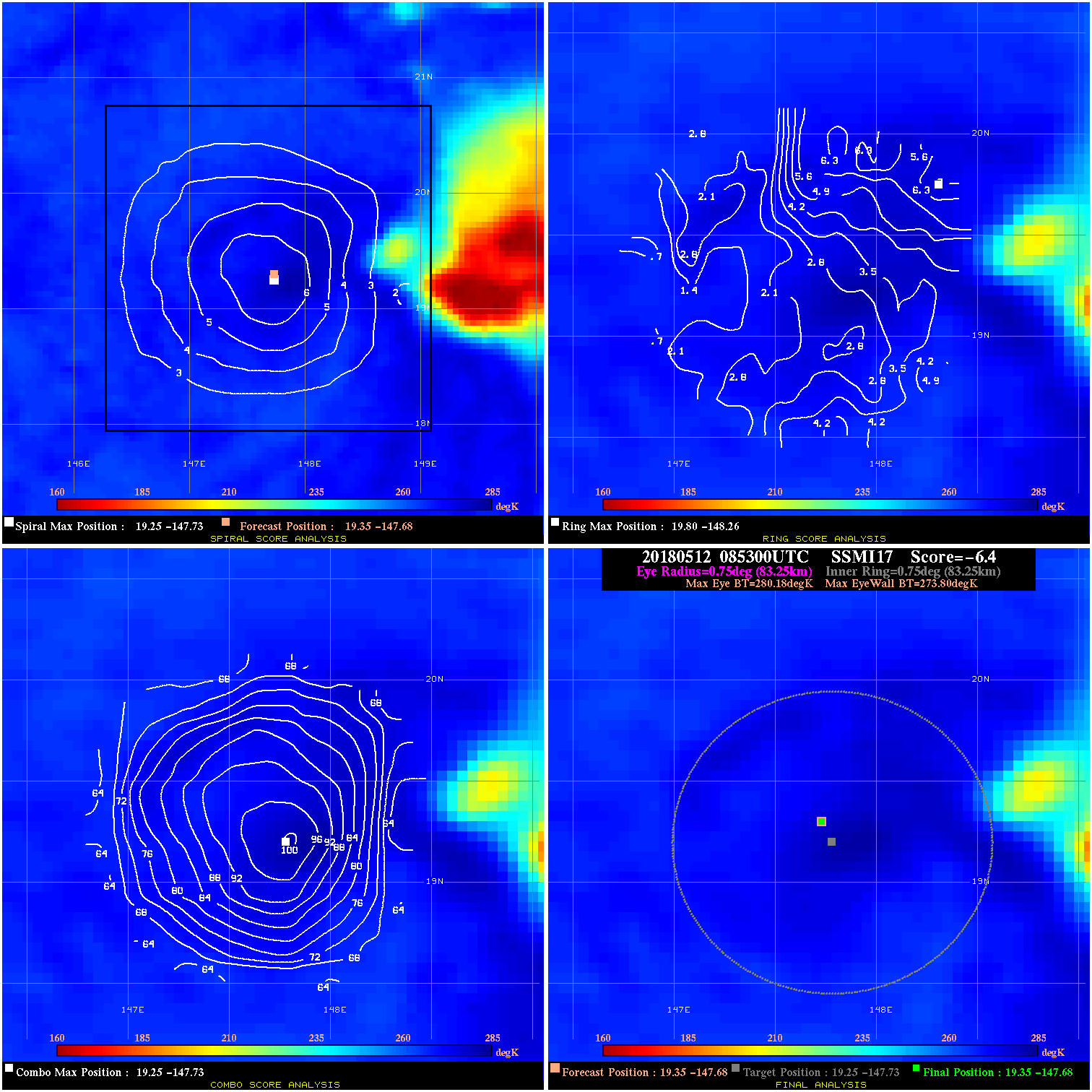
20180512 085300 -6.4 N/A 4.1% 166.65 6.38 30.0 SSMI17 19.4 -147.7 19.4 -147.7 19.3 -147.7 Analysis Plot
20180512 154809 -3.6 N/A N/A 22.22 3.57 35.0 AMSR2 19.0 -146.5 19.0 -146.5 19.0 -147.1 Analysis Plot
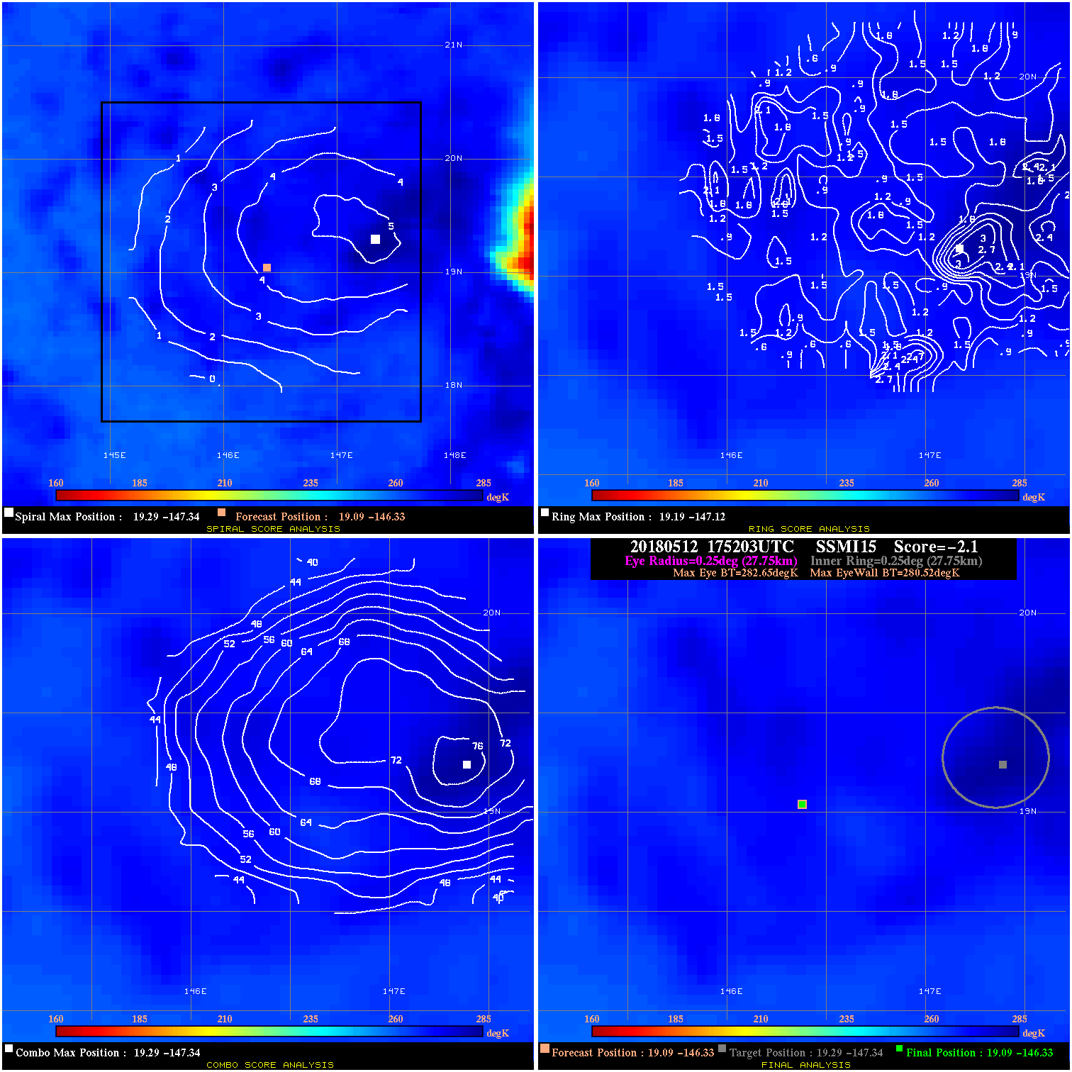
20180512 175203 -2.1 N/A N/A 55.55 2.13 35.0 SSMI15 19.1 -146.3 19.1 -146.3 19.3 -147.3 Analysis Plot
20180512 203700 -3.5 N/A 4.1% 177.76 3.50 35.0 SSMI18 19.0 -146.4 19.0 -146.4 19.8 -146.6 Analysis Plot
20180512 212600 -4.9 N/A 13.7% 111.10 4.95 35.0 SSMI17 19.0 -146.3 19.0 -146.3 19.7 -147.0 Analysis Plot
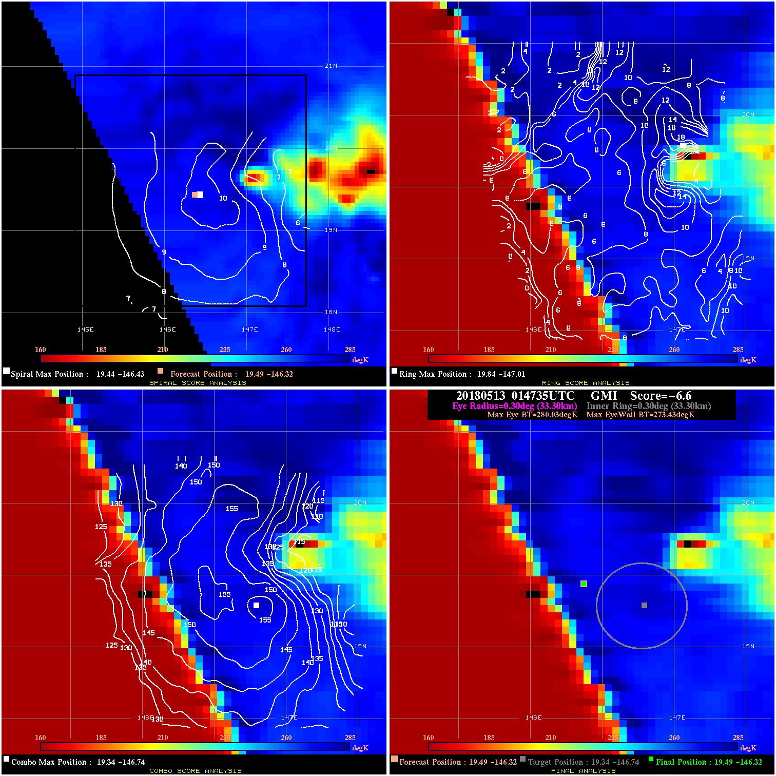
20180513 014735 -6.6 N/A 11.0% 66.66 6.60 35.0 GMI 19.5 -146.3 19.5 -146.3 19.3 -146.7 Analysis Plot
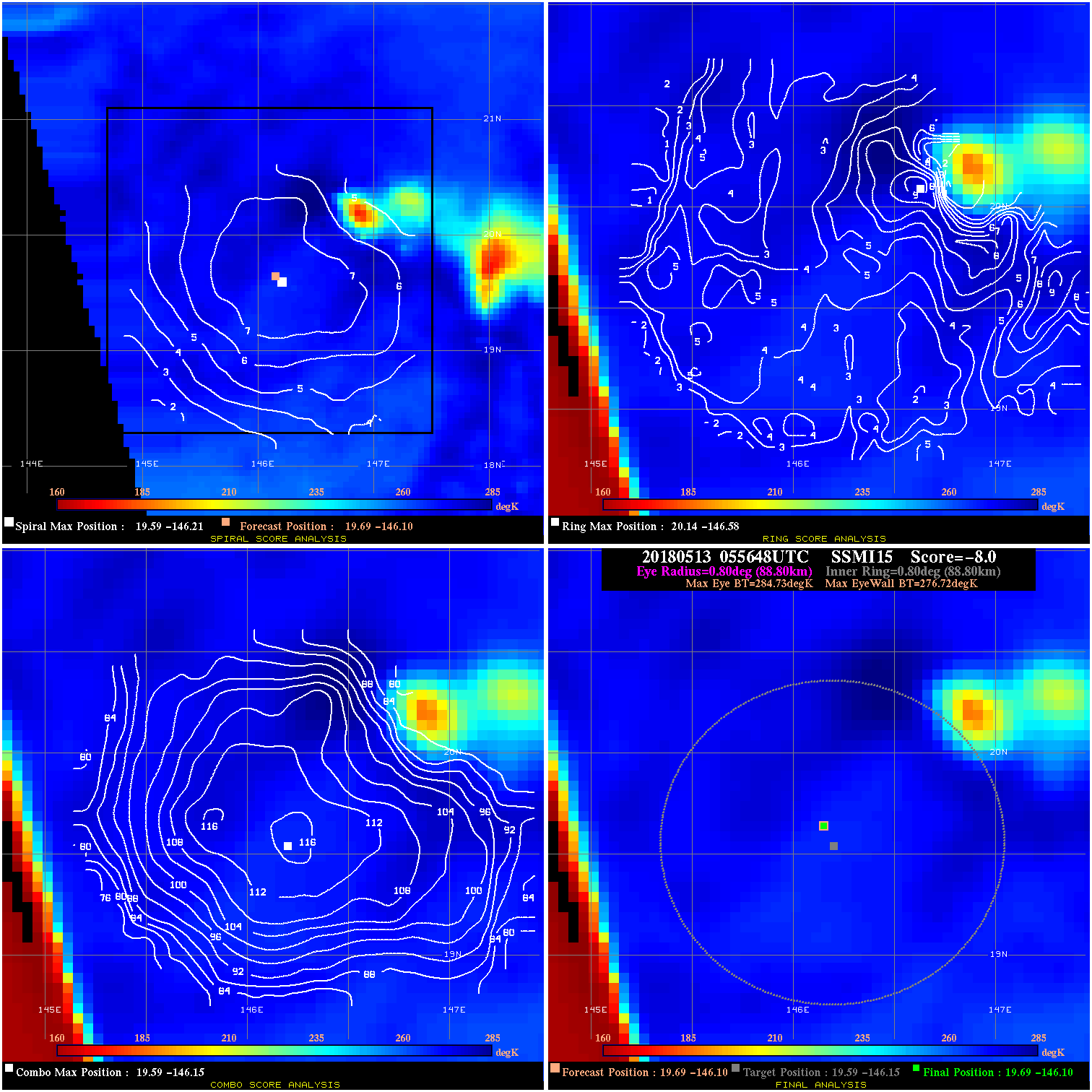
20180513 055648 -8.0 N/A N/A 177.76 8.01 35.0 SSMI15 19.7 -146.1 19.7 -146.1 19.6 -146.1 Analysis Plot
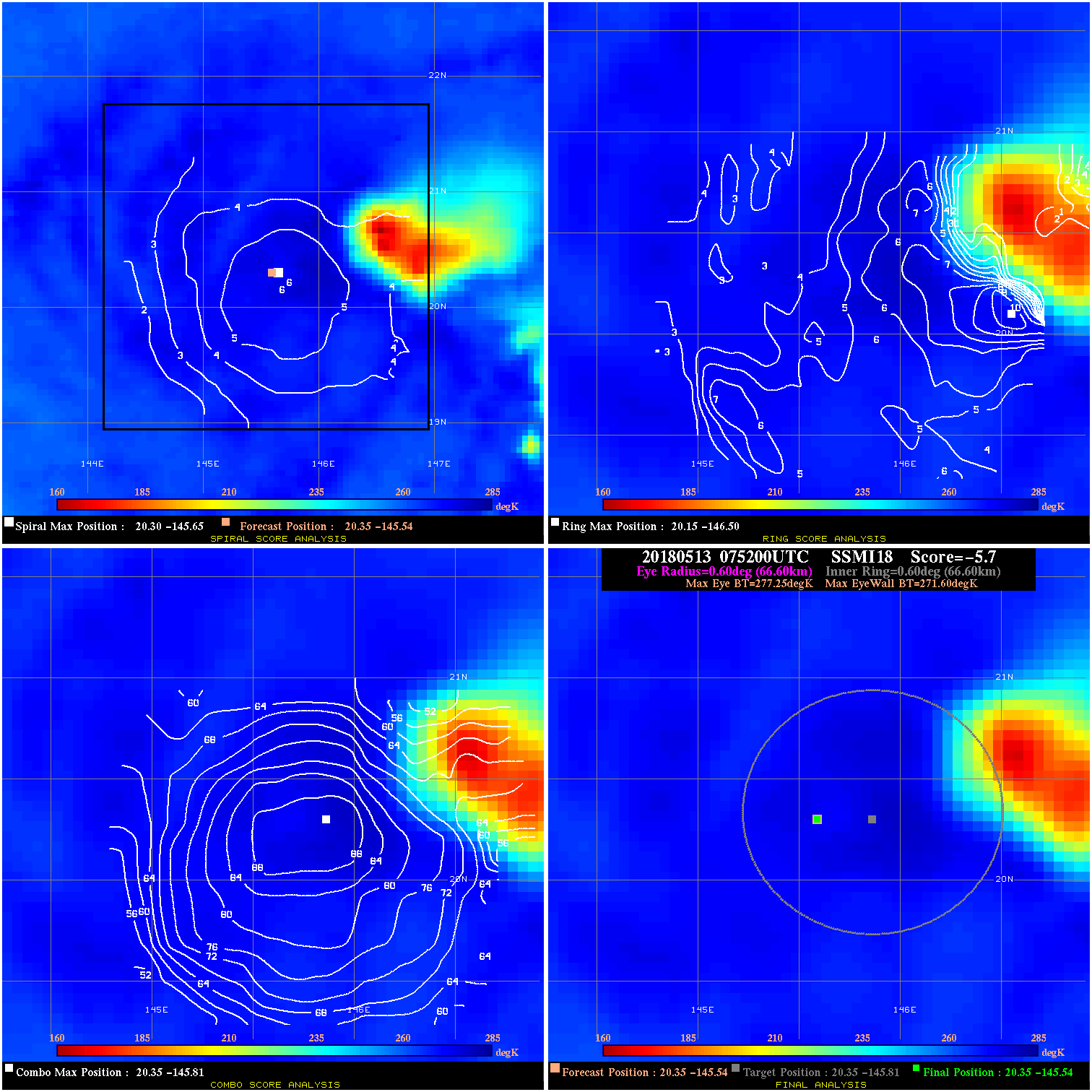
20180513 075200 -5.7 N/A 13.7% 133.32 5.65 30.0 SSMI18 20.4 -145.5 20.4 -145.5 20.4 -145.8 Analysis Plot
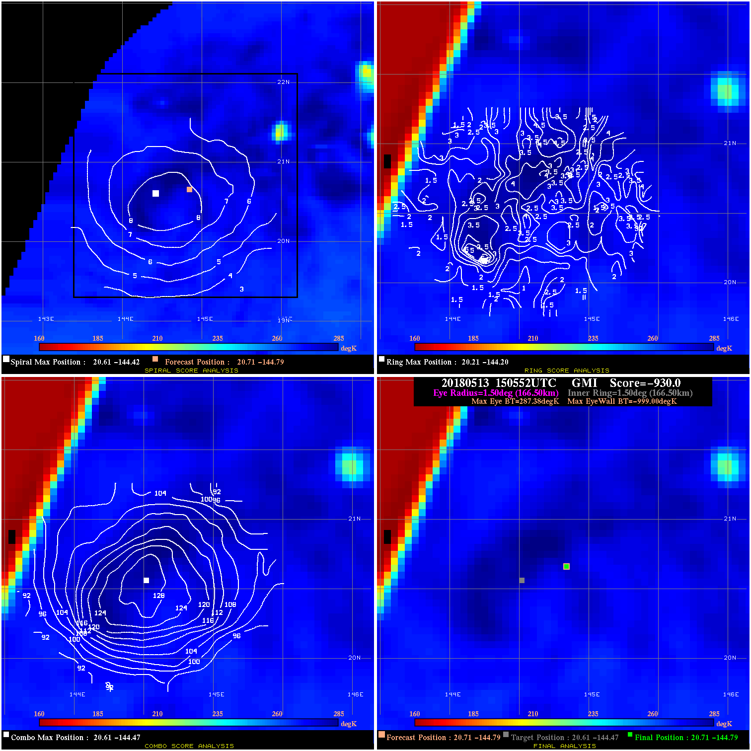
20180513 150552 -930.0 N/A N/A N/A 0.00 30.0 GMI 20.7 -144.8 20.7 -144.8 20.6 -144.5 Analysis Plot
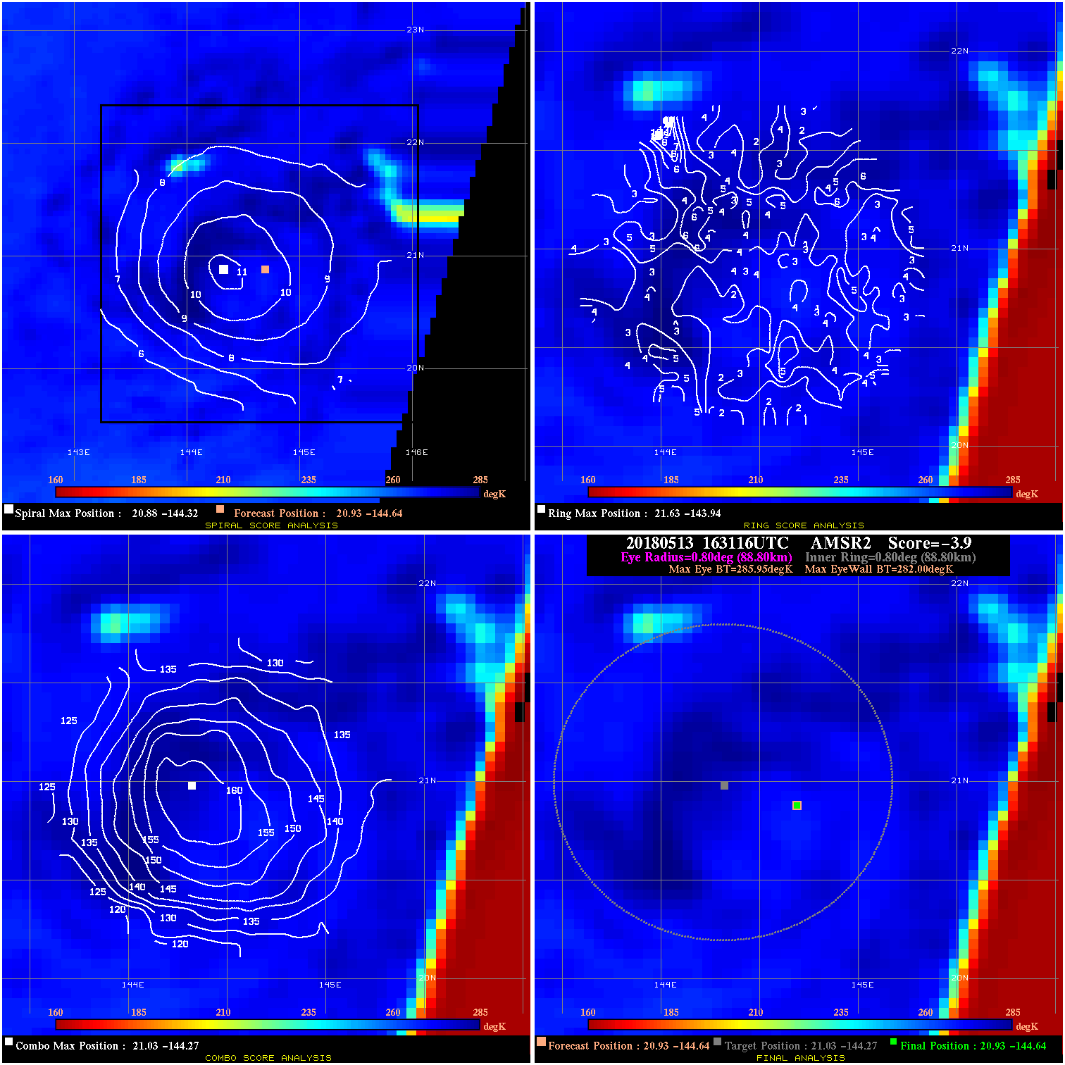
20180513 163116 -3.9 N/A N/A 177.76 3.95 30.0 AMSR2 20.9 -144.6 20.9 -144.6 21.0 -144.3 Analysis Plot
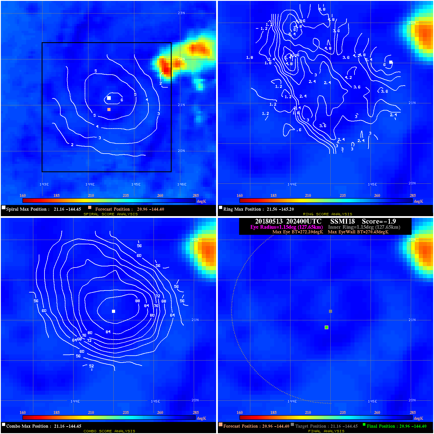
20180513 202400 -1.9 N/A 5.5% 255.53 1.94 25.0 SSMI18 21.0 -144.4 21.0 -144.4 21.2 -144.4 Analysis Plot
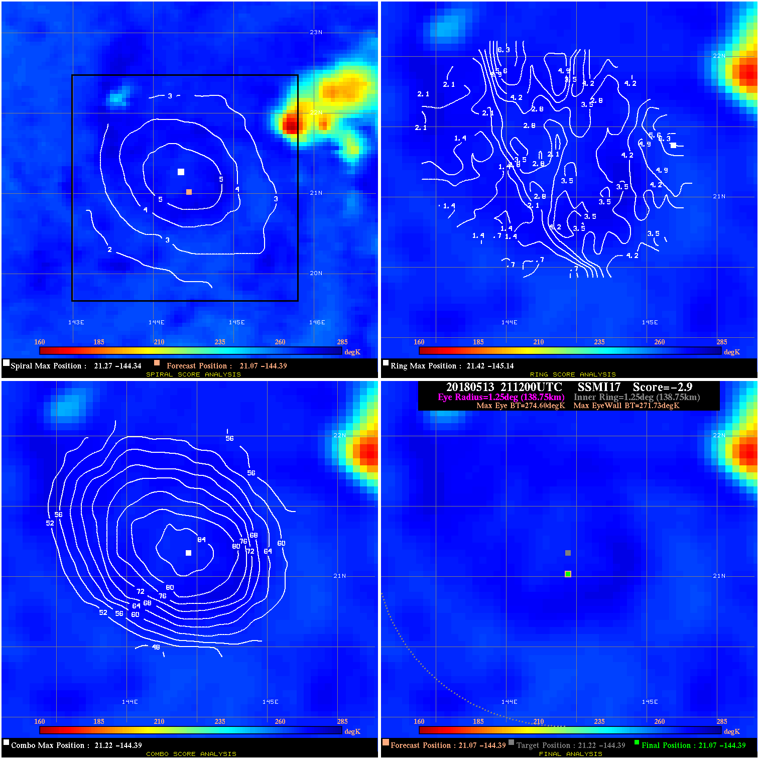
20180513 211200 -2.9 N/A 5.5% 277.75 2.87 25.0 SSMI17 21.1 -144.4 21.1 -144.4 21.2 -144.4 Analysis Plot
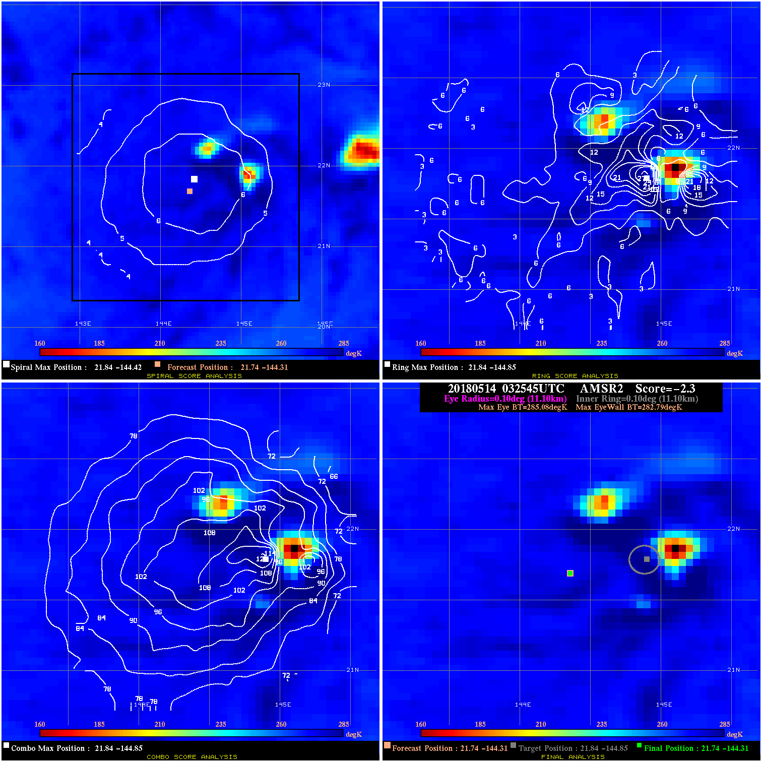
20180514 032545 -2.3 N/A 27.4% 22.22 2.29 25.0 AMSR2 21.7 -144.3 21.7 -144.3 21.8 -144.9 Analysis Plot
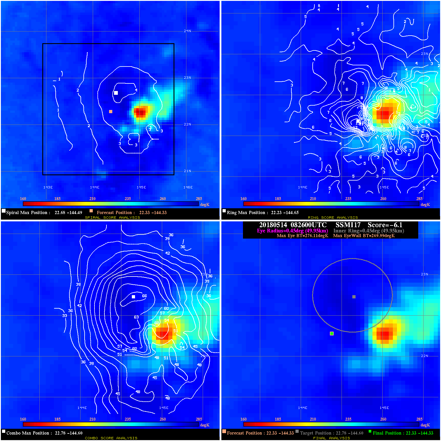
20180514 082600 -6.1 N/A 11.0% 99.99 6.12 25.0 SSMI17 22.3 -144.3 22.3 -144.3 22.8 -144.6 Analysis Plot
|
|
Legend: - Date/Time are determined from PMW imagery at Forecast (initial guess) Lat/Lon position. - Positive/Negative Latitude = North/South Hemisphere; Longitude = Western/Eastern Hemisphere. - "Ring Diam" value indicates the estimated surface eyewall diameter in km (the MI eyewall edge diameter minus 10 km). - "Ring Pct" is the percentage of the "ring" (eyewall inner boundary) that is 1) colder than the "hot spot" (warmest eye pixel) in the eye by 20K, or 2) the percentage that is a) colder than 232K and b) colder than the "hot spot" by 10K, whichever is greater. - Values are red if Ring % <= 65, yellow/brown if Ring % <= 85 and green if Ring % > 85. - "Tb diff" is the difference between the "hot spot" (warmest eye pixel) and the warmest pixel on the eyewall. - Intensity score are listed as negative, and not used, when the JTWC or NHC estimated Vmax is <55 kts in order to rule out weak but highly symmetric TCs. - Error messages in intensity scores: -920 is used when the hottest pixel in the eye is <200K, to prevent false positives; -930 means <85% of eyewall has observations/data. |