Tropical Storm 06W
|
Passive Microwave (PMW) Intensity Information Advanced Dvorak Technique (ADT) Version 8.2.1 |
Overpass Inten Ring Ring Wind Forecast Final Target
Date Time Score Meaning Pct Diam BTdiff Est Sat Lat Lon Lat Lon Lat Lon
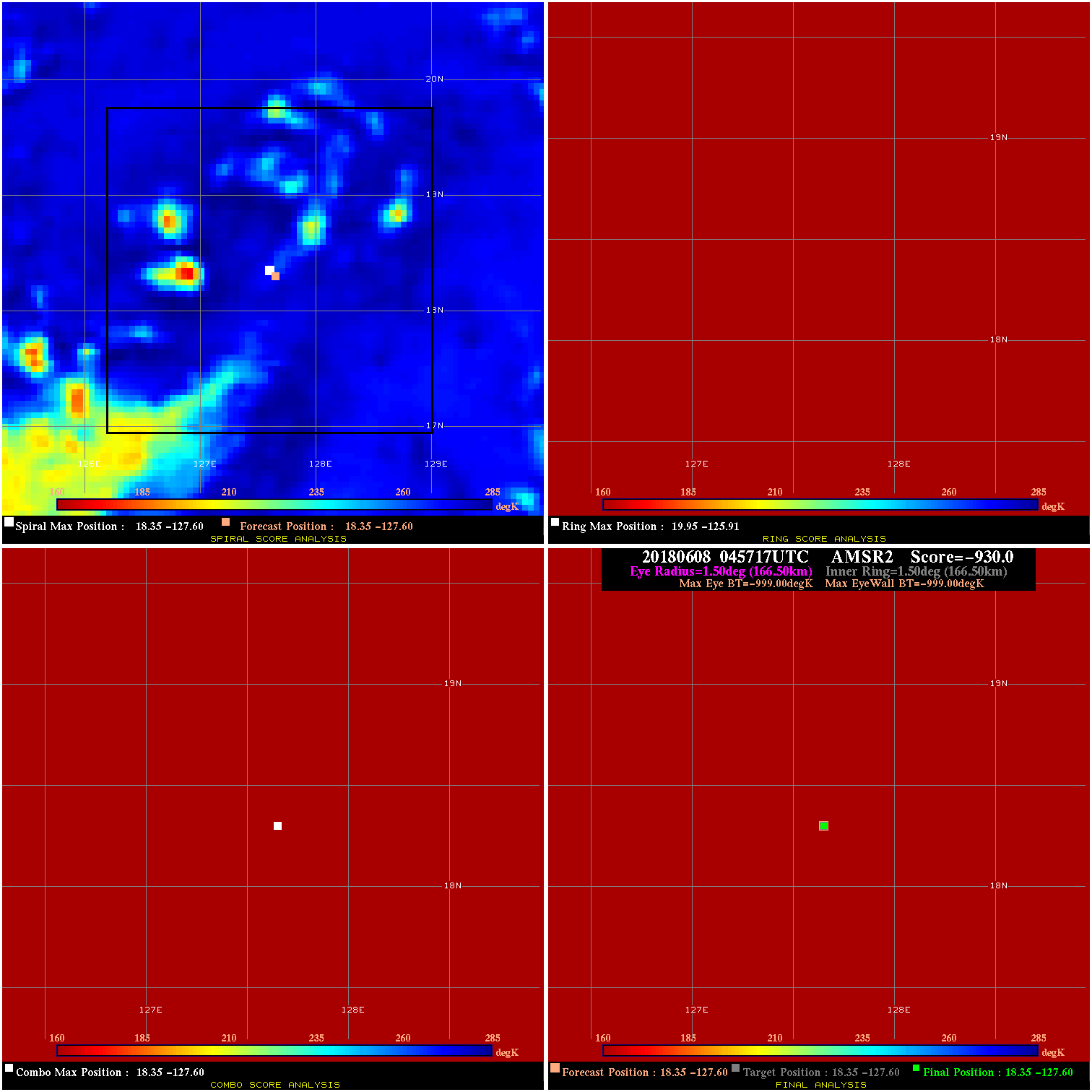
20180608 045717 -0.0 N/A N/A N/A 0.00 40.0 AMSR2 18.4 -127.6 18.4 -127.6 18.4 -127.6 Analysis Plot
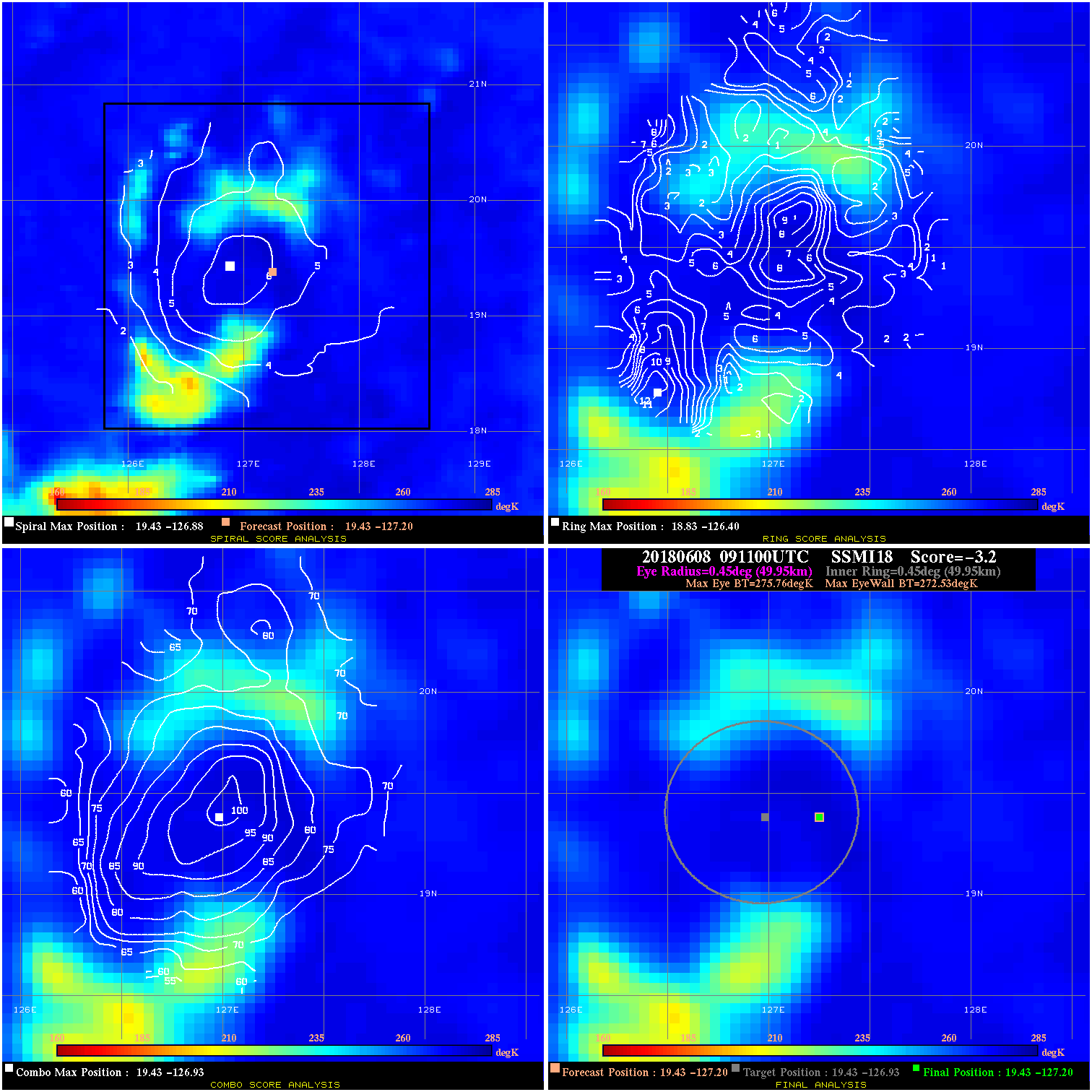
20180608 091100 -3.2 N/A 21.9% 99.99 3.23 40.0 SSMI18 19.4 -127.2 19.4 -127.2 19.4 -126.9 Analysis Plot
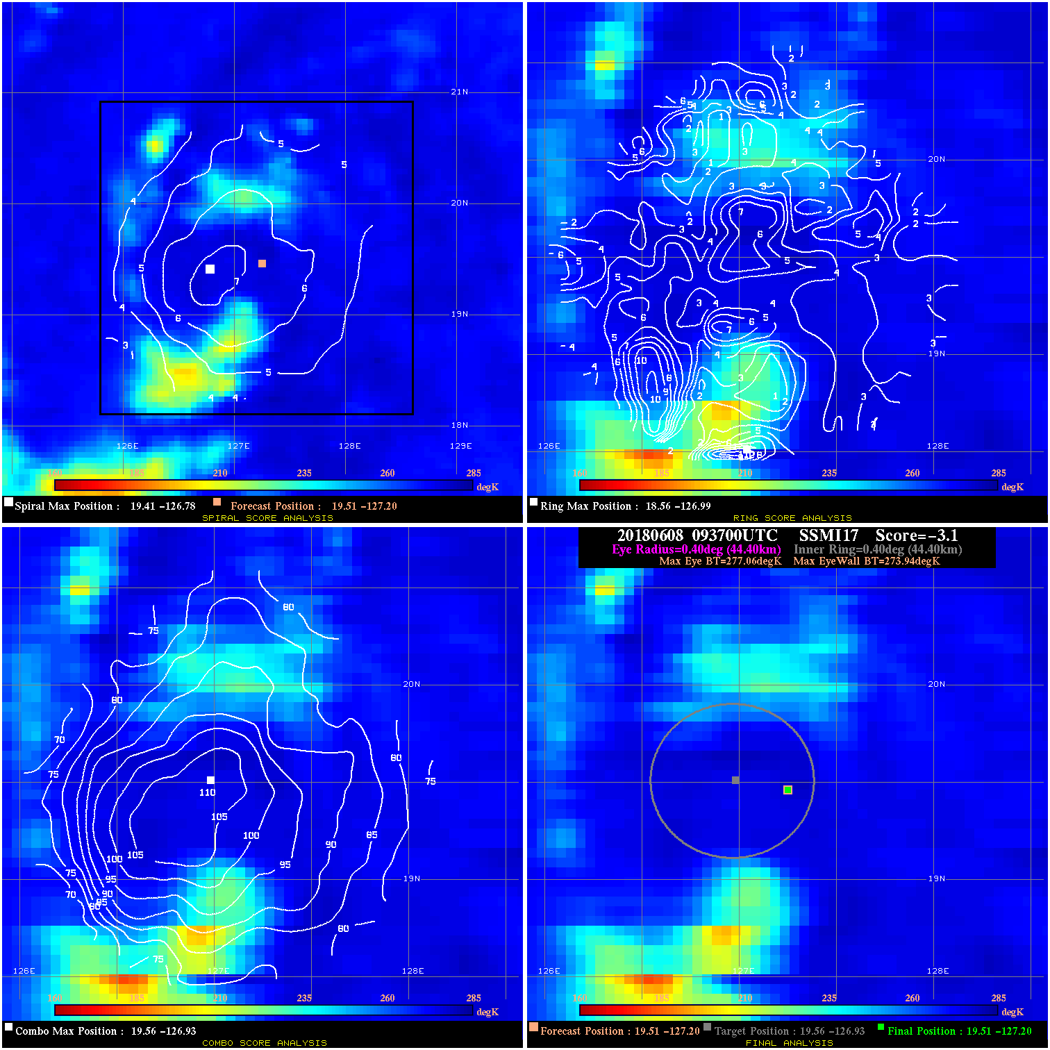
20180608 093700 -3.1 N/A 1.4% 88.88 3.12 40.0 SSMI17 19.5 -127.2 19.5 -127.2 19.6 -126.9 Analysis Plot
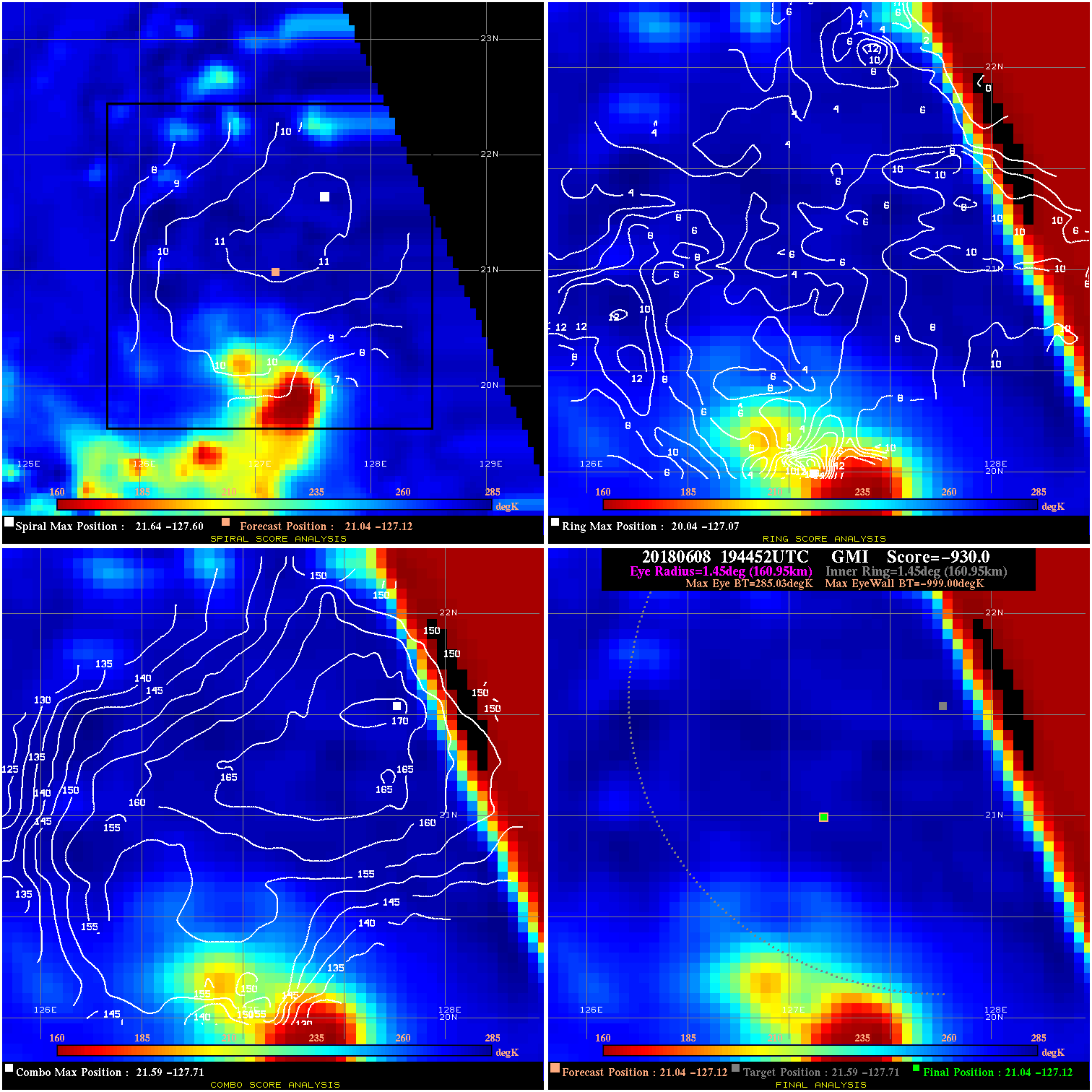
20180608 194452 -930.0 N/A N/A N/A 0.00 40.0 GMI 21.0 -127.1 21.0 -127.1 21.6 -127.7 Analysis Plot
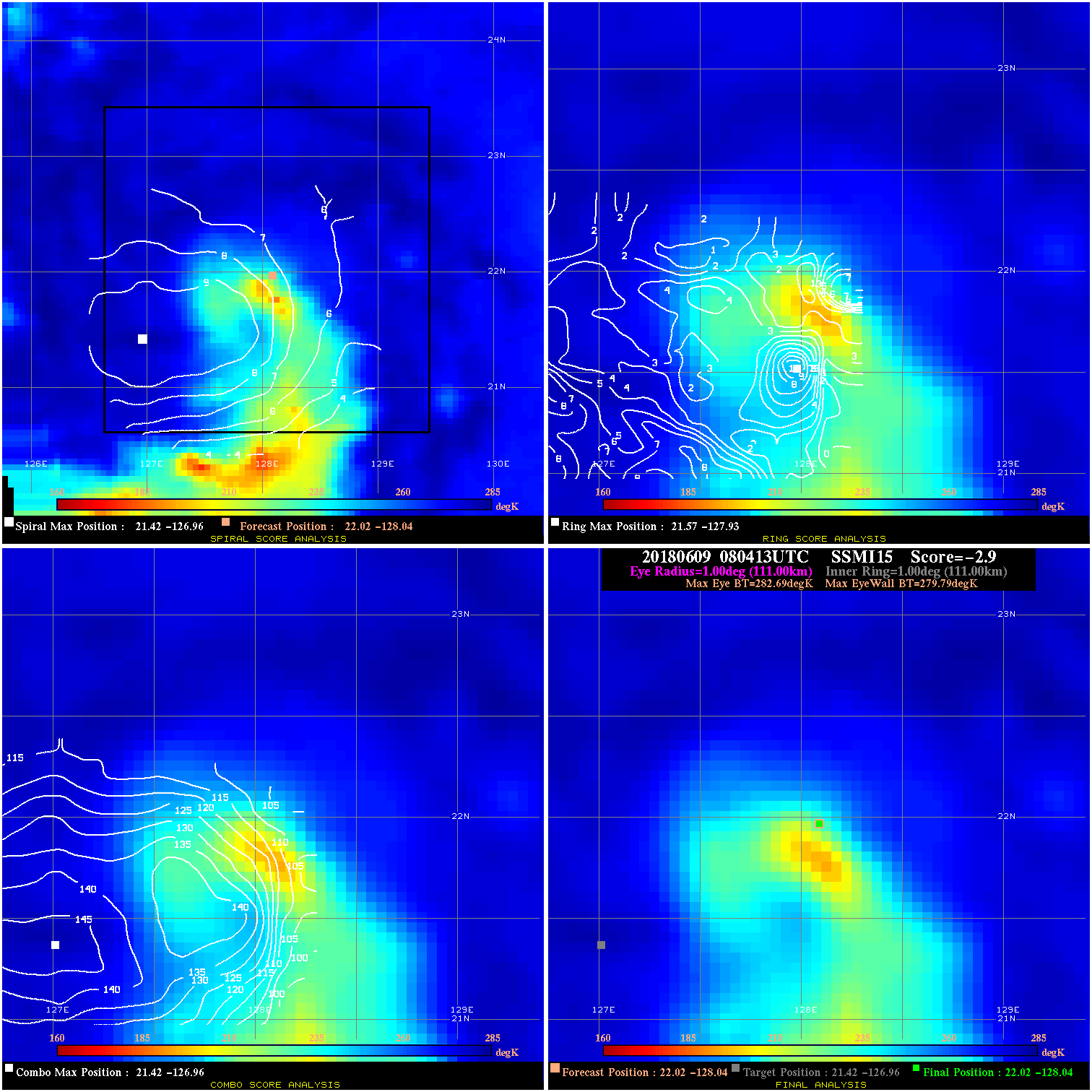
20180609 080413 -2.9 N/A 20.3% 222.20 2.90 40.0 SSMI15 22.0 -128.0 22.0 -128.0 21.4 -127.0 Analysis Plot
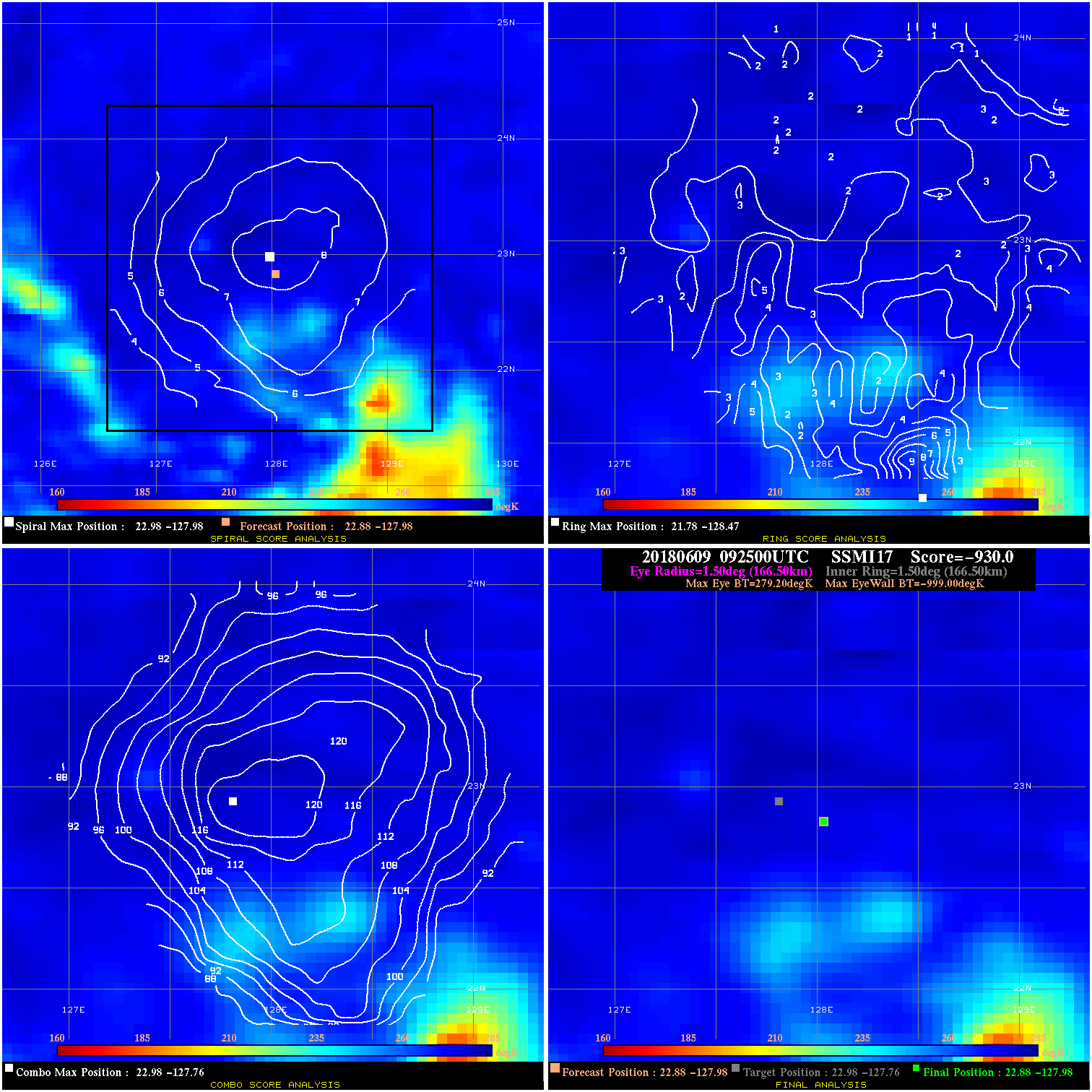
20180609 092500 -930.0 N/A N/A N/A 0.00 45.0 SSMI17 22.9 -128.0 22.9 -128.0 23.0 -127.8 Analysis Plot
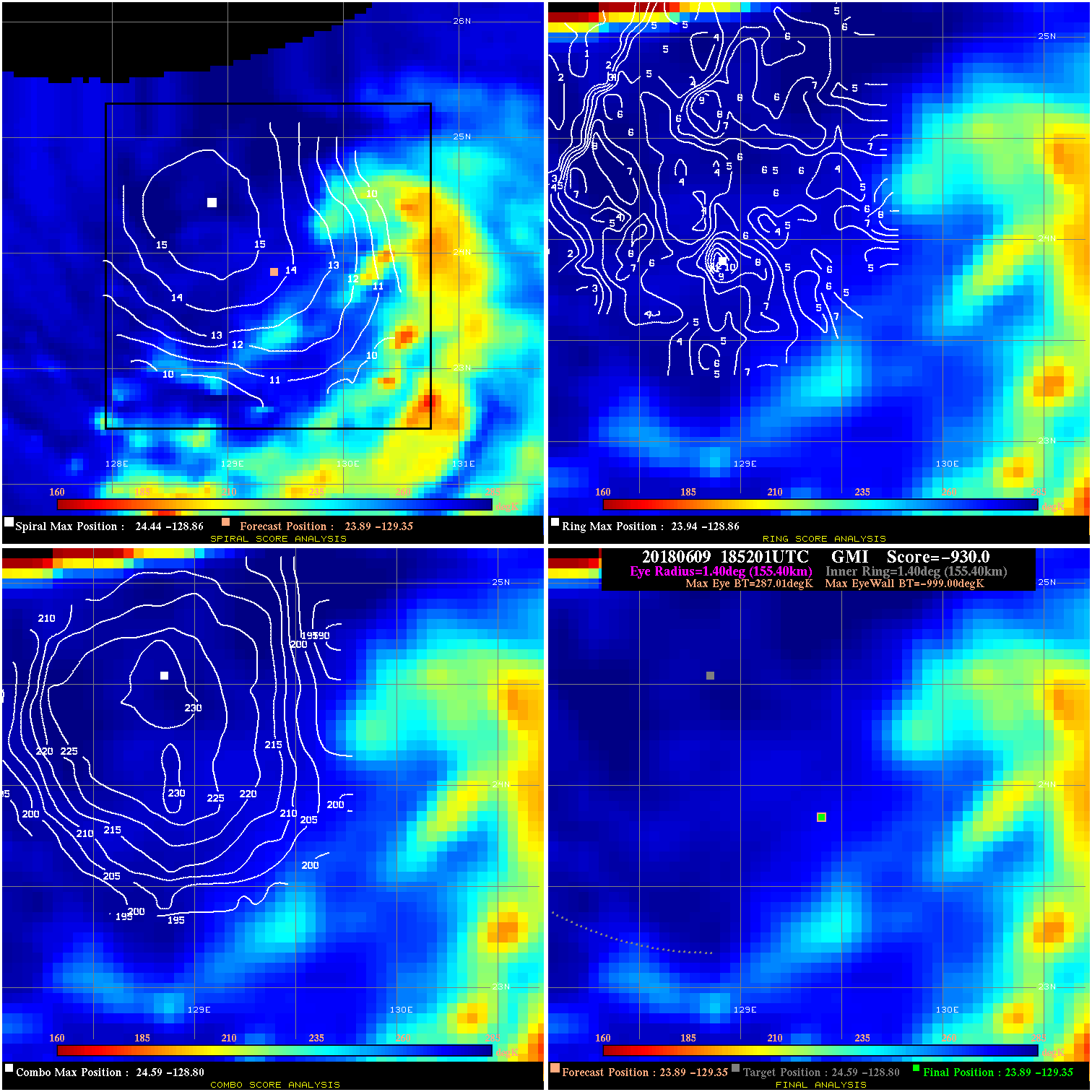
20180609 185201 -930.0 N/A N/A N/A 0.00 50.0 GMI 23.9 -129.4 23.9 -129.4 24.6 -128.8 Analysis Plot
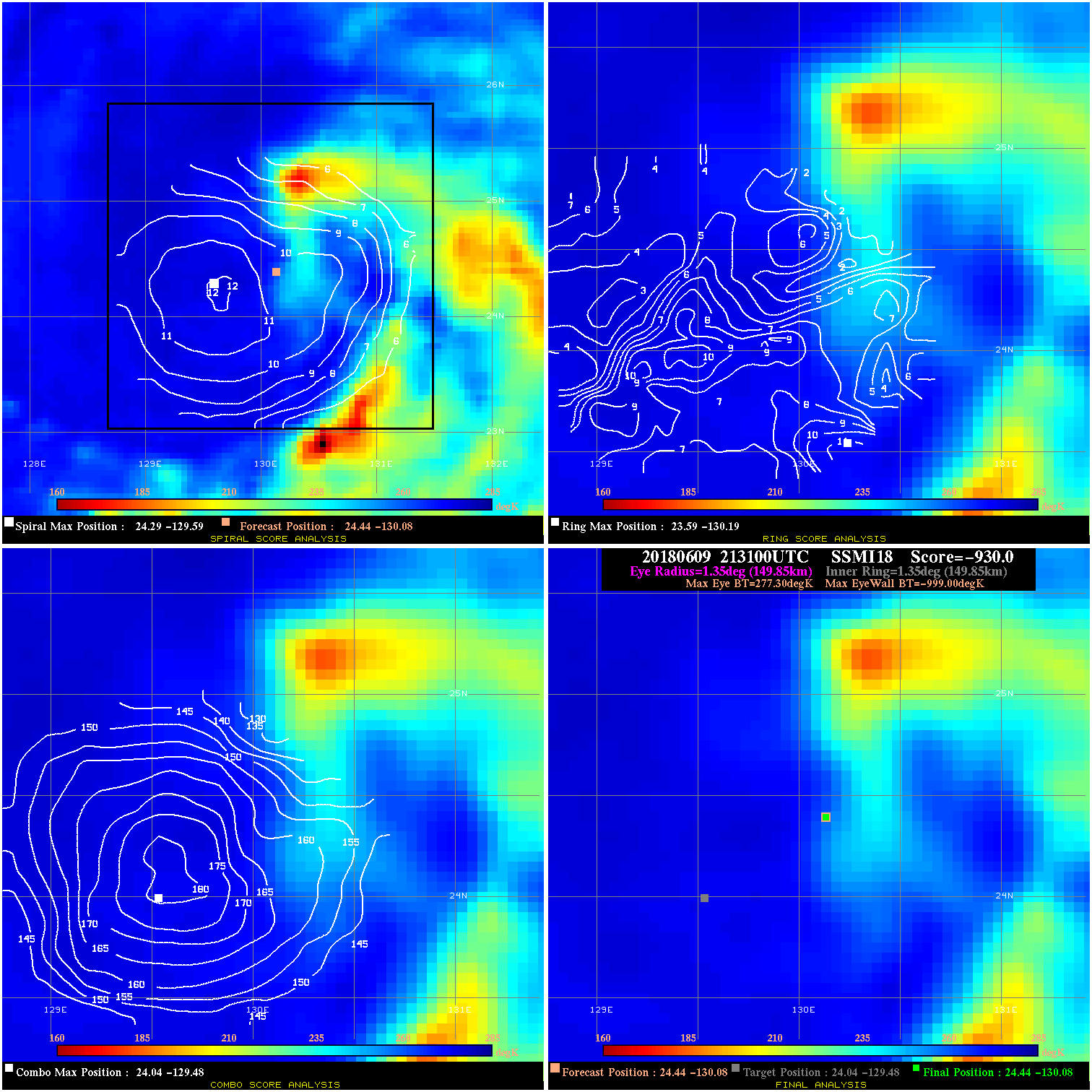
20180609 213100 -930.0 N/A N/A N/A 0.00 50.0 SSMI18 24.4 -130.1 24.4 -130.1 24.0 -129.5 Analysis Plot
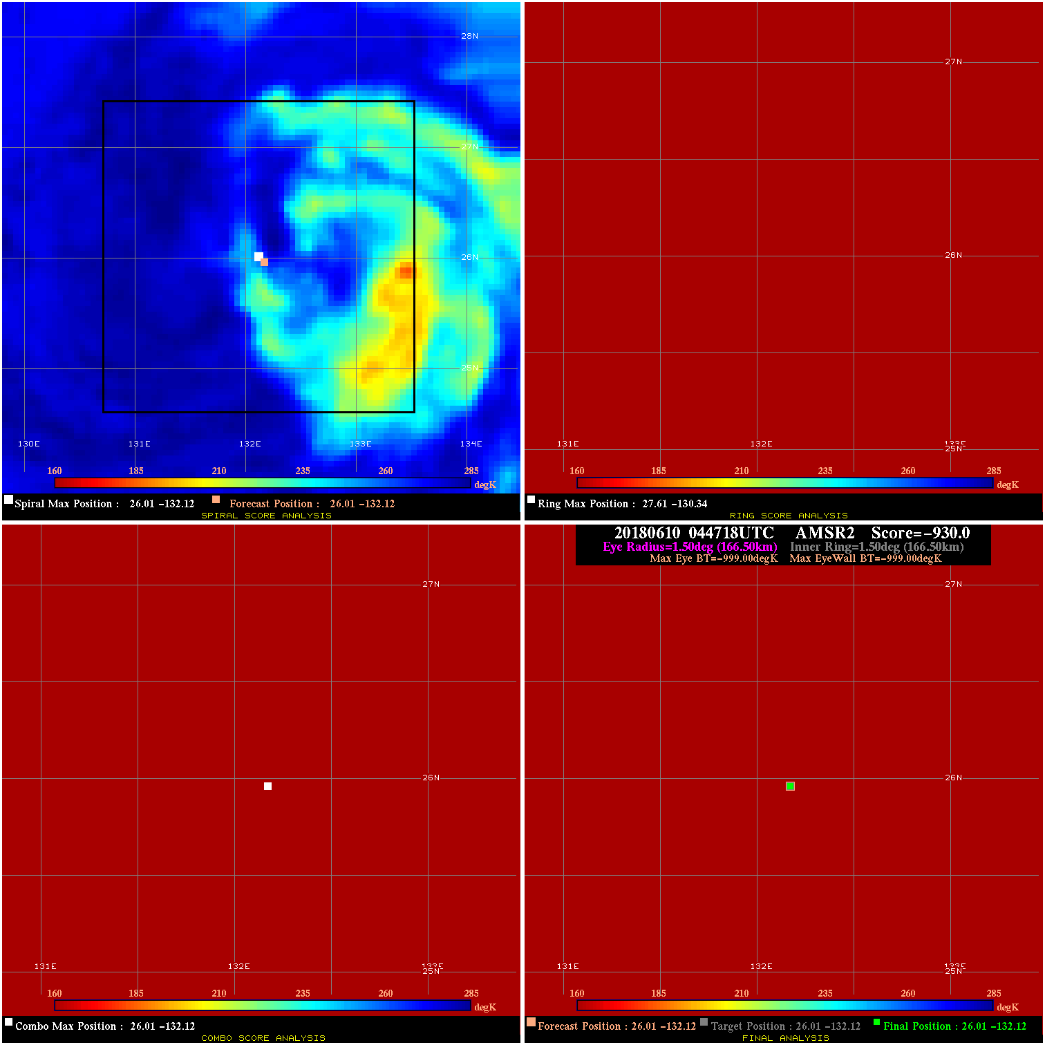
20180610 044718 -0.0 N/A N/A N/A 0.00 60.0 AMSR2 26.0 -132.1 26.0 -132.1 26.0 -132.1 Analysis Plot
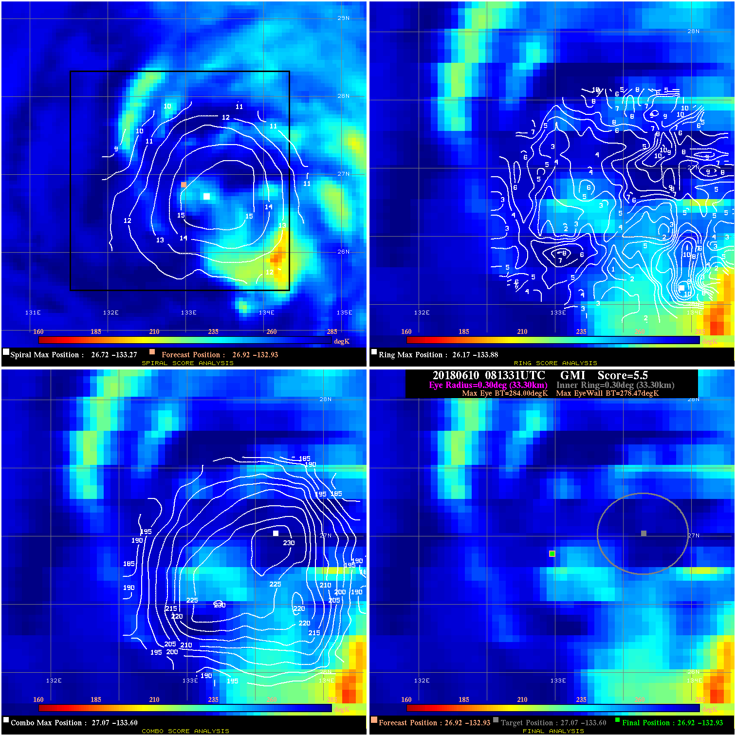
20180610 081331 5.5 N/A N/A 66.66 5.53 60.0 GMI 26.9 -132.9 26.9 -132.9 27.1 -133.6 Analysis Plot
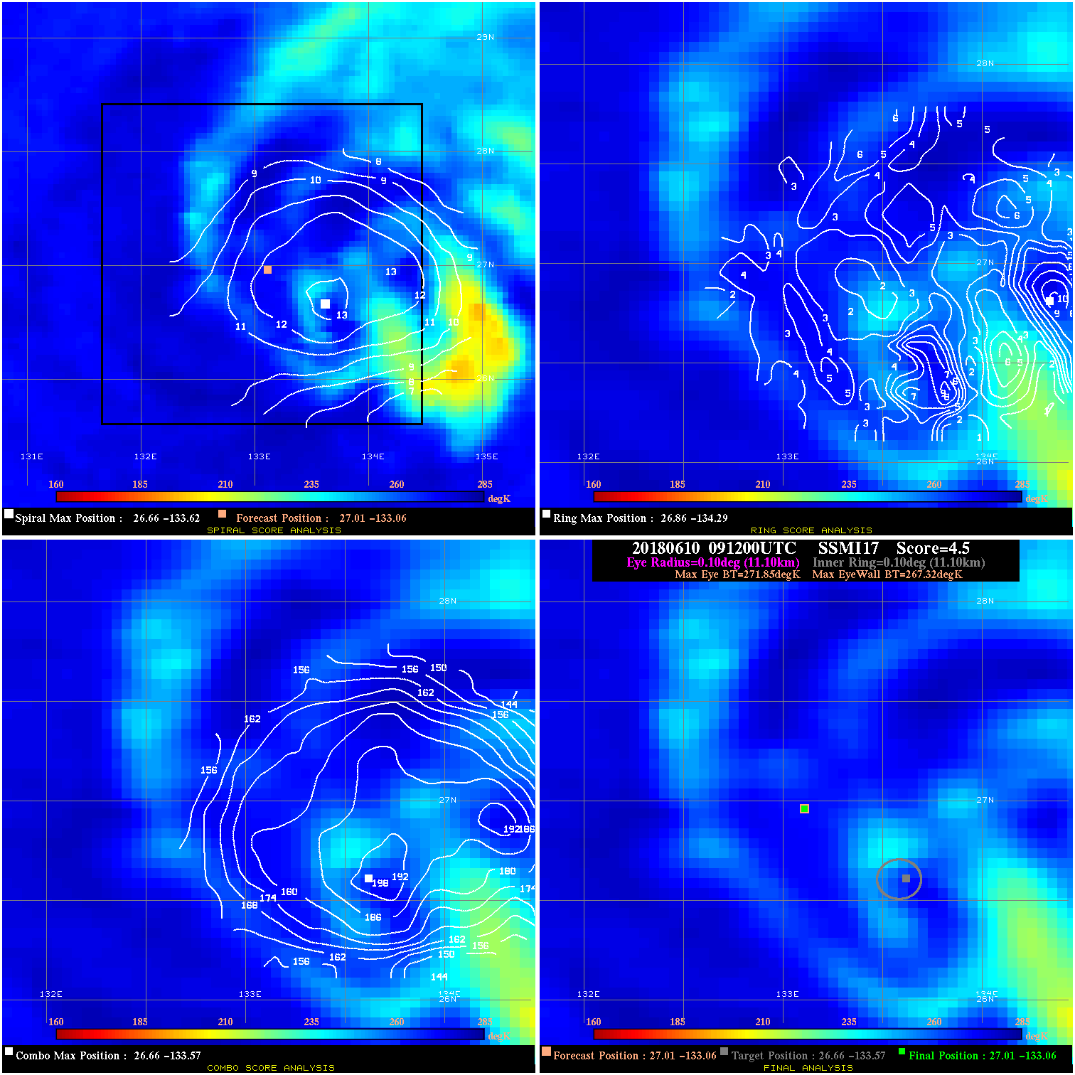
20180610 091200 4.5 N/A N/A 22.22 4.53 60.0 SSMI17 27.0 -133.1 27.0 -133.1 26.7 -133.6 Analysis Plot
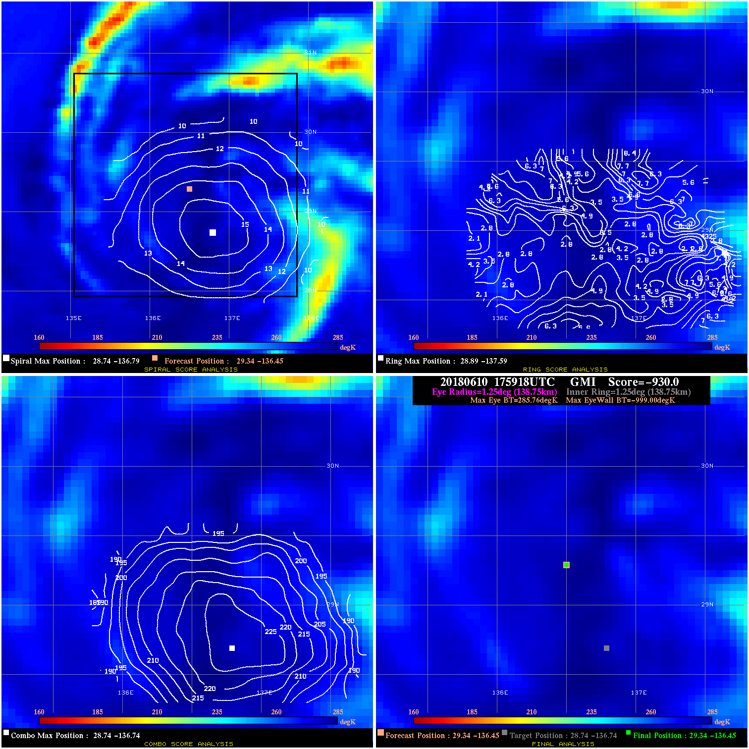
20180610 175918 -930.0 N/A N/A N/A 0.00 50.0 GMI 29.3 -136.4 29.3 -136.4 28.7 -136.7 Analysis Plot
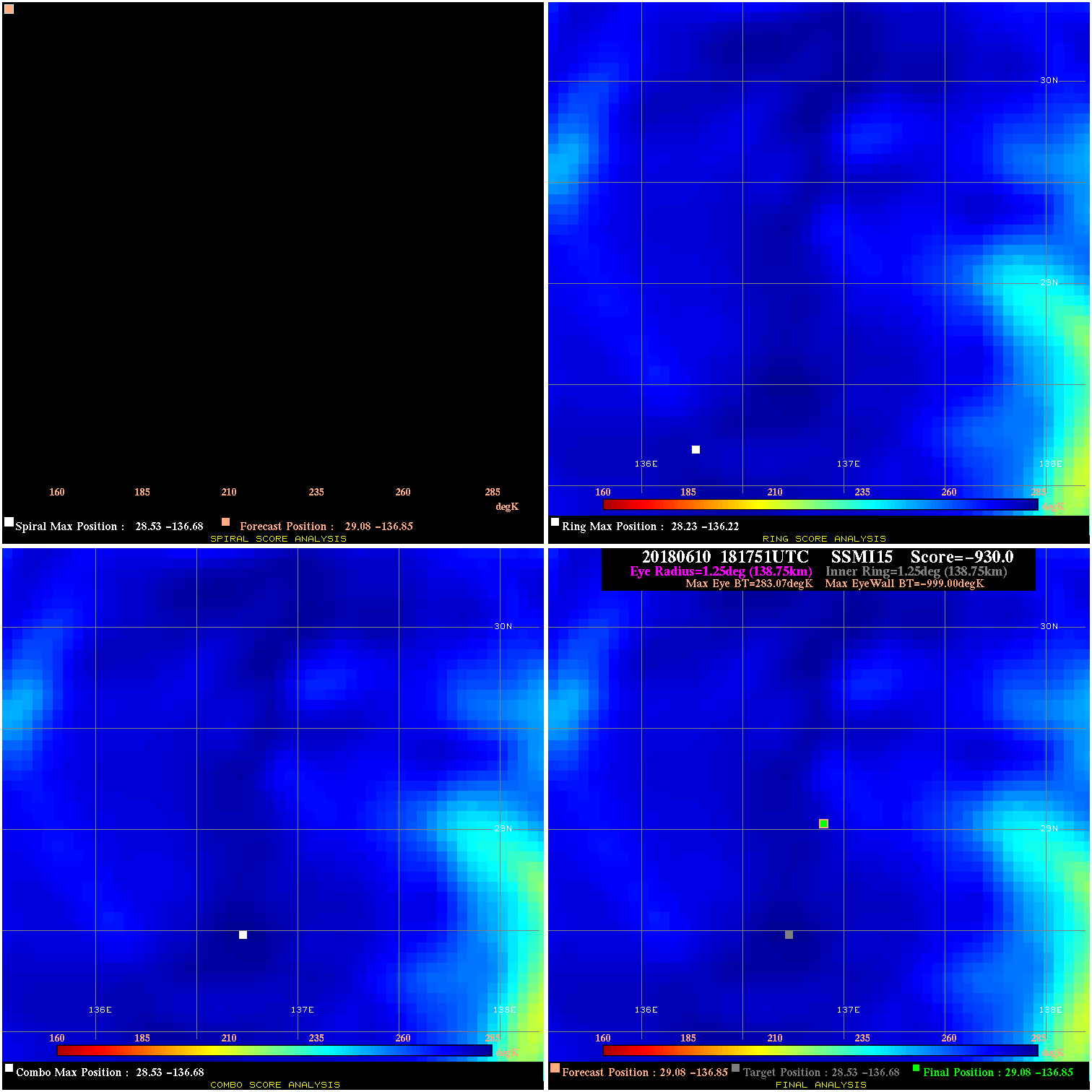
20180610 181751 -930.0 N/A N/A N/A 0.00 50.0 SSMI15 29.1 -136.9 29.1 -136.9 28.5 -136.7 Analysis Plot
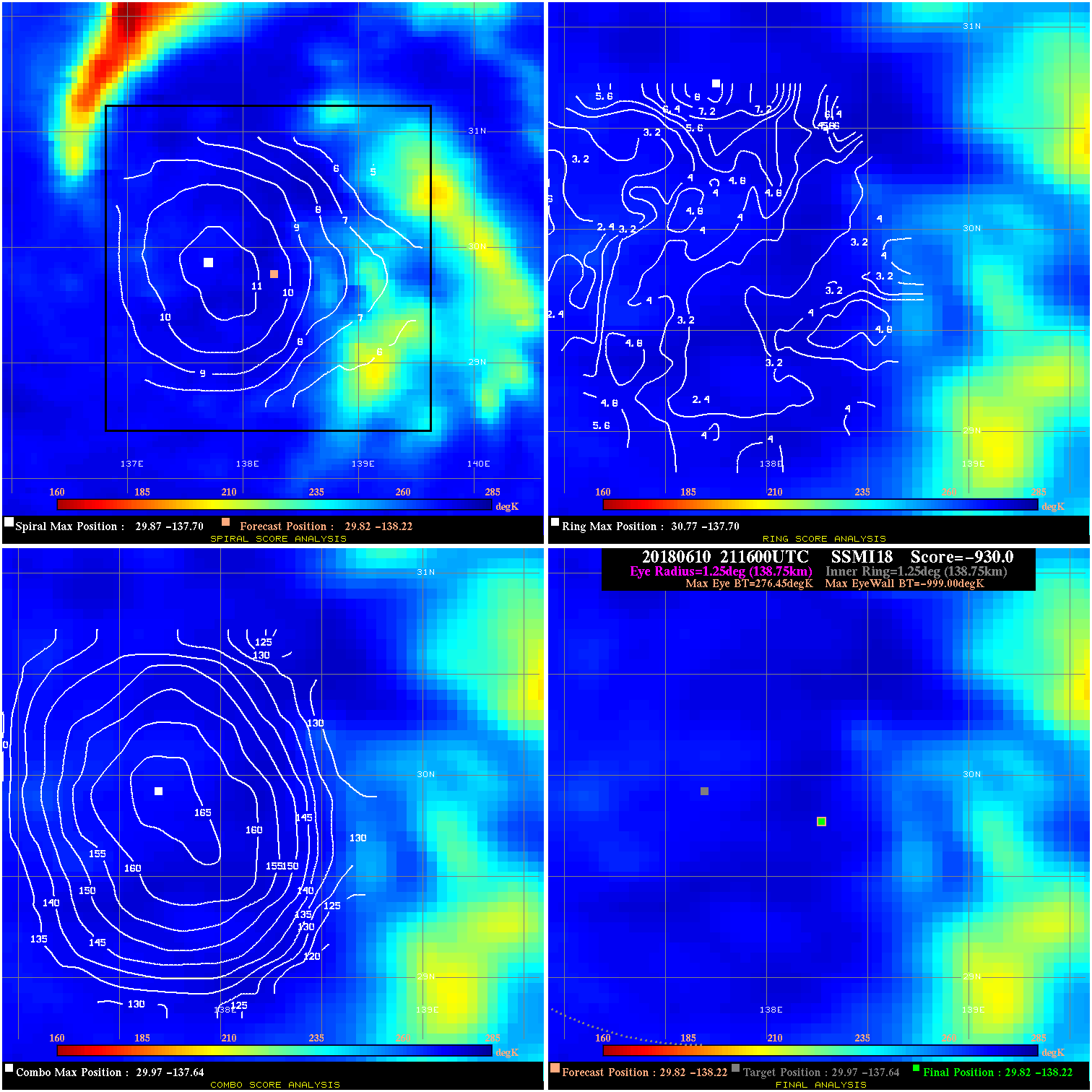
20180610 211600 -930.0 N/A N/A N/A 0.00 50.0 SSMI18 29.8 -138.2 29.8 -138.2 30.0 -137.6 Analysis Plot
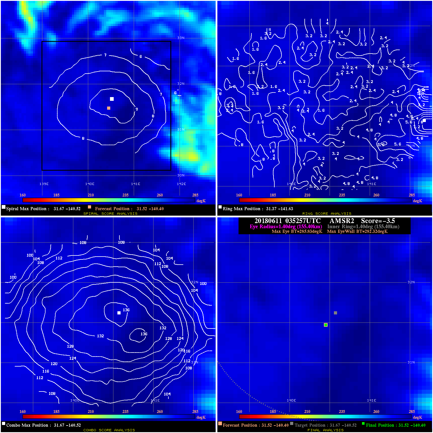
20180611 035257 -3.5 N/A 1.4% 311.08 3.51 45.0 AMSR2 31.5 -140.4 31.5 -140.4 31.7 -140.5 Analysis Plot
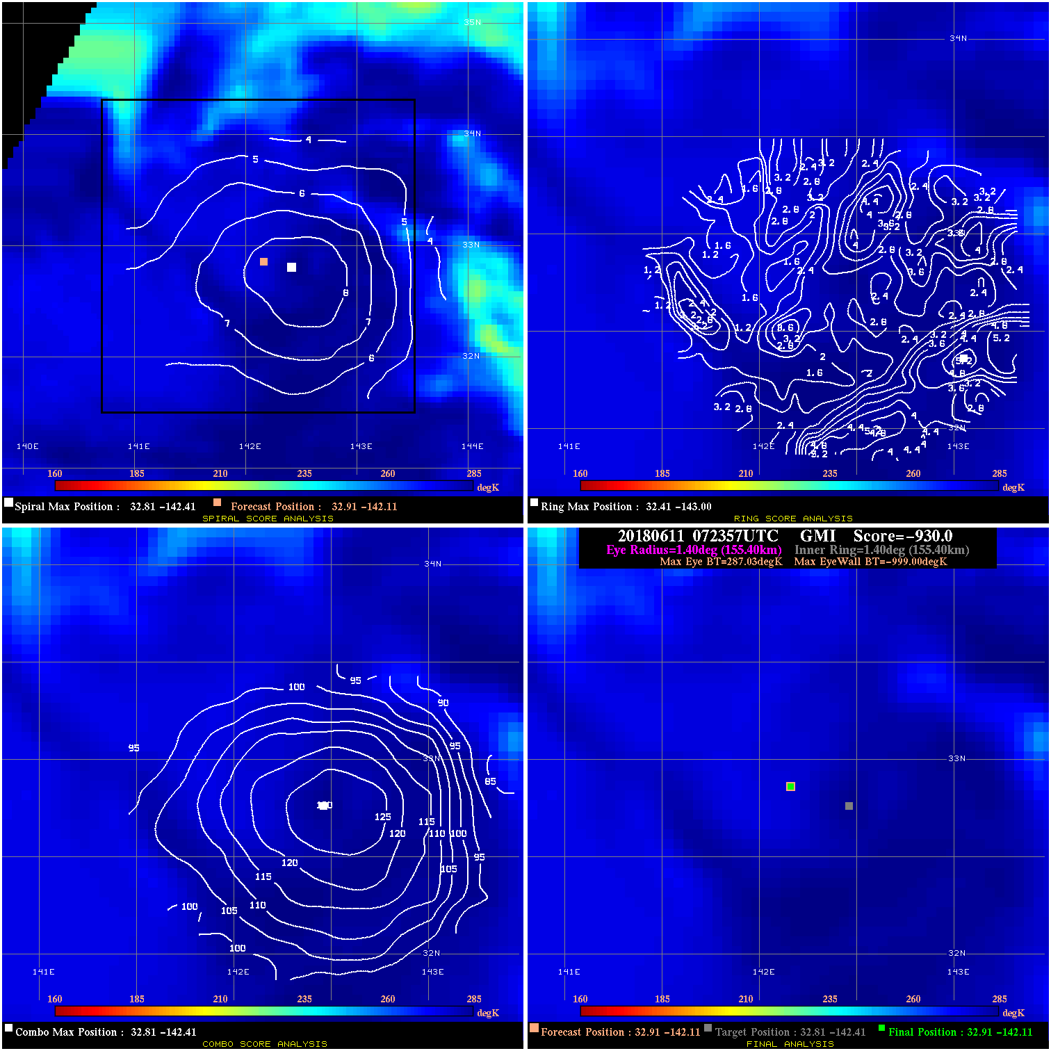
20180611 072357 -930.0 N/A N/A N/A 0.00 45.0 GMI 32.9 -142.1 32.9 -142.1 32.8 -142.4 Analysis Plot
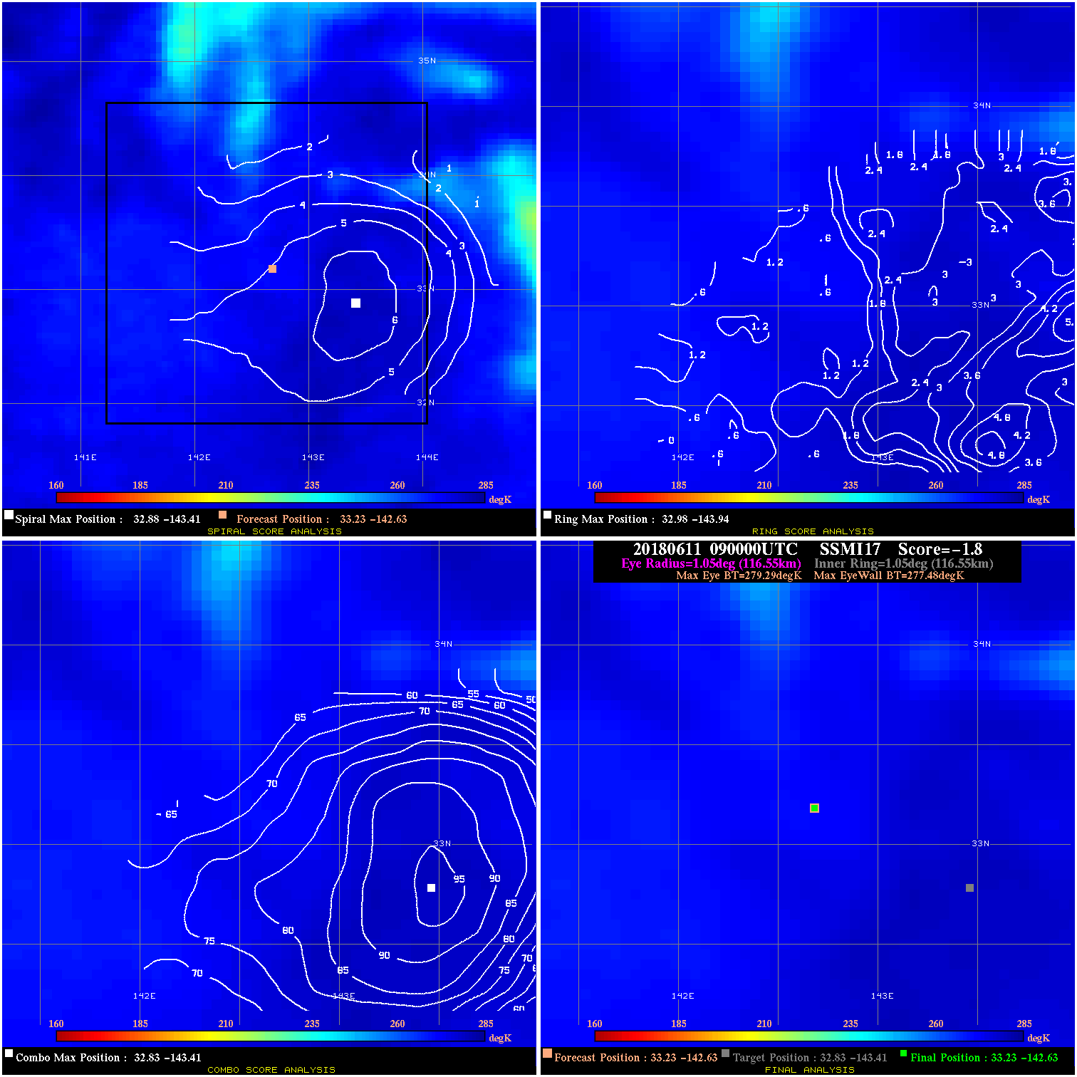
20180611 090000 -1.8 N/A 3.0% 233.31 1.81 45.0 SSMI17 33.2 -142.6 33.2 -142.6 32.8 -143.4 Analysis Plot
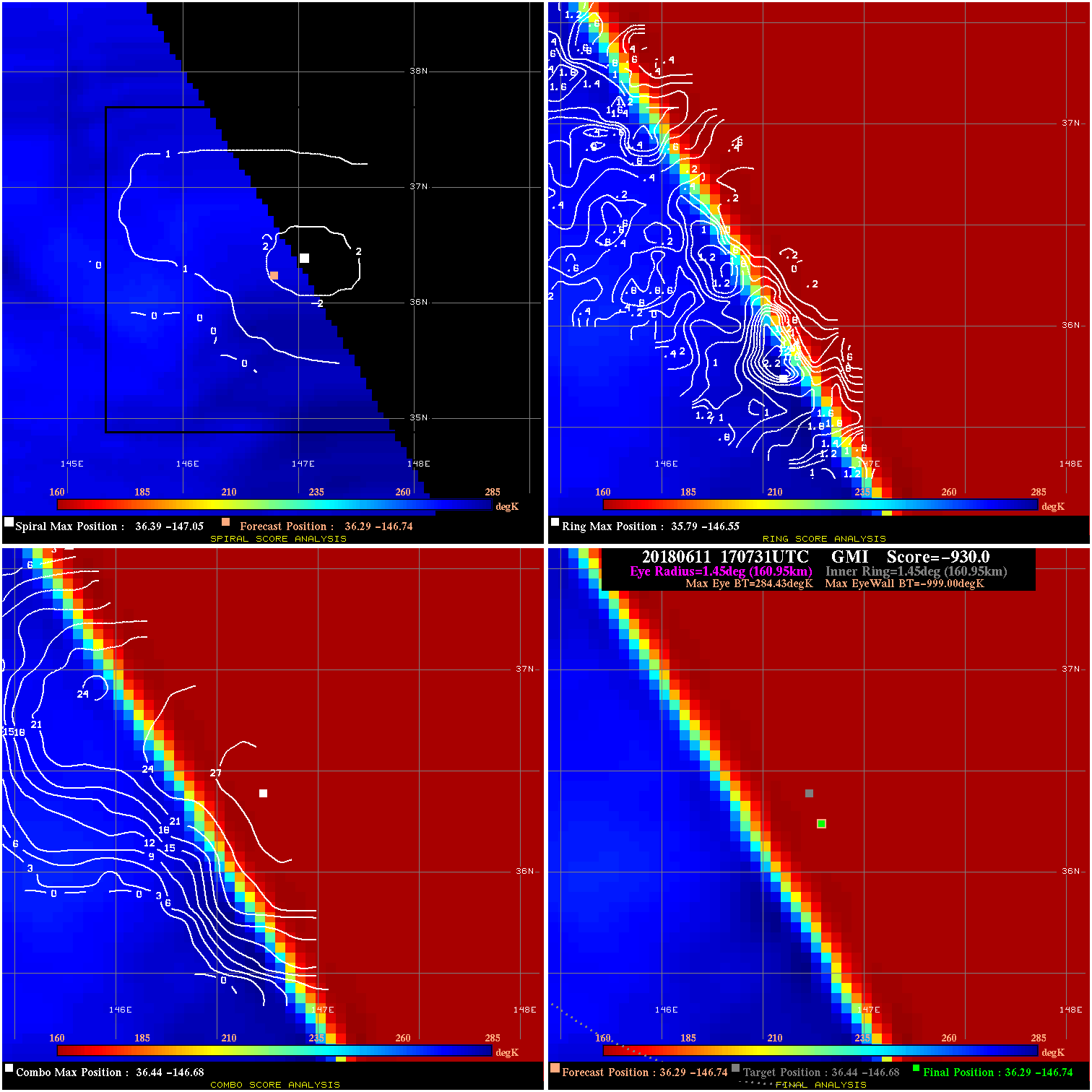
20180611 170731 -930.0 N/A N/A N/A 0.00 45.0 GMI 36.3 -146.7 36.3 -146.7 36.4 -146.7 Analysis Plot
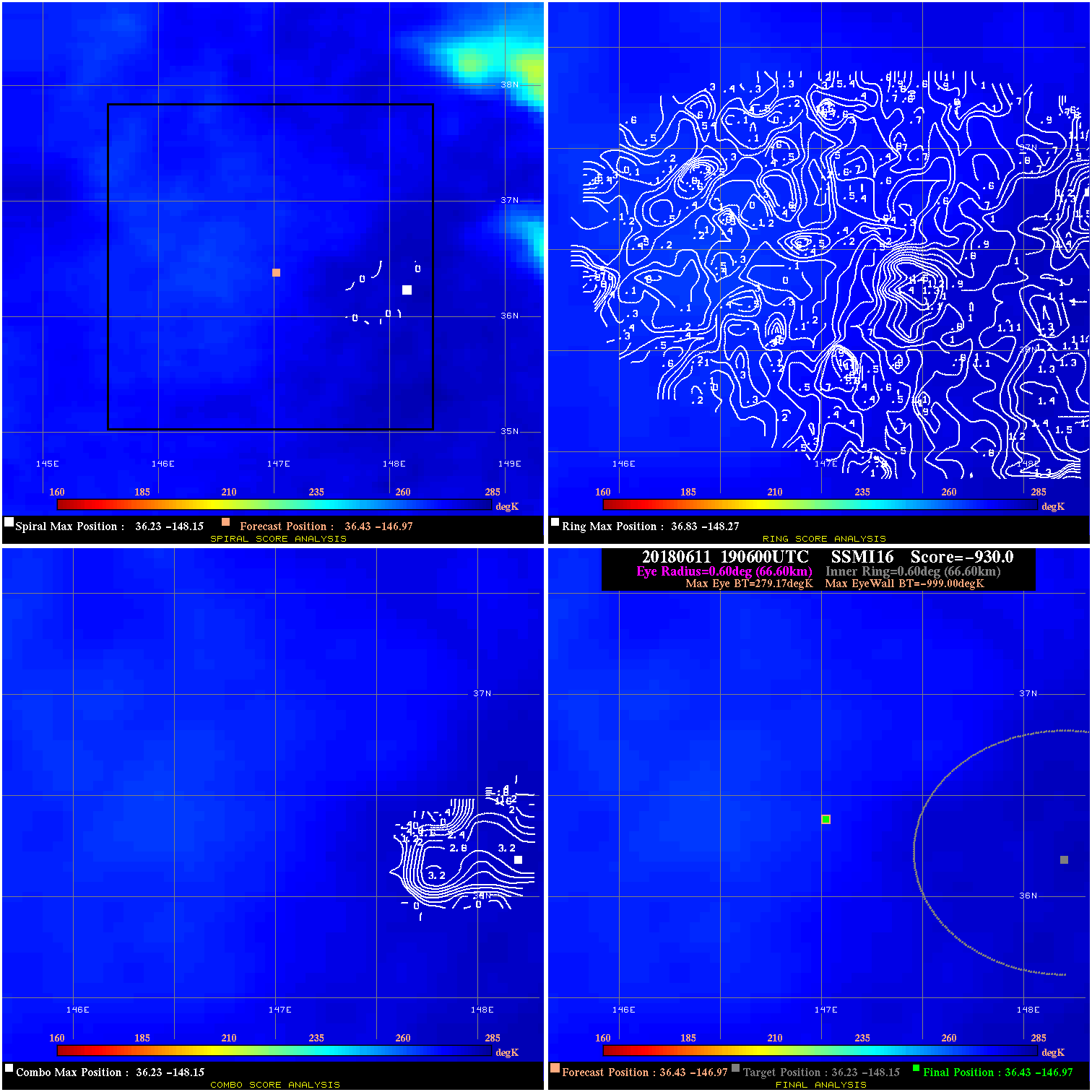
20180611 190600 -930.0 N/A N/A N/A 0.00 45.0 SSMI16 36.4 -147.0 36.4 -147.0 36.2 -148.1 Analysis Plot
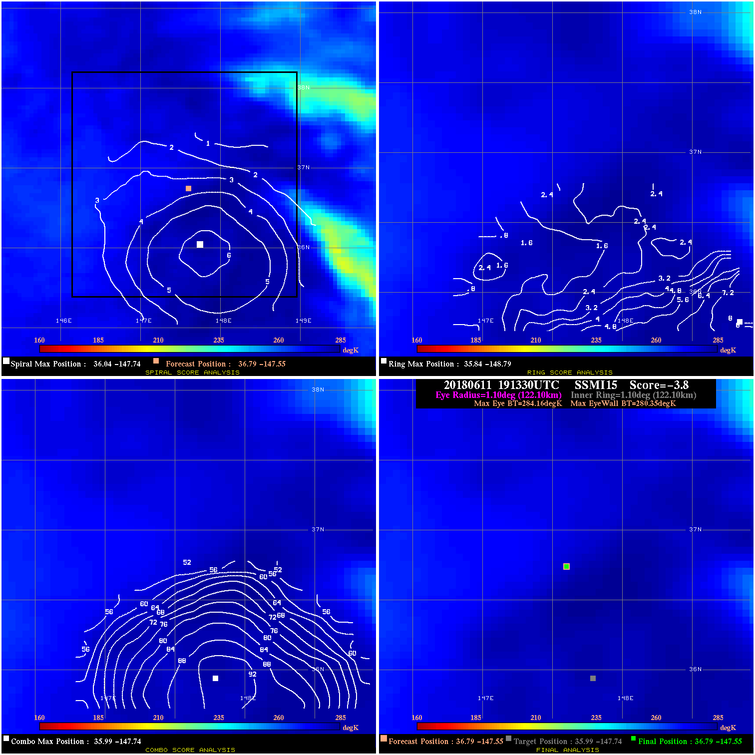
20180611 191330 -3.8 N/A 8.2% 244.42 3.81 45.0 SSMI15 36.8 -147.6 36.8 -147.6 36.0 -147.7 Analysis Plot
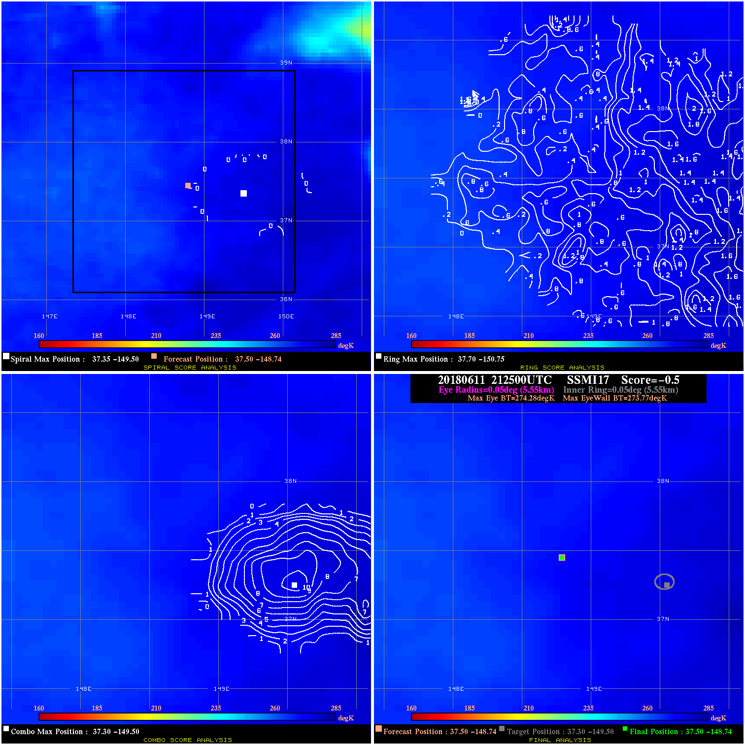
20180611 212500 -0.5 N/A N/A 11.11 .51 45.0 SSMI17 37.5 -148.7 37.5 -148.7 37.3 -149.5 Analysis Plot
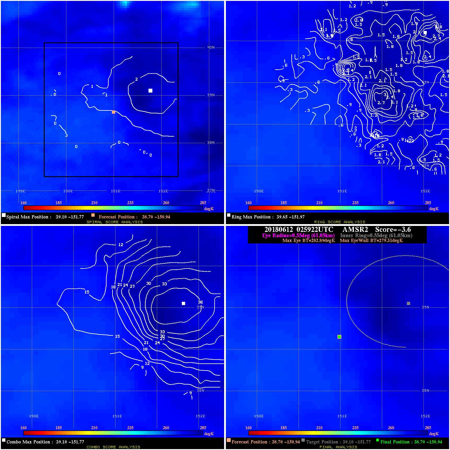
20180612 025922 -3.6 N/A N/A 122.21 3.58 45.0 AMSR2 38.7 -150.9 38.7 -150.9 39.1 -151.8 Analysis Plot
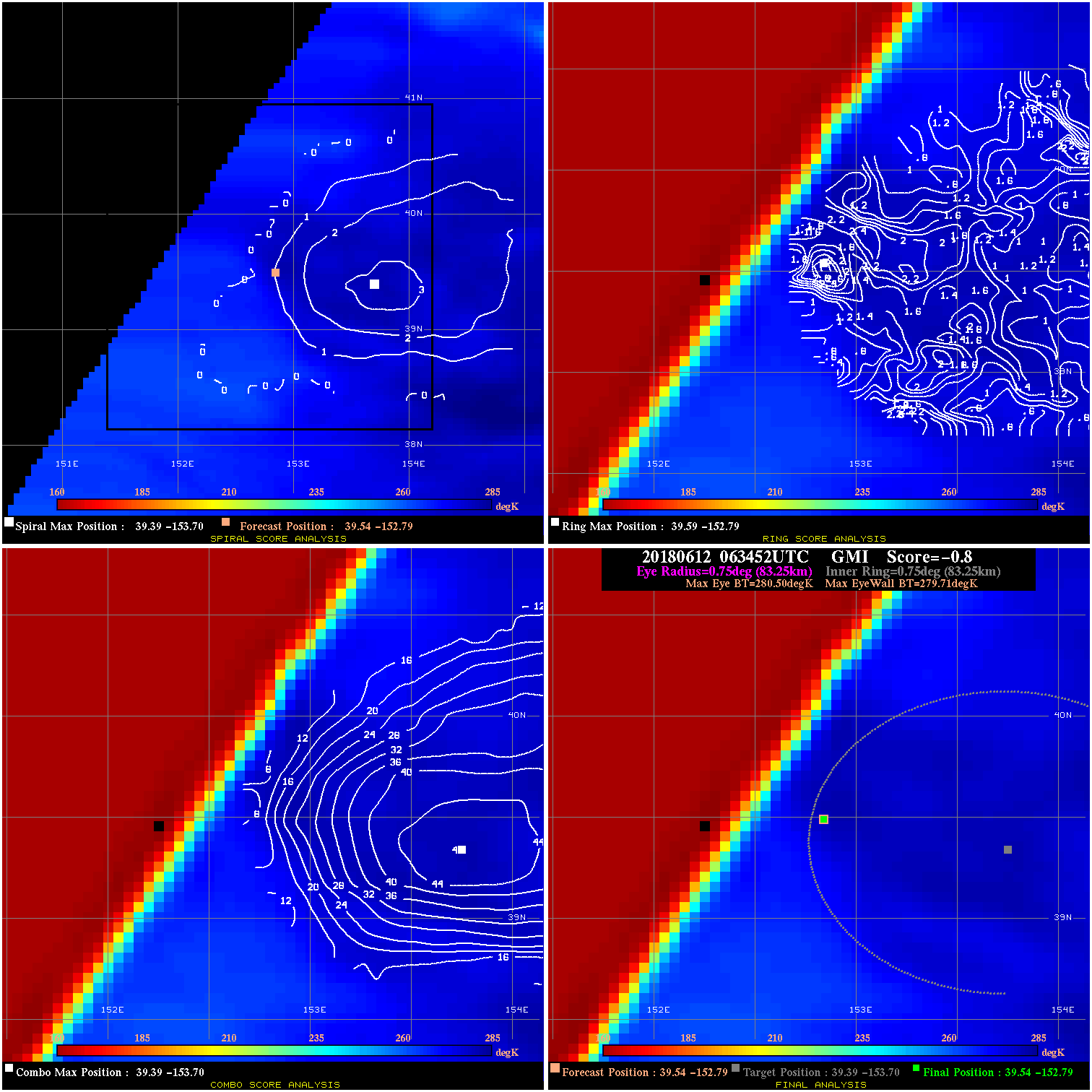
20180612 063452 -0.8 N/A N/A 166.65 .79 45.0 GMI 39.5 -152.8 39.5 -152.8 39.4 -153.7 Analysis Plot
|
|
Legend: - Date/Time are determined from PMW imagery at Forecast (initial guess) Lat/Lon position. - Positive/Negative Latitude = North/South Hemisphere; Longitude = Western/Eastern Hemisphere. - "Ring Diam" value indicates the estimated surface eyewall diameter in km (the MI eyewall edge diameter minus 10 km). - "Ring Pct" is the percentage of the "ring" (eyewall inner boundary) that is 1) colder than the "hot spot" (warmest eye pixel) in the eye by 20K, or 2) the percentage that is a) colder than 232K and b) colder than the "hot spot" by 10K, whichever is greater. - Values are red if Ring % <= 65, yellow/brown if Ring % <= 85 and green if Ring % > 85. - "Tb diff" is the difference between the "hot spot" (warmest eye pixel) and the warmest pixel on the eyewall. - Intensity score are listed as negative, and not used, when the JTWC or NHC estimated Vmax is <55 kts in order to rule out weak but highly symmetric TCs. - Error messages in intensity scores: -920 is used when the hottest pixel in the eye is <200K, to prevent false positives; -930 means <85% of eyewall has observations/data. |