Tropical Depression 12S
|
Passive Microwave (PMW) Intensity Information Hurricane Intensity Estimation (HIE) Algorithm Version 9.0 |
Overpass Inten Ring Ring Wind Forecast Final Target
Date Time Score Meaning Pct Diam BTdiff Est Sat Lat Lon Lat Lon Lat Lon
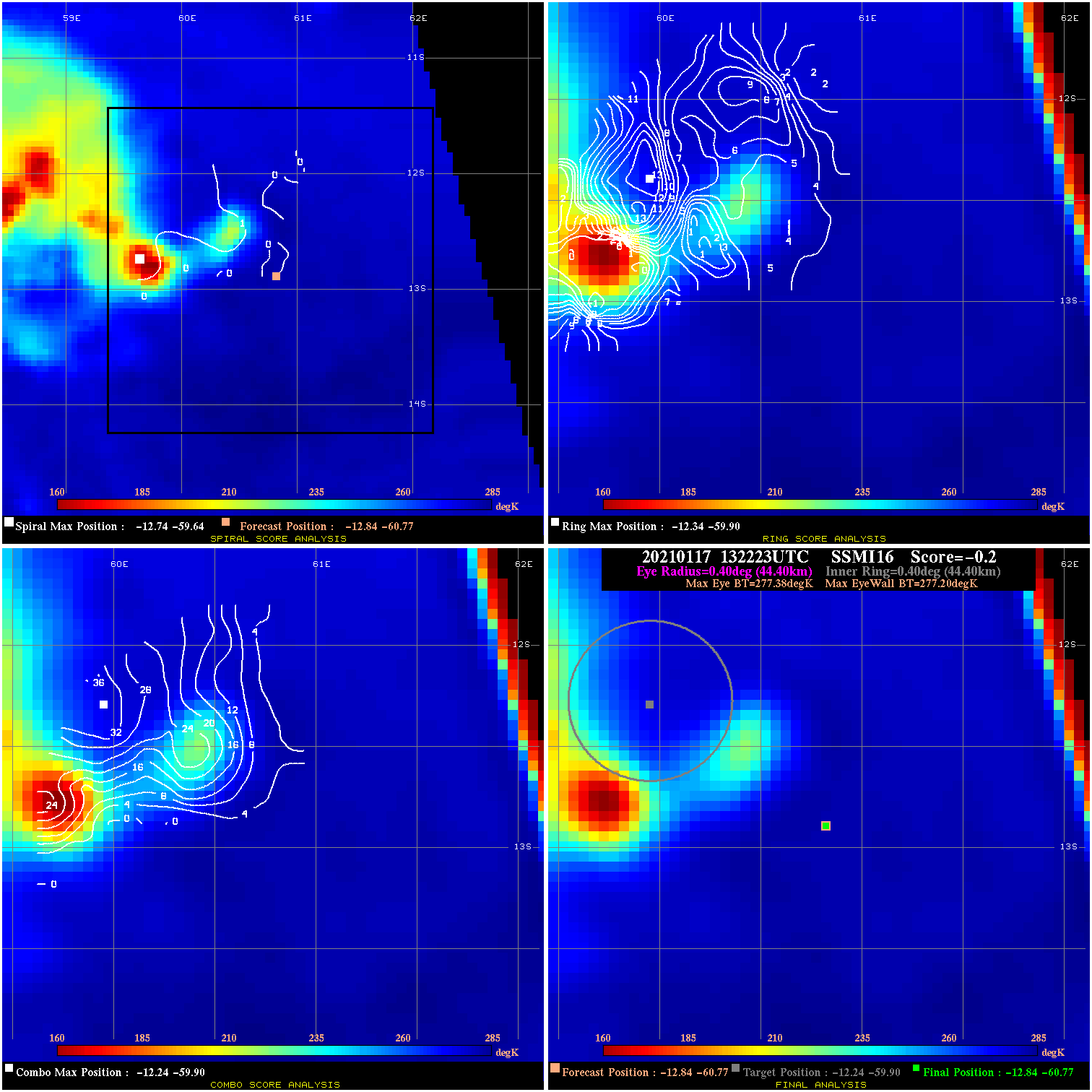
20210117 132223 -0.2 N/A 42.5% 88.88 .18 35.0 SSMI16 -12.8 -60.8 -12.8 -60.8 -12.2 -59.9 Analysis Plot
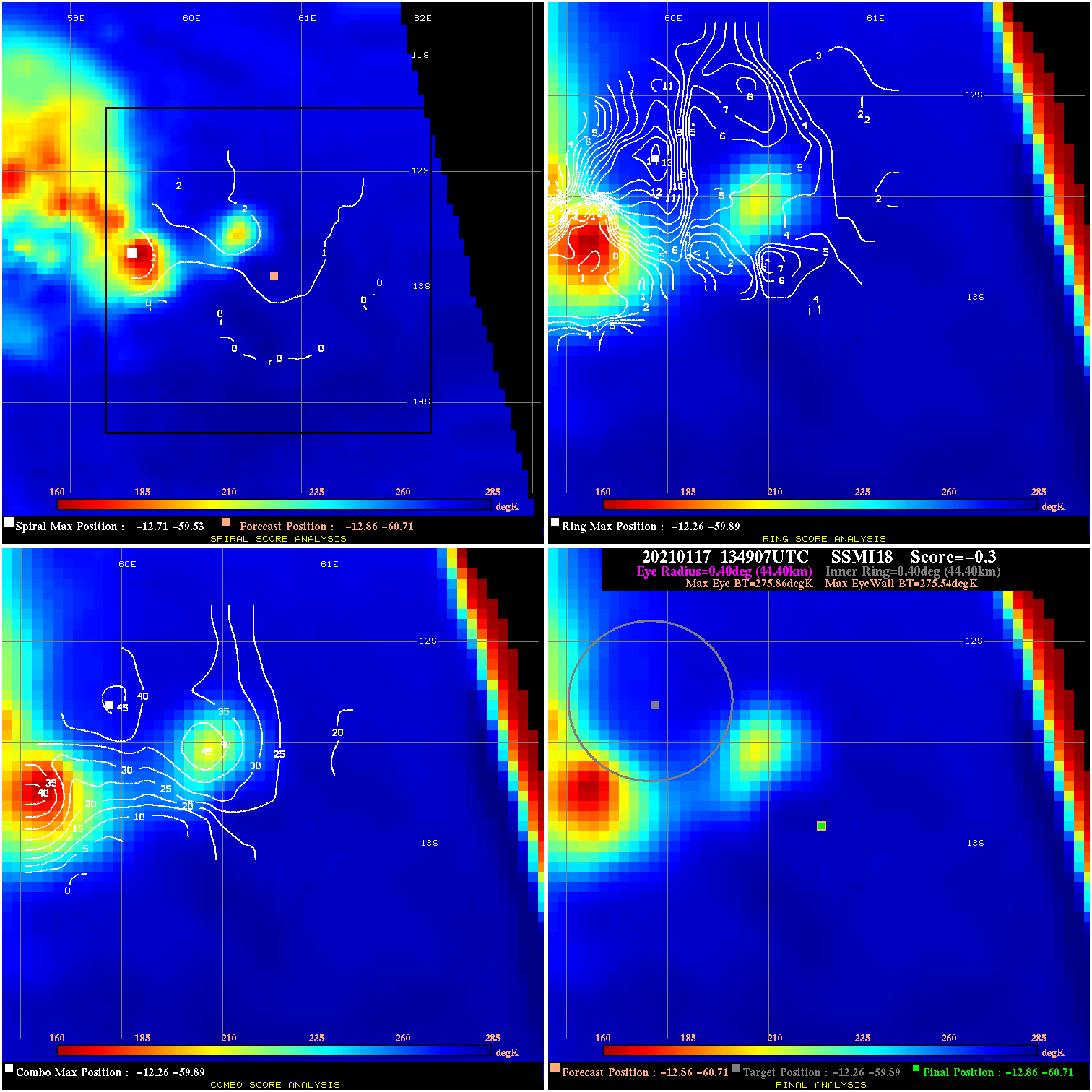
20210117 134907 -0.3 N/A 39.7% 88.88 .32 35.0 SSMI18 -12.9 -60.7 -12.9 -60.7 -12.3 -59.9 Analysis Plot
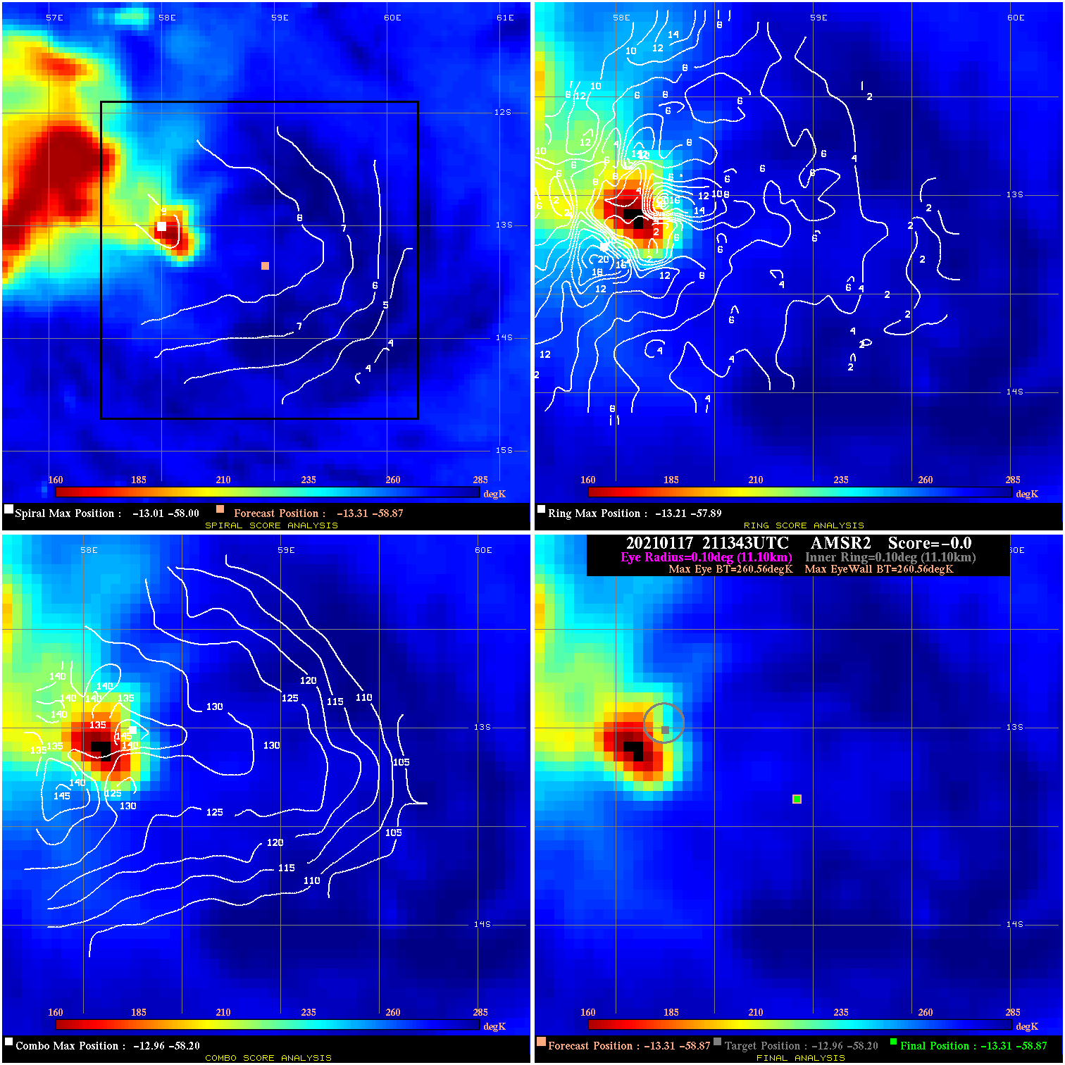
20210117 211343 N/A N/A N/A N/A N/A 40.0 AMSR2 -13.3 -58.9 -13.3 -58.9 -13.0 -58.2 Analysis Plot
20210118 011150 -0.7 N/A N/A 133.32 .67 40.0 SSMI18 -13.4 -58.3 -13.4 -58.3 -13.4 -58.4 Analysis Plot
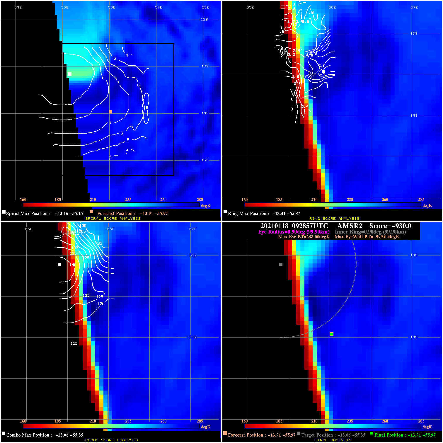
20210118 092857 -930.0 N/A N/A N/A 0.00 45.0 AMSR2 -13.9 -56.0 -13.9 -56.0 -13.1 -55.3 Analysis Plot
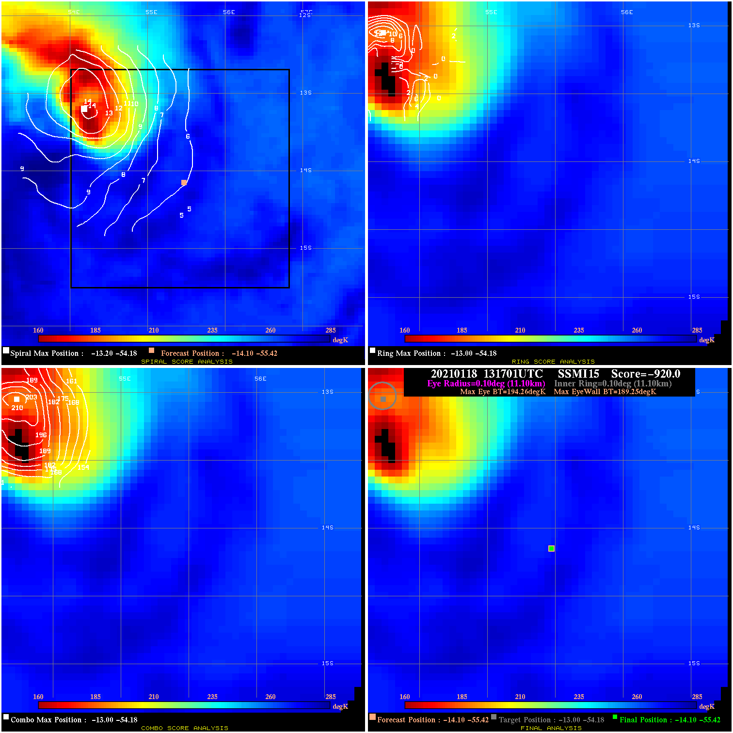
20210118 131701 -920.0 N/A 100.0% 22.22 5.01 45.0 SSMI15 -14.1 -55.4 -14.1 -55.4 -13.0 -54.2 Analysis Plot
20210118 211313 -7.0 N/A 20.5% 199.98 7.01 50.0 GMI -14.3 -52.6 -14.3 -52.6 -14.0 -52.4 Analysis Plot
20210119 102847 -3.5 N/A 41.1% 11.11 3.49 50.0 GMI -14.6 -51.1 -15.3 -50.6 -15.3 -50.6 Analysis Plot
20210120 022336 -8.7 N/A N/A 99.99 8.71 45.0 SSMI18 -15.6 -49.0 -15.6 -49.0 -15.7 -48.7 Analysis Plot
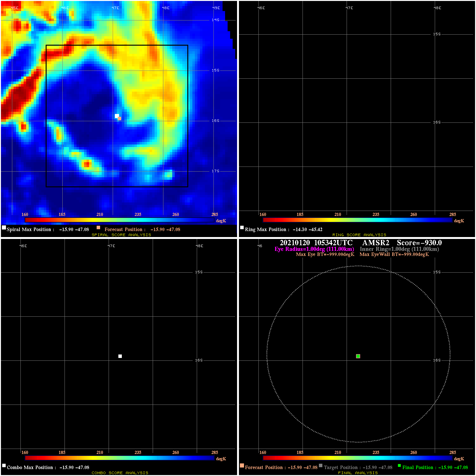
20210120 105342 N/A N/A N/A N/A N/A 35.0 AMSR2 -15.9 -47.1 -15.9 -47.1 -15.9 -47.1 Analysis Plot
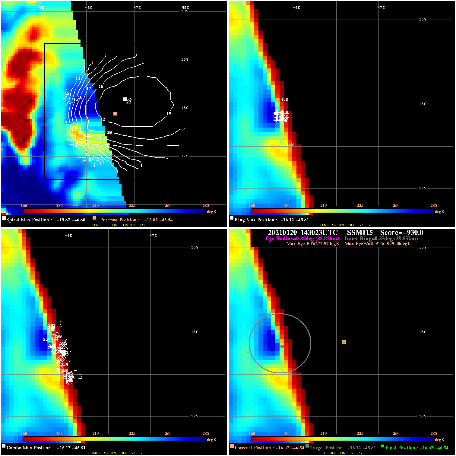
20210120 143023 -930.0 N/A N/A N/A 0.00 35.0 SSMI15 -16.1 -46.5 -16.1 -46.5 -16.1 -45.8 Analysis Plot
20210120 143617 -930.0 N/A N/A N/A 0.00 35.0 SSMI18 -16.1 -46.4 -16.1 -46.4 -15.6 -46.8 Analysis Plot
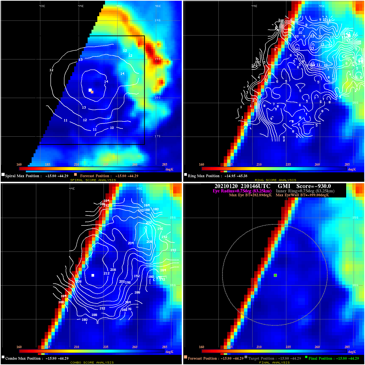
20210120 210146 -930.0 N/A N/A N/A 0.00 35.0 GMI -15.8 -44.3 -15.8 -44.3 -15.8 -44.3 Analysis Plot
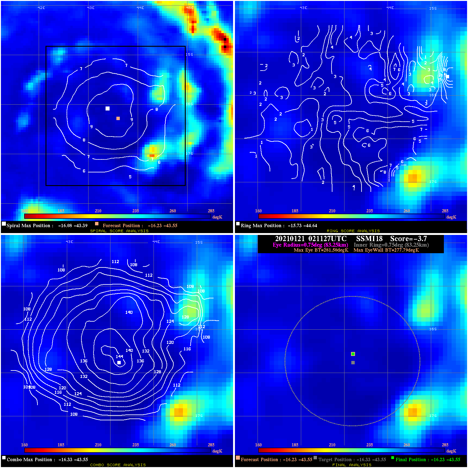
20210121 021127 -3.7 N/A 9.6% 166.65 3.71 35.0 SSMI18 -16.2 -43.5 -16.2 -43.5 -16.3 -43.5 Analysis Plot
20210121 101848 N/A N/A N/A N/A N/A 35.0 GMI -16.9 -41.8 -16.9 -41.8 -16.6 -41.7 Analysis Plot
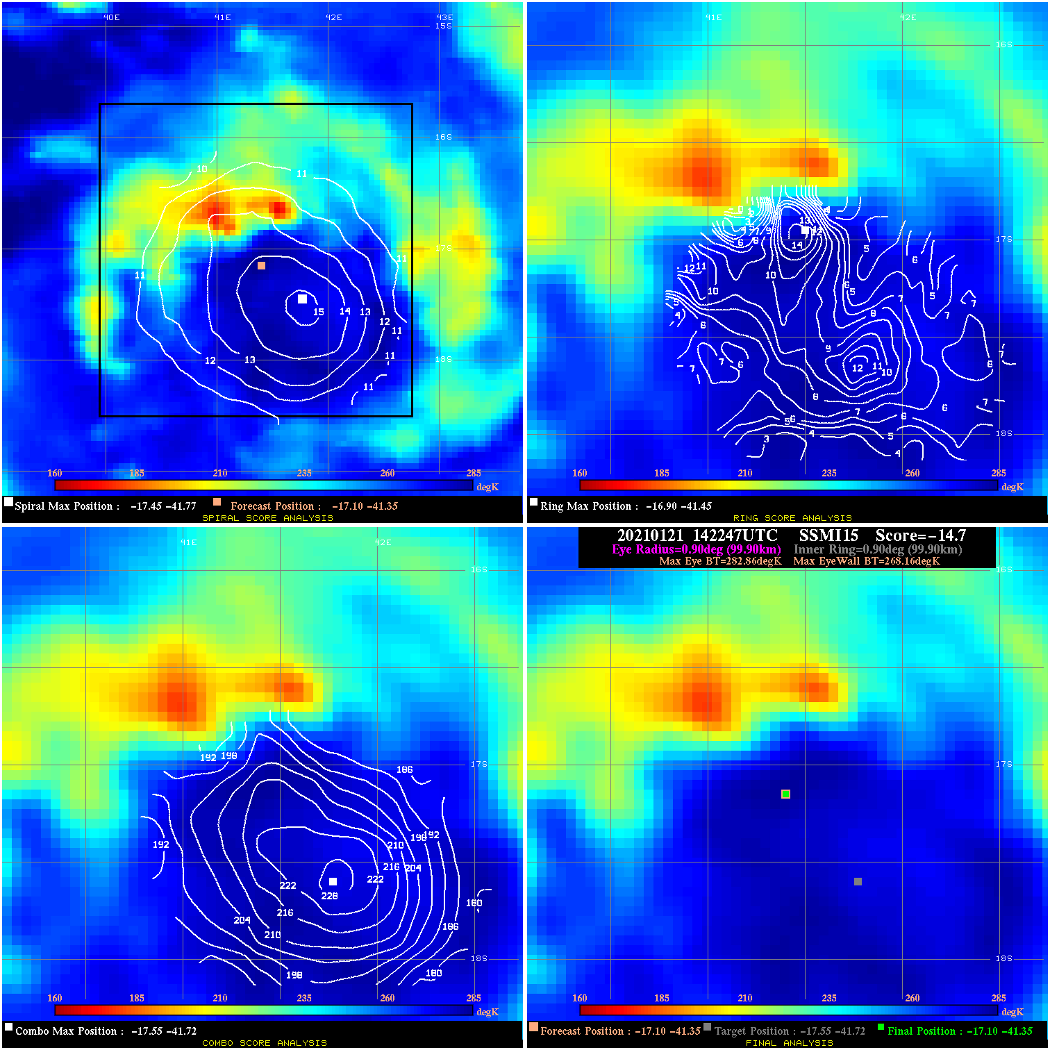
20210121 142247 -14.7 N/A 21.9% 199.98 14.70 35.0 SSMI15 -17.1 -41.3 -17.1 -41.3 -17.5 -41.7 Analysis Plot
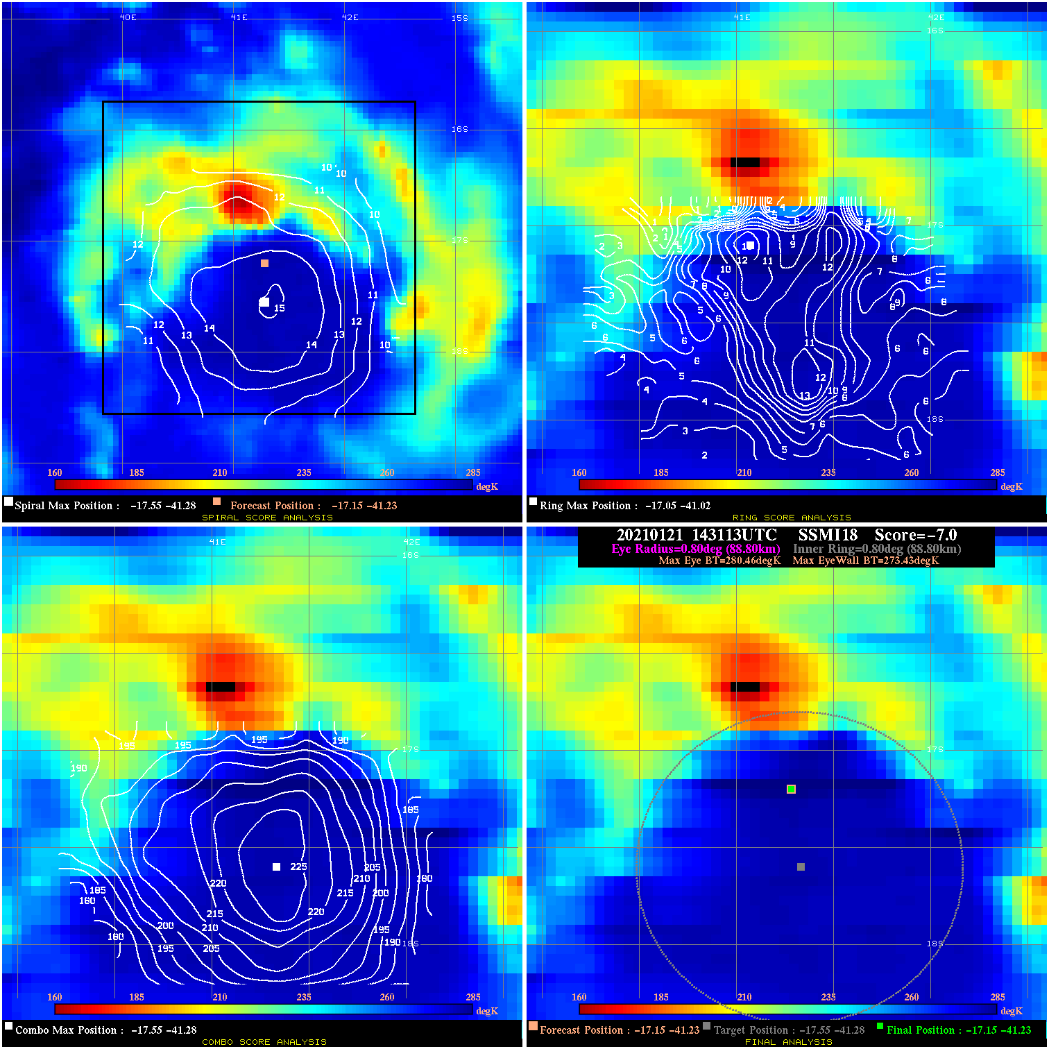
20210121 143113 -7.0 N/A 30.1% 177.76 7.03 35.0 SSMI18 -17.1 -41.2 -17.1 -41.2 -17.5 -41.3 Analysis Plot
20210123 032458 -930.0 N/A N/A N/A 0.00 75.0 SSMI16 -20.1 -34.6 -20.3 -34.5 -20.3 -34.5 Analysis Plot
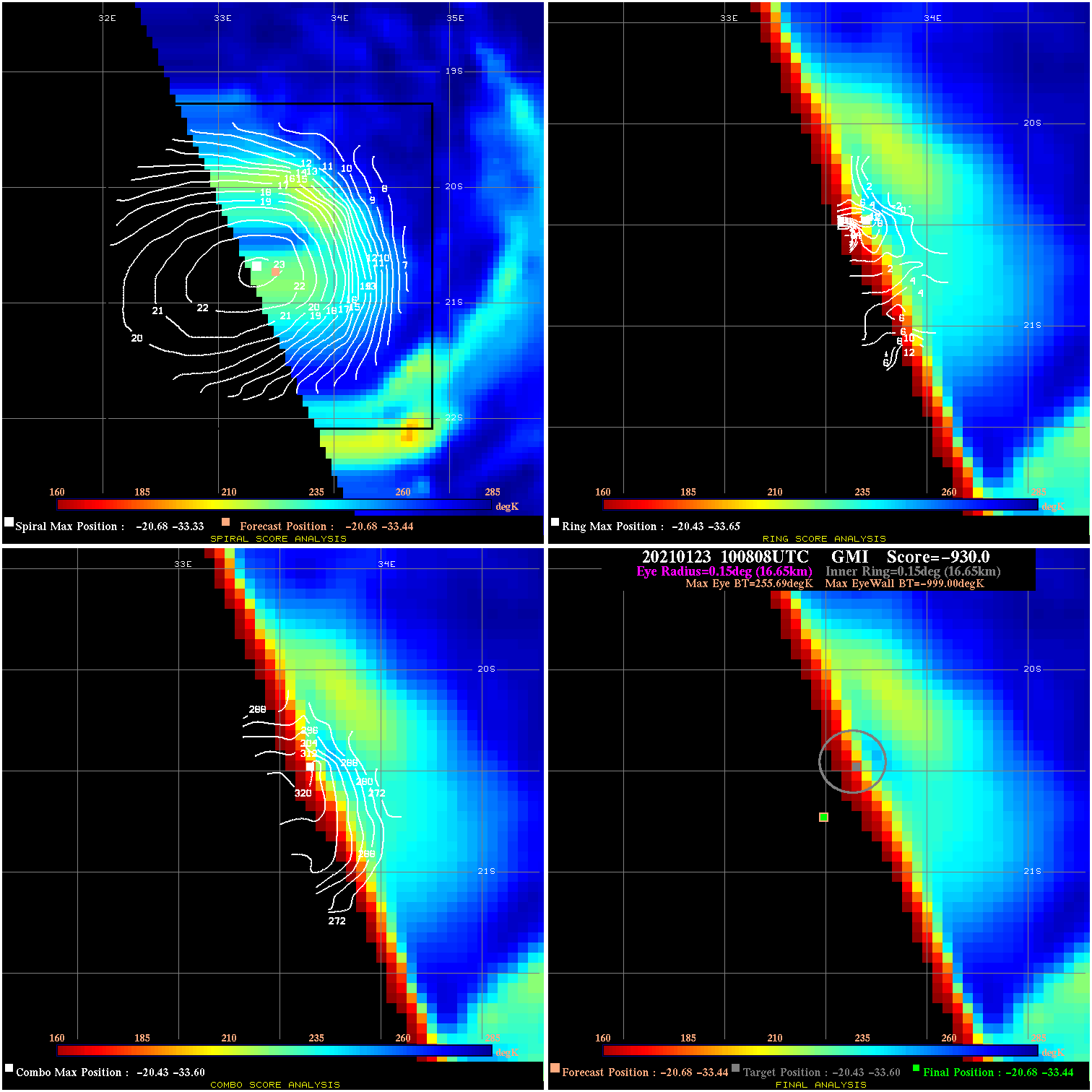
20210123 100808 -930.0 N/A N/A N/A 0.00 75.0 GMI -20.7 -33.4 -20.7 -33.4 -20.4 -33.6 Analysis Plot
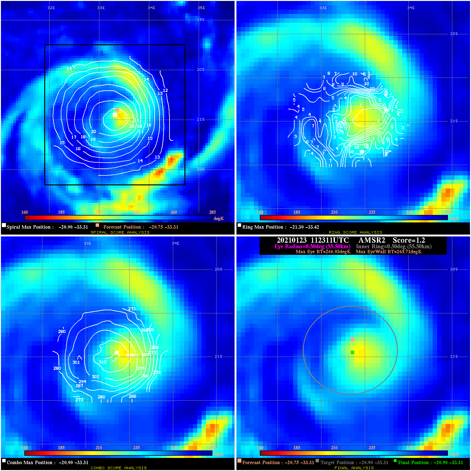
20210123 112311 1.2 N/A 13.7% 111.10 1.22 75.0 AMSR2 -20.8 -33.3 -20.9 -33.3 -20.9 -33.3 Analysis Plot
20210123 152608 -930.0 N/A N/A N/A 0.00 75.0 SSMI16 -21.0 -32.8 -21.3 -32.8 -21.3 -32.8 Analysis Plot
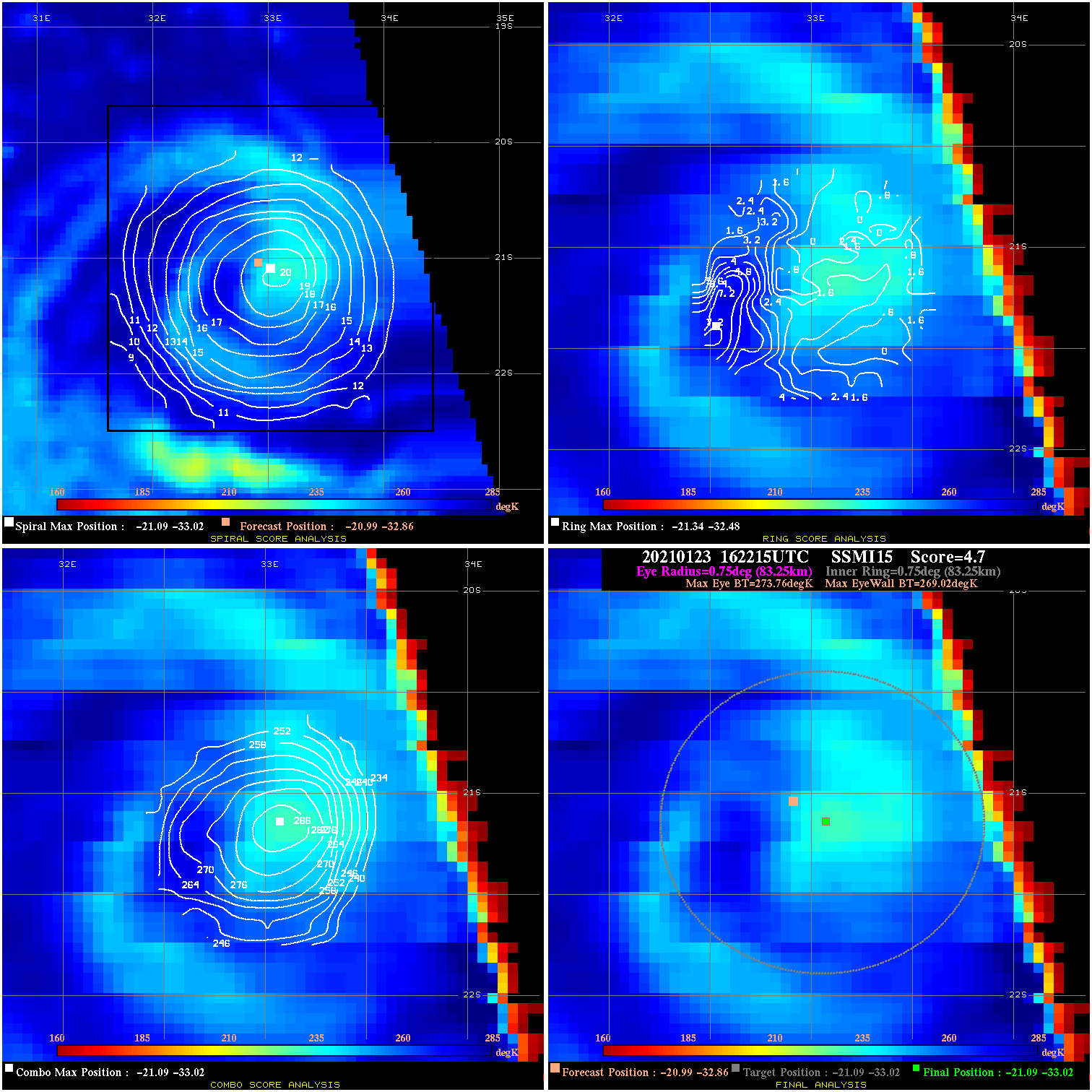
20210123 162215 4.7 N/A N/A 166.65 4.74 75.0 SSMI15 -21.0 -32.9 -21.1 -33.0 -21.1 -33.0 Analysis Plot
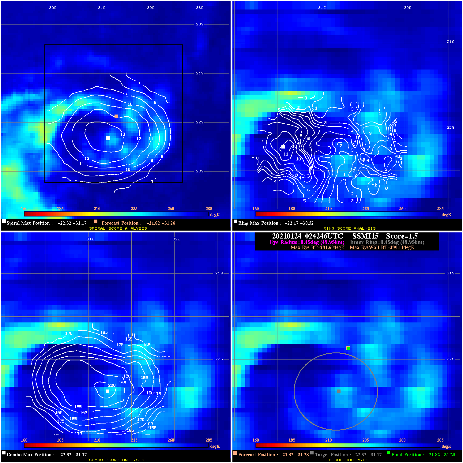
20210124 024246 1.5 N/A N/A 99.99 1.49 75.0 SSMI15 -21.8 -31.3 -21.8 -31.3 -22.3 -31.2 Analysis Plot
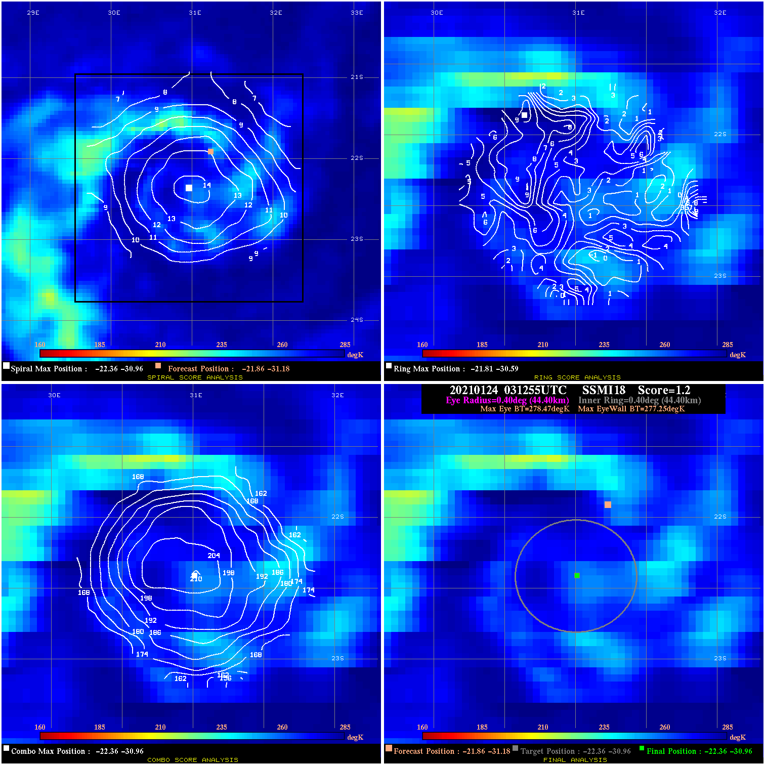
20210124 031255 1.2 N/A N/A 88.88 1.22 75.0 SSMI18 -21.9 -31.2 -22.4 -31.0 -22.4 -31.0 Analysis Plot
|
|
Legend: - Date/Time are determined from PMW imagery at Forecast (initial guess) Lat/Lon position. - Positive/Negative Latitude = North/South Hemisphere; Longitude = Western/Eastern Hemisphere. - "Ring Diam" value indicates the estimated surface eyewall diameter in km (the MI eyewall edge diameter minus 10 km). - "Ring Pct" is the percentage of the "ring" (eyewall inner boundary) that is 1) colder than the "hot spot" (warmest eye pixel) in the eye by 20K, or 2) the percentage that is a) colder than 232K and b) colder than the "hot spot" by 10K, whichever is greater. - Values are red if Ring % <= 65, yellow/brown if Ring % <= 85 and green if Ring % > 85. - "Tb diff" is the difference between the "hot spot" (warmest eye pixel) and the warmest pixel on the eyewall. - Intensity score are listed as negative, and not used, when the JTWC or NHC estimated Vmax is <55 kts in order to rule out weak but highly symmetric TCs. - Error messages in intensity scores: -920 is used when the hottest pixel in the eye is <200K, to prevent false positives; -930 means <85% of eyewall has observations/data. |