Tropical Storm 01L
|
Passive Microwave (PMW) Intensity Information Hurricane Intensity Estimation (HIE) Algorithm Version 9.0 |
Overpass Inten Ring Ring Wind Forecast Final Target
Date Time Score Meaning Pct Diam BTdiff Est Sat Lat Lon Lat Lon Lat Lon
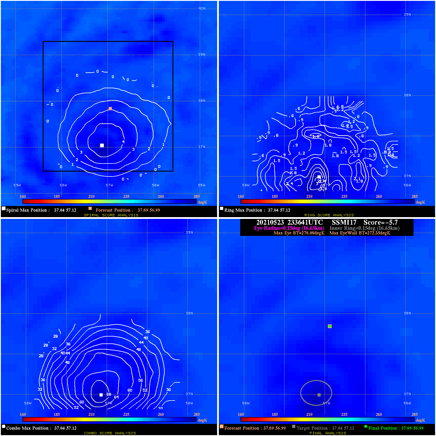
20210523 233641 -5.7 N/A N/A 33.33 5.73 35.0 SSMI17 37.9 57.0 37.9 57.0 37.0 57.1 Analysis Plot
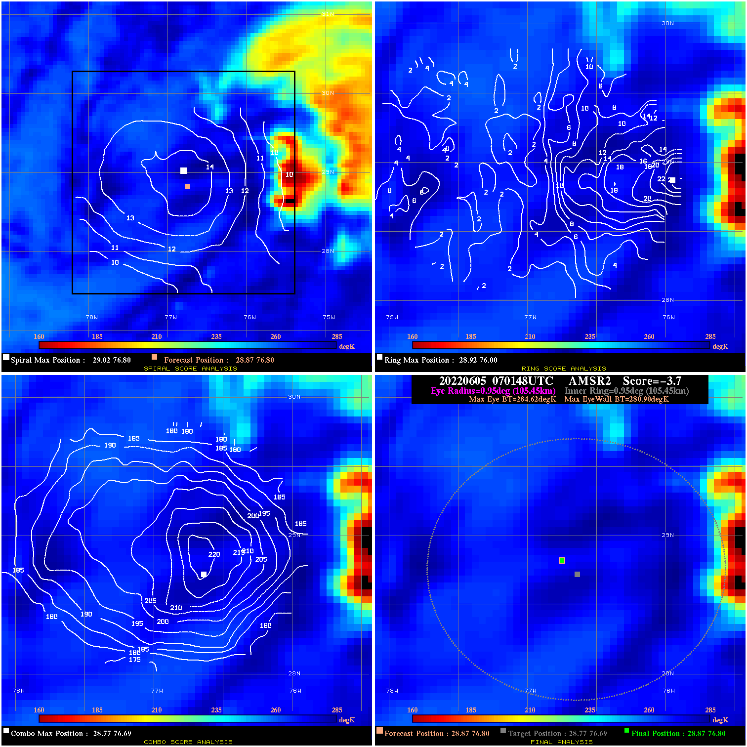
20220605 070148 -3.7 N/A 11.0% 211.09 3.72 45.0 AMSR2 28.9 76.8 28.9 76.8 28.8 76.7 Analysis Plot
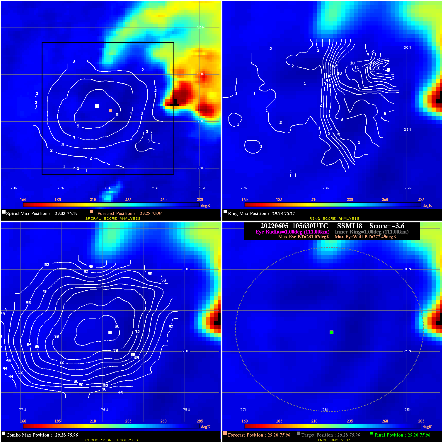
20220605 105630 -3.6 N/A 11.0% 222.20 3.58 45.0 SSMI18 29.3 76.0 29.3 76.0 29.3 76.0 Analysis Plot
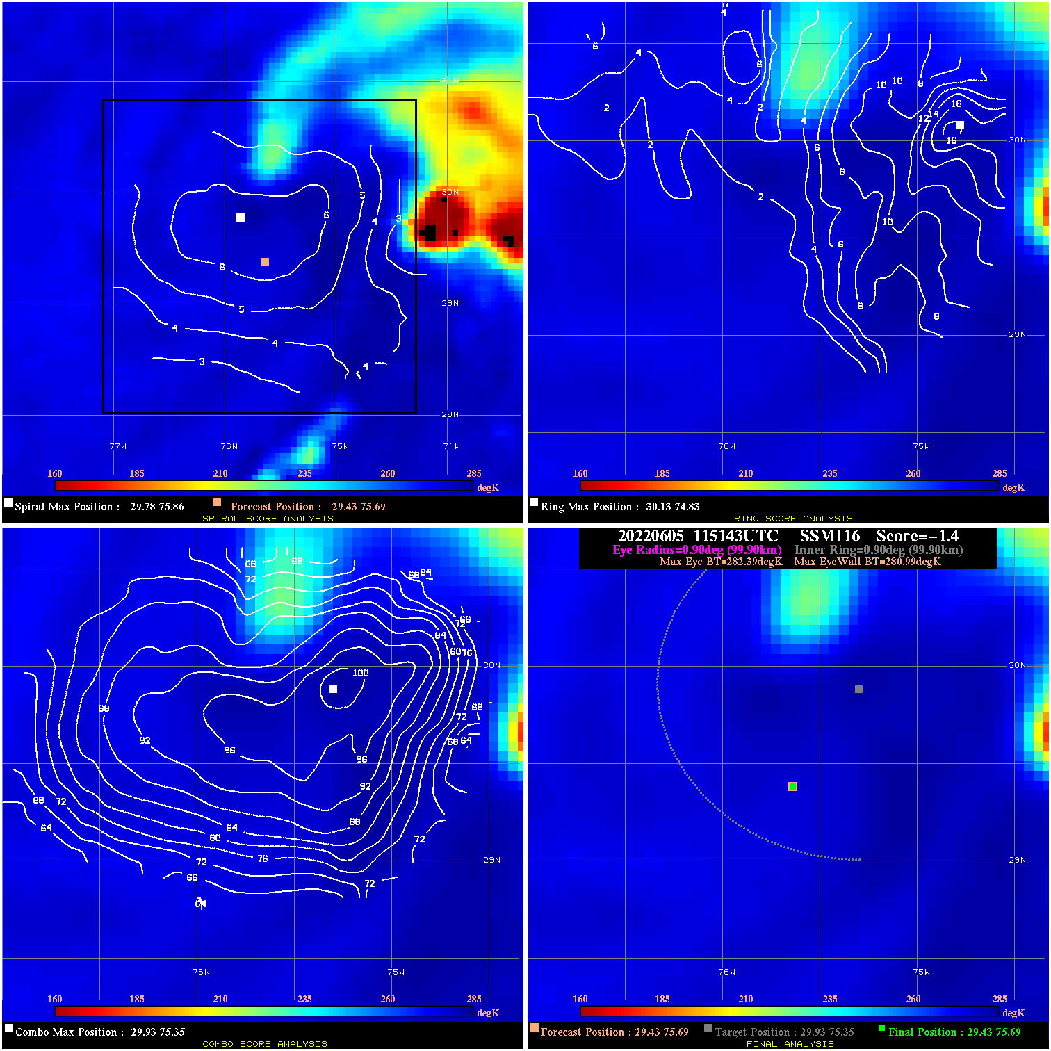
20220605 115143 -1.4 N/A 9.6% 199.98 1.40 45.0 SSMI16 29.4 75.7 29.4 75.7 29.9 75.3 Analysis Plot
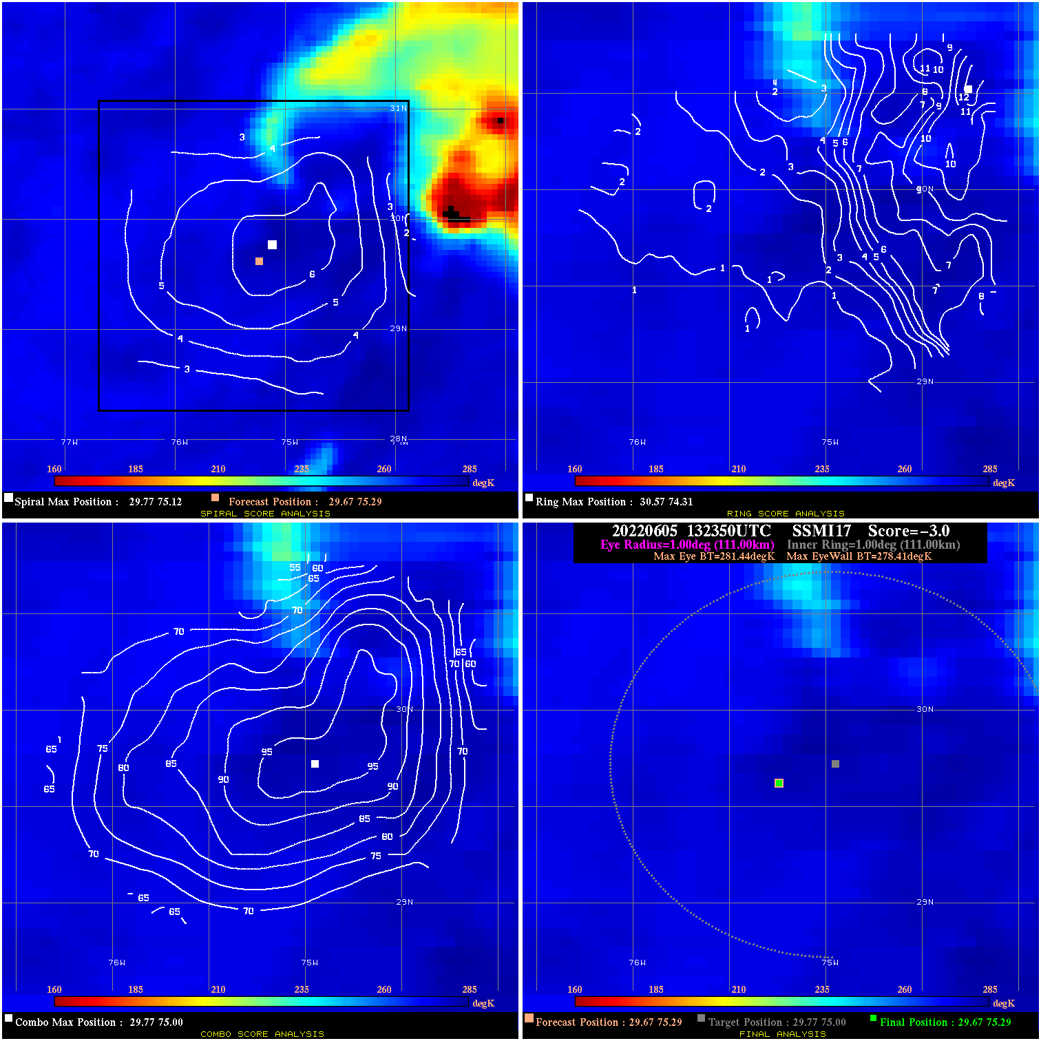
20220605 132350 -3.0 N/A 1.4% 222.20 3.03 45.0 SSMI17 29.7 75.3 29.7 75.3 29.8 75.0 Analysis Plot
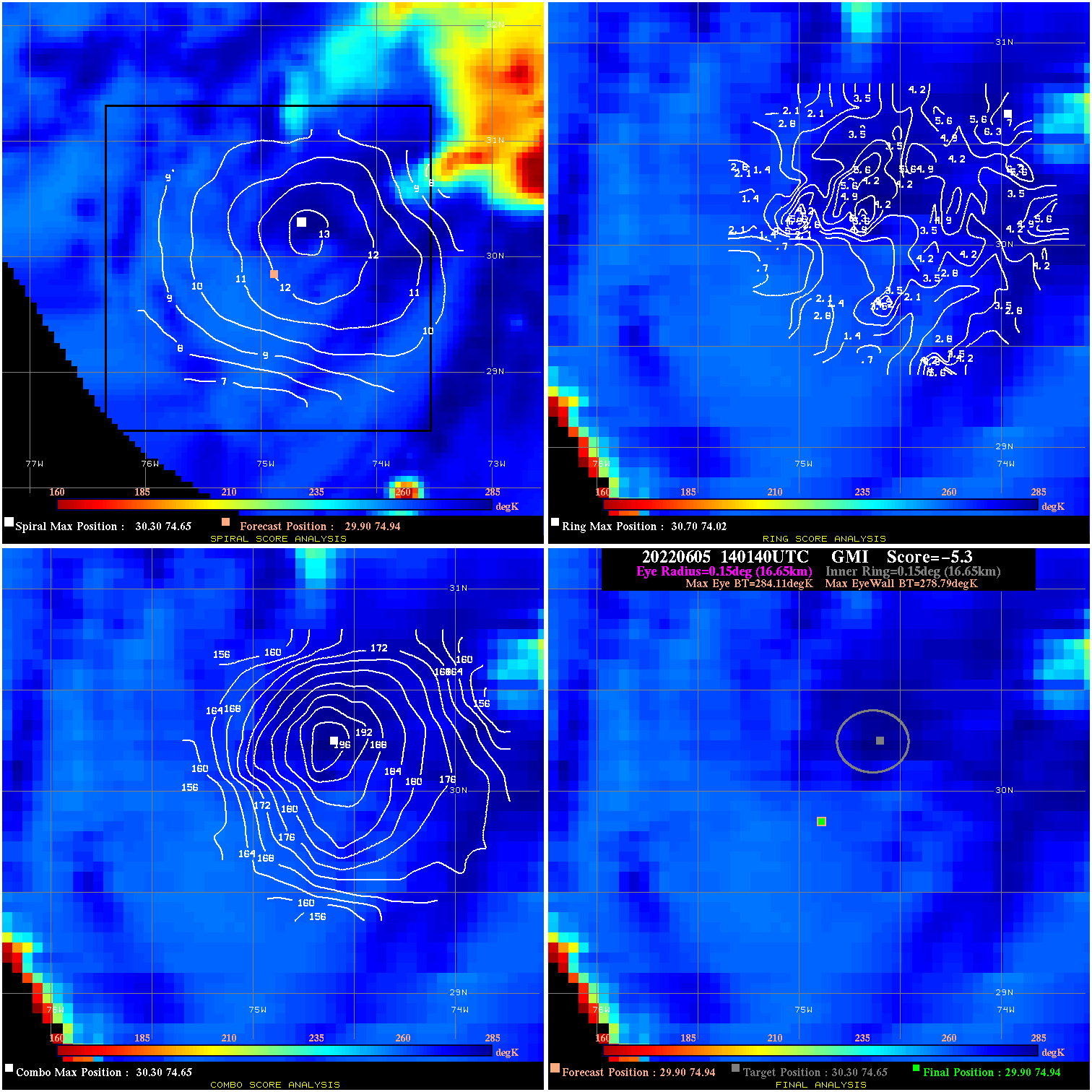
20220605 140140 -5.3 N/A N/A 33.33 5.32 45.0 GMI 29.9 74.9 29.9 74.9 30.3 74.7 Analysis Plot
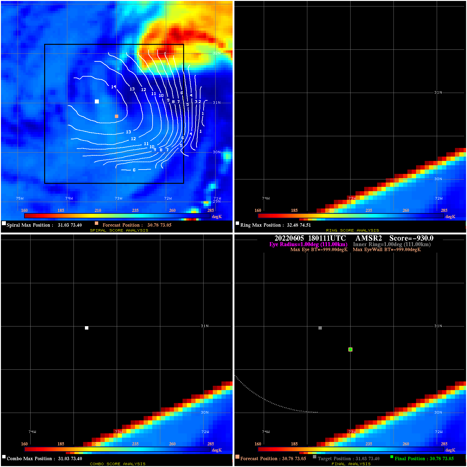
20220605 180111 N/A N/A N/A N/A N/A 50.0 AMSR2 30.8 73.1 30.8 73.1 31.0 73.4 Analysis Plot
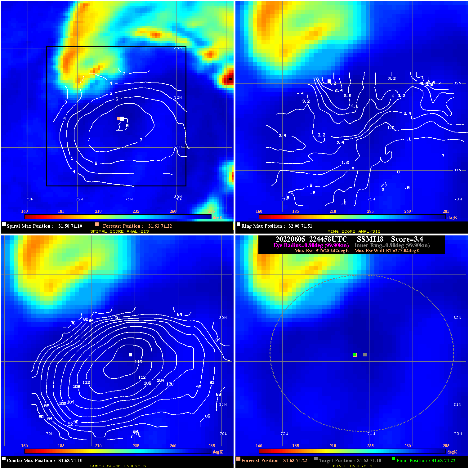
20220605 224458 3.4 N/A 8.2% 199.98 3.38 55.0 SSMI18 31.6 71.2 31.6 71.2 31.6 71.1 Analysis Plot
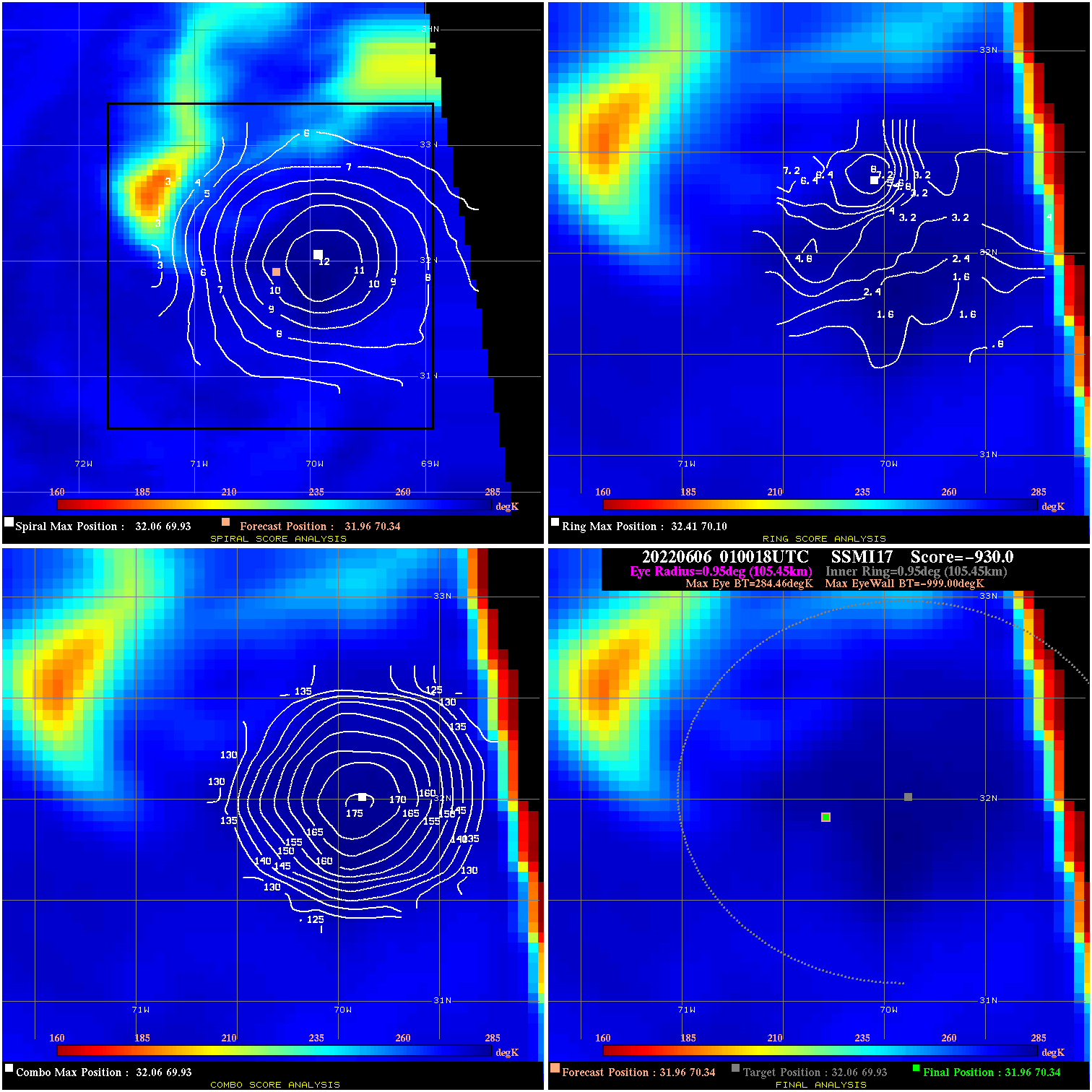
20220606 010018 -930.0 N/A N/A N/A 0.00 55.0 SSMI17 32.0 70.3 32.0 70.3 32.1 69.9 Analysis Plot
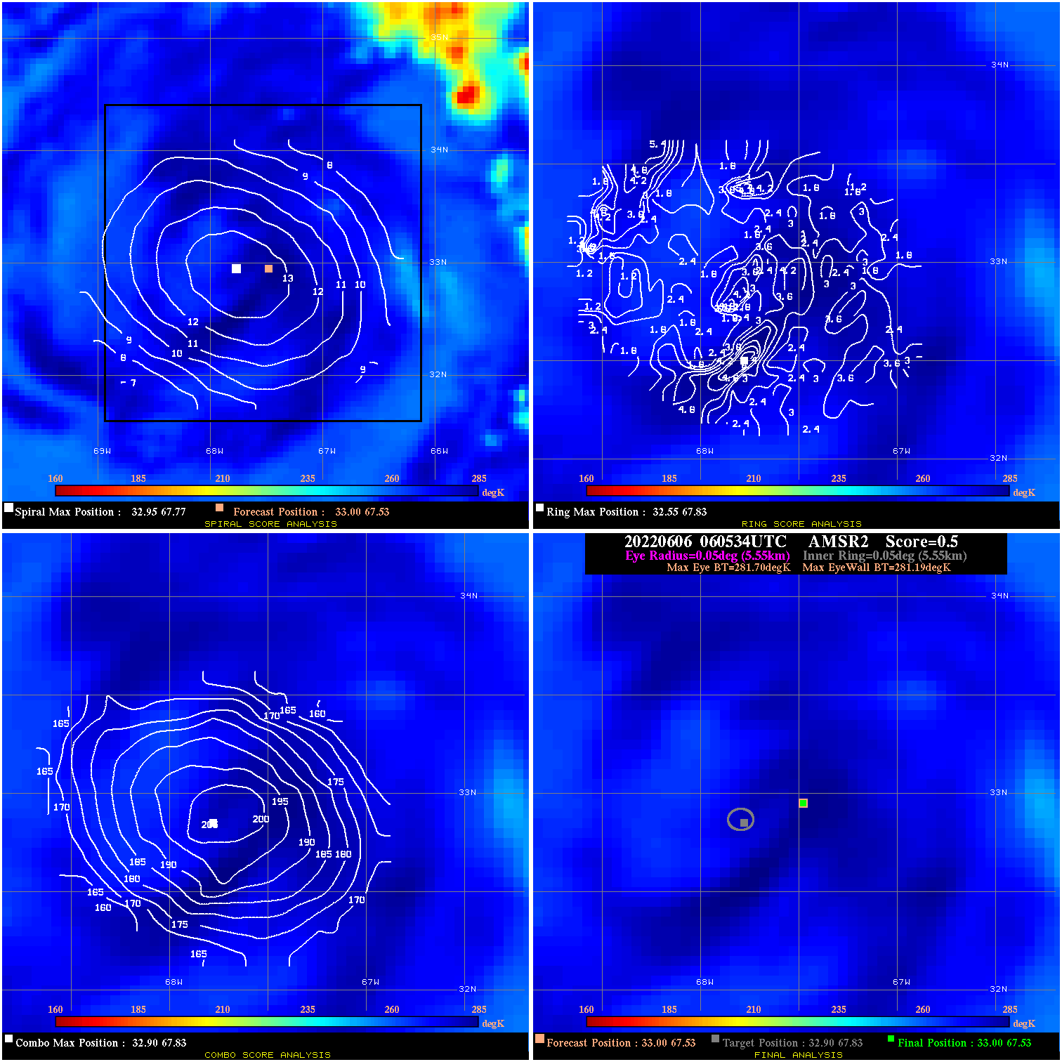
20220606 060534 0.5 N/A N/A 11.11 .51 60.0 AMSR2 33.0 67.5 33.0 67.5 32.9 67.8 Analysis Plot
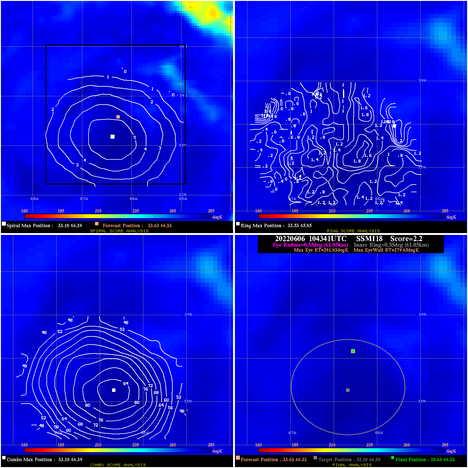
20220606 104341 2.2 N/A N/A 122.21 2.18 60.0 SSMI18 33.6 66.3 33.6 66.3 33.2 66.4 Analysis Plot
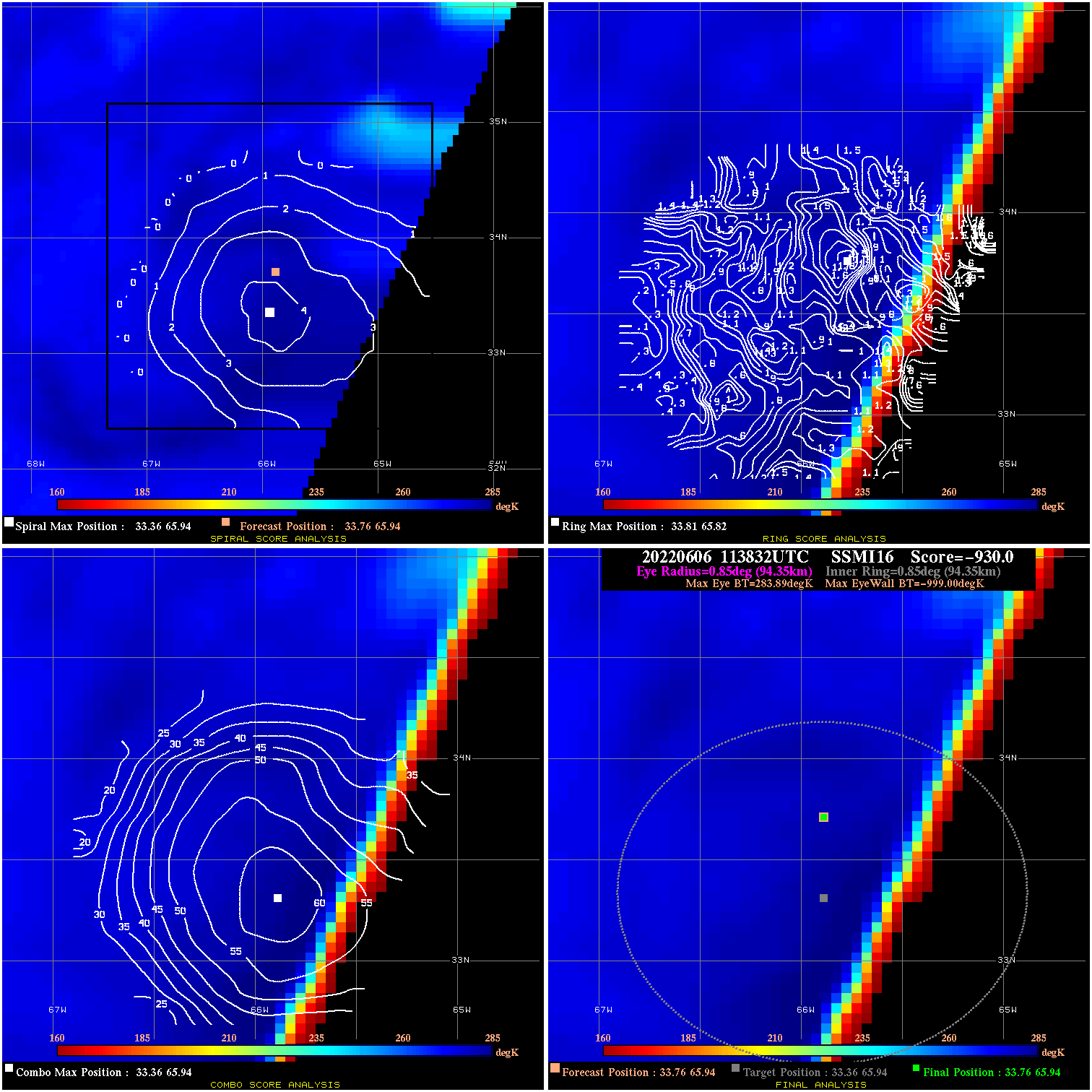
20220606 113832 -930.0 N/A N/A N/A 0.00 60.0 SSMI16 33.8 65.9 33.8 65.9 33.4 65.9 Analysis Plot
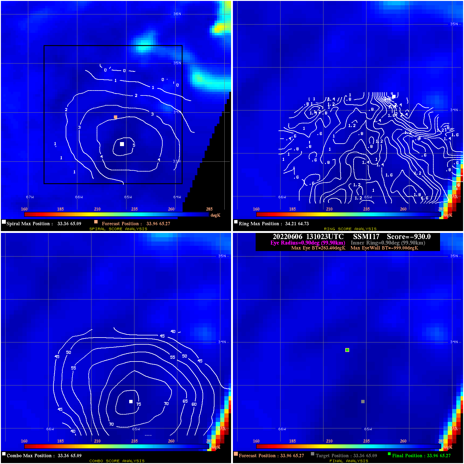
20220606 131023 -930.0 N/A N/A N/A 0.00 60.0 SSMI17 34.0 65.3 34.0 65.3 33.4 65.1 Analysis Plot
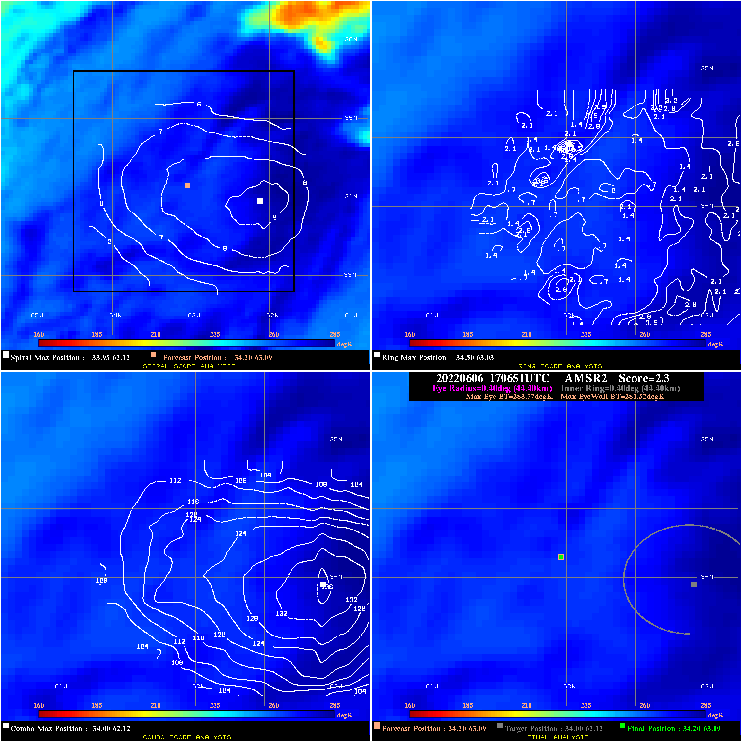
20220606 170651 2.3 N/A N/A 88.88 2.25 55.0 AMSR2 34.2 63.1 34.2 63.1 34.0 62.1 Analysis Plot
|
|
Legend: - Date/Time are determined from PMW imagery at Forecast (initial guess) Lat/Lon position. - Positive/Negative Latitude = North/South Hemisphere; Longitude = Western/Eastern Hemisphere. - "Ring Diam" value indicates the estimated surface eyewall diameter in km (the MI eyewall edge diameter minus 10 km). - "Ring Pct" is the percentage of the "ring" (eyewall inner boundary) that is 1) colder than the "hot spot" (warmest eye pixel) in the eye by 20K, or 2) the percentage that is a) colder than 232K and b) colder than the "hot spot" by 10K, whichever is greater. - Values are red if Ring % <= 65, yellow/brown if Ring % <= 85 and green if Ring % > 85. - "Tb diff" is the difference between the "hot spot" (warmest eye pixel) and the warmest pixel on the eyewall. - Intensity score are listed as negative, and not used, when the JTWC or NHC estimated Vmax is <55 kts in order to rule out weak but highly symmetric TCs. - Error messages in intensity scores: -920 is used when the hottest pixel in the eye is <200K, to prevent false positives; -930 means <85% of eyewall has observations/data. |