Tropical Depression 09P
|
Passive Microwave (PMW) Intensity Information Hurricane Intensity Estimation (HIE) Algorithm Version 9.0 |
Overpass Inten Ring Ring Wind Forecast Final Target
Date Time Score Meaning Pct Diam BTdiff Est Sat Lat Lon Lat Lon Lat Lon
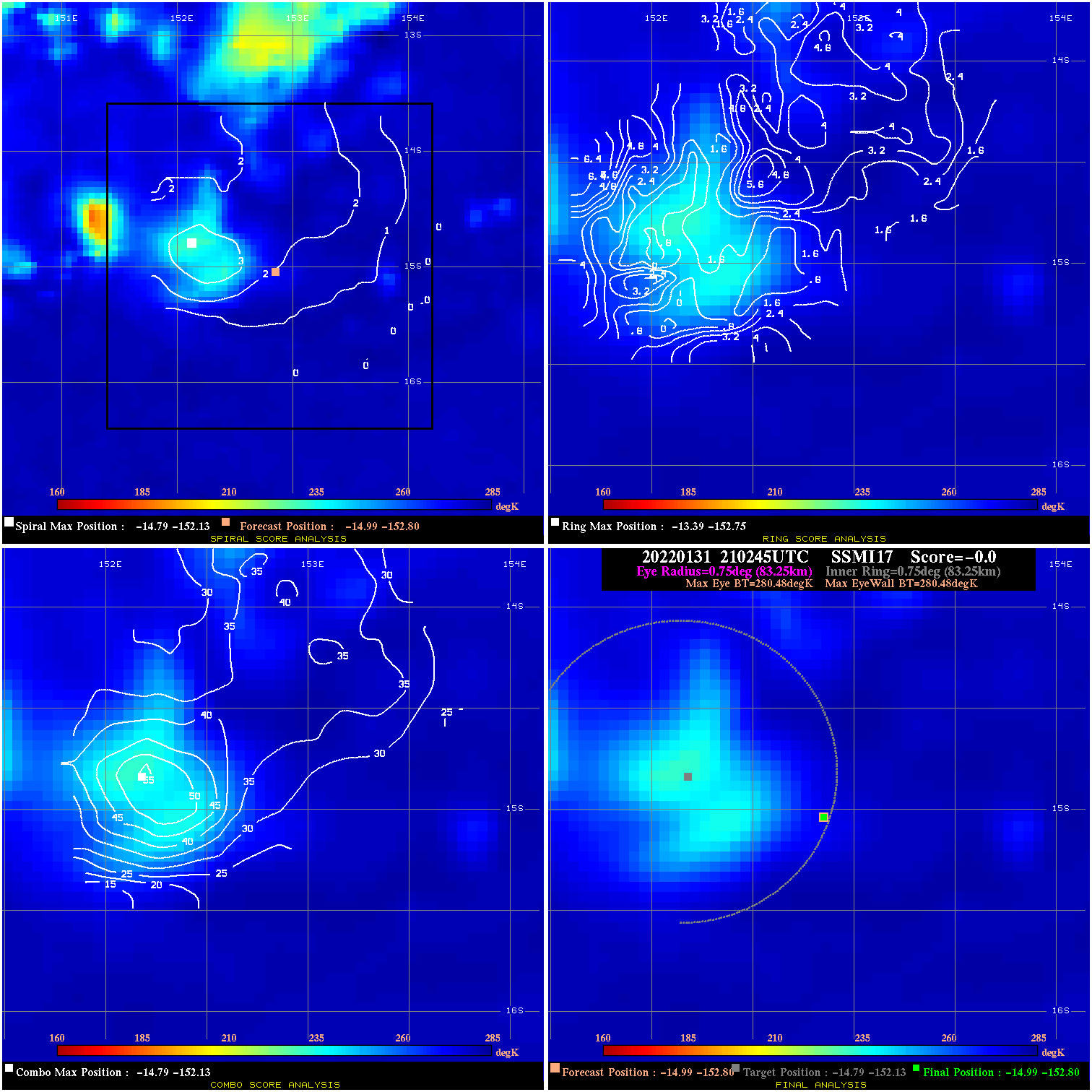
20220131 210245 N/A N/A N/A N/A N/A 35.0 SSMI17 -15.0 -152.8 -15.0 -152.8 -14.8 -152.1 Analysis Plot
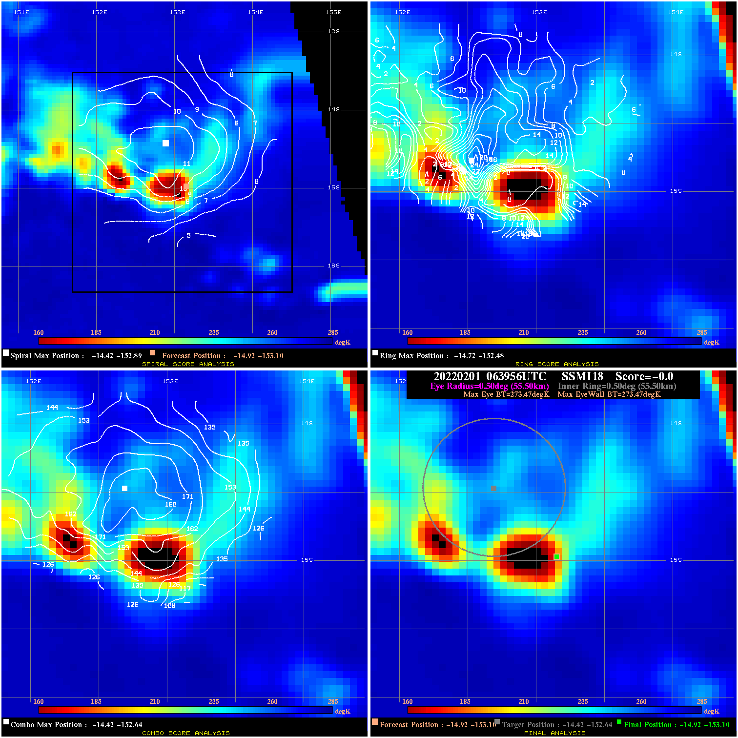
20220201 063956 N/A N/A N/A N/A N/A 35.0 SSMI18 -14.9 -153.1 -14.9 -153.1 -14.4 -152.6 Analysis Plot
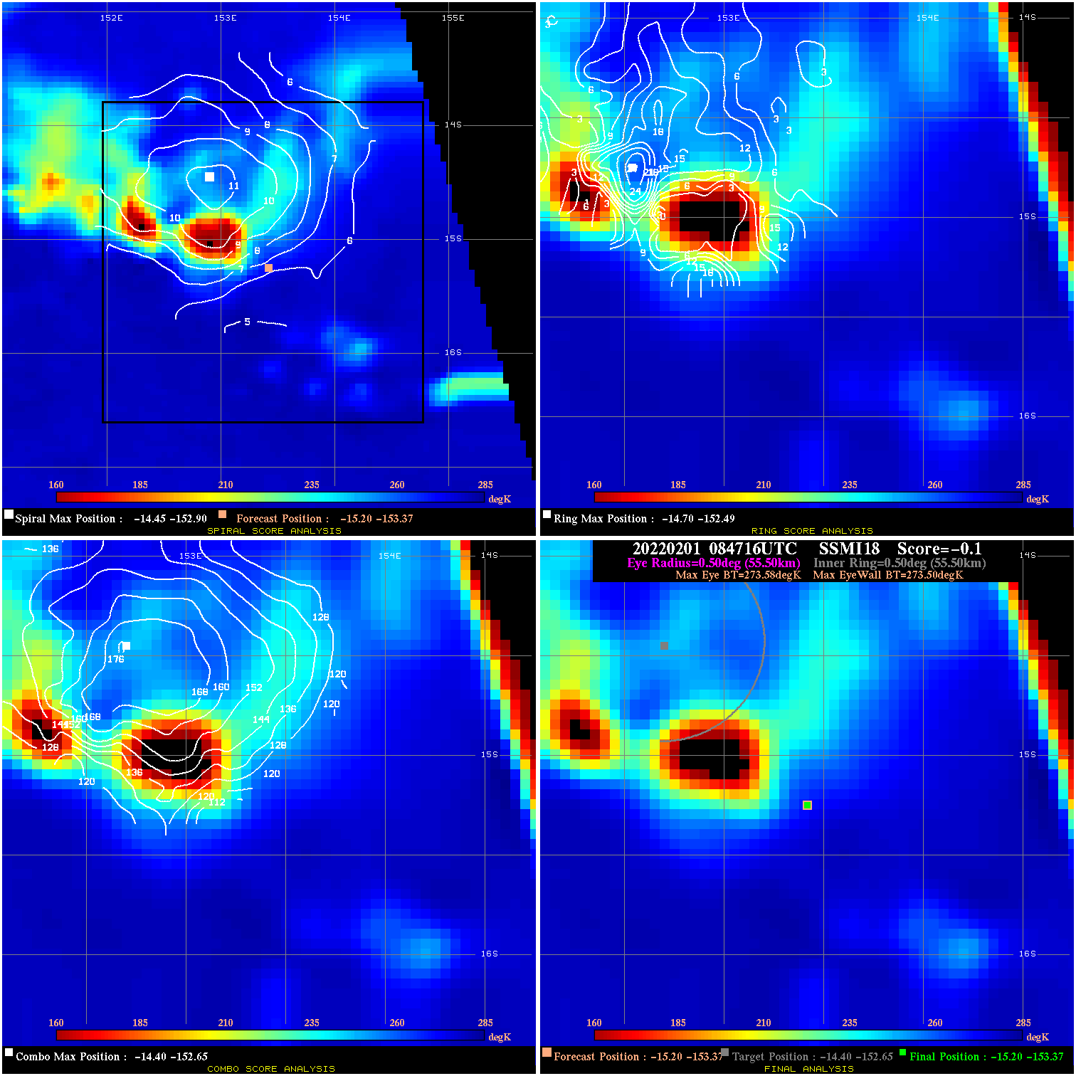
20220201 084716 -0.1 N/A 43.8% 111.10 .08 35.0 SSMI18 -15.2 -153.4 -15.2 -153.4 -14.4 -152.6 Analysis Plot
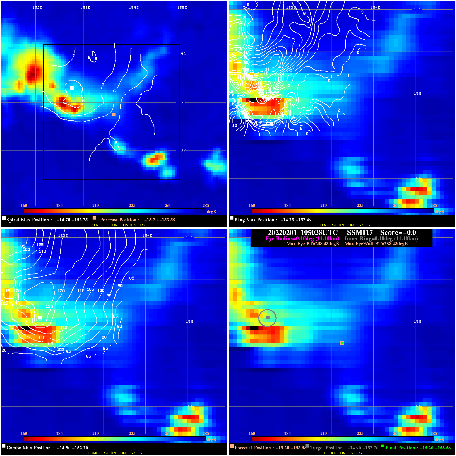
20220201 105038 N/A N/A N/A N/A N/A 35.0 SSMI17 -15.2 -153.6 -15.2 -153.6 -14.9 -152.7 Analysis Plot
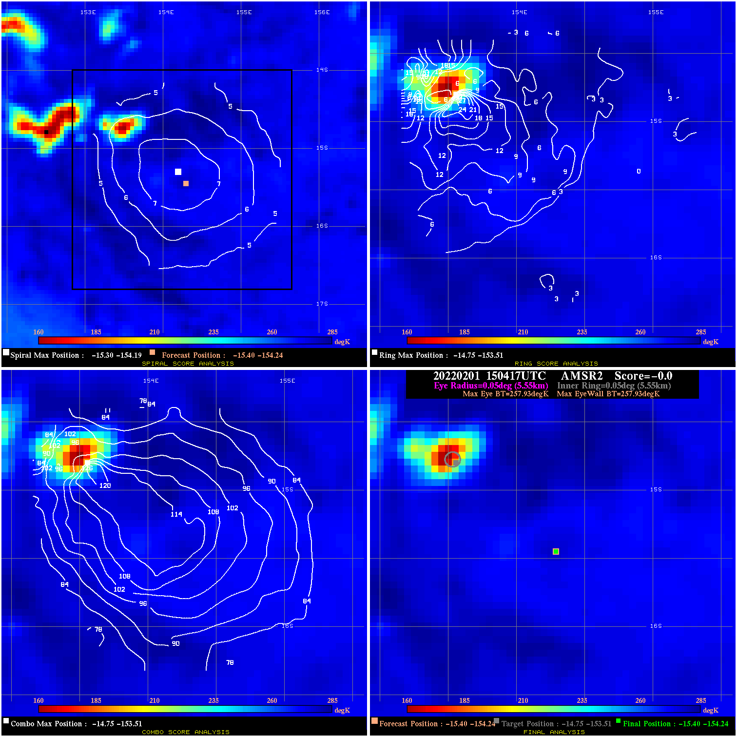
20220201 150417 N/A N/A N/A N/A N/A 35.0 AMSR2 -15.4 -154.2 -15.4 -154.2 -14.8 -153.5 Analysis Plot
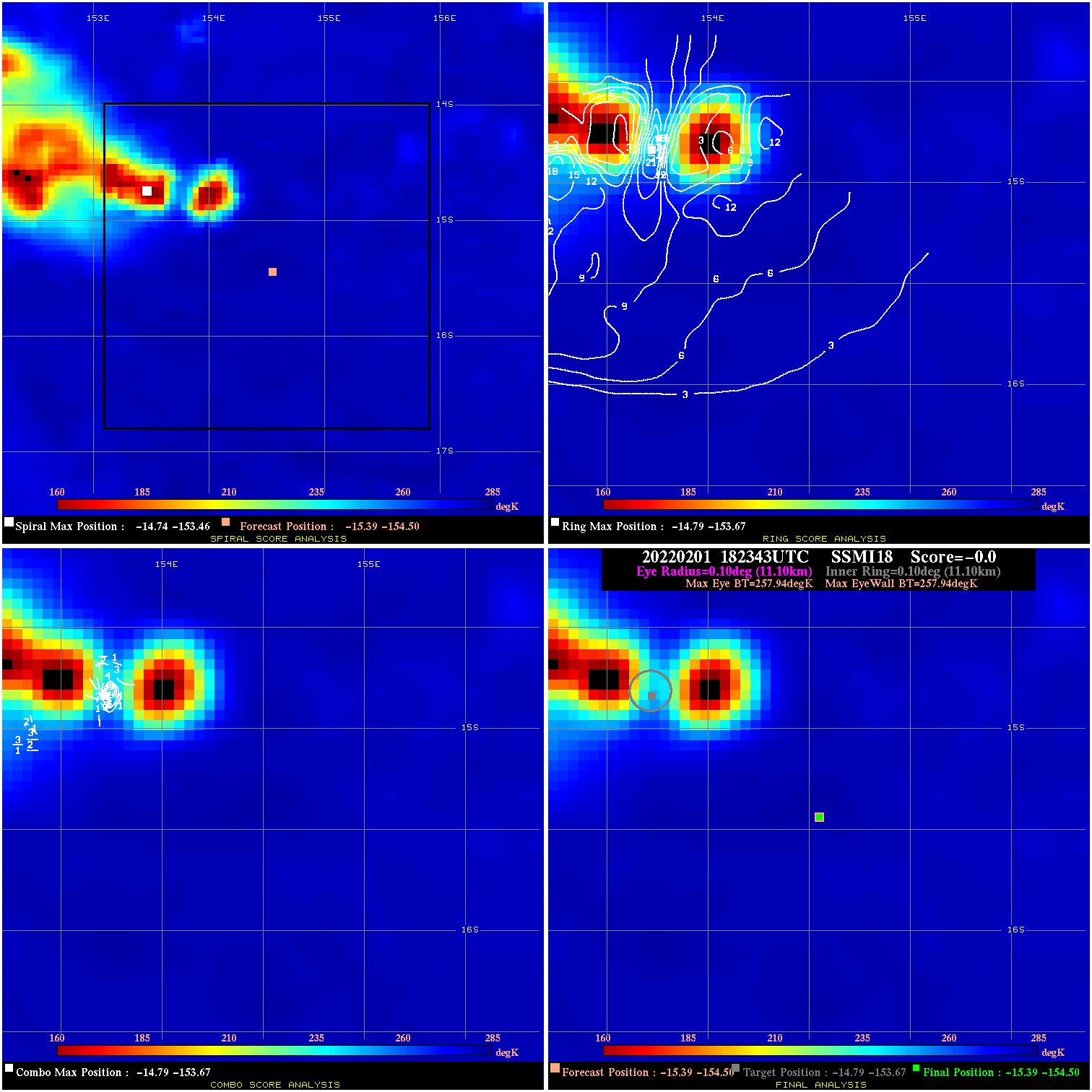
20220201 182343 N/A N/A N/A N/A N/A 35.0 SSMI18 -15.4 -154.5 -15.4 -154.5 -14.8 -153.7 Analysis Plot
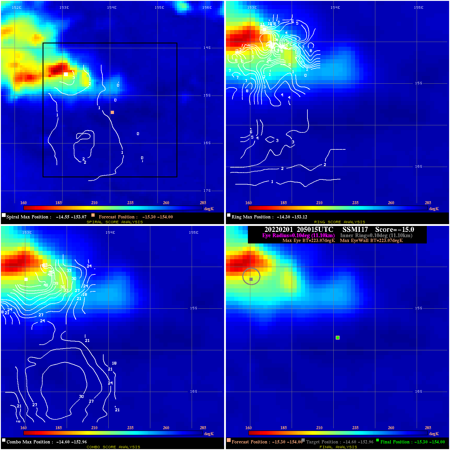
20220201 205015 N/A N/A N/A N/A N/A 35.0 SSMI17 -15.3 -154.0 -15.3 -154.0 -14.6 -153.0 Analysis Plot
20220202 031741 -5.3 N/A 1.4% 211.09 5.28 30.0 AMSR2 -15.0 -154.4 -15.0 -154.4 -14.9 -154.3 Analysis Plot
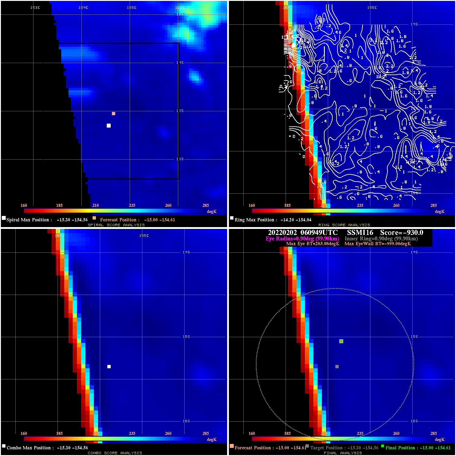
20220202 060949 -930.0 N/A N/A N/A 0.00 30.0 SSMI16 -15.0 -154.6 -15.0 -154.6 -15.3 -154.6 Analysis Plot
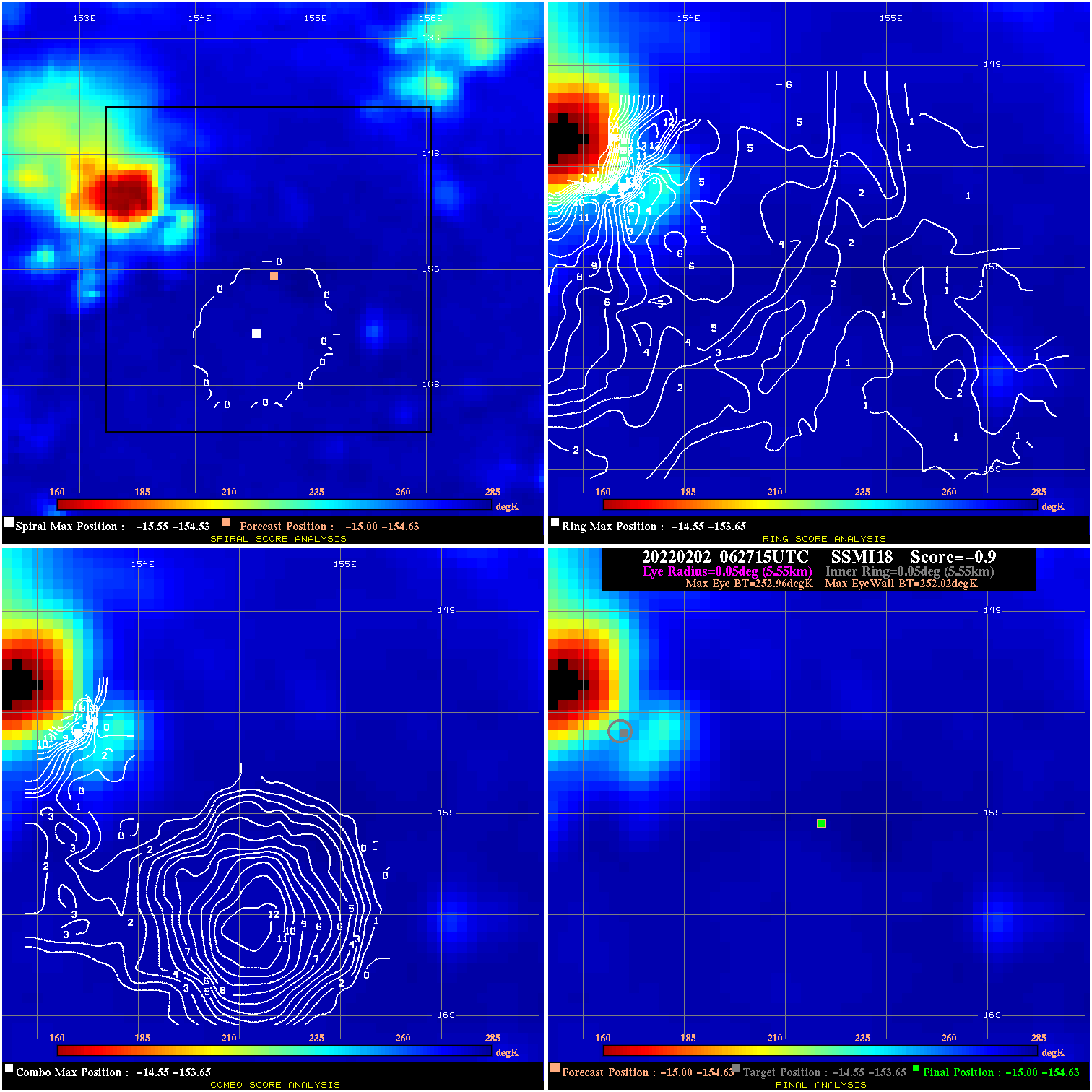
20220202 062715 -0.9 N/A 31.5% 11.11 .94 30.0 SSMI18 -15.0 -154.6 -15.0 -154.6 -14.6 -153.6 Analysis Plot
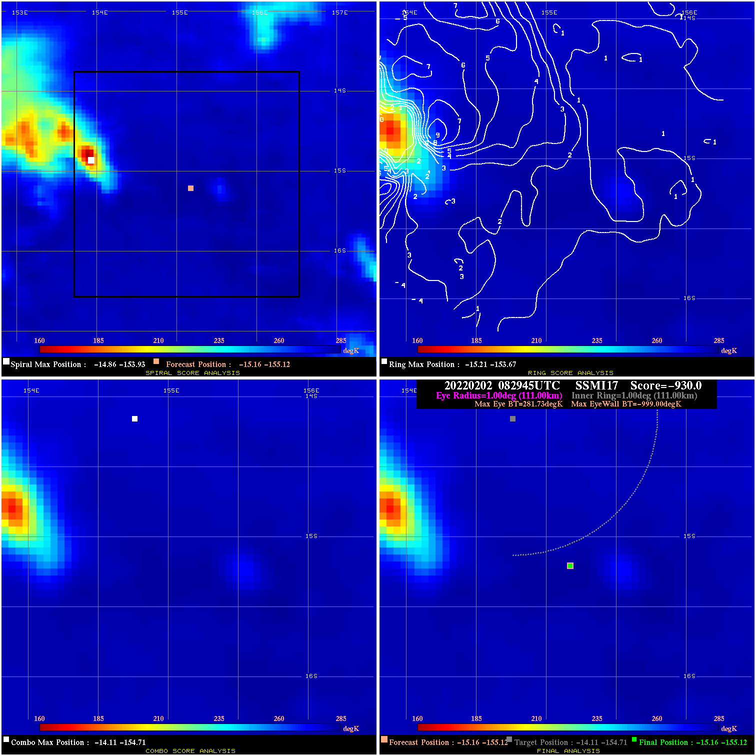
20220202 082945 -930.0 N/A N/A N/A 0.00 30.0 SSMI17 -15.2 -155.1 -15.2 -155.1 -14.1 -154.7 Analysis Plot
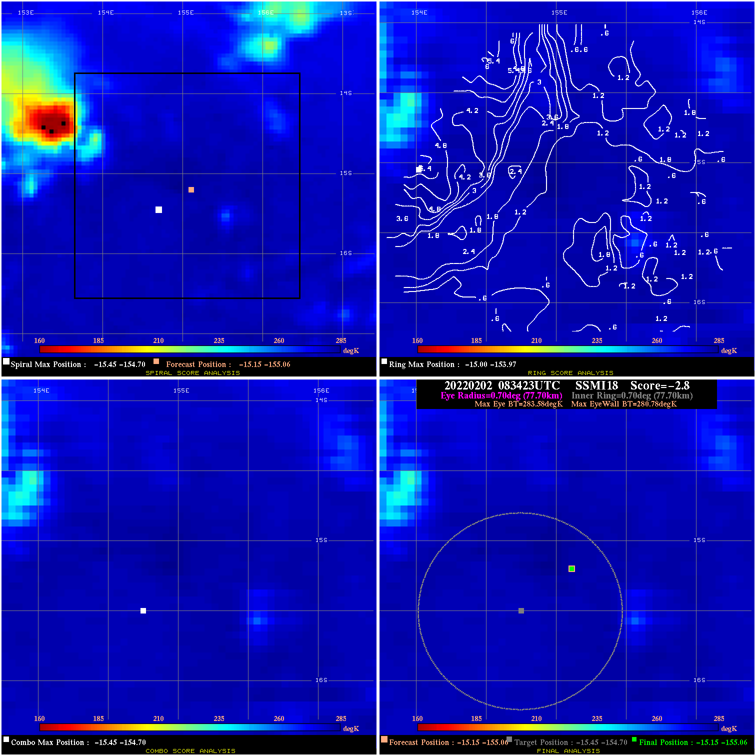
20220202 083423 -2.8 N/A N/A 155.54 2.80 30.0 SSMI18 -15.1 -155.1 -15.1 -155.1 -15.4 -154.7 Analysis Plot
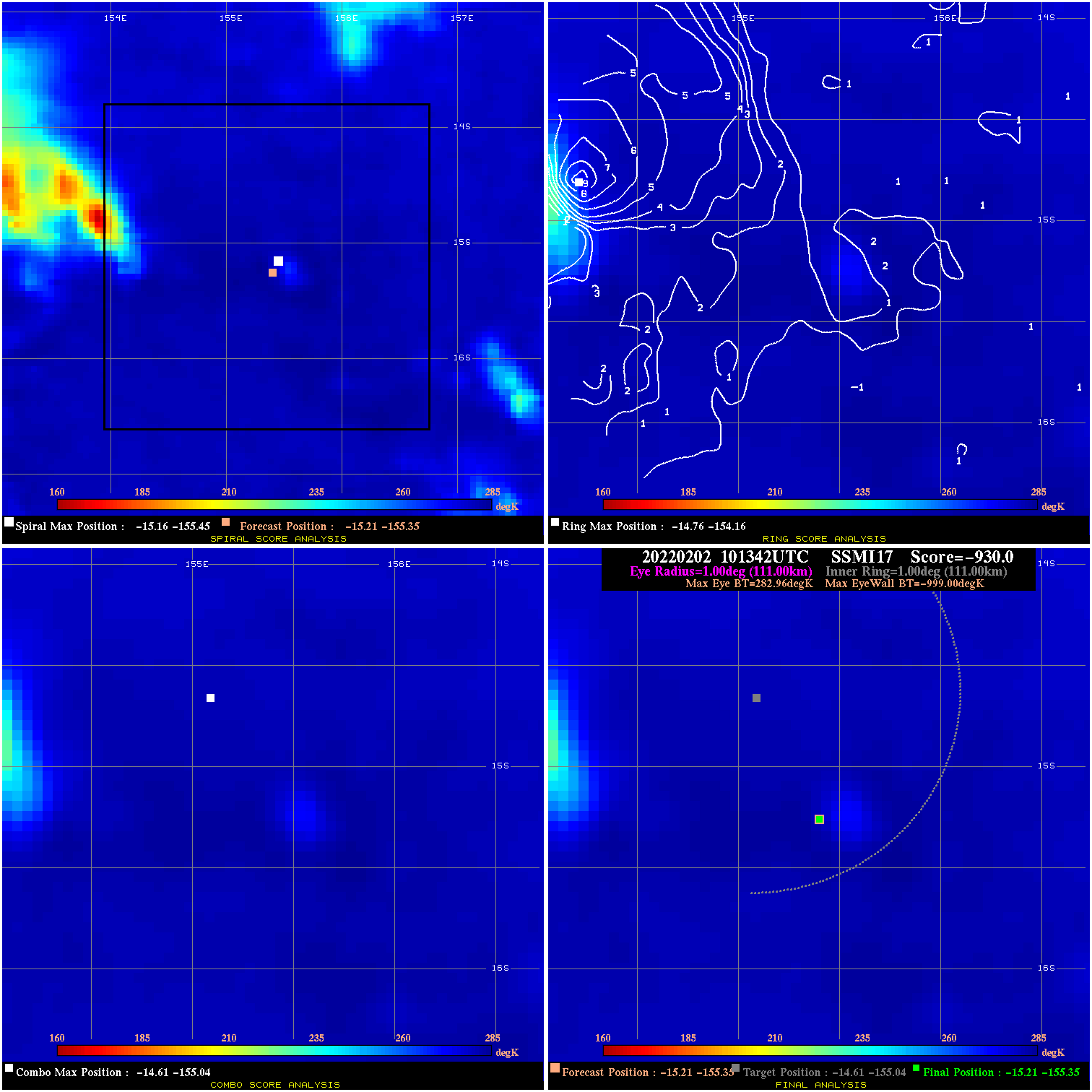
20220202 101342 -930.0 N/A N/A N/A 0.00 30.0 SSMI17 -15.2 -155.4 -15.2 -155.4 -14.6 -155.0 Analysis Plot
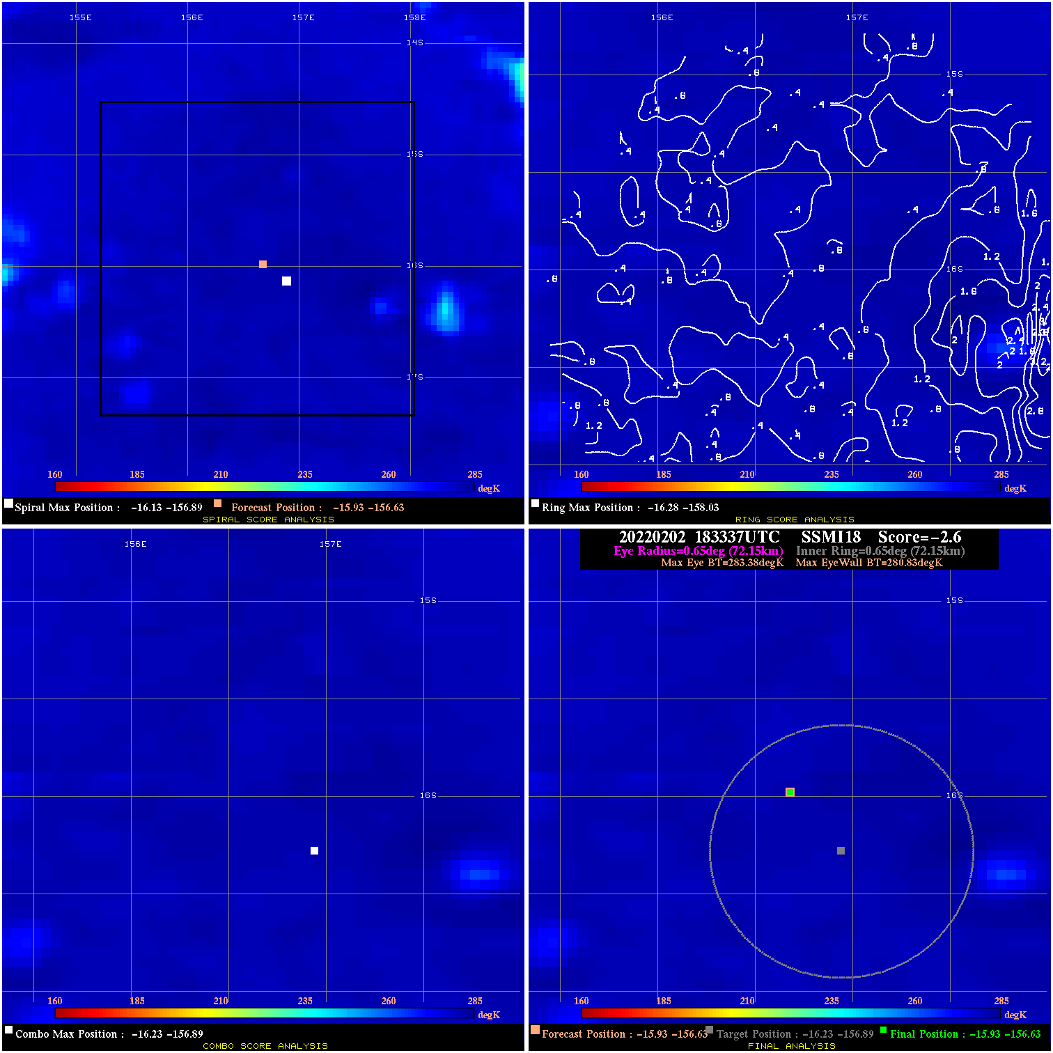
20220202 183337 -2.6 N/A N/A 144.43 2.55 25.0 SSMI18 -15.9 -156.6 -15.9 -156.6 -16.2 -156.9 Analysis Plot
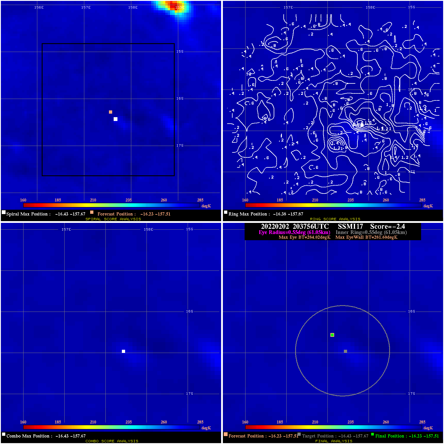
20220202 203756 -2.4 N/A N/A 122.21 2.42 20.0 SSMI17 -16.2 -157.5 -16.2 -157.5 -16.4 -157.7 Analysis Plot
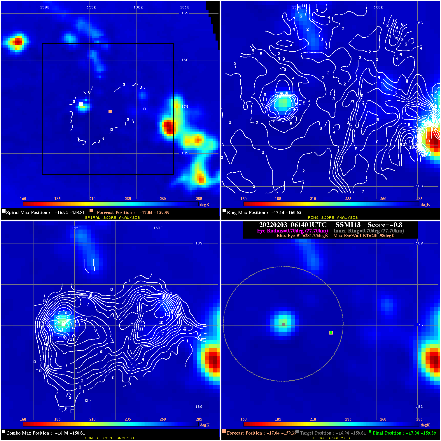
20220203 061401 -0.8 N/A N/A 155.54 .77 15.0 SSMI18 -17.0 -159.4 -17.0 -159.4 -16.9 -158.8 Analysis Plot
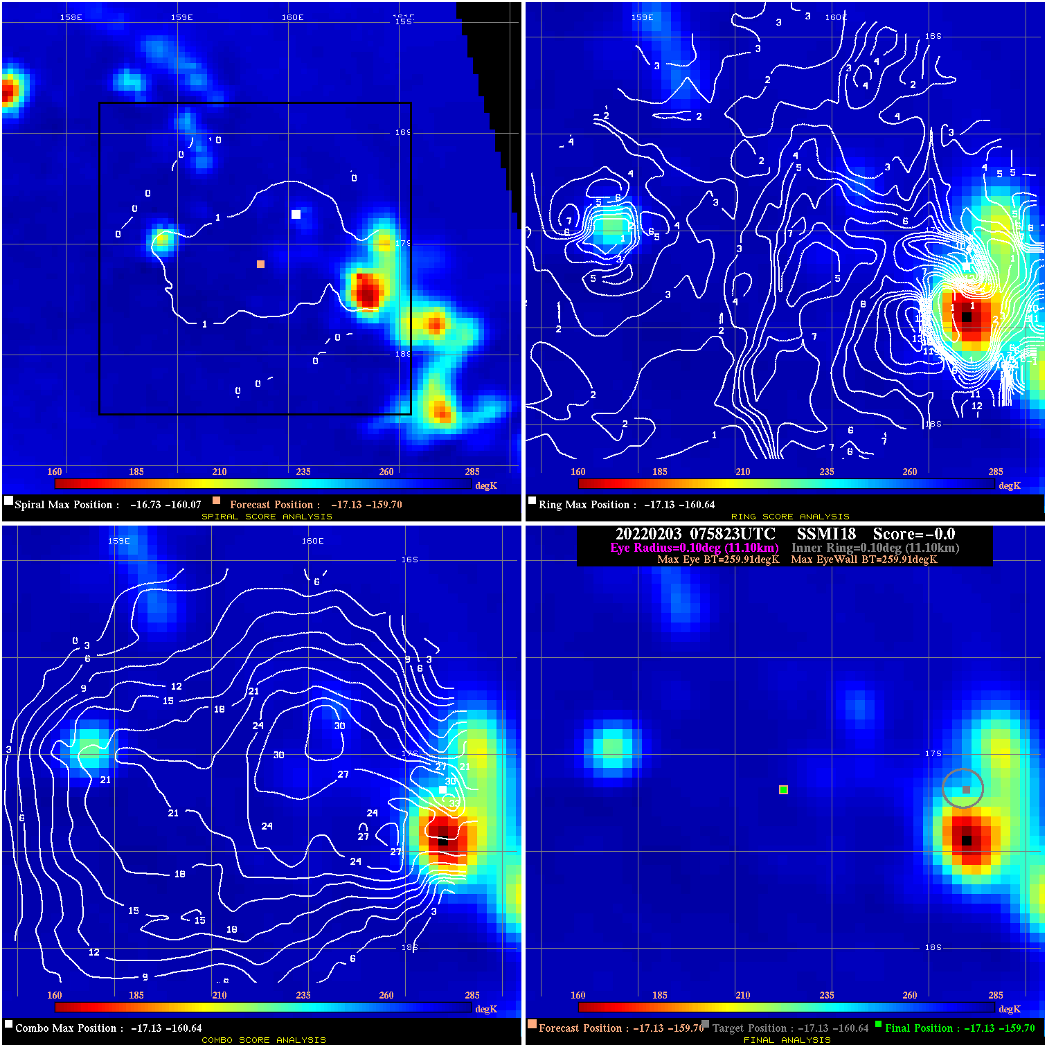
20220203 075823 N/A N/A N/A N/A N/A 15.0 SSMI18 -17.1 -159.7 -17.1 -159.7 -17.1 -160.6 Analysis Plot
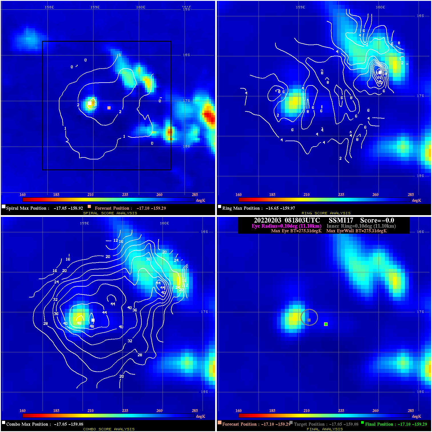
20220203 081803 N/A N/A N/A N/A N/A 20.0 SSMI17 -17.1 -159.3 -17.1 -159.3 -17.0 -159.1 Analysis Plot
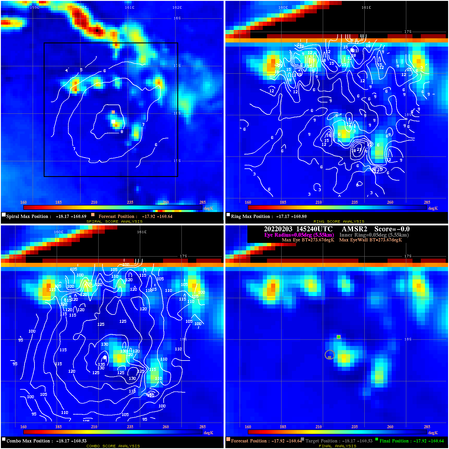
20220203 145240 N/A N/A N/A N/A N/A 20.0 AMSR2 -17.9 -160.6 -17.9 -160.6 -18.2 -160.5 Analysis Plot
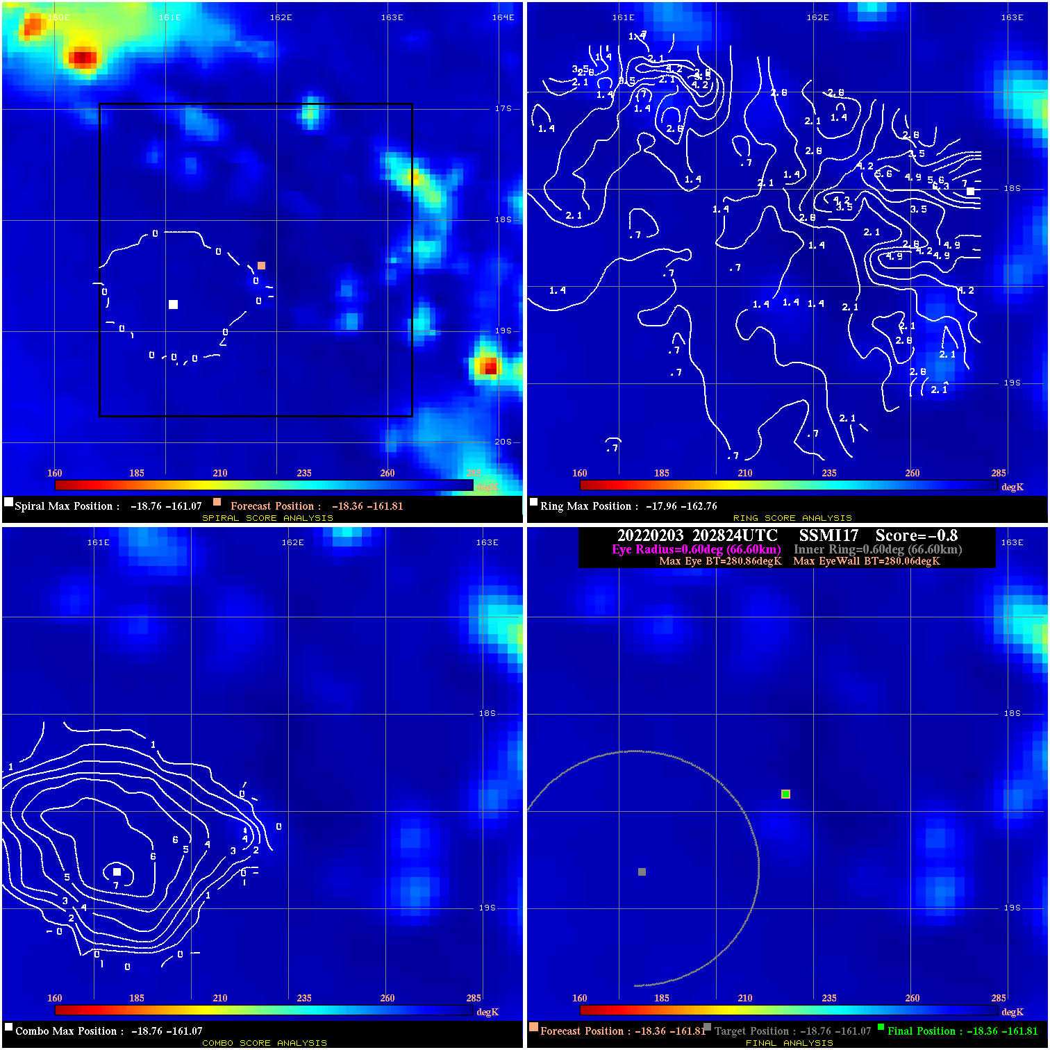
20220203 202824 -0.8 N/A N/A 133.32 .80 20.0 SSMI17 -18.4 -161.8 -18.4 -161.8 -18.8 -161.1 Analysis Plot
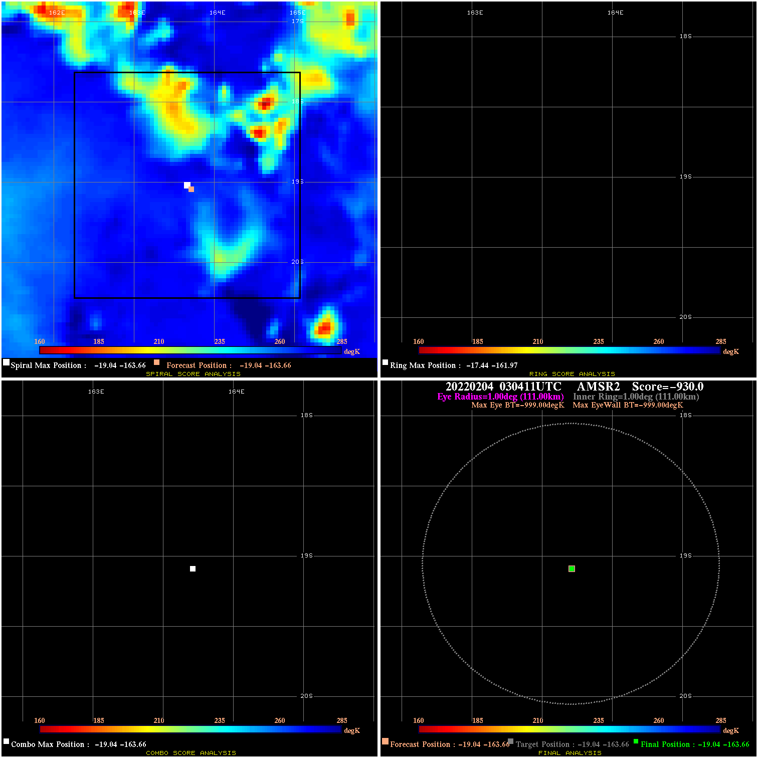
20220204 030411 N/A N/A N/A N/A N/A 20.0 AMSR2 -19.0 -163.7 -19.0 -163.7 -19.0 -163.7 Analysis Plot
|
|
Legend: - Date/Time are determined from PMW imagery at Forecast (initial guess) Lat/Lon position. - Positive/Negative Latitude = North/South Hemisphere; Longitude = Western/Eastern Hemisphere. - "Ring Diam" value indicates the estimated surface eyewall diameter in km (the MI eyewall edge diameter minus 10 km). - "Ring Pct" is the percentage of the "ring" (eyewall inner boundary) that is 1) colder than the "hot spot" (warmest eye pixel) in the eye by 20K, or 2) the percentage that is a) colder than 232K and b) colder than the "hot spot" by 10K, whichever is greater. - Values are red if Ring % <= 65, yellow/brown if Ring % <= 85 and green if Ring % > 85. - "Tb diff" is the difference between the "hot spot" (warmest eye pixel) and the warmest pixel on the eyewall. - Intensity score are listed as negative, and not used, when the JTWC or NHC estimated Vmax is <55 kts in order to rule out weak but highly symmetric TCs. - Error messages in intensity scores: -920 is used when the hottest pixel in the eye is <200K, to prevent false positives; -930 means <85% of eyewall has observations/data. |