Tropical Depression 14E
|
Passive Microwave (PMW) Intensity Information Hurricane Intensity Estimation (HIE) Algorithm Version 9.0 |
Overpass Inten Ring Ring Wind Forecast Final Target
Date Time Score Meaning Pct Diam BTdiff Est Sat Lat Lon Lat Lon Lat Lon
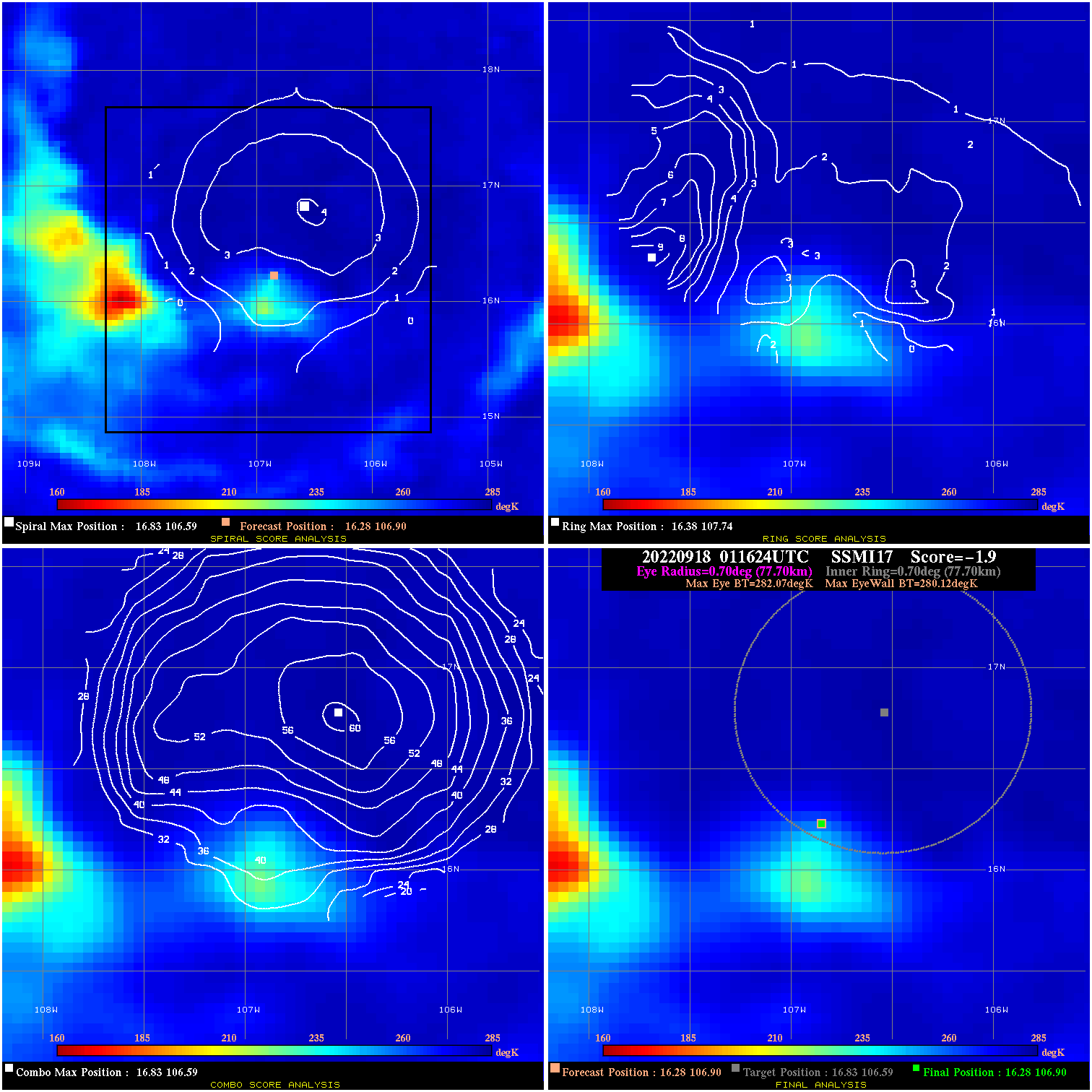
20220918 011624 -1.9 N/A N/A 155.54 1.95 40.0 SSMI17 16.3 106.9 16.3 106.9 16.8 106.6 Analysis Plot
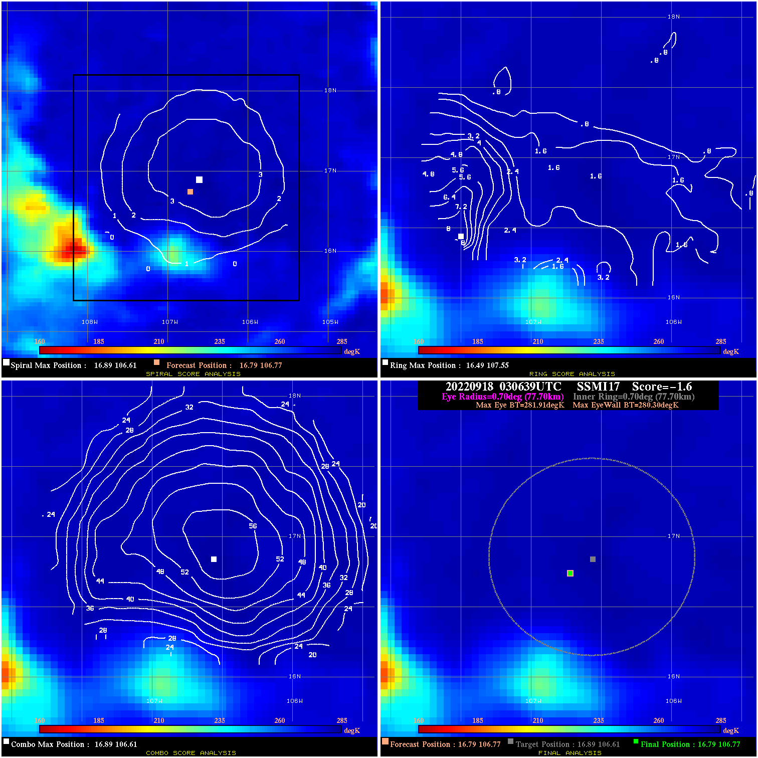
20220918 030639 -1.6 N/A N/A 155.54 1.61 40.0 SSMI17 16.8 106.8 16.8 106.8 16.9 106.6 Analysis Plot
20220918 083746 -3.4 N/A N/A 222.20 3.39 40.0 AMSR2 17.7 106.6 17.7 106.6 18.0 106.4 Analysis Plot
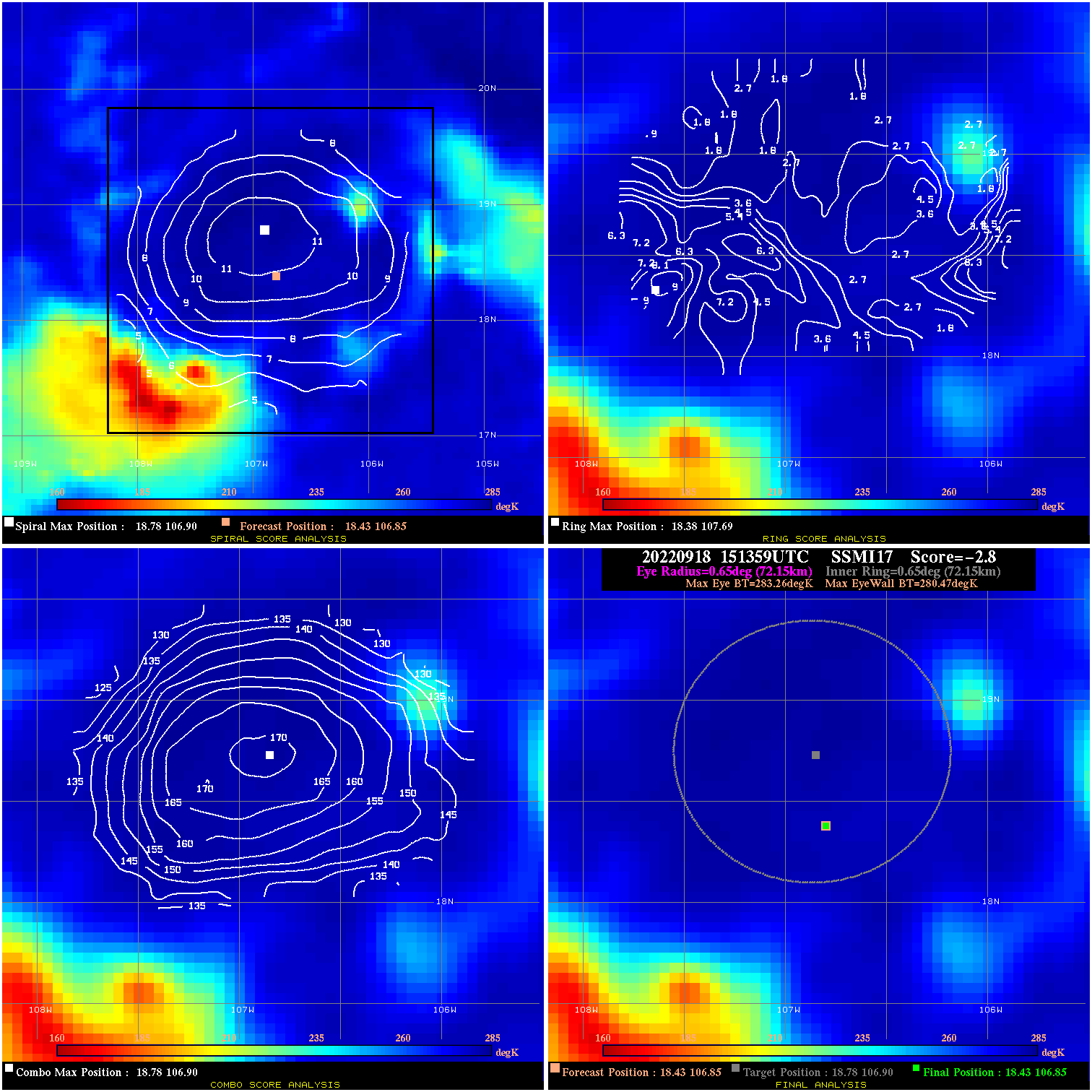
20220918 151359 -2.8 N/A N/A 144.43 2.79 40.0 SSMI17 18.4 106.8 18.4 106.8 18.8 106.9 Analysis Plot
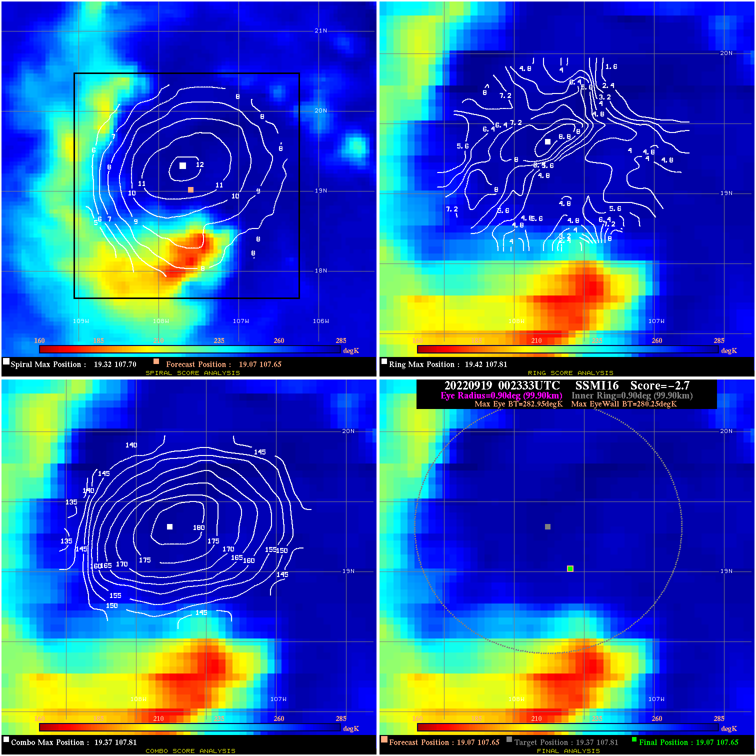
20220919 002333 -2.7 N/A 37.0% 199.98 2.70 40.0 SSMI16 19.1 107.7 19.1 107.7 19.4 107.8 Analysis Plot
20220919 011303 -3.0 N/A 32.9% 199.98 2.97 40.0 SSMI17 19.1 107.7 19.1 107.7 19.8 107.7 Analysis Plot
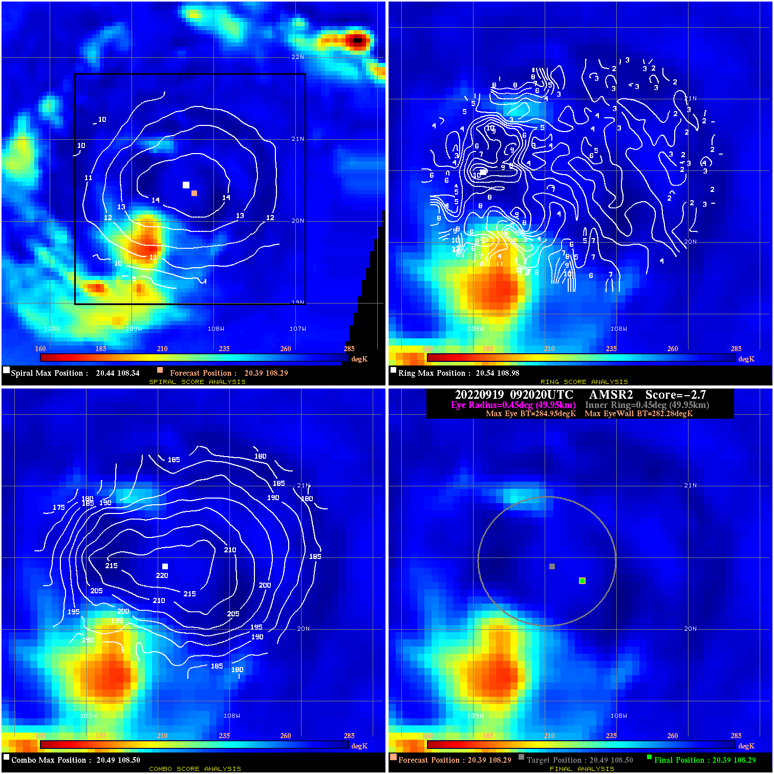
20220919 092020 -2.7 N/A 9.6% 99.99 2.67 50.0 AMSR2 20.4 108.3 20.4 108.3 20.5 108.5 Analysis Plot
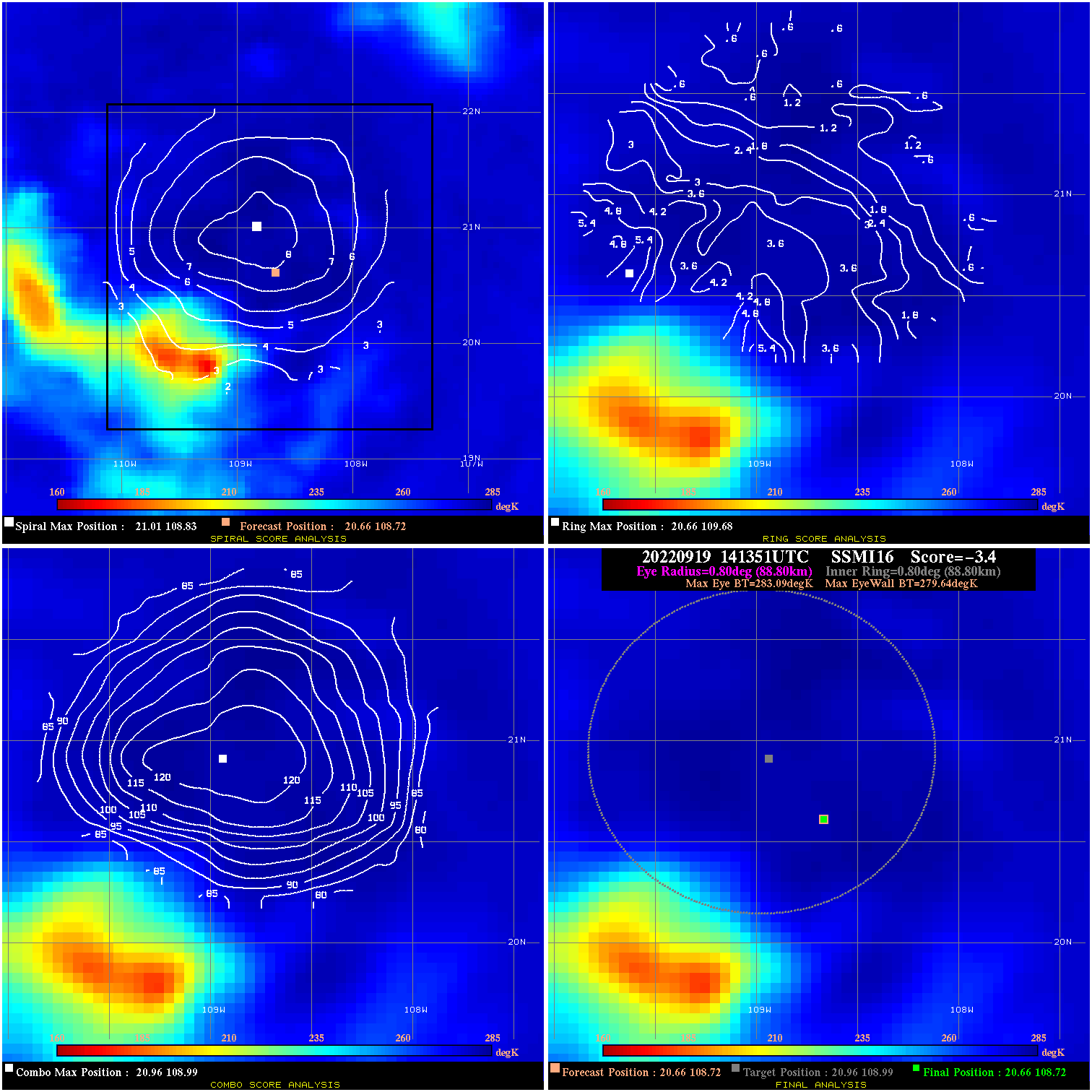
20220919 141351 -3.4 N/A 13.7% 177.76 3.45 50.0 SSMI16 20.7 108.7 20.7 108.7 21.0 109.0 Analysis Plot
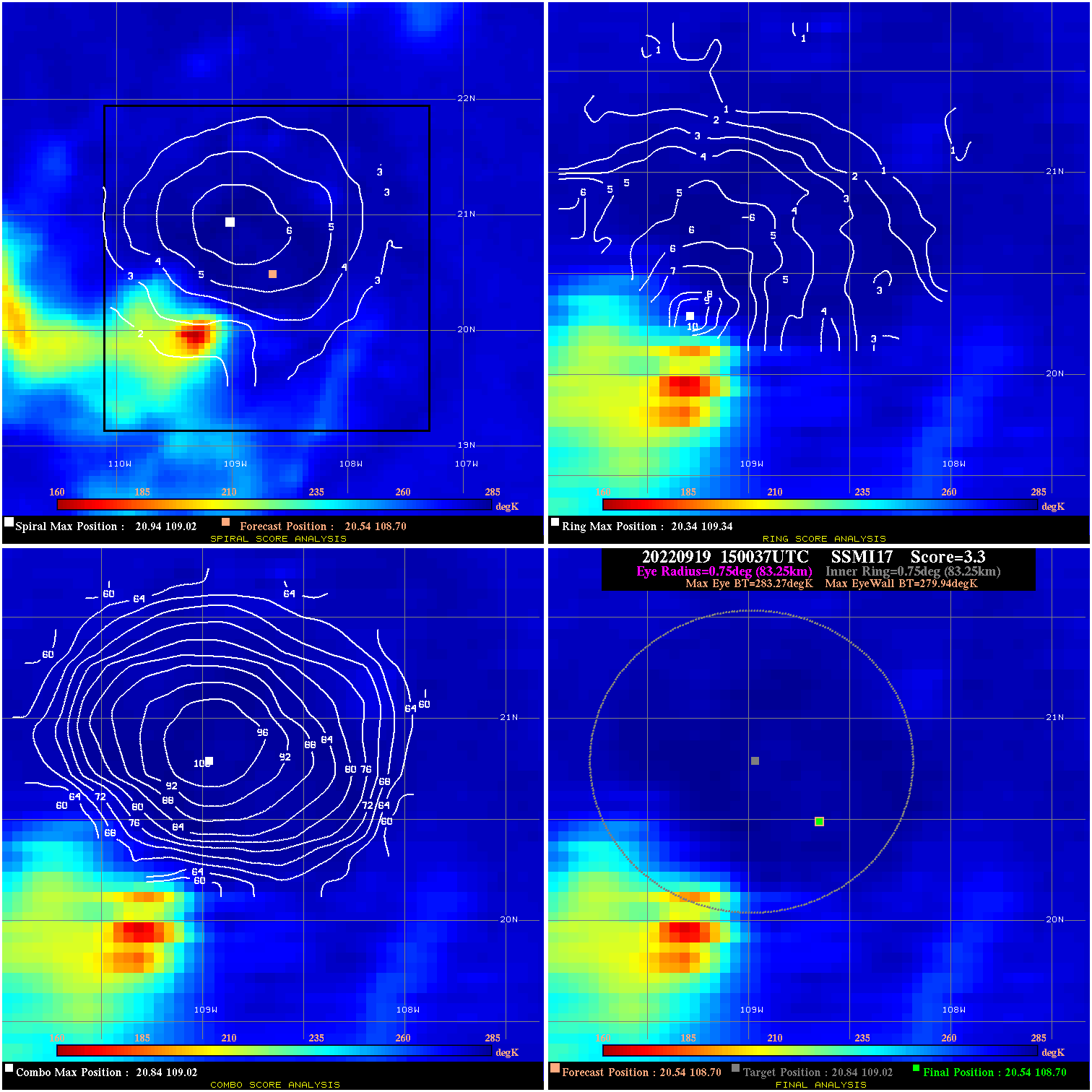
20220919 150037 3.3 N/A 12.3% 166.65 3.33 55.0 SSMI17 20.5 108.7 20.5 108.7 20.8 109.0 Analysis Plot
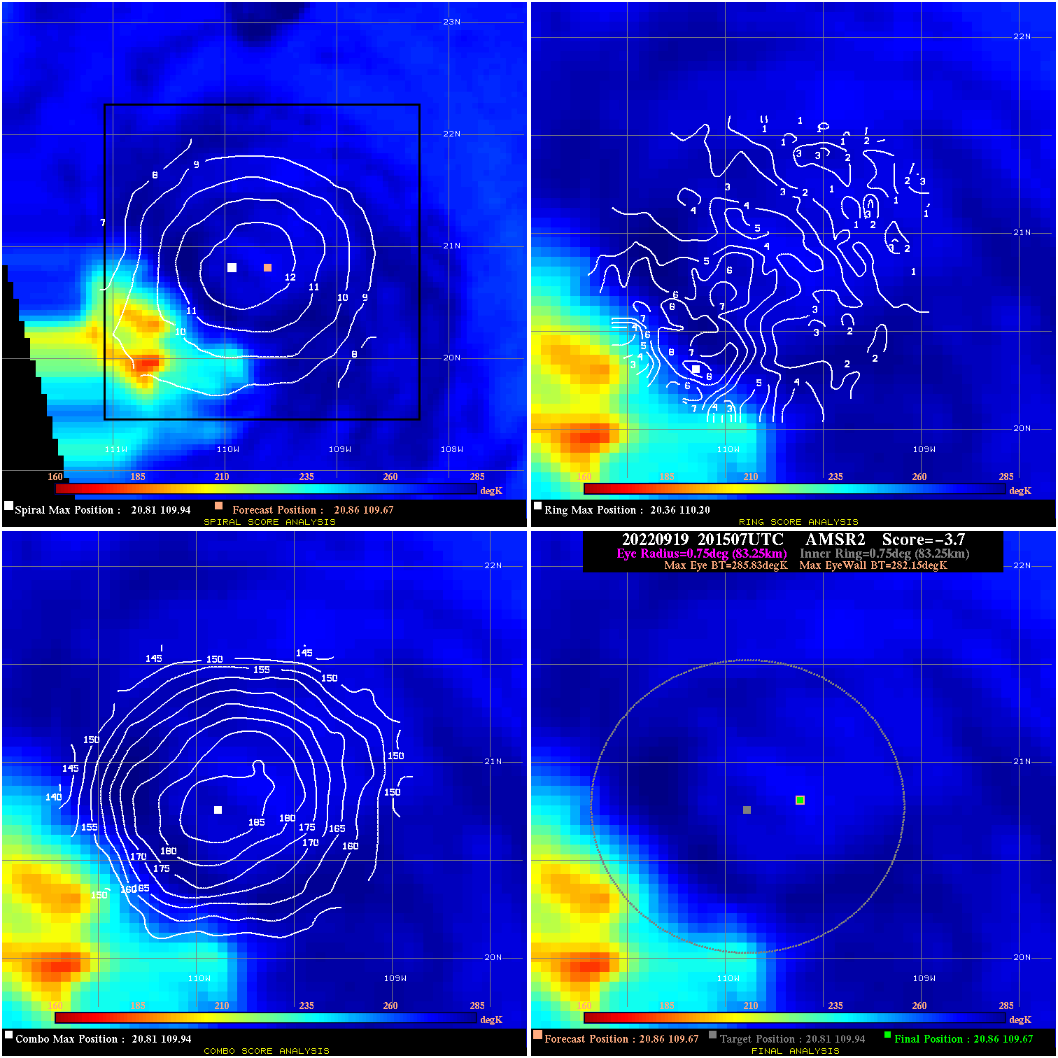
20220919 201507 -3.7 N/A 11.0% 166.65 3.68 50.0 AMSR2 20.9 109.7 20.9 109.7 20.8 109.9 Analysis Plot
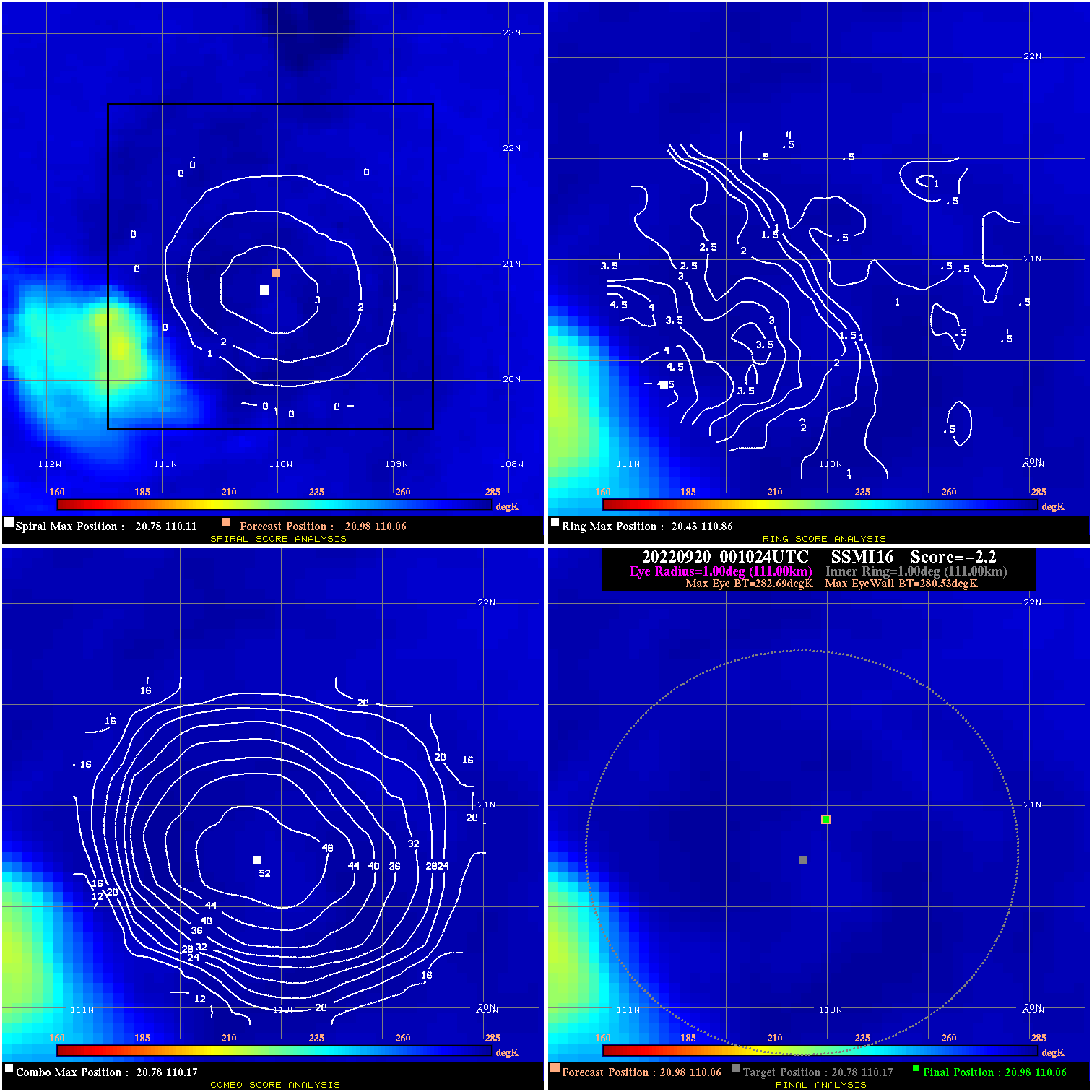
20220920 001024 -2.2 N/A 8.2% 222.20 2.16 50.0 SSMI16 21.0 110.1 21.0 110.1 20.8 110.2 Analysis Plot
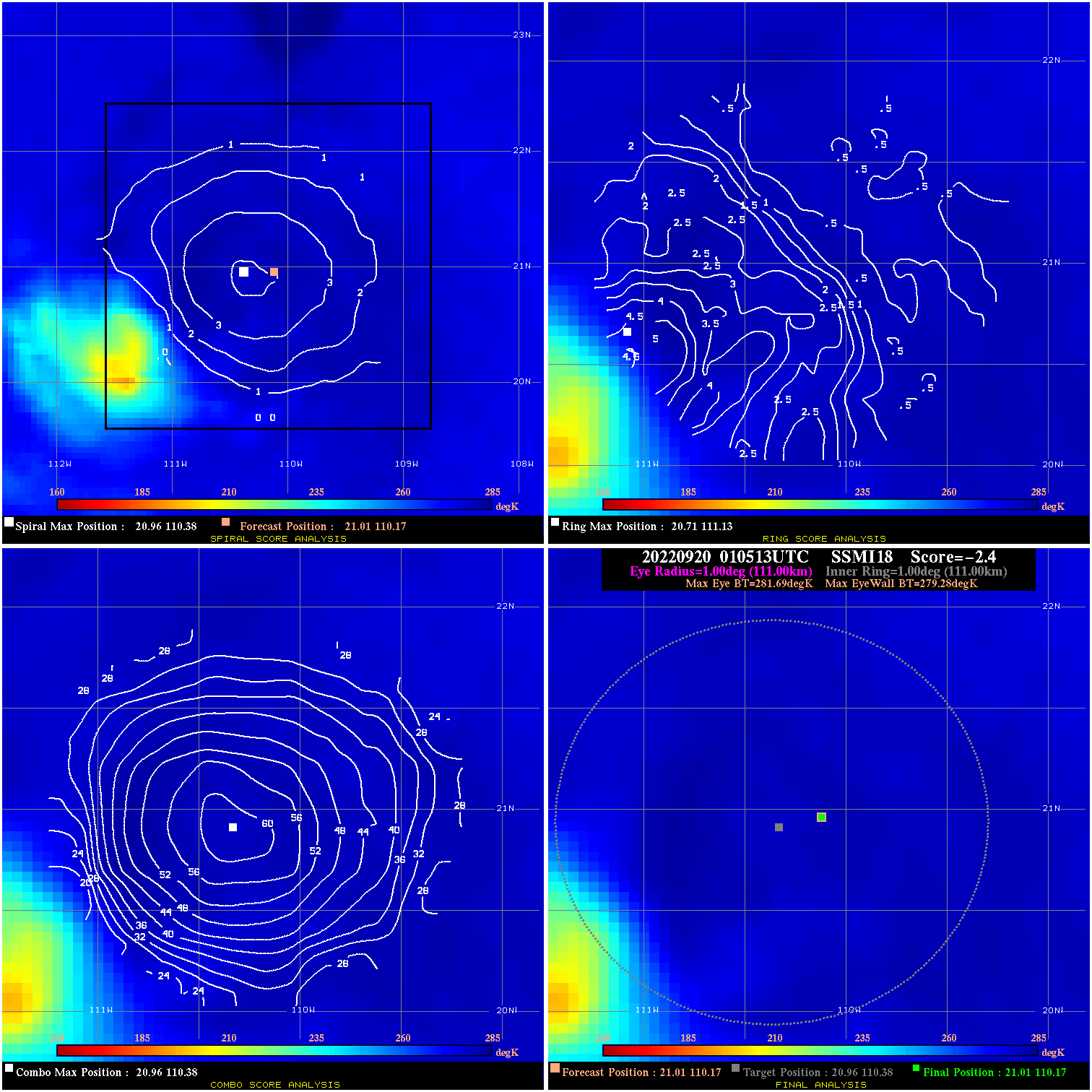
20220920 010513 -2.4 N/A 8.2% 222.20 2.41 50.0 SSMI18 21.0 110.2 21.0 110.2 21.0 110.4 Analysis Plot
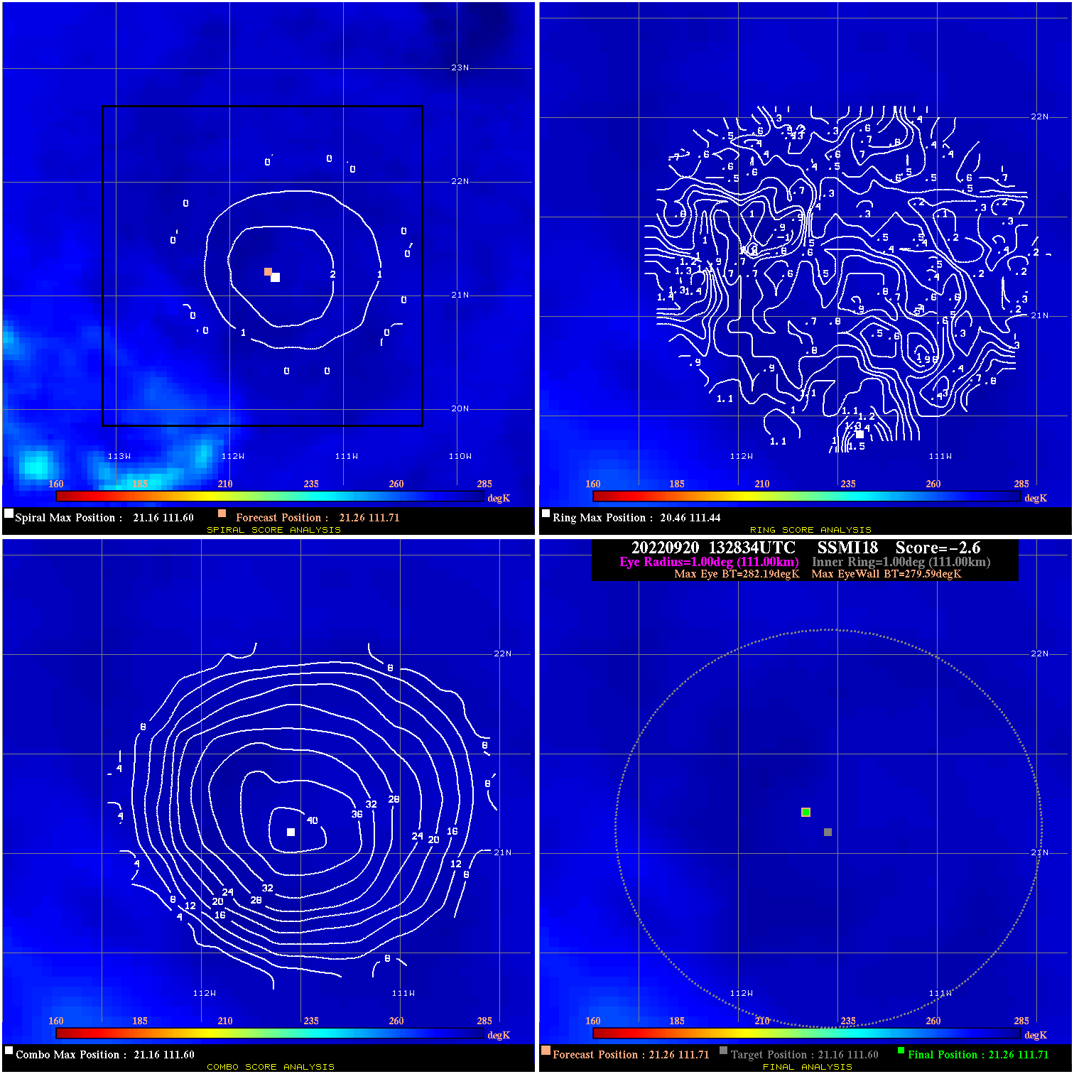
20220920 132834 -2.6 N/A N/A 222.20 2.60 40.0 SSMI18 21.3 111.7 21.3 111.7 21.2 111.6 Analysis Plot
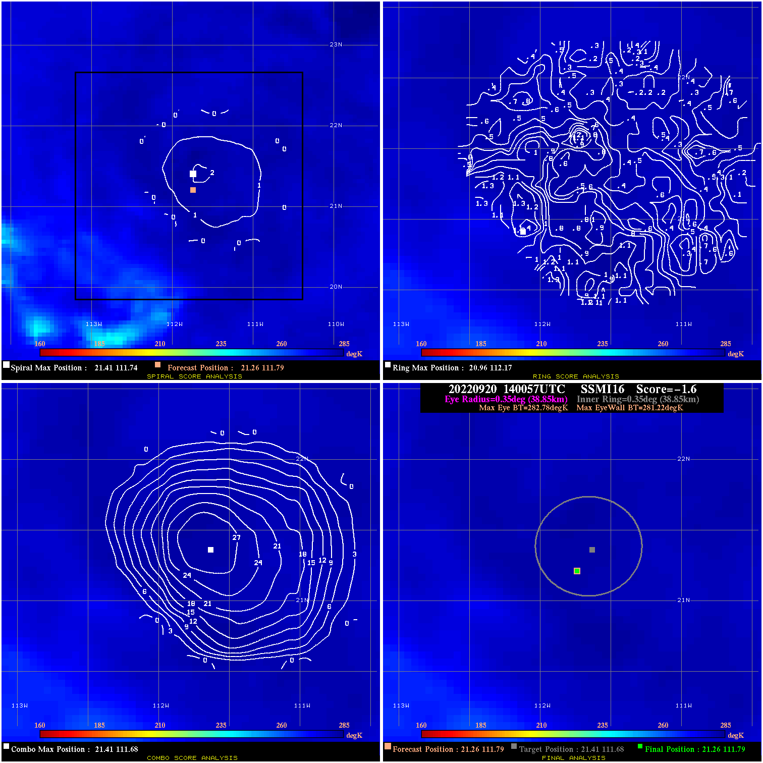
20220920 140057 -1.6 N/A N/A 77.77 1.56 40.0 SSMI16 21.3 111.8 21.3 111.8 21.4 111.7 Analysis Plot
|
|
Legend: - Date/Time are determined from PMW imagery at Forecast (initial guess) Lat/Lon position. - Positive/Negative Latitude = North/South Hemisphere; Longitude = Western/Eastern Hemisphere. - "Ring Diam" value indicates the estimated surface eyewall diameter in km (the MI eyewall edge diameter minus 10 km). - "Ring Pct" is the percentage of the "ring" (eyewall inner boundary) that is 1) colder than the "hot spot" (warmest eye pixel) in the eye by 20K, or 2) the percentage that is a) colder than 232K and b) colder than the "hot spot" by 10K, whichever is greater. - Values are red if Ring % <= 65, yellow/brown if Ring % <= 85 and green if Ring % > 85. - "Tb diff" is the difference between the "hot spot" (warmest eye pixel) and the warmest pixel on the eyewall. - Intensity score are listed as negative, and not used, when the JTWC or NHC estimated Vmax is <55 kts in order to rule out weak but highly symmetric TCs. - Error messages in intensity scores: -920 is used when the hottest pixel in the eye is <200K, to prevent false positives; -930 means <85% of eyewall has observations/data. |