Tropical Depression 14L
|
Passive Microwave (PMW) Intensity Information Hurricane Intensity Estimation (HIE) Algorithm Version 9.0 |
Overpass Inten Ring Ring Wind Forecast Final Target
Date Time Score Meaning Pct Diam BTdiff Est Sat Lat Lon Lat Lon Lat Lon
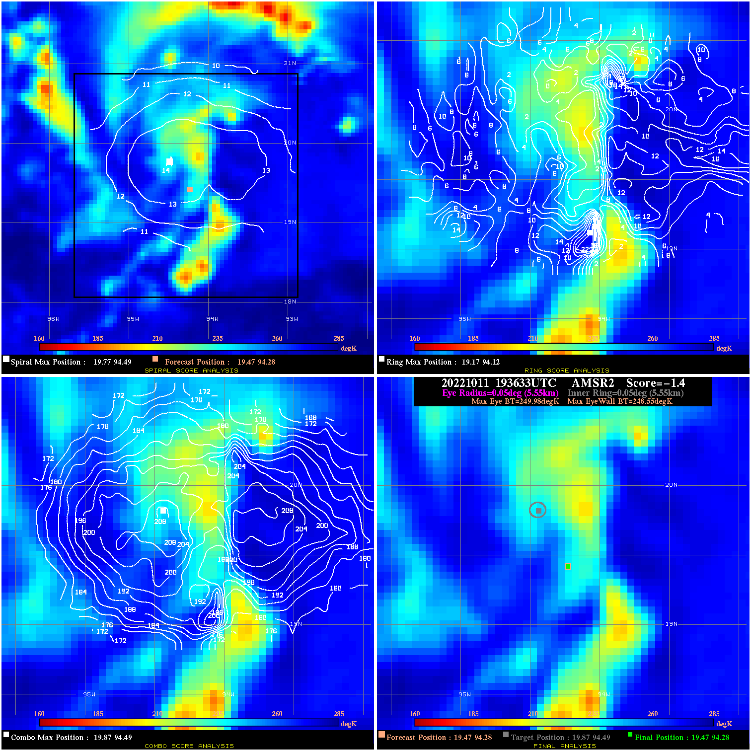
20221011 193633 -1.4 N/A N/A 11.11 1.43 35.0 AMSR2 19.5 94.3 19.5 94.3 19.9 94.5 Analysis Plot
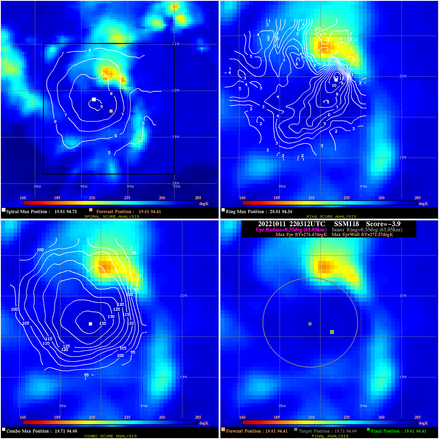
20221011 220312 -3.9 N/A 15.1% 122.21 3.90 35.0 SSMI18 19.6 94.4 19.6 94.4 19.7 94.7 Analysis Plot
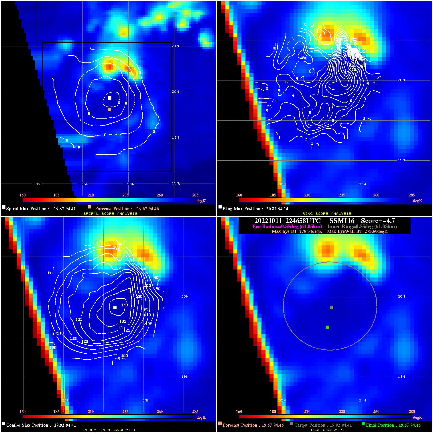
20221011 224658 -4.7 N/A 19.2% 122.21 4.74 35.0 SSMI16 19.7 94.5 19.7 94.5 19.9 94.4 Analysis Plot
20221011 234114 -3.7 N/A 17.8% 122.21 3.66 35.0 SSMI18 19.7 94.5 19.7 94.5 19.7 94.7 Analysis Plot
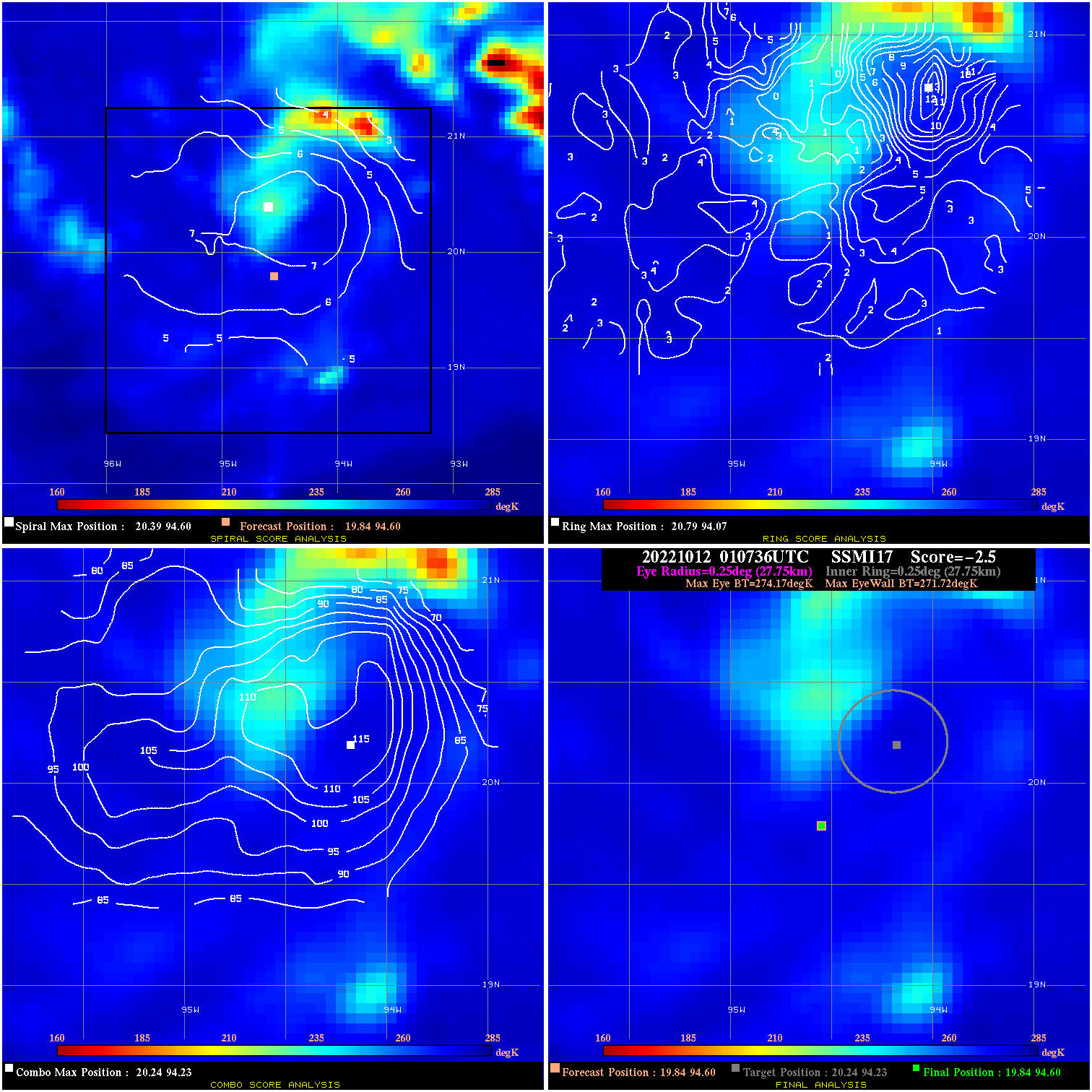
20221012 010736 -2.5 N/A 4.1% 55.55 2.45 35.0 SSMI17 19.8 94.6 19.8 94.6 20.2 94.2 Analysis Plot
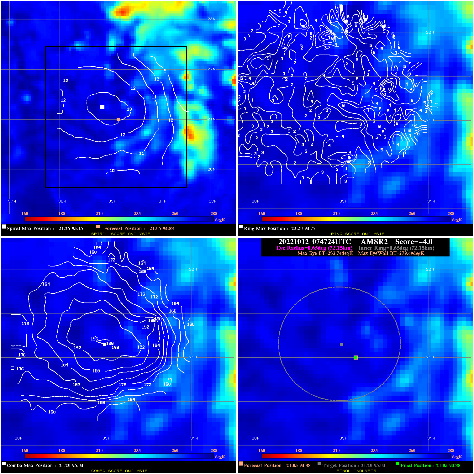
20221012 074724 -4.0 N/A N/A 144.43 4.05 35.0 AMSR2 21.0 94.9 21.0 94.9 21.2 95.0 Analysis Plot
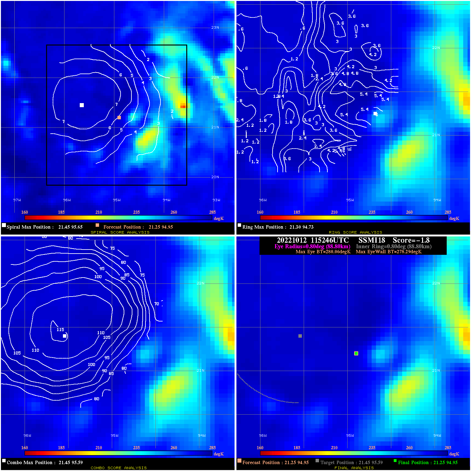
20221012 115246 -1.8 N/A N/A 177.76 1.77 35.0 SSMI18 21.3 94.9 21.3 94.9 21.5 95.6 Analysis Plot
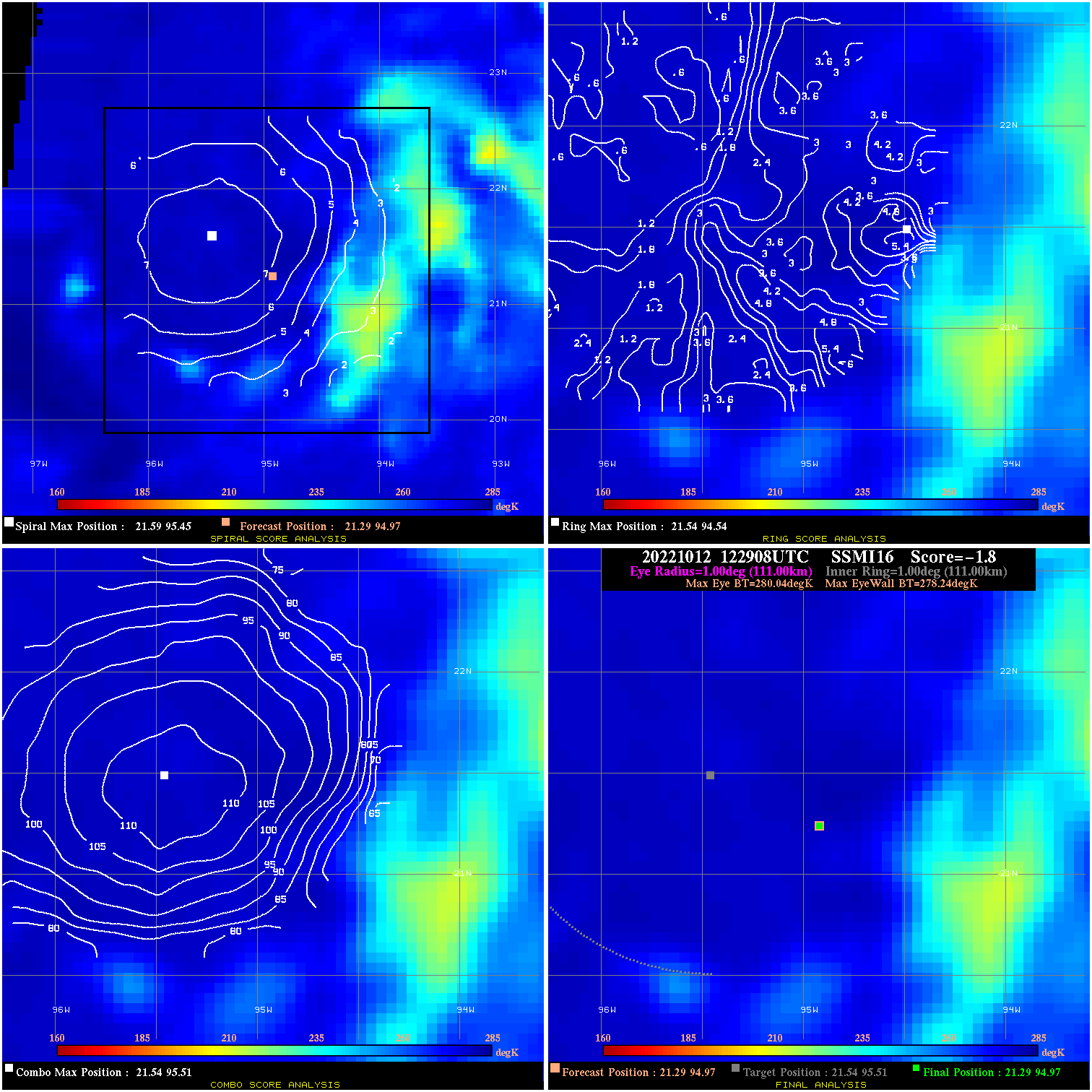
20221012 122908 -1.8 N/A 2.9% 222.20 1.80 35.0 SSMI16 21.3 95.0 21.3 95.0 21.5 95.5 Analysis Plot
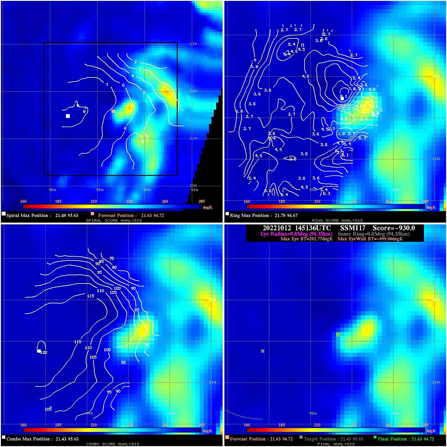
20221012 145136 -930.0 N/A N/A N/A 0.00 40.0 SSMI17 21.6 94.7 21.6 94.7 21.4 95.6 Analysis Plot
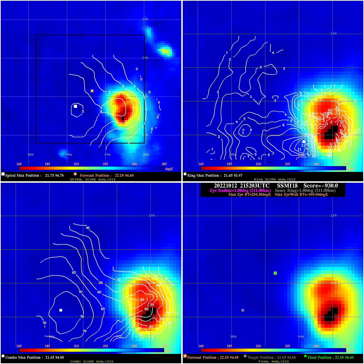
20221012 215203 -930.0 N/A N/A N/A 0.00 50.0 SSMI18 22.2 94.4 22.2 94.4 21.6 94.9 Analysis Plot
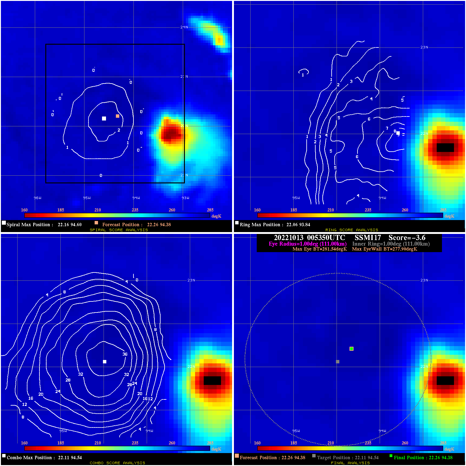
20221013 005350 -3.6 N/A 12.3% 222.20 3.64 50.0 SSMI17 22.3 94.4 22.3 94.4 22.1 94.5 Analysis Plot
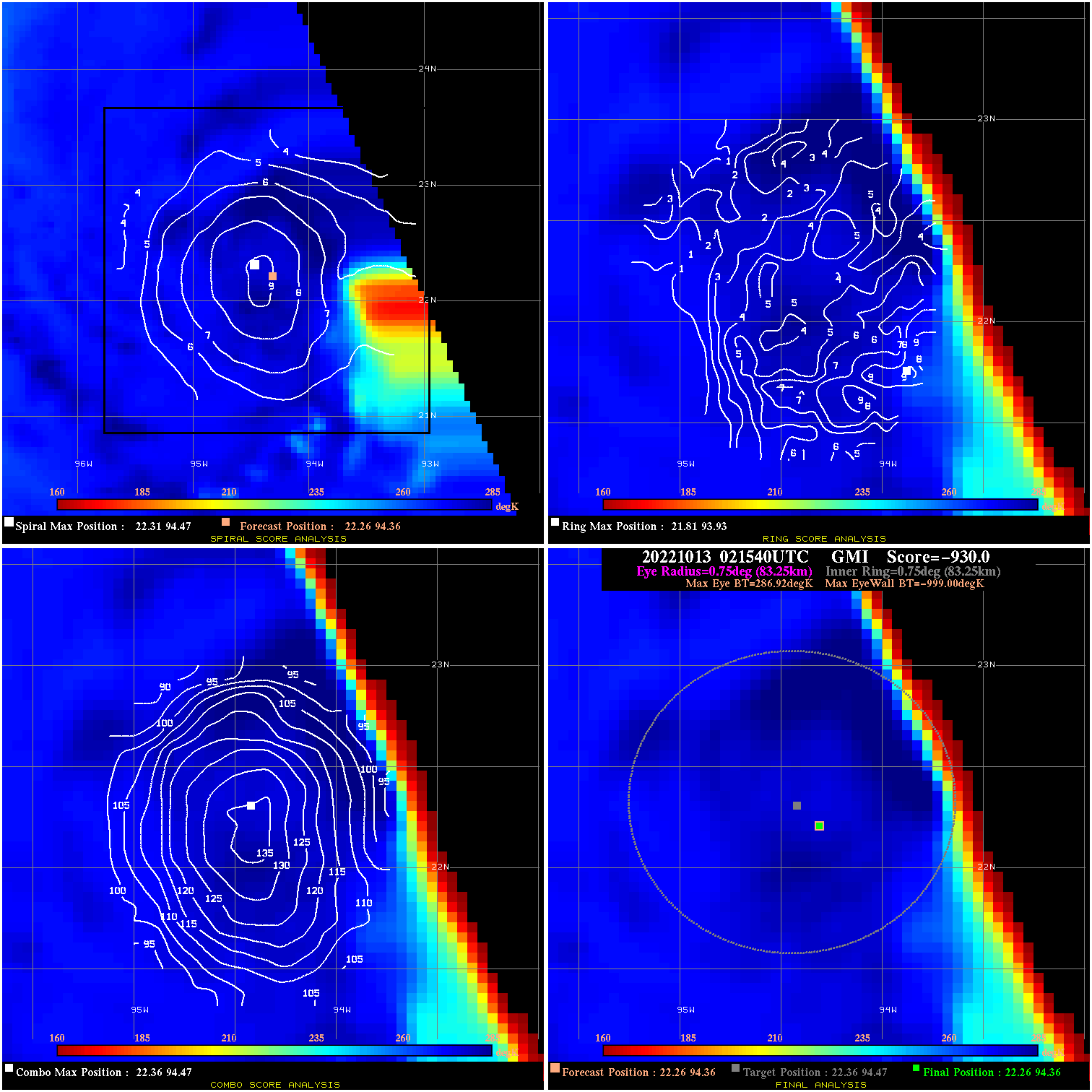
20221013 021540 -930.0 N/A N/A N/A 0.00 50.0 GMI 22.3 94.4 22.3 94.4 22.4 94.5 Analysis Plot
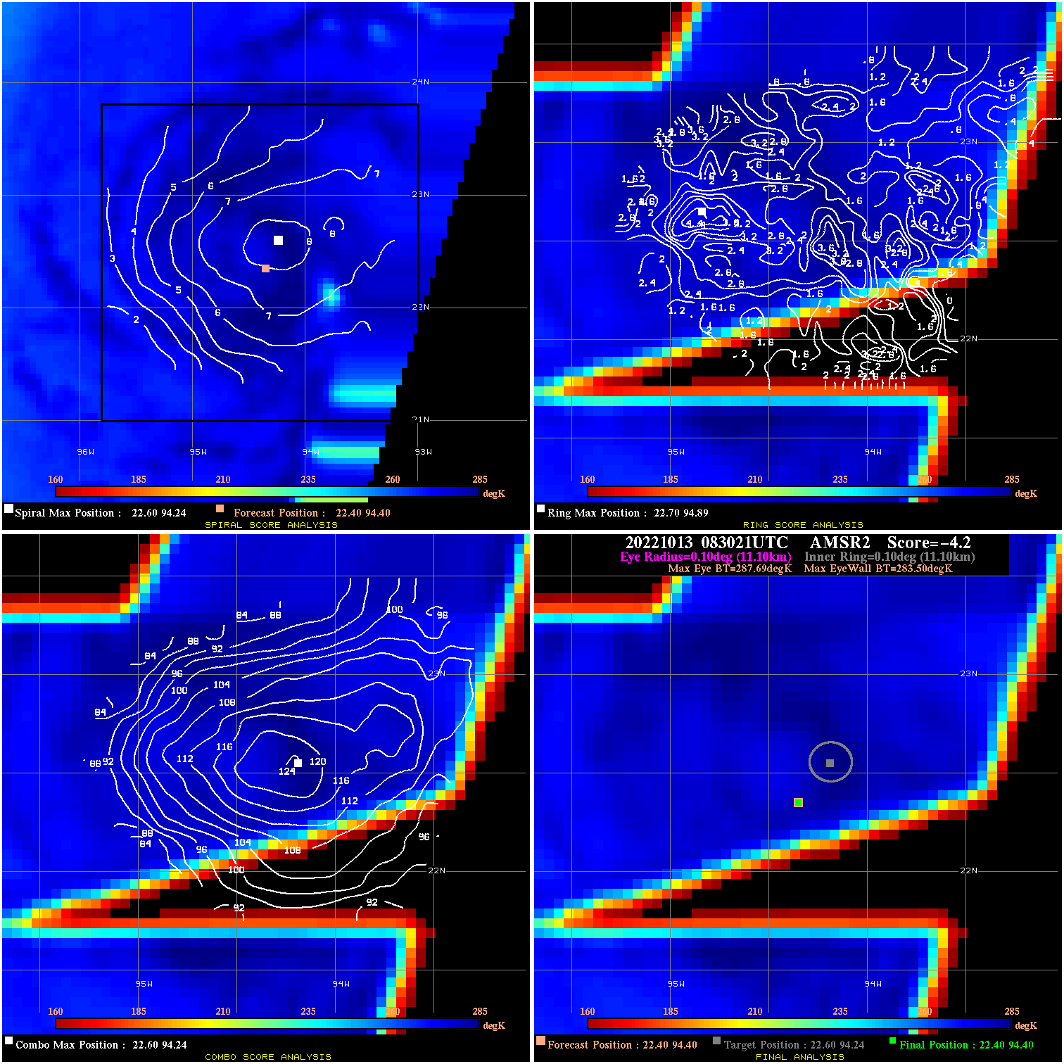
20221013 083021 -4.2 N/A N/A 22.22 4.19 45.0 AMSR2 22.4 94.4 22.4 94.4 22.6 94.2 Analysis Plot
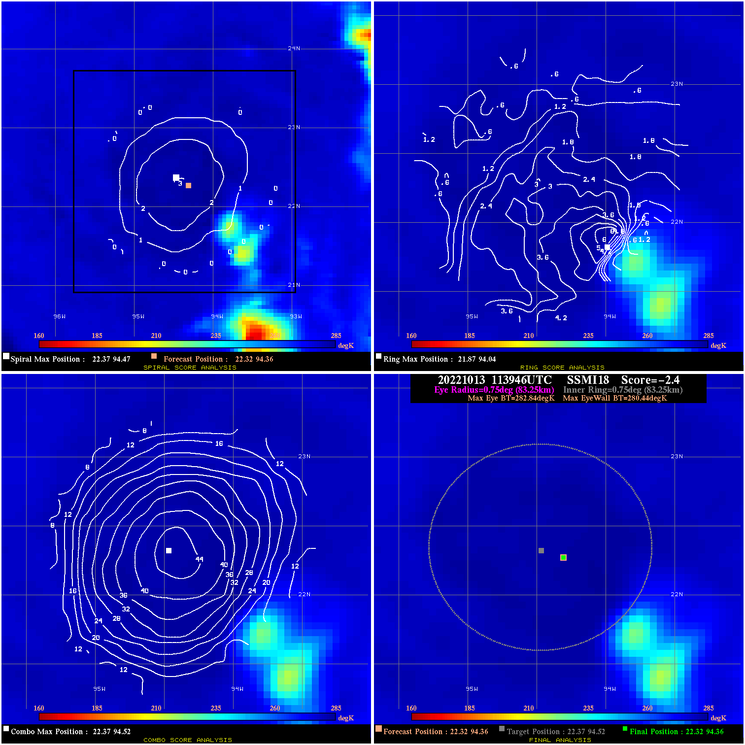
20221013 113946 -2.4 N/A N/A 166.65 2.40 45.0 SSMI18 22.3 94.4 22.3 94.4 22.4 94.5 Analysis Plot
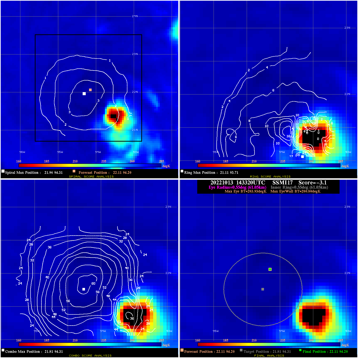
20221013 143320 -3.1 N/A 11.0% 122.21 3.13 45.0 SSMI17 22.1 94.2 22.1 94.2 21.8 94.3 Analysis Plot
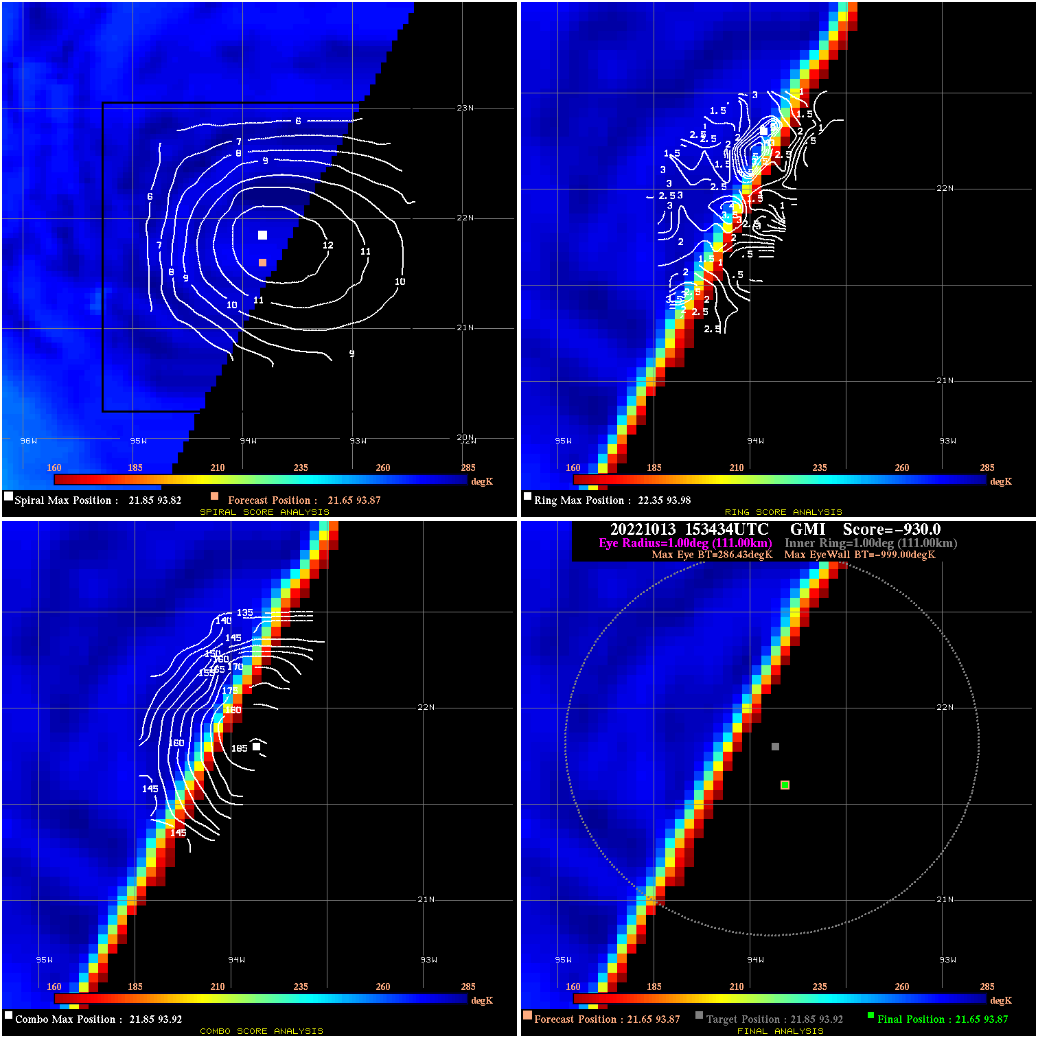
20221013 153434 -930.0 N/A N/A N/A 0.00 45.0 GMI 21.6 93.9 21.6 93.9 21.9 93.9 Analysis Plot
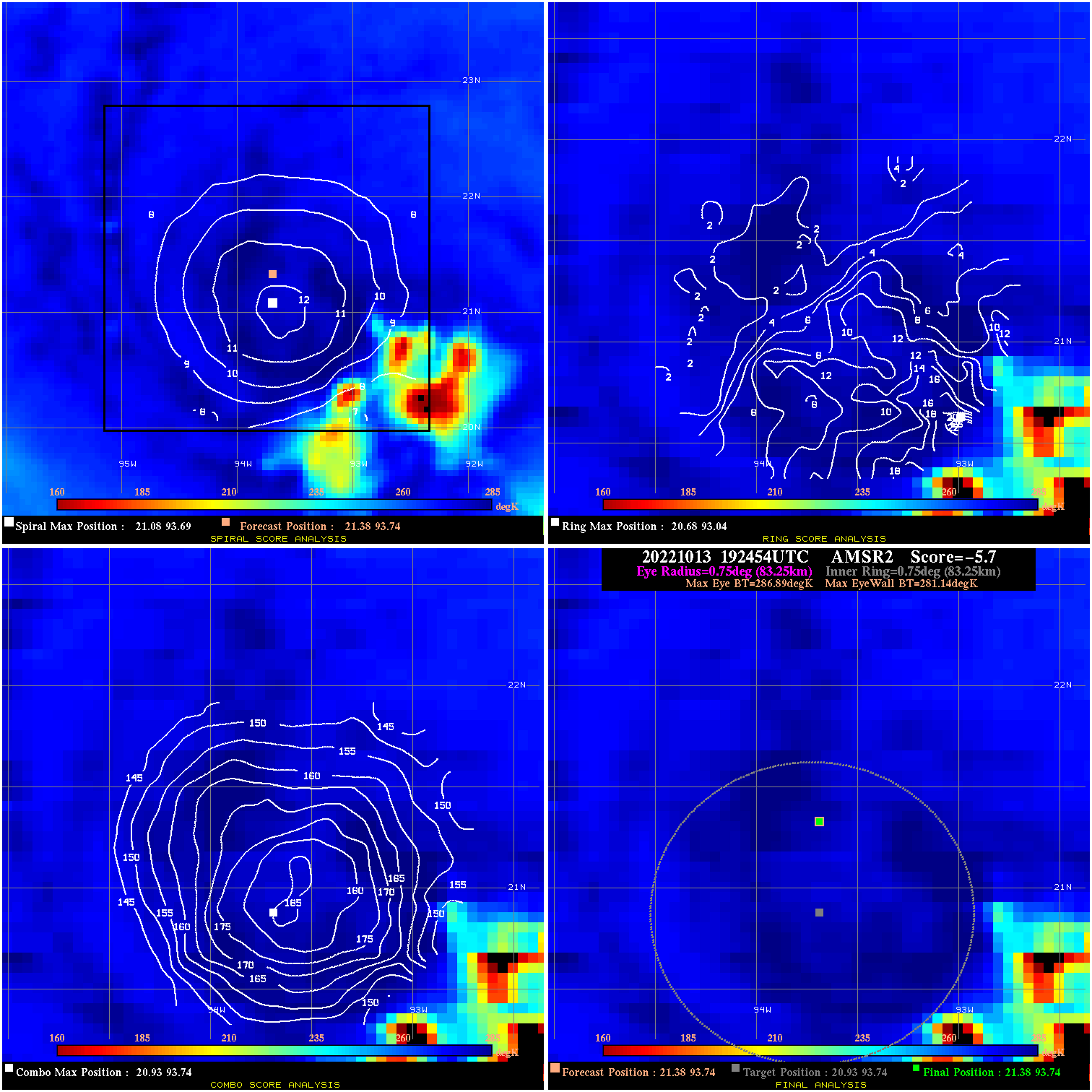
20221013 192454 -5.7 N/A 13.7% 166.65 5.75 45.0 AMSR2 21.4 93.7 21.4 93.7 20.9 93.7 Analysis Plot
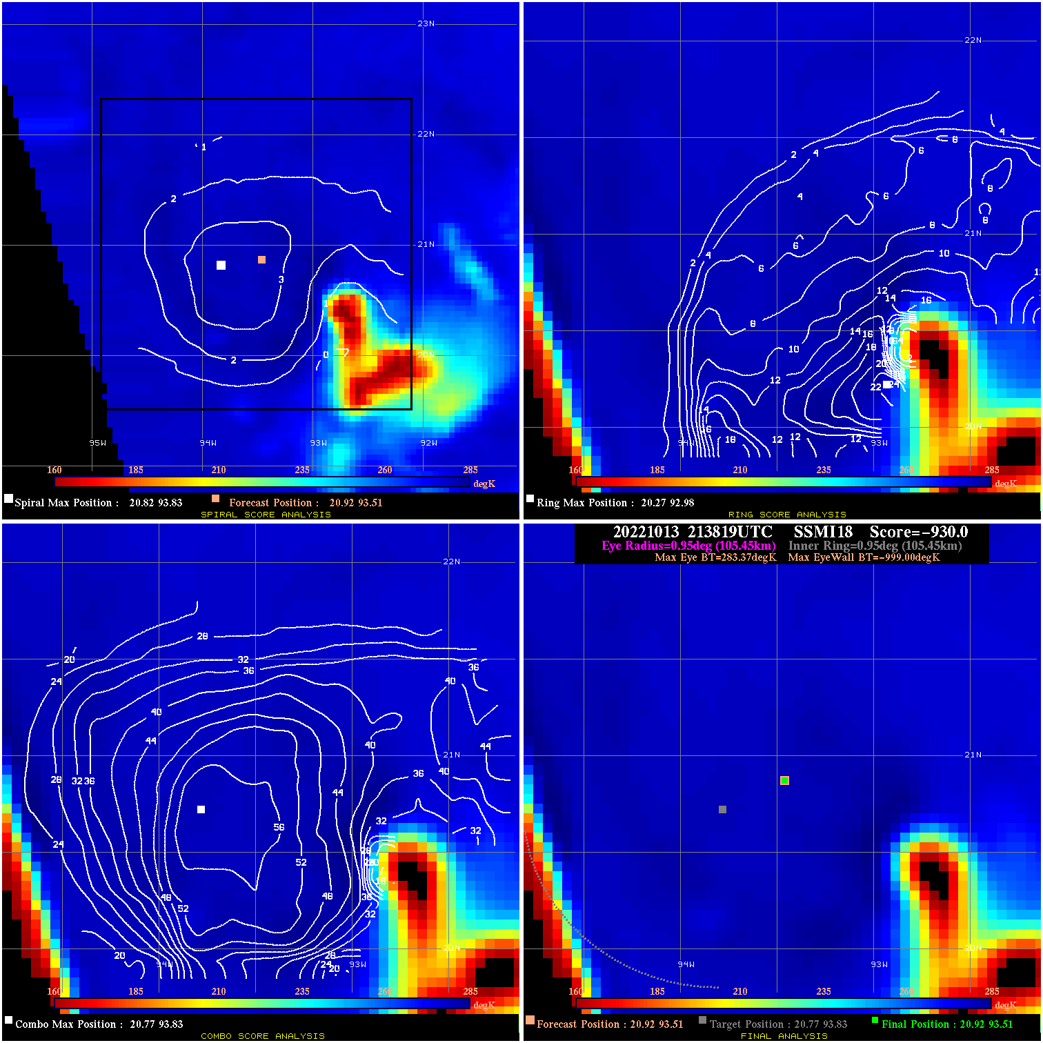
20221013 213819 -930.0 N/A N/A N/A 0.00 40.0 SSMI18 20.9 93.5 20.9 93.5 20.8 93.8 Analysis Plot
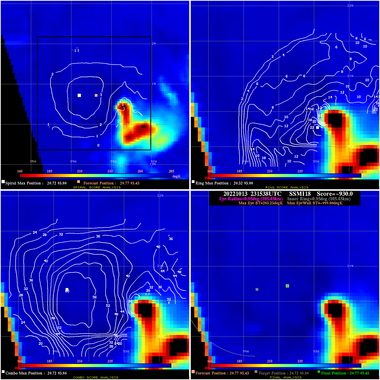
20221013 231538 -930.0 N/A N/A N/A 0.00 40.0 SSMI18 20.8 93.4 20.8 93.4 20.7 93.9 Analysis Plot
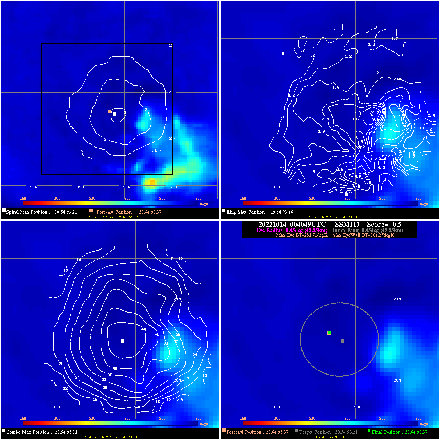
20221014 004049 -0.5 N/A N/A 99.99 .46 40.0 SSMI17 20.6 93.4 20.6 93.4 20.5 93.2 Analysis Plot
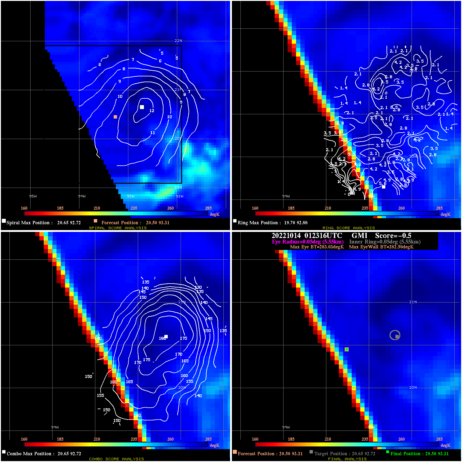
20221014 012316 -0.5 N/A N/A 11.11 .53 40.0 GMI 20.5 93.3 20.5 93.3 20.6 92.7 Analysis Plot
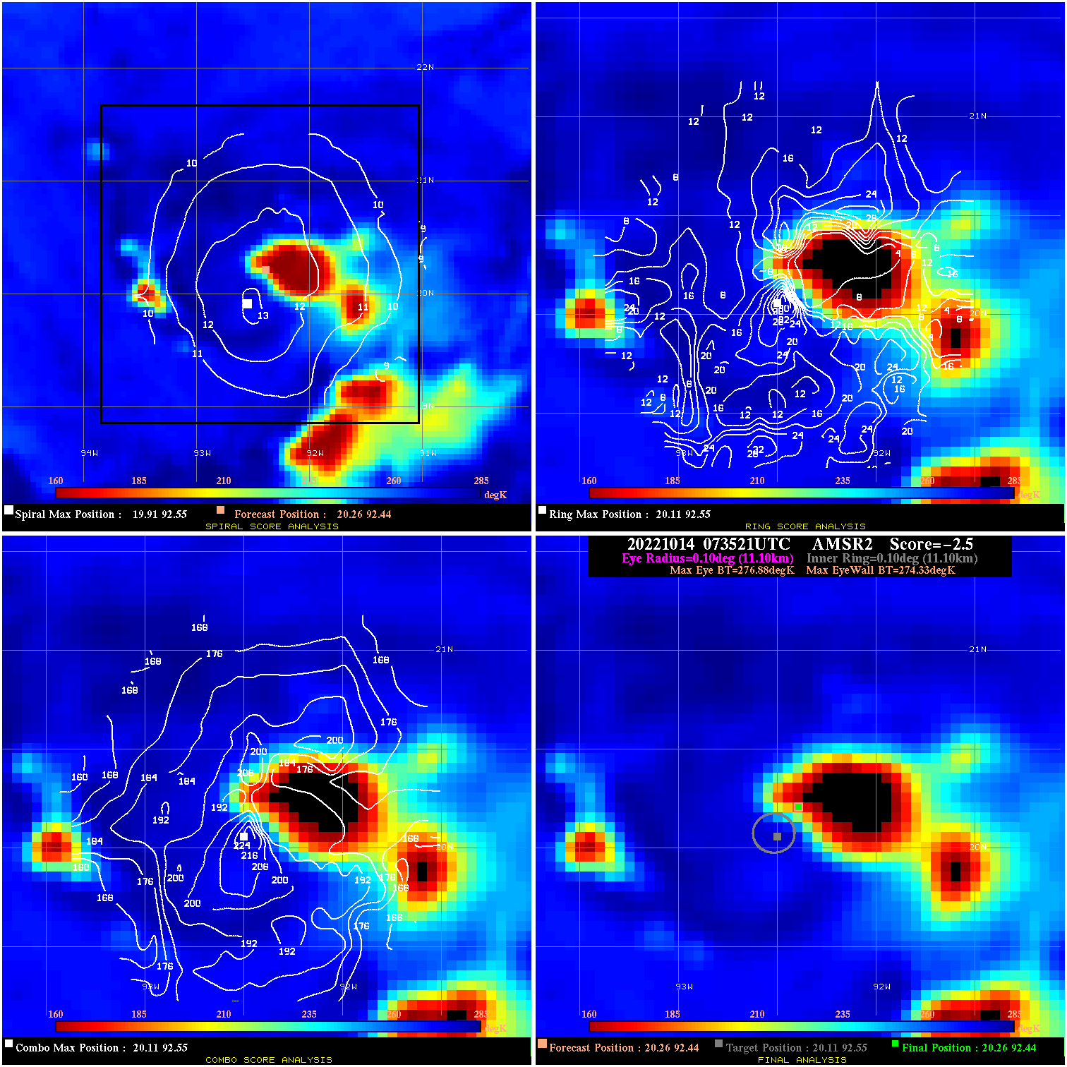
20221014 073521 -2.5 N/A 37.0% 22.22 2.55 35.0 AMSR2 20.3 92.4 20.3 92.4 20.1 92.6 Analysis Plot
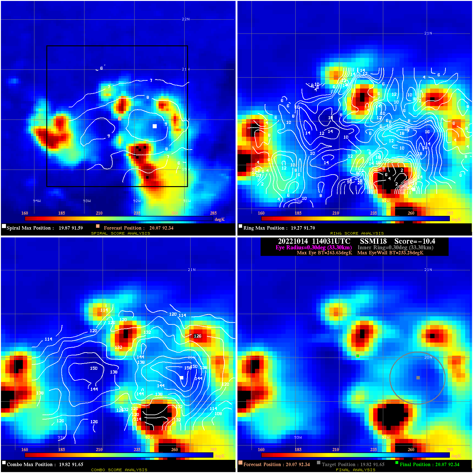
20221014 114031 -10.4 N/A 68.5% 66.66 10.35 35.0 SSMI18 20.1 92.3 20.1 92.3 19.8 91.7 Analysis Plot
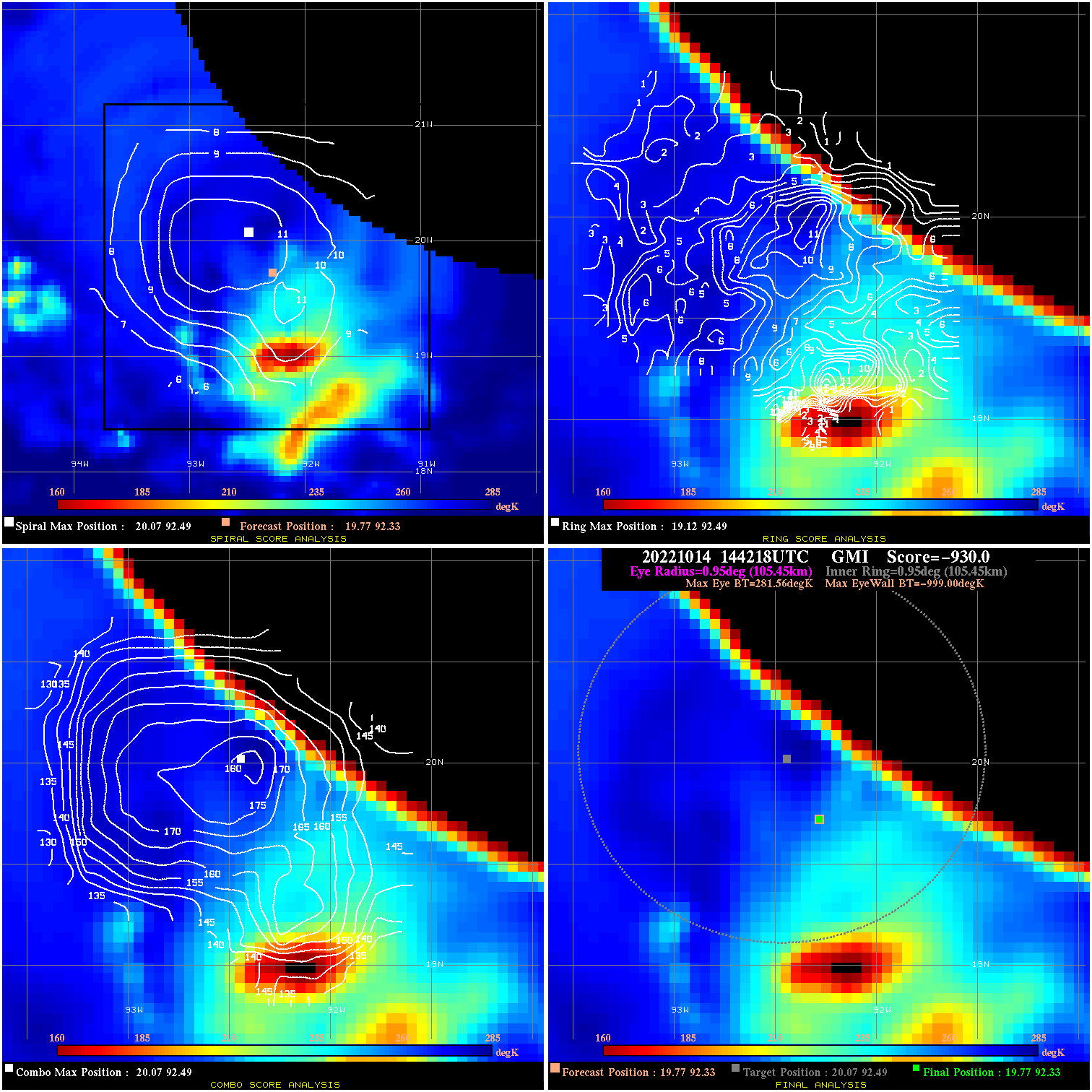
20221014 144218 -930.0 N/A N/A N/A 0.00 35.0 GMI 19.8 92.3 19.8 92.3 20.1 92.5 Analysis Plot
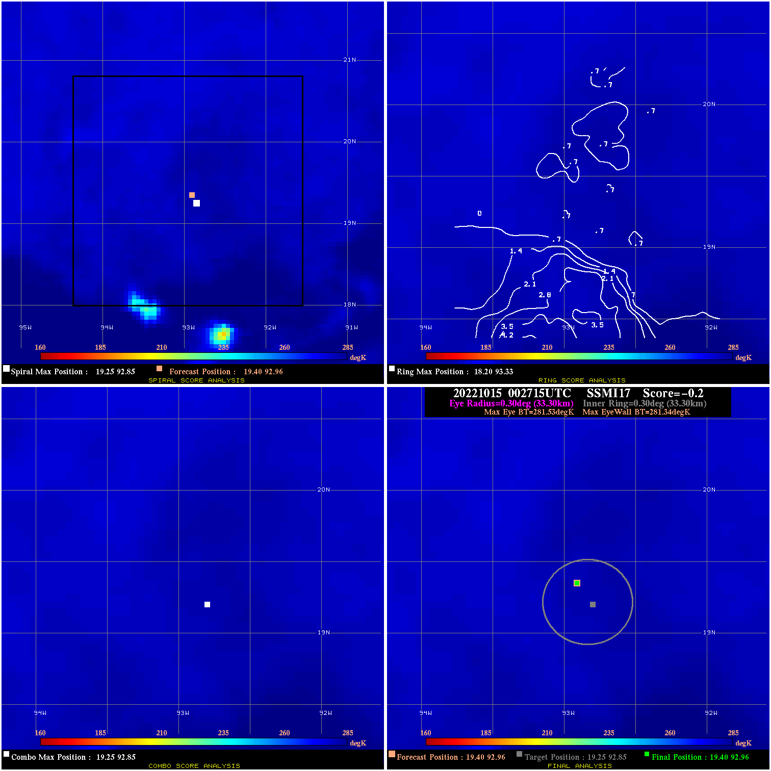
20221015 002715 -0.2 N/A N/A 66.66 .19 35.0 SSMI17 19.4 93.0 19.4 93.0 19.3 92.8 Analysis Plot
|
|
Legend: - Date/Time are determined from PMW imagery at Forecast (initial guess) Lat/Lon position. - Positive/Negative Latitude = North/South Hemisphere; Longitude = Western/Eastern Hemisphere. - "Ring Diam" value indicates the estimated surface eyewall diameter in km (the MI eyewall edge diameter minus 10 km). - "Ring Pct" is the percentage of the "ring" (eyewall inner boundary) that is 1) colder than the "hot spot" (warmest eye pixel) in the eye by 20K, or 2) the percentage that is a) colder than 232K and b) colder than the "hot spot" by 10K, whichever is greater. - Values are red if Ring % <= 65, yellow/brown if Ring % <= 85 and green if Ring % > 85. - "Tb diff" is the difference between the "hot spot" (warmest eye pixel) and the warmest pixel on the eyewall. - Intensity score are listed as negative, and not used, when the JTWC or NHC estimated Vmax is <55 kts in order to rule out weak but highly symmetric TCs. - Error messages in intensity scores: -920 is used when the hottest pixel in the eye is <200K, to prevent false positives; -930 means <85% of eyewall has observations/data. |