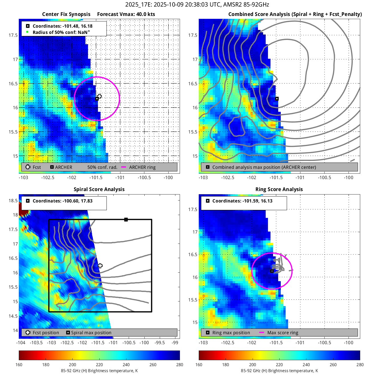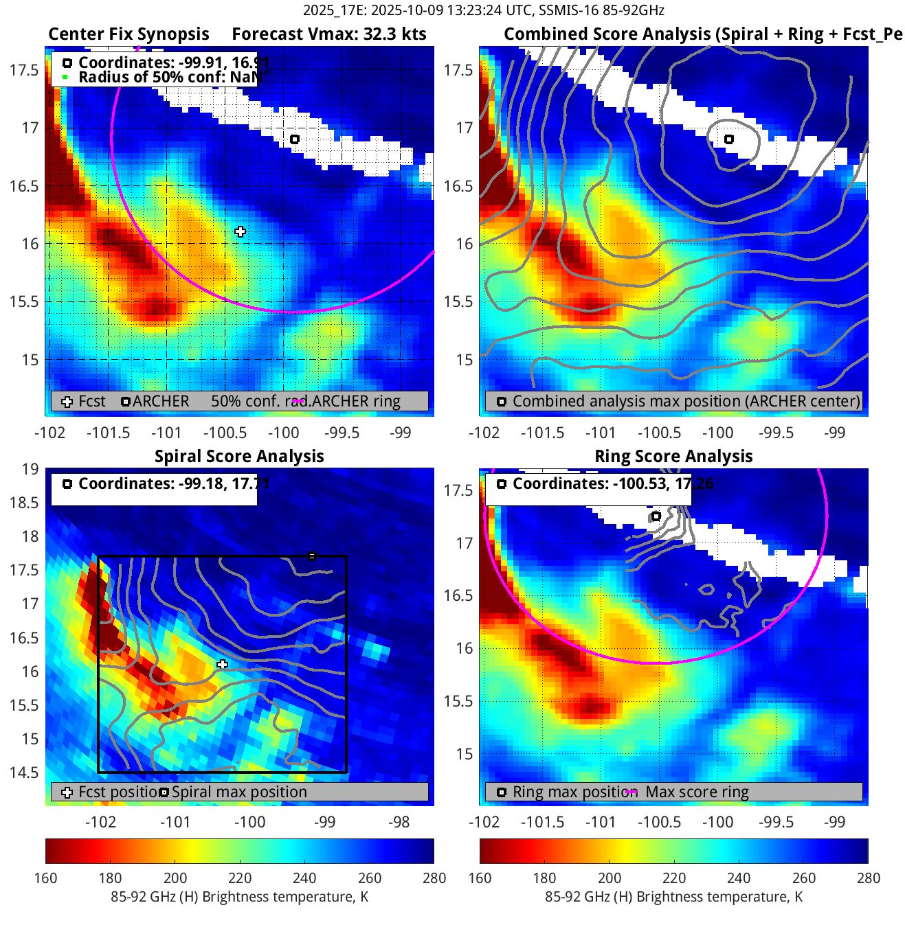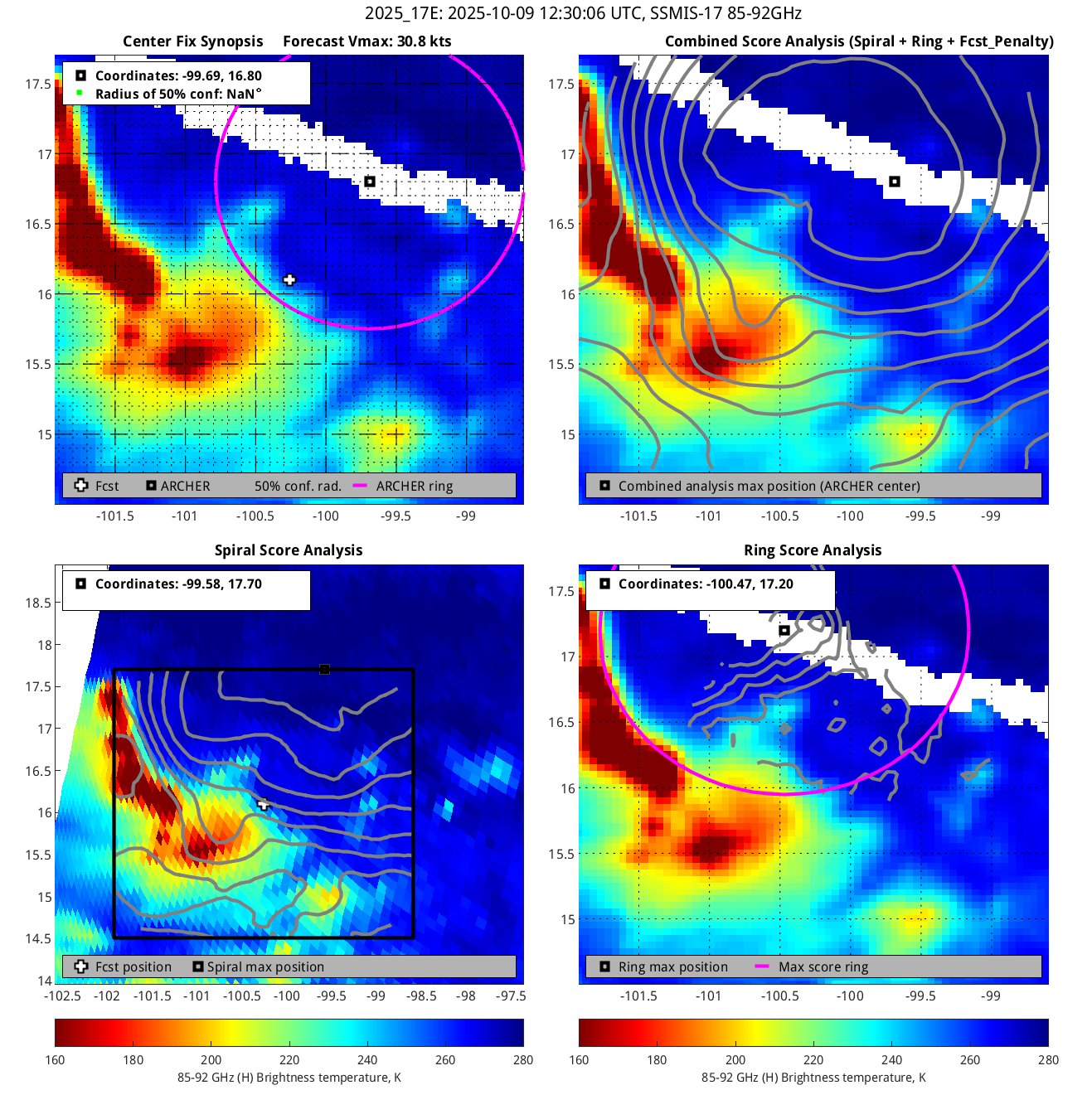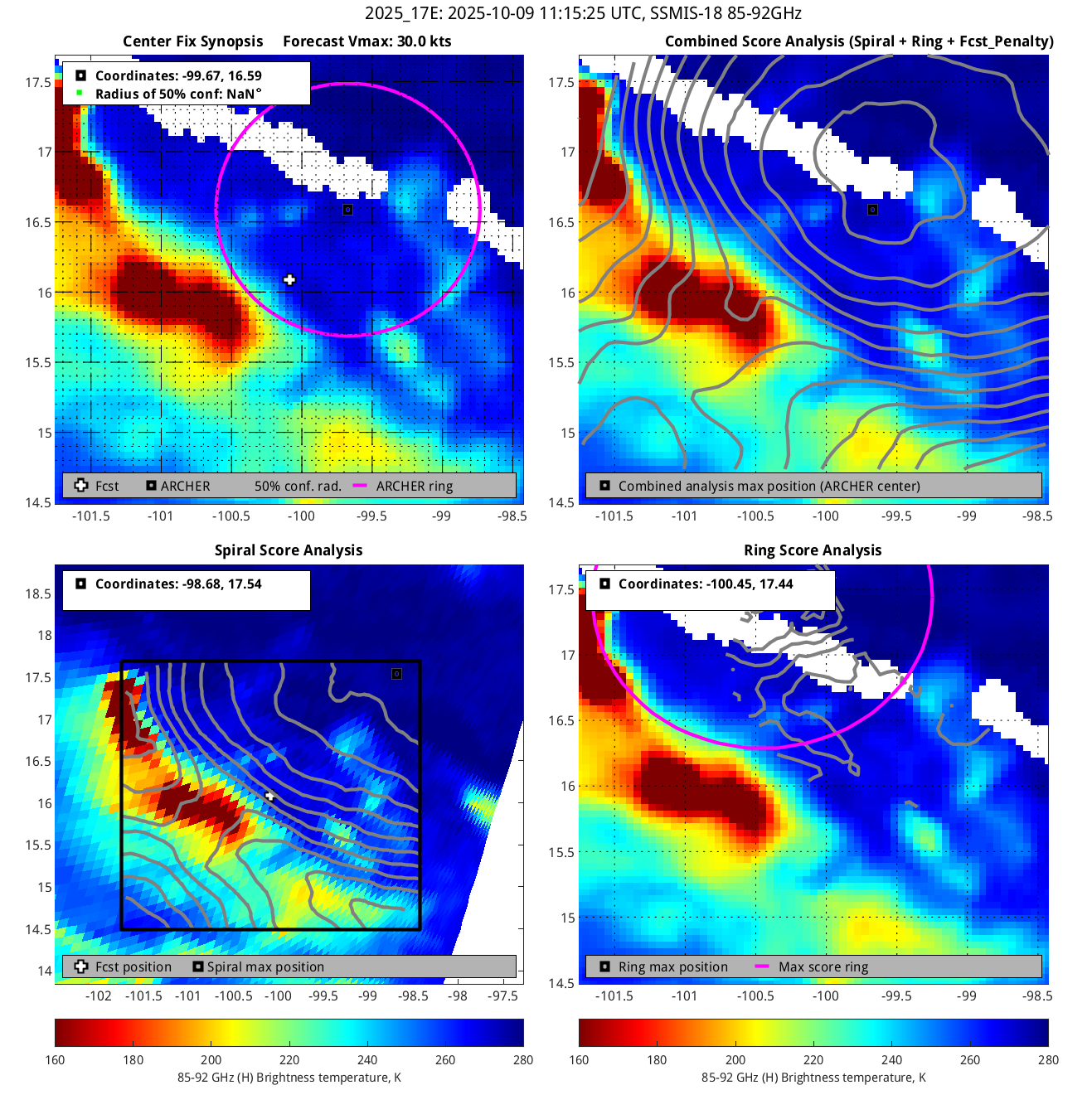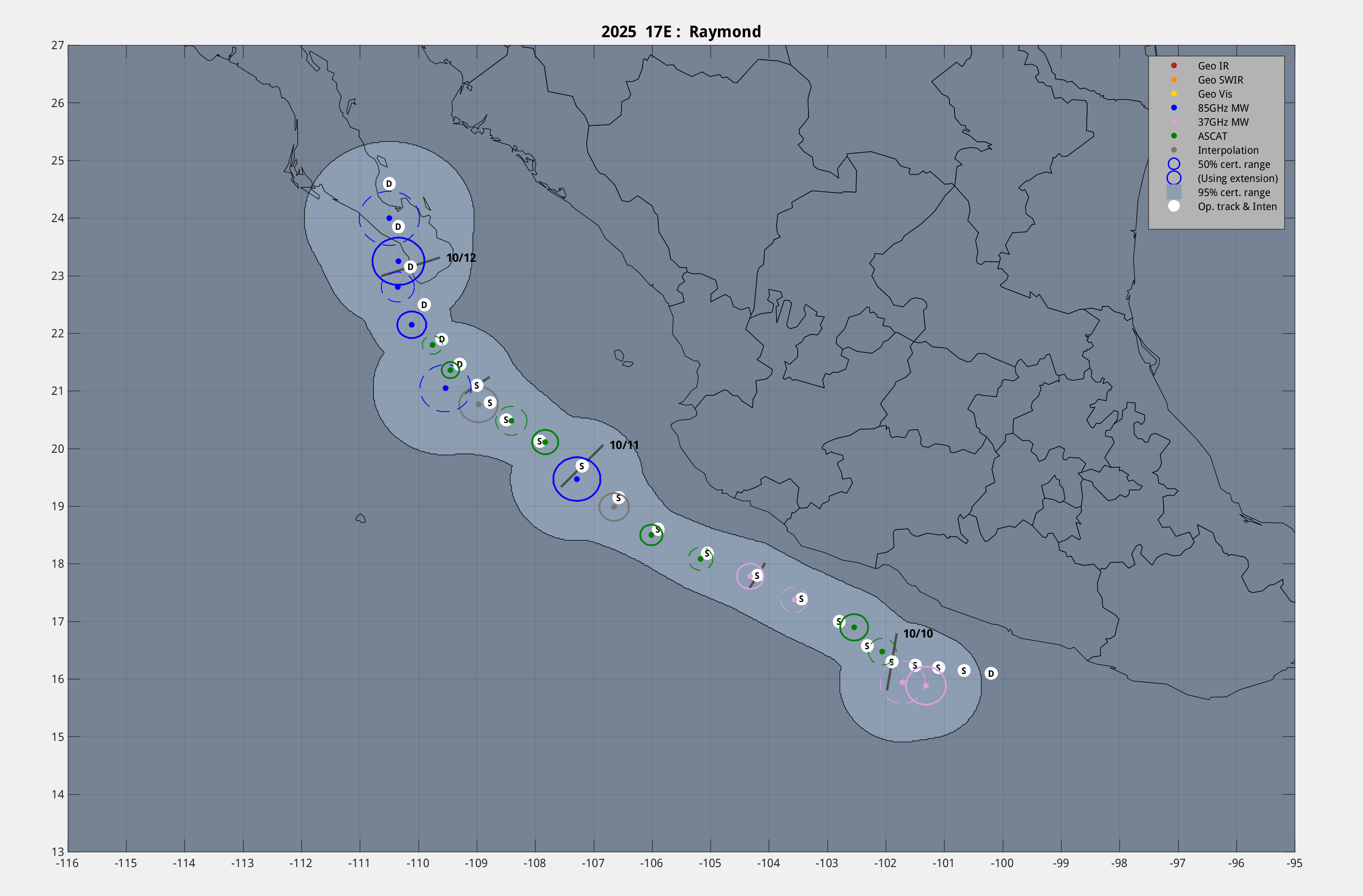
-- Link to M-PERC page --

Geo IR 85-92GHz
Date/Time_(UTC) Source Sensor Vmax(kts) ARCHER Lat Lon Geo-ref Lat Lon 50% cert. rad. 95% cert. rad. Eye diam (deg) % cert. of eye
20251012 04:00:00 Metop-C ASCAT 26.1 *** *** *** *** *** *** *** ***
20251012 03:57:00 Metop-C ASCAT 26.1 *** *** *** *** *** *** *** ***
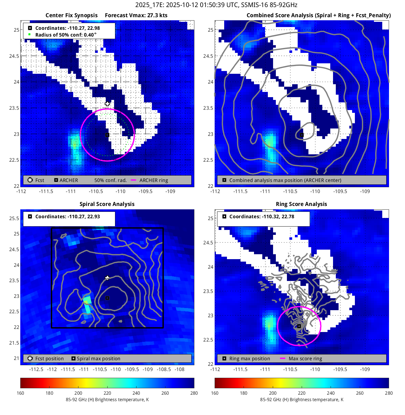
20251012 01:50:39 * SSMIS-16 85-92GHz 27.3 22.98 -110.27 23.25 -110.34 0.40 1.12 1.00 4.4
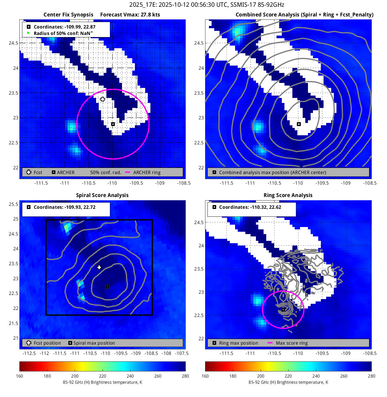
20251012 00:56:30 SSMIS-17 85-92GHz 27.8 *** *** *** *** *** *** 1.40 ***
20251011 23:42:07 SSMIS-18 85-92GHz 28.5 *** *** *** *** *** *** 3.00 ***
20251011 21:18:26 * GMI 85-92GHz 29.8 22.22 -110.14 22.15 -110.12 0.23 0.64 1.00 5.6
20251011 21:18:26 GMI 37GHz 29.8 22.47 -110.09 22.40 -110.06 0.44 1.26 0.60 ***
20251011 20:27:40 AMSR2 85-92GHz 30.0 22.18 -109.85 22.30 -109.90 0.42 1.18 0.10 2.5
20251011 20:27:40 AMSR2 37GHz 30.0 22.23 -109.42 22.35 -109.47 0.54 1.52 1.40 ***
20251011 16:45:00 Metop-C ASCAT 31.0 21.71 -109.74 21.90 -109.87 0.94 2.65 *** ***
20251011 15:57:00 * Metop-A ASCAT 31.7 21.49 -109.55 21.36 -109.45 0.13 0.37 *** ***
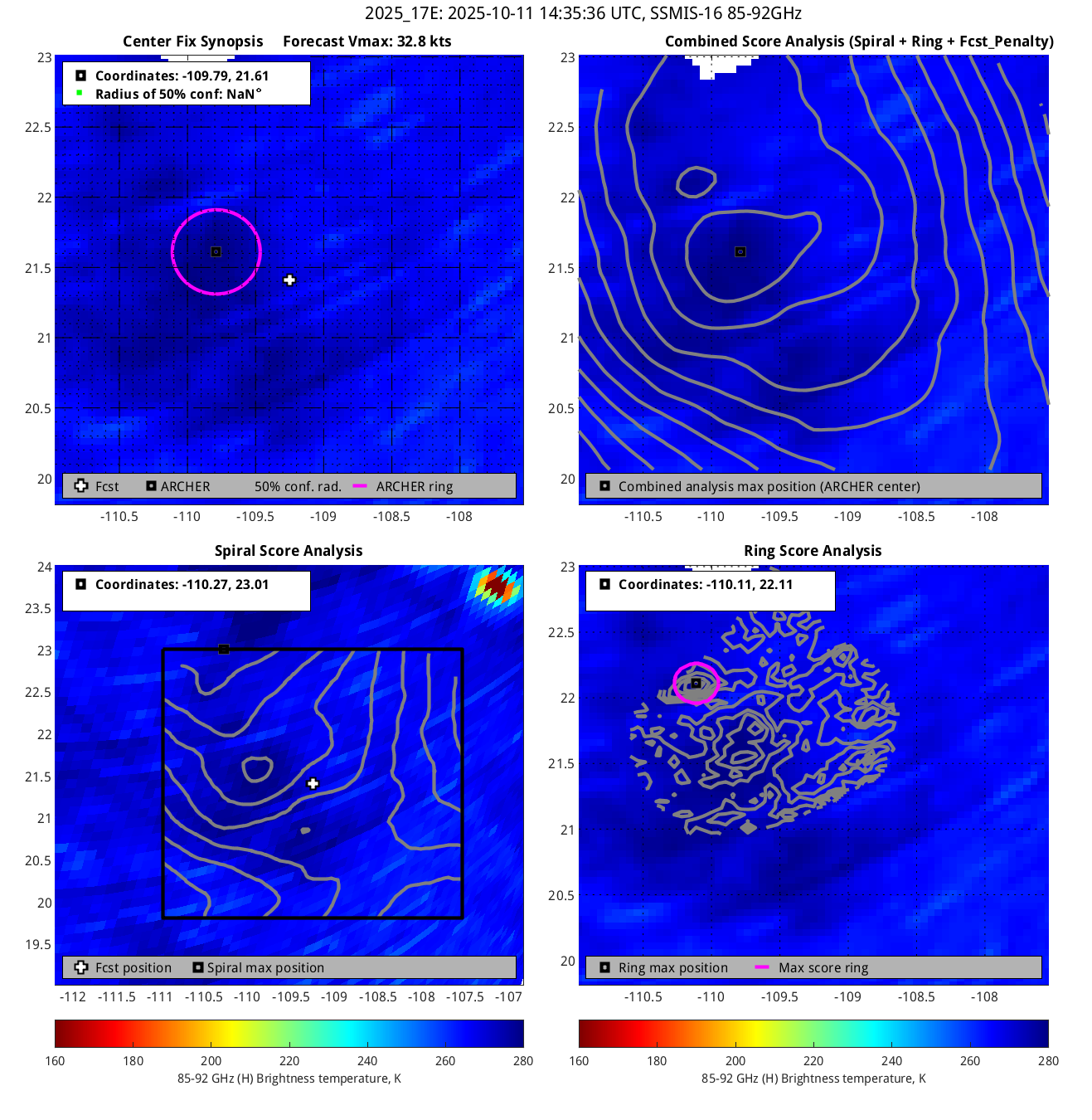
20251011 14:35:36 SSMIS-16 85-92GHz 32.8 *** *** *** *** *** *** 0.60 ***
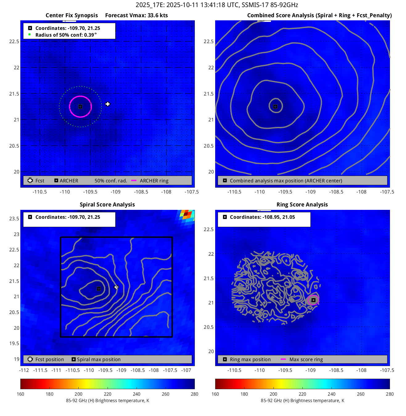
20251011 13:41:18 * SSMIS-17 85-92GHz 33.6 21.25 -109.70 21.41 -109.83 0.39 1.11 0.40 1.1
20251011 04:18:00 Metop-C ASCAT 41.4 19.15 -108.86 18.98 -108.56 3.36 9.49 *** ***
20251011 03:30:00 * Metop-A ASCAT 42.1 20.18 -107.95 20.11 -107.83 0.21 0.60 *** ***
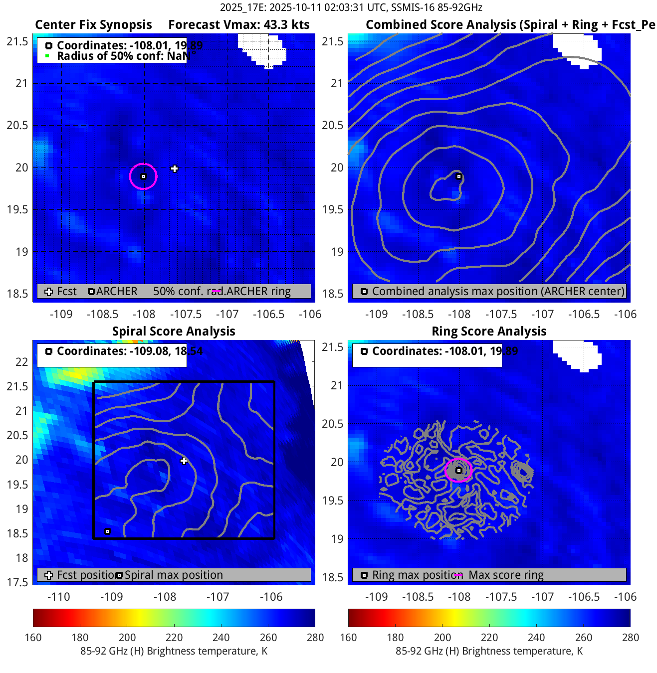
20251011 02:03:31 SSMIS-16 85-92GHz 43.3 *** *** *** *** *** *** 0.30 ***
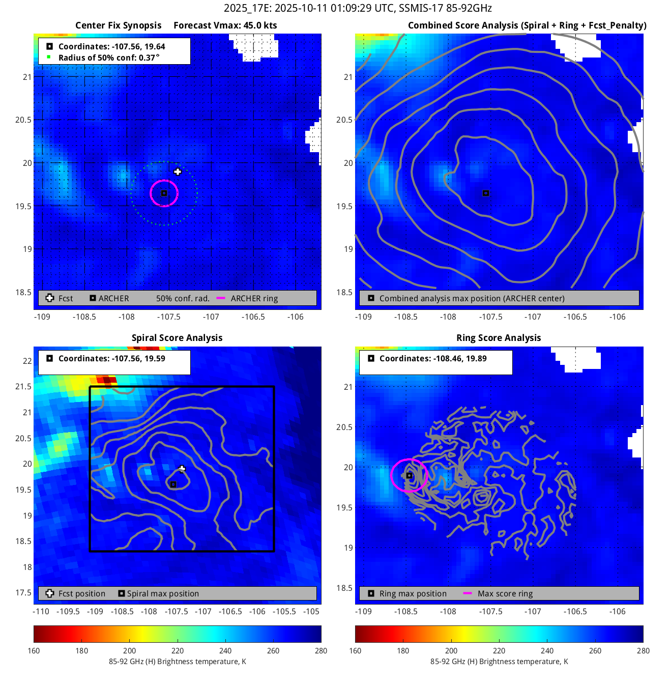
20251011 01:09:29 * SSMIS-17 85-92GHz 45.0 19.64 -107.56 19.47 -107.29 0.37 1.04 0.30 3.2
20251010 17:09:00 Metop-C ASCAT 45.7 18.33 -105.80 18.45 -106.02 0.18 0.50 *** ***
20251010 17:06:00 * Metop-C ASCAT 45.7 18.37 -105.78 18.50 -106.02 0.17 0.48 *** ***
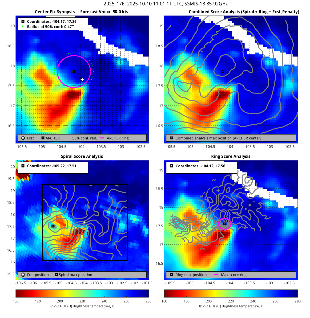
20251010 11:01:11 SSMIS-18 85-92GHz 50.0 17.86 -104.17 17.99 -104.43 0.47 1.32 0.80 7.1
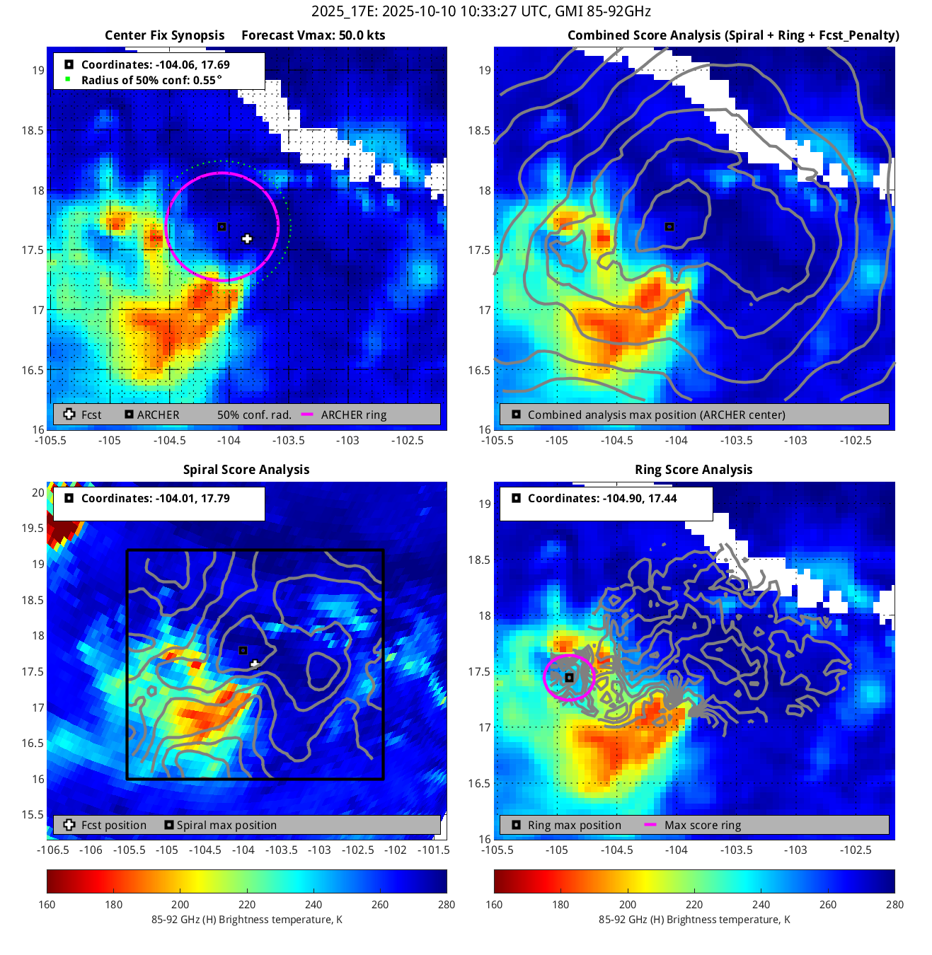
20251010 10:33:27 GMI 85-92GHz 50.0 17.69 -104.06 17.89 -104.43 0.55 1.55 0.90 2.8
20251010 10:33:27 * GMI 37GHz 50.0 17.59 -103.96 17.79 -104.32 0.20 0.58 0.30 ***
20251010 08:50:13 AMSR2 85-92GHz 50.0 *** *** *** *** *** *** 0.10 ***
20251010 08:50:13 AMSR2 37GHz 50.0 17.23 -103.05 17.25 -103.09 0.63 1.78 0.50 ***
20251010 04:36:00 * Metop-C ASCAT 47.7 16.71 -102.31 16.90 -102.55 0.21 0.60 *** ***
20251009 22:27:05 SSMIS-18 85-92GHz 40.0 *** *** *** *** *** *** 0.80 ***
20251009 21:08:26 GMI 85-92GHz 40.0 *** *** *** *** *** *** 0.70 ***
20251009 21:08:26 * GMI 37GHz 40.0 15.89 -101.34 15.89 -101.32 0.33 0.92 0.40 ***
20251009 20:38:03 AMSR2 85-92GHz 40.0 *** *** *** *** *** *** 0.90 ***
20251009 20:38:03 AMSR2 37GHz 40.0 *** *** *** *** *** *** 3.00 ***
20251009 13:23:24 SSMIS-16 85-92GHz 32.3 *** *** *** *** *** *** 3.00 ***
20251009 12:30:06 SSMIS-17 85-92GHz 30.8 *** *** *** *** *** *** 2.10 ***
20251009 11:15:25 SSMIS-18 85-92GHz 30.0 *** *** *** *** *** *** 1.80 ***

Key:

Date/Time: UTC time. If this observation is used in the track it is marked with a "*". If it is used for its own 3-hr window, it is put in bold.

Source/sensor: Satellite source of the analyzed image.

Vmax: Maximum winds listed in the forecast center analysis/forecast, *not* ARCHER.

ARCHER lat/lon: Coordinates of the ARCHER algorithm, valid at the time of the observation. If no center fix could be found, then it is "***".

Geo ref lat/lon: Coordinates of the ARCHER algorithm, valid at the time of the *nearest geo image*.

50% cert. rad.: Radius of the circle (in degrees) that defines the area in which the ARCHER center of rotation is 50% certain. The lower the number, the more certain the position.
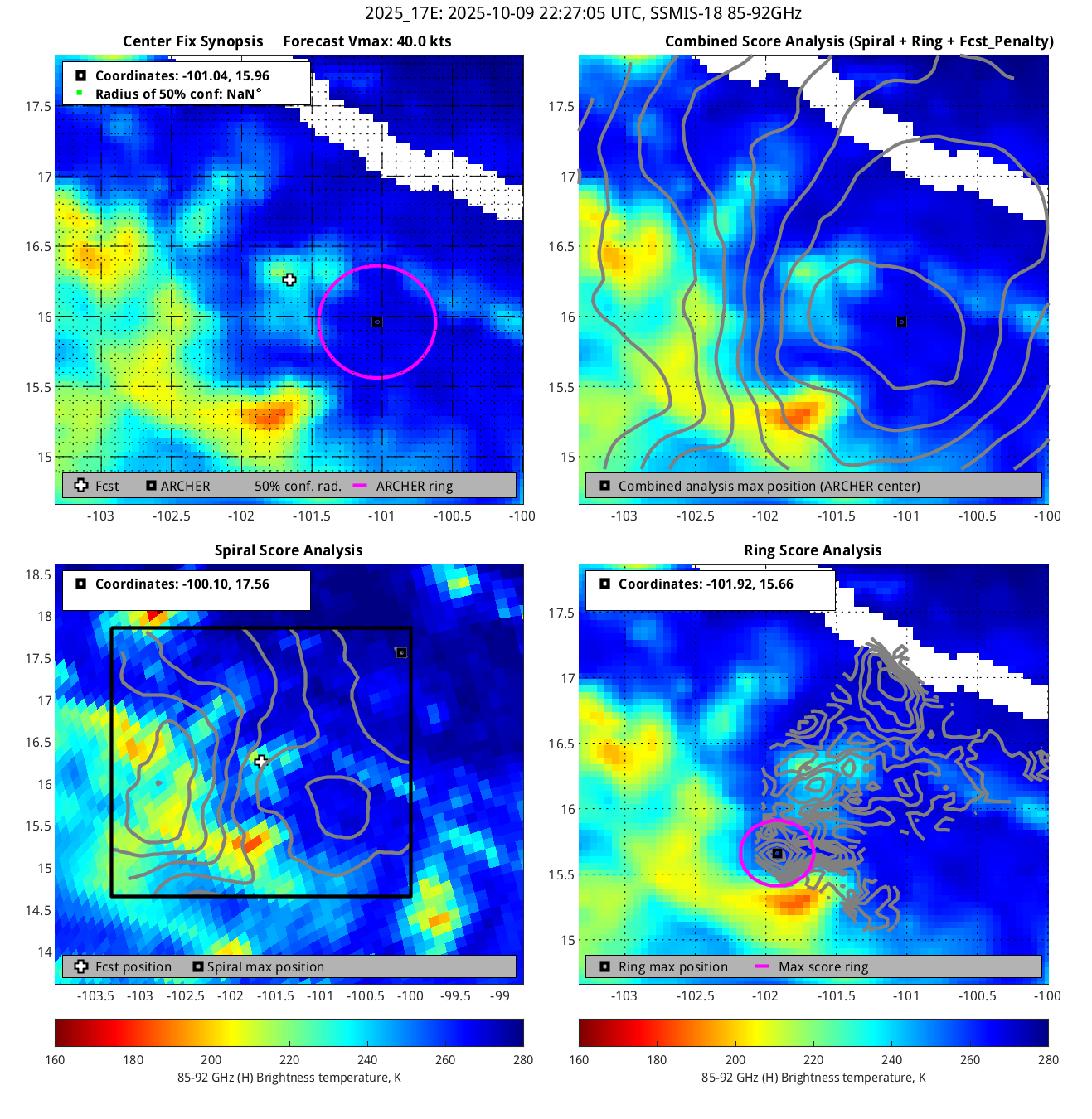
95% cert. rad.: Radius of the circle (in degrees) that defines the area in which the ARCHER center of rotation is 95% certain.

Eye diam (deg): ARCHER-resolved eye diameter (in degrees). Green: robust, yellow: less certain, red: not robust.

% cert. of eye: Percent certainty that an eye exists in this image, determined by ARCHER. Currently only available for IR and 85-92 GHz imagery.

Links to related versions: Summary table, ARCHER Track table, ARCHER Track Image Archive, Intensity Estimation, ARCHER-ERC page, F-Decks

This page automatically updates every 5 minutes