|
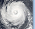
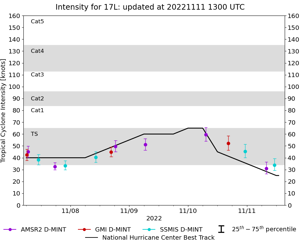
Storm: 17L
| Date | Time | MW Sensor | Average
(30th-70th percentile) | 25th percentile | 75th percentile | Image |
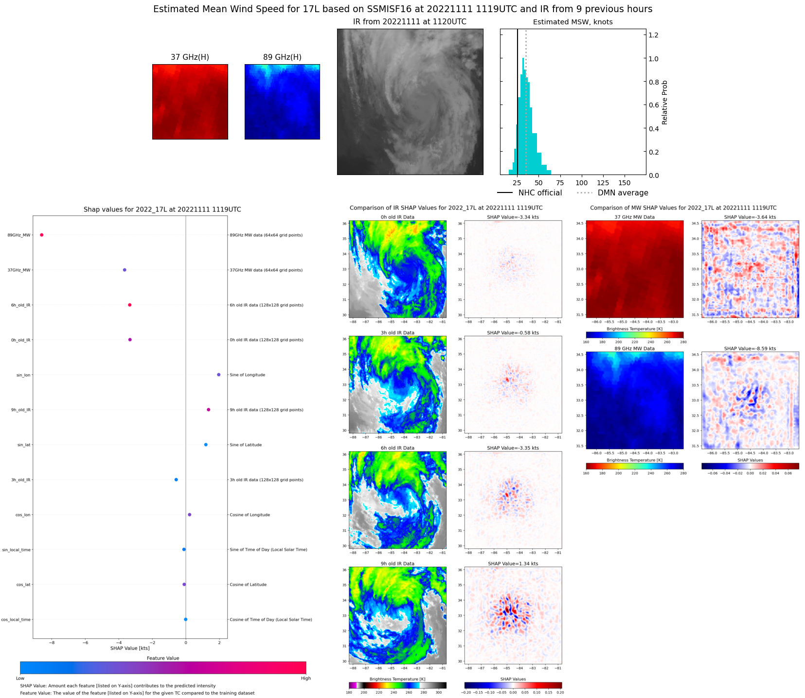
| 20221111 | 1119 UTC | SSMISF16 | 34 kts | 29 kts | 39 kts | 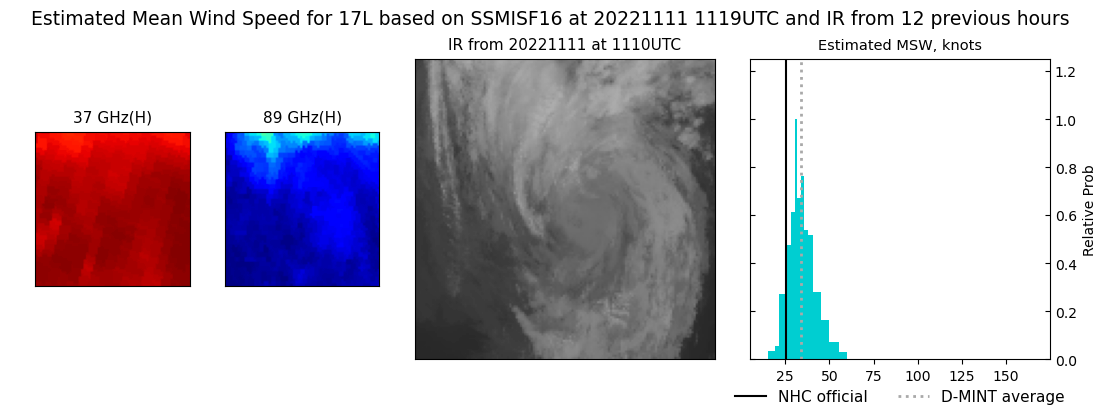 |
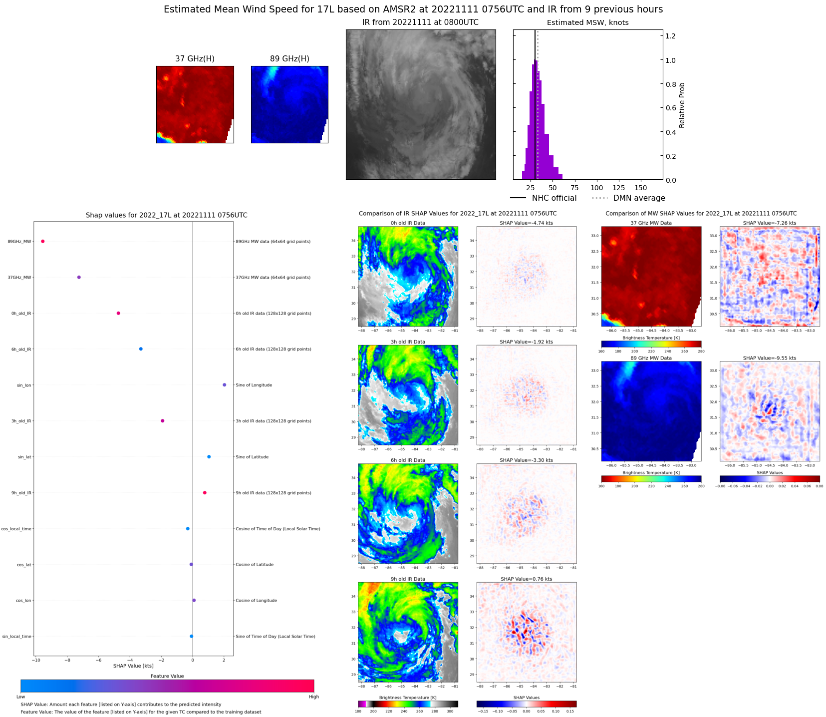
| 20221111 | 0756 UTC | AMSR2 | 31 kts | 27 kts | 36 kts | 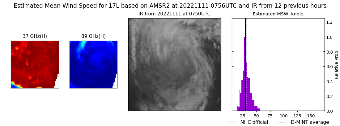 |
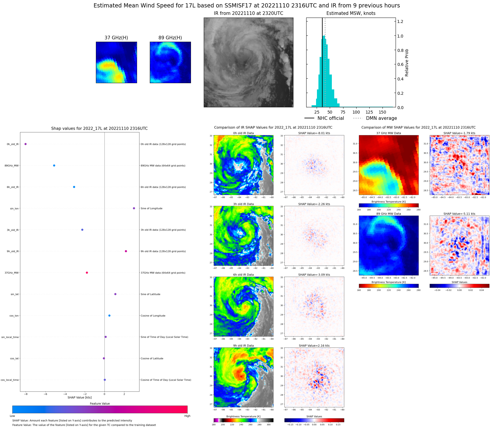
| 20221110 | 2316 UTC | SSMISF17 | 45 kts | 40 kts | 51 kts | 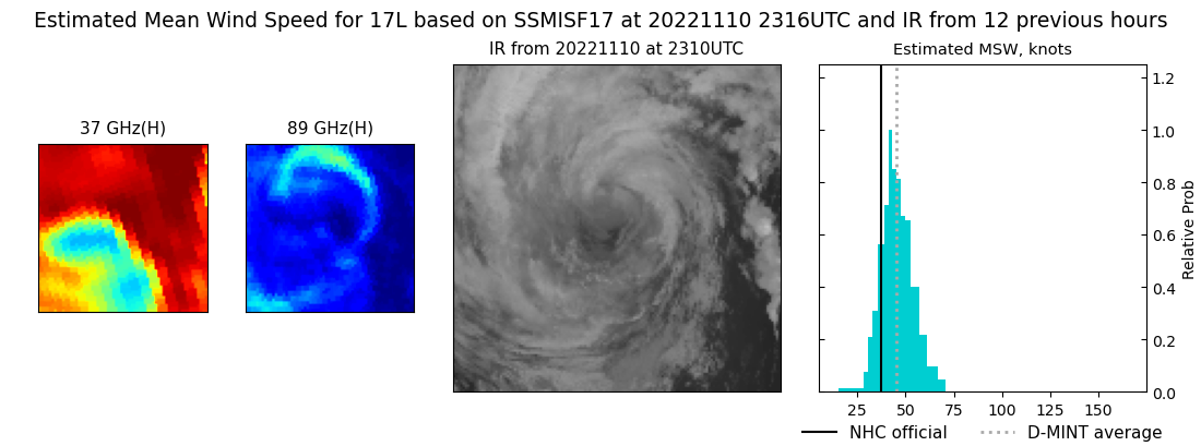 |
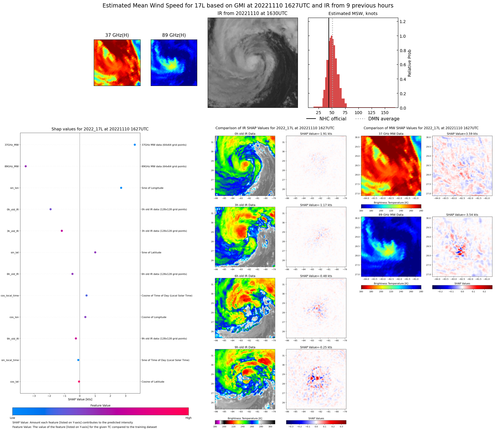
| 20221110 | 1627 UTC | GMI | 52 kts | 46 kts | 58 kts | 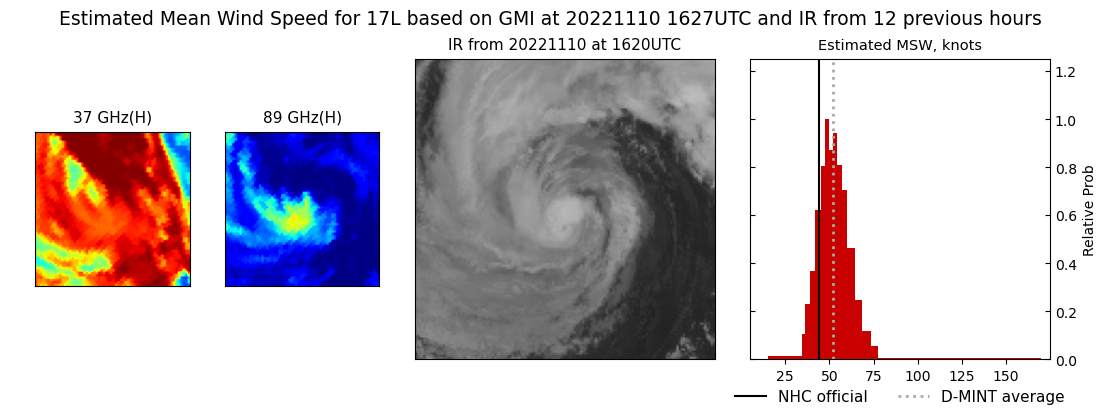 |
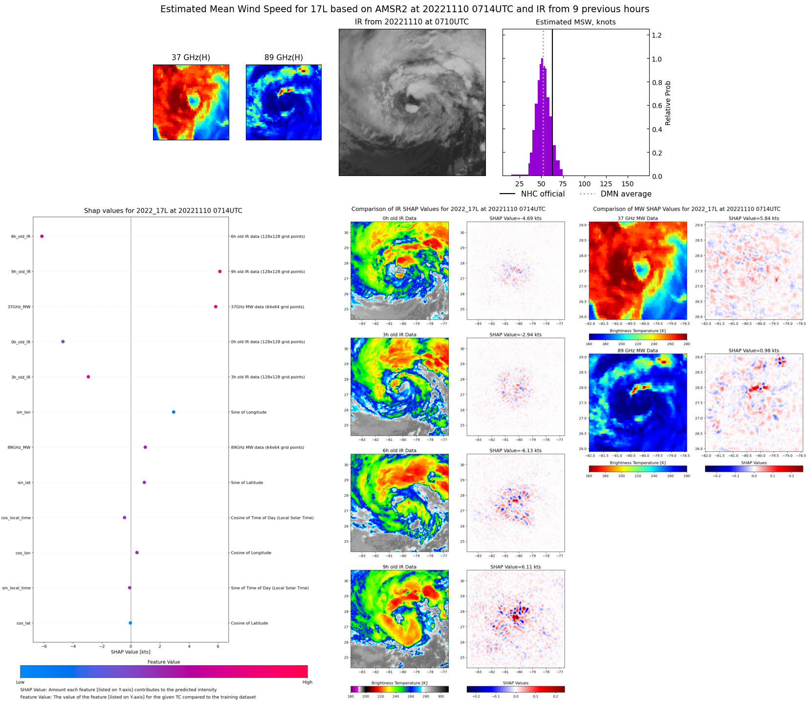
| 20221110 | 0714 UTC | AMSR2 | 60 kts | 54 kts | 65 kts | 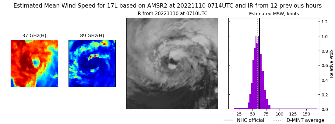 |
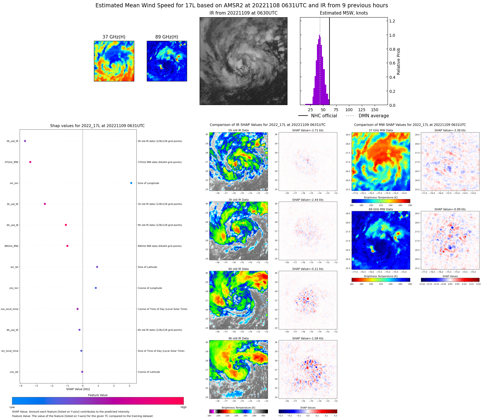
| 20221109 | 0631 UTC | AMSR2 | 51 kts | 47 kts | 56 kts | 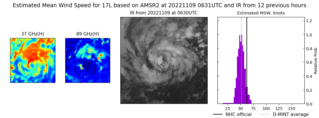 |
| 20221108 | 1824 UTC | AMSR2 | 50 kts | 45 kts | 54 kts | 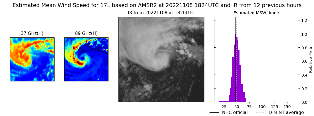 |
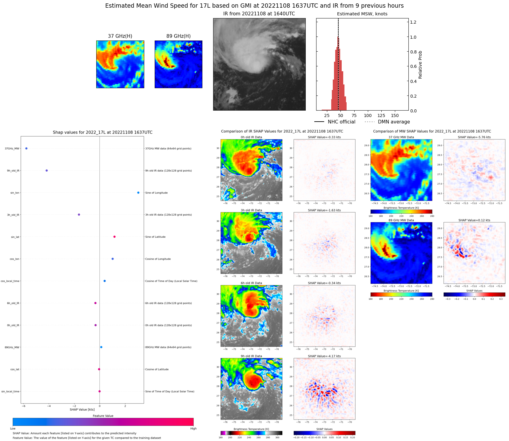
| 20221108 | 1637 UTC | GMI | 45 kts | 41 kts | 49 kts | 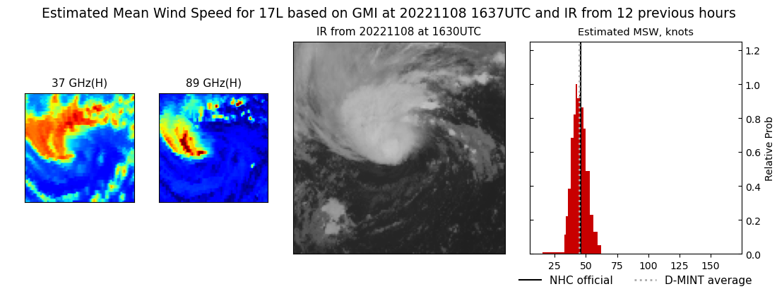 |
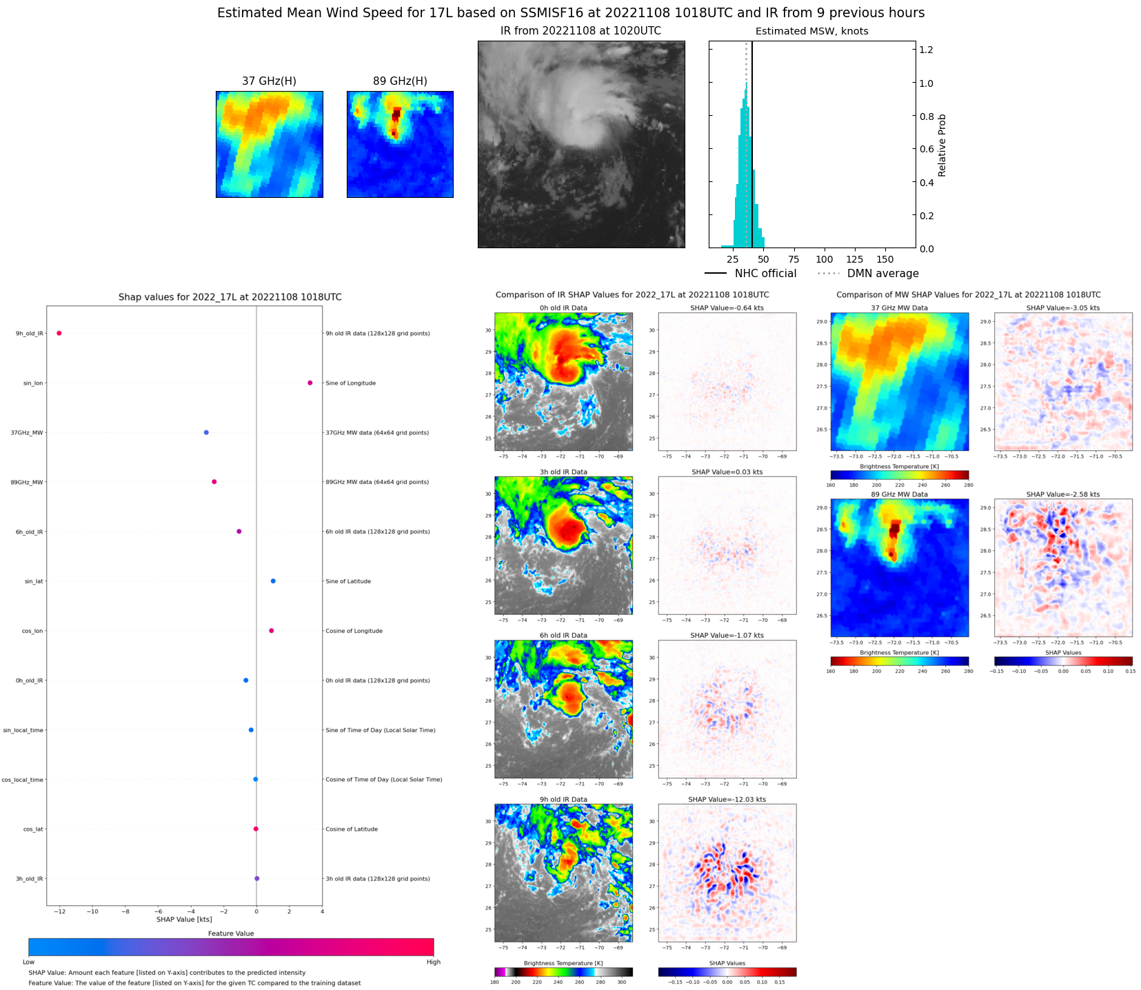
| 20221108 | 1018 UTC | SSMISF16 | 40 kts | 36 kts | 45 kts | 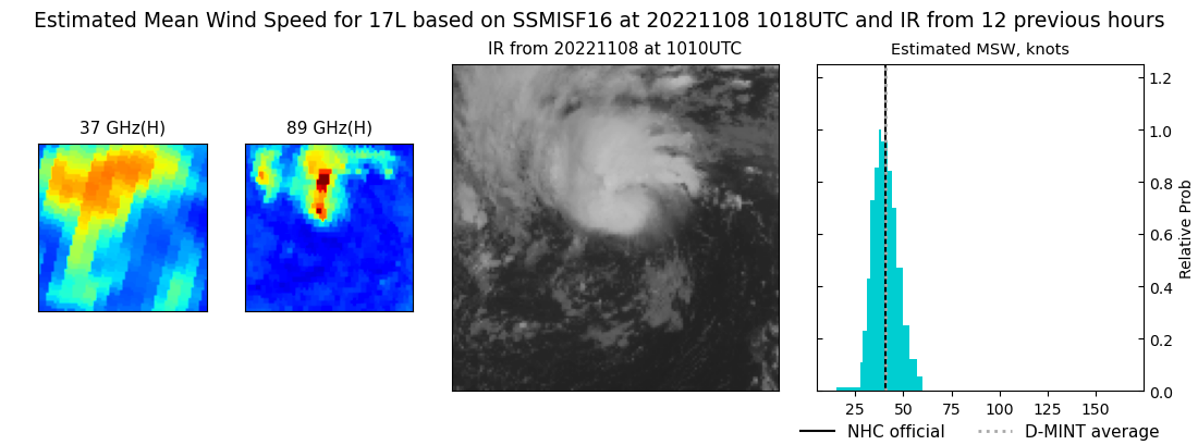 |
| 20221107 | 2149 UTC | SSMISF16 | 33 kts | 30 kts | 37 kts | 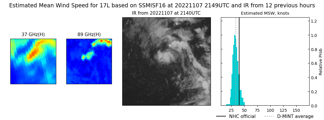 |
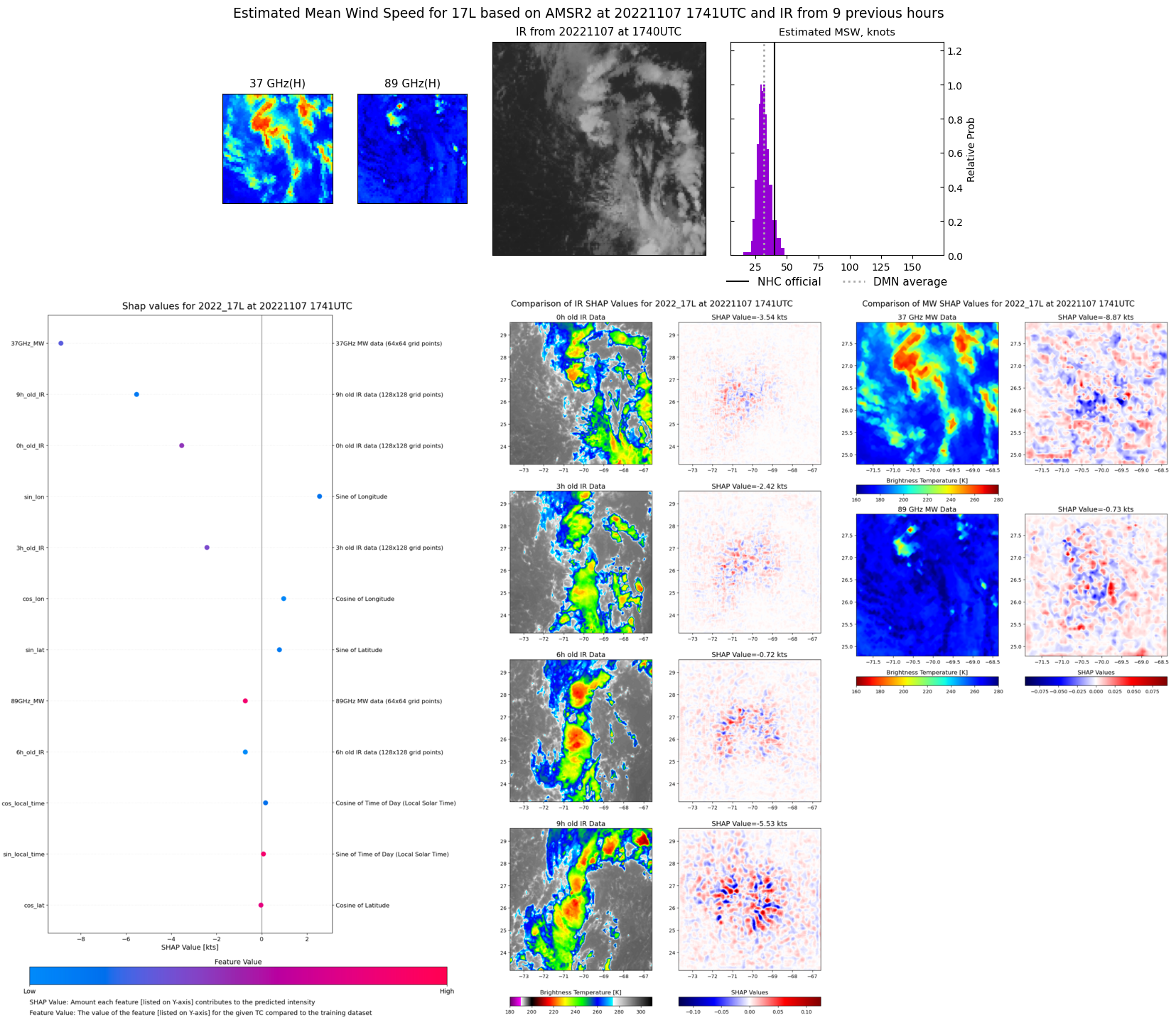
| 20221107 | 1741 UTC | AMSR2 | 33 kts | 30 kts | 36 kts | 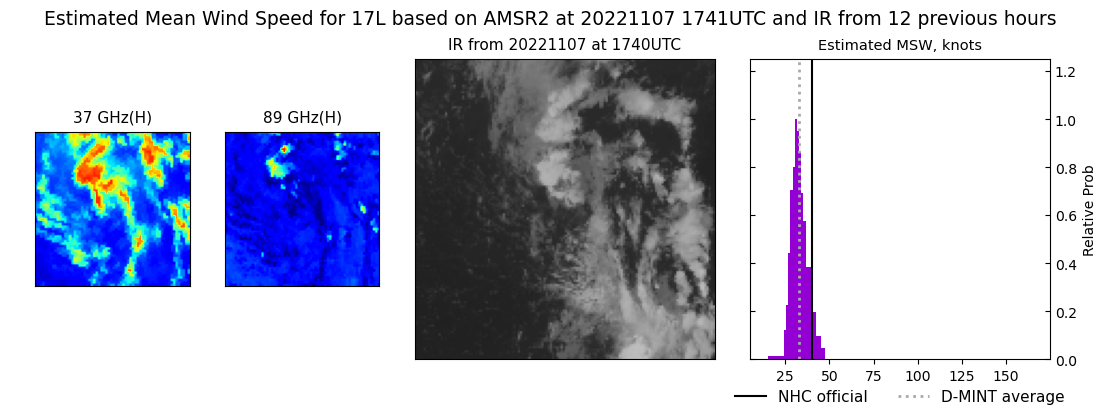 |
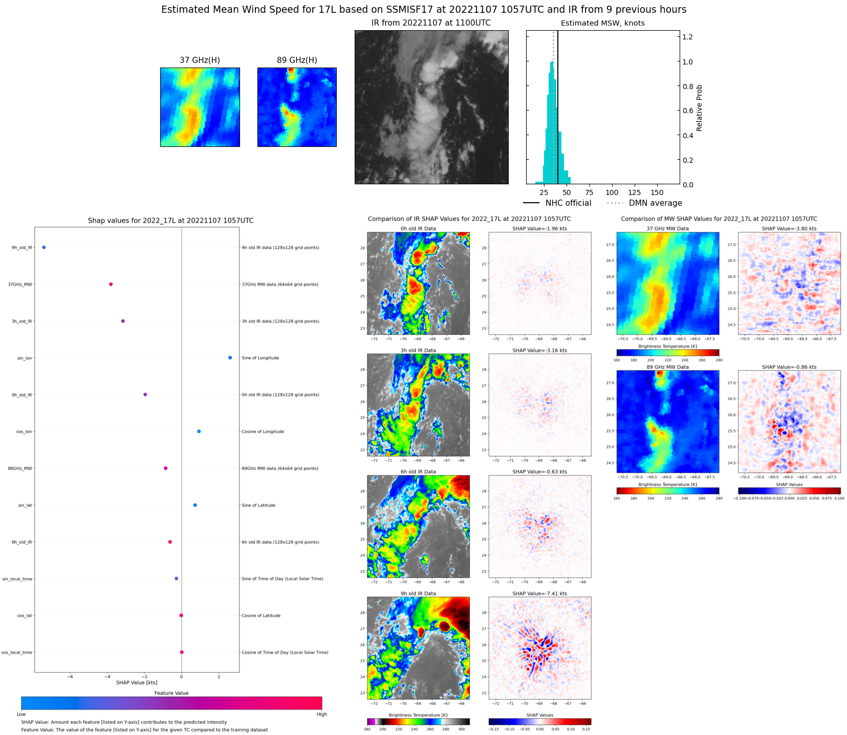
| 20221107 | 1057 UTC | SSMISF17 | 38 kts | 34 kts | 43 kts | 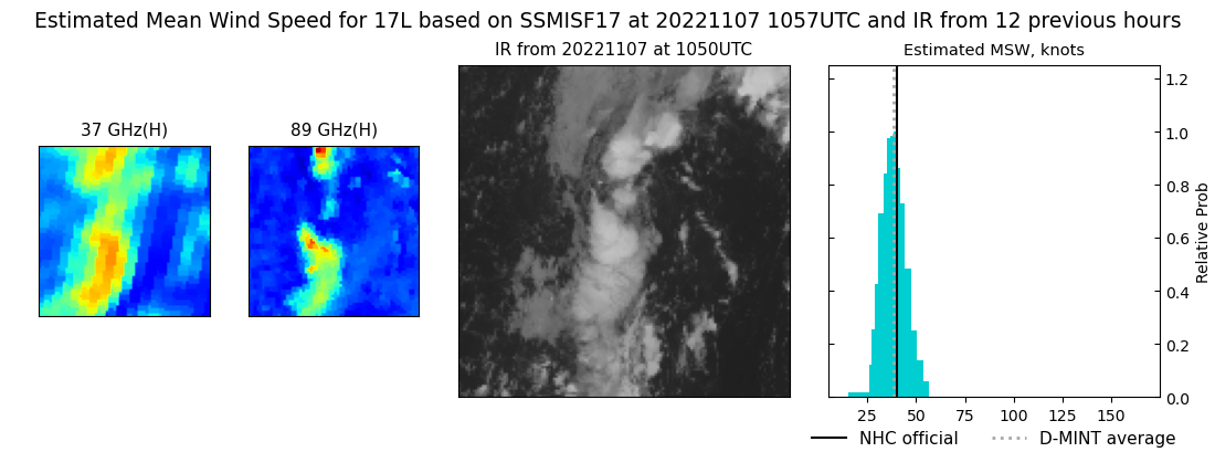 |
| 20221107 | 0644 UTC | AMSR2 | 45 kts | 40 kts | 50 kts | 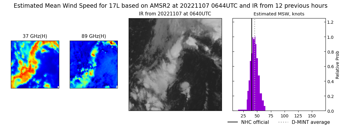 |
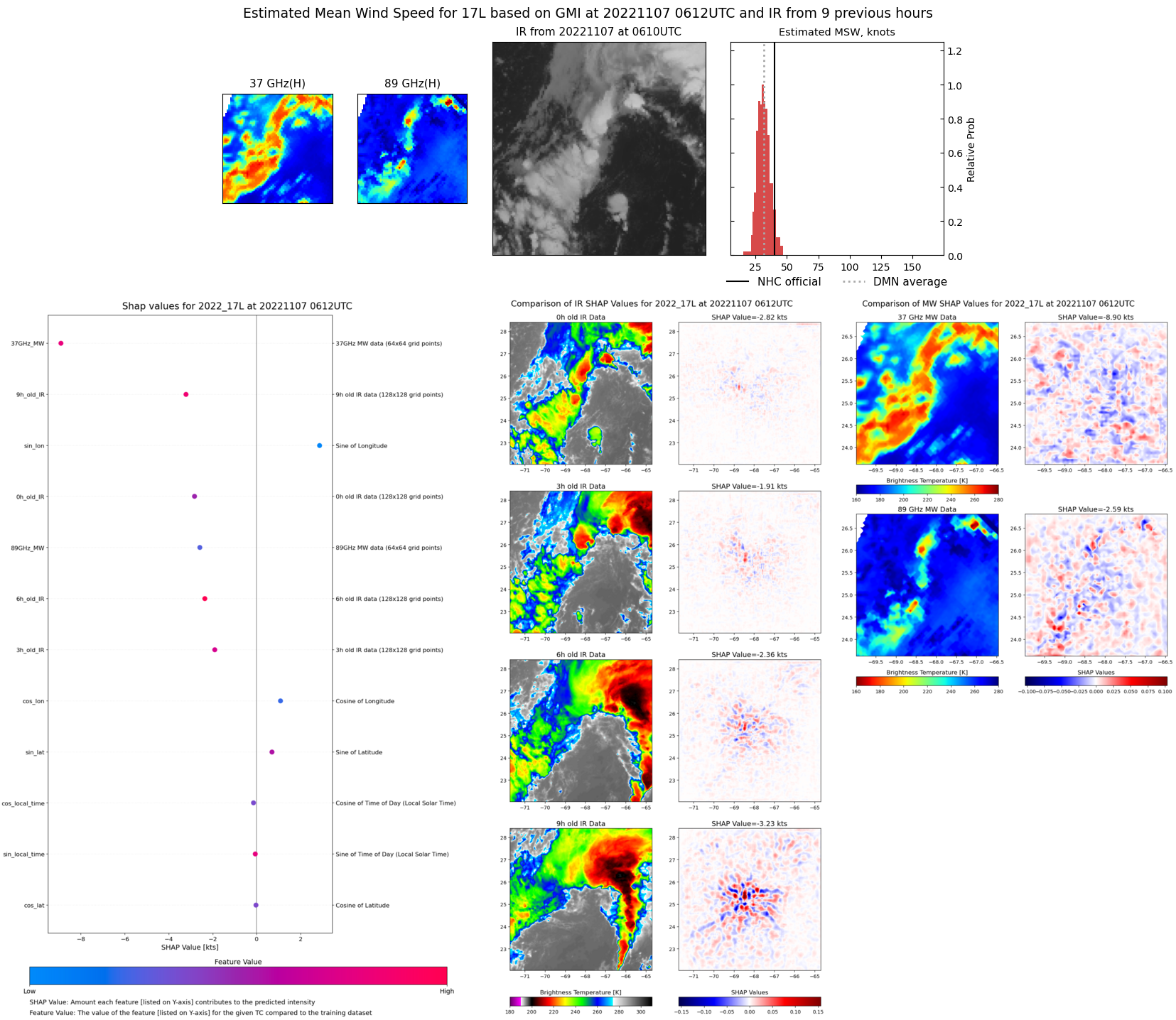
| 20221107 | 0612 UTC | GMI | 42 kts | 38 kts | 47 kts | 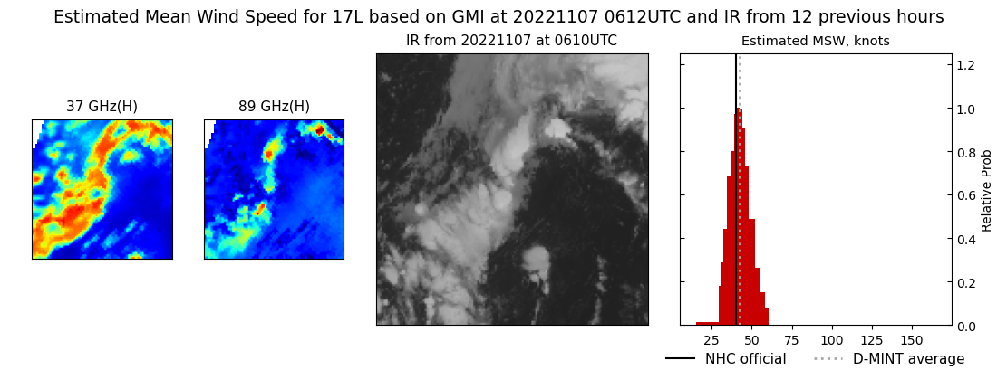 |
|