|
||

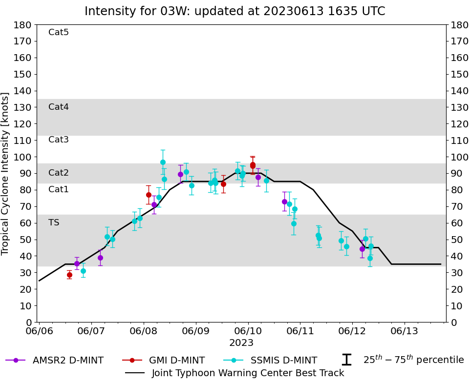 |
D-MINT HISTORY FILE for 2023_03W
| Date | Time | MW Sensor | MSLP | Vmax (30th-70th percentile average) | Vmax 25th percentile | Vmax 75th percentile | Image |
| 20230612 | 0831 UTC | SSMISF17 | NaN hPa | 46 kts | 41 kts | 52 kts | 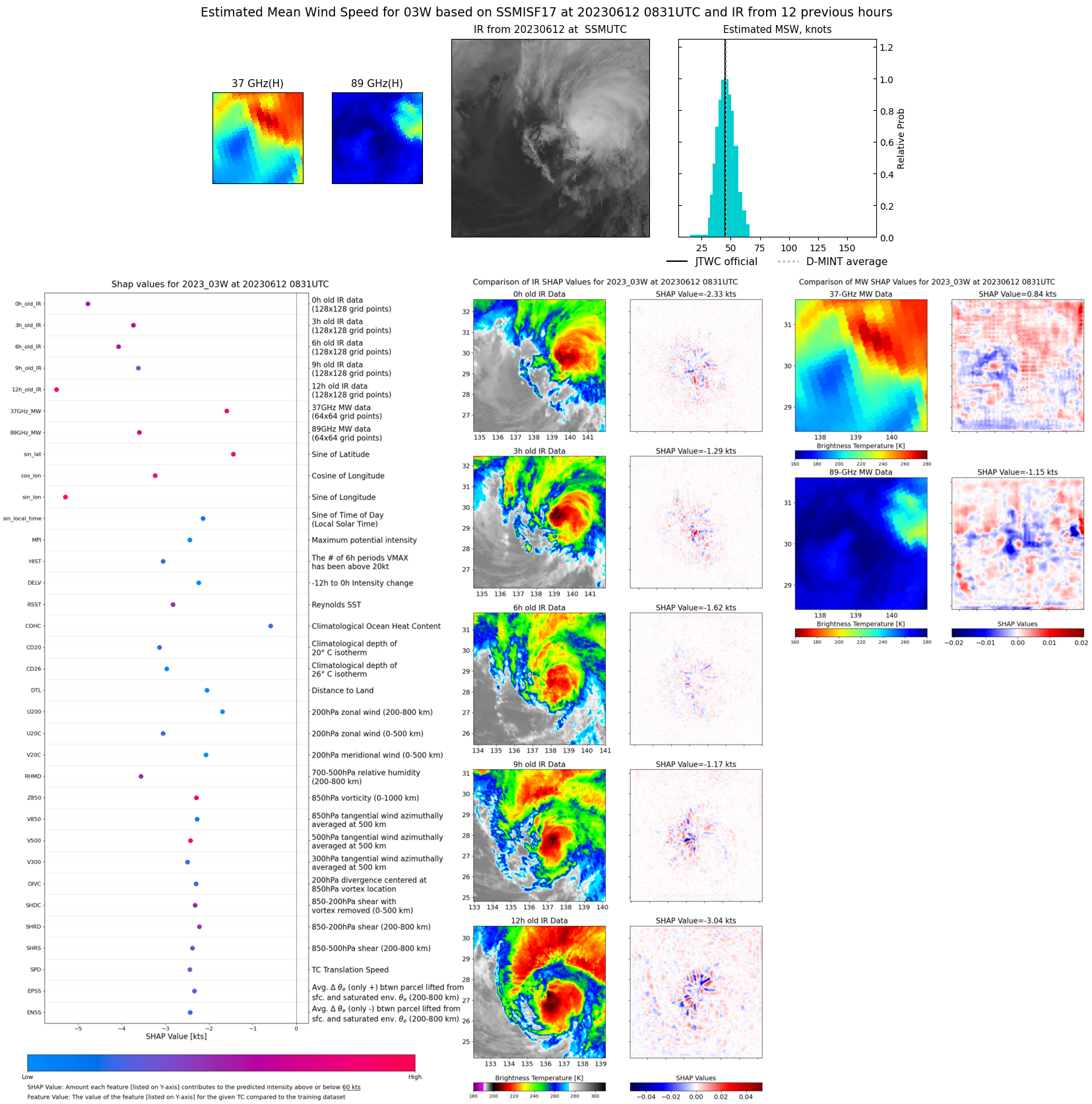 |
| 20230612 | 0759 UTC | SSMISF16 | NaN hPa | 39 kts | 34 kts | 44 kts | 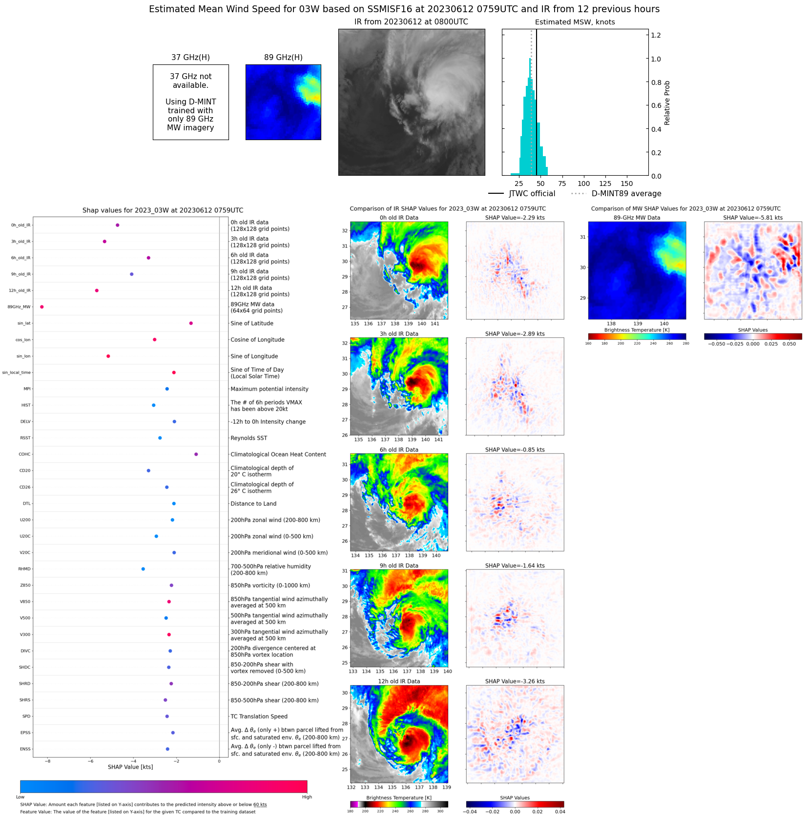 |
| 20230612 | 0605 UTC | SSMISF18 | NaN hPa | 50 kts | 45 kts | 56 kts |  |
| 20230612 | 0424 UTC | AMSR2 | NaN hPa | 44 kts | 39 kts | 50 kts | 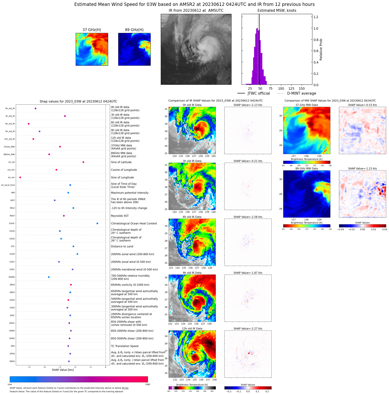 |
| 20230611 | 2113 UTC | SSMISF17 | NaN hPa | 46 kts | 40 kts | 52 kts | 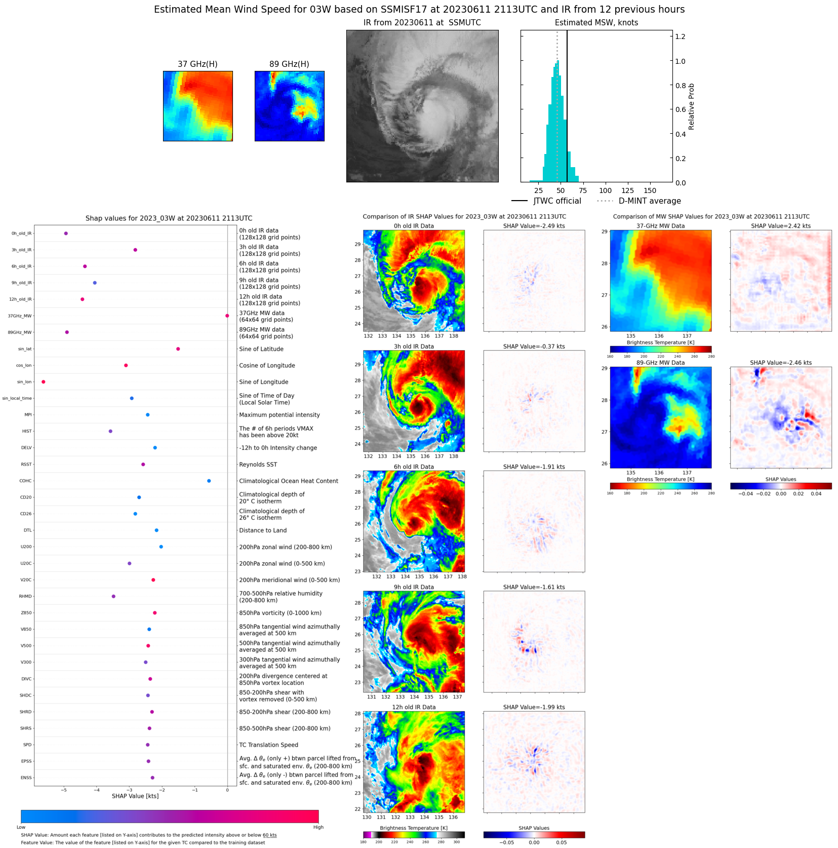 |
| 20230611 | 1847 UTC | SSMISF18 | NaN hPa | 49 kts | 44 kts | 55 kts | 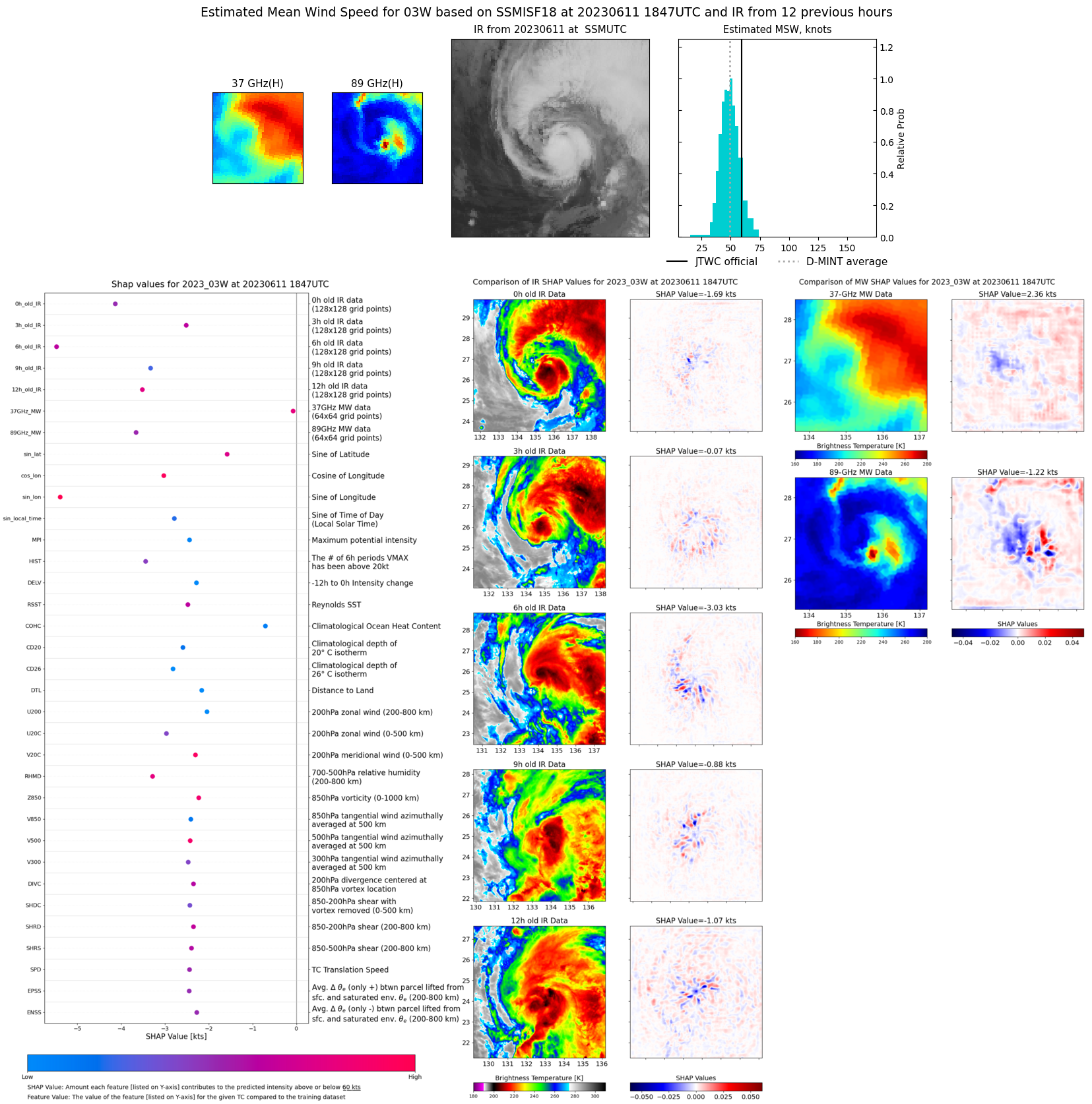 |
| 20230611 | 0845 UTC | SSMISF17 | NaN hPa | 51 kts | 45 kts | 57 kts | 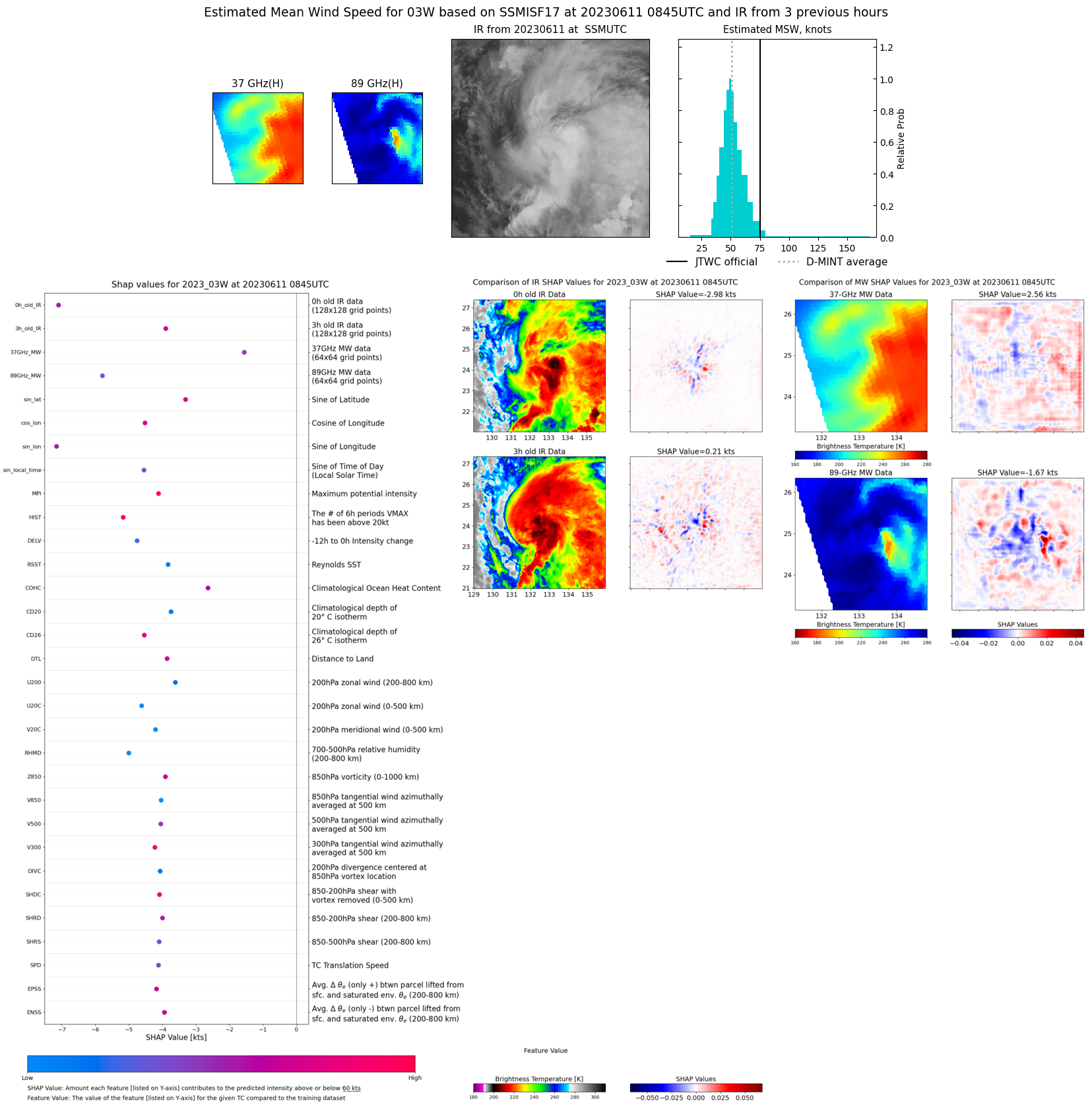 |
| 20230611 | 0811 UTC | SSMISF16 | NaN hPa | 53 kts | 47 kts | 59 kts | 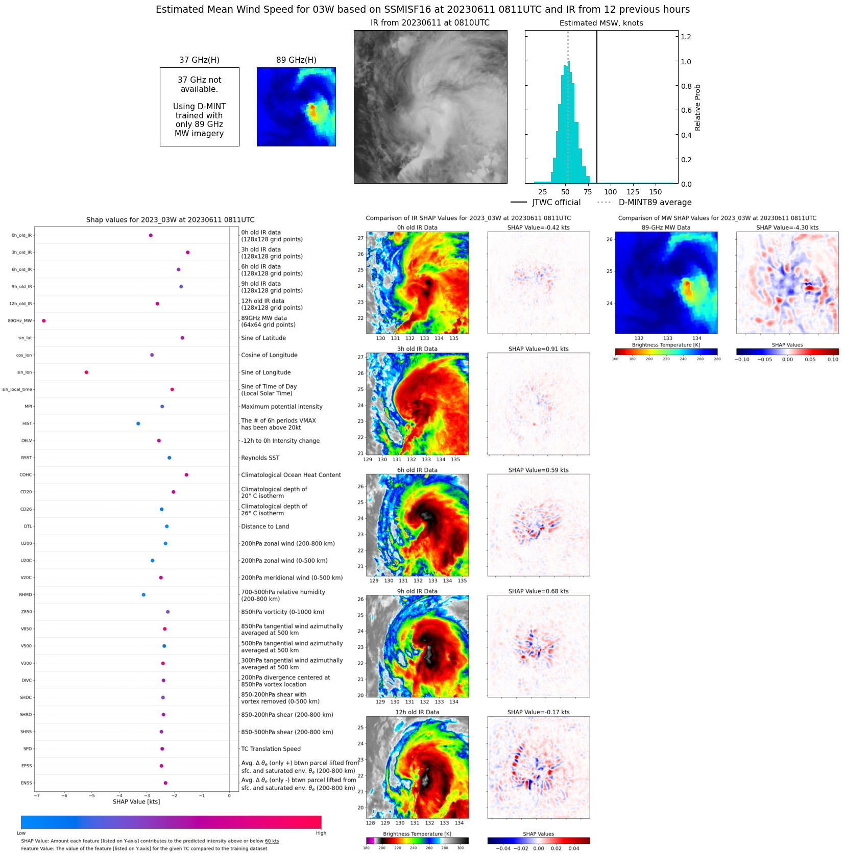 |
| 20230610 | 2128 UTC | SSMISF17 | NaN hPa | 68 kts | 63 kts | 75 kts | 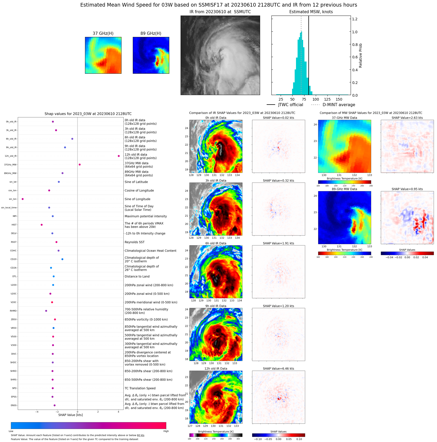 |
| 20230610 | 2055 UTC | SSMISF16 | NaN hPa | 59 kts | 53 kts | 66 kts | 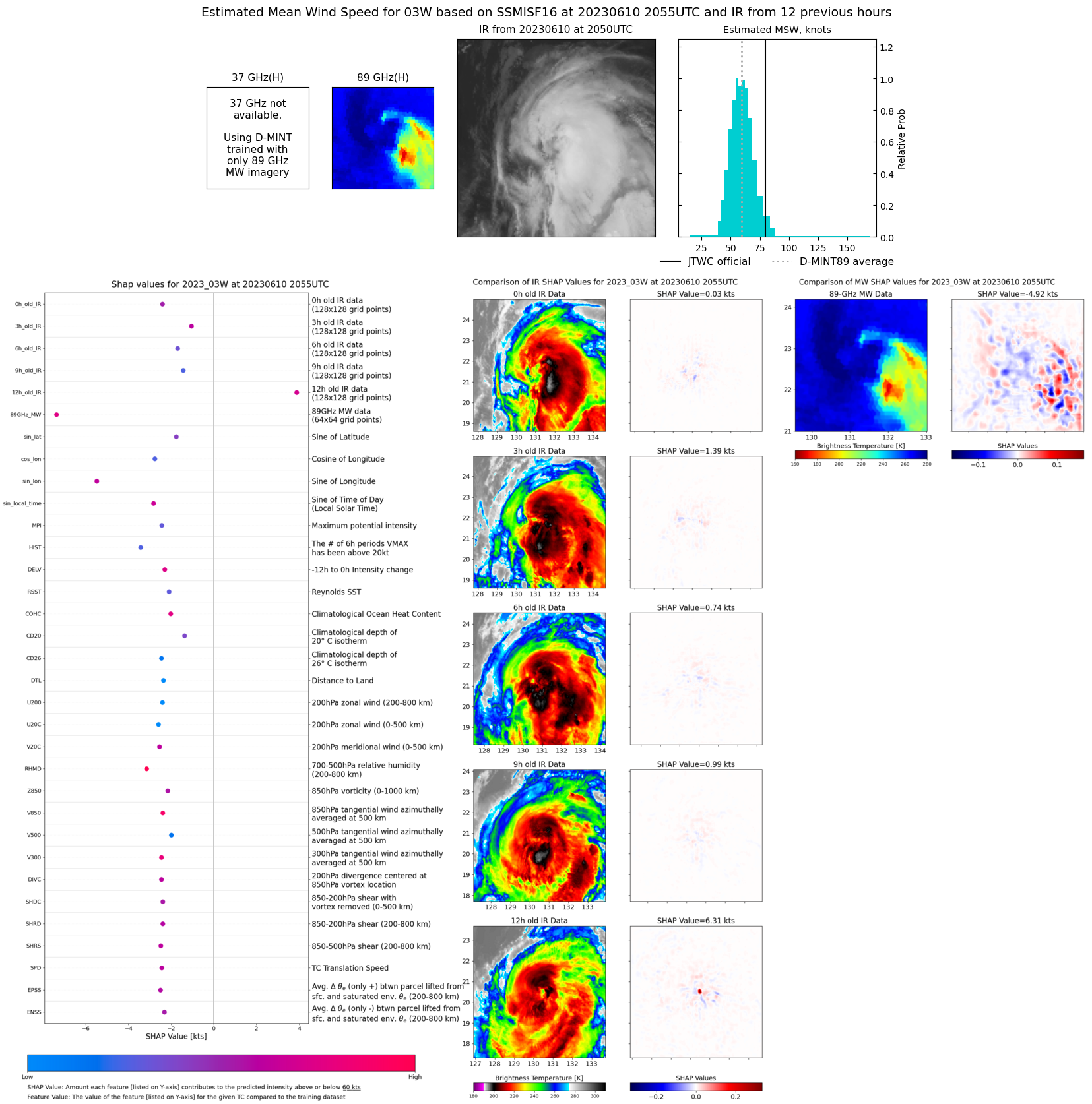 |
| 20230610 | 1901 UTC | SSMISF18 | NaN hPa | 72 kts | 65 kts | 79 kts | 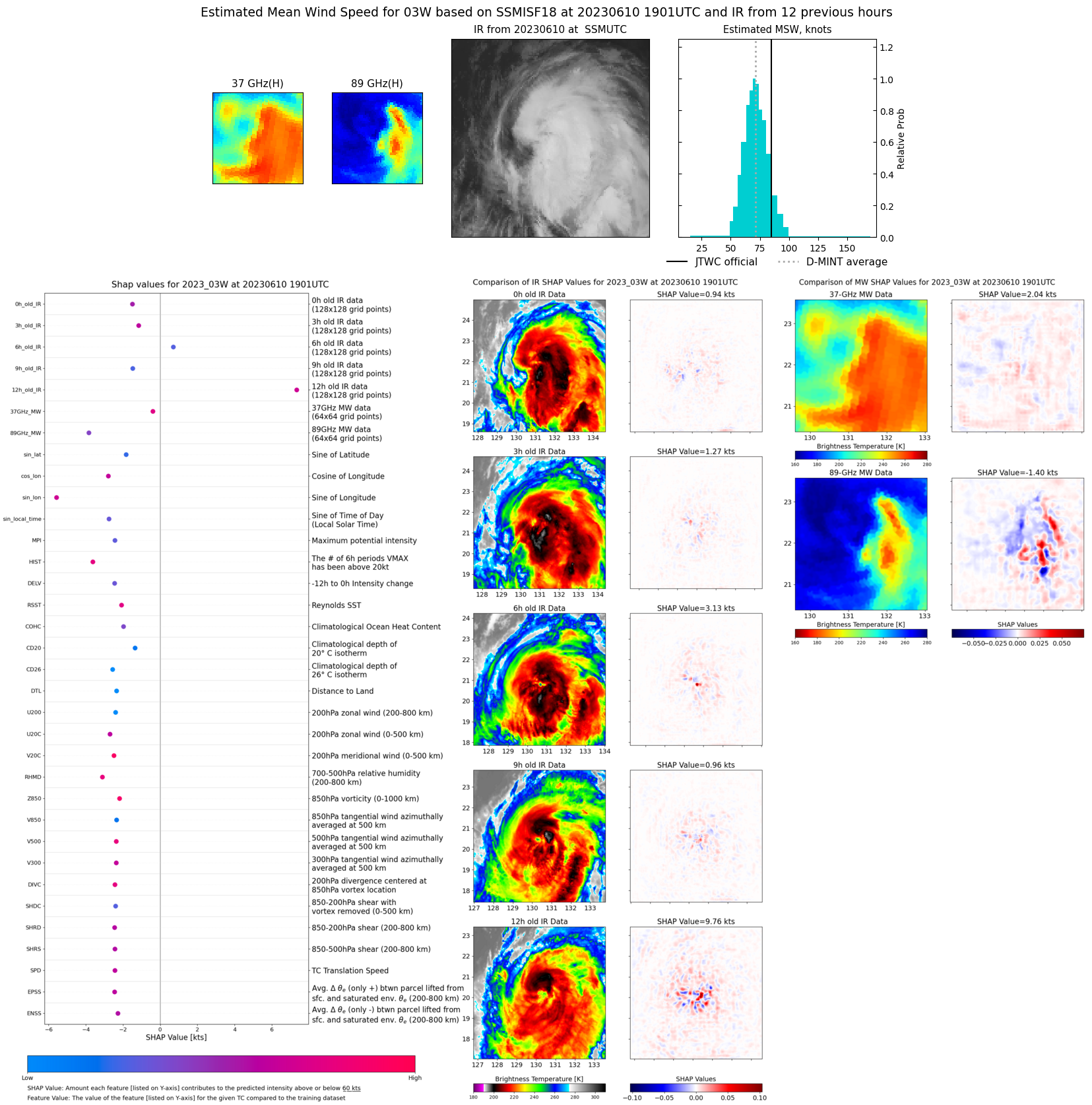 |
| 20230610 | 1645 UTC | AMSR2 | NaN hPa | 73 kts | 67 kts | 79 kts | 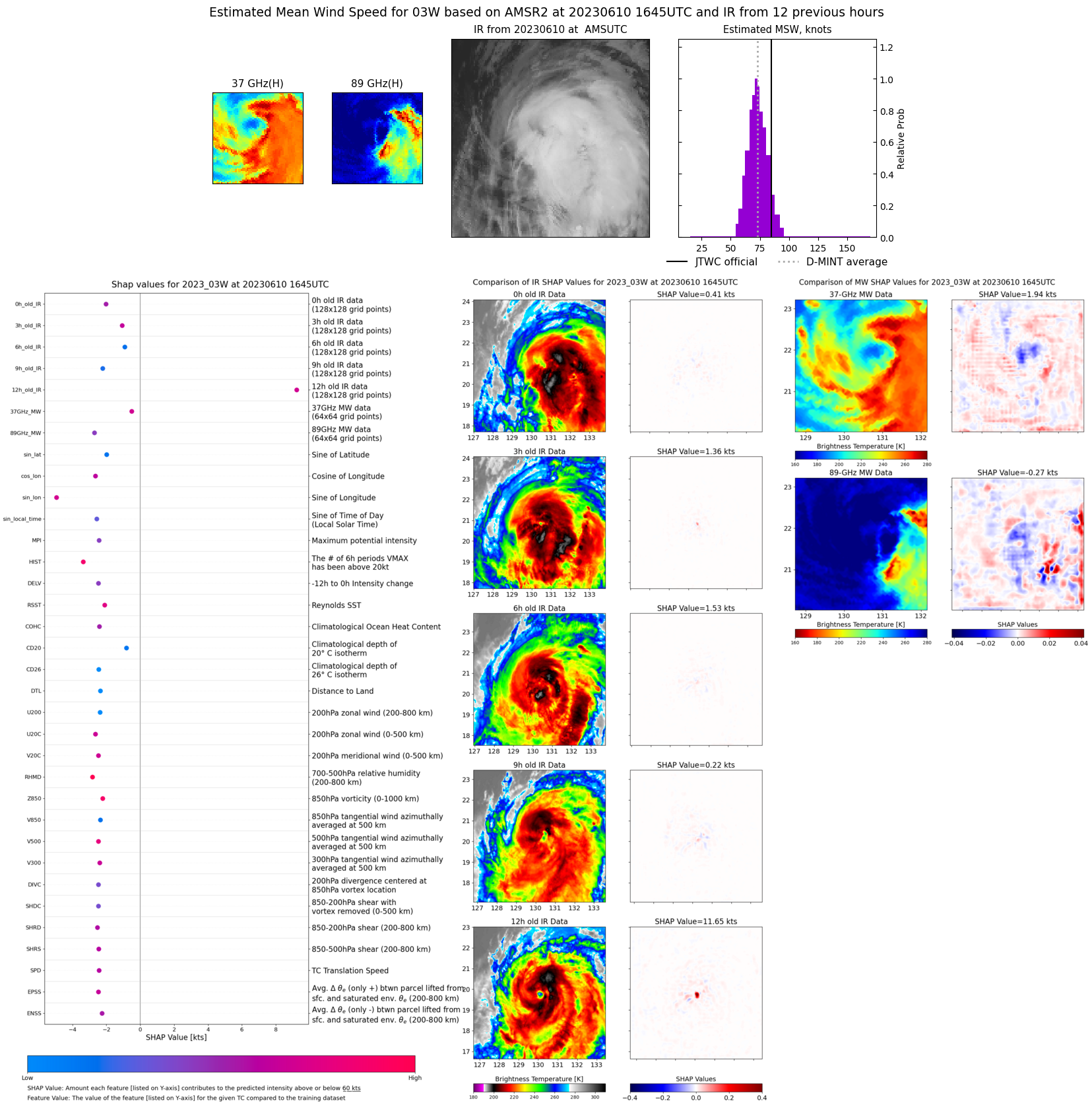 |
| 20230610 | 0823 UTC | SSMISF16 | NaN hPa | 85 kts | 79 kts | 92 kts | 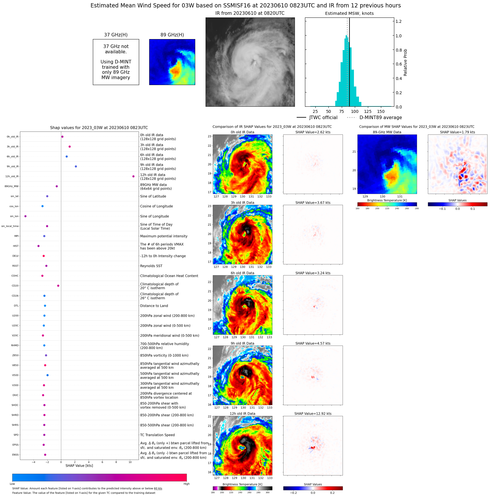 |
| 20230610 | 0434 UTC | AMSR2 | NaN hPa | 88 kts | 82 kts | 93 kts | 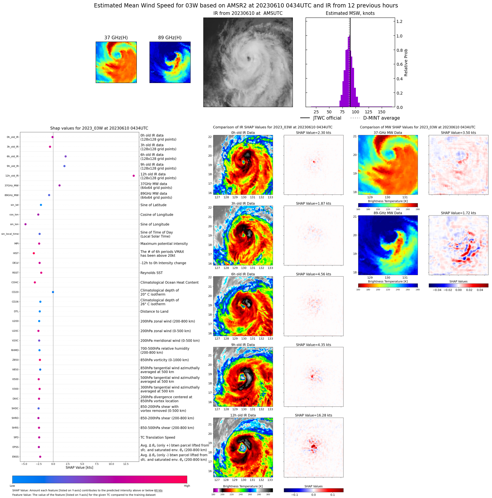 |
| 20230610 | 0205 UTC | GMI | NaN hPa | 95 kts | 89 kts | 100 kts |  |
| 20230610 | 0201 UTC | GMI | NaN hPa | 95 kts | 90 kts | 100 kts | 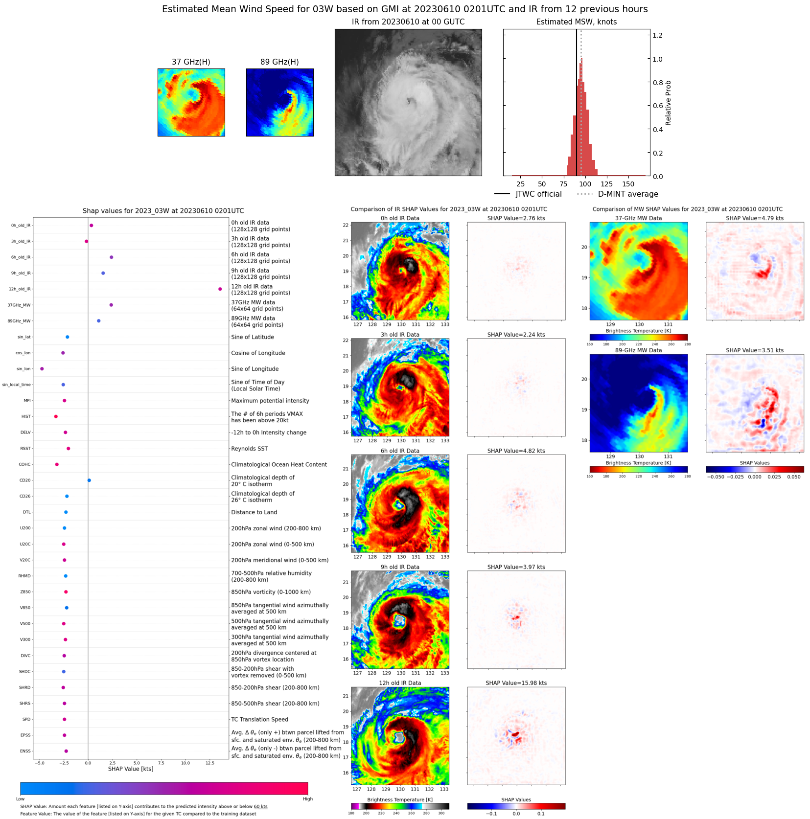 |
| 20230609 | 2143 UTC | SSMISF17 | NaN hPa | 90 kts | 85 kts | 95 kts | 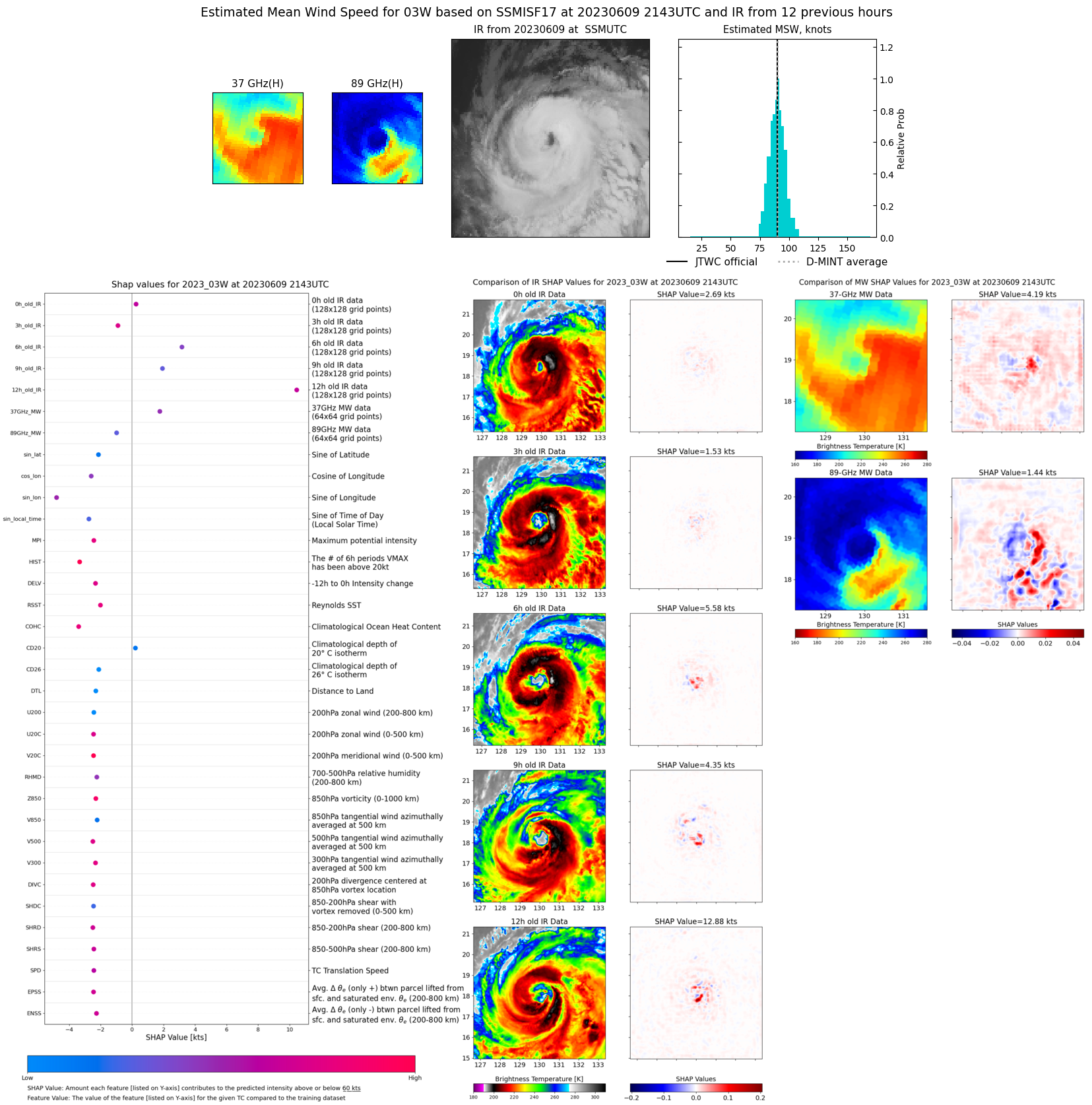 |
| 20230609 | 2109 UTC | SSMISF16 | NaN hPa | 88 kts | 82 kts | 95 kts | 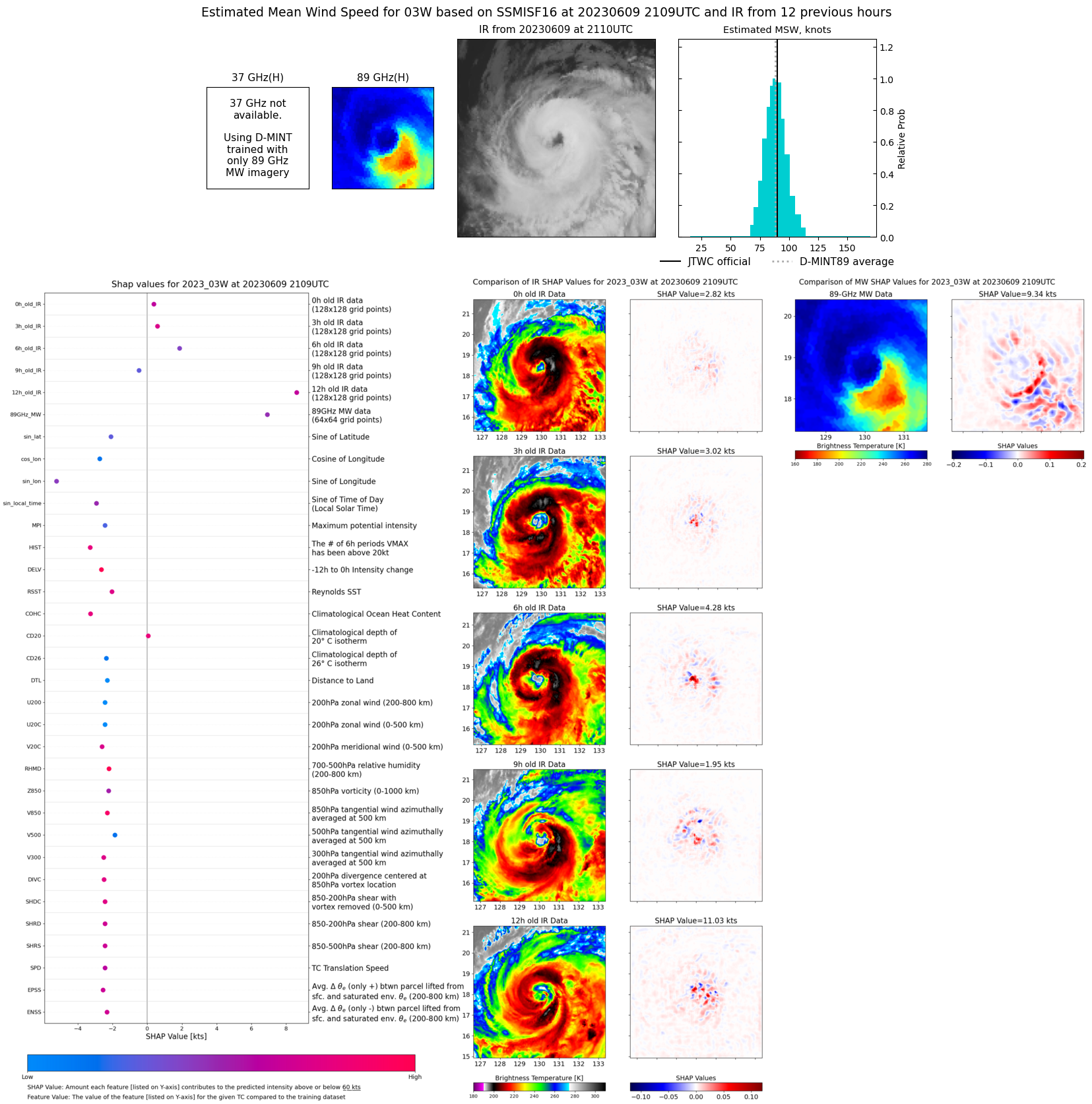 |
| 20230609 | 1914 UTC | SSMISF18 | NaN hPa | 91 kts | 86 kts | 97 kts | 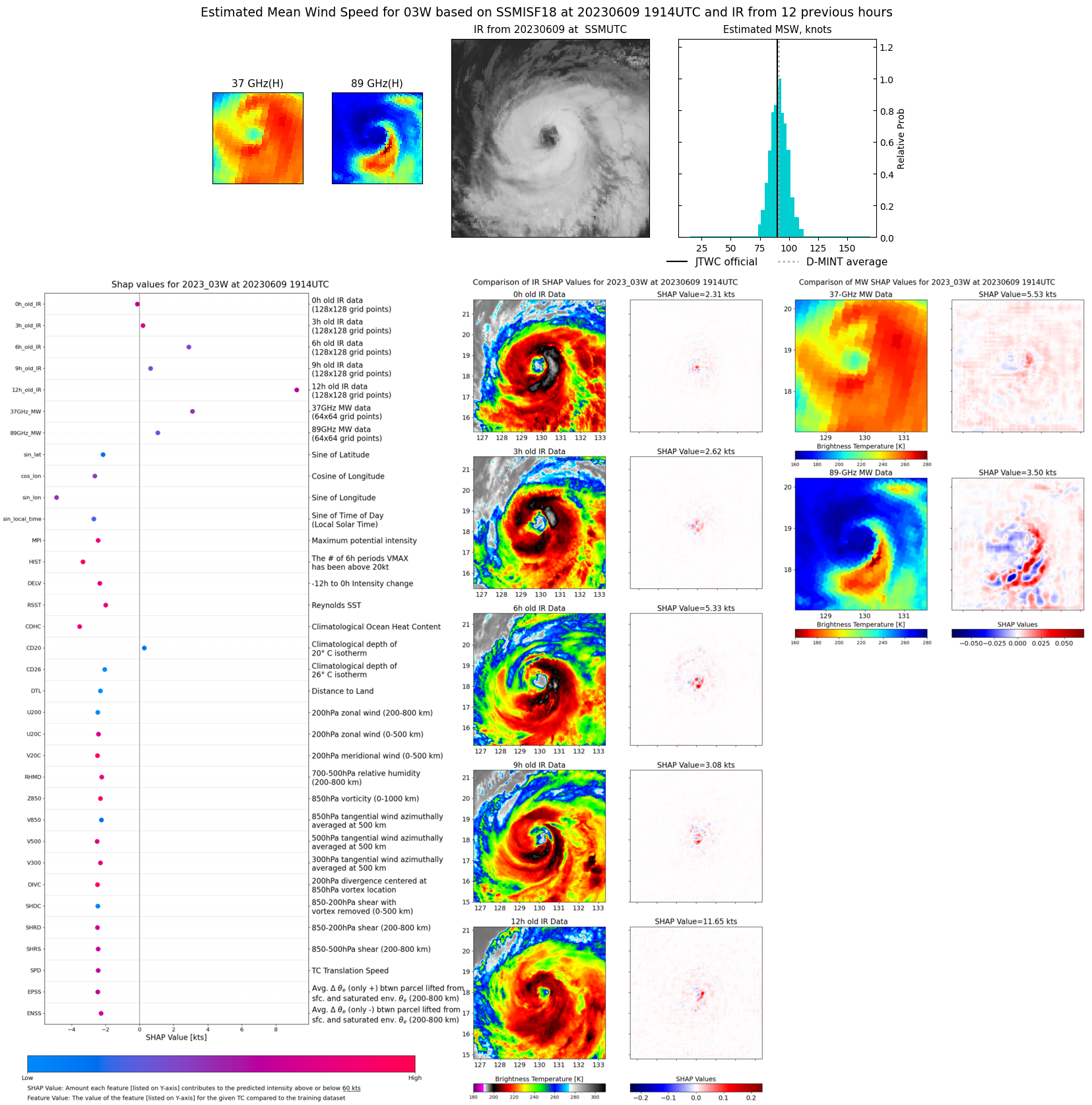 |
| 20230609 | 1241 UTC | GMI | NaN hPa | 83 kts | 78 kts | 89 kts | 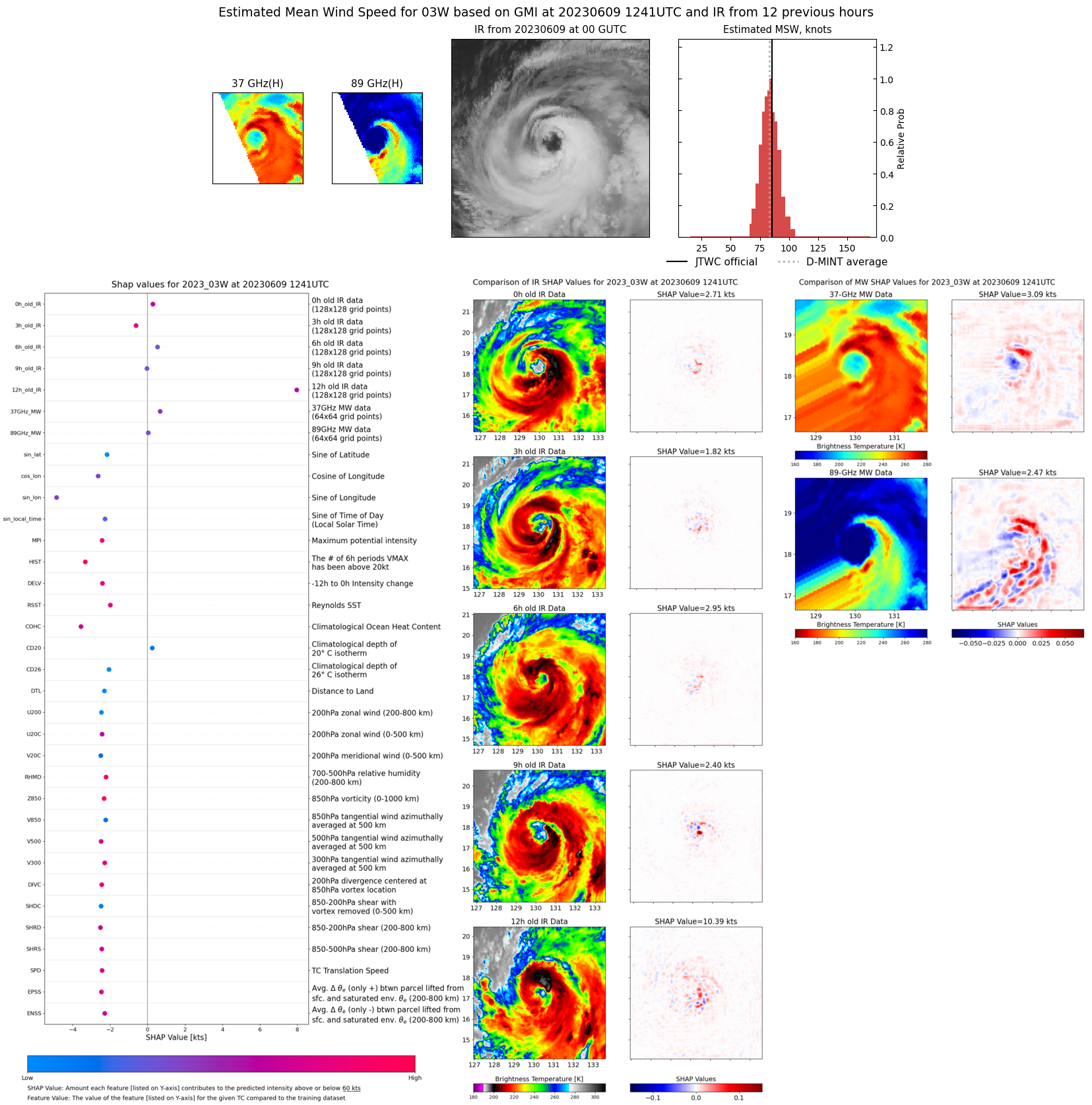 |
| 20230609 | 0909 UTC | SSMISF17 | NaN hPa | 84 kts | 78 kts | 91 kts | 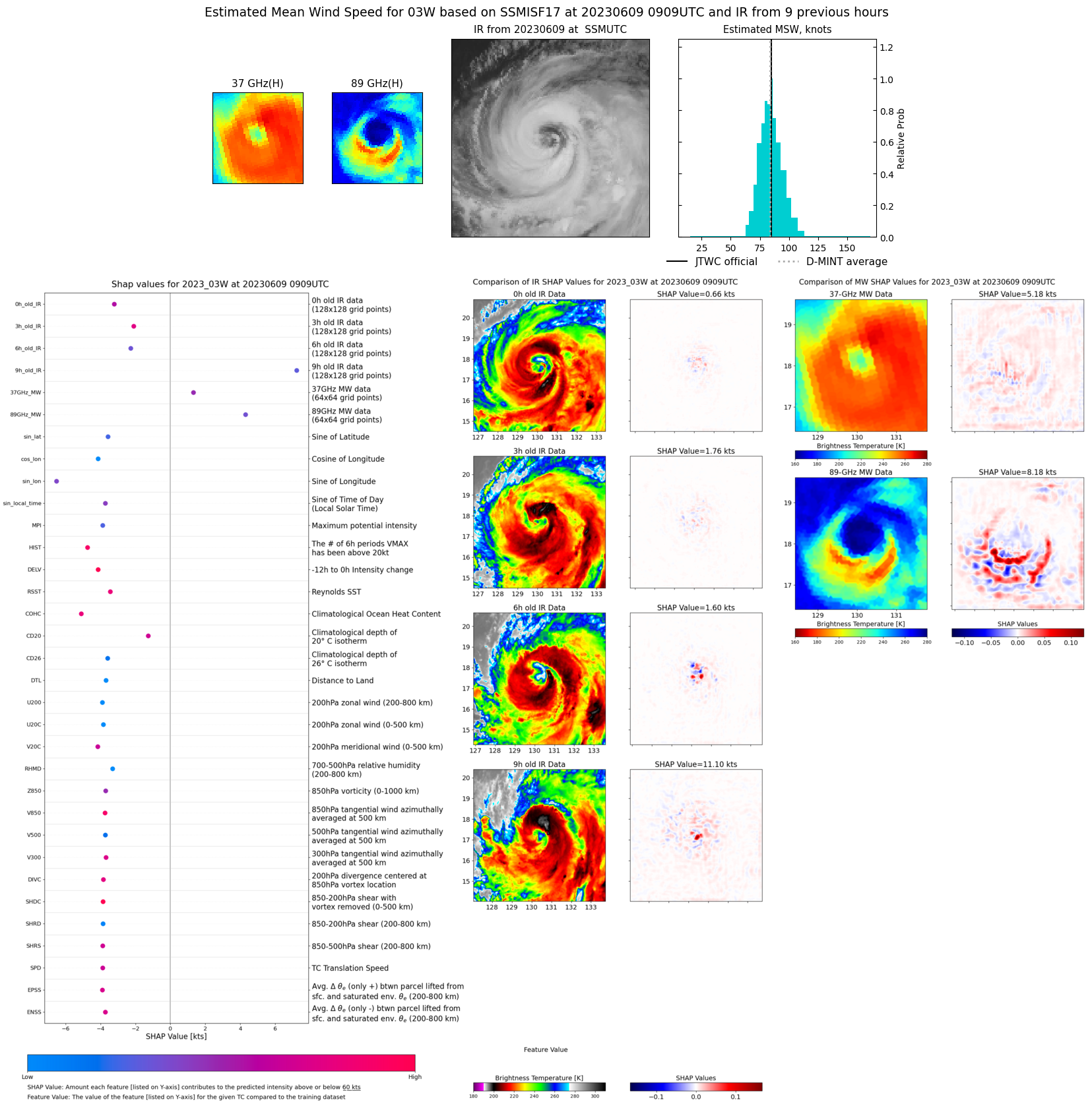 |
| 20230609 | 0836 UTC | SSMISF16 | NaN hPa | 86 kts | 79 kts | 93 kts | 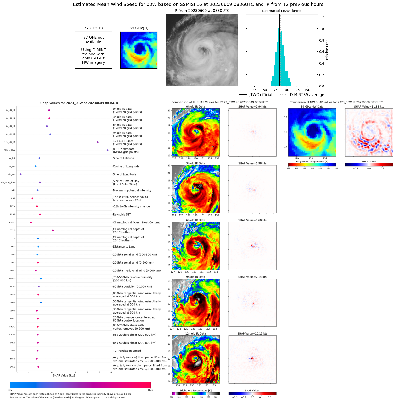 |
| 20230609 | 0641 UTC | SSMISF18 | NaN hPa | 84 kts | 78 kts | 90 kts | 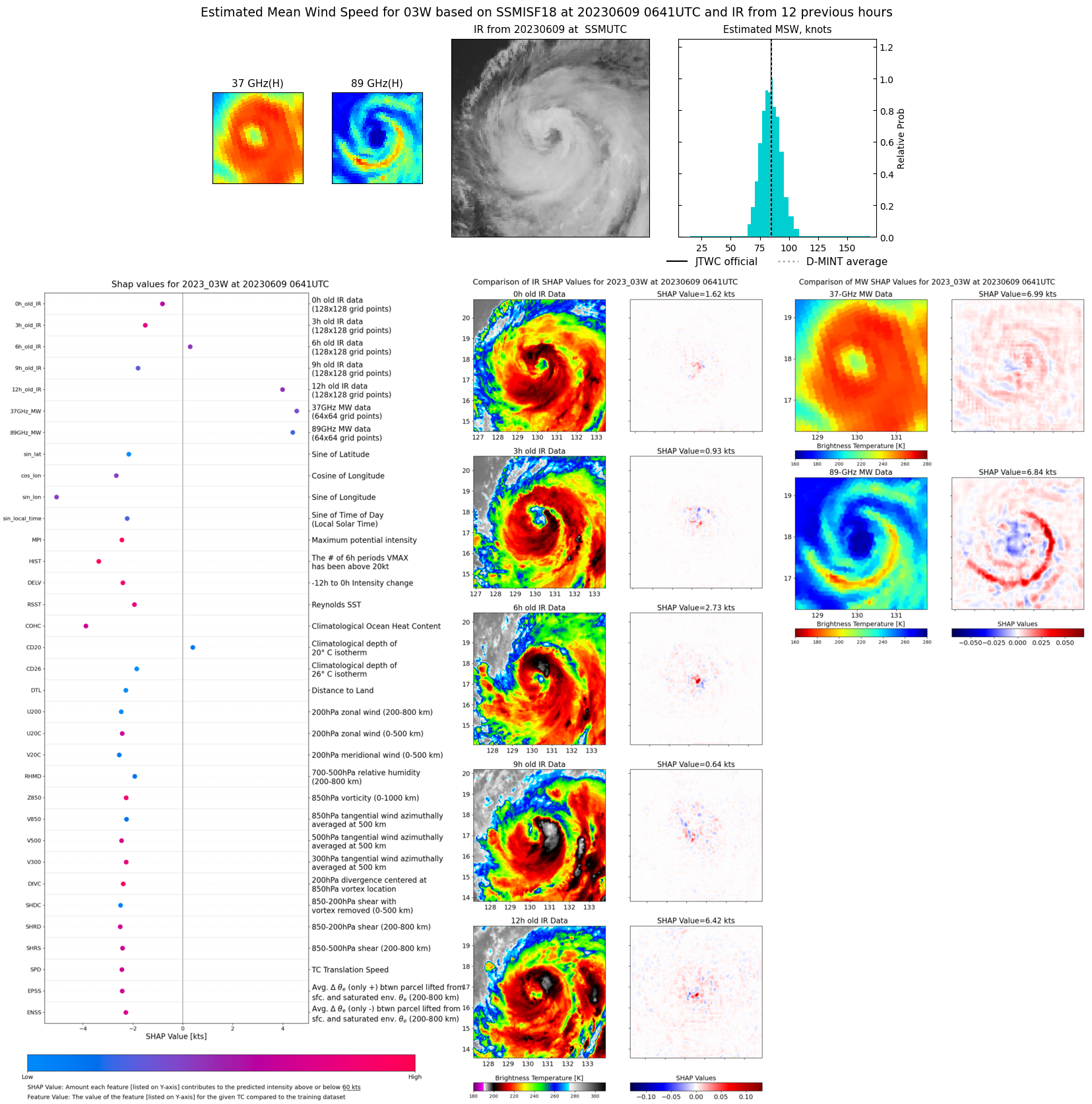 |
| 20230608 | 2156 UTC | SSMISF17 | NaN hPa | 83 kts | 77 kts | 88 kts | 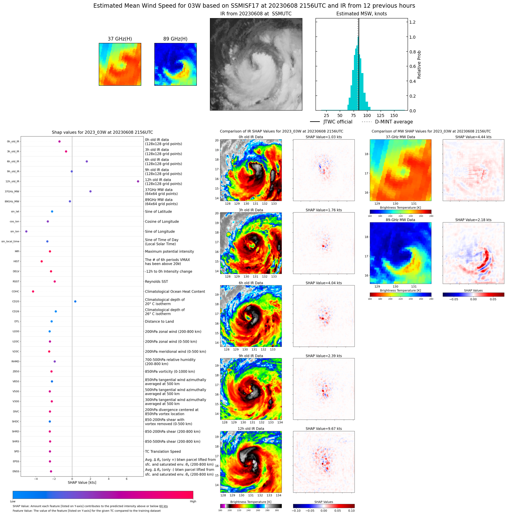 |
| 20230608 | 1928 UTC | SSMISF18 | NaN hPa | 91 kts | 85 kts | 96 kts | 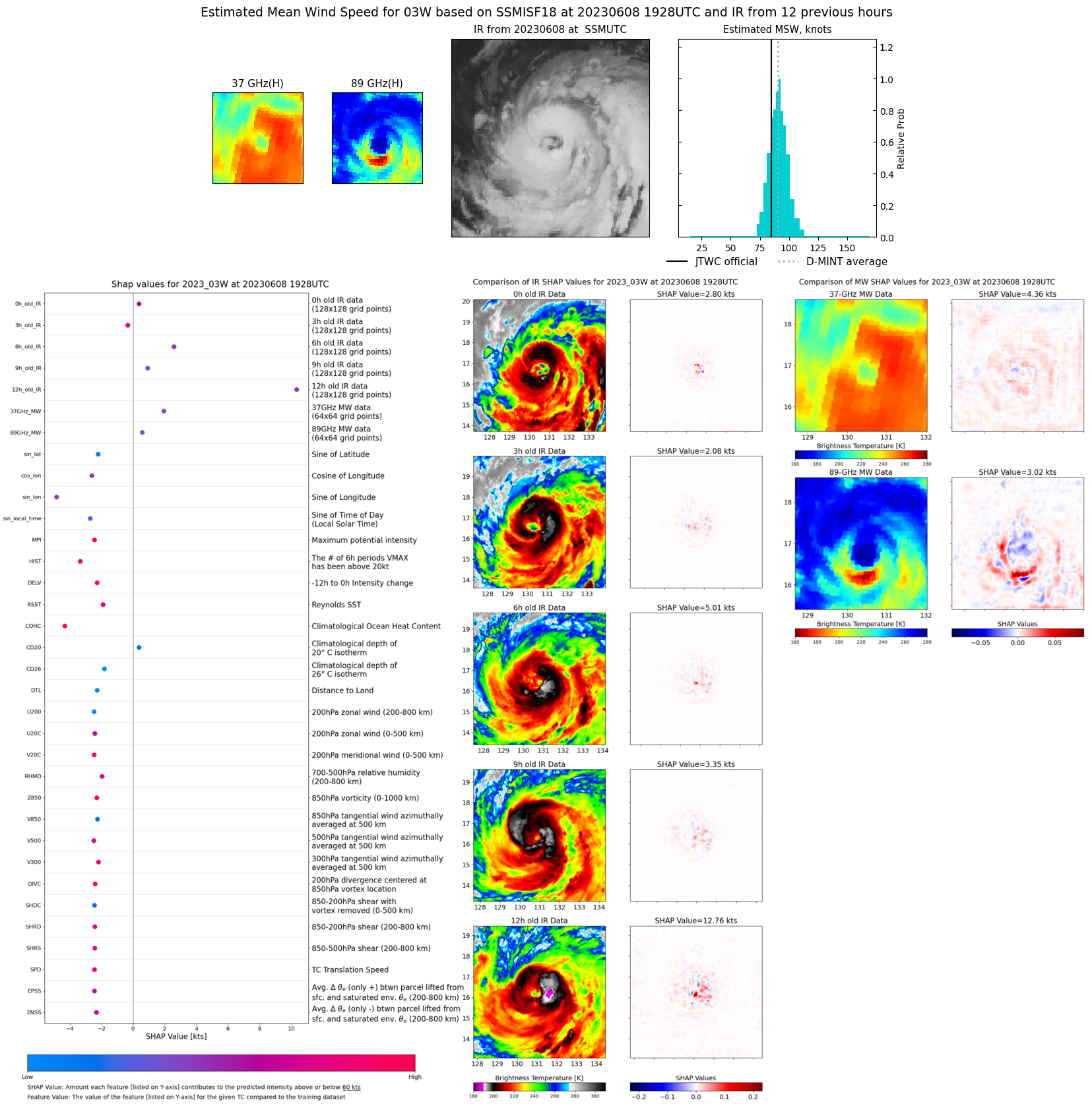 |
| 20230608 | 1658 UTC | AMSR2 | NaN hPa | 89 kts | 84 kts | 95 kts | 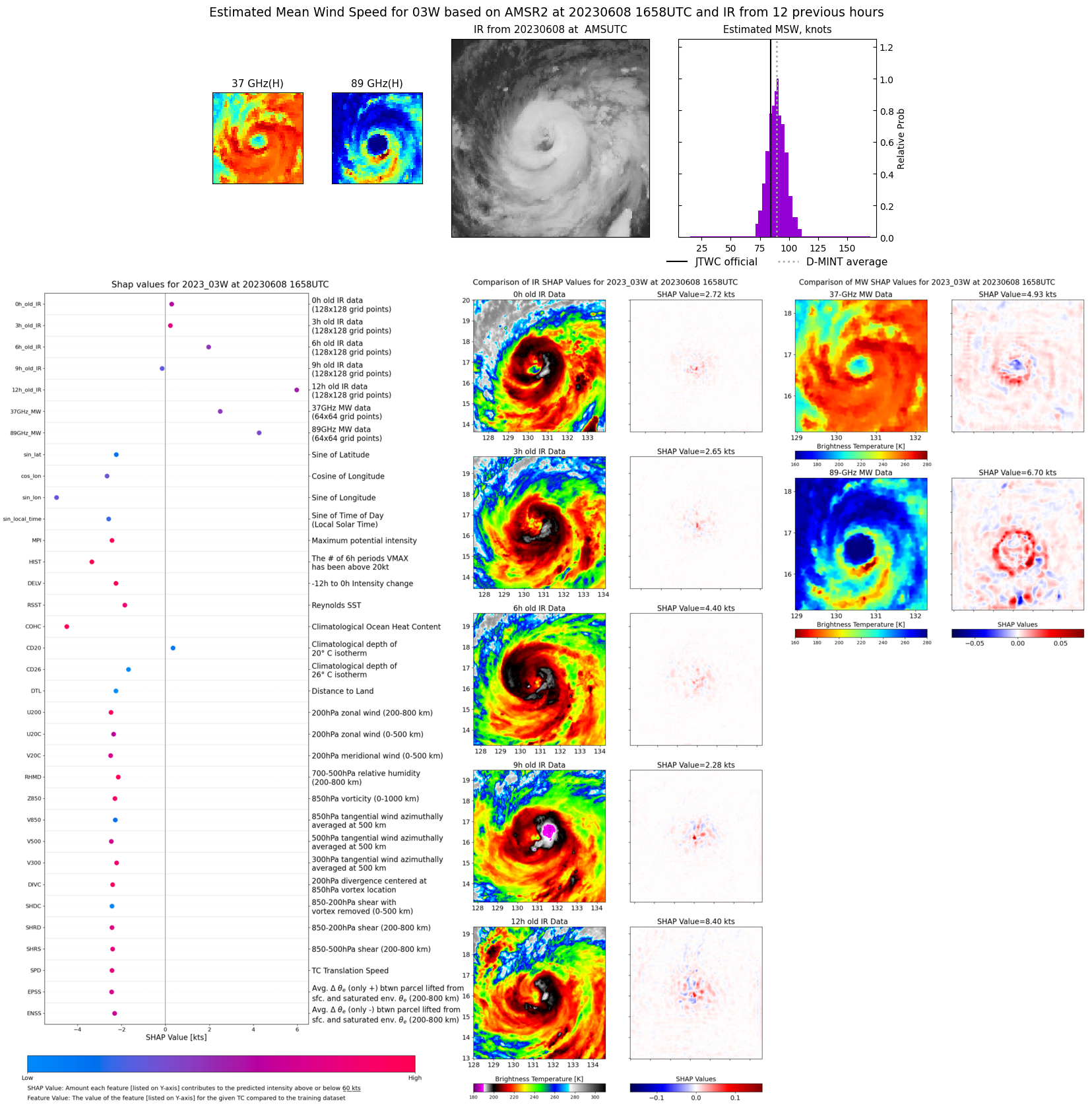 |
| 20230608 | 0922 UTC | SSMISF17 | NaN hPa | 87 kts | 80 kts | 93 kts | 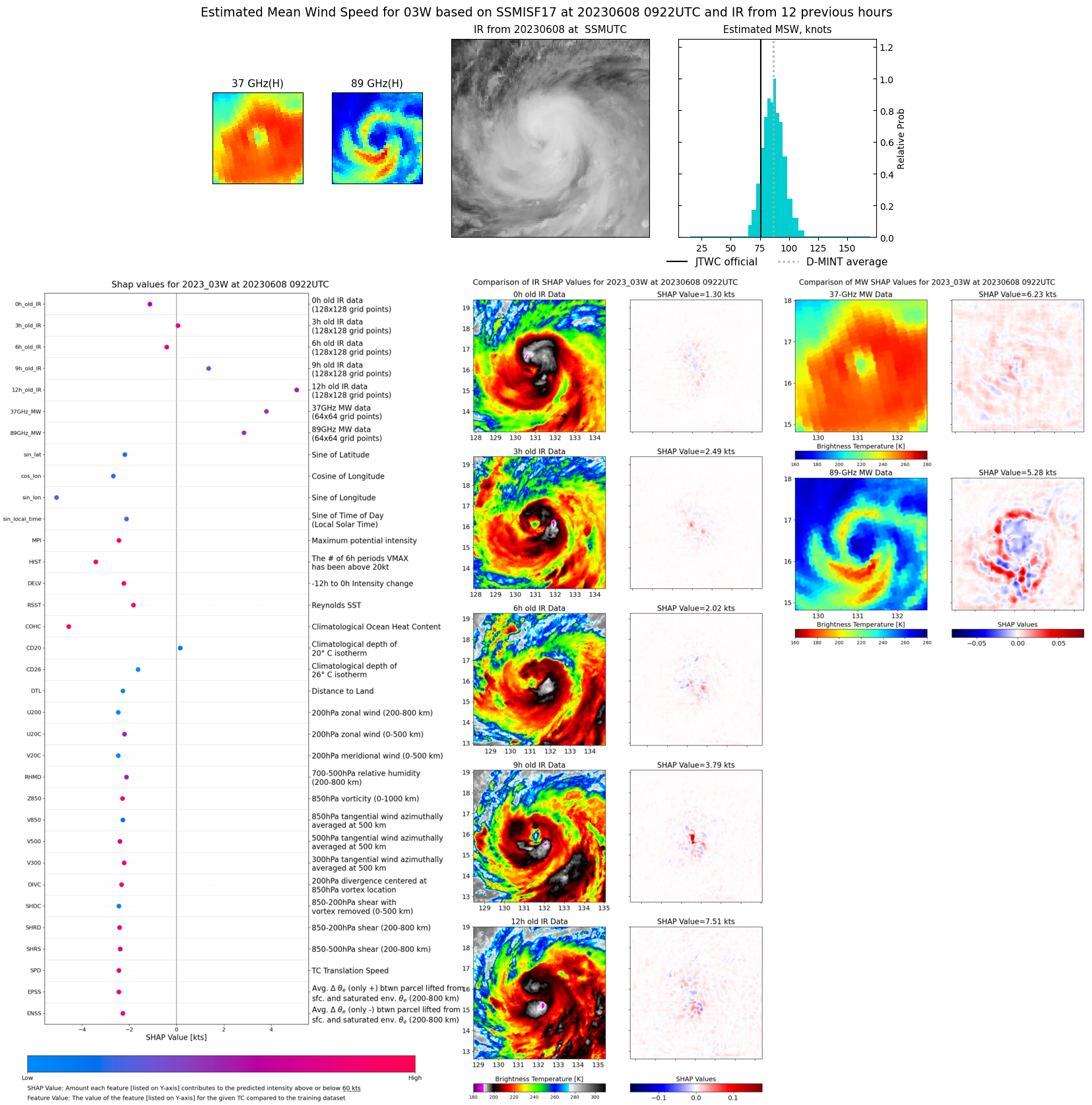 |
| 20230608 | 0849 UTC | SSMISF16 | NaN hPa | 97 kts | 89 kts | 104 kts | 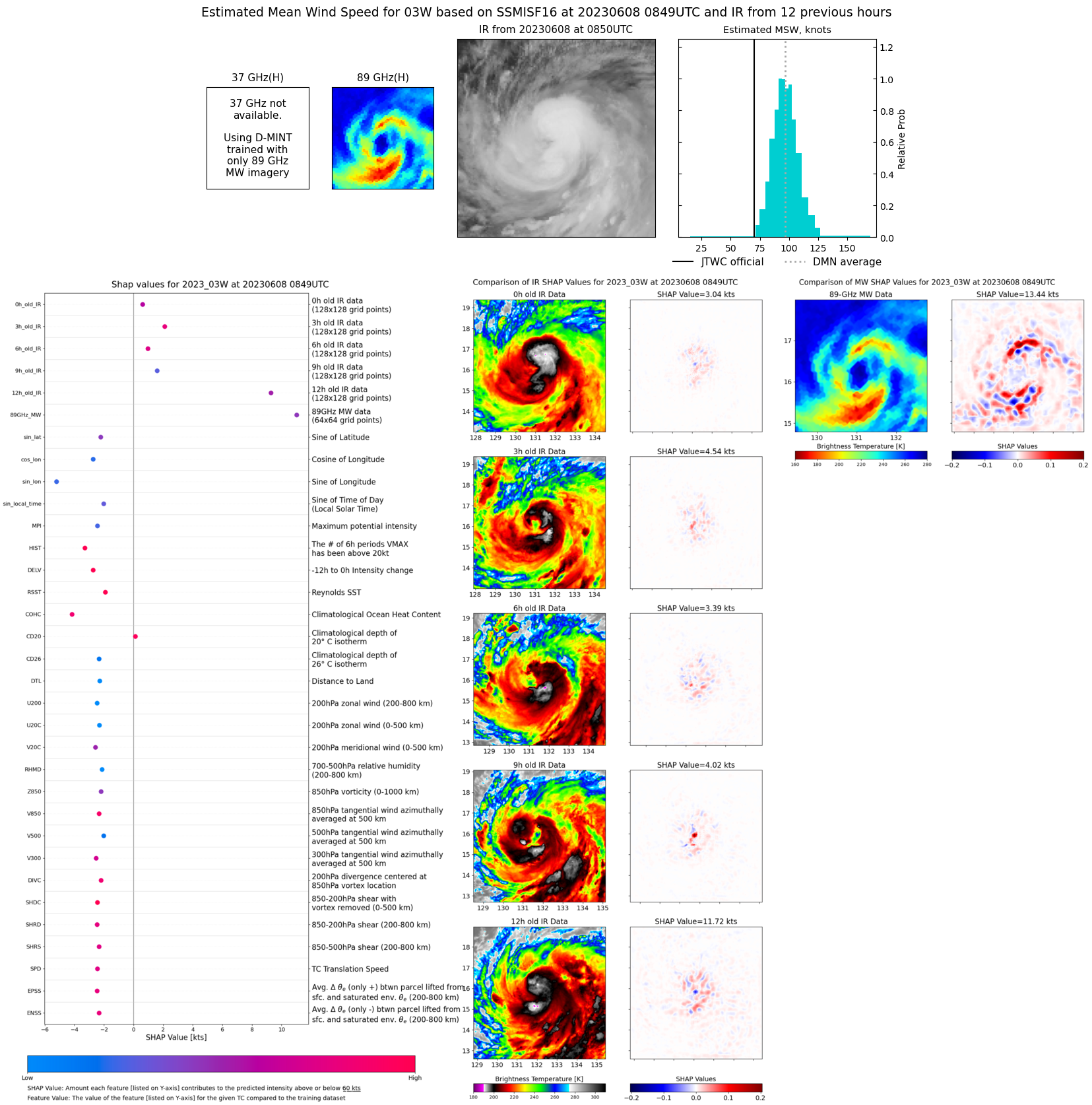 |
| 20230608 | 0653 UTC | SSMISF18 | NaN hPa | 75 kts | 70 kts | 81 kts | 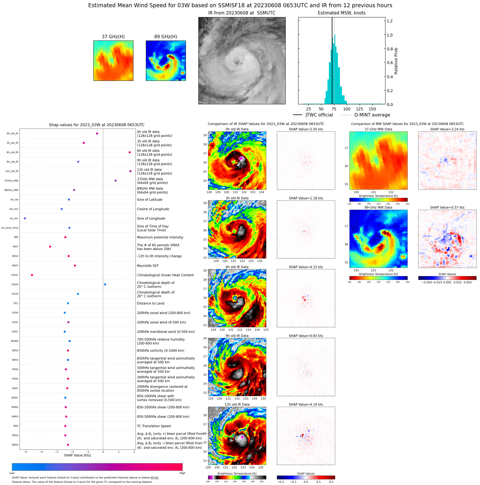 |
| 20230608 | 0445 UTC | AMSR2 | NaN hPa | 71 kts | 66 kts | 77 kts |  |
| 20230608 | 0211 UTC | GMI | NaN hPa | 77 kts | 71 kts | 83 kts | 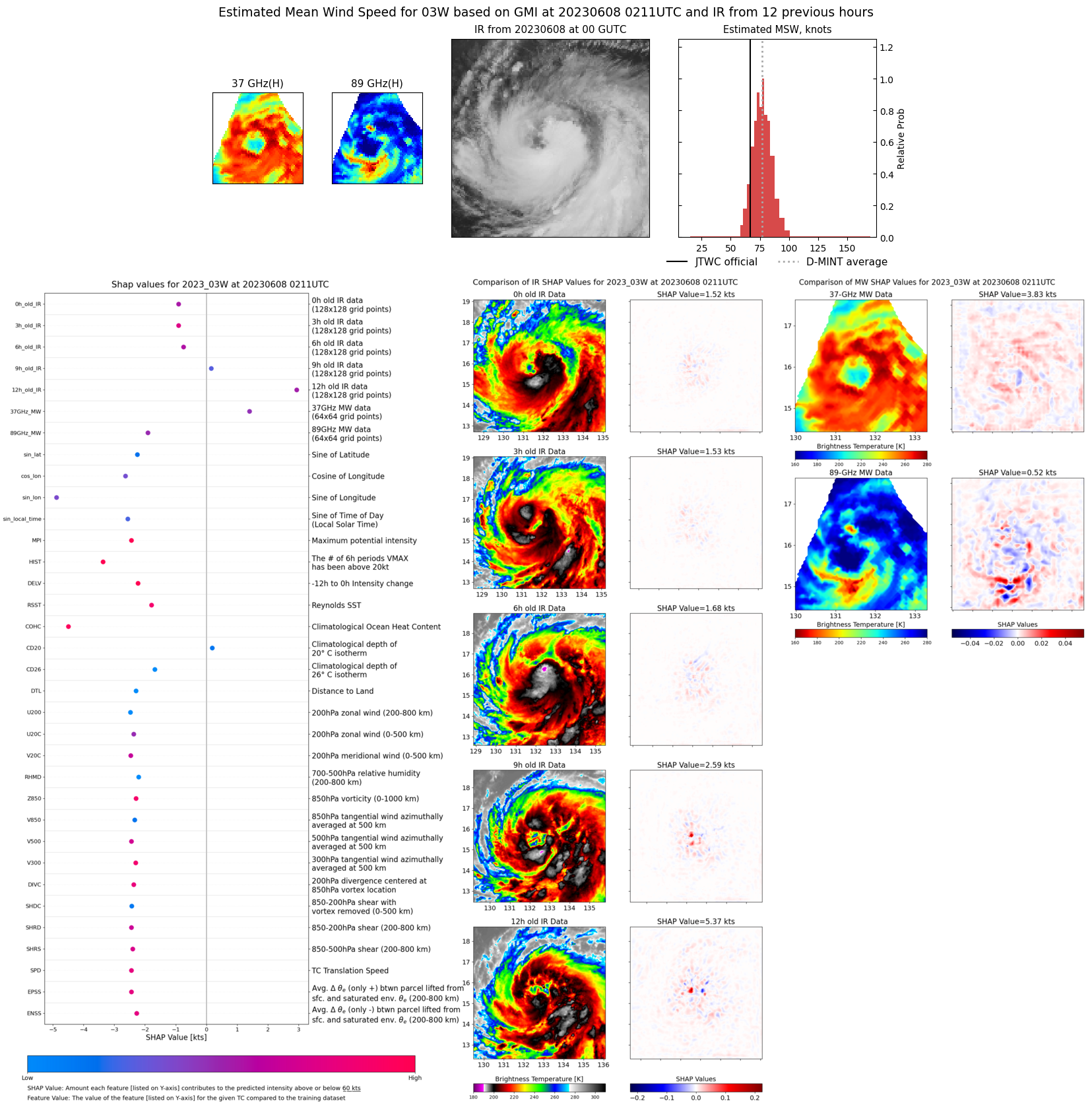 |
| 20230607 | 2211 UTC | SSMISF17 | NaN hPa | 63 kts | 57 kts | 69 kts | 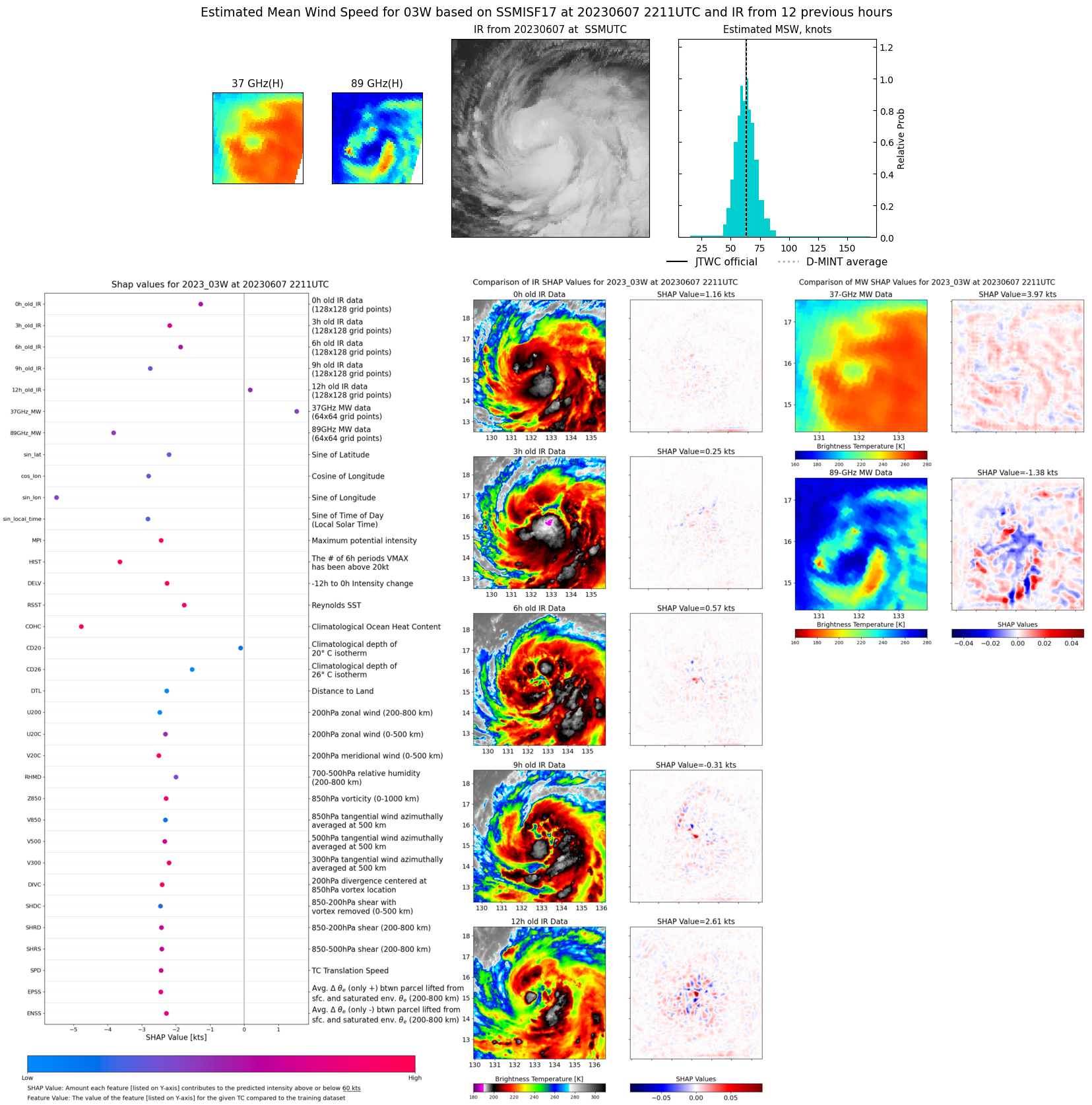 |
| 20230607 | 1942 UTC | SSMISF18 | NaN hPa | 61 kts | 55 kts | 67 kts | 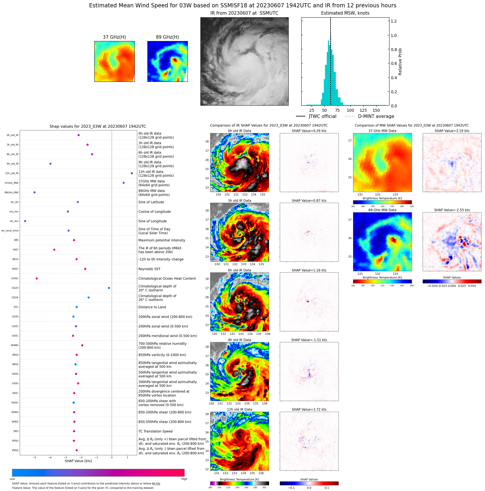 |
| 20230607 | 0936 UTC | SSMISF17 | NaN hPa | 50 kts | 45 kts | 56 kts | 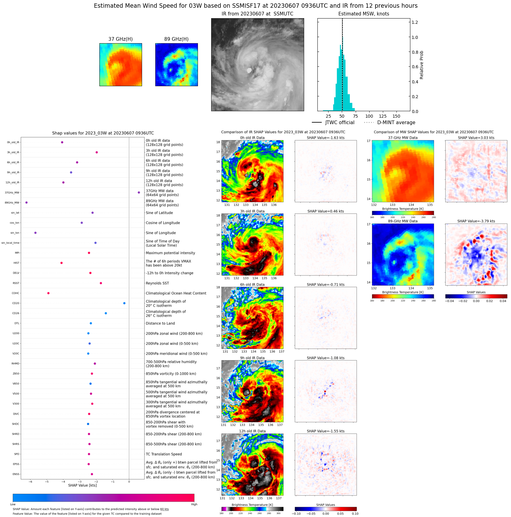 |
| 20230607 | 0706 UTC | SSMISF18 | NaN hPa | 52 kts | 46 kts | 57 kts | 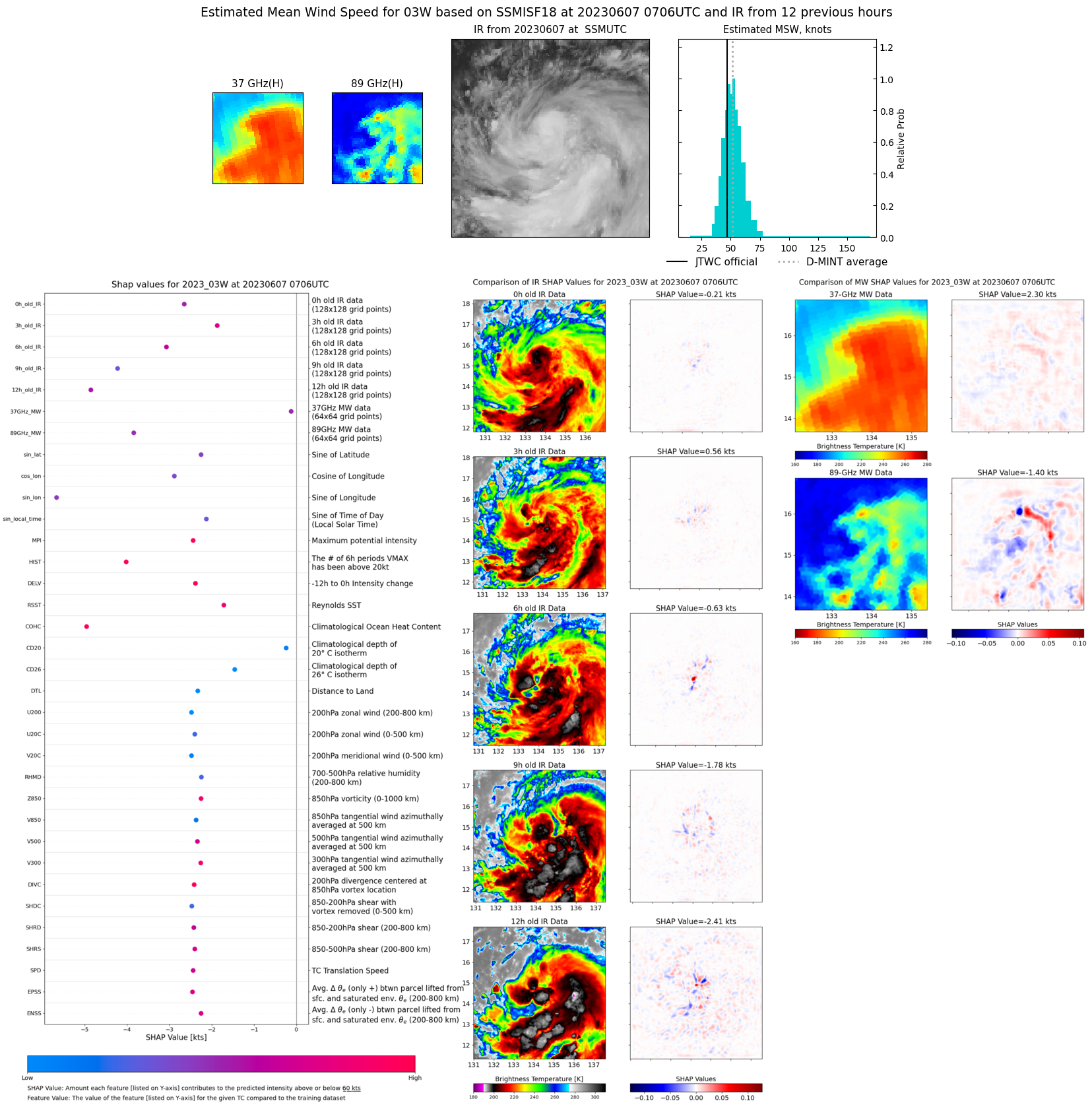 |
| 20230607 | 0403 UTC | AMSR2 | NaN hPa | 39 kts | 34 kts | 44 kts | 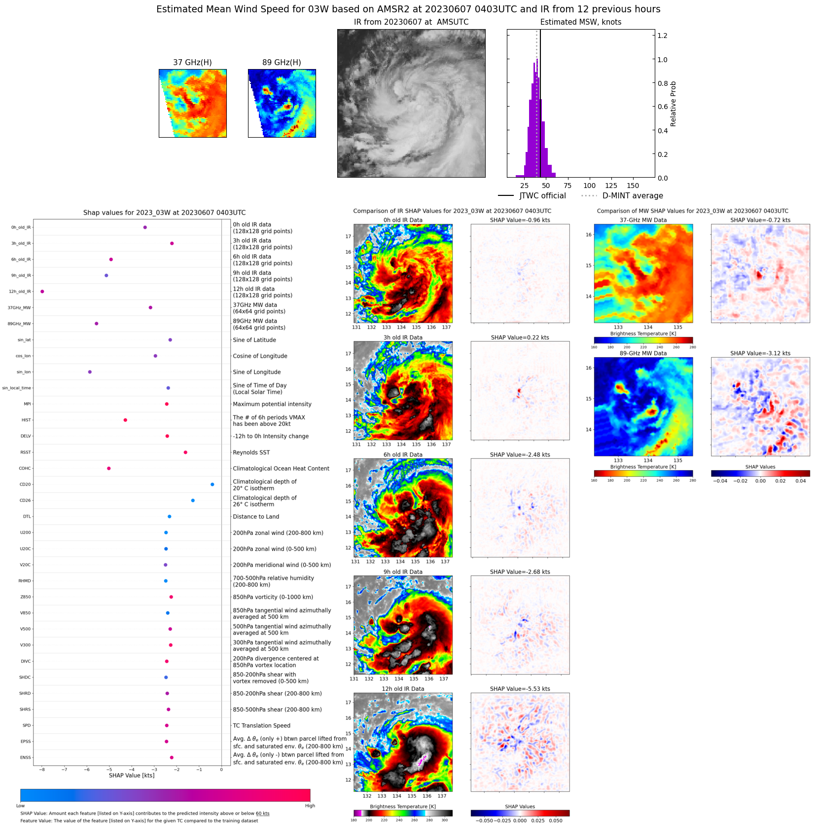 |
| 20230606 | 2010 UTC | SSMISF16 | NaN hPa | 31 kts | 27 kts | 36 kts | 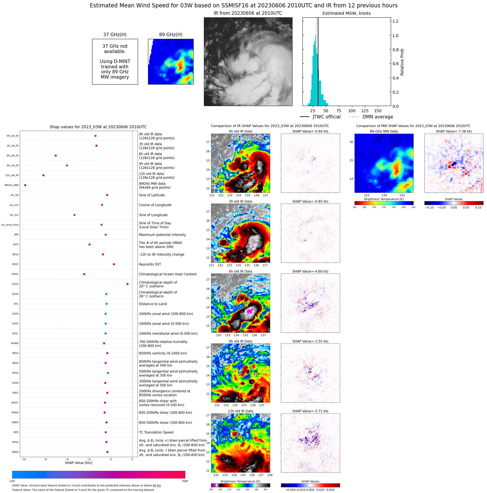 |
| 20230606 | 1712 UTC | AMSR2 | NaN hPa | 35 kts | 32 kts | 39 kts | 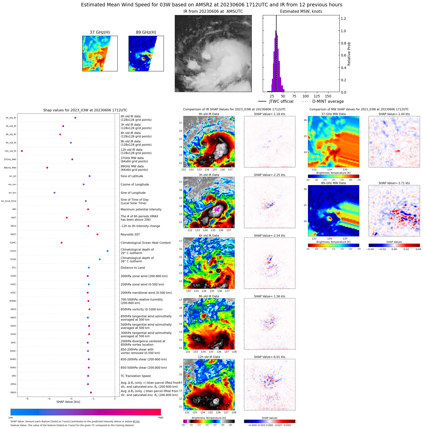 |
| 20230606 | 1346 UTC | GMI | NaN hPa | 29 kts | 26 kts | 31 kts | 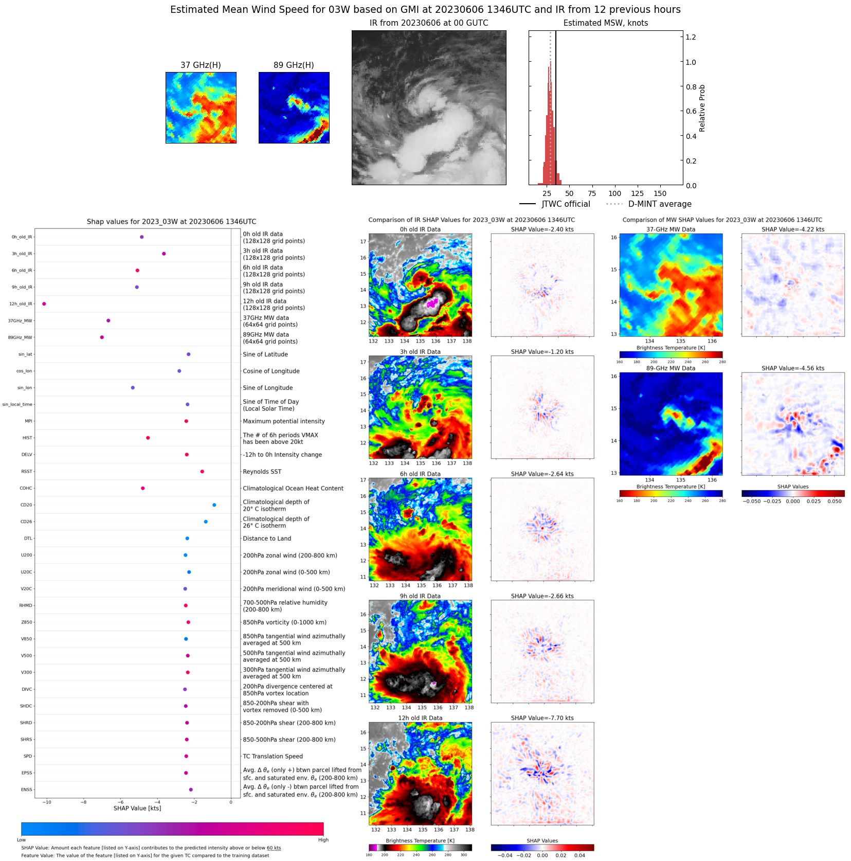 |
| 20230605 | 1628 UTC | AMSR2 | NaN hPa | 23 kts | 22 kts | 24 kts | 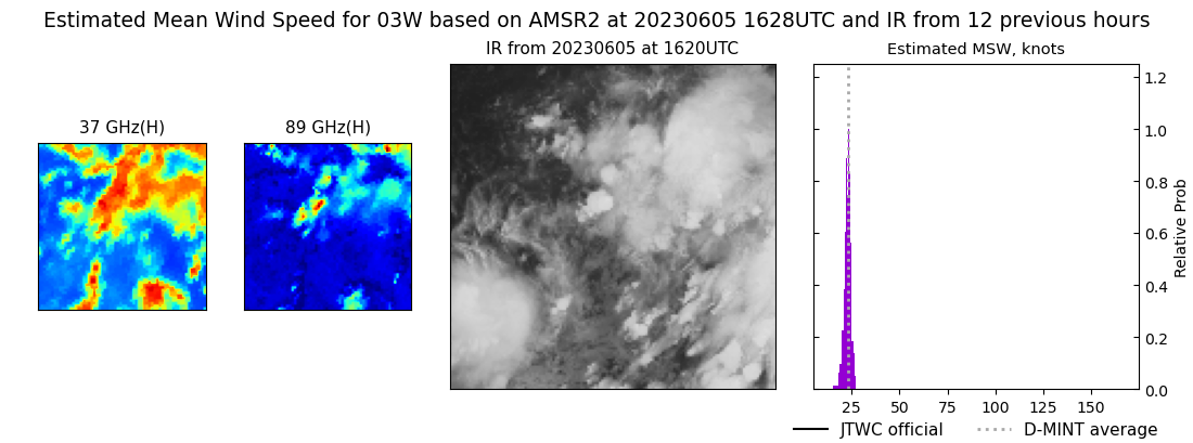 |