|
||

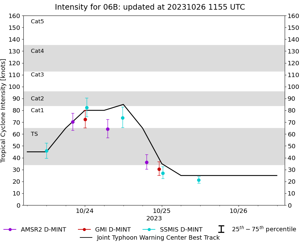 |
D-MINT HISTORY FILE for 2023_06B
| Date | Time | MW Sensor | MSLP | Vmax (30th-70th percentile average) | Vmax 25th percentile | Vmax 75th percentile | Image |
| 20231025 | 1133 UTC | SSMISF17 | 1005 hPa | 21 kts | 19 kts | 24 kts |  |
| 20231025 | 0017 UTC | SSMISF17 | 1006 hPa | 27 kts | 22 kts | 33 kts |  |
| 20231024 | 2306 UTC | GMI | 1004 hPa | 31 kts | 25 kts | 37 kts |  |
| 20231024 | 1914 UTC | AMSR2 | 999 hPa | 36 kts | 30 kts | 43 kts |  |
| 20231024 | 1145 UTC | SSMISF17 | 977 hPa | 74 kts | 66 kts | 83 kts |  |
| 20231024 | 0703 UTC | AMSR2 | 978 hPa | 64 kts | 57 kts | 72 kts |  |
| 20231024 | 0031 UTC | SSMISF17 | 975 hPa | 82 kts | 75 kts | 91 kts |  |
| 20231024 | 0002 UTC | GMI | 990 hPa | 72 kts | 65 kts | 80 kts | 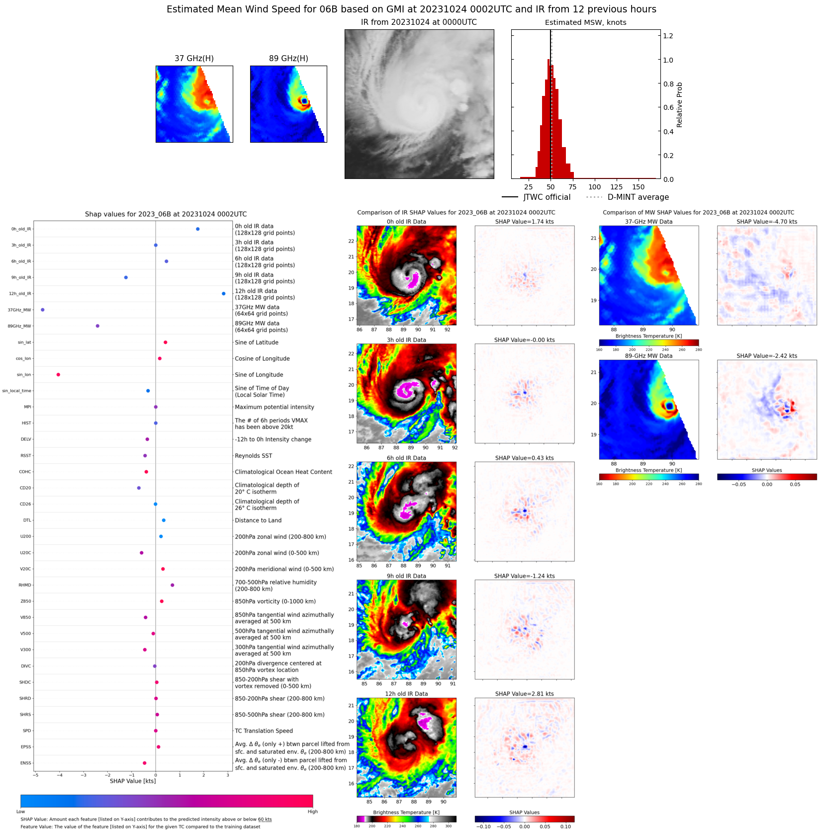 |
| 20231023 | 2009 UTC | AMSR2 | 975 hPa | 70 kts | 63 kts | 78 kts |  |
| 20231023 | 1158 UTC | SSMISF17 | 992 hPa | 46 kts | 40 kts | 52 kts |  |