|
||

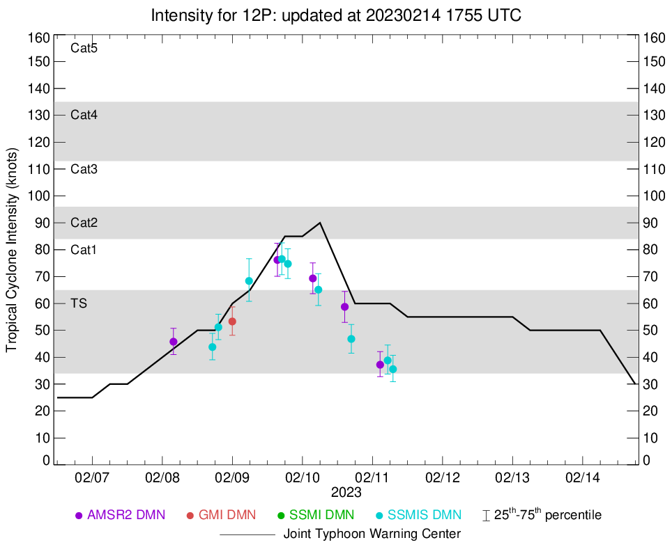 |
D-MINT HISTORY FILE for 2023_12P
| Date | Time | MW Sensor | MSLP | Vmax (30th-70th percentile average) | Vmax 25th percentile | Vmax 75th percentile | Image |
| 20230211 | 0700 UTC | SSMISF17 | NaN hPa | 36 kts | 31 kts | 41 kts | 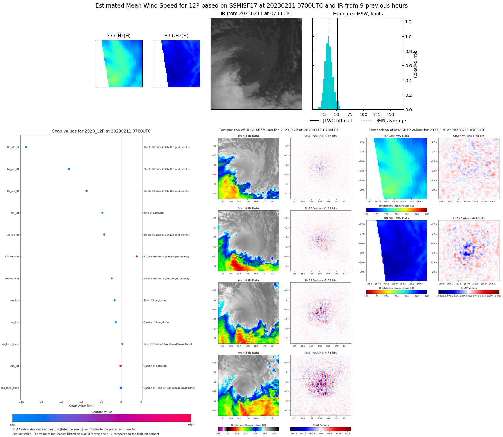 |
| 20230211 | 0511 UTC | SSMISF18 | NaN hPa | 39 kts | 34 kts | 45 kts | 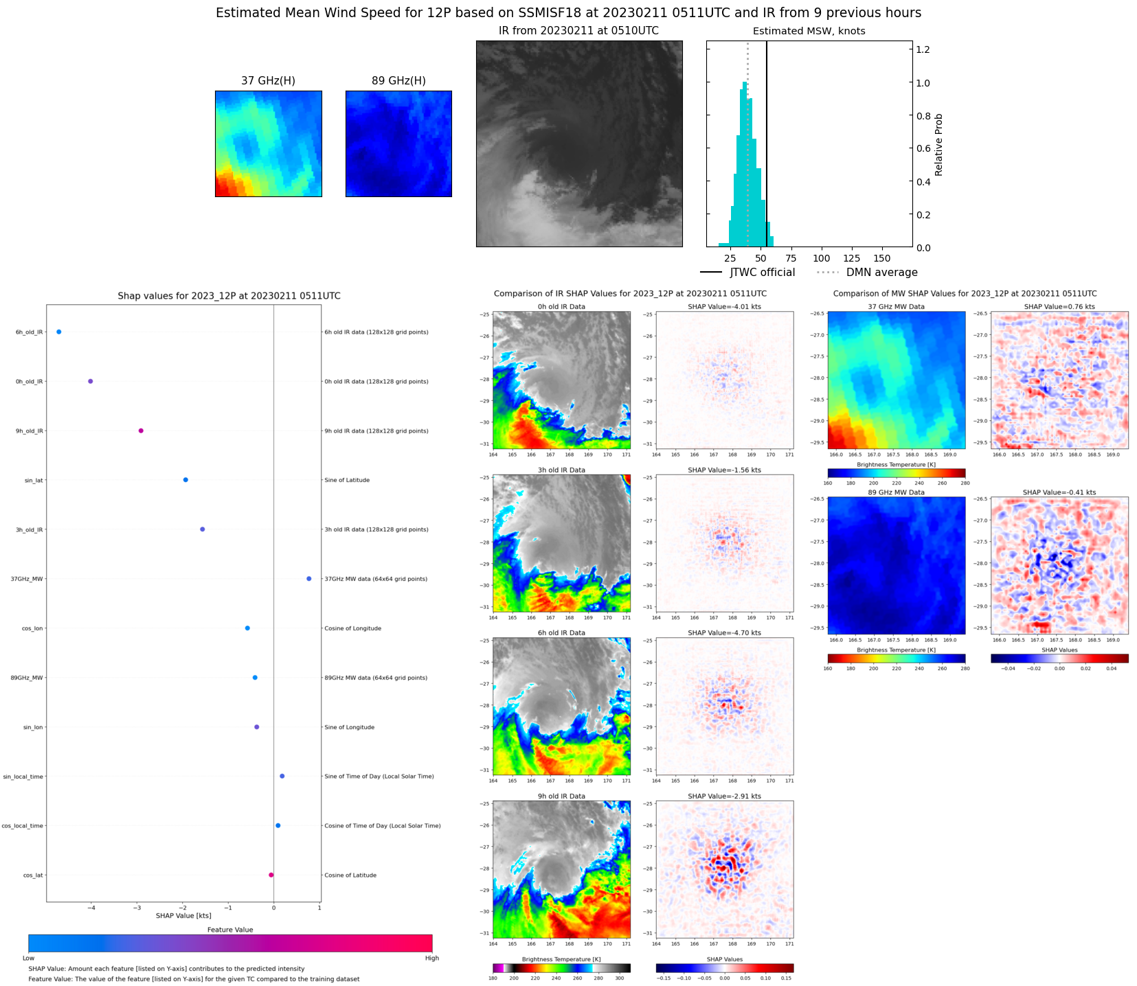 |
| 20230211 | 0236 UTC | AMSR2 | NaN hPa | 37 kts | 33 kts | 42 kts |  |
| 20230210 | 1643 UTC | SSMISF18 | NaN hPa | 47 kts | 41 kts | 52 kts | 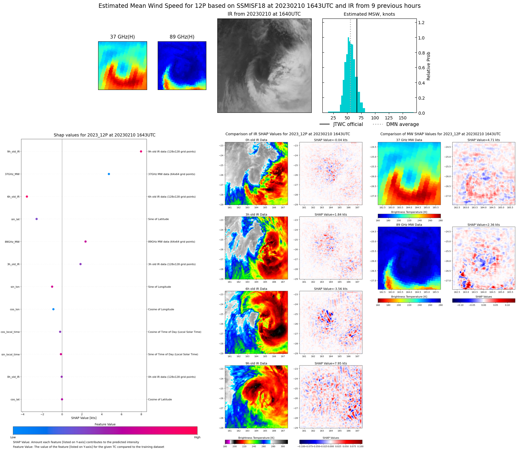 |
| 20230210 | 1429 UTC | AMSR2 | NaN hPa | 59 kts | 53 kts | 65 kts | 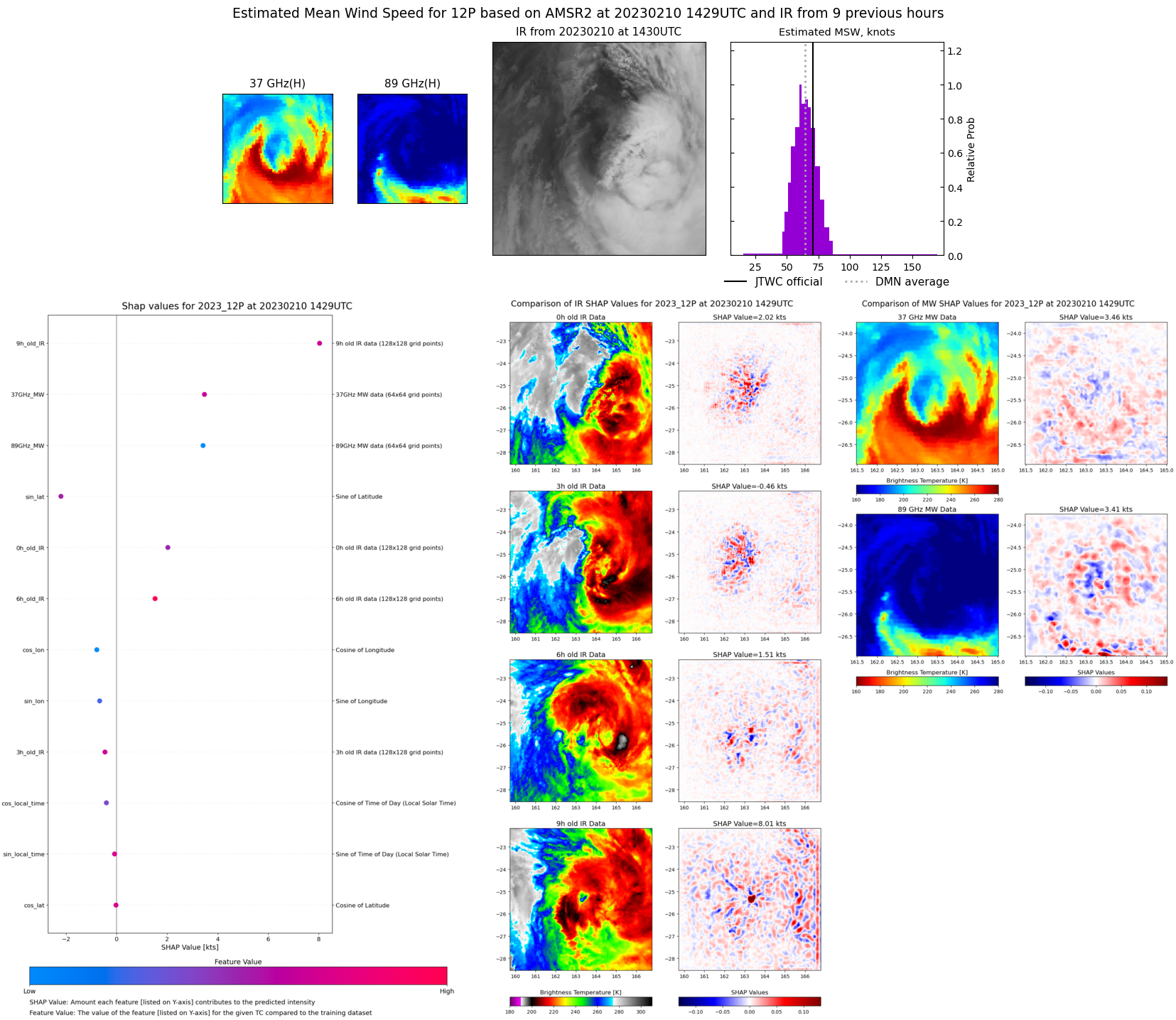 |
| 20230210 | 0526 UTC | SSMISF18 | NaN hPa | 65 kts | 59 kts | 71 kts | 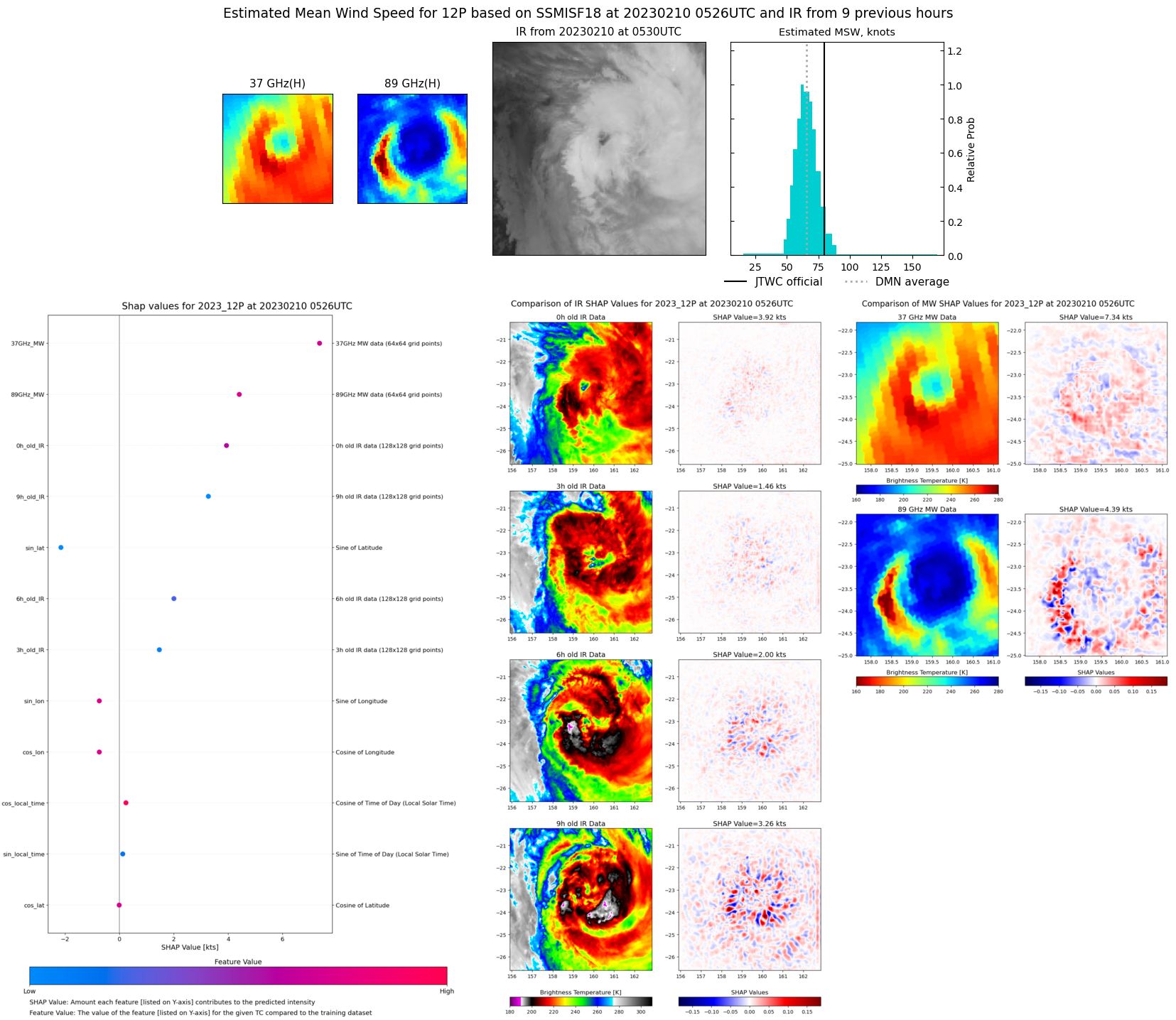 |
| 20230210 | 0333 UTC | AMSR2 | NaN hPa | 69 kts | 64 kts | 75 kts | 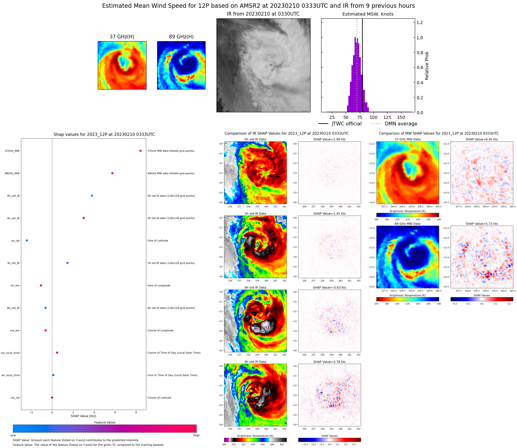 |
| 20230209 | 1859 UTC | SSMISF16 | NaN hPa | 75 kts | 69 kts | 80 kts | 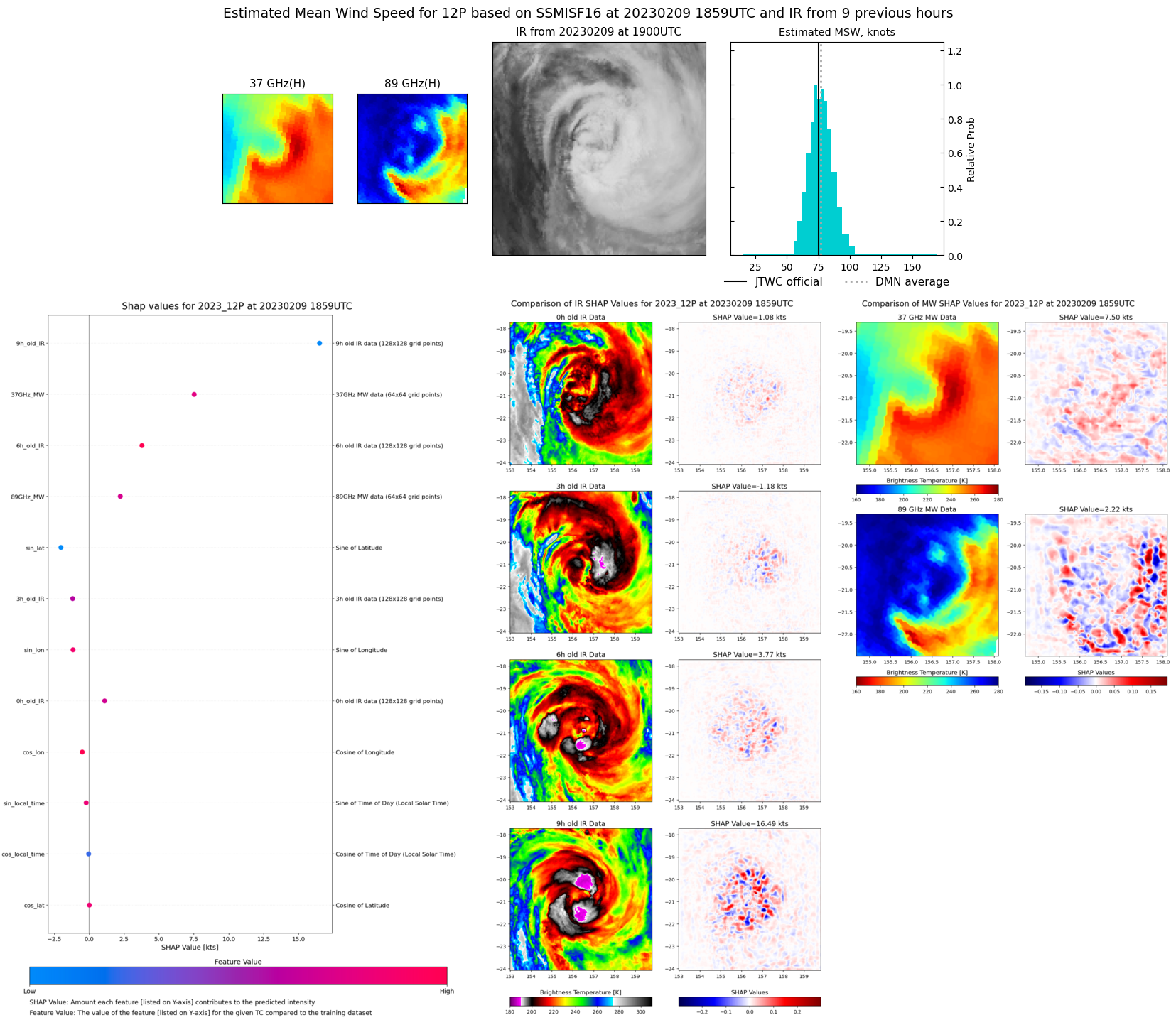 |
| 20230209 | 1655 UTC | SSMISF18 | NaN hPa | 77 kts | 71 kts | 83 kts | 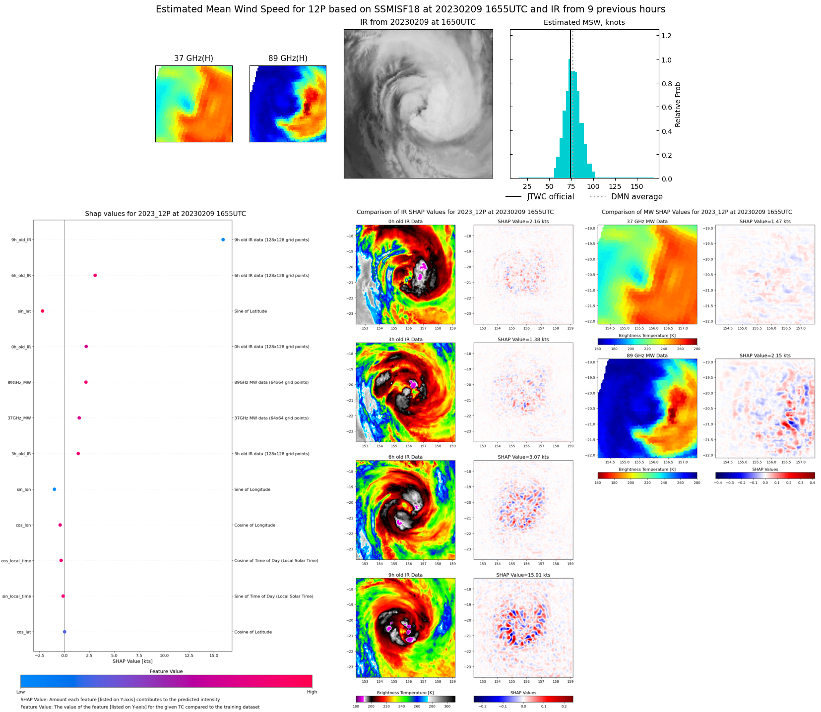 |
| 20230209 | 1524 UTC | AMSR2 | NaN hPa | 76 kts | 70 kts | 82 kts | 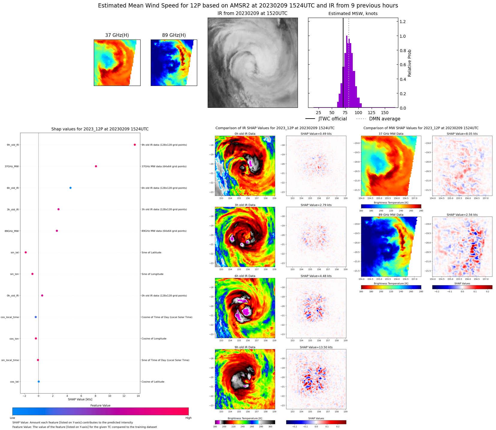 |
| 20230209 | 0541 UTC | SSMISF18 | NaN hPa | 68 kts | 61 kts | 77 kts | 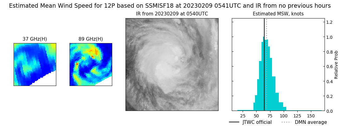 |
| 20230208 | 2357 UTC | GMI | NaN hPa | 53 kts | 48 kts | 59 kts | 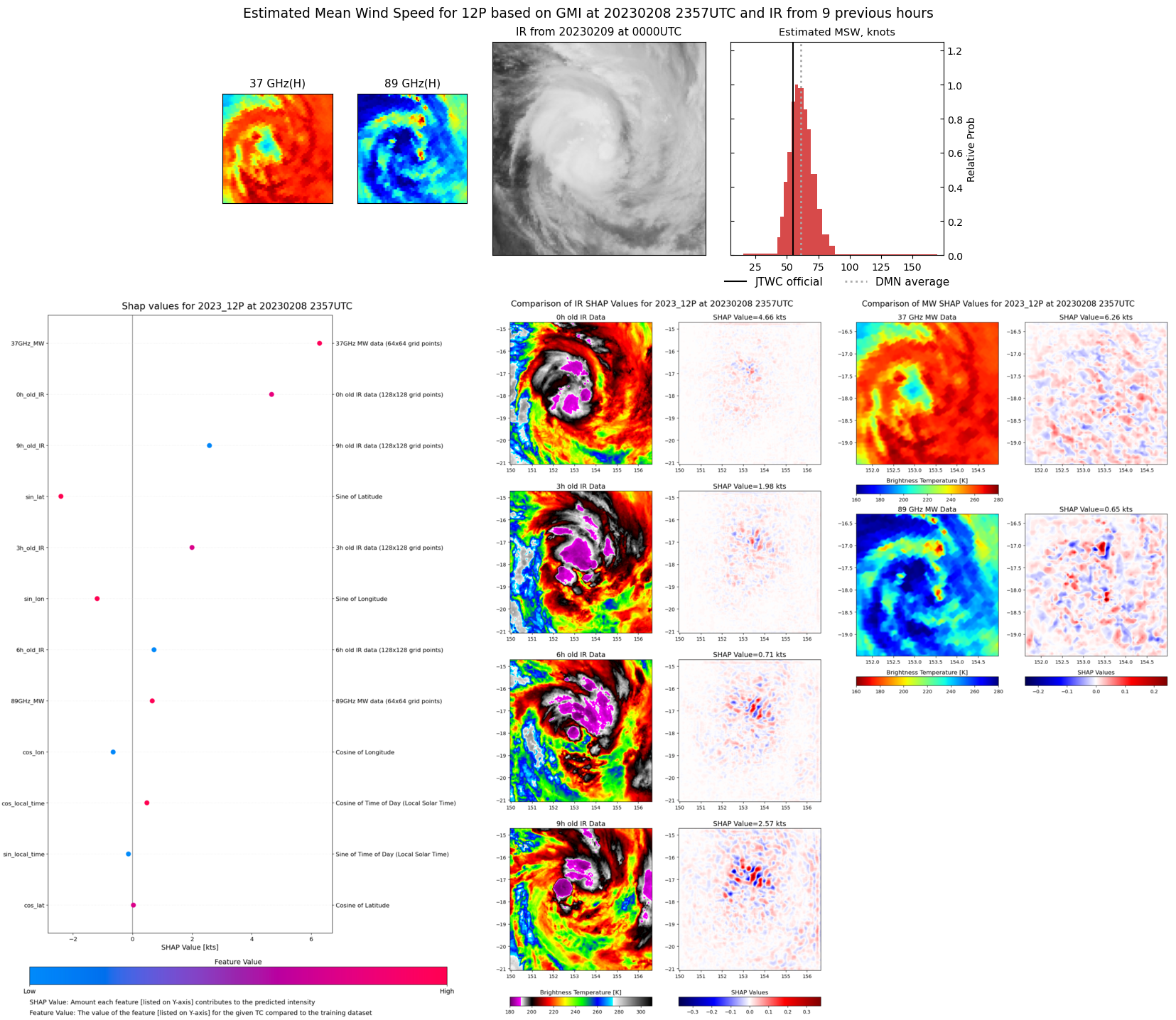 |
| 20230208 | 1911 UTC | SSMISF16 | NaN hPa | 51 kts | 47 kts | 56 kts |  |
| 20230208 | 1708 UTC | SSMISF18 | NaN hPa | 44 kts | 39 kts | 49 kts | 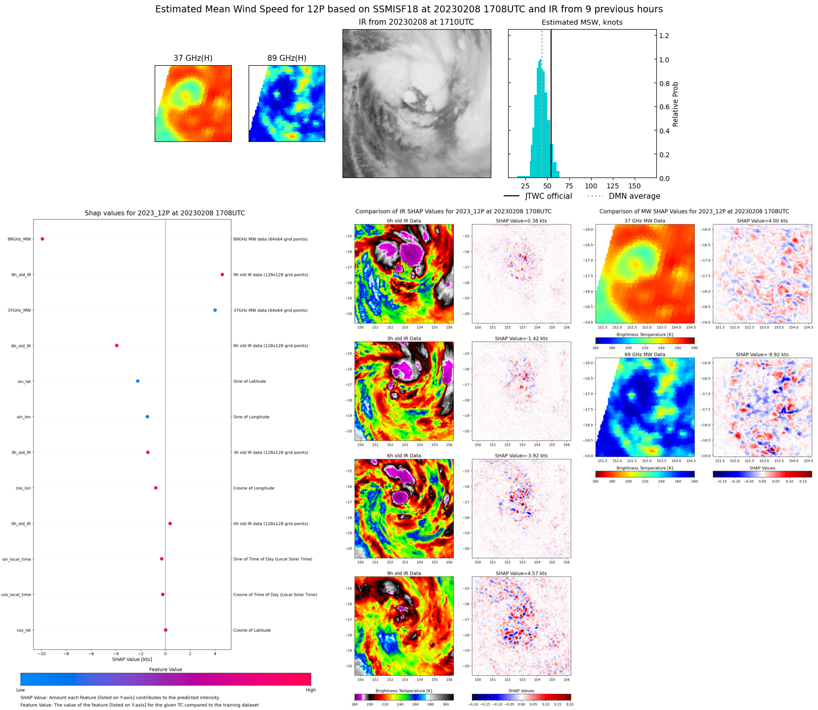 |
| 20230208 | 0348 UTC | AMSR2 | NaN hPa | 46 kts | 41 kts | 51 kts | 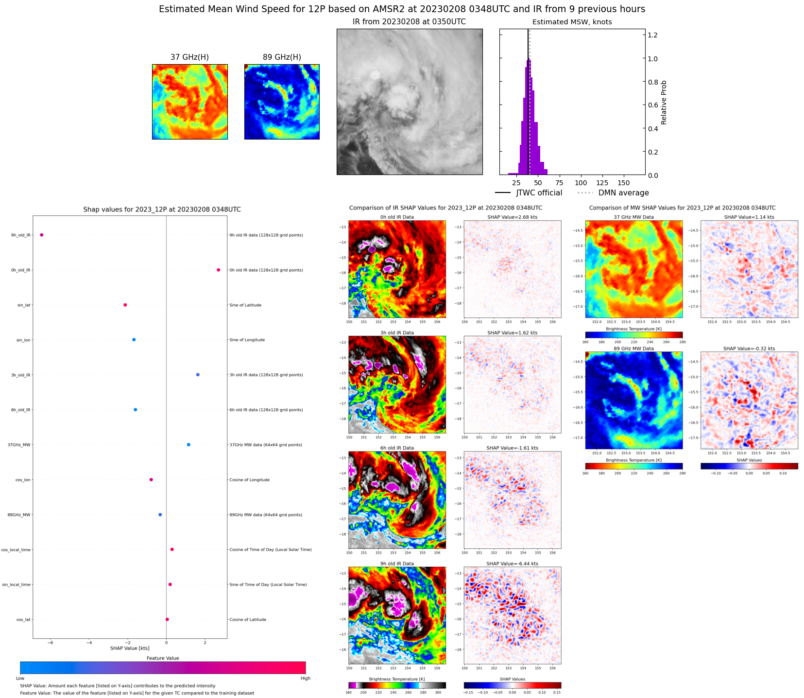 |