|
||

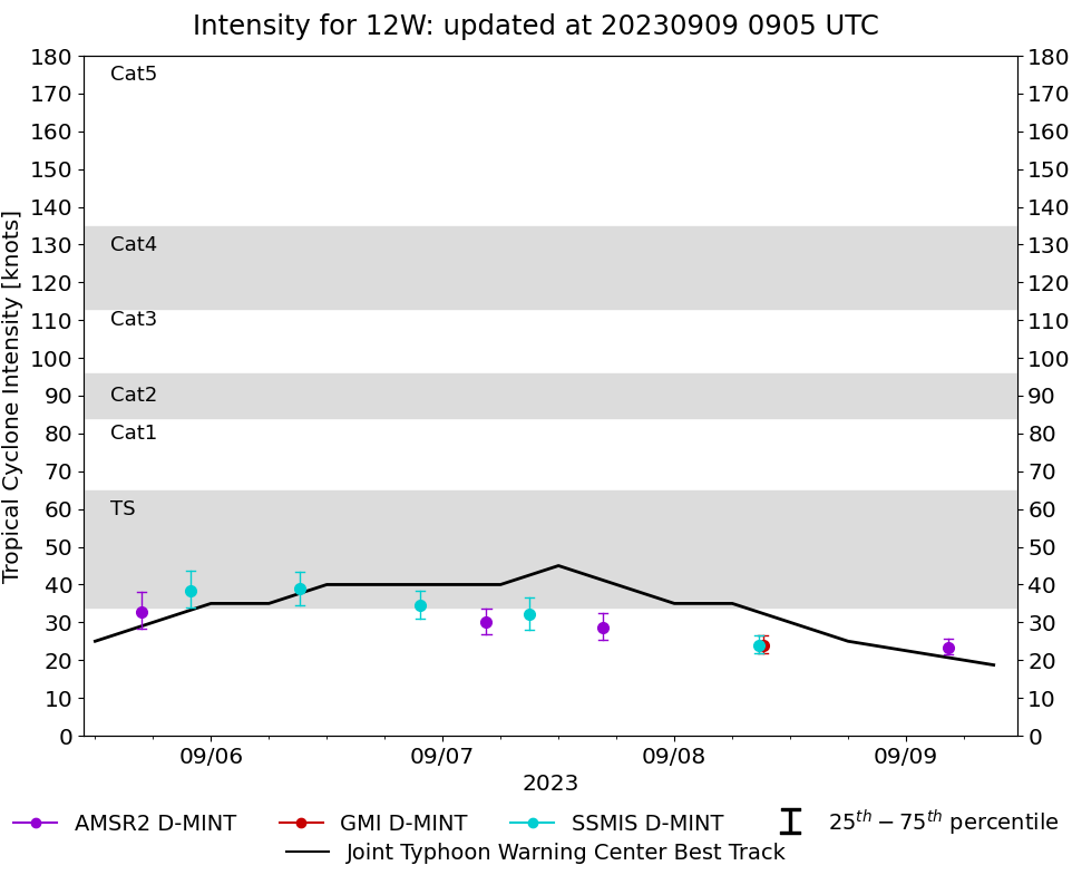 |
D-MINT HISTORY FILE for 2023_12W
| Date | Time | MW Sensor | MSLP | Vmax (30th-70th percentile average) | Vmax 25th percentile | Vmax 75th percentile | Image |
| 20230909 | 0421 UTC | AMSR2 | 1003 hPa | 23 kts | 22 kts | 26 kts | 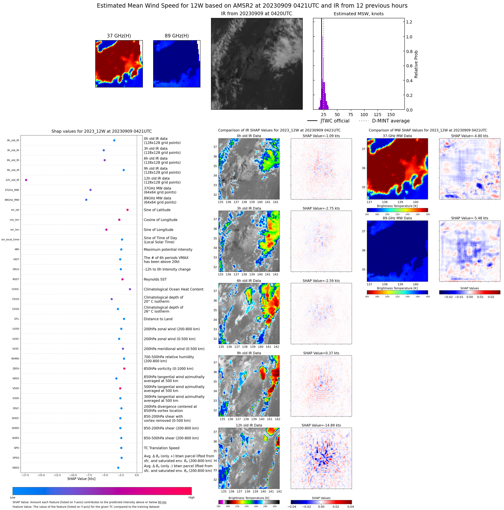 |
| 20230908 | 0911 UTC | GMI | 1003 hPa | 24 kts | 22 kts | 27 kts | 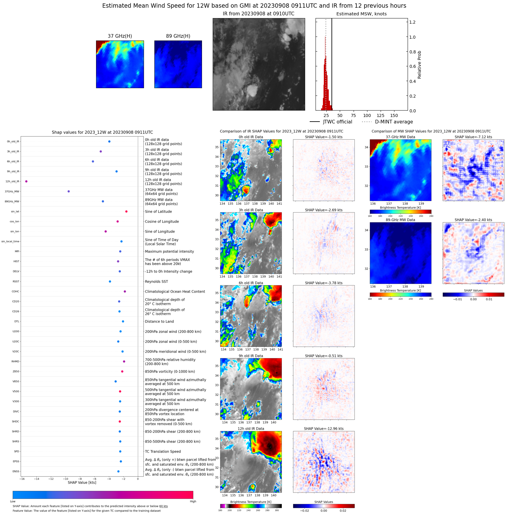 |
| 20230908 | 0846 UTC | SSMISF17 | 1003 hPa | 24 kts | 22 kts | 27 kts | 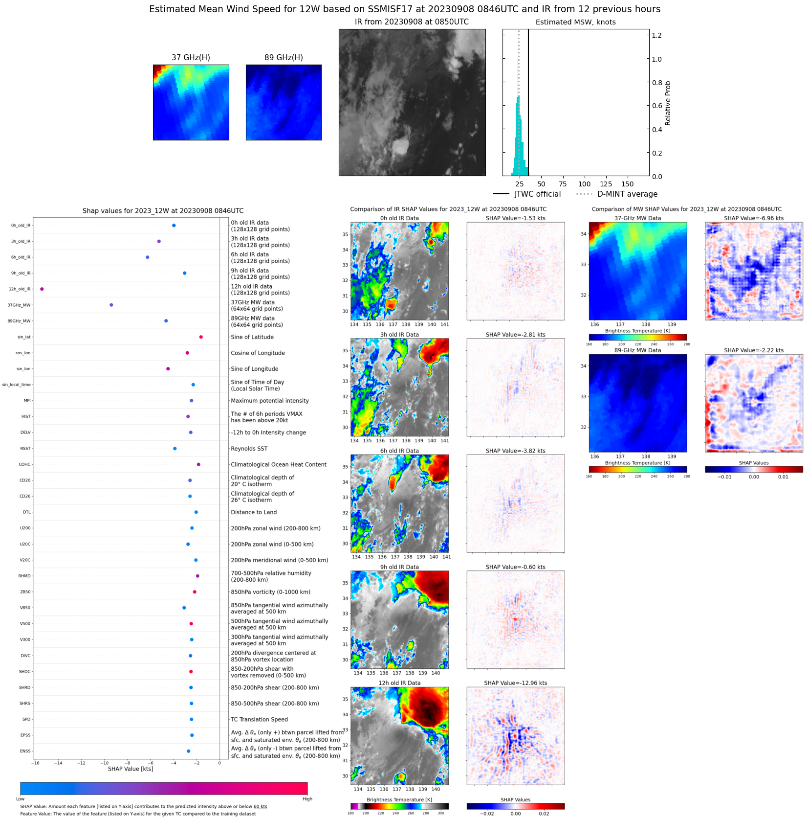 |
| 20230907 | 1635 UTC | AMSR2 | 1001 hPa | 29 kts | 25 kts | 33 kts | 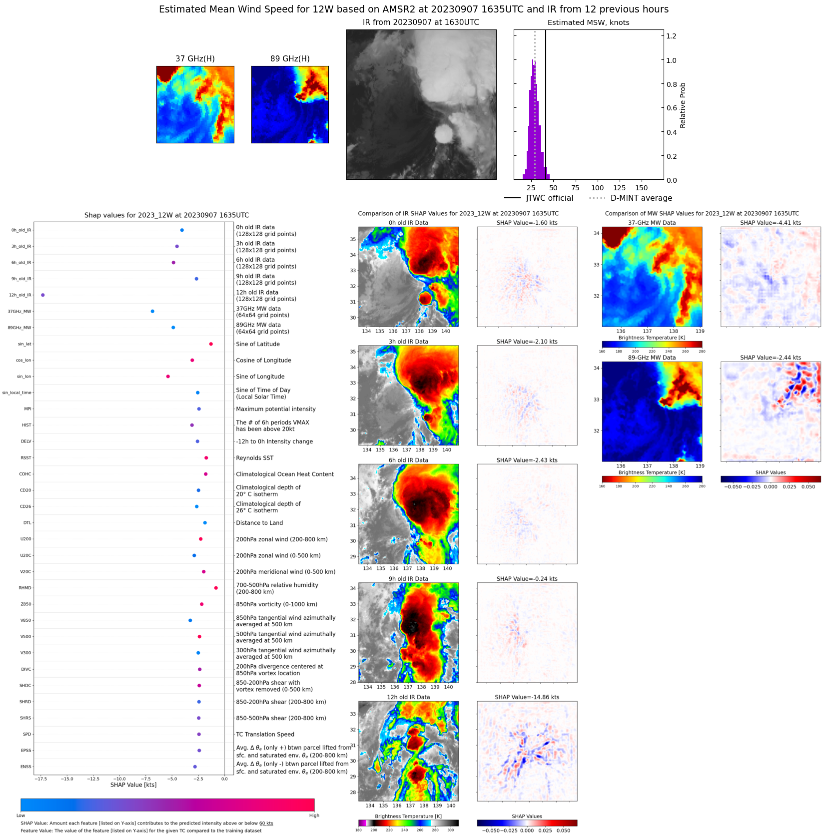 |
| 20230907 | 0859 UTC | SSMISF17 | 999 hPa | 32 kts | 28 kts | 37 kts | 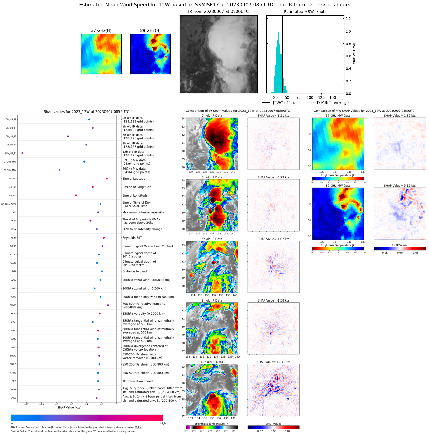 |
| 20230907 | 0431 UTC | AMSR2 | 1001 hPa | 30 kts | 27 kts | 34 kts | 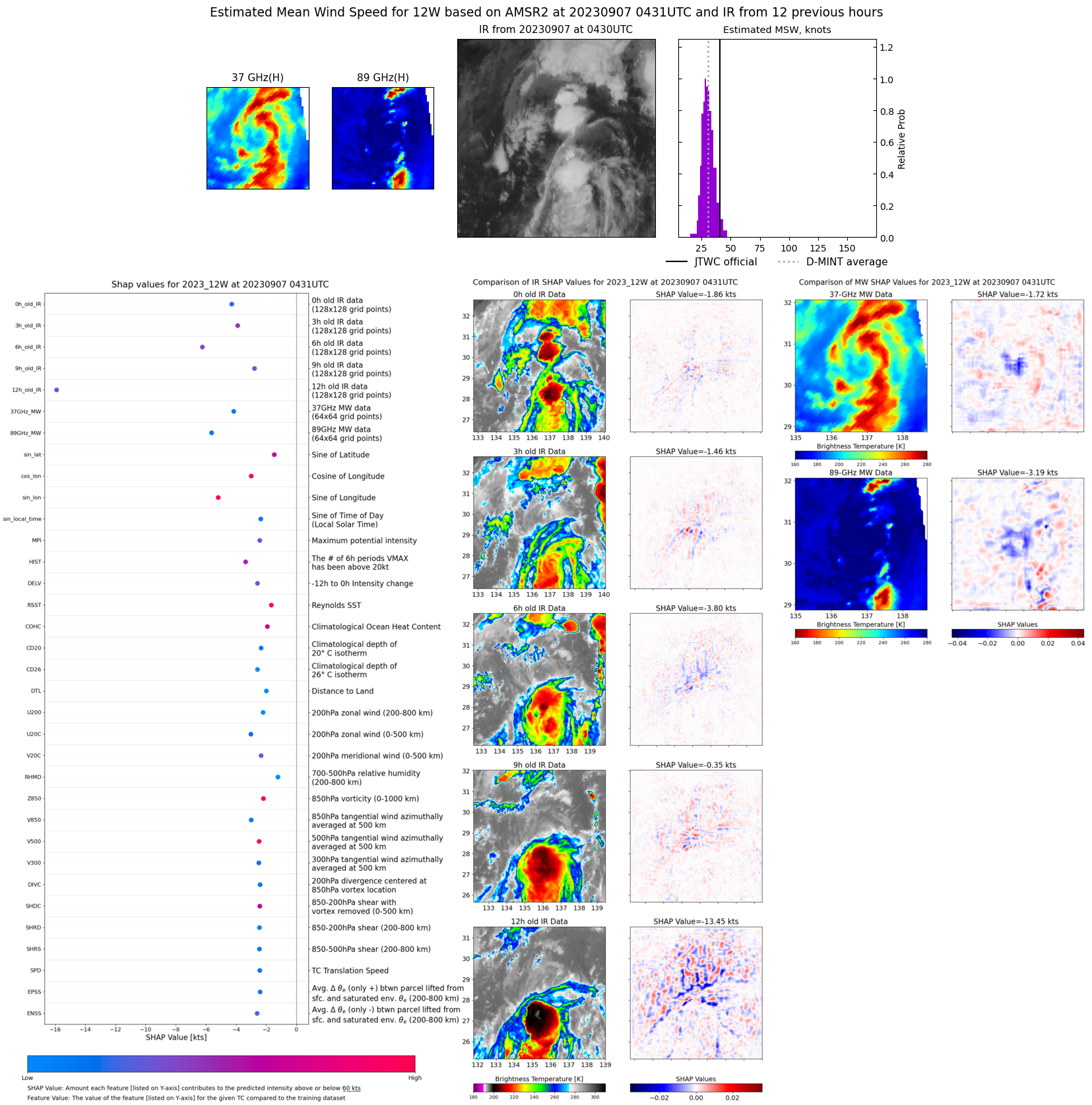 |
| 20230906 | 2140 UTC | SSMISF17 | 997 hPa | 35 kts | 31 kts | 38 kts | 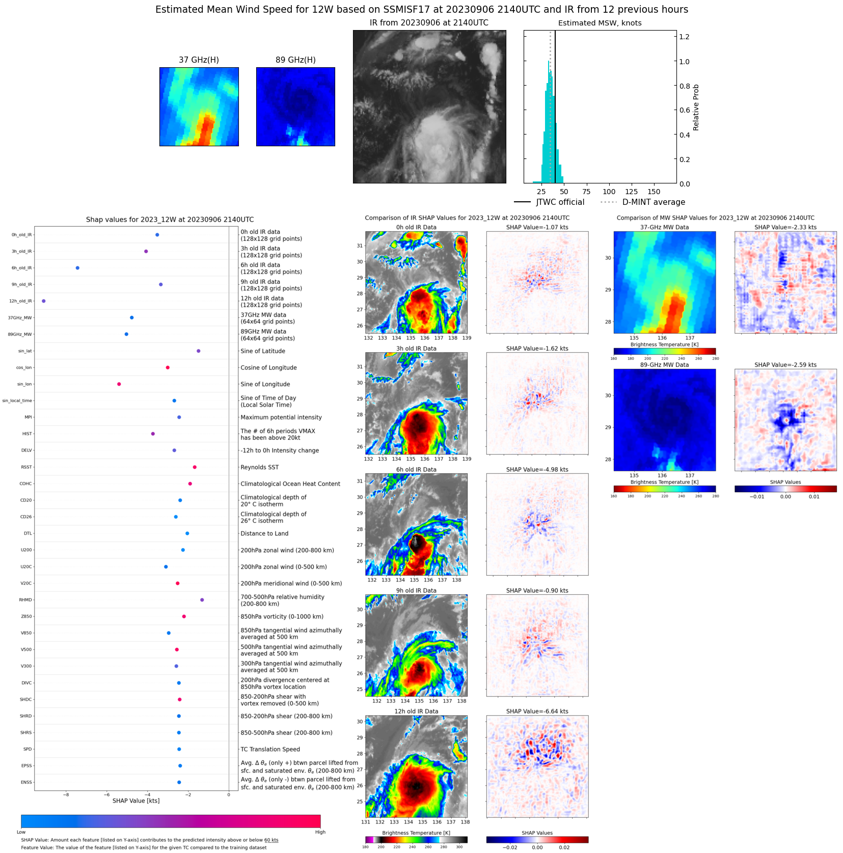 |
| 20230906 | 0912 UTC | SSMISF17 | 995 hPa | 39 kts | 35 kts | 43 kts | 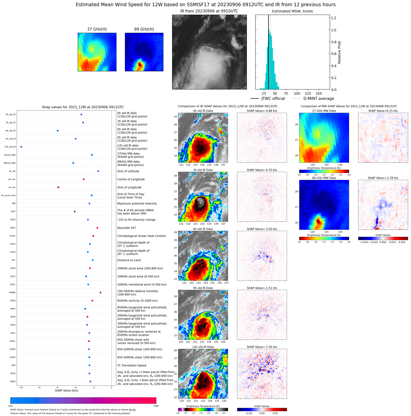 |
| 20230905 | 2155 UTC | SSMISF17 | 997 hPa | 38 kts | 34 kts | 44 kts | 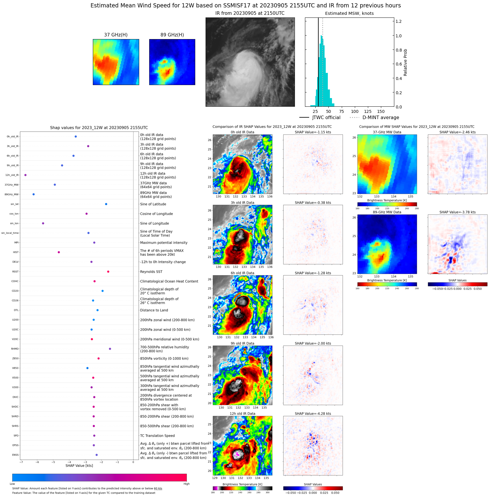 |
| 20230905 | 1650 UTC | AMSR2 | 1000 hPa | 33 kts | 28 kts | 38 kts |  |