|
||

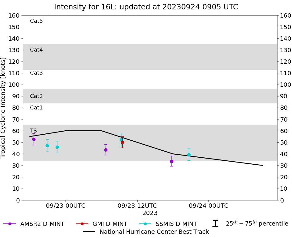 |
D-MINT HISTORY FILE for 2023_16L
| Date | Time | MW Sensor | MSLP | Vmax (30th-70th percentile average) | Vmax 25th percentile | Vmax 75th percentile | Image |
| 20230923 | 2041 UTC | SSMISF18 | 994 hPa | 39 kts | 34 kts | 45 kts |  |
| 20230923 | 1745 UTC | AMSR2 | 995 hPa | 34 kts | 29 kts | 38 kts |  |
| 20230923 | 0931 UTC | GMI | 997 hPa | 50 kts | 45 kts | 55 kts |  |
| 20230923 | 0918 UTC | SSMISF18 | 996 hPa | 52 kts | 47 kts | 57 kts |  |
| 20230923 | 0642 UTC | AMSR2 | 994 hPa | 44 kts | 39 kts | 48 kts |  |
| 20230922 | 2234 UTC | SSMISF17 | 995 hPa | 46 kts | 41 kts | 51 kts |  |
| 20230922 | 2053 UTC | SSMISF18 | 996 hPa | 47 kts | 42 kts | 53 kts |  |
| 20230922 | 1839 UTC | AMSR2 | 998 hPa | 53 kts | 48 kts | 58 kts |  |