|
||

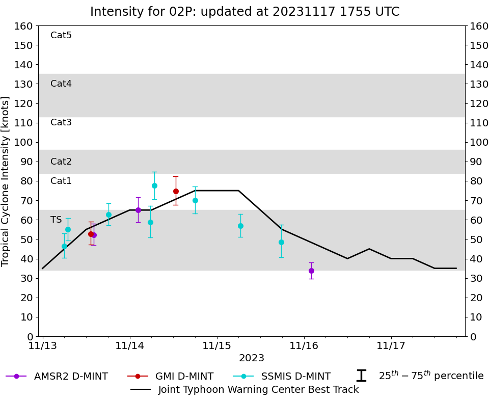 |
D-MINT HISTORY FILE for 2024_02P
| Date | Time | MW Sensor | MSLP | Vmax (30th-70th percentile average) | Vmax 25th percentile | Vmax 75th percentile | Image |
| 20231116 | 0201 UTC | AMSR2 | 1007 hPa | 34 kts | 30 kts | 38 kts | 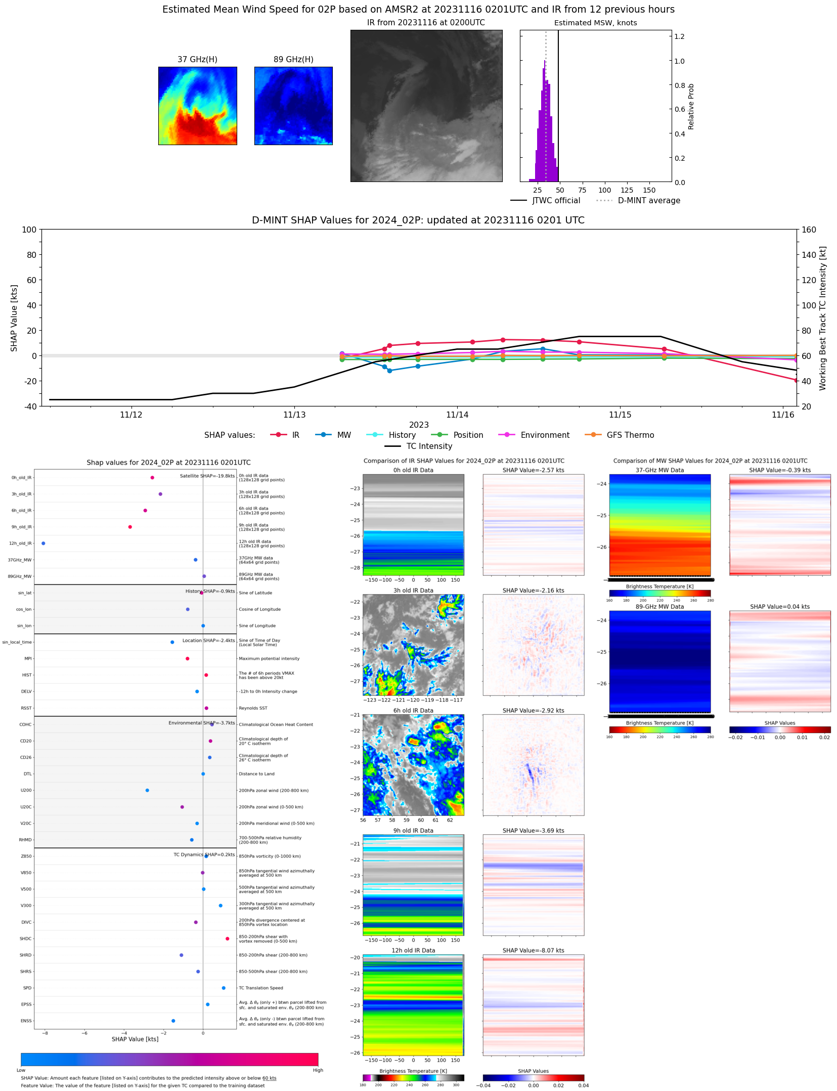 |
| 20231115 | 1745 UTC | SSMISF17 | 995 hPa | 49 kts | 41 kts | 58 kts | 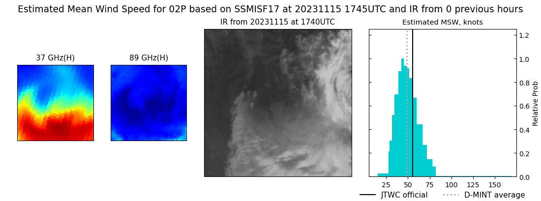 |
| 20231115 | 0630 UTC | SSMISF17 | 985 hPa | 57 kts | 51 kts | 63 kts | 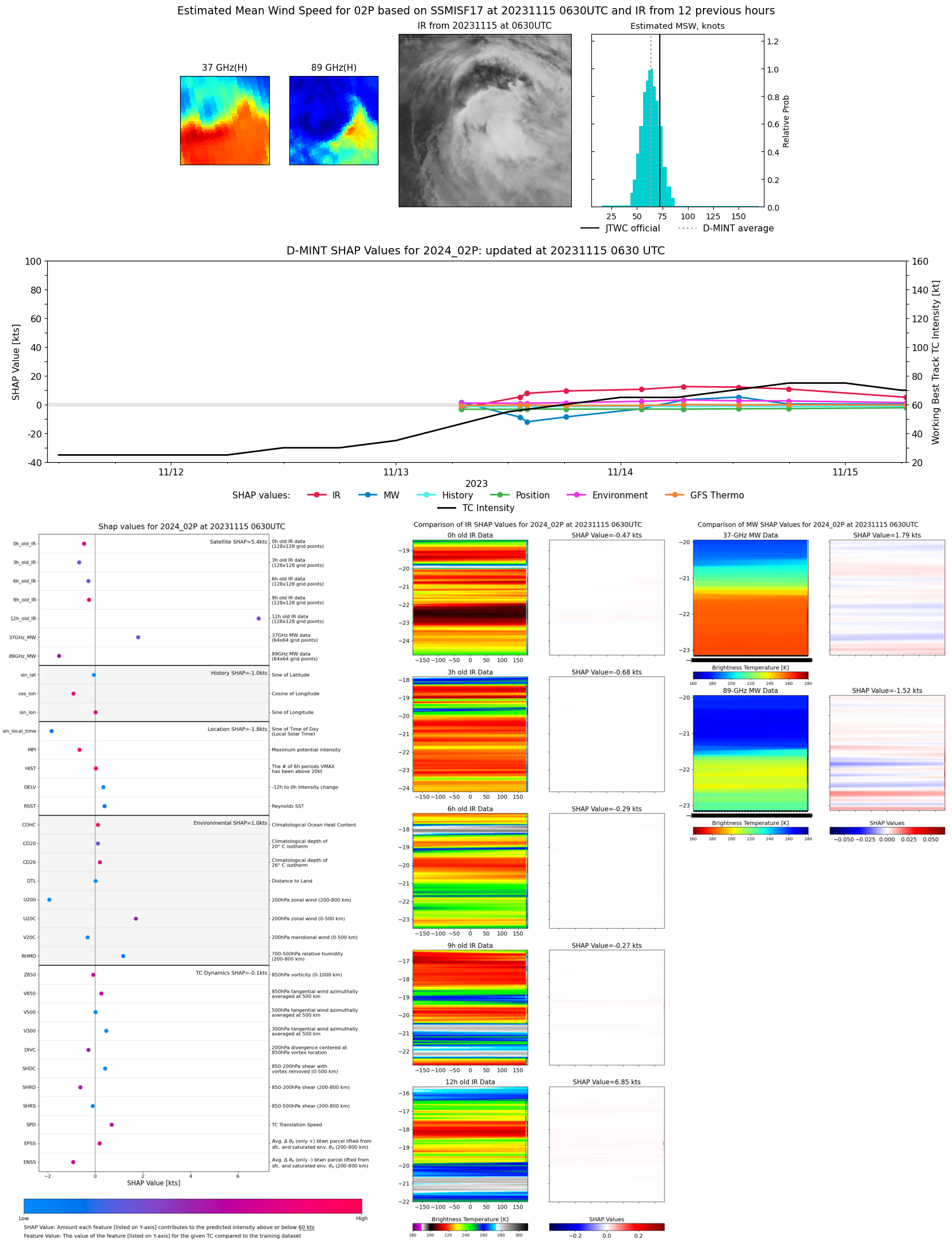 |
| 20231114 | 1757 UTC | SSMISF17 | 974 hPa | 70 kts | 63 kts | 77 kts | 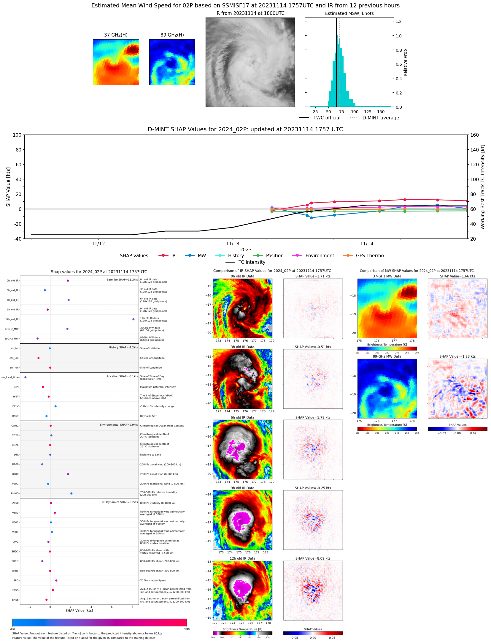 |
| 20231114 | 1238 UTC | GMI | 967 hPa | 75 kts | 68 kts | 82 kts | 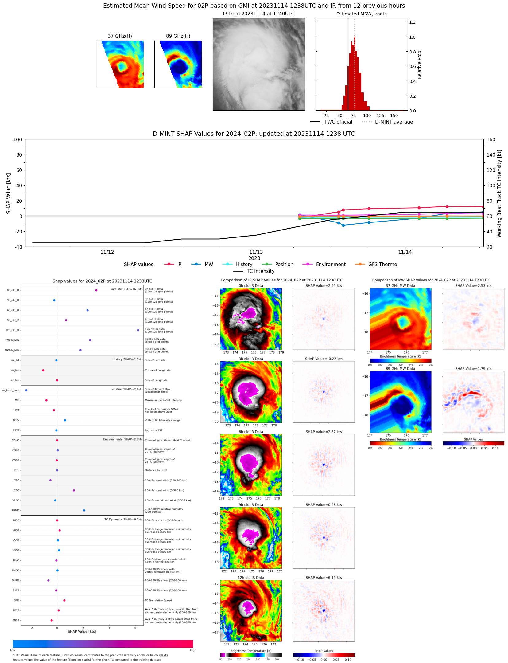 |
| 20231114 | 0645 UTC | SSMISF17 | 971 hPa | 78 kts | 70 kts | 85 kts | 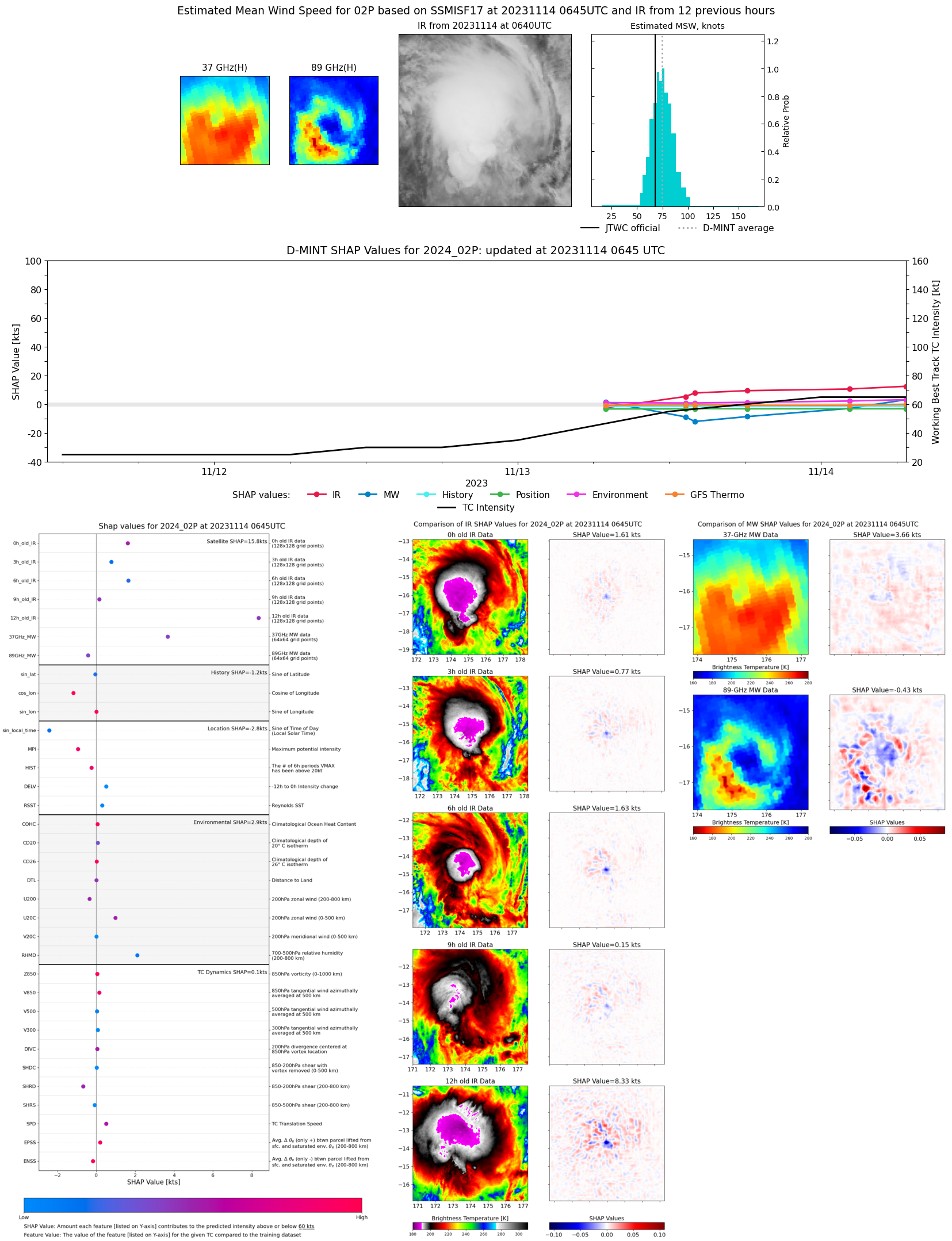 |
| 20231114 | 0541 UTC | SSMISF16 | 985 hPa | 59 kts | 51 kts | 67 kts | 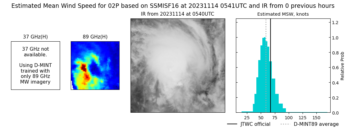 |
| 20231114 | 0216 UTC | AMSR2 | 985 hPa | 65 kts | 59 kts | 72 kts | 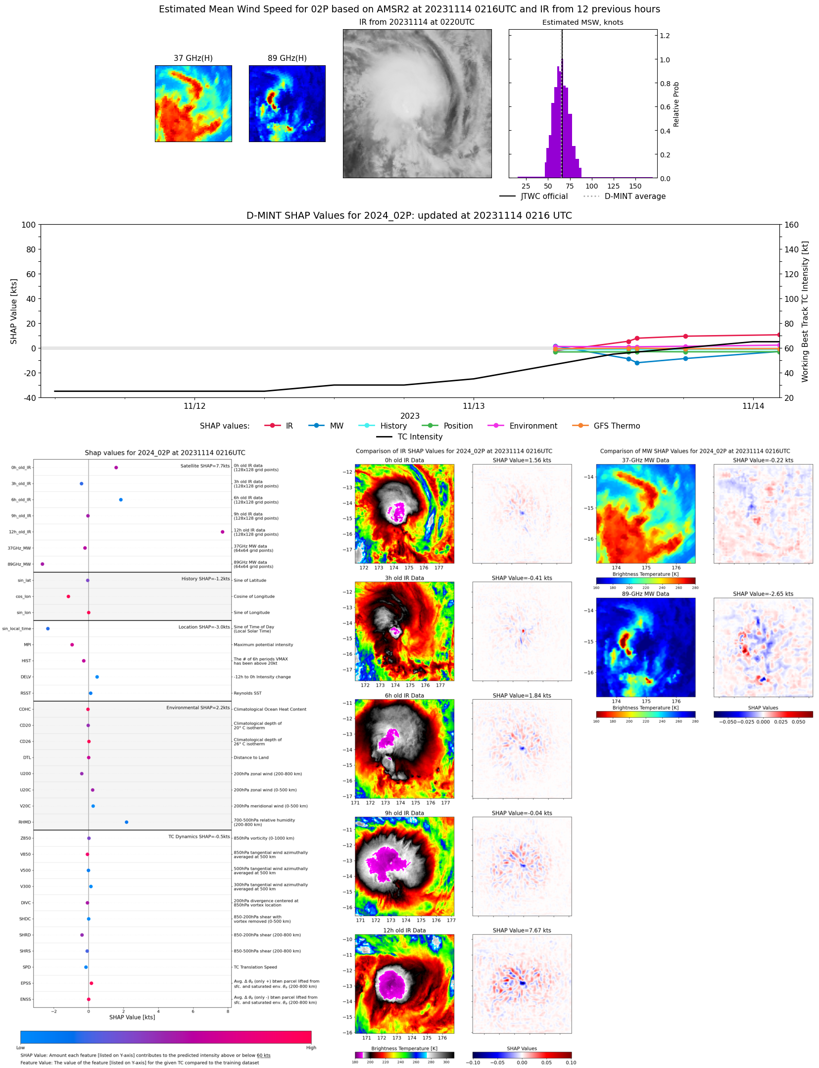 |
| 20231113 | 1810 UTC | SSMISF17 | 990 hPa | 63 kts | 57 kts | 68 kts | 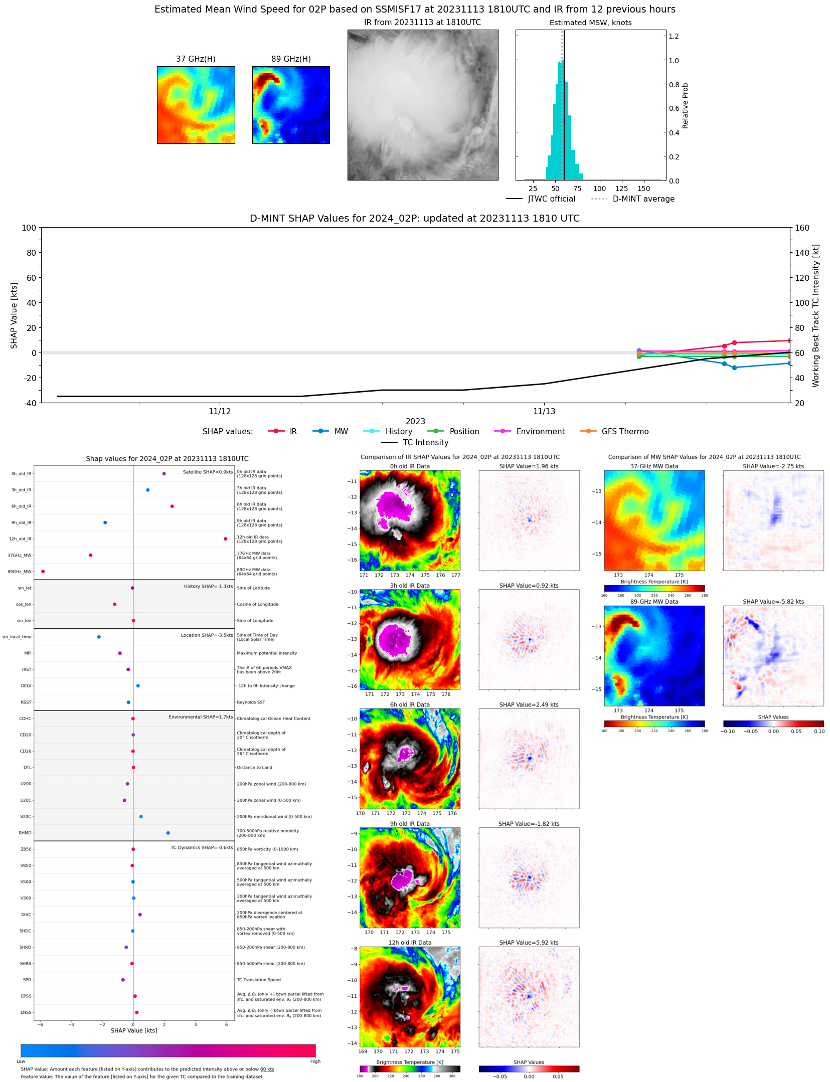 |
| 20231113 | 1402 UTC | AMSR2 | 988 hPa | 52 kts | 47 kts | 58 kts |  |
| 20231113 | 1318 UTC | GMI | 986 hPa | 53 kts | 47 kts | 59 kts | 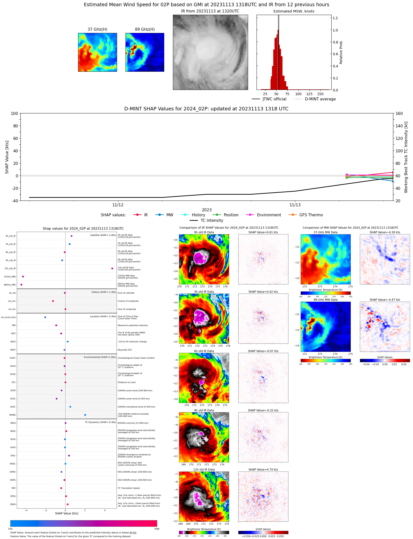 |
| 20231113 | 0700 UTC | SSMISF17 | 982 hPa | 55 kts | 49 kts | 61 kts | 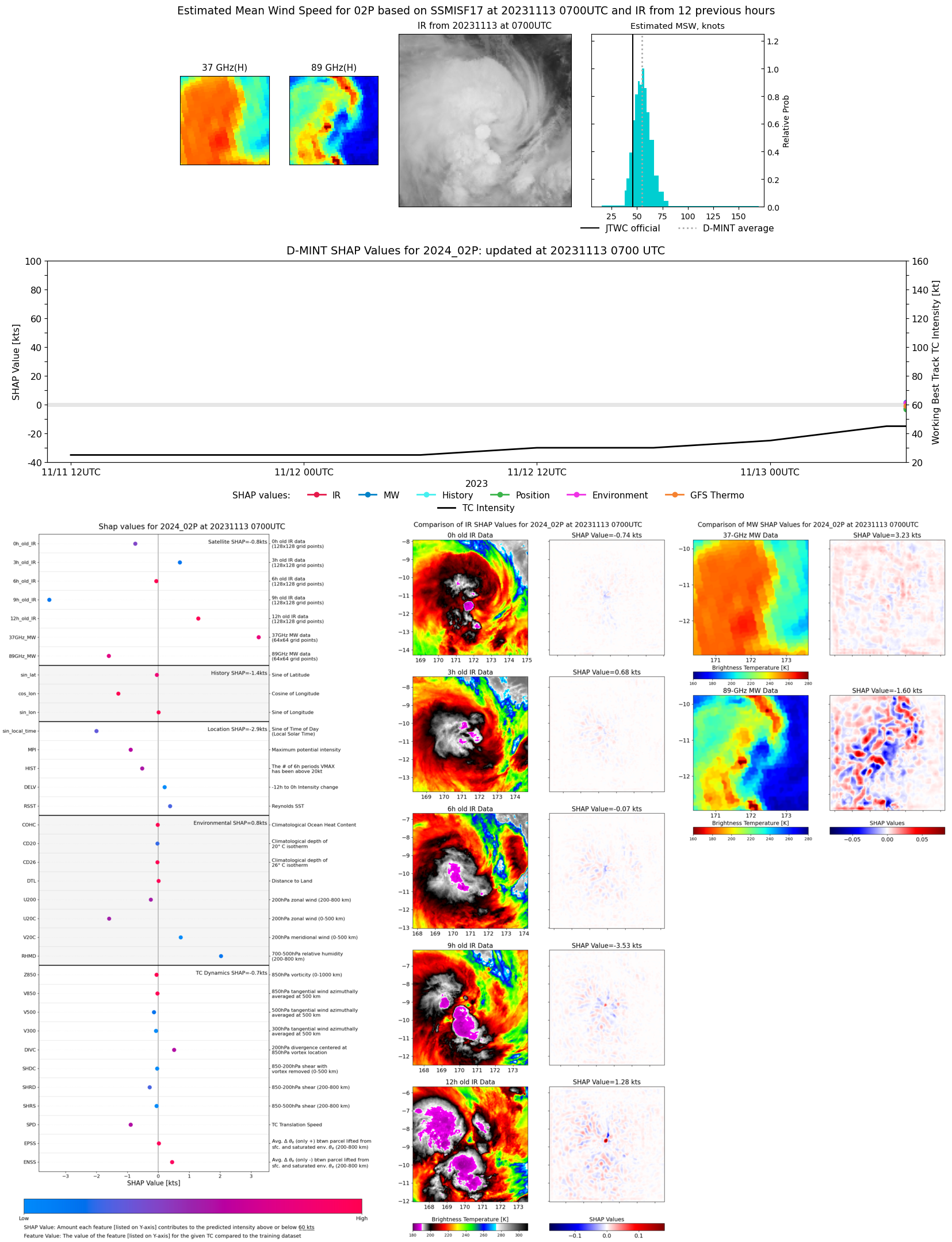 |
| 20231113 | 0555 UTC | SSMISF16 | 988 hPa | 46 kts | 40 kts | 53 kts | 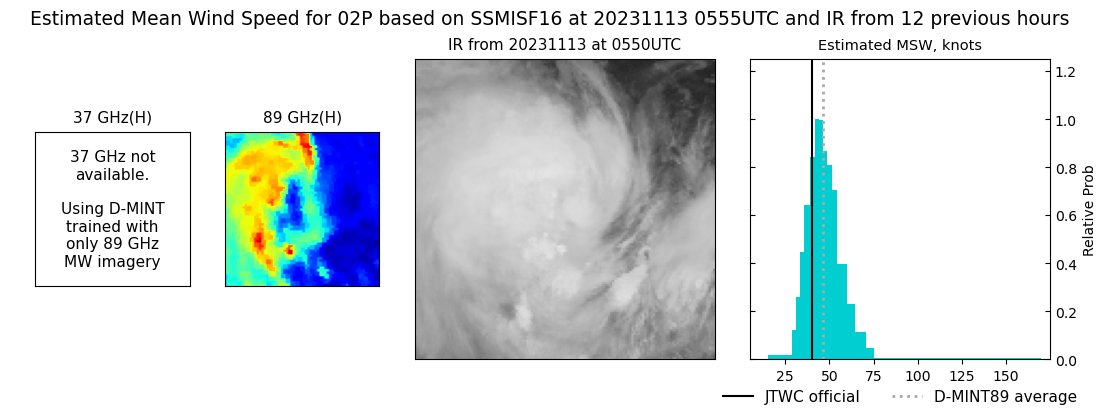 |