|
||

 |
D-MINT HISTORY FILE for 2024_08S
| Date | Time | MW Sensor | MSLP | Vmax (30th-70th percentile average) | Vmax 25th percentile | Vmax 75th percentile | Image |
| 20240127 | 1506 UTC | SSMISF17 | 1004 hPa | 21 kts | 20 kts | 22 kts | 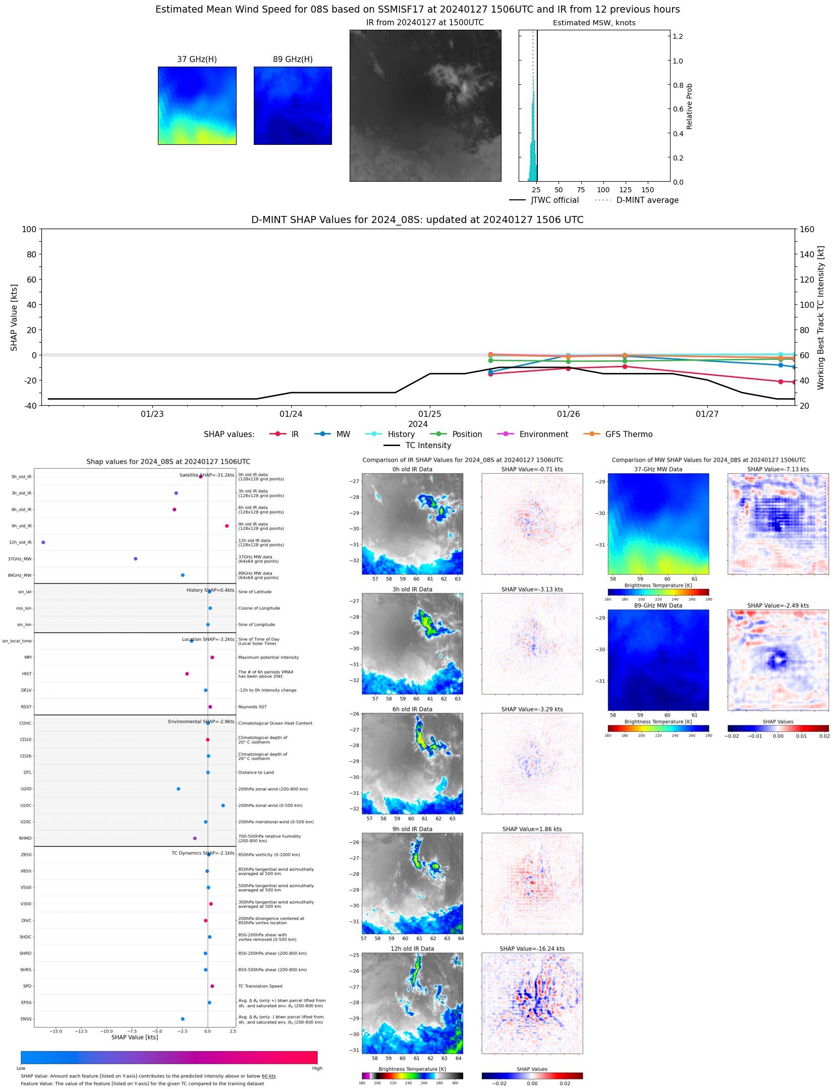 |
| 20240127 | 1434 UTC | SSMISF16 | 1005 hPa | 18 kts | 17 kts | 20 kts |  |
| 20240127 | 1240 UTC | SSMISF18 | 1003 hPa | 23 kts | 22 kts | 25 kts | 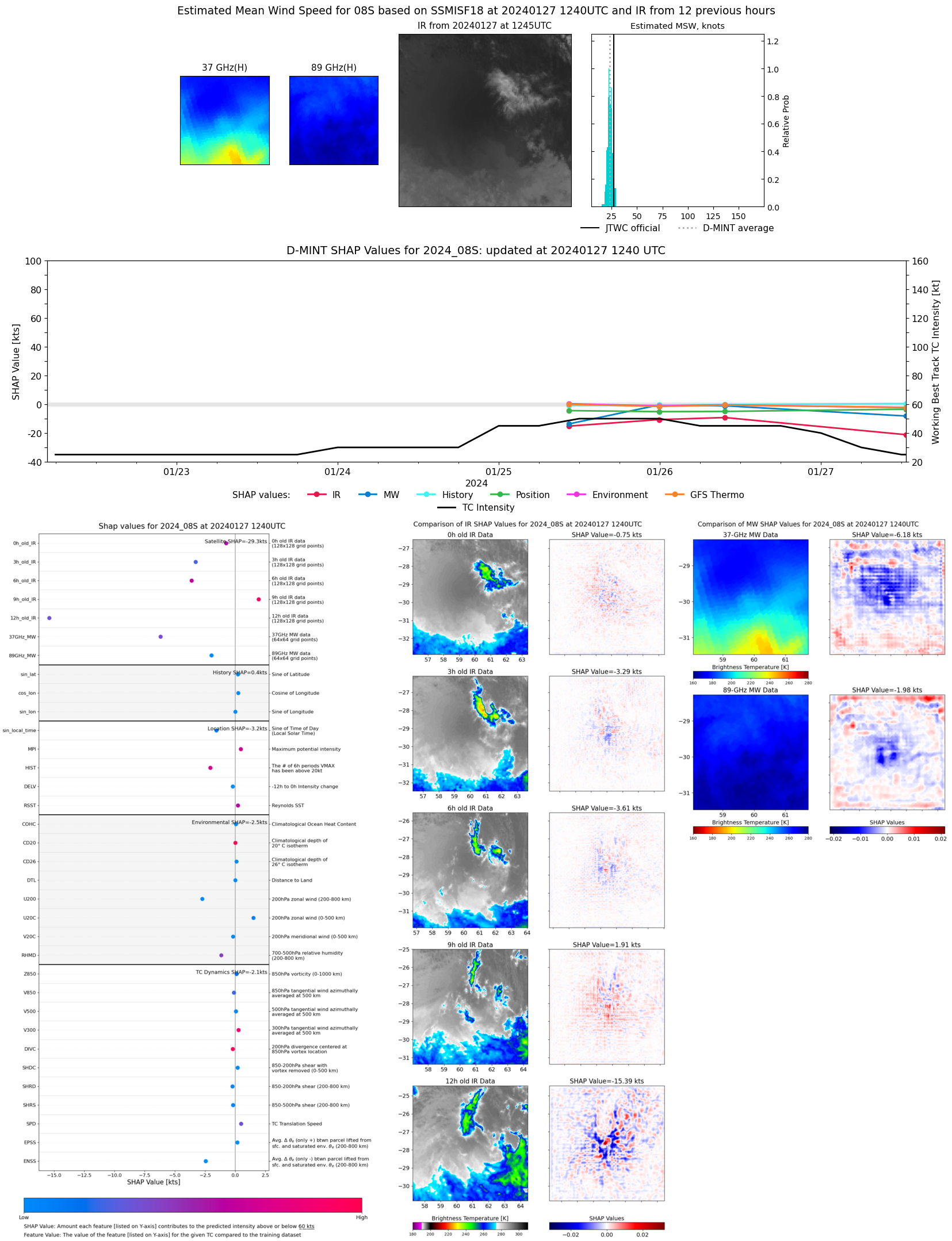 |
| 20240126 | 0943 UTC | GMI | 996 hPa | 44 kts | 39 kts | 49 kts | 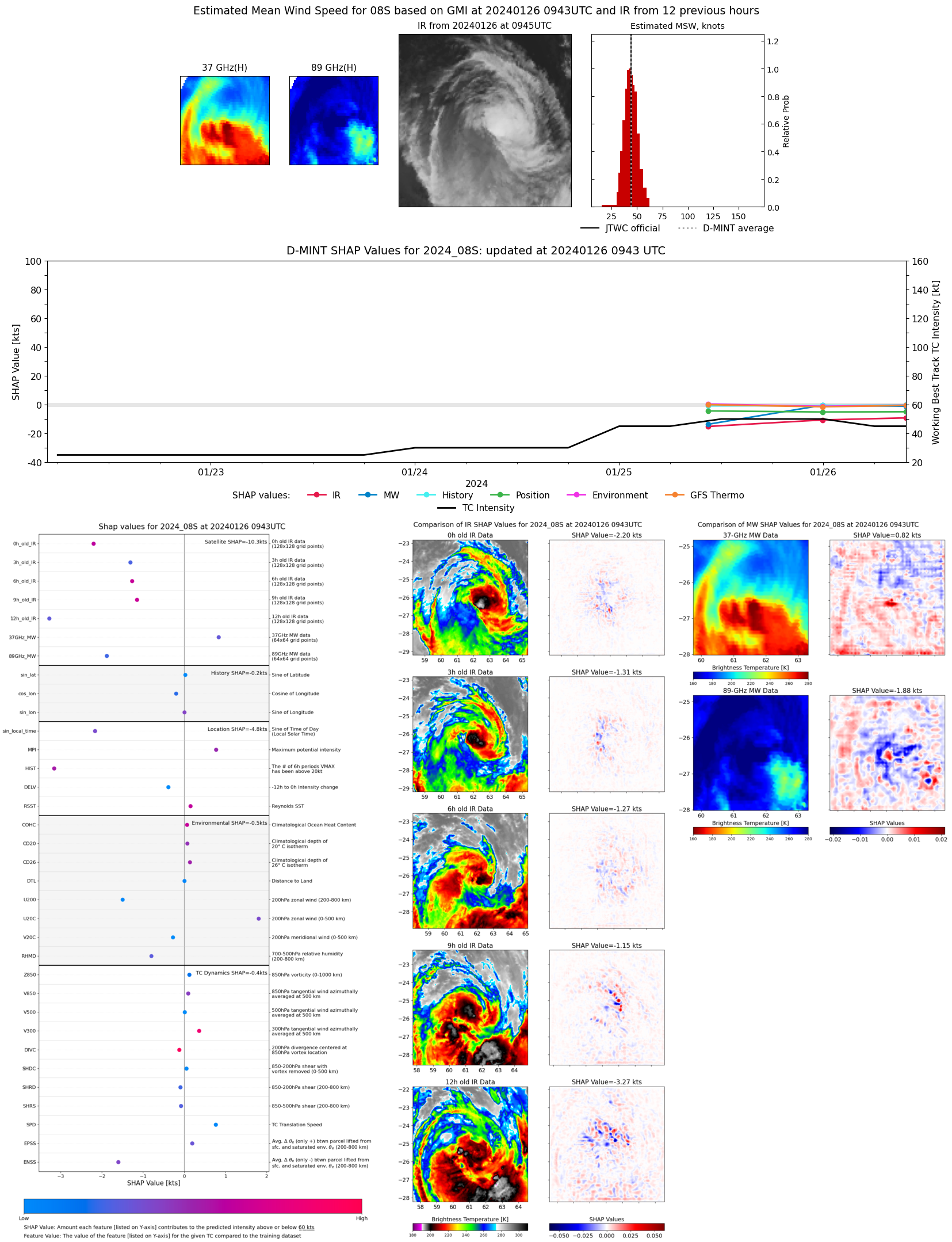 |
| 20240125 | 2353 UTC | GMI | 995 hPa | 41 kts | 37 kts | 45 kts | 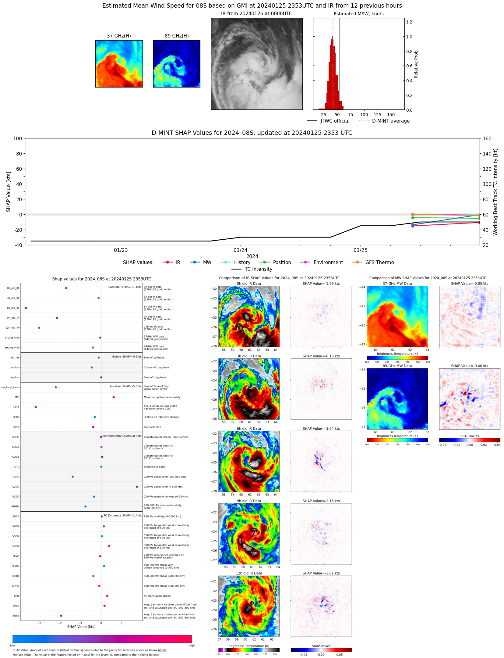 |
| 20240125 | 1028 UTC | GMI | 1005 hPa | 26 kts | 24 kts | 29 kts |  |