|
||

 |
D-MINT HISTORY FILE for 2024_17S
| Date | Time | MW Sensor | MSLP | Vmax (30th-70th percentile average) | Vmax 25th percentile | Vmax 75th percentile | Image |
| 20240313 | 2215 UTC | AMSR2 | 999 hPa | 35 kts | 31 kts | 39 kts | 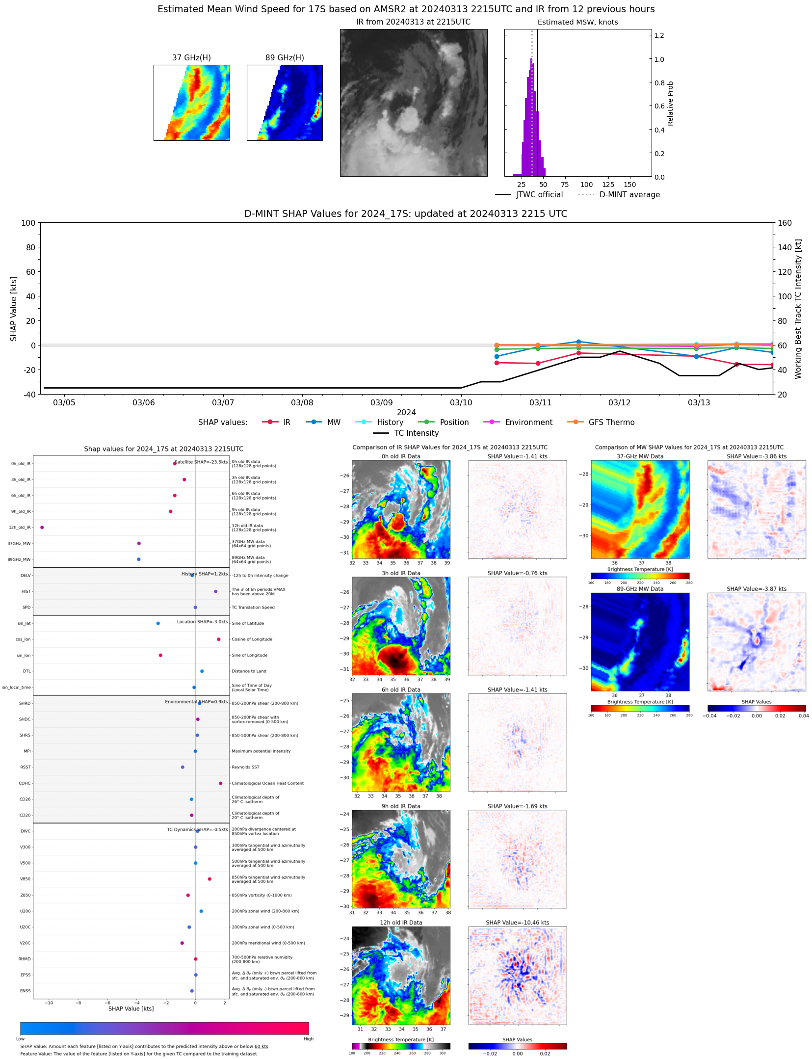 |
| 20240313 | 1116 UTC | AMSR2 | 991 hPa | 42 kts | 37 kts | 47 kts |  |
| 20240312 | 2308 UTC | AMSR2 | 993 hPa | 39 kts | 34 kts | 44 kts |  |
| 20240312 | 1148 UTC | GMI | 1001 hPa | 39 kts | 34 kts | 44 kts | 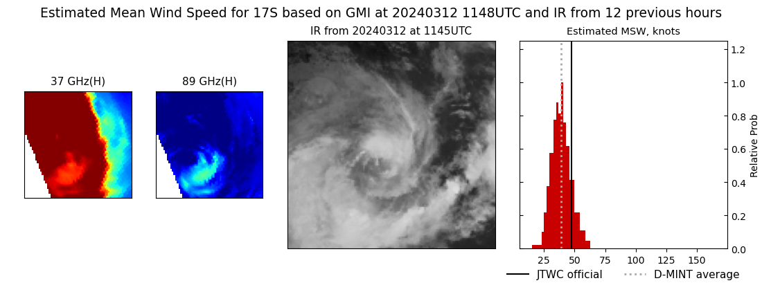 |
| 20240311 | 1130 UTC | AMSR2 | 988 hPa | 54 kts | 49 kts | 59 kts |  |
| 20240310 | 2308 UTC | GMI | 998 hPa | 40 kts | 36 kts | 45 kts | 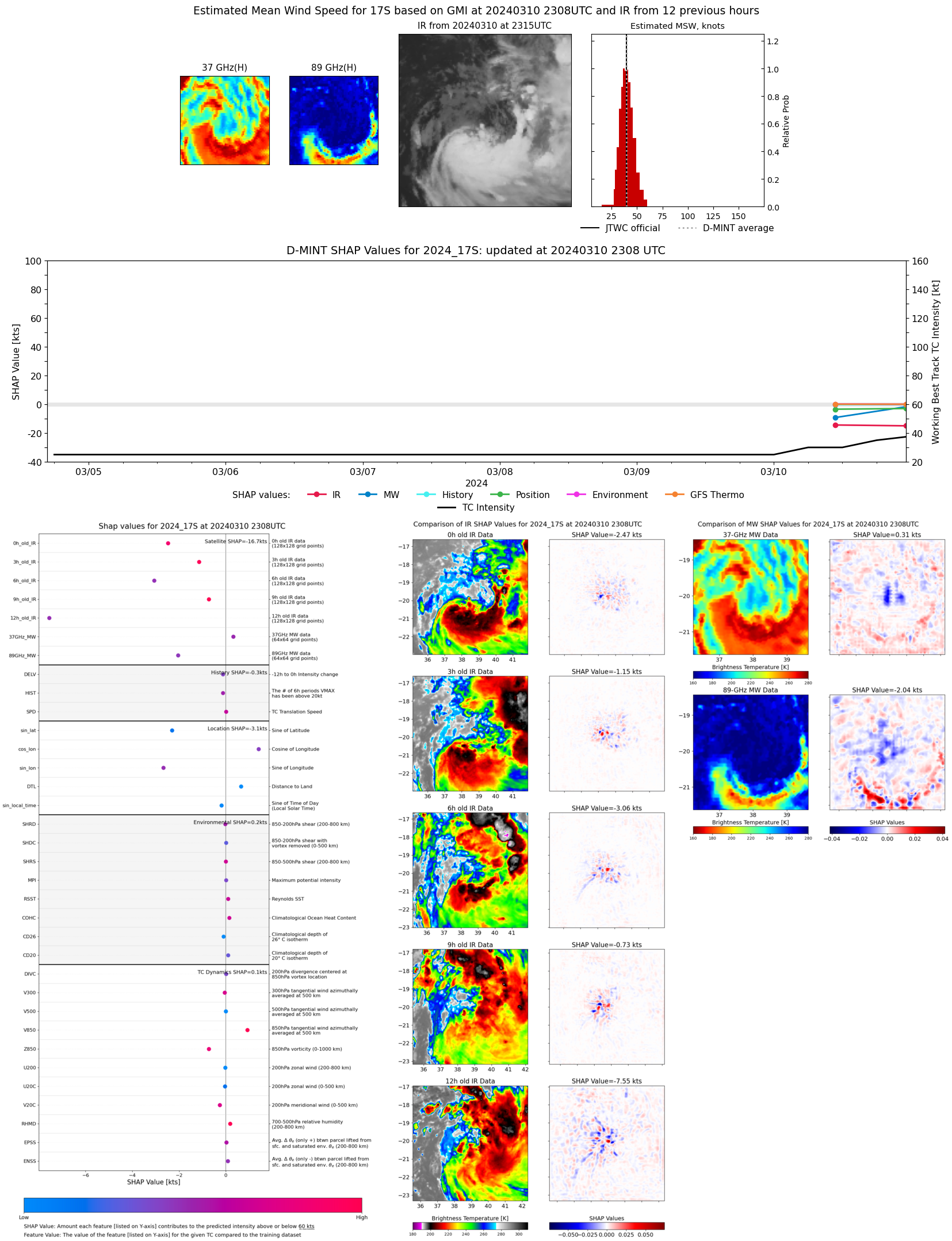 |
| 20240310 | 1047 UTC | AMSR2 | 1001 hPa | 33 kts | 29 kts | 37 kts |  |