|
||

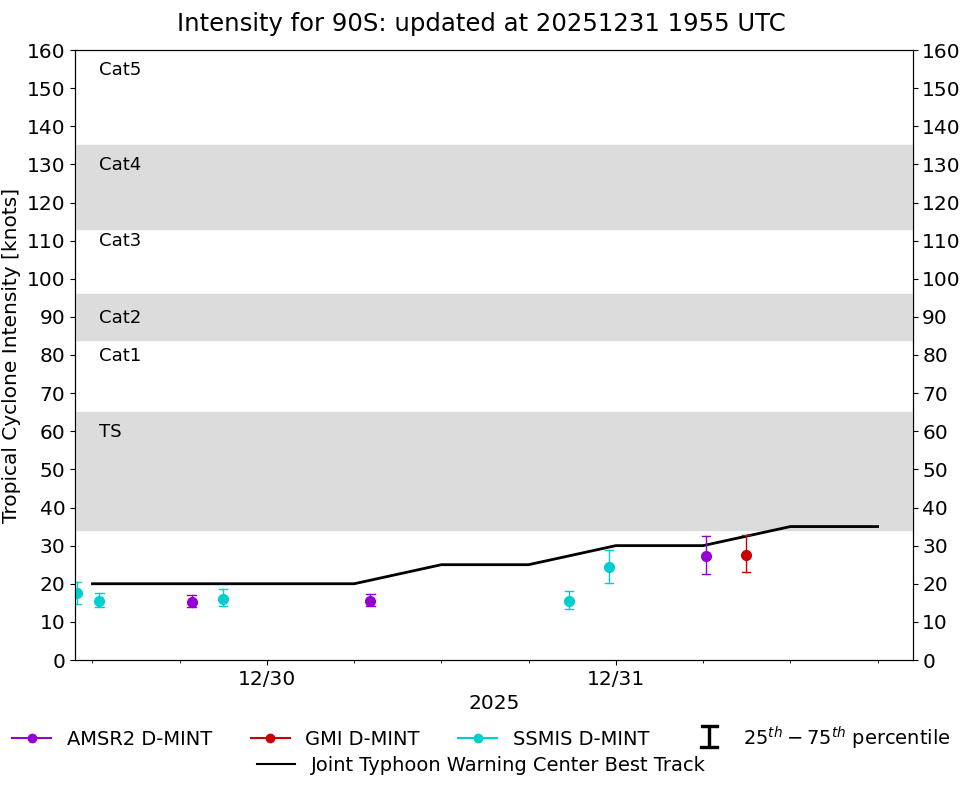 |
D-MINT HISTORY FILE for 2026_90S
| Date | Time | MW Sensor | Vmax (30th-70th percentile average) | Vmax 25th percentile | Vmax 75th percentile | Image |
| 20251231 | 0856 UTC | GMI | 28 kts | 23 kts | 33 kts |  |
| 20251231 | 0612 UTC | AMSR2 | 27 kts | 23 kts | 32 kts |  |
| 20251230 | 2331 UTC | SSMISF17 | 24 kts | 20 kts | 29 kts |  |
| 20251230 | 2047 UTC | SSMISF18 | 15 kts | 13 kts | 18 kts |  |
| 20251230 | 0707 UTC | AMSR2 | 16 kts | 14 kts | 17 kts |  |
| 20251229 | 2100 UTC | SSMISF18 | 16 kts | 14 kts | 19 kts |  |
| 20251229 | 1849 UTC | AMSR2 | 15 kts | 14 kts | 17 kts |  |
| 20251229 | 1229 UTC | SSMISF16 | 15 kts | 14 kts | 18 kts |  |
| 20251229 | 1056 UTC | SSMISF17 | 17 kts | 15 kts | 21 kts |  |
| 20251229 | 0625 UTC | AMSR2 | 15 kts | 14 kts | 17 kts |  |