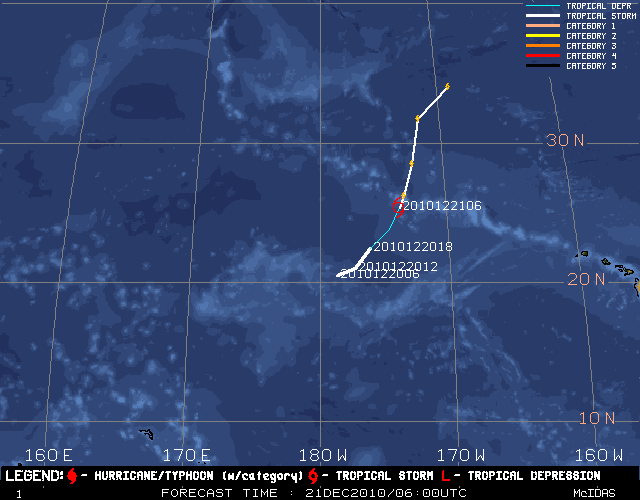
The image above depicts the latest JTWC forecast positions for the current Tropical Storm/Typhoon in the West Pacific in addition to the previous storm locations and intensities. (See Disclaimer below).
Presented are the current position (the large, red Tropical Storm/Typhoon symbol), current intensity (the number within the symbol, as listed on the previous page), forecast positions for 12, 24, 36, 48, 72, 96, and 120 hours (the smaller typhoon symbols connected by the thin white line), and the previous storm track locations (intensity indicated within KEY).