|
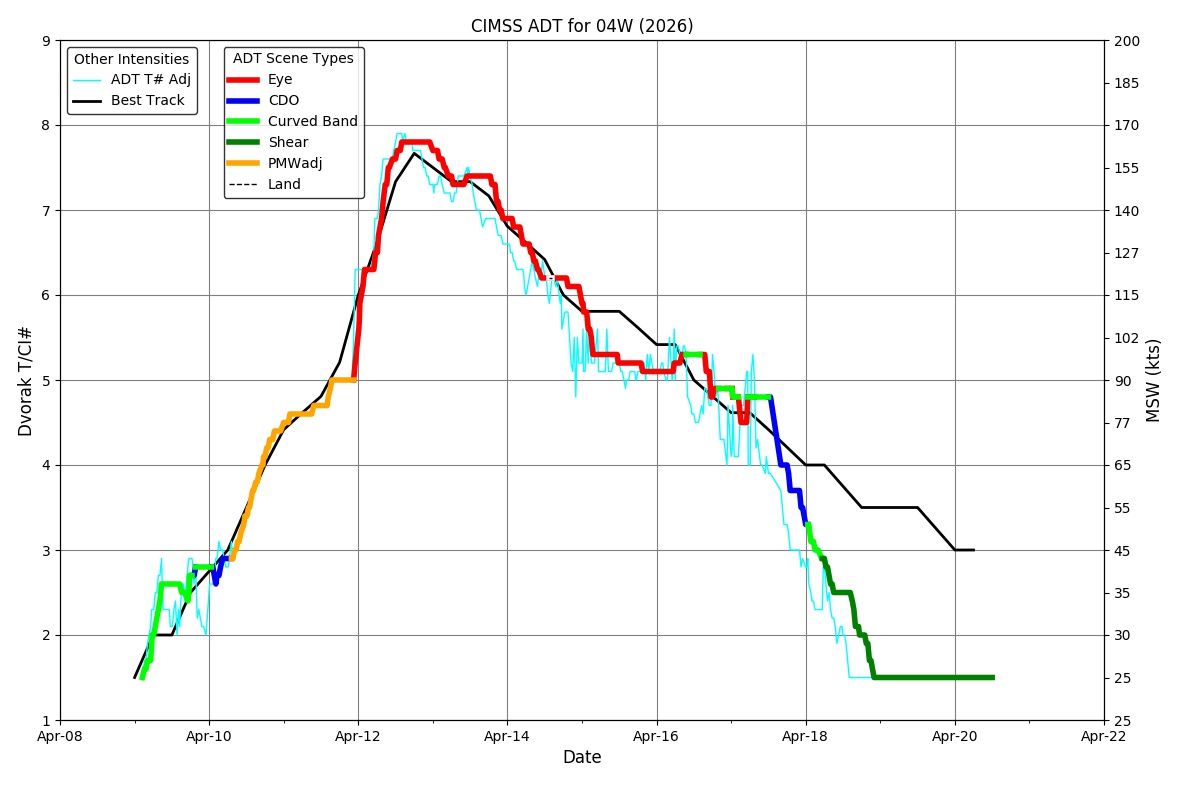
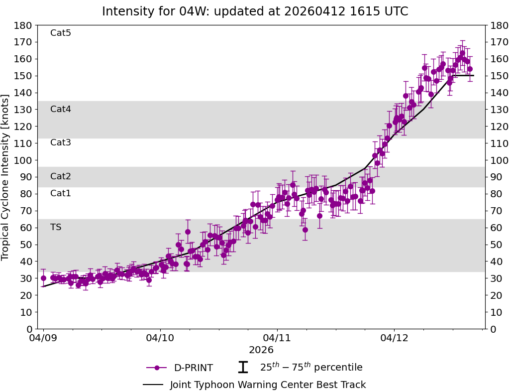
Current Intensity Estimates
|
ADT
|
| Date |
Time |
Vmax |
MSLP |
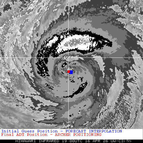
| 16Apr2026 |
1900UTC |
87 kts |
960 hPa |
| Scene |
CI# |
FT# |
AdjT# |
RawT# |
Eye T |
Cloud T |
| EYE |
4.9 |
4.8 |
4.8 |
4.8 |
-7.96C |
-51.61C |
|
|
|
|
AiDT
|
| Date |
Time |
Vmax |
|
| 16Apr2026 |
1900UTC |
83 kts |
|
|
|
|
|
DPRINT
|
| Date |
Time |
Vmax |
MSLP |
| 16Apr2026 |
1900UTC |
94 kts |
966 hPa |
| Vmax 25% |
Vmax 75% |
|
|
| 89 kts |
99 kts |
|
|
|
|
|
|
DMINT
|
| Date |
Time |
Vmax |
MSLP |
| 16Apr2026 |
1854UTC |
98 kts |
956 hPa |
| Vmax 25% |
Vmax 75% |
MW Instr. |
|
| 93 kts |
104 kts |
SSMISF18 |
|
|
|
| Date |
Time |
Vmax |
MSLP |
| 16Apr2026 |
1611UTC |
97 kts |
961 hPa |
| Vmax 25% |
Vmax 75% |
MW Instr. |
|
| 91 kts |
102 kts |
ATMS-N21 |
|
16Apr2026 |
1855UTC |
19.19N |
144.99E |
| Satellite |
Sensor |
Eye Diameter |
Eye Cert % |
| SSMIS-18 |
85-92GHz |
1.90 deg |
100.0% |
|
|
|
|
TC Structure
|
MPERC
|
| Date |
Time |
Prob. ERC onset
Full Model |
Prob. ERC onset
V-based |
| 16Apr2026 |
1800UTC |
2% |
9% |
|
|
|
|
MIMIC-TPW
|
|
|
|
MIMIC-TC
|
|
|
|
Shear Analysis
|
| Date |
Time |
Shear Magnitude
|
Shear Direction
|
| 16Apr2026 |
1800UTC |
7 kts |
226 deg |
| Deep-layer vertical wind shear interpolated to storm center derived from the CIMSS AMV-aided analyses with vortex removed |
|
|
|
|
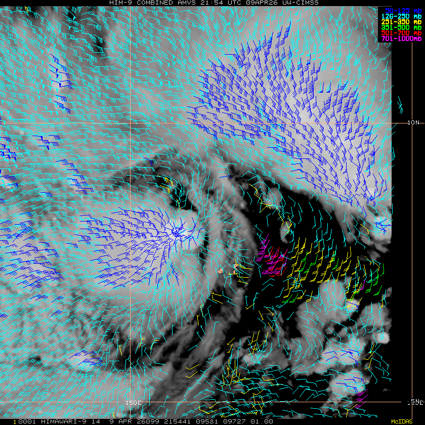
TC-Scale AMVs
|
|
|
|