|
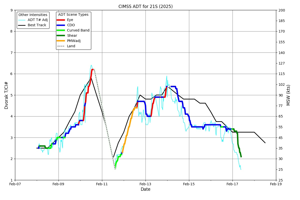
Current Intensity Estimates
|
ADT
|
| Date |
Time |
Vmax |
MSLP |
| 14Feb2026 |
0530UTC |
99 kts |
952 hPa |
| Scene |
CI# |
FT# |
AdjT# |
RawT# |
Eye T |
Cloud T |
| UNIFRM |
5.4 |
5.0 |
4.8 |
4.4 |
-57.42C |
-61.76C |
|
|
|
|
AiDT
|
| Date |
Time |
Vmax |
|
| 14Feb2026 |
0530UTC |
99 kts |
|
|
|
|
|
DPRINT
|
| Date |
Time |
Vmax |
MSLP |
| 14Feb2026 |
0530UTC |
84 kts |
961 hPa |
| Vmax 25% |
Vmax 75% |
|
|
| 79 kts |
90 kts |
|
|
|
|
|
|
DMINT
|
| Date |
Time |
Vmax |
MSLP |
| 14Feb2026 |
0417UTC |
96 kts |
955 hPa |
| Vmax 25% |
Vmax 75% |
MW Instr. |
|
| 90 kts |
103 kts |
SSMISF16 |
|
|
|
| Date |
Time |
Vmax |
MSLP |
| 14Feb2026 |
0347UTC |
89 kts |
955 hPa |
| Vmax 25% |
Vmax 75% |
MW Instr. |
|
| 83 kts |
96 kts |
WSFM01 |
|
14Feb2026 |
0418UTC |
-24.40S |
36.19E |
| Satellite |
Sensor |
Eye Diameter |
Eye Cert % |
| SSMIS-16 |
85-92GHz |
1.60 deg |
55.0% |
|
|
|
|
TC Structure
|
MPERC
|
| Date |
Time |
Prob. ERC onset
Full Model |
Prob. ERC onset
V-based |
| 14Feb2026 |
0400UTC |
8% |
13% |
|
|
|
|
MIMIC-TPW
|
|
|
|
MIMIC-TC
|
|
|
|
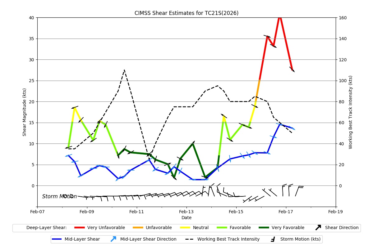
Shear Analysis
|
| Date |
Time |
Shear Magnitude
|
Shear Direction
|
| 14Feb2026 |
000UTC |
8 kts |
246 deg |
| Deep-layer vertical wind shear interpolated to storm center derived from the CIMSS AMV-aided analyses with vortex removed |
|
|
|
|
TC-Scale AMVs
|
|
|
|