|
Current Intensity Estimates
|
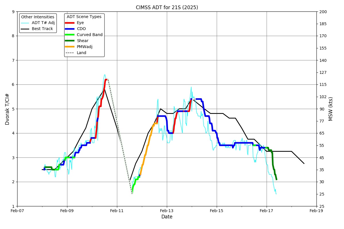
ADT
|
| Date |
Time |
Vmax |
MSLP |
| 17Feb2026 |
0930UTC |
31 kts |
998 hPa |
| Scene |
CI# |
FT# |
AdjT# |
RawT# |
Eye T |
Cloud T |
| SHEAR |
2.1 |
1.6 |
1.5 |
1.5 |
9.89C |
-6.45C |
|
|
|
|
AiDT
|
| Date |
Time |
Vmax |
|
| 17Feb2026 |
0930UTC |
51 kts |
|
|
|
|
|
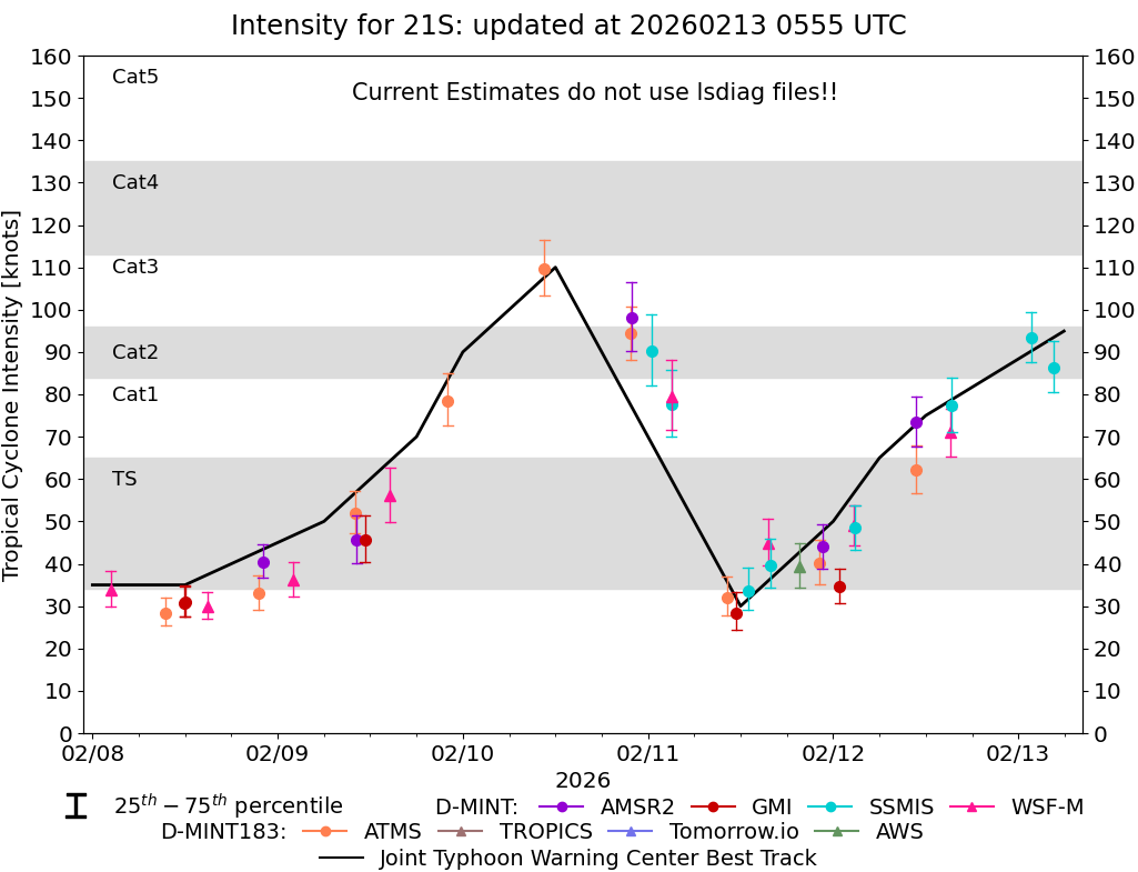
DPRINT
|
| Date |
Time |
Vmax |
MSLP |
| 17Feb2026 |
0930UTC |
43 kts |
990 hPa |
| Vmax 25% |
Vmax 75% |
|
|
| 38 kts |
49 kts |
|
|
|
|
|
|
DMINT
|
| Date |
Time |
Vmax |
MSLP |
| 17Feb2026 |
0739UTC |
40 kts |
991 hPa |
| Vmax 25% |
Vmax 75% |
MW Instr. |
|
| 35 kts |
45 kts |
TMS02 |
|
|
|
|
|
MW Sounders
|
| Date |
Time |
Vmax |
MSLP |
| 18Feb2026 |
0326UTC |
66 kts |
979 hPa |
|
|
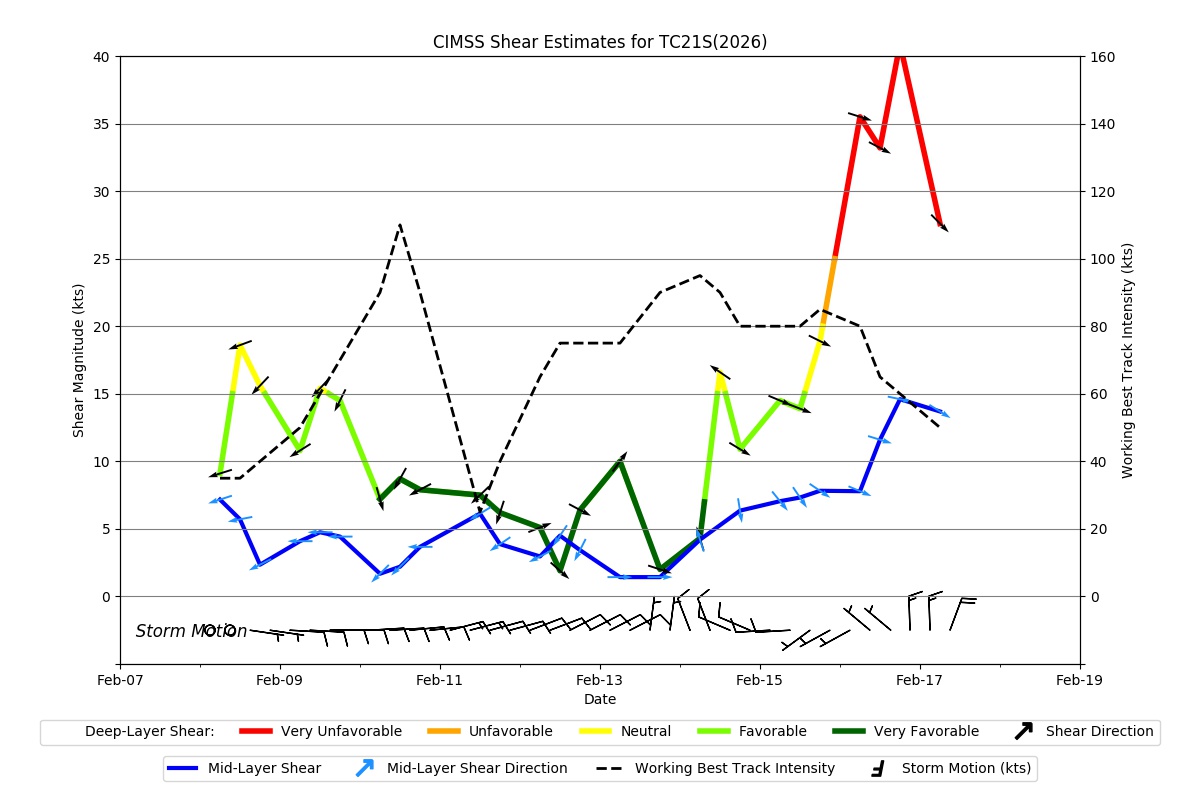
Shear Analysis
|
| Date |
Time |
Shear Magnitude
|
Shear Direction
|
| 18Feb2026 |
600UTC |
N/A kts |
N/A deg |
| Deep-layer vertical wind shear interpolated to storm center derived from the CIMSS AMV-aided analyses with vortex removed |
|
|
|
|
TC-Scale AMVs
|
|
|
|