|
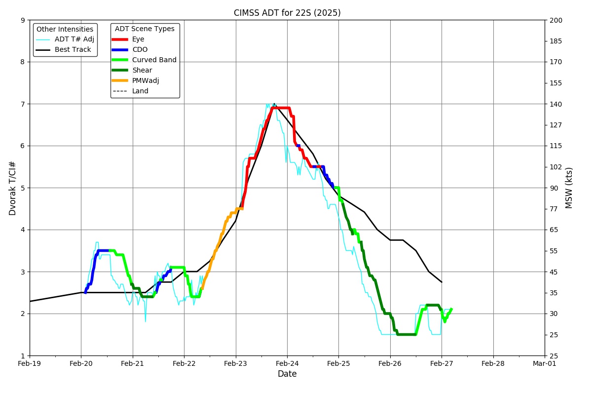
Current Intensity Estimates
|
ADT
|
| Date |
Time |
Vmax |
MSLP |
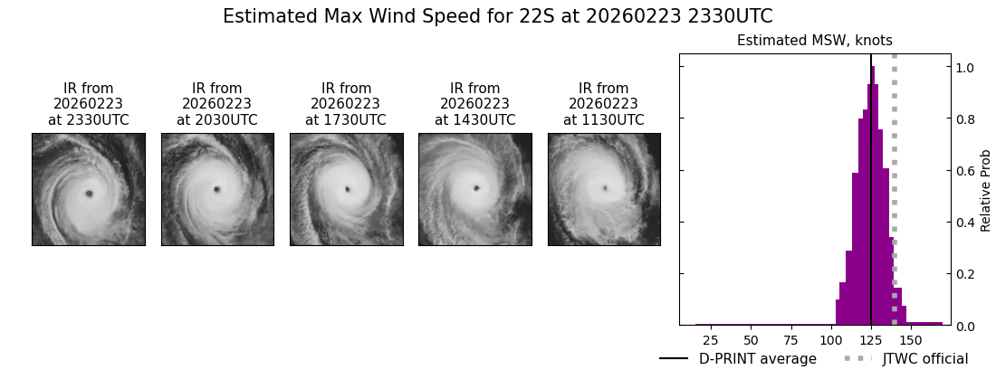
| 23Feb2026 |
2330UTC |
137 kts |
923 hPa |
| Scene |
CI# |
FT# |
AdjT# |
RawT# |
Eye T |
Cloud T |
| EYE |
6.9 |
6.2 |
5.6 |
5.5 |
0.48C |
-62.63C |
|
|
|
|
AiDT
|
| Date |
Time |
Vmax |
|
| 23Feb2026 |
2330UTC |
134 kts |
|
|
|
|
|
DPRINT
|
| Date |
Time |
Vmax |
MSLP |
| 23Feb2026 |
2330UTC |
125 kts |
933 hPa |
| Vmax 25% |
Vmax 75% |
|
|
| 119 kts |
131 kts |
|
|
|
|
|
|
DMINT
|
| Date |
Time |
Vmax |
MSLP |
| 23Feb2026 |
2122UTC |
126 kts |
926 hPa |
| Vmax 25% |
Vmax 75% |
MW Instr. |
|
| 120 kts |
132 kts |
AMSR2 |
|
|
|
| Date |
Time |
Vmax |
MSLP |
| 23Feb2026 |
2100UTC |
121 kts |
941 hPa |
| Vmax 25% |
Vmax 75% |
MW Instr. |
|
| 115 kts |
127 kts |
ATMS-N21 |
|
0.3% |
0.0% |
0.0% |
0.0% |
0.0% |
|
|
|
|
Position Estimates
|
ARCHER
|
| Date |
Time |
Latitude |
Longitude |
| 23Feb2026 |
2123UTC |
-21.06S |
64.71E |
| Satellite |
Sensor |
Eye Diameter |
Eye Cert % |
| AMSR2 |
85-92GHz |
0.40 deg |
100.0% |
|
|
|
|
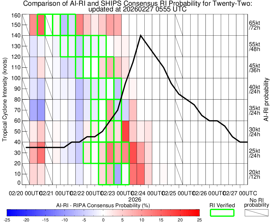
TC Structure
|
MPERC
|
| Date |
Time |
Prob. ERC onset
Full Model |
Prob. ERC onset
V-based |
| 23Feb2026 |
2100UTC |
66% |
78% |
|
|
|
|
MIMIC-TPW
|
|
|
|
MIMIC-TC
|
|
|
|
Shear Analysis
|
| Date |
Time |
Shear Magnitude
|
Shear Direction
|
| 23Feb2026 |
1800UTC |
11 kts |
27 deg |
| Deep-layer vertical wind shear interpolated to storm center derived from the CIMSS AMV-aided analyses with vortex removed |
|
|
|
|
TC-Scale AMVs
|
|
|
|