|
Current Intensity Estimates
|
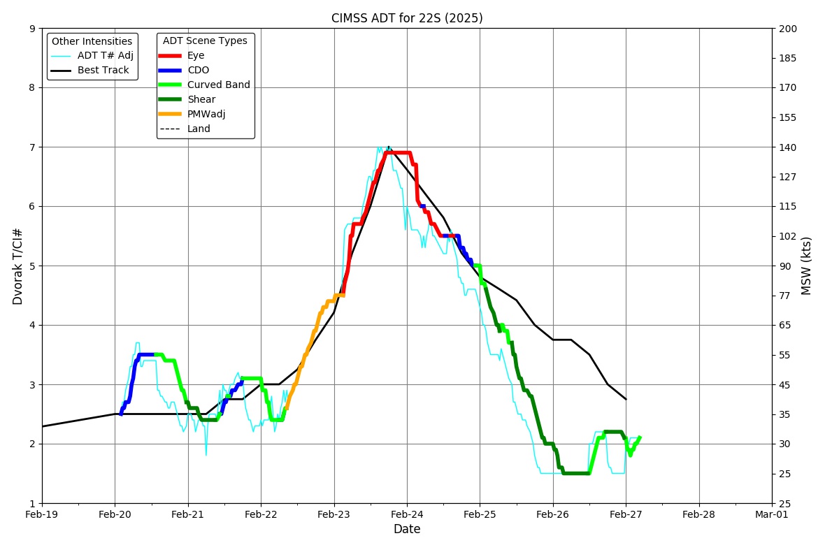
ADT
|
| Date |
Time |
Vmax |
MSLP |
| 25Feb2026 |
0530UTC |
65 kts |
981 hPa |
| Scene |
CI# |
FT# |
AdjT# |
RawT# |
Eye T |
Cloud T |
| SHEAR |
4.0 |
3.5 |
3.5 |
1.5 |
16.25C |
-0.75C |
|
|
|
|
AiDT
|
| Date |
Time |
Vmax |
|
| 25Feb2026 |
0530UTC |
62 kts |
|
|
|
|
|
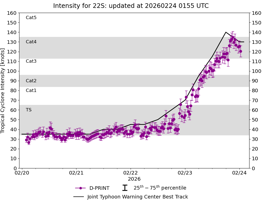
DPRINT
|
| Date |
Time |
Vmax |
MSLP |
| 25Feb2026 |
0530UTC |
50 kts |
984 hPa |
| Vmax 25% |
Vmax 75% |
|
|
| 44 kts |
55 kts |
|
|
|
|
|
|
DMINT
|
| Date |
Time |
Vmax |
MSLP |
| 25Feb2026 |
0147UTC |
56 kts |
977 hPa |
| Vmax 25% |
Vmax 75% |
MW Instr. |
|
| 50 kts |
61 kts |
WSFM01 |
|
|
|
| Date |
Time |
Vmax |
MSLP |
| 25Feb2026 |
0146UTC |
53 kts |
978 hPa |
| Vmax 25% |
Vmax 75% |
MW Instr. |
|
| 48 kts |
59 kts |
SSMISF16 |
|
25Feb2026 |
0146UTC |
-27.33S |
66.07E |
| Satellite |
Sensor |
Eye Diameter |
Eye Cert % |
| SSMIS-16 |
85-92GHz |
0.40 deg |
12.4% |
|
|
|
|
TC Structure
|
MPERC
|
| Date |
Time |
Prob. ERC onset
Full Model |
Prob. ERC onset
V-based |
| 25Feb2026 |
0100UTC |
13% |
7% |
|
|
|
|
MIMIC-TPW
|
|
|
|
MIMIC-TC
|
|
|
|
Shear Analysis
|
| Date |
Time |
Shear Magnitude
|
Shear Direction
|
| 25Feb2026 |
000UTC |
37 kts |
315 deg |
| Deep-layer vertical wind shear interpolated to storm center derived from the CIMSS AMV-aided analyses with vortex removed |
|
|
|
|
TC-Scale AMVs
|
|
|
|