|
Current Intensity Estimates
|
ADT
|
| Date |
Time |
Vmax |
MSLP |
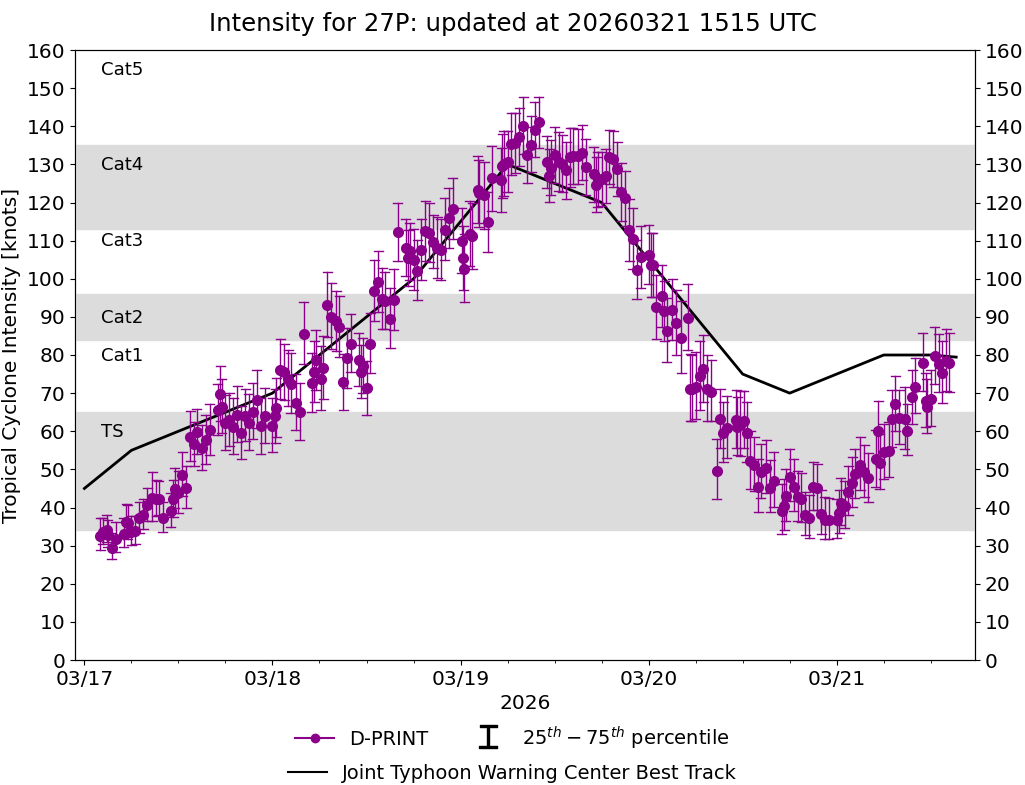
| 19Mar2026 |
0600UTC |
137 kts |
926 hPa |
| Scene |
CI# |
FT# |
AdjT# |
RawT# |
Eye T |
Cloud T |
| UNIFRM |
6.9 |
6.7 |
5.8 |
4.6 |
-79.57C |
-79.49C |
|
|
|
|
AiDT
|
| Date |
Time |
Vmax |
|
| 19Mar2026 |
0600UTC |
129 kts |
|
|
|
|
|
DPRINT
|
| Date |
Time |
Vmax |
MSLP |
| 19Mar2026 |
0600UTC |
131 kts |
932 hPa |
| Vmax 25% |
Vmax 75% |
|
|
| 123 kts |
139 kts |
|
|
|
|
|
|
DMINT
|
| Date |
Time |
Vmax |
MSLP |
| 19Mar2026 |
0607UTC |
130 kts |
925 hPa |
| Vmax 25% |
Vmax 75% |
MW Instr. |
|
| 122 kts |
138 kts |
SSMISF18 |
|
|
|
| Date |
Time |
Vmax |
MSLP |
| 19Mar2026 |
0357UTC |
120 kts |
934 hPa |
| Vmax 25% |
Vmax 75% |
MW Instr. |
|
| 114 kts |
126 kts |
ATMS-N21 |
|
19Mar2026 |
0608UTC |
-13.58S |
146.42E |
| Satellite |
Sensor |
Eye Diameter |
Eye Cert % |
| SSMIS-18 |
85-92GHz |
0.30 deg |
100.0% |
|
|
|
|
TC Structure
|
MPERC
|
| Date |
Time |
Prob. ERC onset
Full Model |
Prob. ERC onset
V-based |
| 18Mar2026 |
2000UTC |
45% |
23% |
|
|
|
|
MIMIC-TPW
|
|
|
|
MIMIC-TC
|
|
|
|
Shear Analysis
|
| Date |
Time |
Shear Magnitude
|
Shear Direction
|
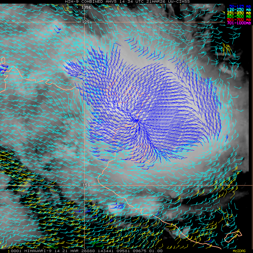
| 19Mar2026 |
000UTC |
24 kts |
88 deg |
| Deep-layer vertical wind shear interpolated to storm center derived from the CIMSS AMV-aided analyses with vortex removed |
|
|
|
|
TC-Scale AMVs
|
|
|
|